|
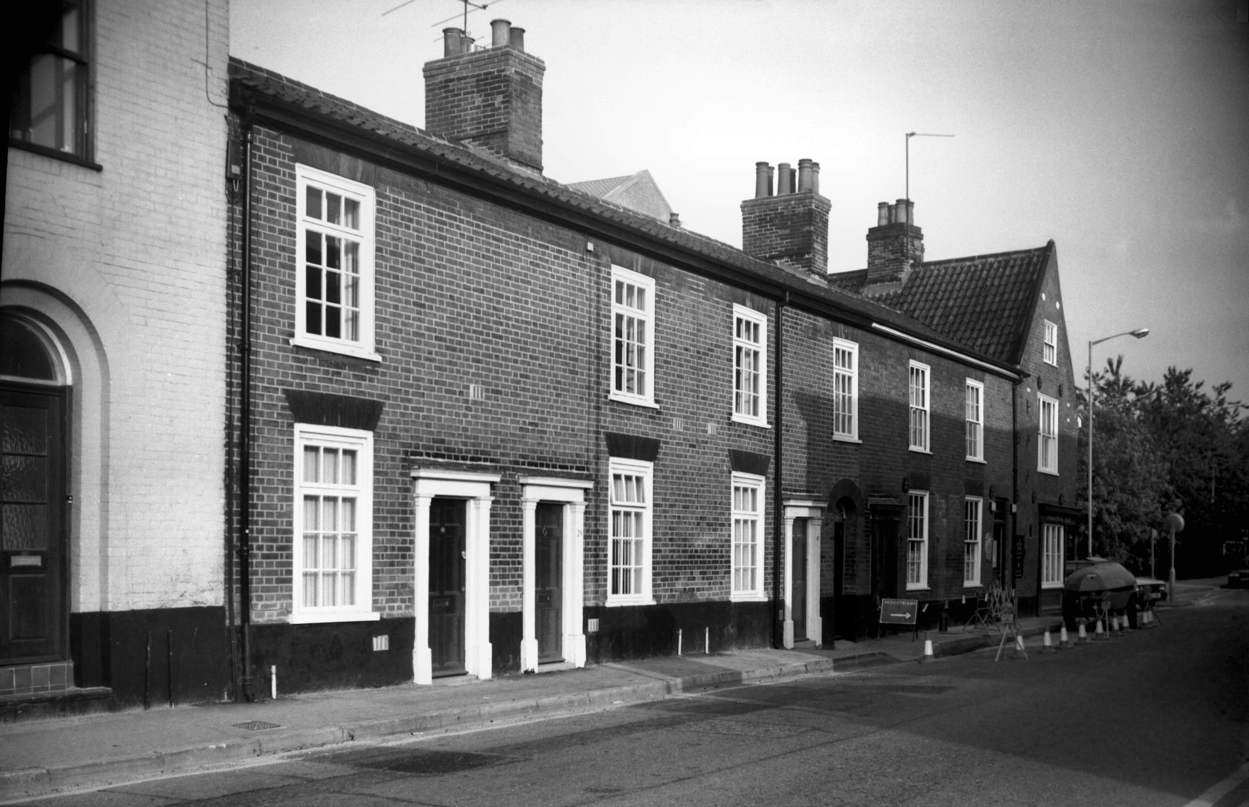
Constitution Hill: |
| |
From
Magdalen Rd / St
Clement's Hill towards Spixworth, North Walsham
passing Wall Rd
East side |
|
|
Constitution Hill 68 [6669] 1991-04-29
|
|
|
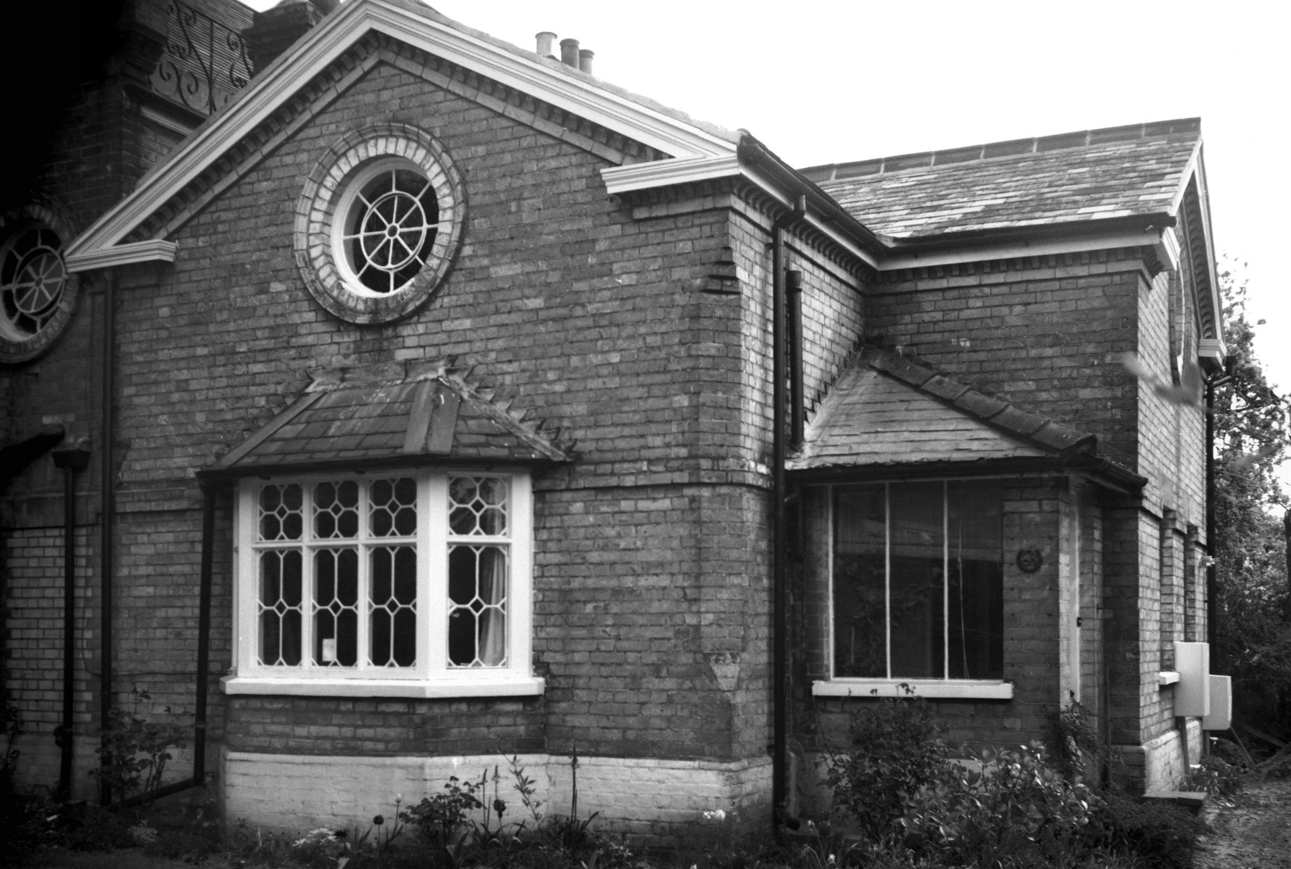
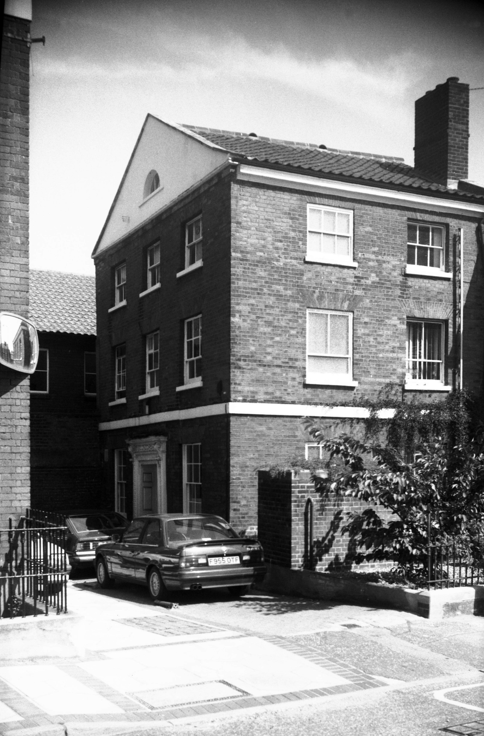
Constitution Hill 82 Chaumiere de L'Etoile [6661]
1991-04-17
|
|
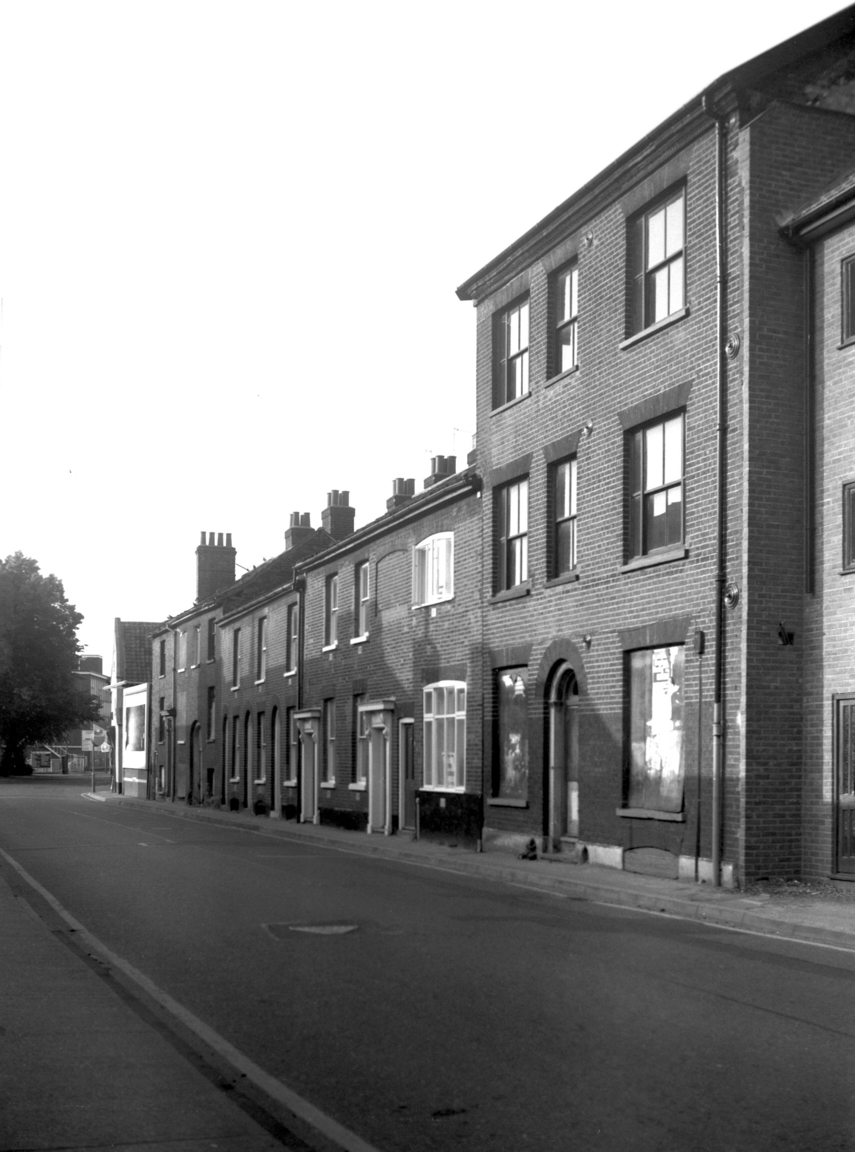
Cooper Lane: |
| |
From
Sandy Lane |
|
|
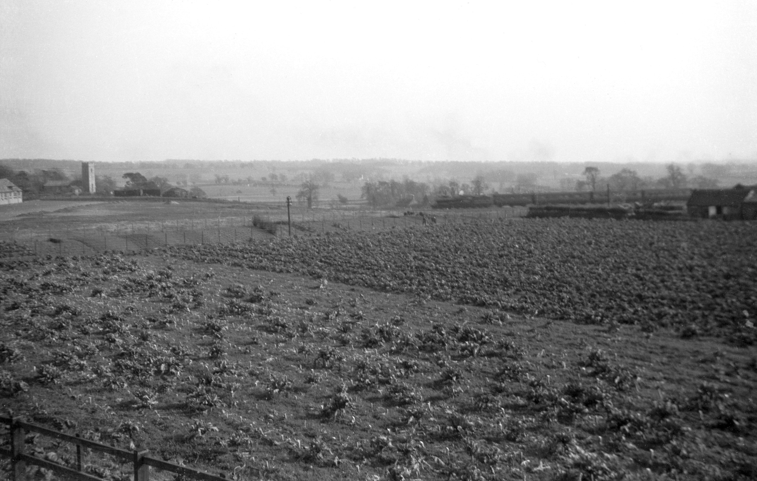
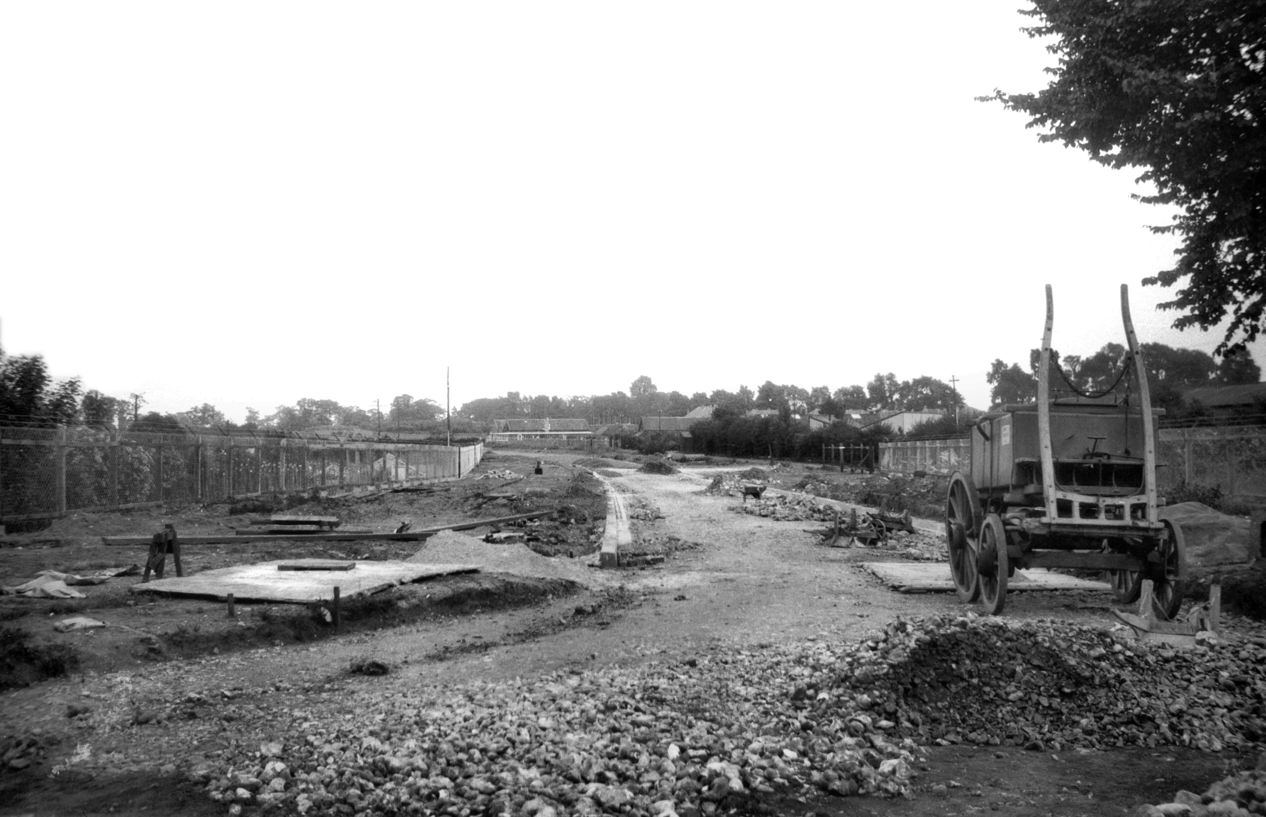
Cooper Lane estate site view to Lakenham [B515]
1933-04-08
View across Sandy Lane and the railway towards Old
Lakenham church. |
|
|
Cooper Lane The Alders [6384] 1986-06-12
|
|
Coslany St: |
| |
From
Westwick St to Oak St / Colegate
East side |
|
|
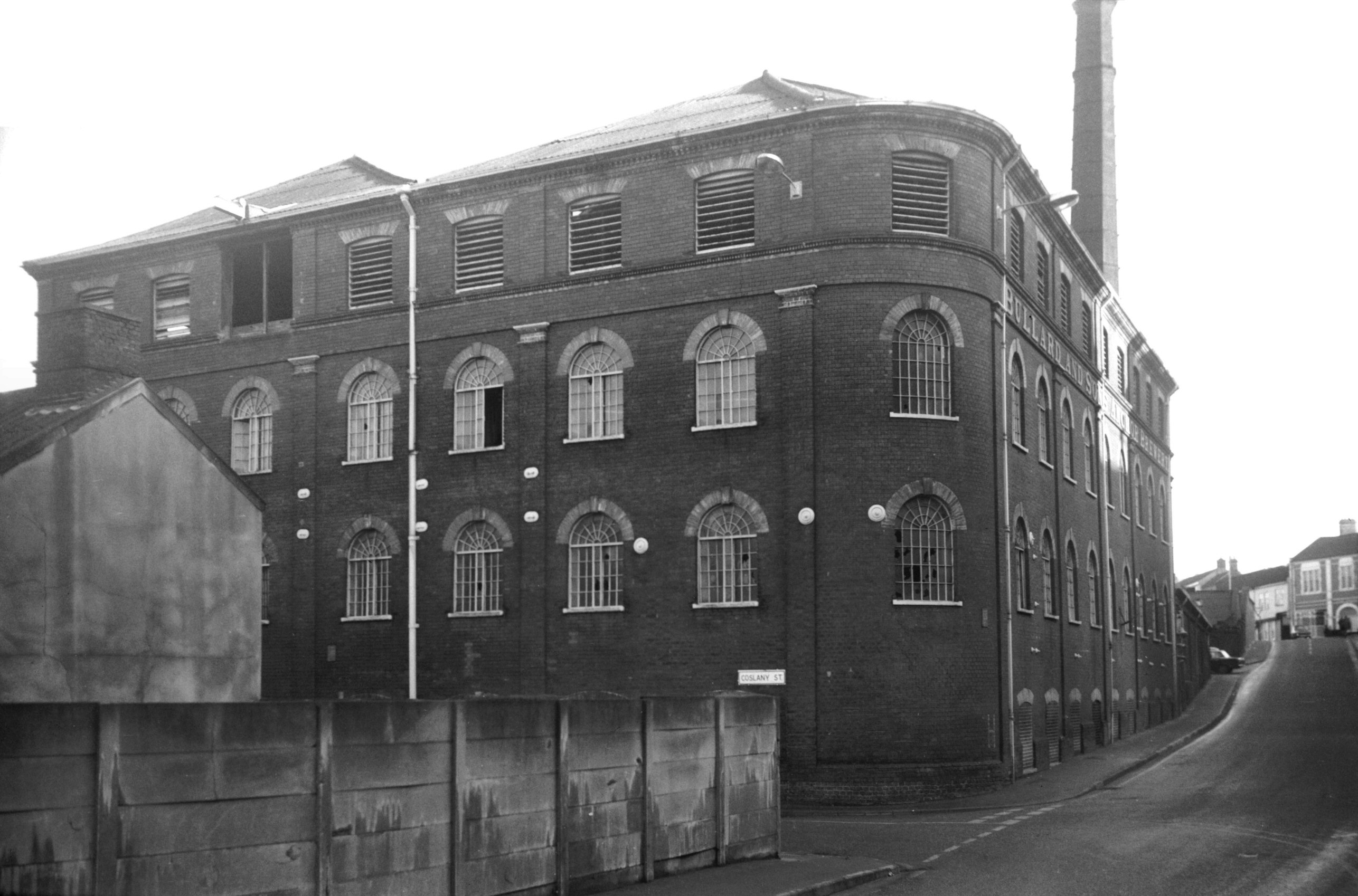
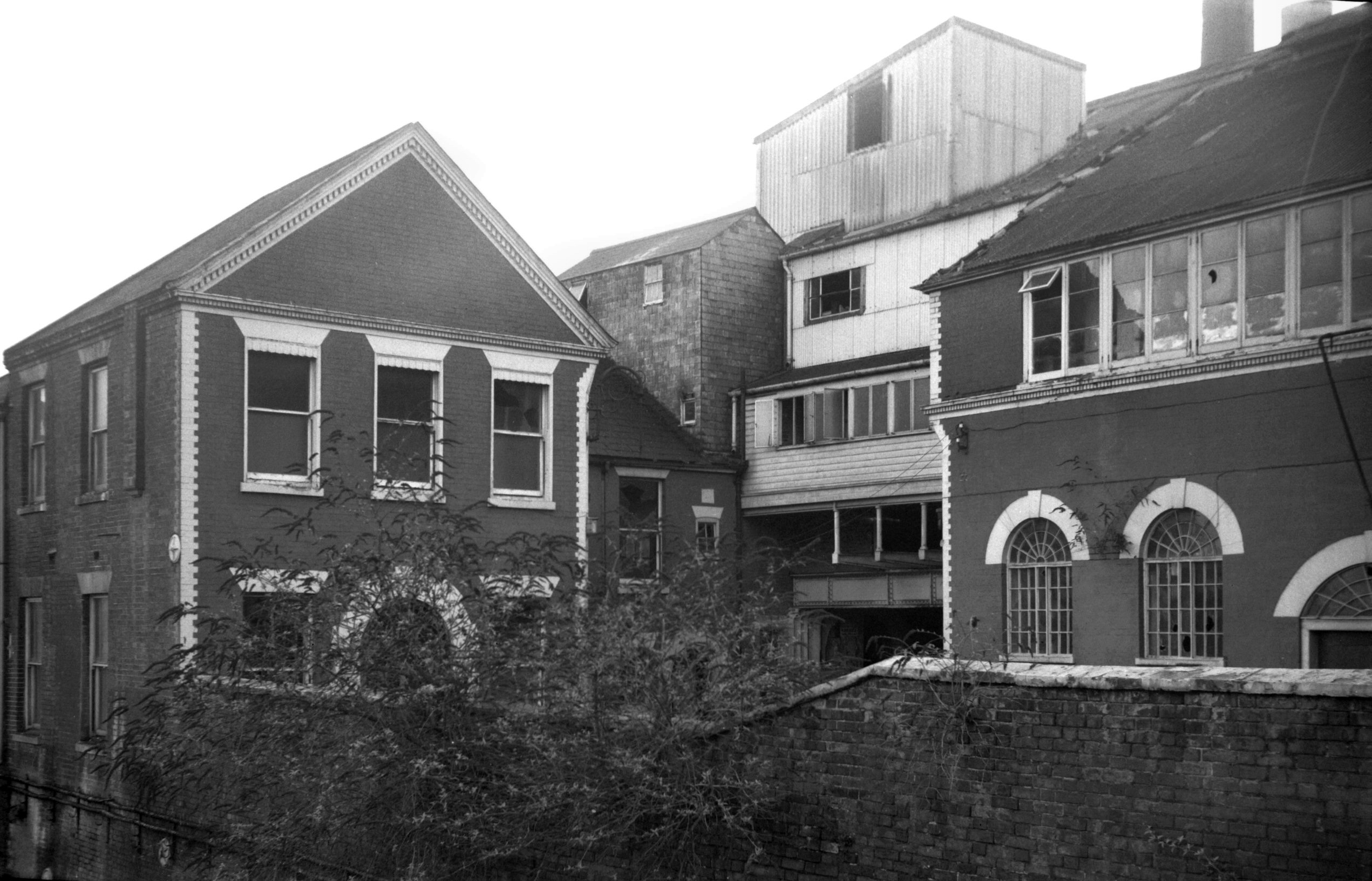
Coslany St Bullard's fermentation hall [5342]
1973-01-05
Corner of Westwick St. |
|
|
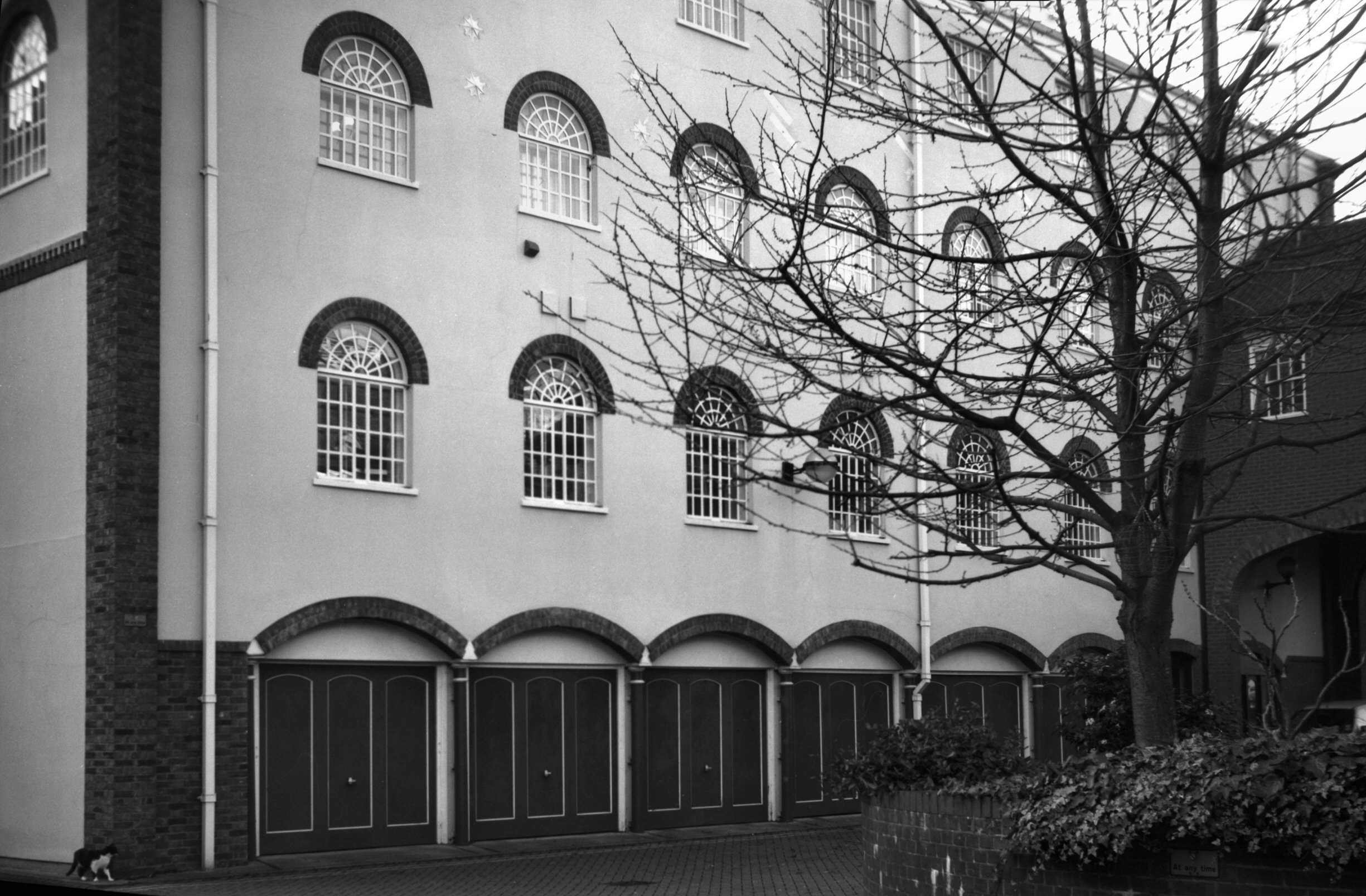
Coslany St Bullard's fermentation hall N [7608]
1998-12-13
North facade. |
|
|
Coslany St Bullard's brewery frontage [5344]
1973-01-05
|
|
|
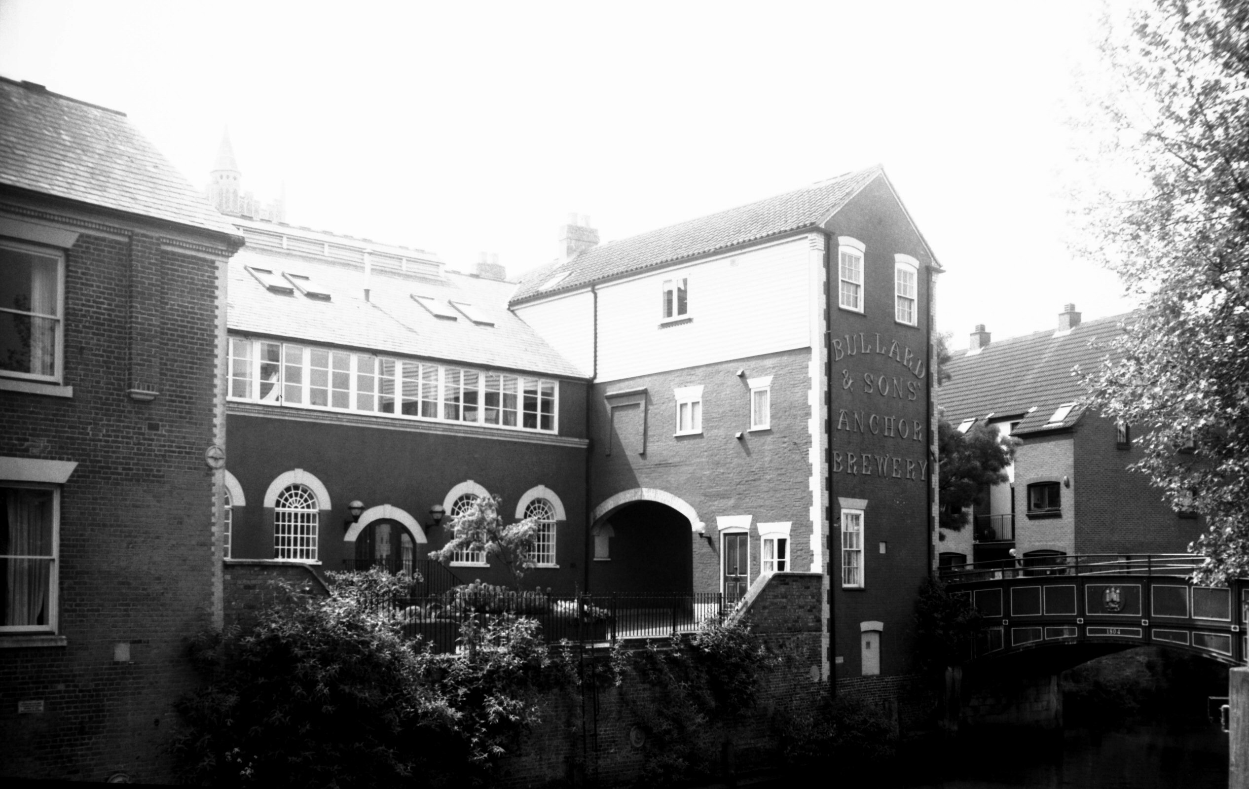
Coslany St Bullard's Anchor Brewery Stores [6297]
1984-04-28
Former Anchor Brewery Stores PH. |
|
|
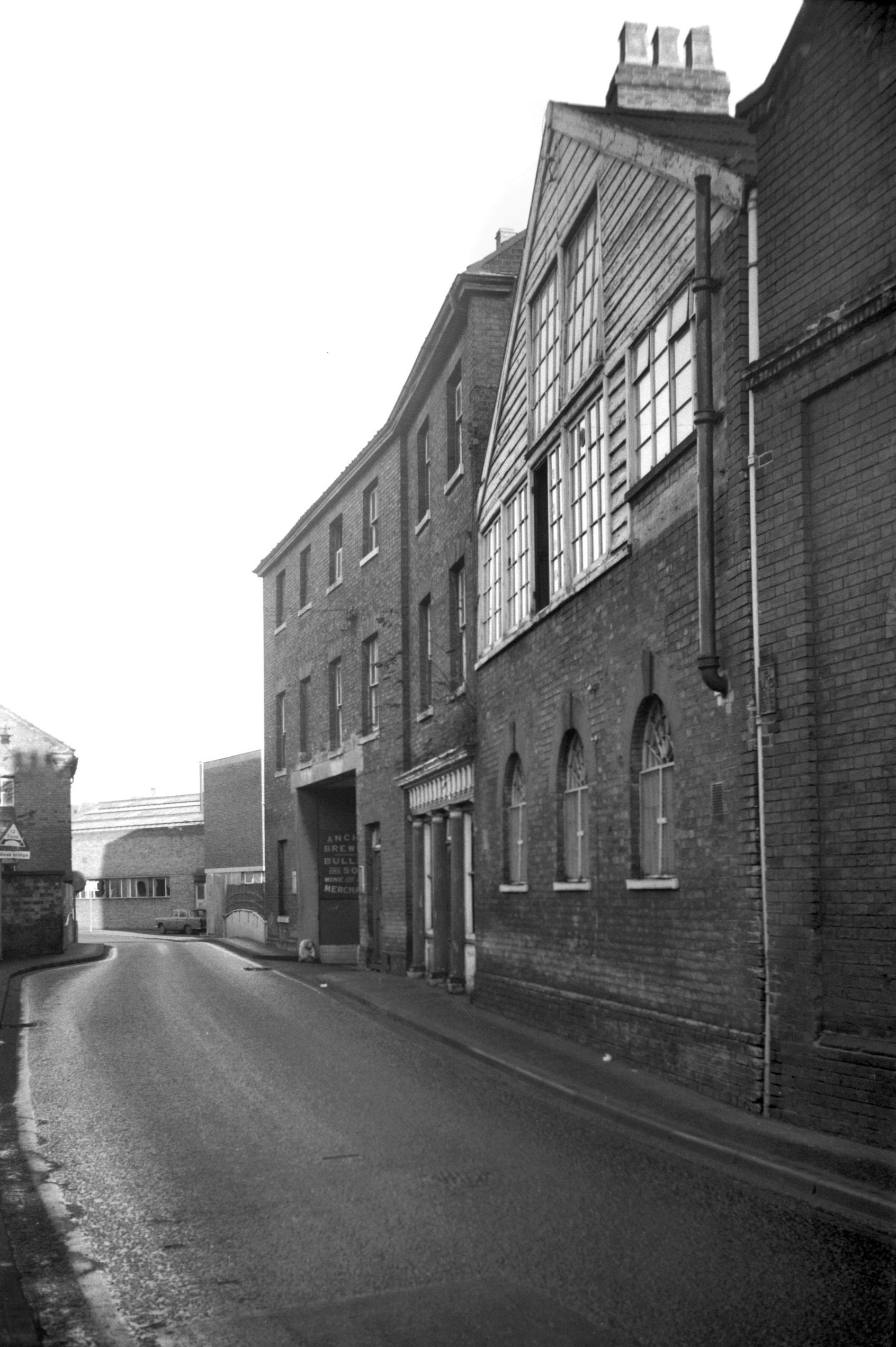
Coslany St Bullard's counting house [5343] 1973-01-05
And Directors' office from St Miles' bridge. |
|
|
Coslany St Bullard's former brewery offices [7754]
2000-05-14
St Miles' bridge, right. |
|
|
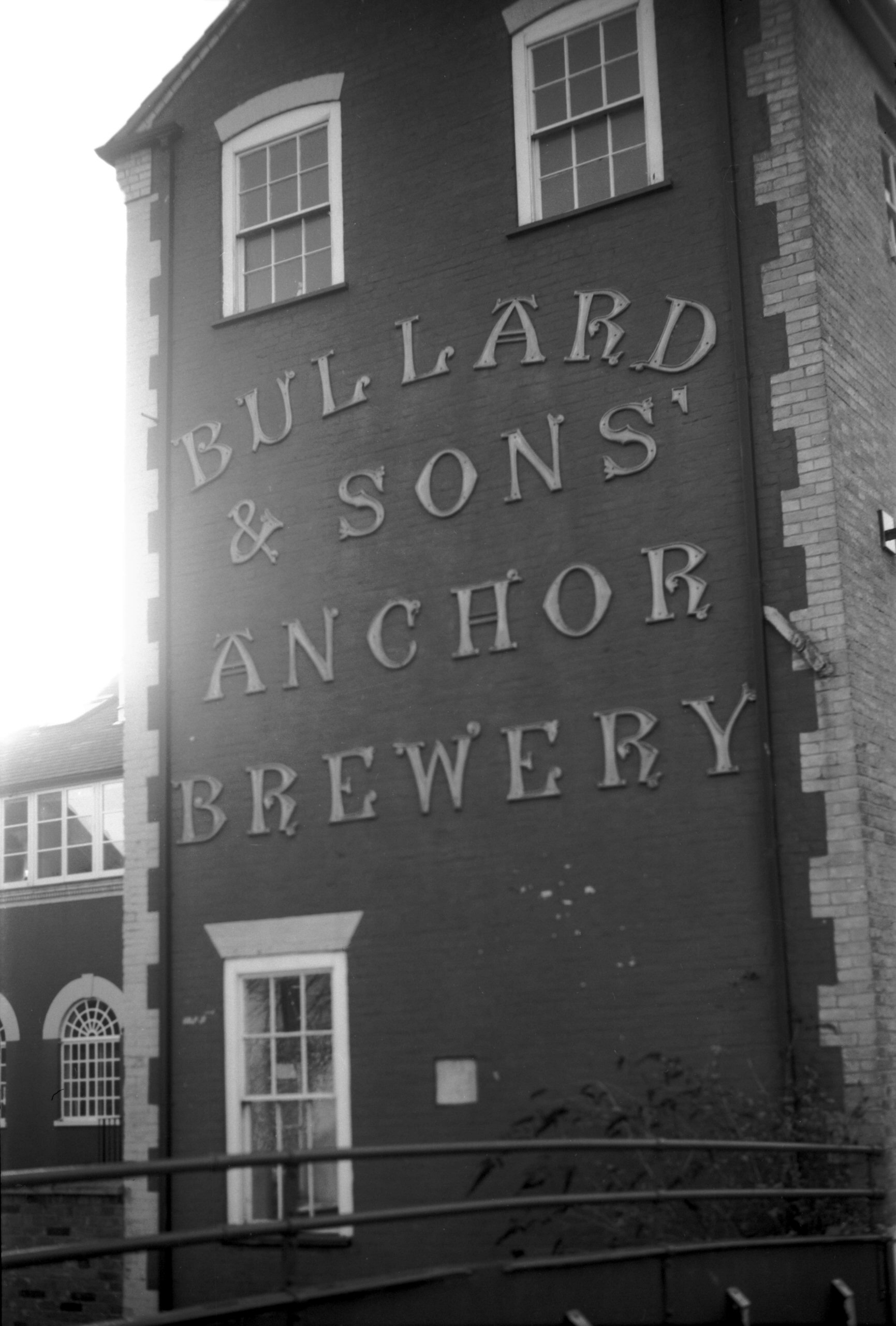
Coslany St Bullard's north side lettering [7607]
1998-12-13
Overlooking the river. |
|
|
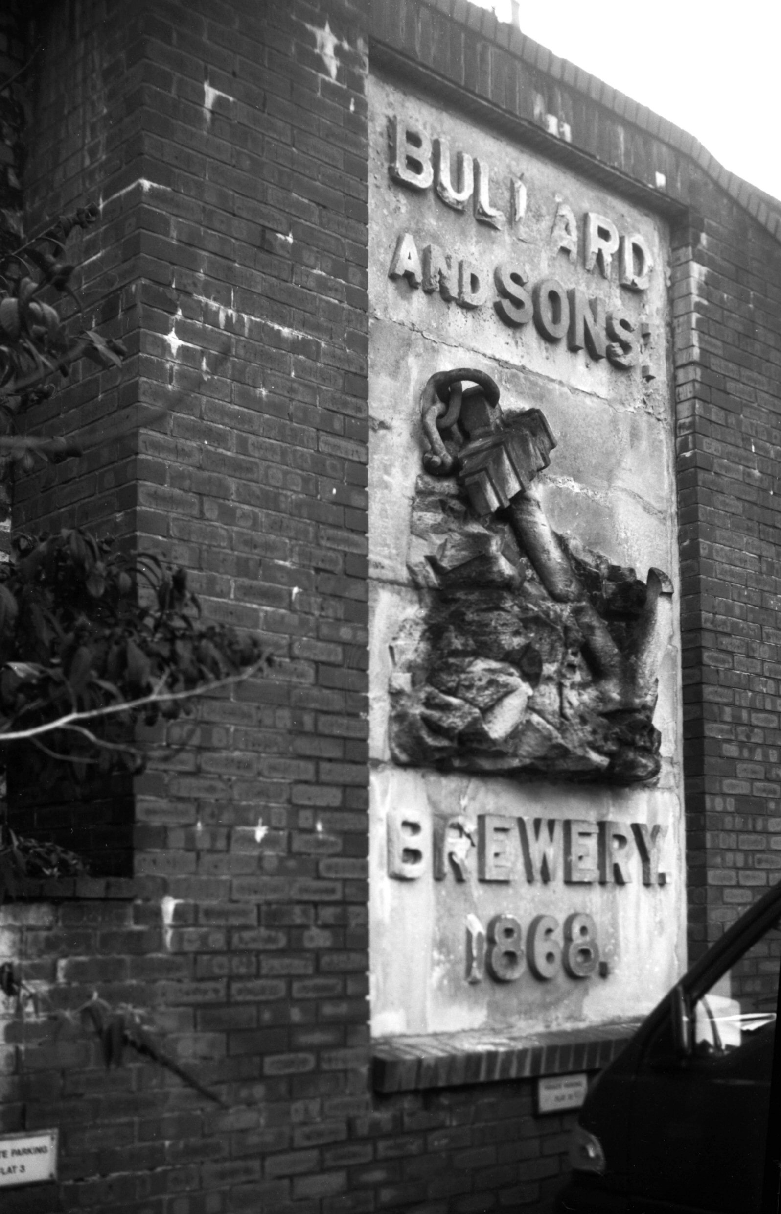
Coslany St Bullard's sculpted anchor panel [7606]
1998-12-13
Formerly at the base of Bullard's brewery chimney. |
|
|
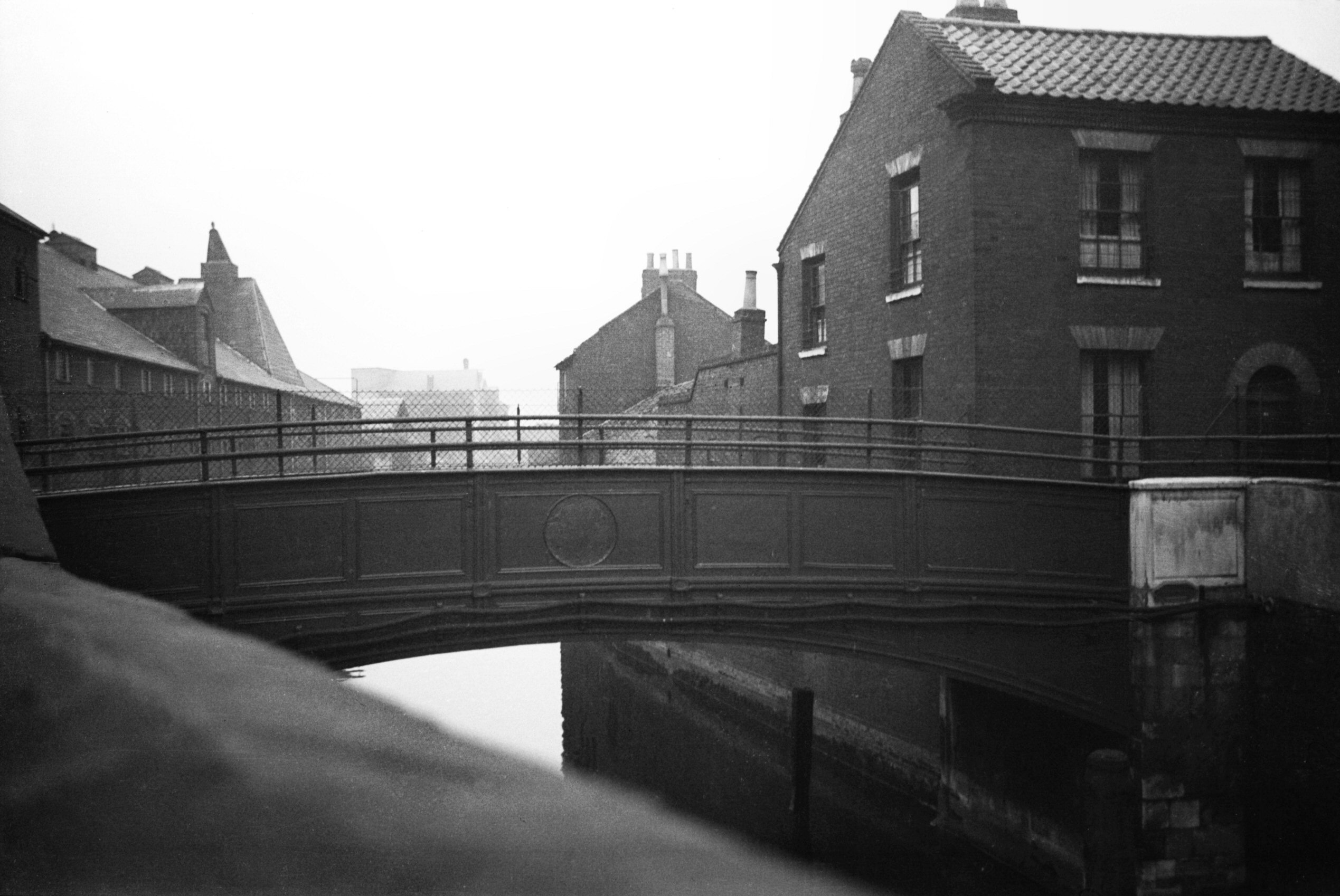
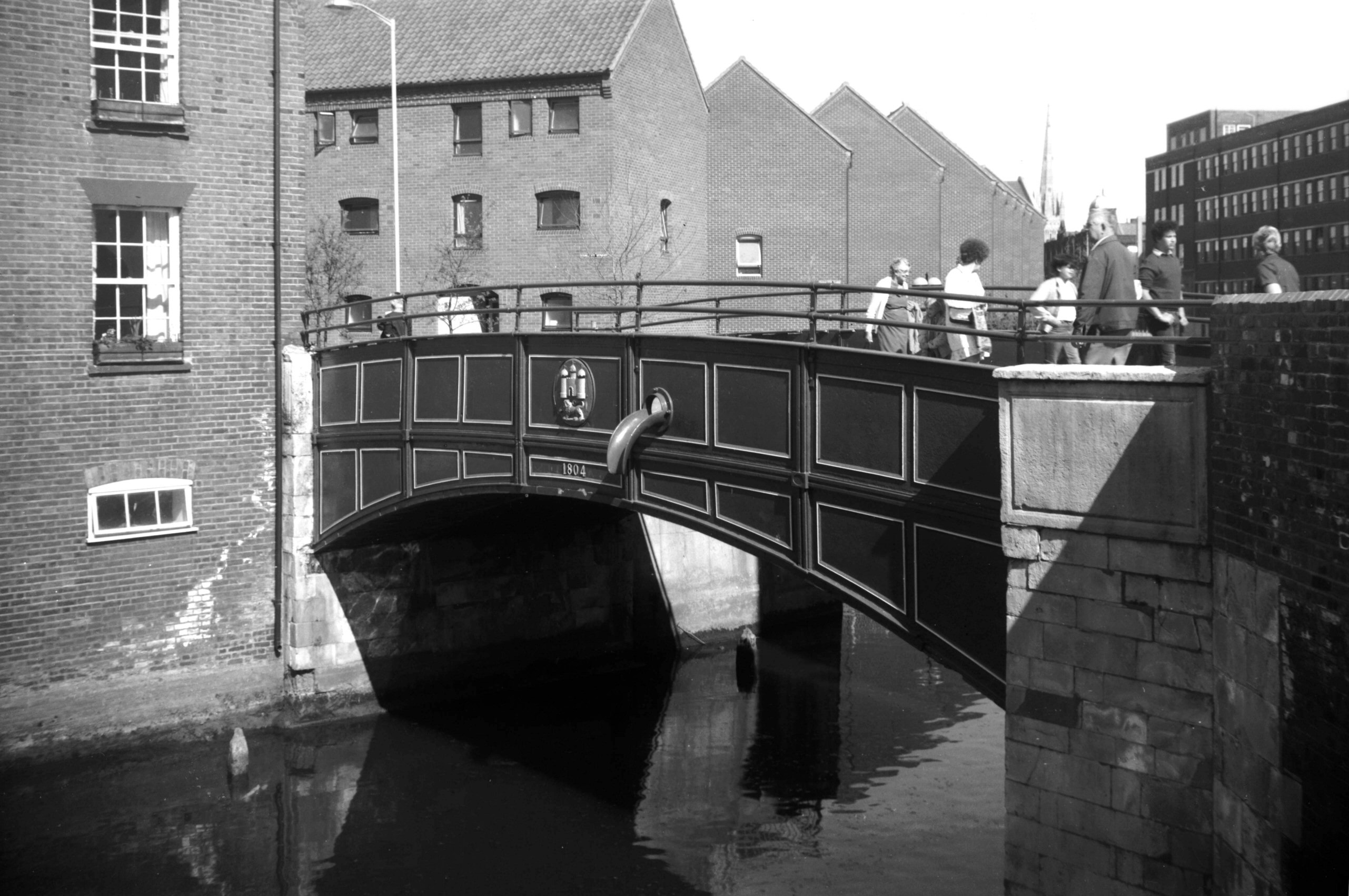
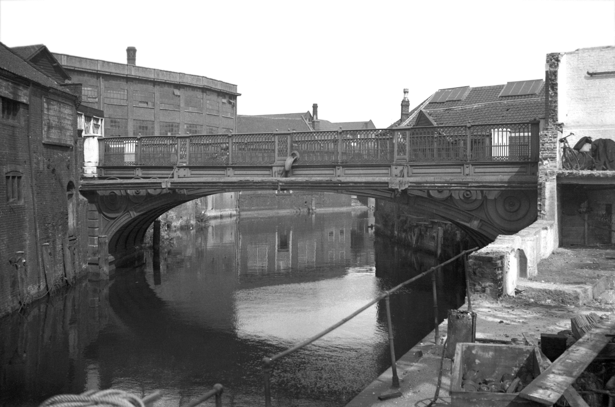
Wensum St Miles' Bridge Coslany east side [0056]
1934-03-22
|
|
|
Wensum St Miles' Bridge Coslany east side [0057]
1934-03-22
|
|
|
Wensum St Miles' Bridge Coslany east side [5433]
1975-07-03
Of previous structures the earlier ones were of timber.
Originally there were two bridges here, linking an island
to the mainland. By 1521 (and perhaps for some time
before) the island had become joined to the mainland as
on this date a single bridge was built here of stone. The
present structure was designed by James Frost, builder
and architect, and was opened on 15th November 1804. It
is of cast iron with a single span of approximately 30
feet and width between parapets 15 feet. |
|
|
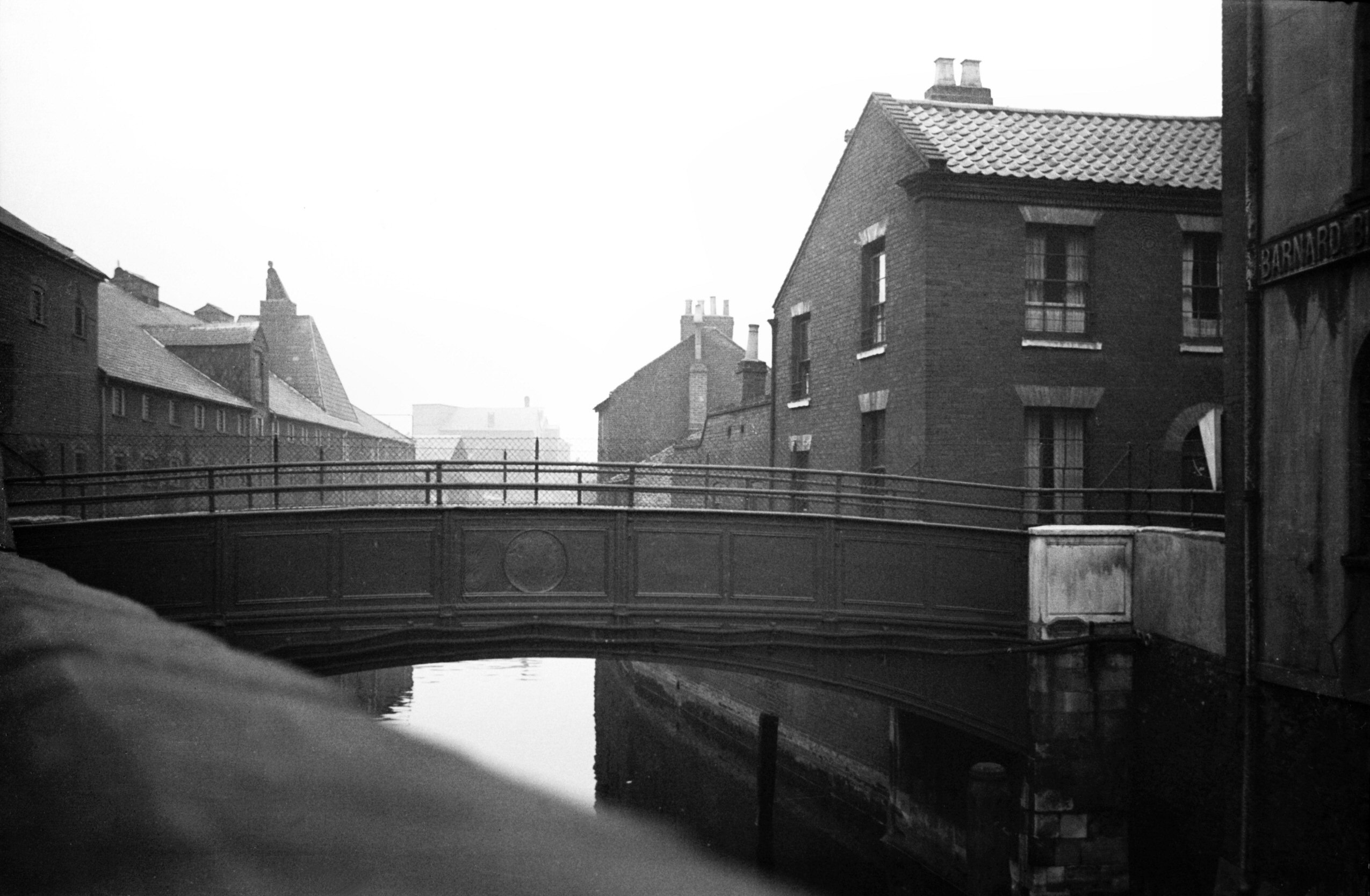
Wensum St Miles' Bridge Coslany west side [6296]
1984-04-27
|
|
|
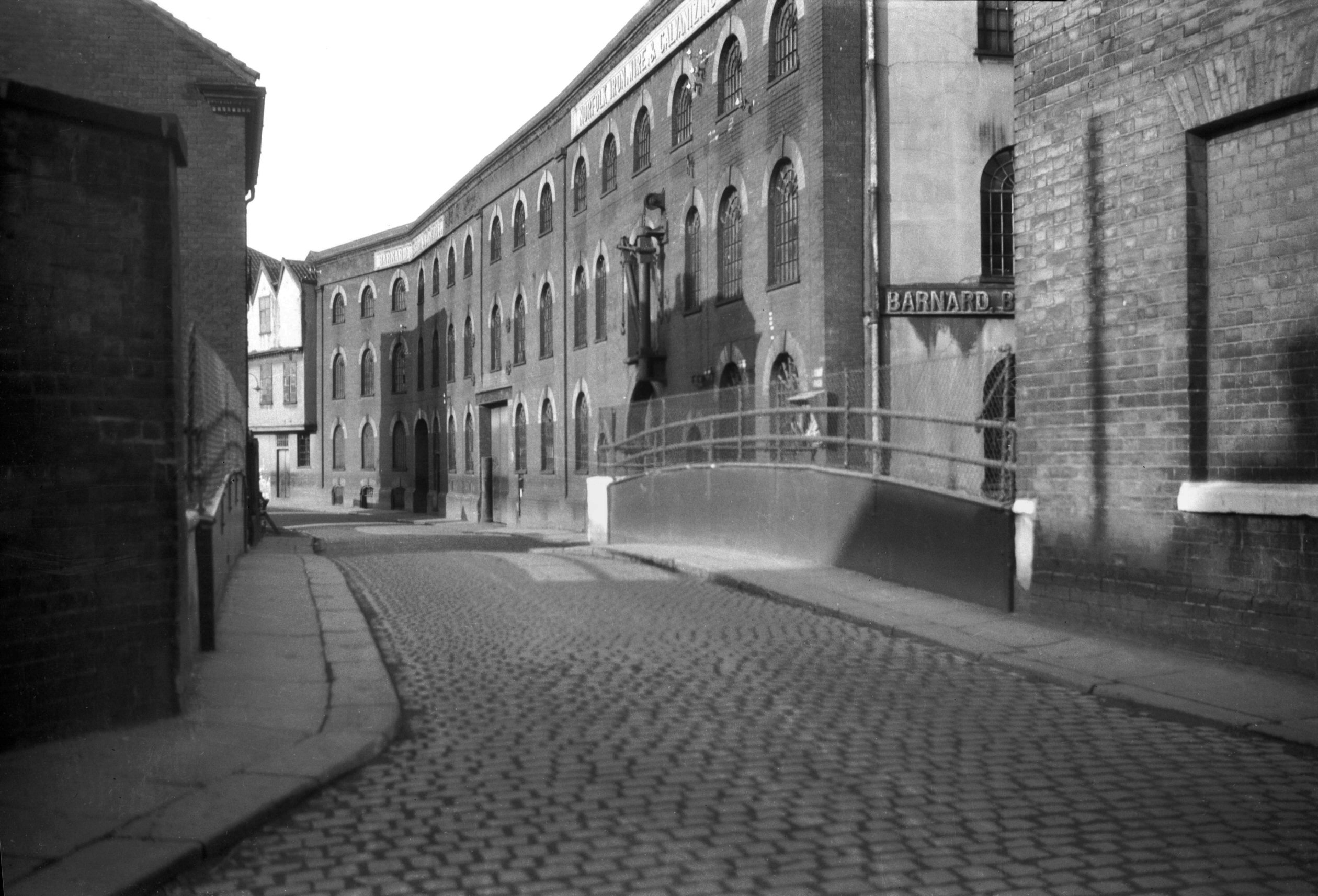
Coslany St Barnard Bishop's iron foundry [B622]
1933-07-11
Barnard, Bishop and Barnard Norfolk Ironworks, 19c. |
|
|
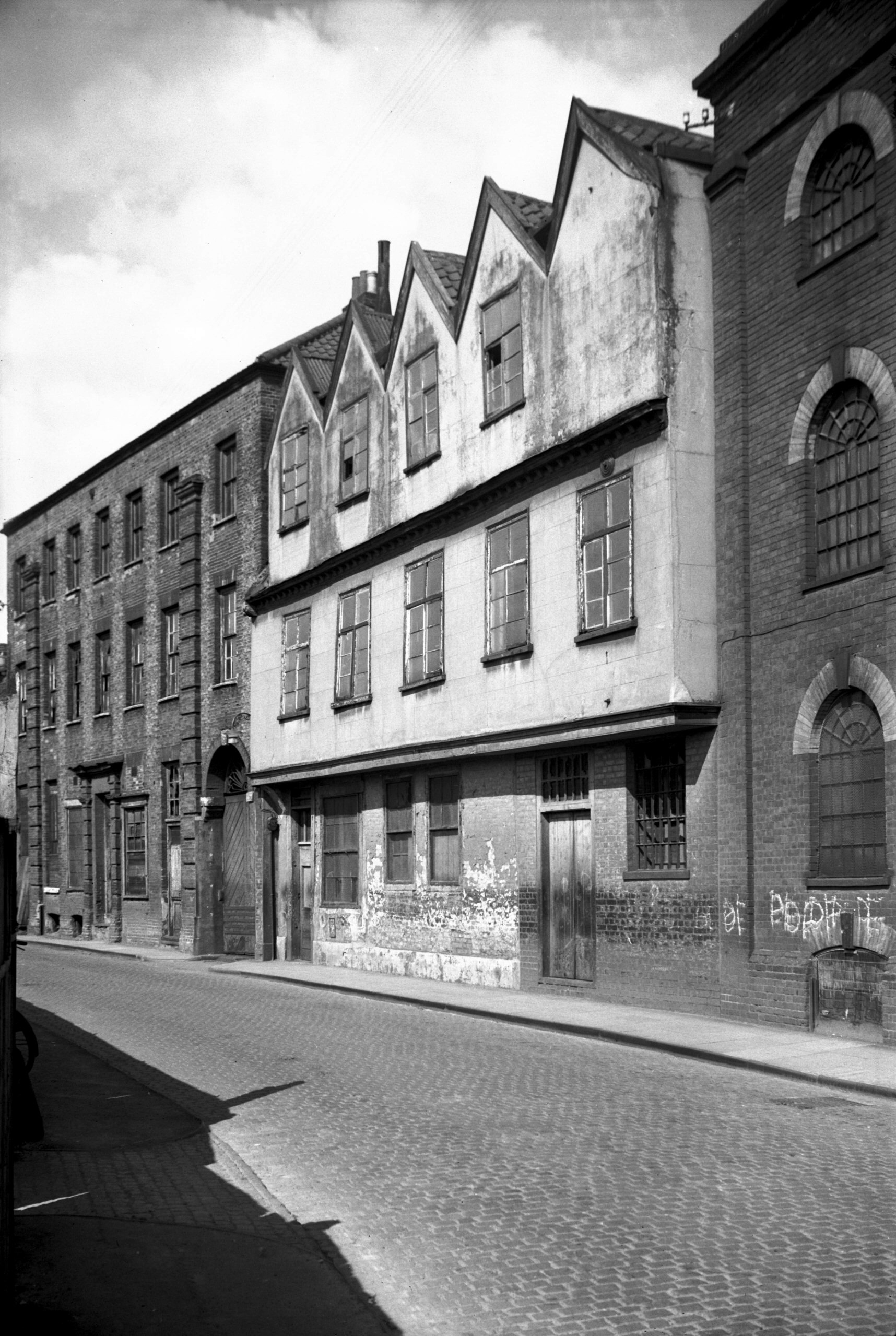
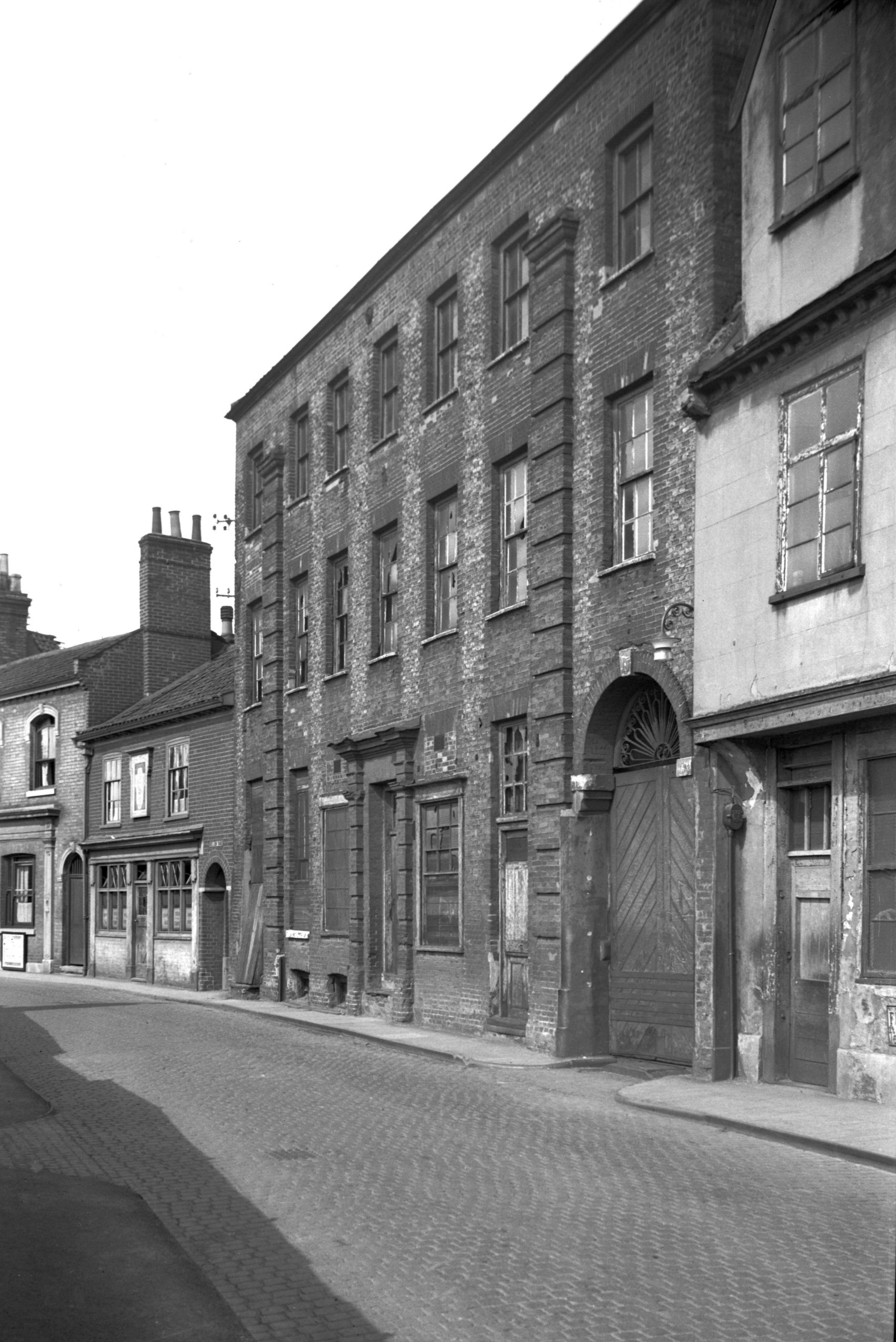
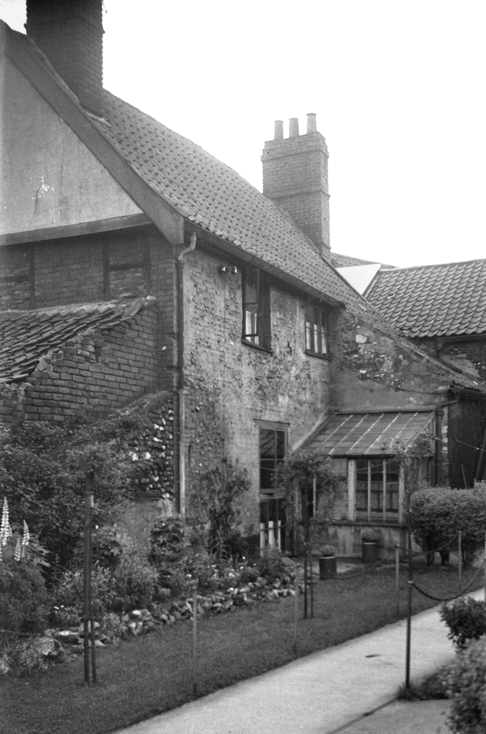
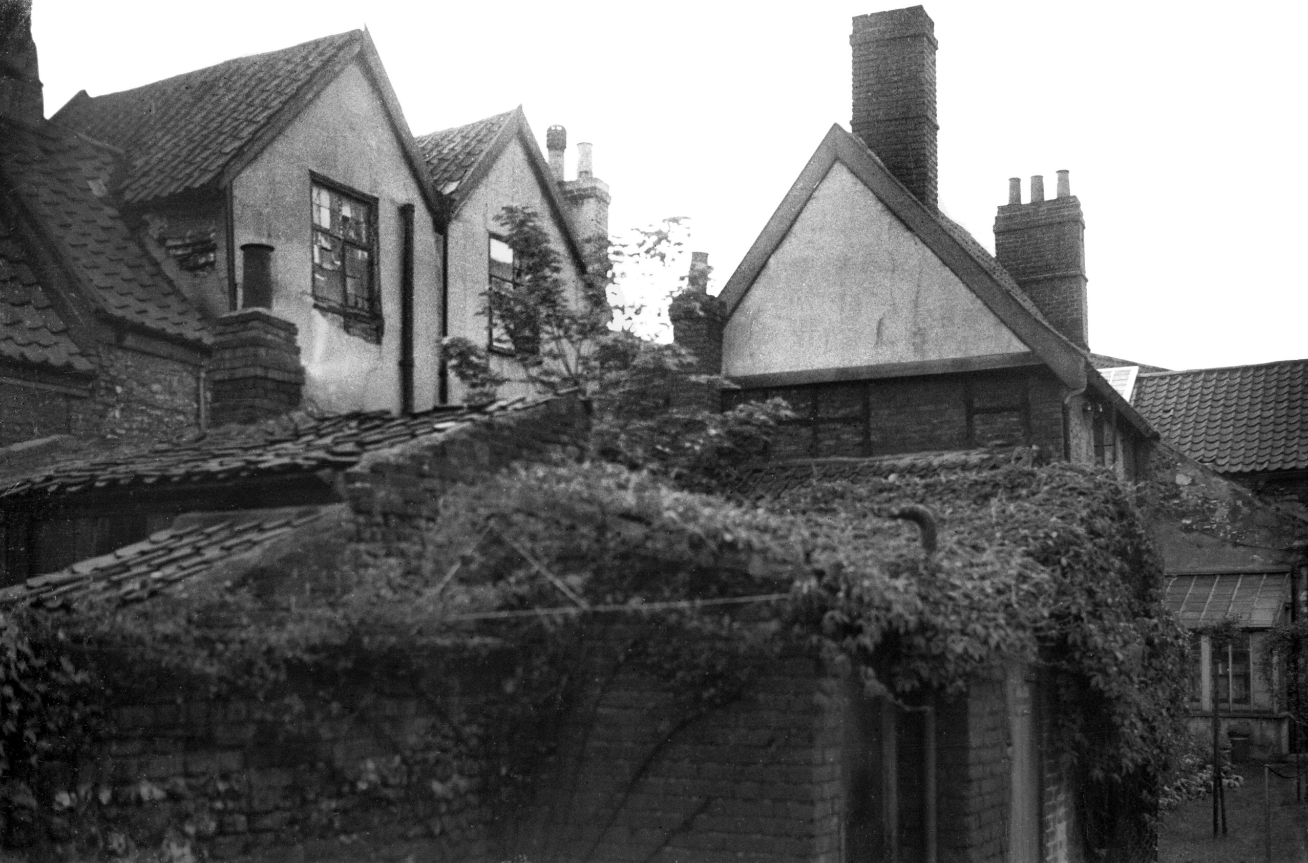
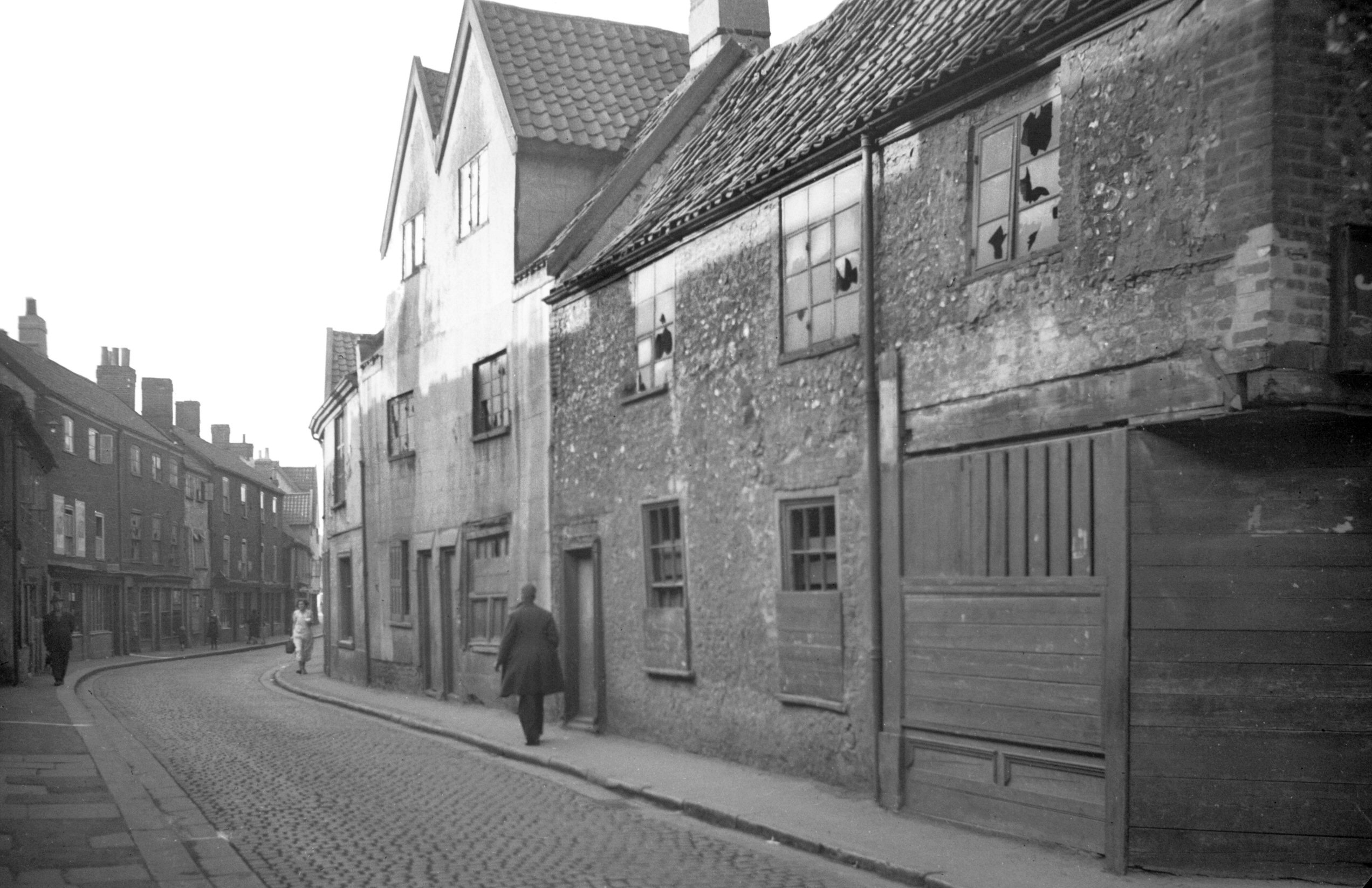
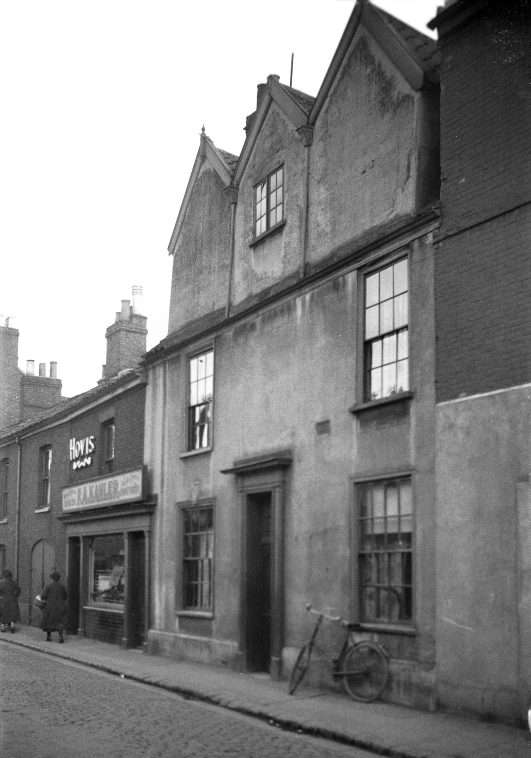
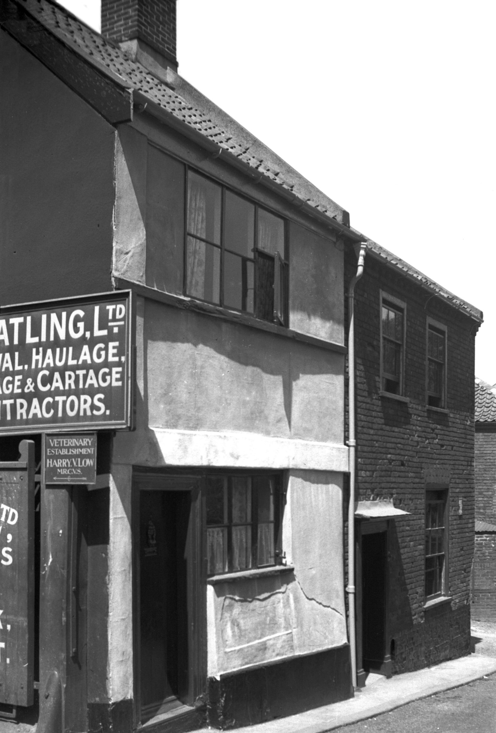
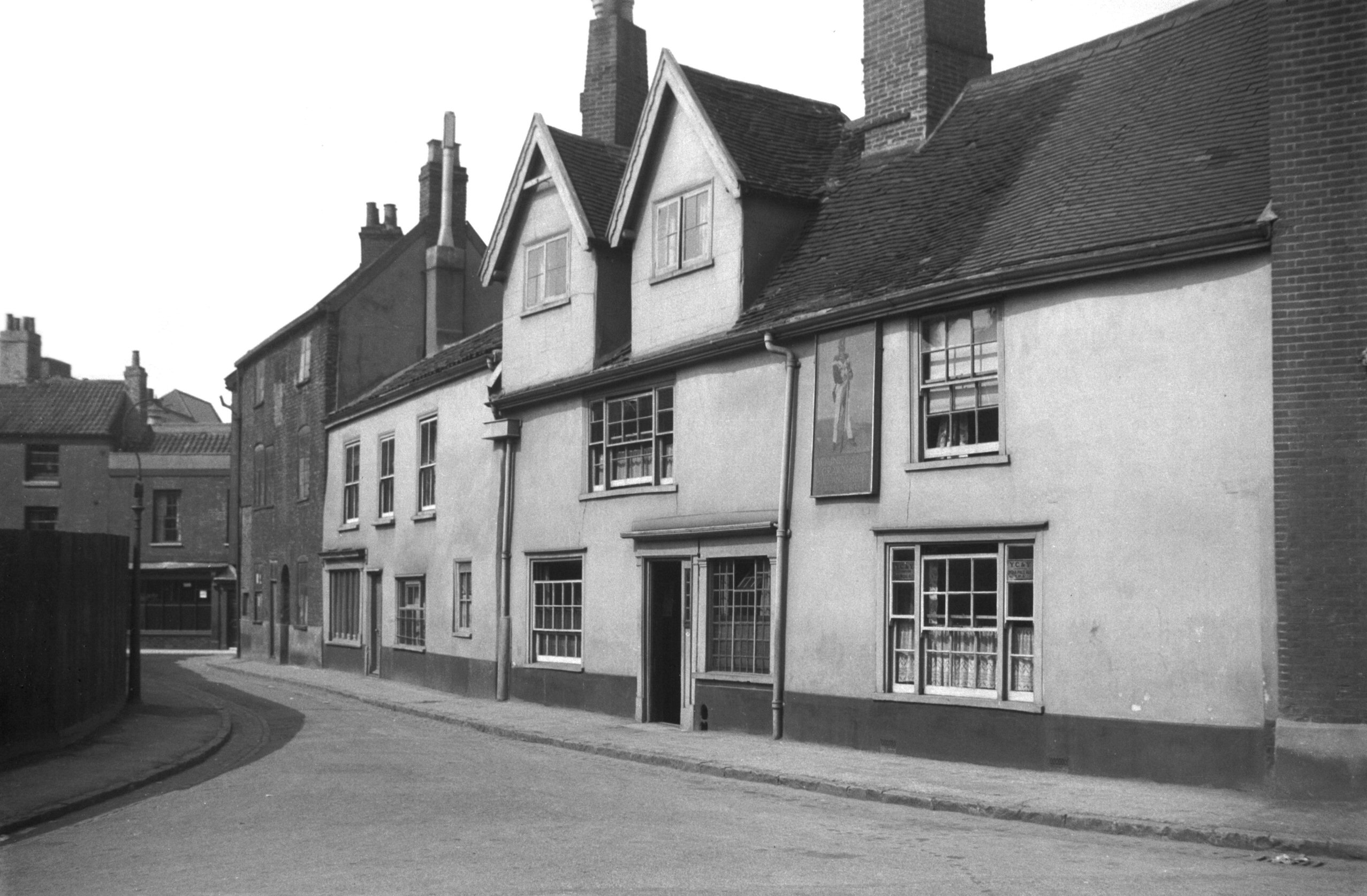
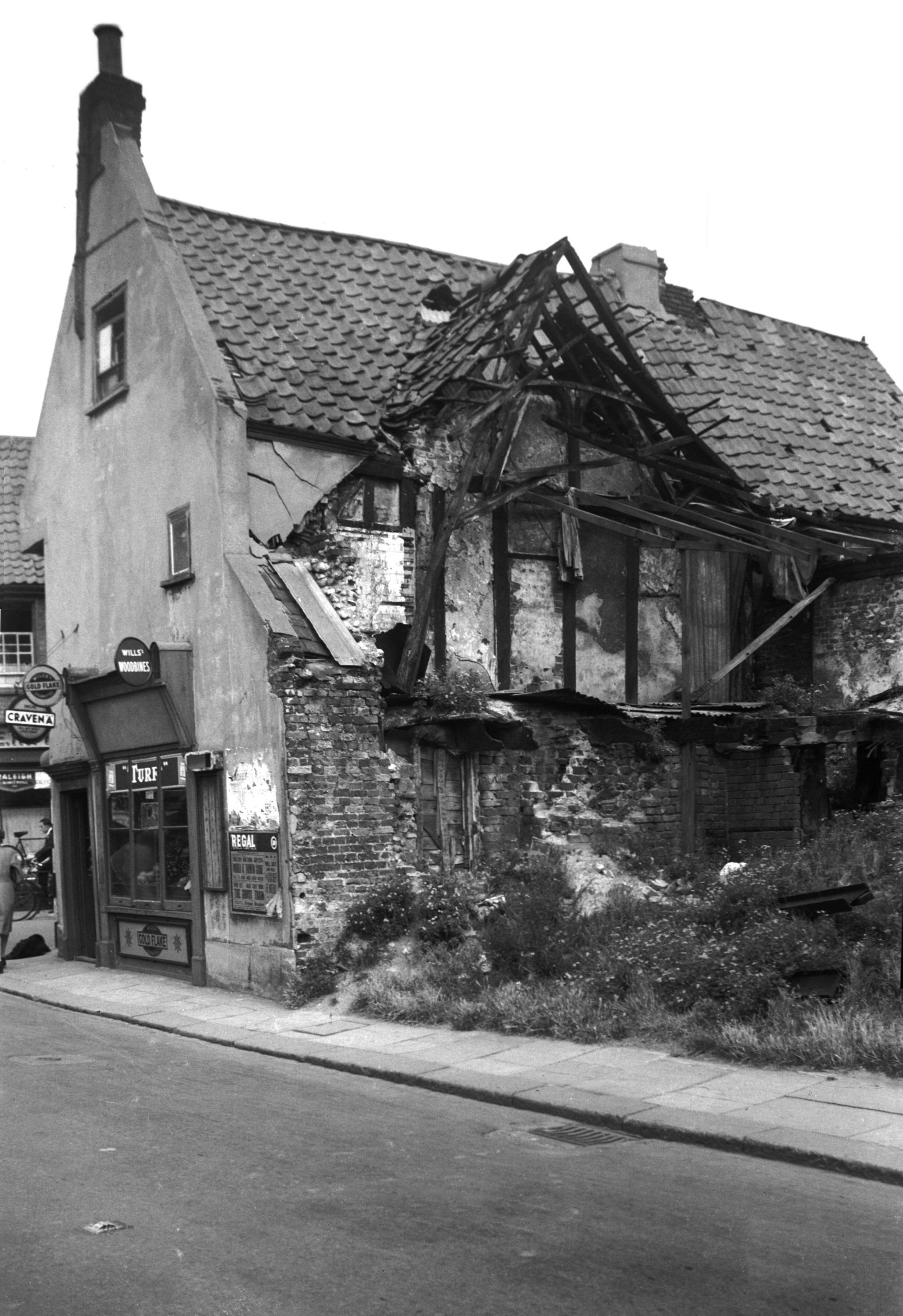
Coslany St 20 to 22 [3196] 1939-07-30
An unusual feature, at least in Norwich, used to be the
iron kerbs that ran along either side of Coslany St. It
was perhaps no coincidence that for many years about an
acre of land adjoining the riverside on the east of this
narrow street was occupied by Barnard's foundry. No
doubt, therefore, this special kerb was laid to protect
the edges of the pavements from the excessive wear and
tear, which might otherwise have been caused by heavy
iron-tyred horse-drawn vehicles entering and leaving the
premises.
By the 1920s the houses in this street, like those of Elm
Hill, had become very run-down, but unlike Elm Hill they
had nobody to plead sufficiently strongly for their
restoration. Adjoining the foundry were three houses that
survived until after the war. Their being listed as grade
III under the Town and Country Planning Act was
insufficient to save them when the whole site was
eventually cleared for a housing development. One was a
three-storeyed mansion of red and blue bricks, the front
supported by pilasters, and with a central doorway also
of moulded brick. The other two were timber framed,
possibly 17c, the first floor jettied and the attic floor
lit by a series of five dormers.
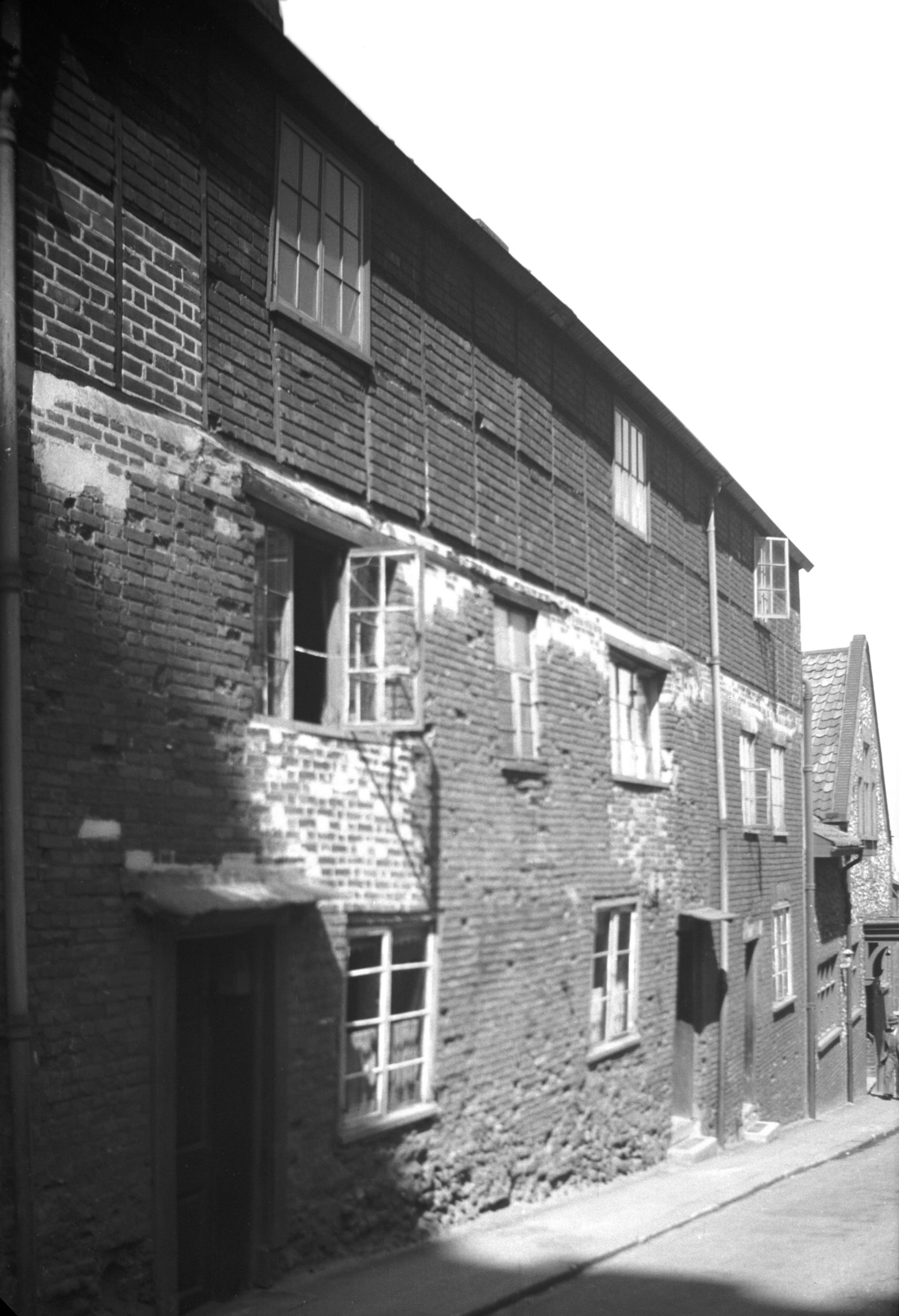
Most of the houses on the opposite side had been cleared
away by 1933. We may still judge their appearance,
however, from a delightful watercolour by Mr Charles
Hobbis which was reproduced a year later in the
Snapdragon annual. The principal building depicted had
once been the Waggon and Horses public house, known
before 1844 as the Jolly Dyers, but originally a
merchant's mansion. It was not until it was being
dismantled that a beautiful ceiling of moulded oak,
thought to date from about 1540, came to light. Plastered
over so that only the principal mouldings showed, the
ceiling was discovered too late to save the building. The
beams of the ceiling, however, were carefully taken down
to be re-used in a public house then being rebuilt at
Brandon - the Flintknappers - where visitors may still
admire this specimen of mediaeval craftsmanship.
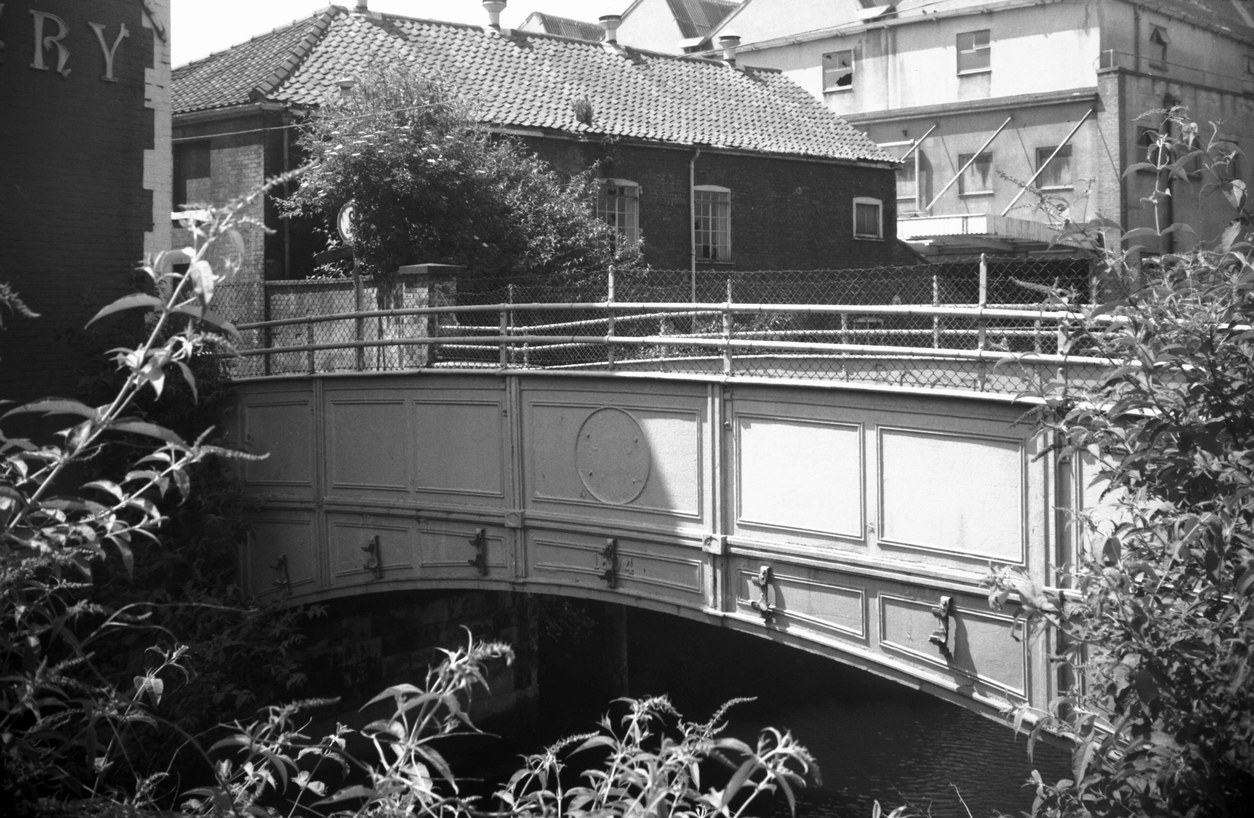
Coslany St crosses the Wensum by the narrow St Miles'
bridge (built 1804), now brick paved and open only to
pedestrians. Here was the extensive Anchor Brewery of
Bullards, now transformed into a new housing, shopping
and office development with the old fermentation hall,
counting house and taproom admirably adapted by
Scrolapoint to their new roles. |
|
|
Coslany St 24 [3195] 1939-07-30
|
|
|
Coslany St 30 [B139] 1931-00-00
|
|
Cowgate: |
| |
From
Magdalen St to Barrack St / Whitefriars / St
Crispin's Rd (formerly to
Whitefriar's bridge)
passing Little Bull Close, Peacock
St
North / east side |
|
|
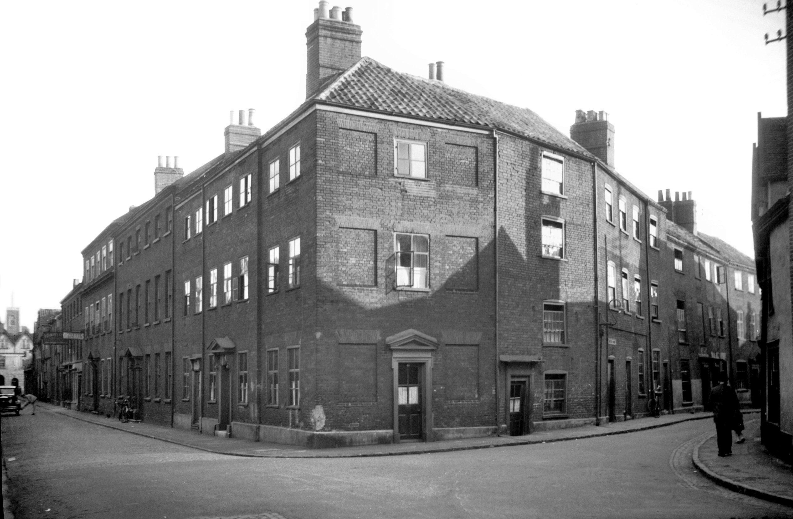
Cowgate 31 [6482] 1987-08-21
|
|
|
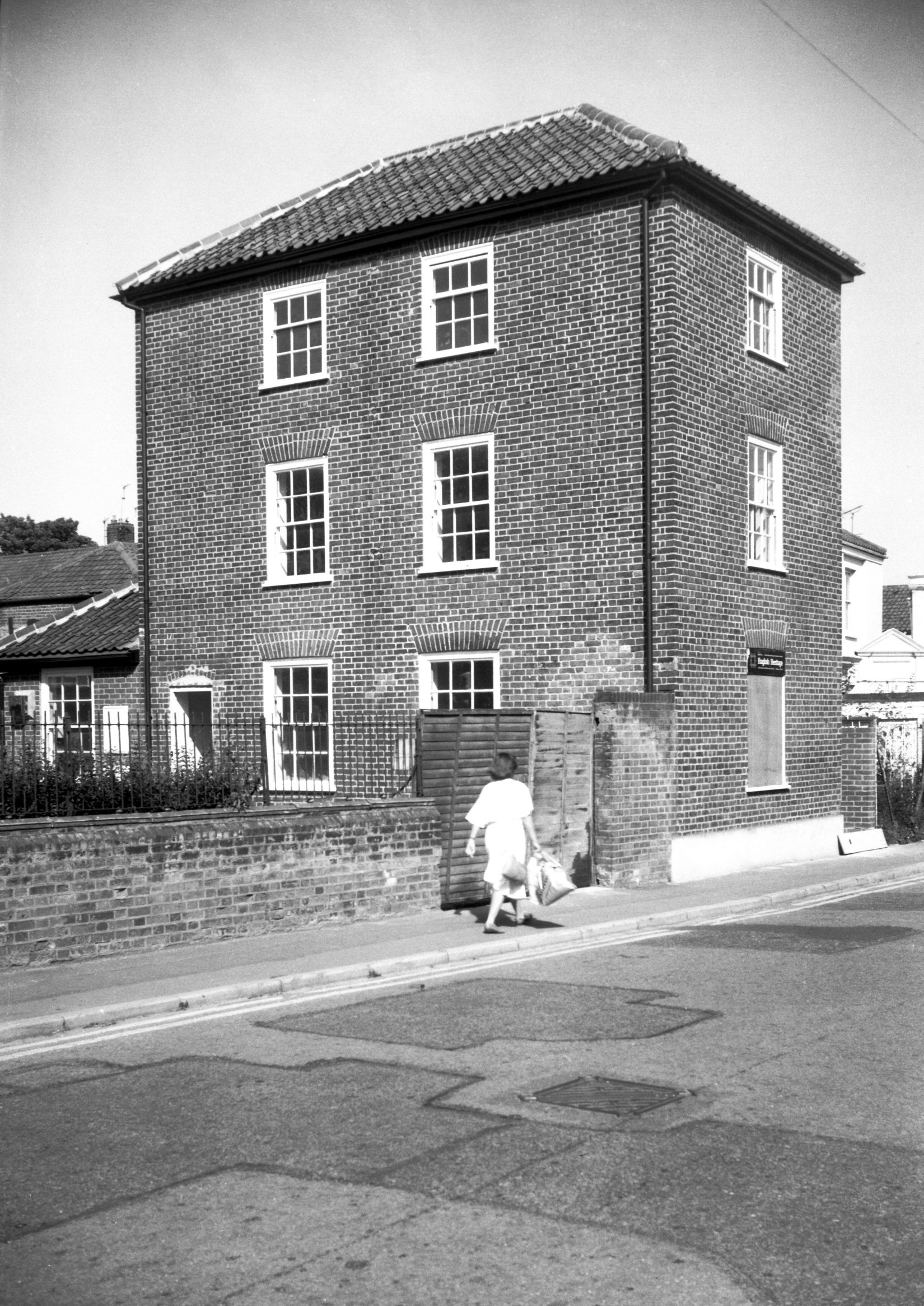
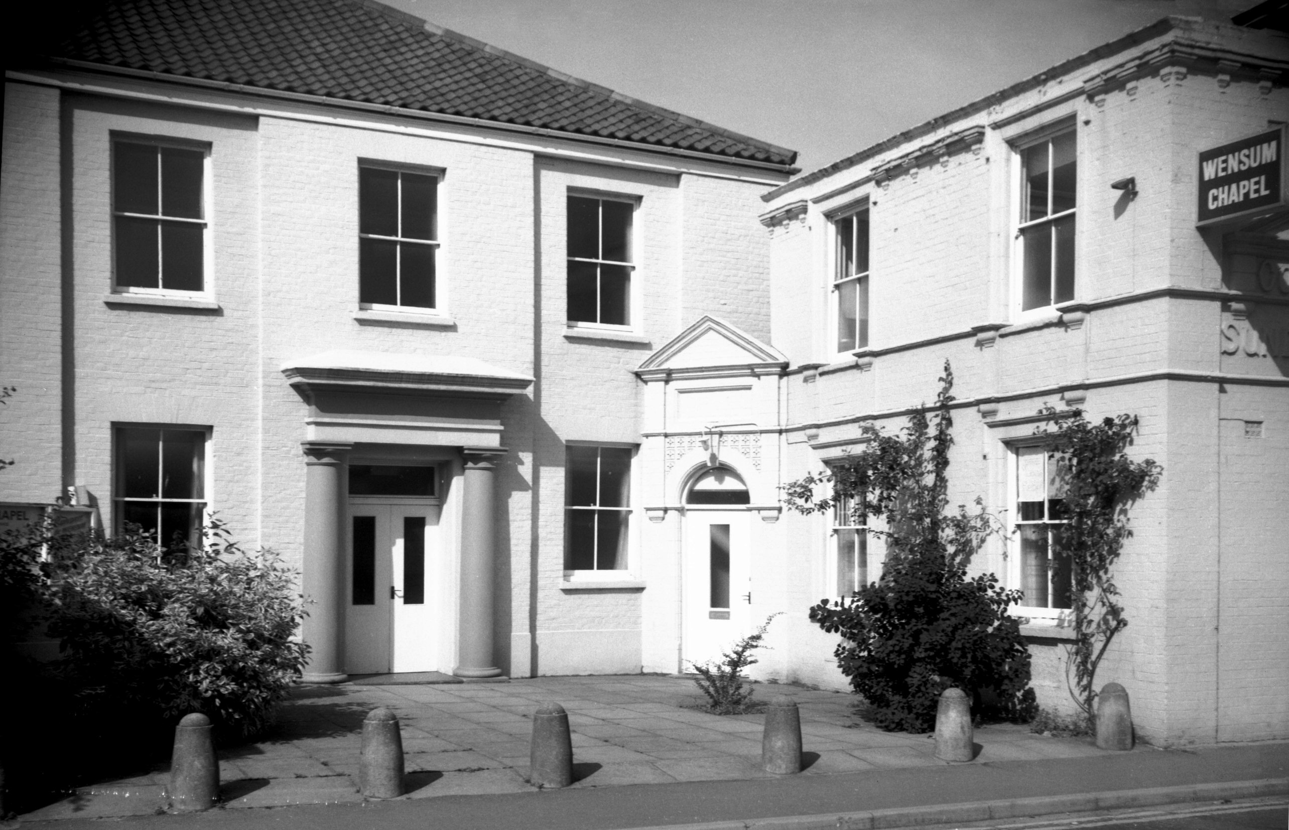
Cowgate Wensum chapel [6483] 1987-08-21
Built 1842 as a Primitive Methodist Chapel. Purchased by
the Christian Brethren 1947. |
|
|
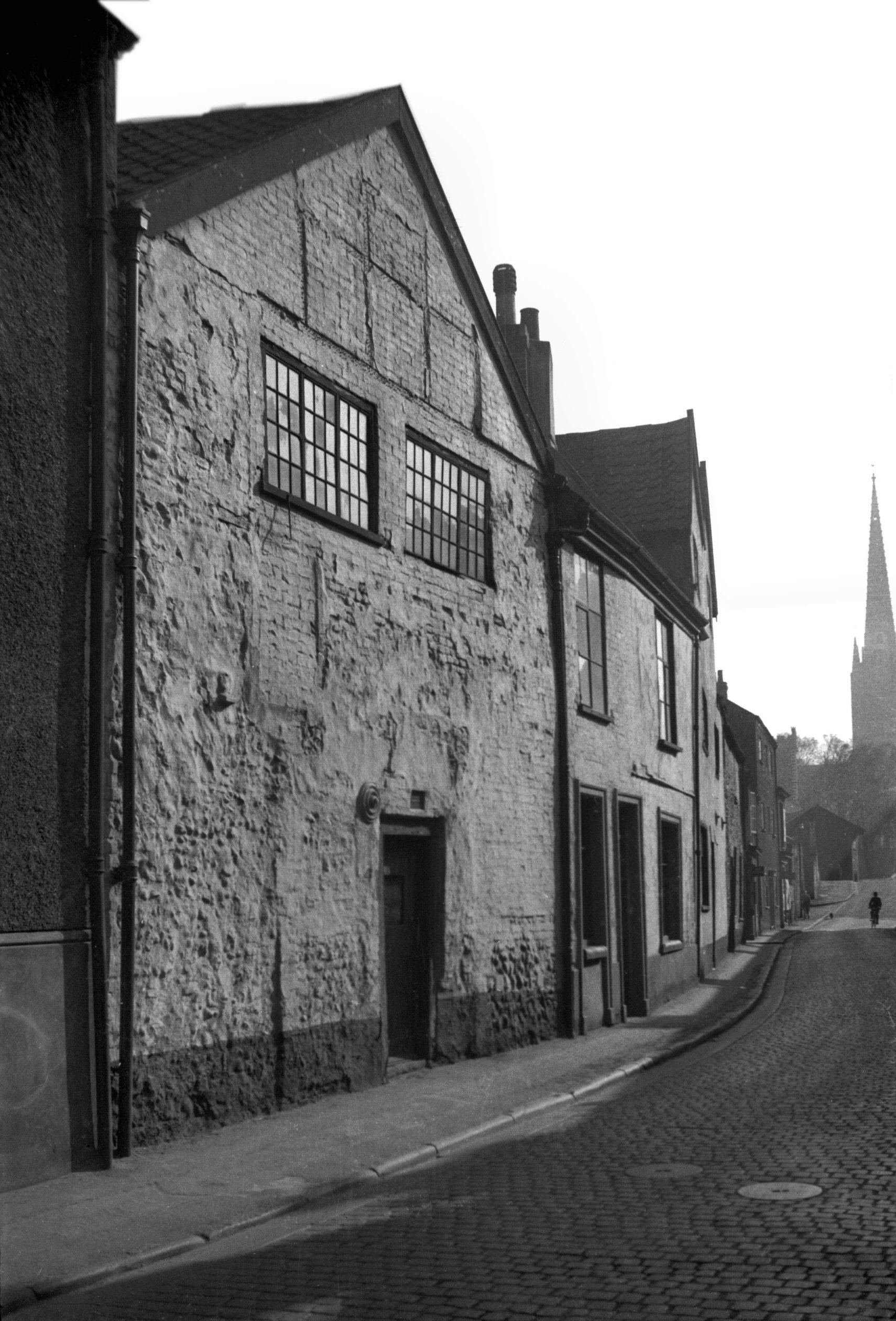
Cowgate 131 [2121] 1938-03-06
The undercroft is a fragment of the Whitefriars'
monastery.
This section of Cowgate south of Barrack St is now part
of Whitefriars. |
|
|
Cowgate 135 to 137 [2120] 1938-03-06
|
|
|
Cowgate Factory Yard view north [1653] 1937-05-29
|
|
|
Cowgate 135 to 137 rear from Factory Yard [1652]
1937-05-29
|
|
|
Cowgate 135 to 141 [0931] 1936-05-06
|
| |
South
/ west side |
|
|
Cowgate 8 [0912] 1936-05-01
|
|
|
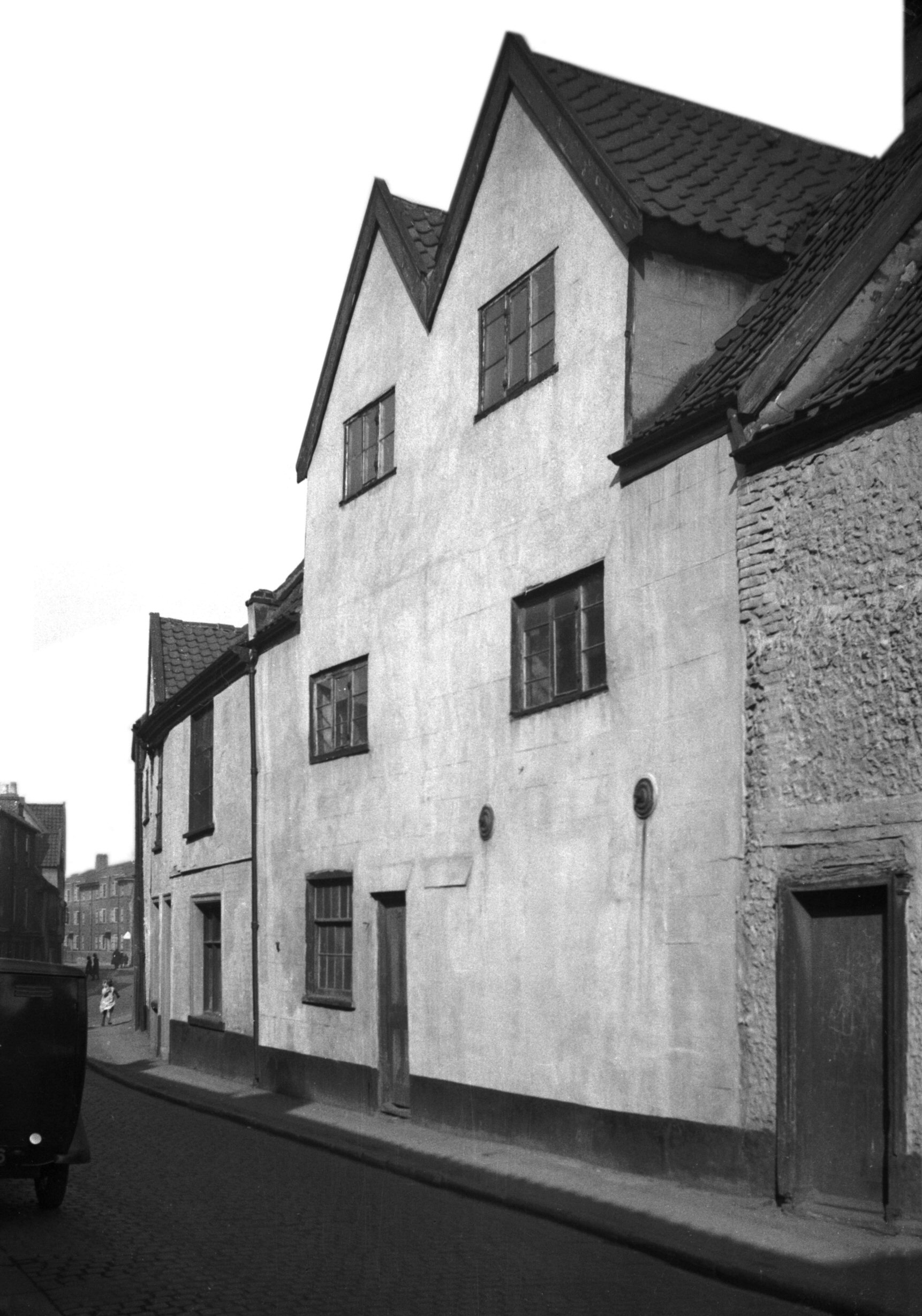
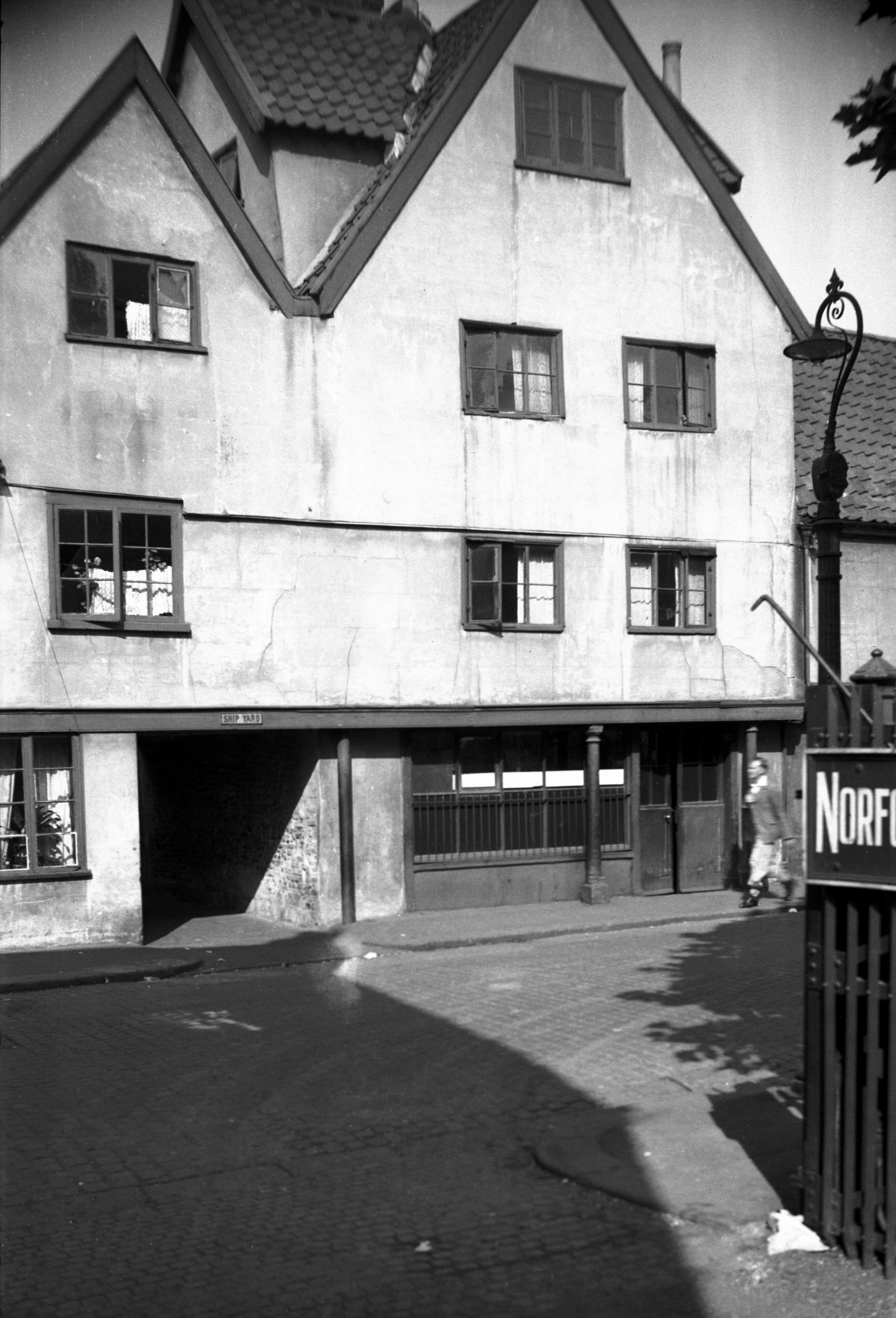
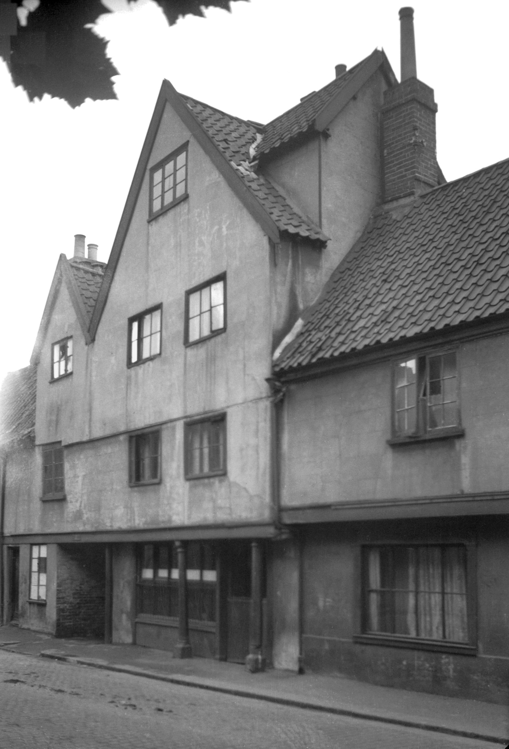
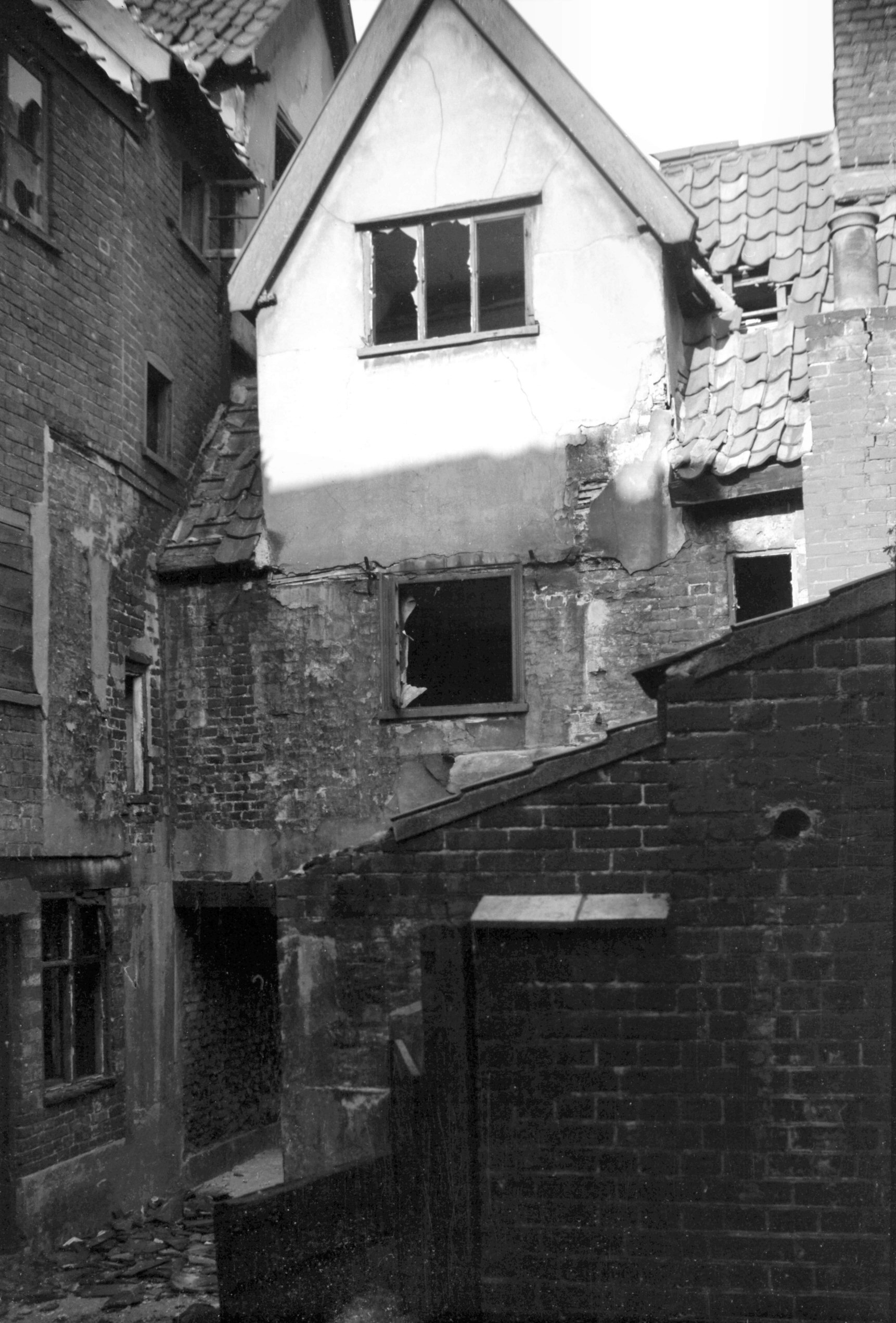
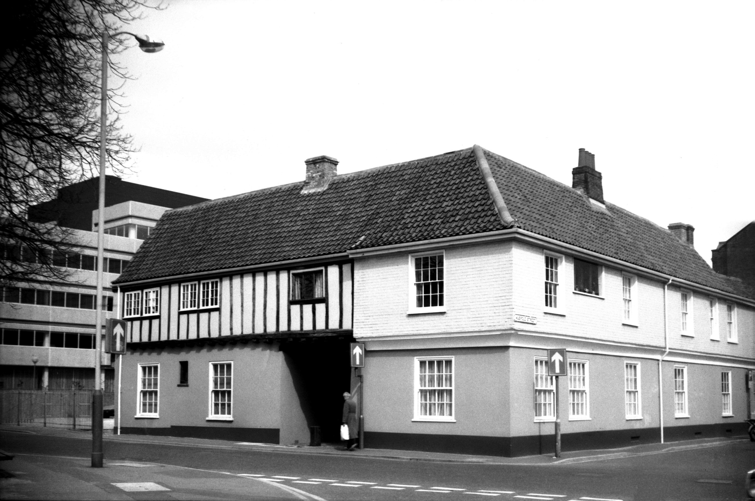
Cowgate 106 Fastolff's House [0620] 1935-08-06
The road north from Whitefriar's Bridge was formerly
called Cowgate. A comparatively narrow thoroughfare, it
bent slightly northeastwards before reaching St James'
church, and thence by a sharp bend to the west entering
Magdalen St. On the right, before reaching Barrack St,
was a hotch-potch of houses and industrial buildings,
while the left-hand side was flanked largely by early 19c
red-brick three-storeyed tenements.
One notable exception, however, was the timber-framed
cement-rendered Fastolff House. This faced St James'
churchyard, forming Nos 104-108 Cowgate, but was
condemned in 1936 by its inclusion in a local clearance
area. It had a very striking appearance with its two
prominent gables, and with the front overhang supported
by two posts. The northern gable was carried up an extra
storey and had small dormers on either side for lighting
the attic. Local antiquaries had no doubt that it was of
15c origin and could be identified as Sir John Fastolff's
city house (Sir John owned Caister Castle and died in
1450). The historian Francis Blomefield had this to say:
"There is an ancient house in this parish (St
Paul's) opposite to St James' church, in which Mr Rich.
Carr now dwells, which was called anciently Fastolff's
Place, and was built by the great Sir John Fastolff of
Caister-by-Yarmouth, Knt., and is called in some old
evidences, his place or city-house in Pokethorpe; to
which manor it pays a rent of 1s.5d. a year. His great
hall is now a baking office; the bow-window is adorned
with the images of St Margaret; St John, Baptist in his
garment of camel's hair; the Virgin Mary; St Blase
holding a wool comb, and St Catherine. In a large north
window are ten effigies of great warriors and chiefs, as
David, Sampson, Hercules &c., holding bows, swords
and halberds &c., ornaments suitable to the taste of
so great a warrior as Sir John was."
During the 19c it became the Ship inn, the name being
perpetuated in the adjoining yard.
Now the whole scene has changed. Cowgate from the bridge
to the giant roundabout linking Barrack St with St
Crispin's Rd (Inner Link road) has been straightened and
widened to more than double its former width and has been
renamed Whitefriars. |
|
|
Cowgate 106 Fastolff's House [1434] 1936-09-20
|
|
|
Cowgate 106 Fastolff's House from Ship Yard [2973]
1939-05-13
|
|
Cow Hill: |
| |
From
St Giles'
St to Pottergate / Ten
Bell Lane
passing Willow Lane |
|
|
Cow Hill 1 [1681] 1937-06-05
|
|
|
Cow Hill 2 to 3 [1343] 1936-08-29
|
|
|
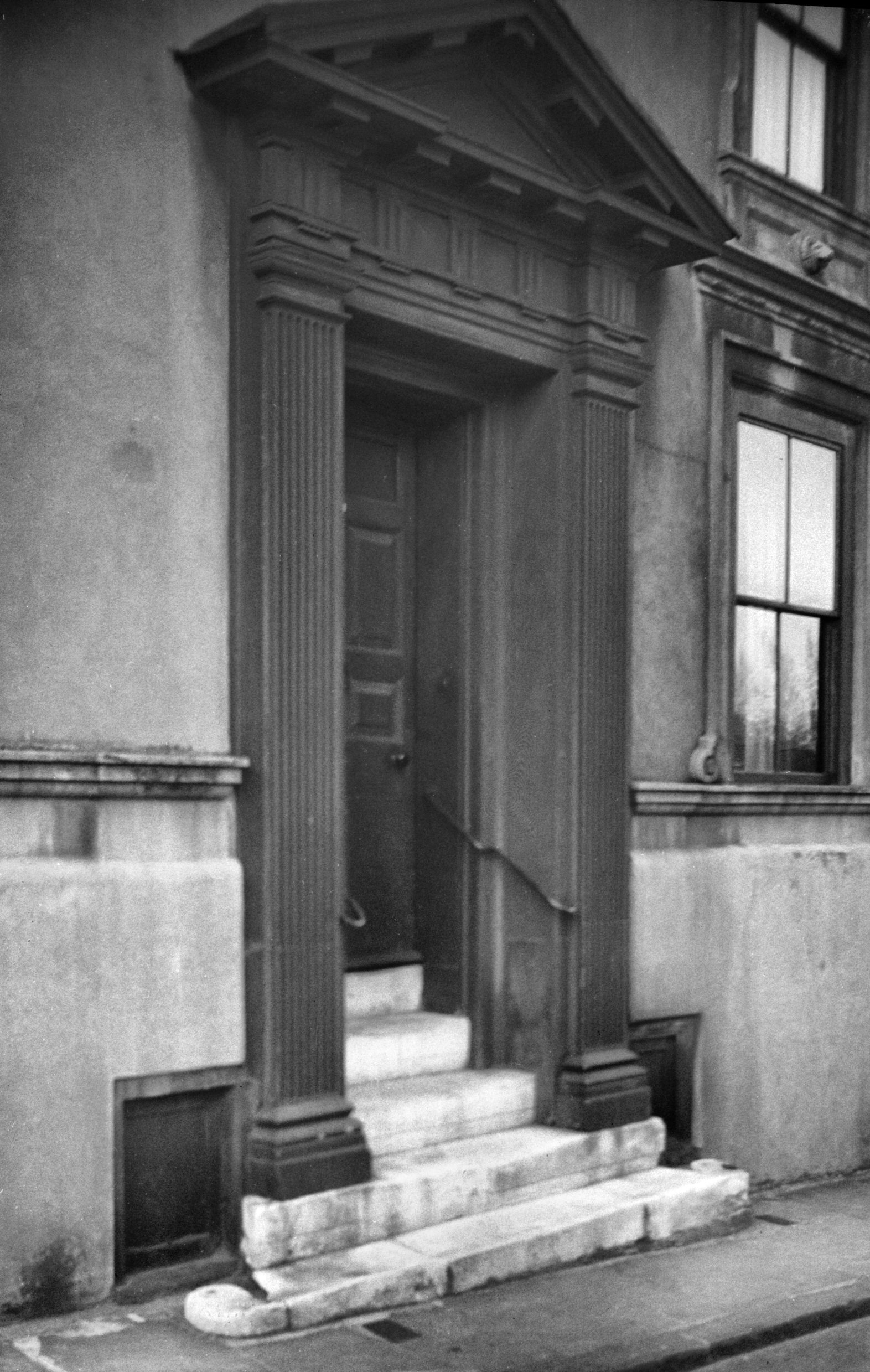
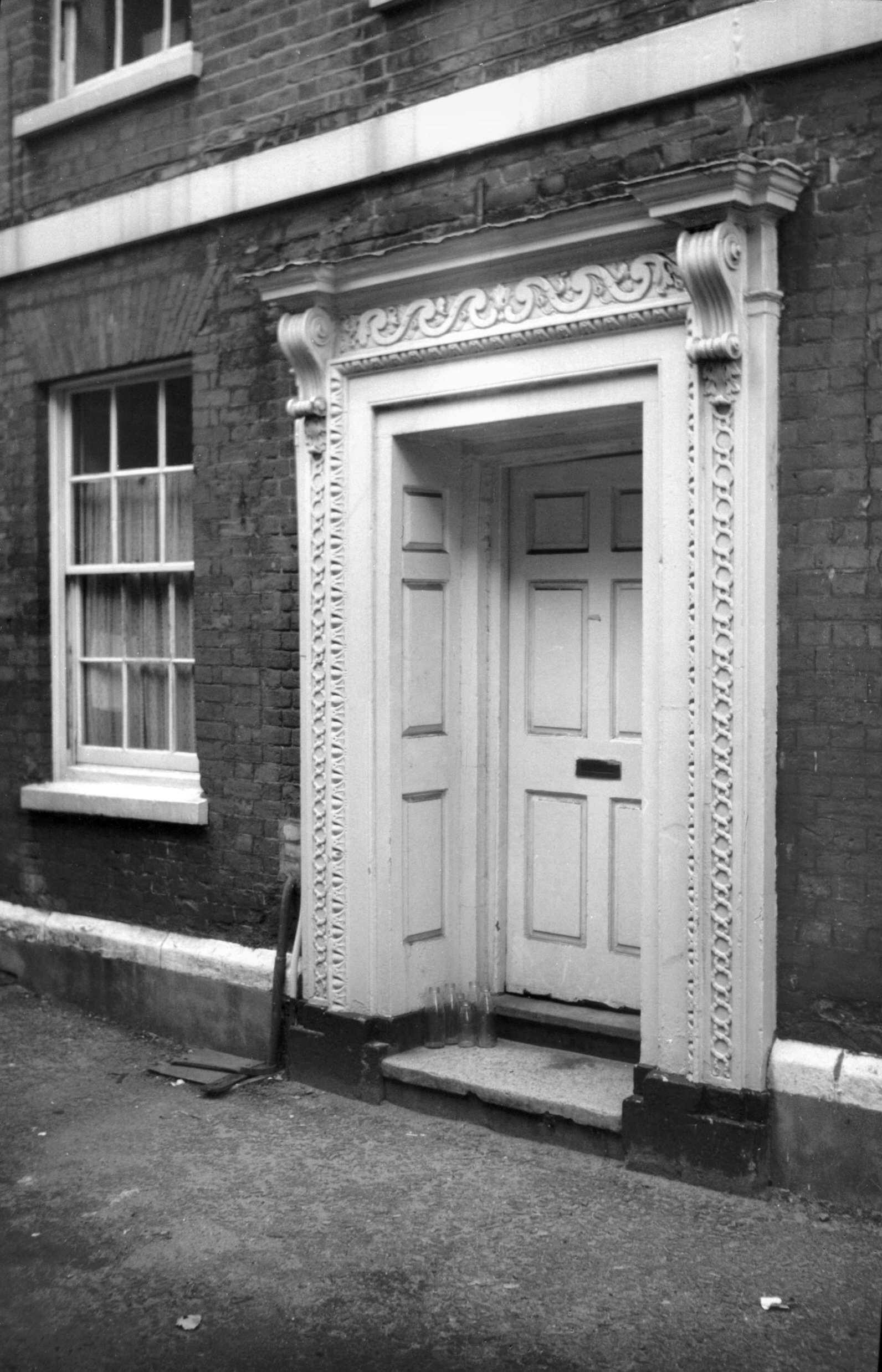
Cow Hill 3 Georgian doorway [0488] 1935-04-21
|
|
|
Cow Hill 4 [1680] 1937-06-05
|
|
|
Cow Hill 8 to 11 [1342] 1936-08-29
|
|
|
Cow Hill Cow Yard west side [1367] 1936-09-03
Cow Hill runs from Pottergate to St Giles' St. The
carriageways of this and neighbouring Willow Lane
retained their cobbled paving until the end of 1925, when
they were covered with a thick layer of asphalt. Holkham
House, a short distance along to the right, is mentioned
in his History of St Giles' Parish by Sir Peter
Eade, who noted that it was then (1886) divided into
three tenements occupied respectively by Mr Read, Mr
Stevens and Mr Brock. He also stated that it was
"previously occupied and built by Mr Patience, who
called his residence 'Holkham House' from its resemblance
in miniature to Holkham Hall".
However, writing in Norfolk Archaeology Vol.32
about the architect Robert Brettingham (1696-1786), Mr
A.Paget Baggs says "In about 1740 he owned the
property now known as Holkham House, Cow Hill, and it is
probable that the building was designed by him or his
brother Matthew". He also mentions John Thomas
Patience, describing him as an "architect and City
Surveyor. Early in his career he was living at Holkham
House, Cow Hill, but later he moved to 3, York
Place". One of the outstanding features of Holkham
House is a very fine ceiling of moulded plaster.
Cow Yard, like the hill itself, obtained its name from
the sign of the Red Cow, a public house standing in 1760
on the site now occupied by the parish hall. At the back
of the yard, behind Holkham House, stood the little
cottage illustrated, with its partly leaded casements and
a commodious dormer giving light and additional space to
the attic. The garden (not a common feature of old
Norwich yards) gave it an almost rural appearance, but
all was cleared away under an improvement scheme. |
|
|
Cow Hill house spanning Cow Yard [1344] 1936-08-29
|
|
|
Cow Hill 15 to 17 Holkham House [0384] 1935-03-03
Early 19c. The residence of John Thomas Patience
architect and City Surveyor, designer of Friends Meeting
House, Lady Lane Methodist Chapel and the Roman Catholic
chapel Willow Lane. |
|
|
Cow Hill 15 to 17 north wing south side [6539]
1989-03-25
|
|
|
Cow Hill 18 [1371] 1936-09-03
|
|
|
Cow Hill 18 rear from Pottergate 98 [6481] 1987-08-21
|
|
|
Cow Hill view north COLOUR [2959] 1939-04-12
|
|
The Crescent: |
| |
Off
Chapel
Field Rd |
|
|
Crescent The NW side [5203] 1968-06-04
|
|
Cross Lane: |
| |
From
St George's
St to Calvert St
North side |
|
|
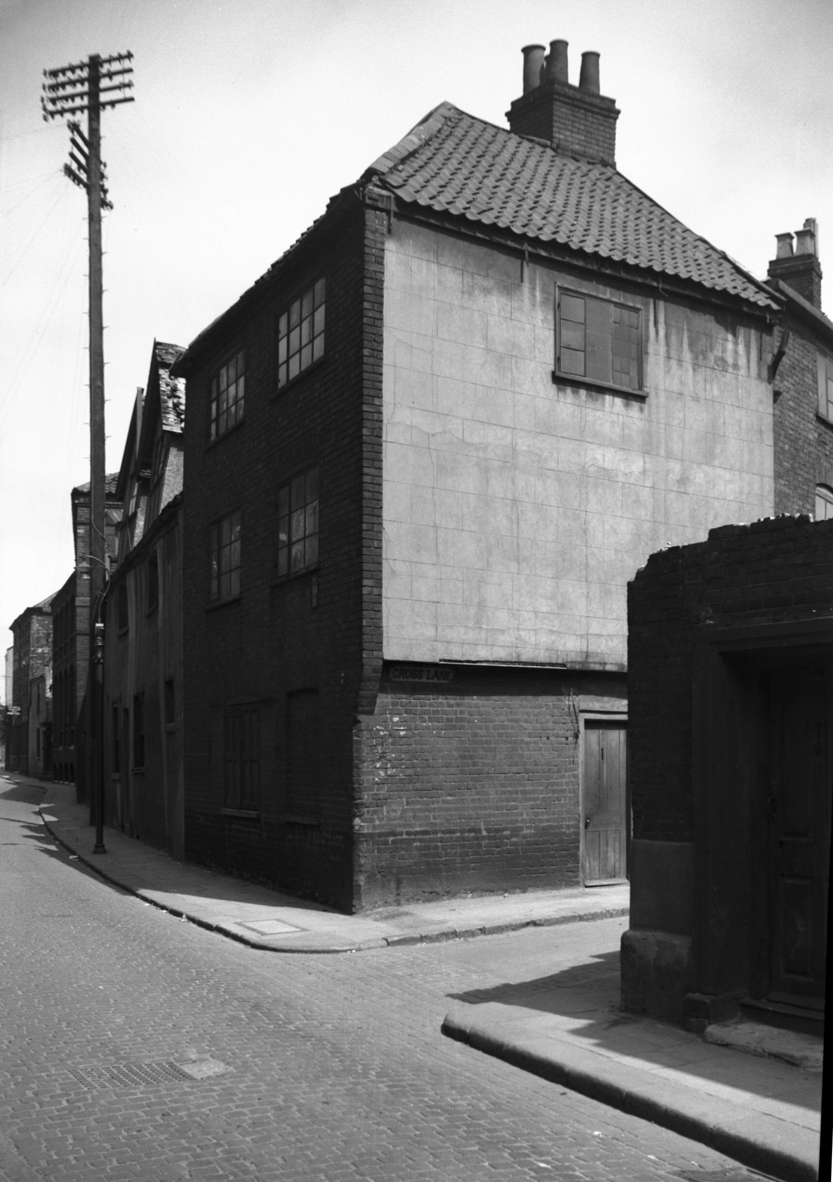
Cross Lane 1 from St George St [3034] 1939-05-29
|
|
|
Cross Lane 1 to 5 Rifleman PH [3210] 1939-08-07
The Rifleman PH is believed to be the house which Crome
the artist visited nightly. |
| |
South
side |
|
|
Cross Lane 6 to 14 [1060] 1936-06-27
On the right. Calvert St 2 to 22 on the left. |
|
Crown Rd: |
| |
From
Agricultural
Hall Plain to Cattlemarket St |
|
|
Crown Rd Royal Mail sorting office [5898] 1978-04-25
|
|
|
Crown Rd 34 [6621] 1990-07-12
|
|
|
Crown Rd 34 Georgian doorway [4712] 1962-09-08
|
|
|
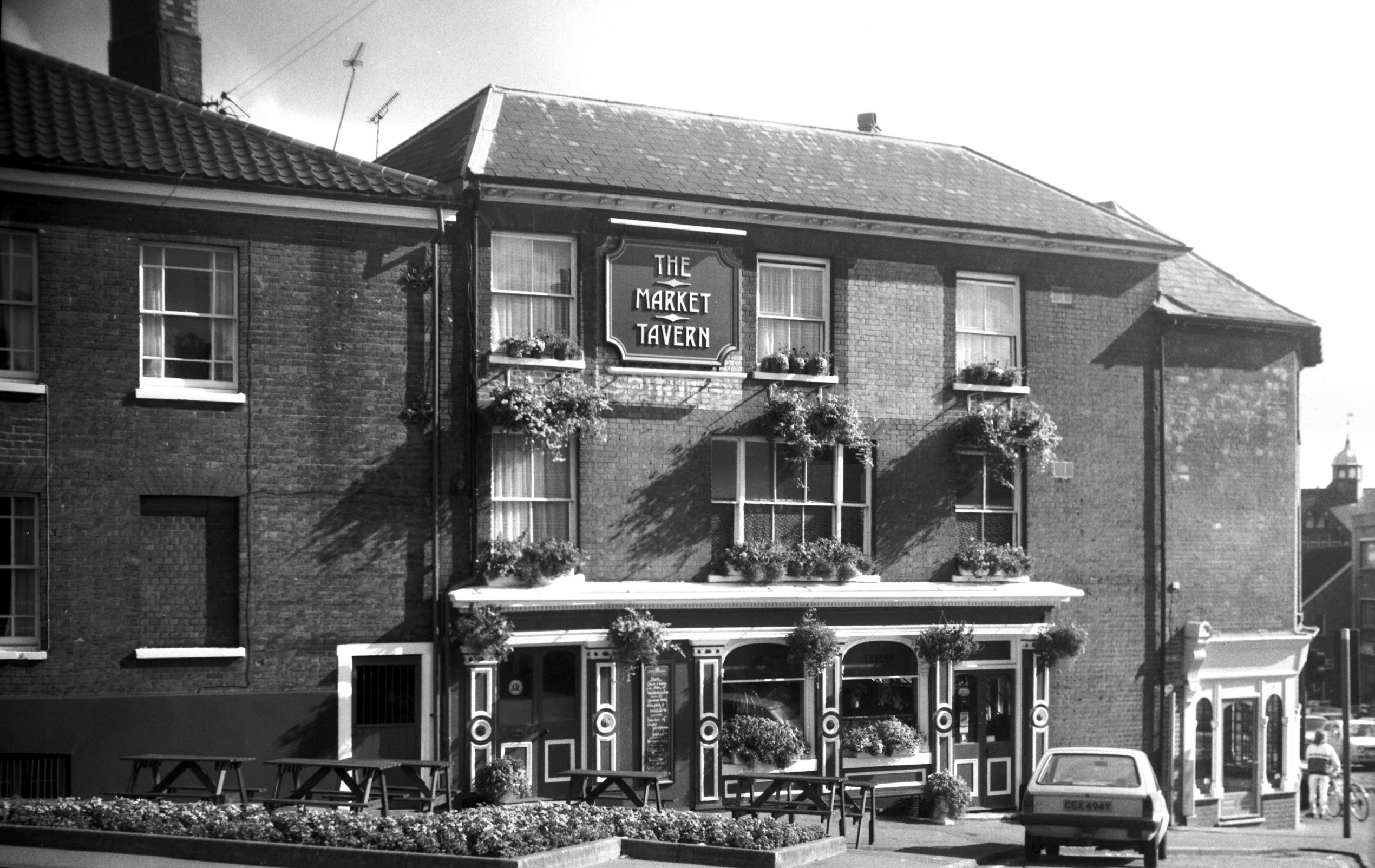
Crown Rd 39 Market Tavern [6488] 1987-09-26
|
|
Daniels Rd: |
| |
From
Newmarket
Rd / Mile End Rd to Ipswich Rd / Lakenham Rd |
|
|
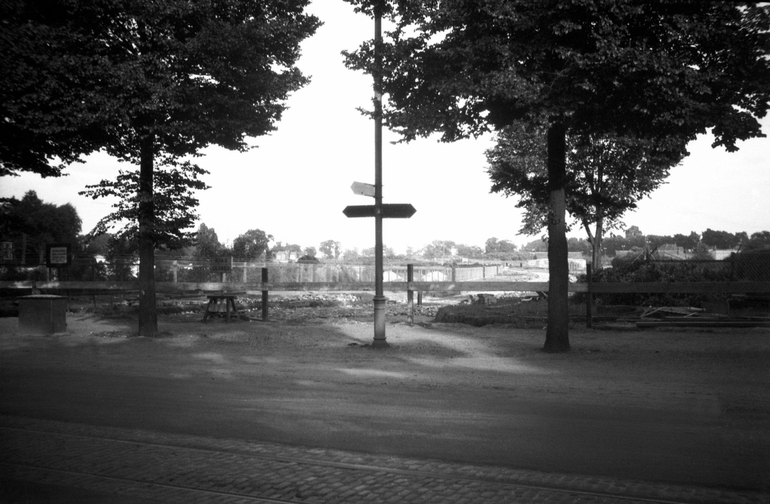
Daniels Rd construction from Newmarket Rd [B601]
1933-06-28
|
|
|
Daniels Rd construction from Newmarket Rd [B637]
1933-07-22
|
|
|
Daniels Rd at Newmarket Rd [B770] 1933-09-10
|
|
|
Daniels Rd at Newmarket Rd [B769] 1933-09-10
Mile End Rd beyond. |
|
Davey Place: |
| |
From
Market
Place to Castle Meadow
passing Castle St
South side |
|
|
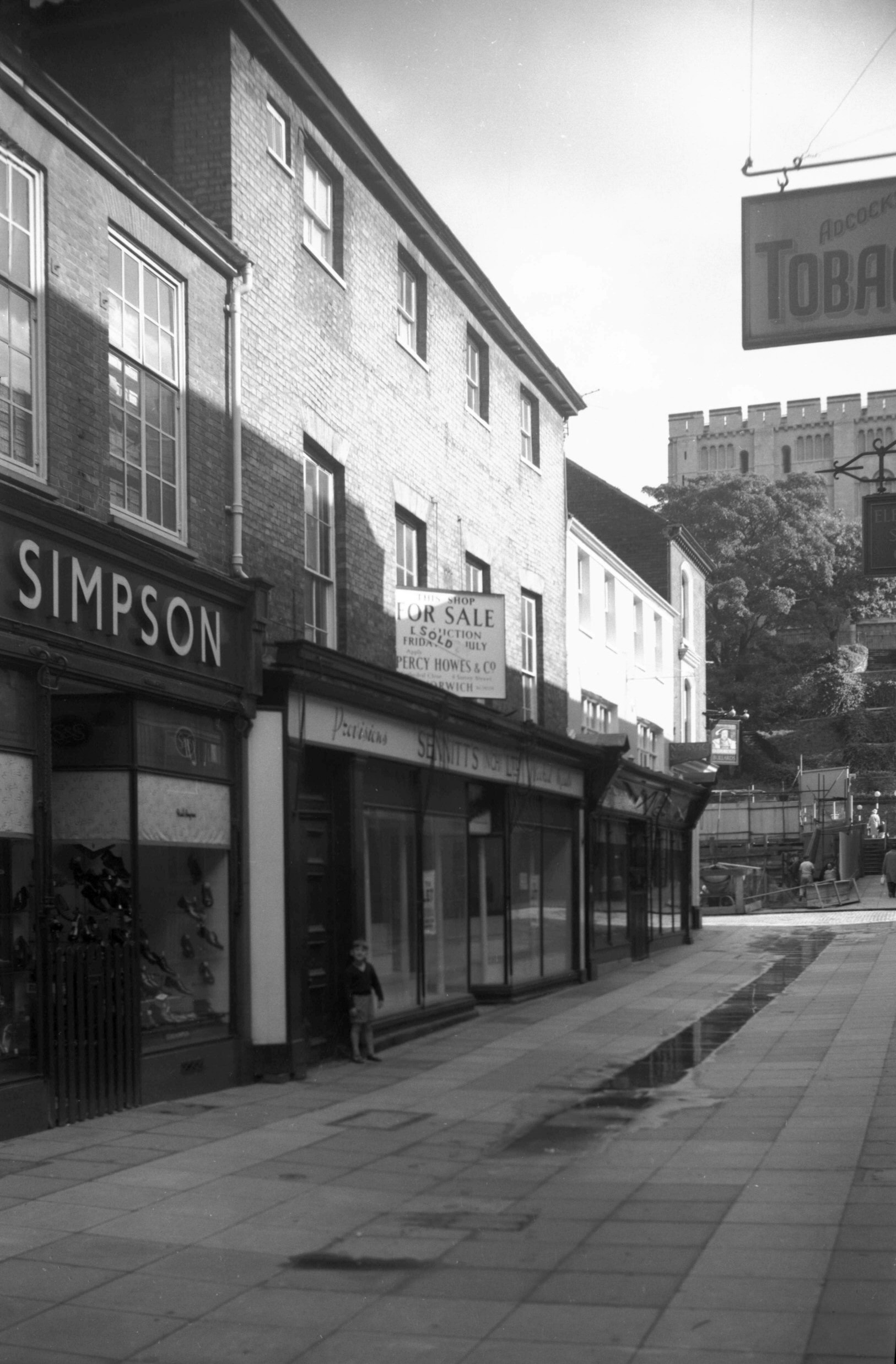
Davey Place 1 to 7 [4610] 1961-06-10
Davey Place was built as a pedestrian thoroughfare in
1813. Alderman Jonathan Davey was responsible, causing
some concern, initially, when he announced that he
intended putting a hole in the King's Head. In fact this
was the name of a public house which was demolished to
give access from the Market Place. |
| |
North
side |
|
|
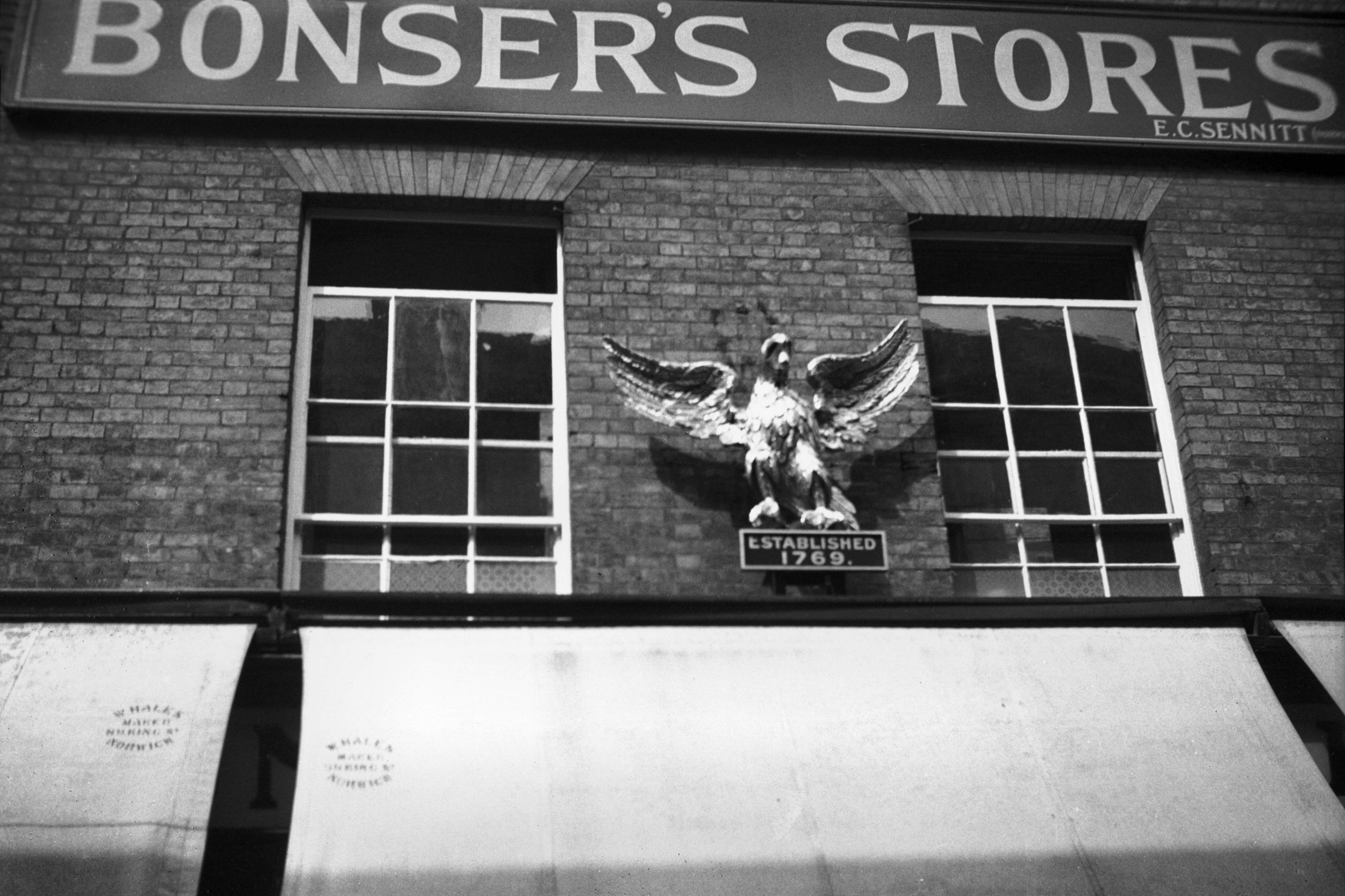
Davey Place 10 Eagle and Pearl at Bonser's [0198]
1934-08-11
Norwich, like other old cities, once boasted of a wide
variety of signs displayed over its shop fronts. Except
for a few now in the Strangers' Hall museum, such as
Dodson's Golden Teapot, Griffiths' Golden Plane, and the
two described below, the majority have disappeared, even
including the ubiquitous barber's pole. The public houses
seem now to be alone in continuing the custom.
Here in Davey Place at least two were carrying out their
original purpose into the 20c. One was the golden fleece,
often referred to as "Skoyles' sheep". This was
suspended outside the shop of Riches and Skoyles, where
the Monsoon shop later opened. The traditional sign of
the wool stapler, it here drew attention to a men's
outfitters and hatters. The proprietor, Robert Skoyles,
who had succeeded his father in the business, died in
1940 aged 84, but he had given up the shop some 35 years
before to go into the wholesale clothing trade, with
premises in Pottergate.
It is possible that the history of this particular sign
went back further than that of Skoyles' shop. For in the
1780s some copper tradesmen's tokens (some circular, some
oval) were issued bearing this symbol enclosed by the
motto "Good Times will come". A representation
of Norwich Castle was shown on the reverse side, with an
inscription on the edge stating that it was issued by
Richard Bacon of Cockey Lane (now London St).
Another old sign to last into the 20c was the Golden
Eagle and Pearl, to be seen for many years above Bonsers,
the grocer's shop at 10, Davey Place. This sign was
originally adopted by Isaac Marsh, a silversmith, who
founded his business in 1769 at a shop on the Walk where
Lloyd's Bank later opened. Successive owners ware Dunham
and Yallop and Etheridge and Ellis, during whose time the
character of the firm changed to that of tea dealers. The
present sign was carved in 1869 by John Culyer as a
faithful copy of the original. About 1875 the firm was
acquired by Bonsers, who later moved to Davey Place.
Early in the 20c the proprietors were J.Utting in
partnership with my great uncle William Plunkett, and
they were succeeded by E.C.Sennitt, who had similar shops
in St Stephen's and Goat Lane. On their giving up in 1938
Goose's bookshop moved here from the Haymarket and the
old sign was handed over to the Norwich Castle museum. |
|
|
Davey Place 10 to 14 [4654] 1961-10-08
|
|
|
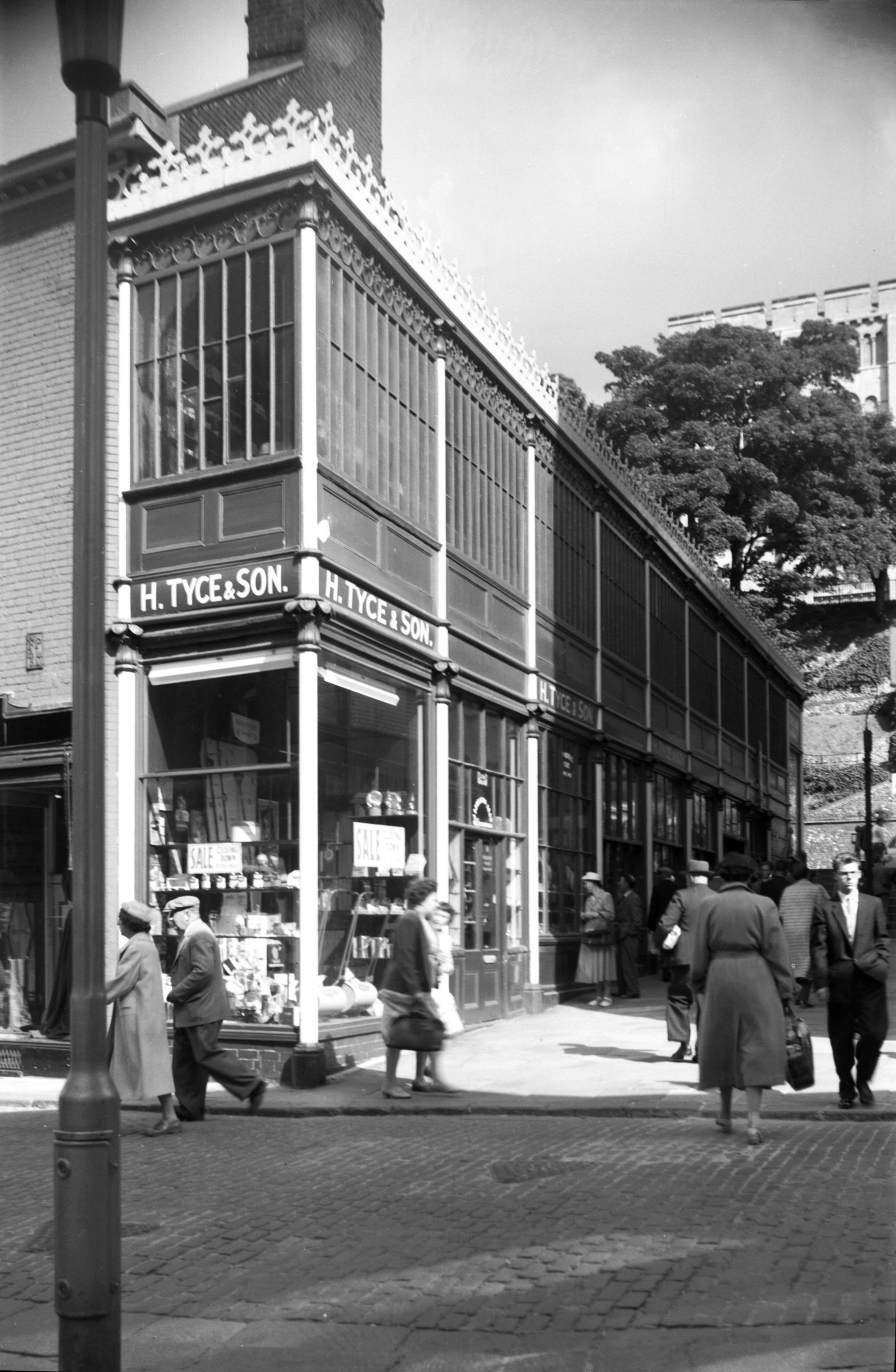
Davey Place 18 Tyce's 19c iron shop front [4526]
1959-08-29
At No 18 Davey Place, alongside the steps to Castle
Meadow, stood until 1960 a narrow building of cast-iron
and glass, 100 feet long and two storeys high, one of the
few examples then remaining of a type of building
pioneered by the Crystal Palace in 1851. For many years
it was occupied, with an adjoining warehouse, by Harry
Tyce and Son, a firm described at the time of its closure
in 1959 as the oldest ironmongery business in the city.
Its founder, John Browne (Mayor in 1798), opened it in
1750 at premises in St Peter's St. In the mid-19c it was
sold to Edward Orams (Sheriff in 1889), who was later
joined in partnership by Harry Tyce. It was due to the
retirement of Harry Tyce's son Mr C.G.Tyce that the
business finally closed.
When it was announced that the freehold of the property
had been sold and that the site would be redeveloped,
various pleas were made for preserving the ironwork, the
chairman of the Norwich Society saying that the building
had "great architectural character and it would be a
pity to lose it". The suggestion was made that it
should be used as a pavilion, perhaps on the Royal
Norfolk showground at New Costessey, but the idea was
found to be impracticable and nothing further was done. |
|
Dereham Rd: |
| |
From
Barn Rd / St
Benedict's St / Grapes Hill towards East
Dereham
passing Midland St, Heigham
Rd, Belvoir St, Nelson
St, Bowthorpe Rd, Turner
Rd, Waterworks Rd, Guardian
Rd, Sweet Briar Rd, Hellesdon
Rd, Bowthorpe, Costessey
North side |
|
|
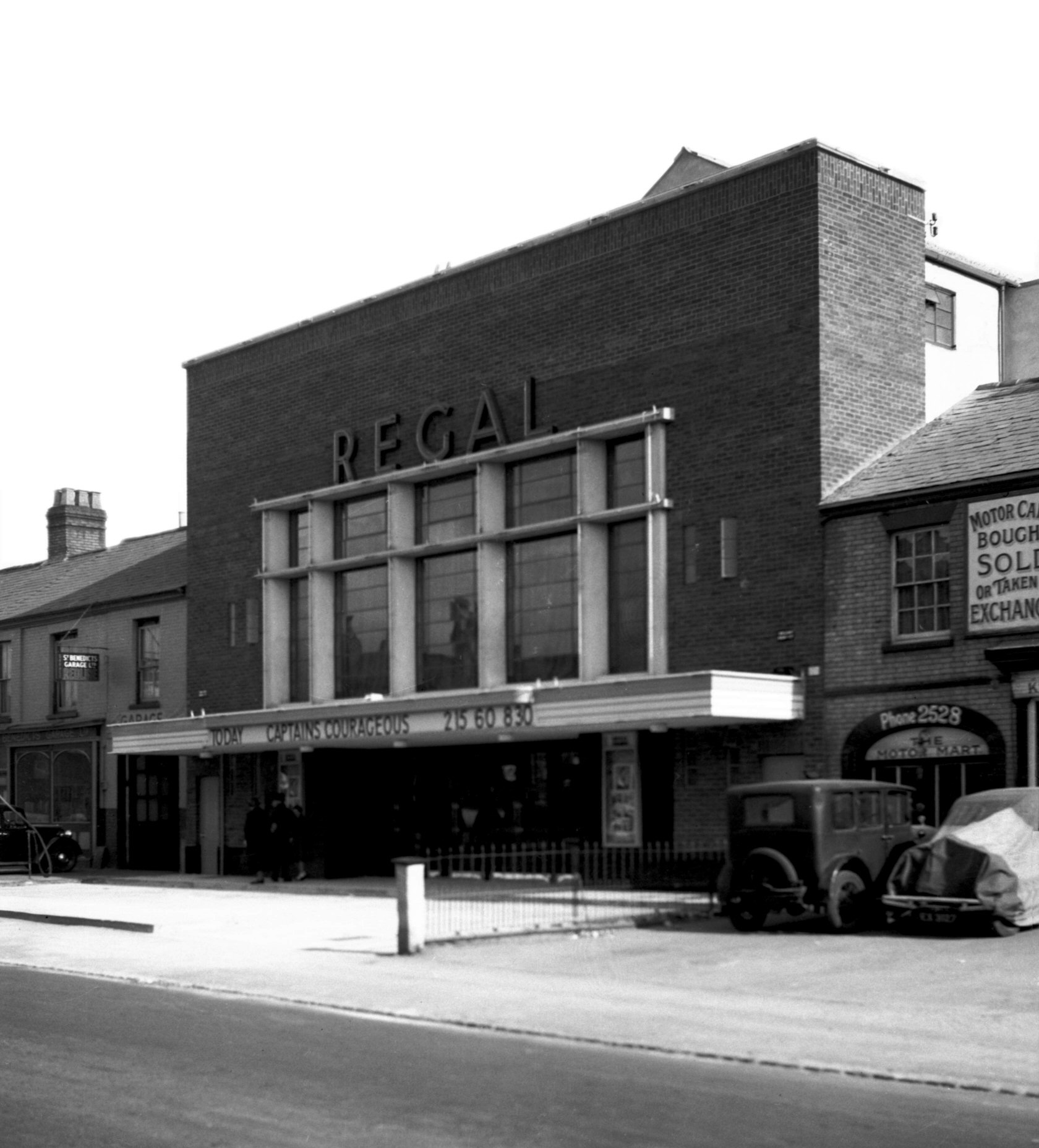
Dereham Rd 5 to 7 [2014] 1937-09-22
Site of the Regal cinema. |
|
|
Dereham Rd Regal day after opening [2348] 1938-04-17
Regal cinema. |
|
|
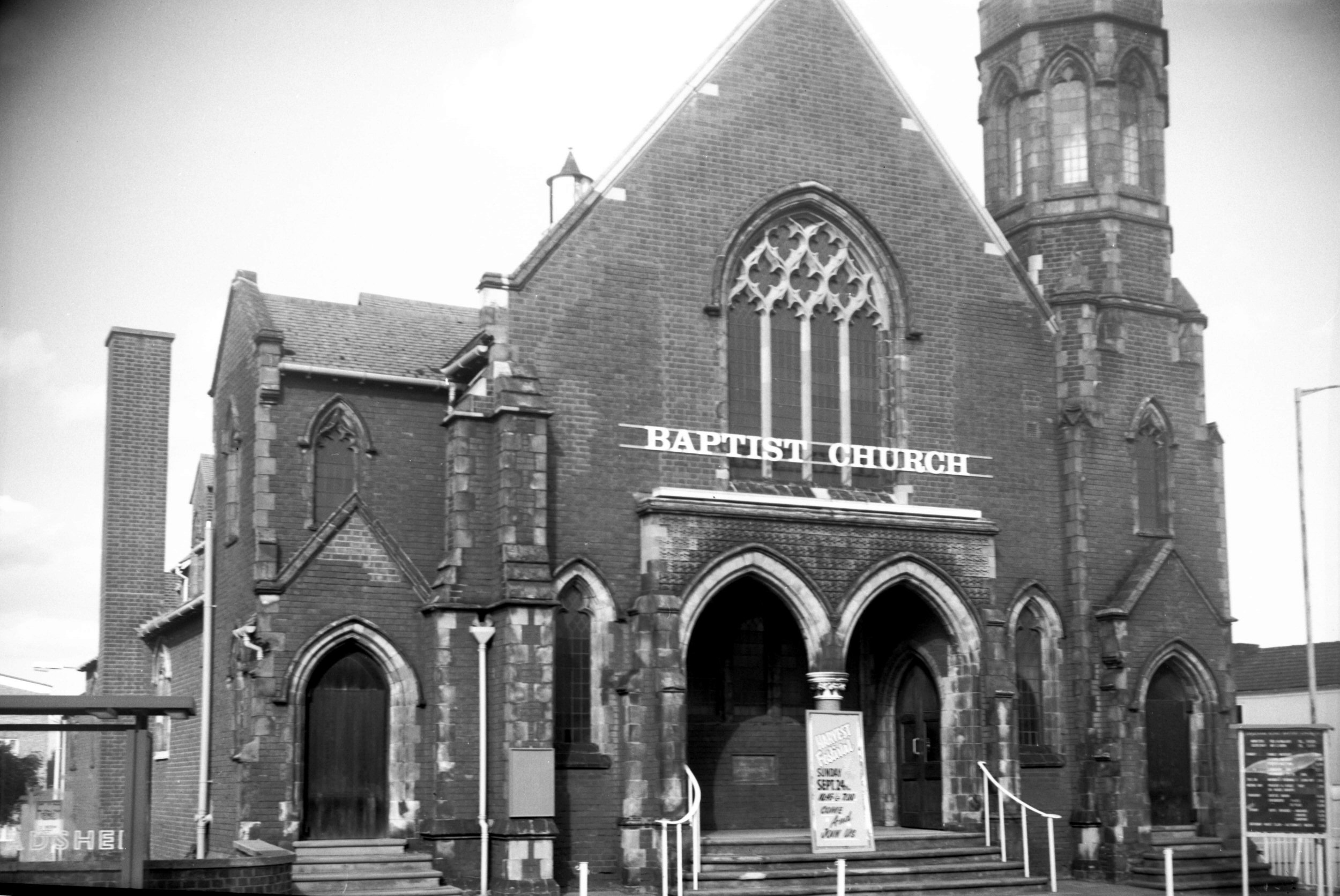
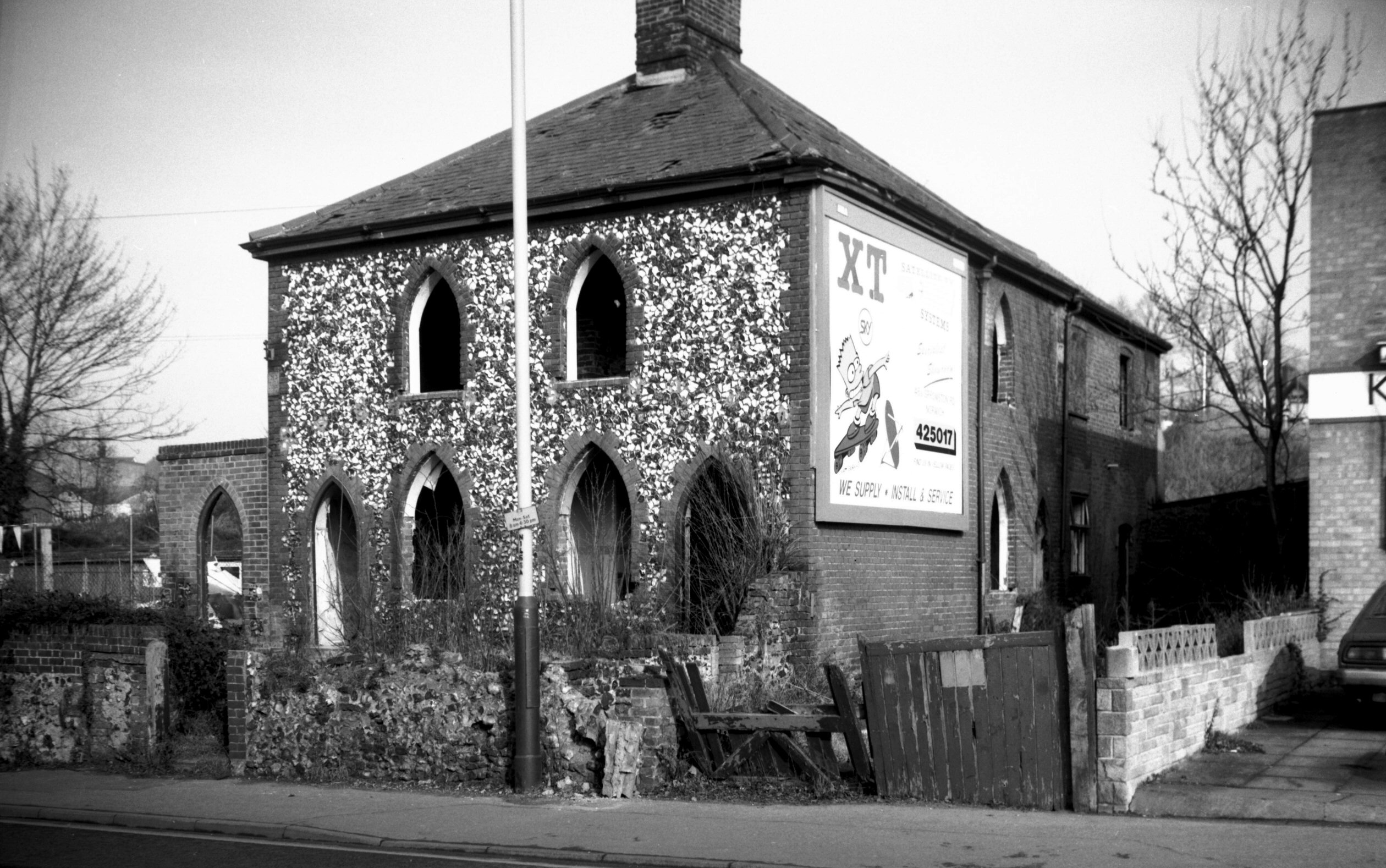
Dereham Rd Baptist church [6591] 1989-09-19
Built 1906, architect A.F.Scott. |
|
|
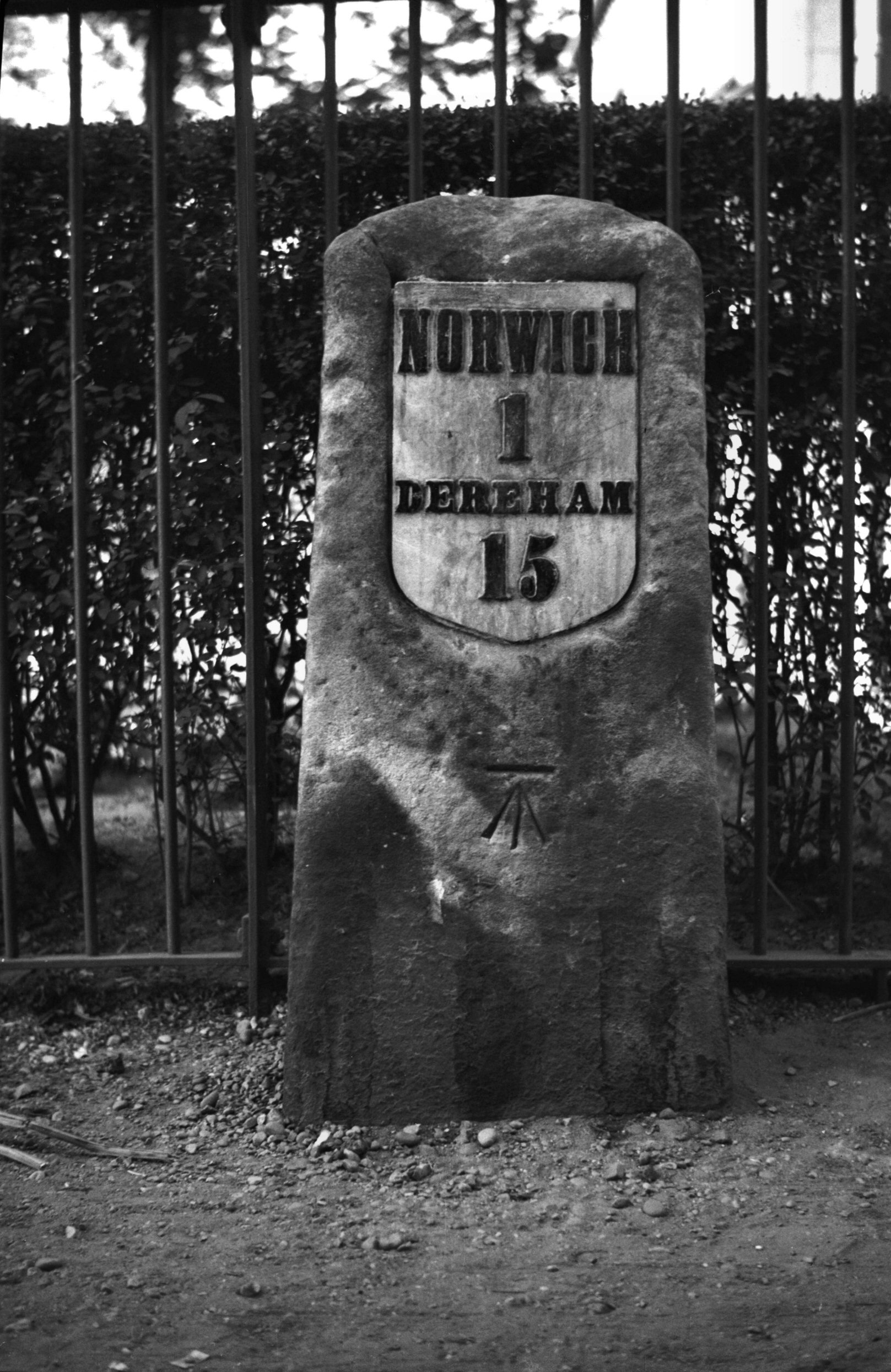
Dereham Rd milestone by Woodlands Park [0609]
1935-08-05
|
|
|
Dereham Rd Gate House PH [2983] 1939-05-19
|
|
|
Dereham Rd Oval PH [2998] 1939-05-21
|
| |
South
side |
|
|
Dereham Rd 2 [1703] 1937-06-08
|
|
|
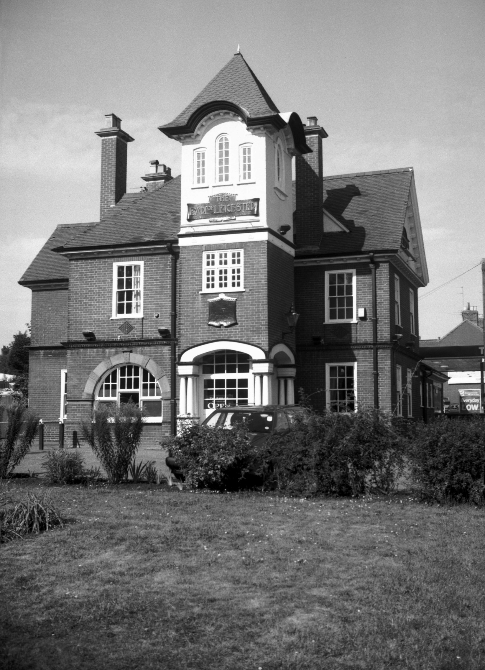
Dereham Rd 238a Earl of Leicester PH [7476]
1997-08-26
|
|
|
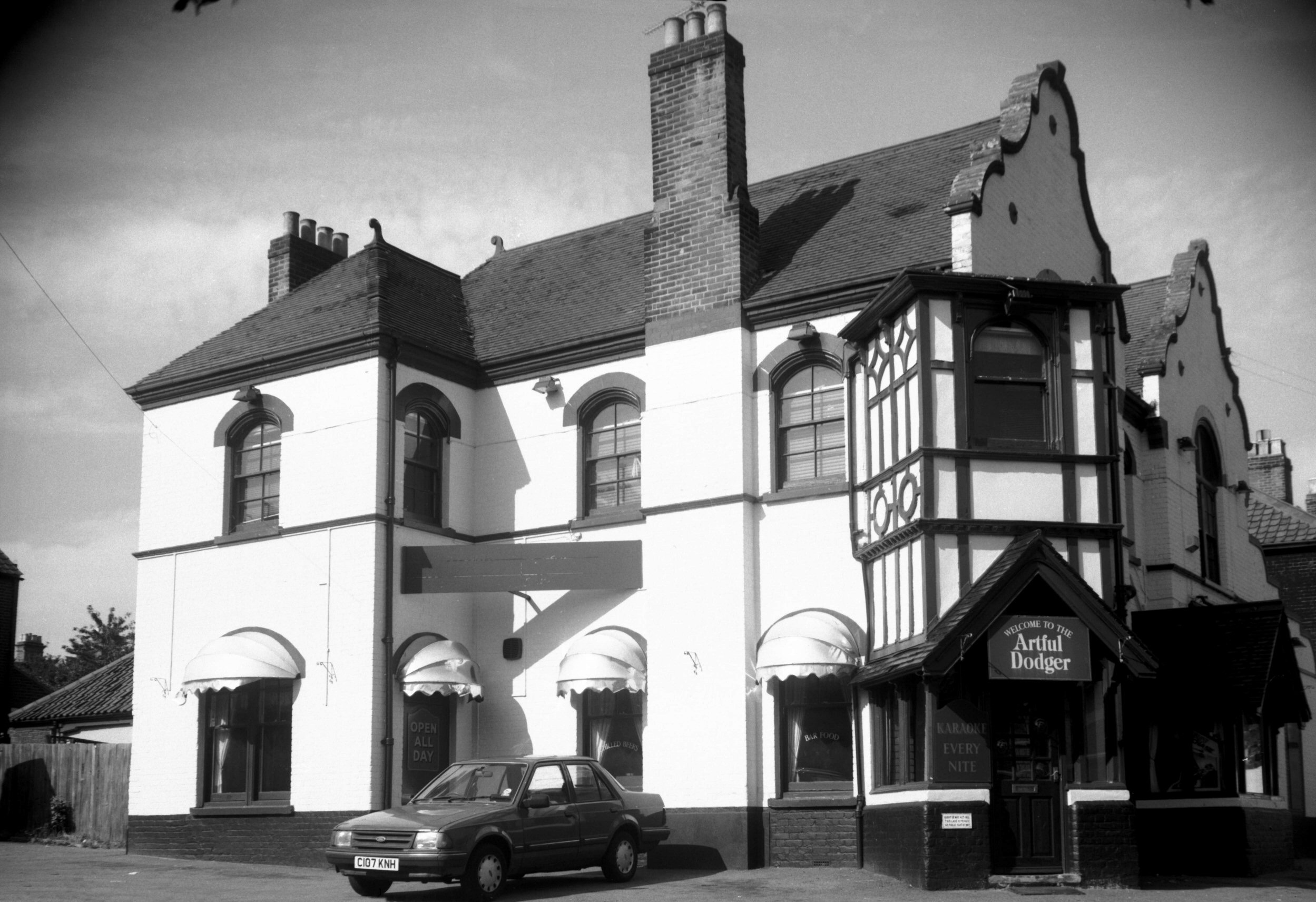
Dereham Rd 286 Artful Dodger PH [7477] 1997-08-26
Formerly the Lord Nelson PH. |
|
|
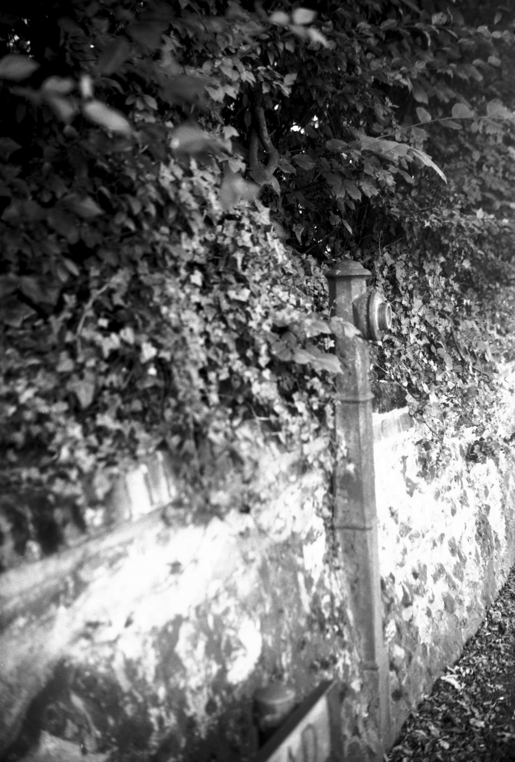
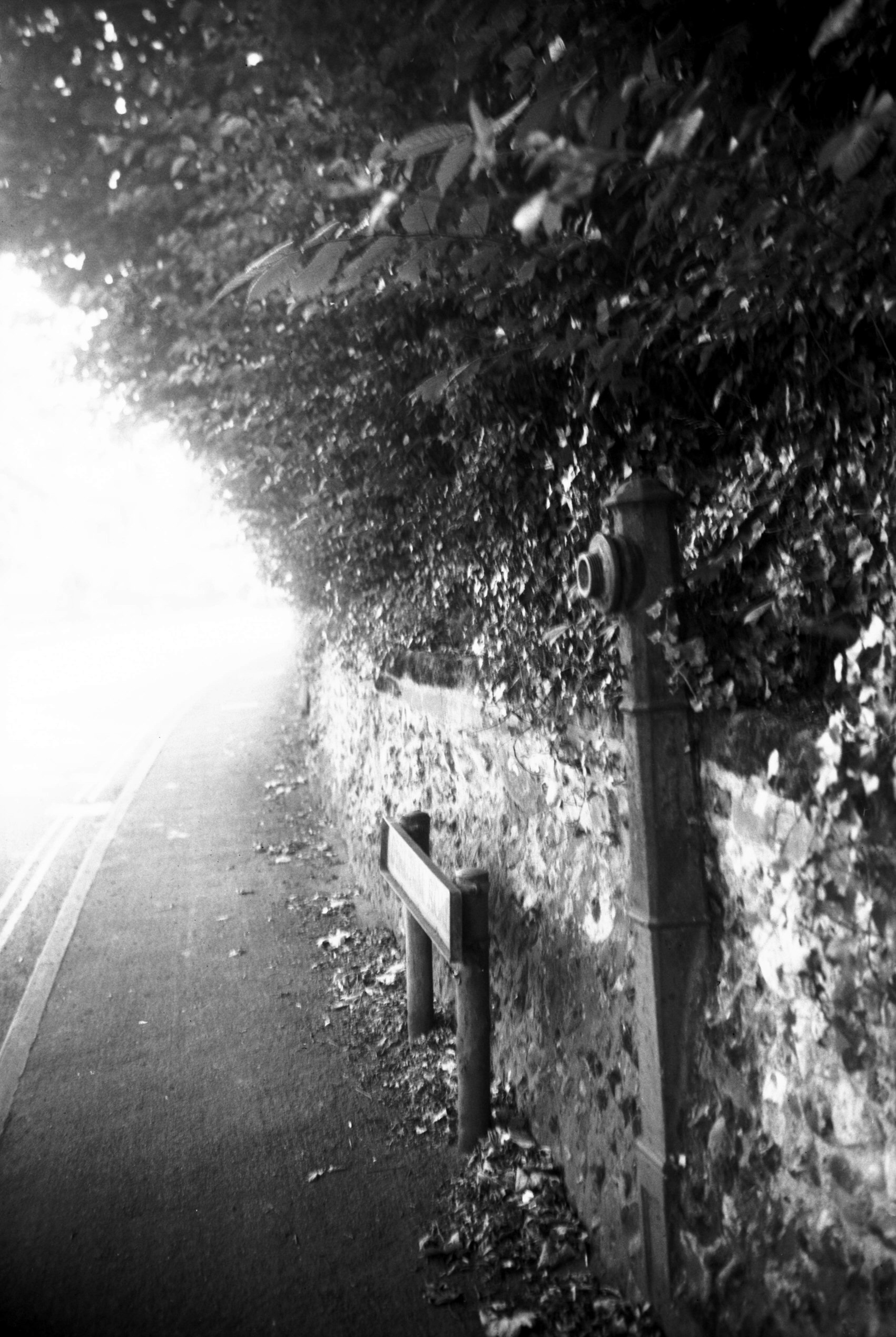
Dereham Rd disused standpipe view west [7890]
2002-07-14
Once used for filling watering carts which laid the dust
in dry weather. Cast by Barnes and Pye, Colegate,
Norwich. [Another one visible in the photo of 20 St John
Maddermarket.] |
|
|
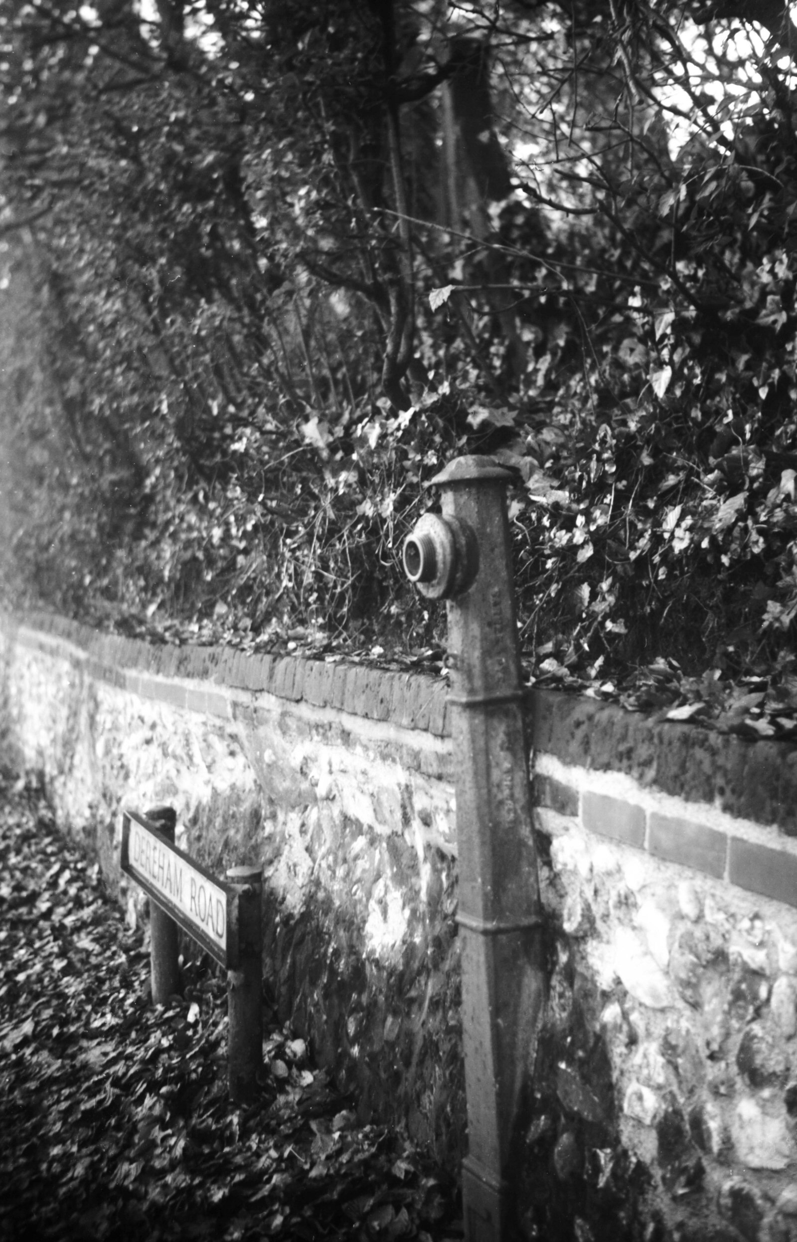
Dereham Rd disused standpipe view east [7786]
2000-11-24
|
|
|
Dereham Rd disused standpipe view east [7889]
2002-07-14
|
|
Drayton Rd: |
| |
From
Aylsham Rd to Sweet Briar Rd / Boundary Rd and towards Drayton
passing St Martin's Rd, Mile
Cross Rd |
|
|
Drayton Rd 7 to 9 [6960] 1993-02-16
19c Gothic cottages. |
|
|
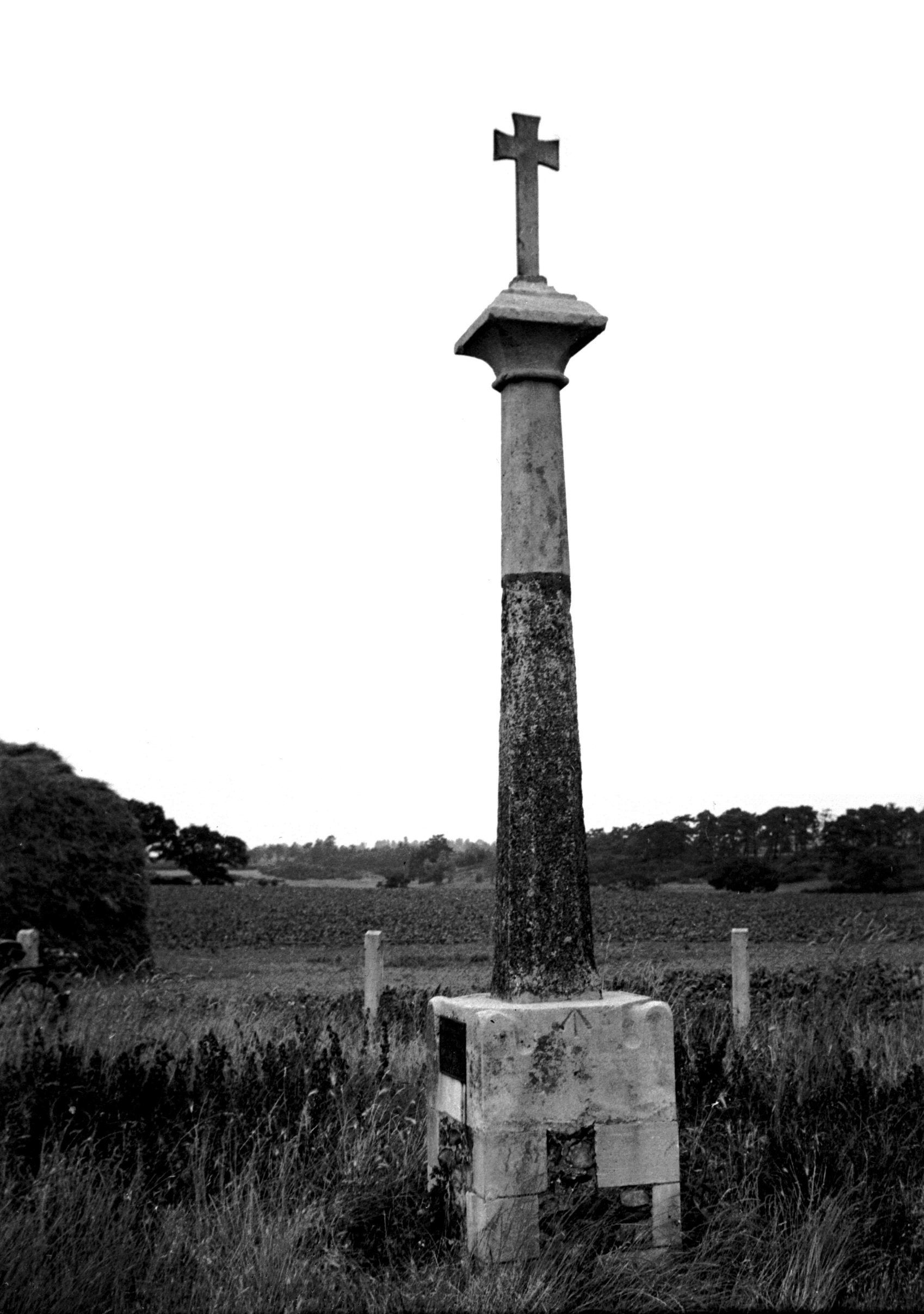
Drayton High Rd Boundary Rd Cross [1747] 1937-07-04
Hellesdon Cross II: stands on the present city boundary
at Drayton Rd. Restored 1902. 5 feet of the octagonal
shaft is original. |
|
Duck Lane: |
| |
From
St
Benedict's St to Pottergate (now part of Wellington Lane) |
|
|
Duck Lane 2 to 4 [1115] 1936-07-13
|
|
|
Duck Lane 10 to 12 [1114] 1936-07-13
|
|
|
Duck Lane 18 [1113] 1936-07-13
Wellington Lane is so-called from the sign of a
beer-house once trading there. The lower part of the
lane, formerly known as Duck Lane, extends from
Pottergate to St Benedict's Gate and was originally part
of the Regia via sub muros or Way under the Walls,
mentioned in records from the early part of the 14c.
Here was a varied collection of old cottages when I
photographed its east side in 1936. One of these had two
storeys and a crow-stepped gable; another had two gables
immediately above its ground floor, giving additional
accommodation in the roof space. None of these survived
the terrible raids of the 27th and 29th April 1942, and
since the war the site between here and Ten Bell Lane has
been redeveloped with a pleasant housing complex. |
|
|
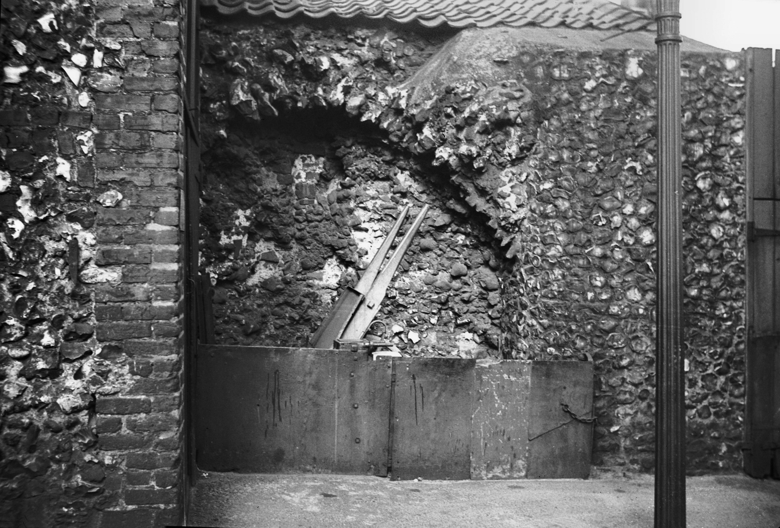
Duck Lane arched recess [2280] 1938-04-10
Wellington Lane wall, known then as Duck Lane. |
|
|
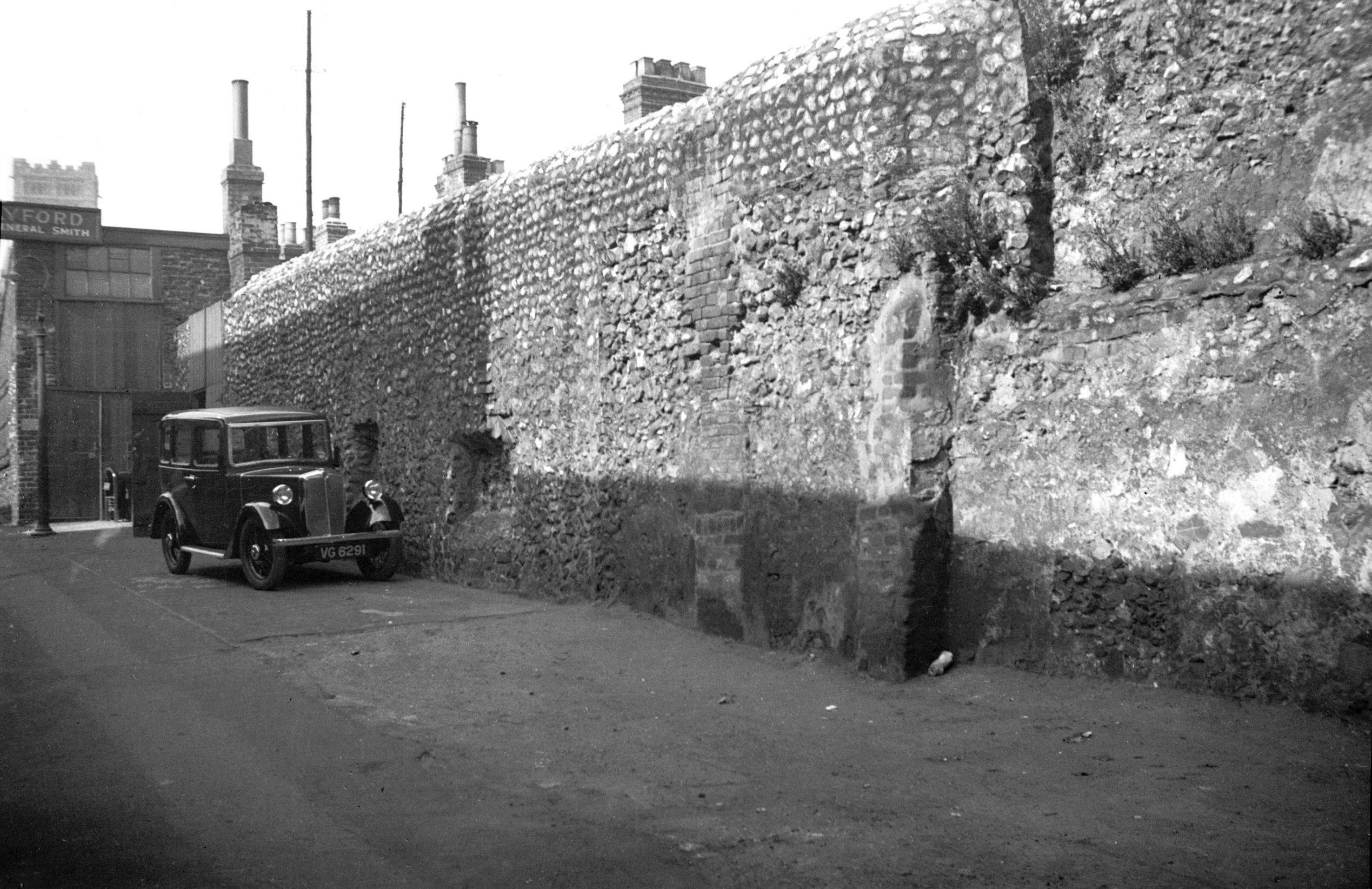
Duck Lane wall from inside city [0106] 1934-05-27
Wellington Lane wall, known then as Duck Lane. |
|
|
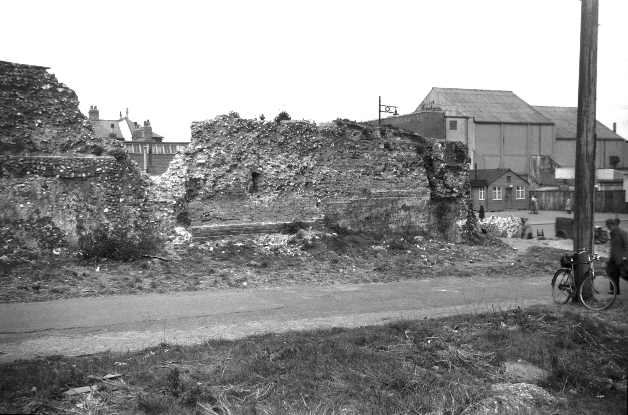
Duck Lane wall from inside city view NW [3985]
1951-04-19
Wellington Lane wall, known then as Duck Lane. |
|
|
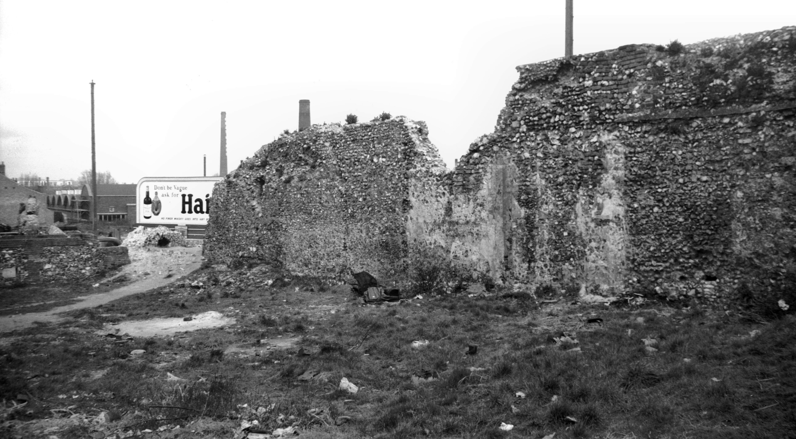
Duck Lane wall from outside city view NE [3987]
1951-04-19
Wellington Lane wall, known then as Duck Lane. |
|
Duke St: |
| |
From
St Andrew's
St / St John Maddermarket / Charing
Cross to St Mary's Plain / Pitt
St / Muspole St (now to St Crispin's Rd)
passing Colegate
East side |
|
|
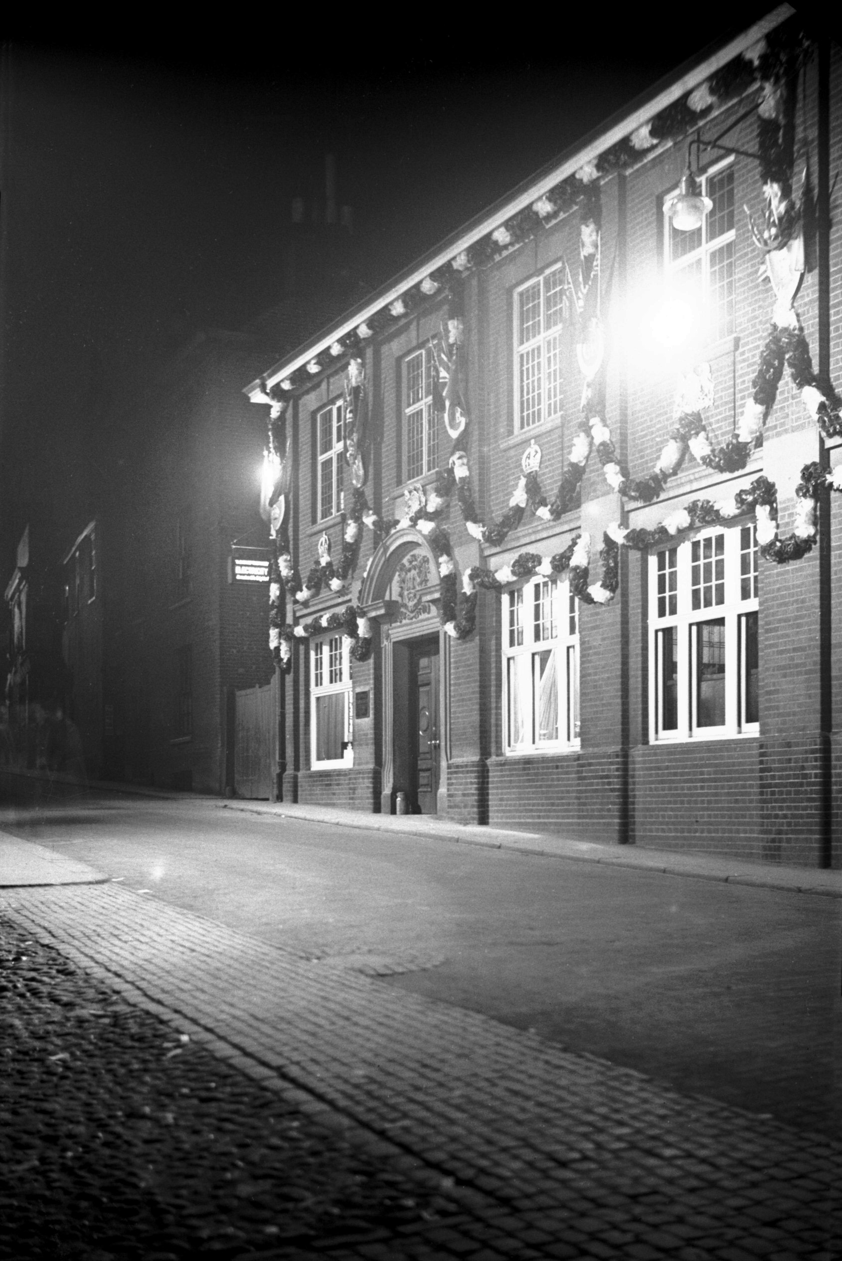
Duke St 5 Electricity works floodlit [1634]
1937-05-13
Municipal offices until 1938. Electricity department. |
|
|
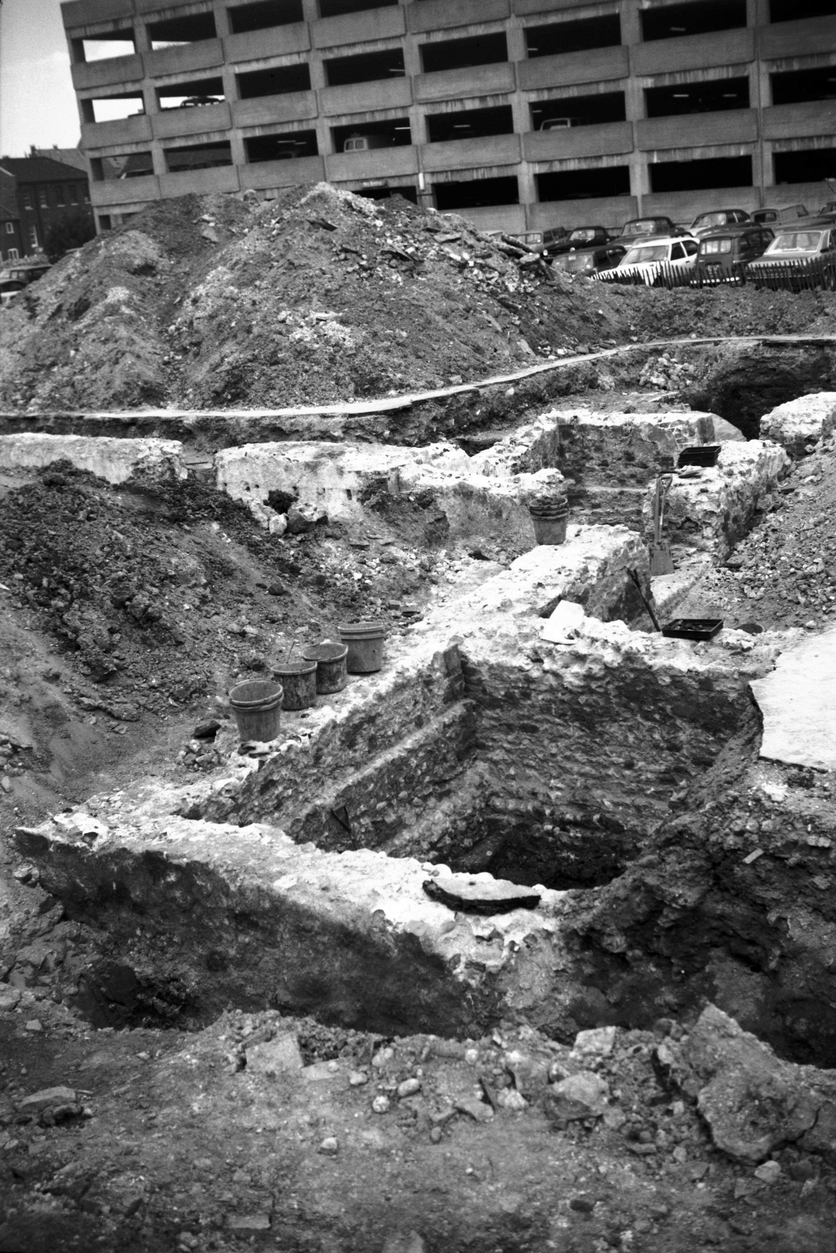
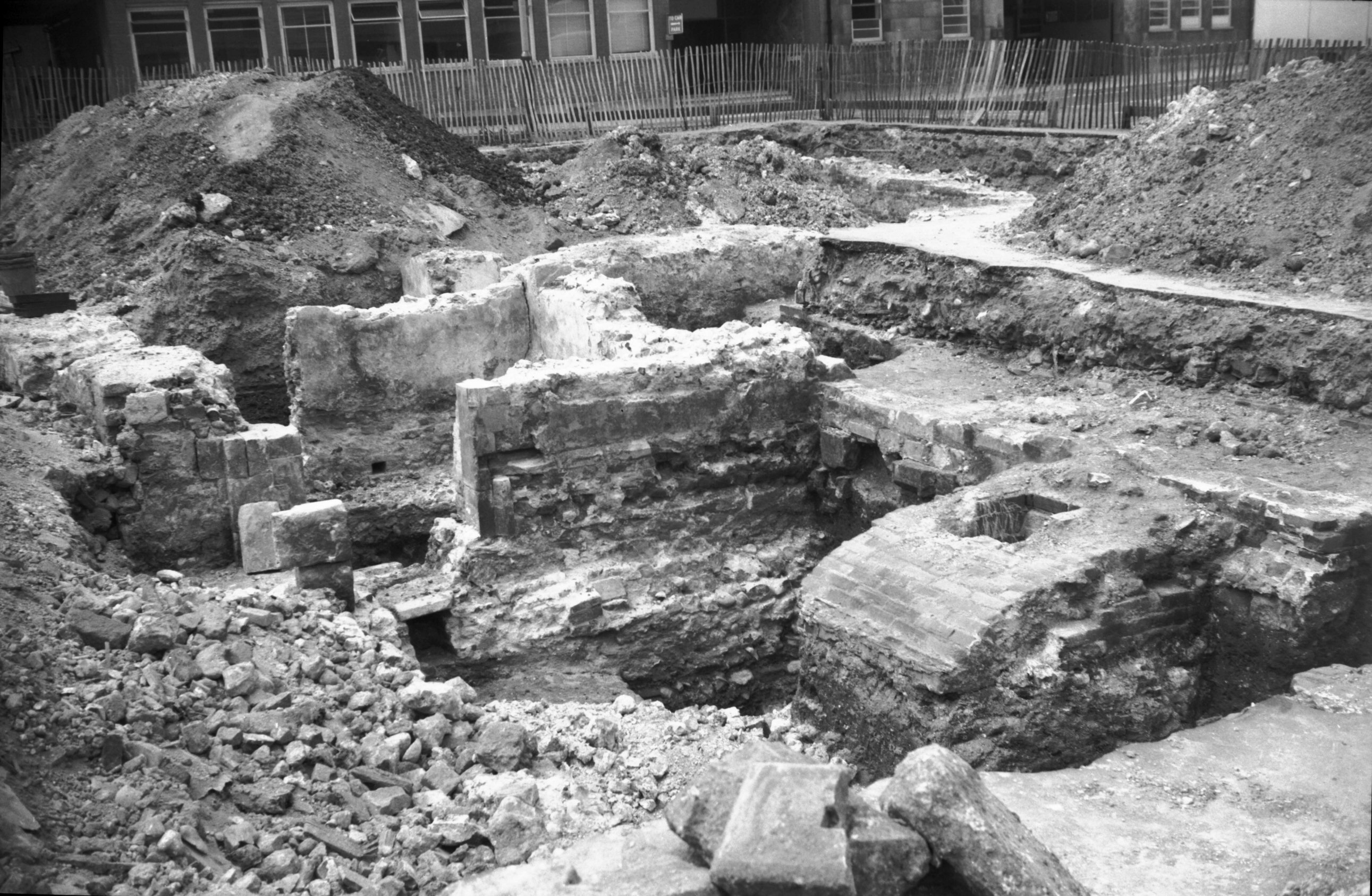
Duke St Duke's Palace foundations view east [5375]
1974-07-09
Foundations of domestic wing, excavated in 1974. |
|
|
Duke St Duke's Palace foundations view west [5376]
1974-07-09
Rebuilt from a smaller structure in 1602. Destroyed
except for the domestic offices in 1711. |
|
|
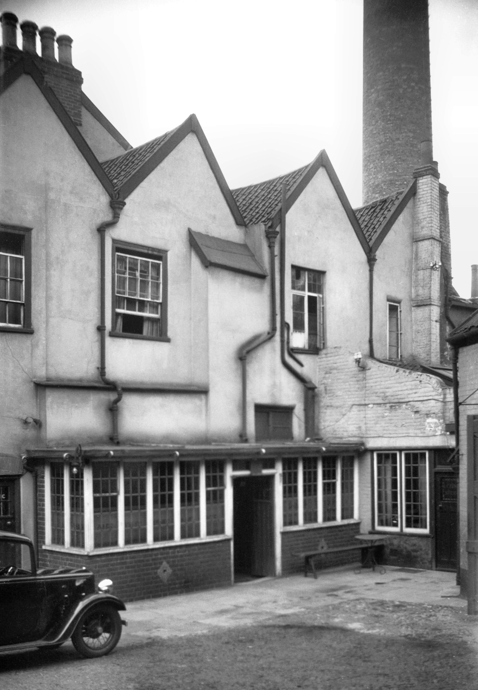
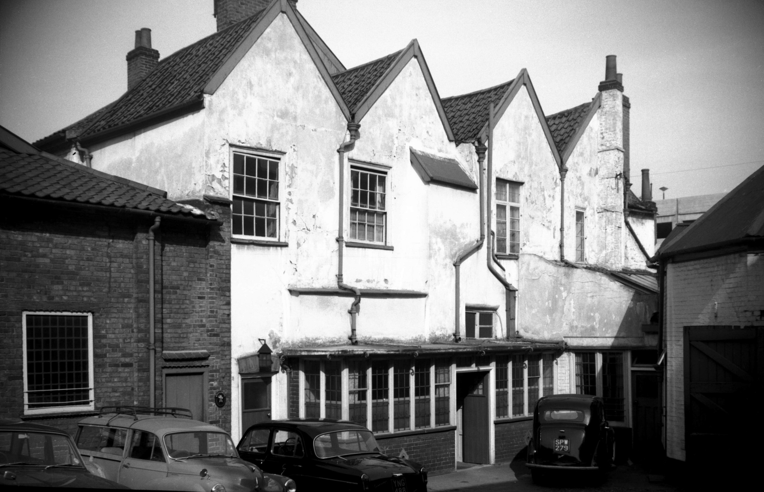
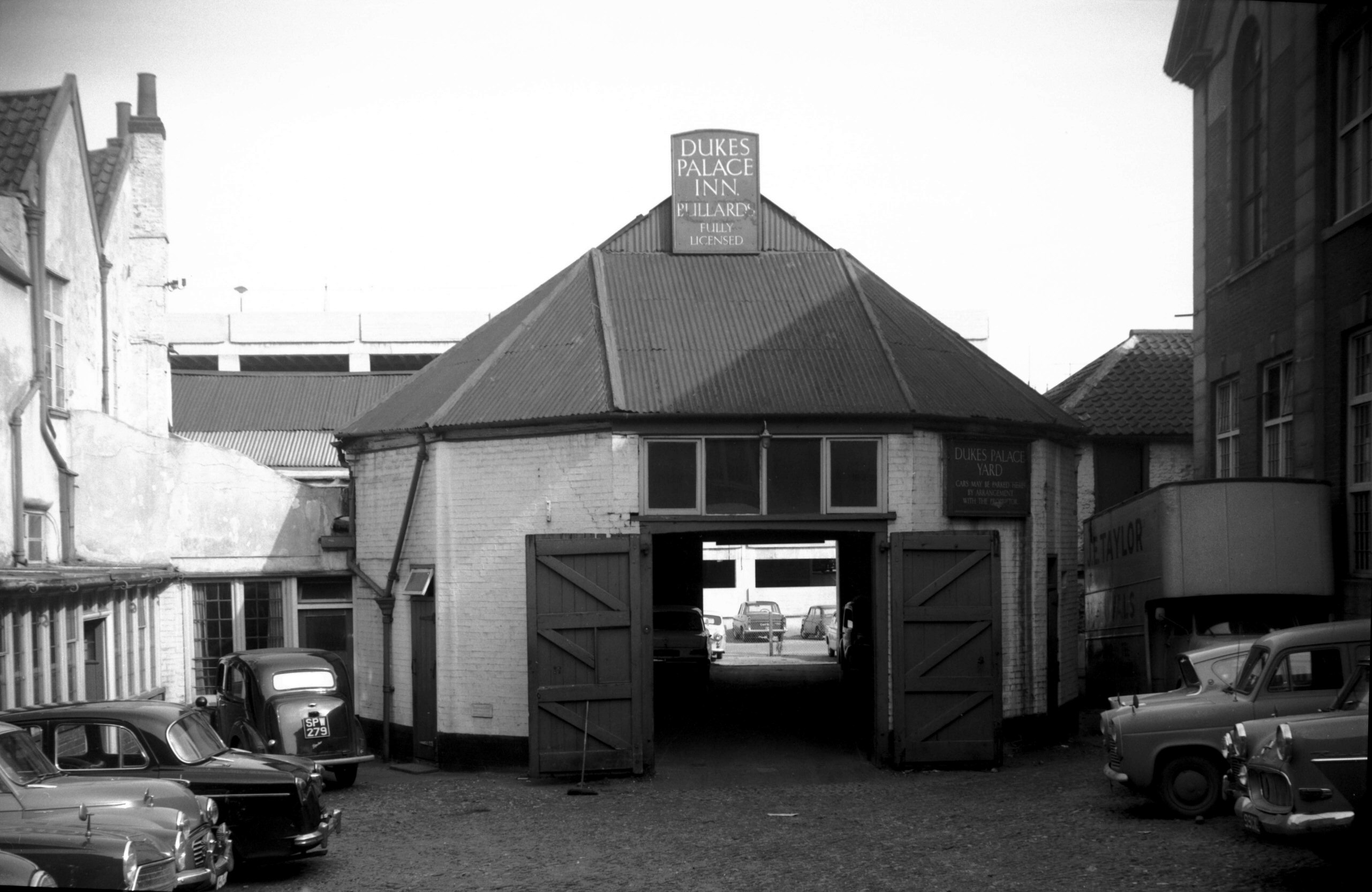
Duke St 7 Duke's Palace PH [1120] 1936-07-13
|
|
|
Duke St 7 Duke's Palace PH [5130] 1967-04-01
Now largely covered by the St Andrew's multi-storey car
park and the new Telephone Exchange, across the Charing
Cross end of Duke St and overlapping on to the adjoining
sites, once stood the Duke of Norfolk's palace. It had
been rebuilt in 1602 from a smaller structure, apparently
making use of a certain amount of material robbed from St
Benet's abbey, in the marshes near Horning. In 1672 it
was again rebuilt or otherwise altered, only to be
demolished in 1711 as a result of a quarrel three years
earlier between the Duke and the Mayor, Thomas Havers.
Fortunately the historian John Kirkpatrick had made
drawings of it only the previous year. From these it
appears to have had a large central courtyard, the main
building standing to the north and having a wing on
either side extending southward. Enclosing the court on
the fourth side was a raised terrace pieced by a central
arched gateway.
One wing, the domestic offices, was allowed to remain
after all else had gone and this was later leased to the
Court of Guardians for use as a workhouse. A drawing of
this reproduced in the book A Great Gothic Fane
(published in 1913) showed a building whose most
remarkable feature was a double row of dormer windows
(eight in each row) giving light to the roof space.
Many will remember the Duke's Palace inn, which stood
midway between the old Public Library and the river. High
up at the back a blocked window opening and the wall
surrounding it had evidently originally formed part of
the palace, but all was swept away when the inn was
pulled down in 1968. All, that is, except for some
foundations of the domestic wing, which were excavated
and mapped in 1974 before being again covered by new
development. |
|
|
Duke St 7 octagonal outbuilding [5129] 1967-04-01
|
|
|
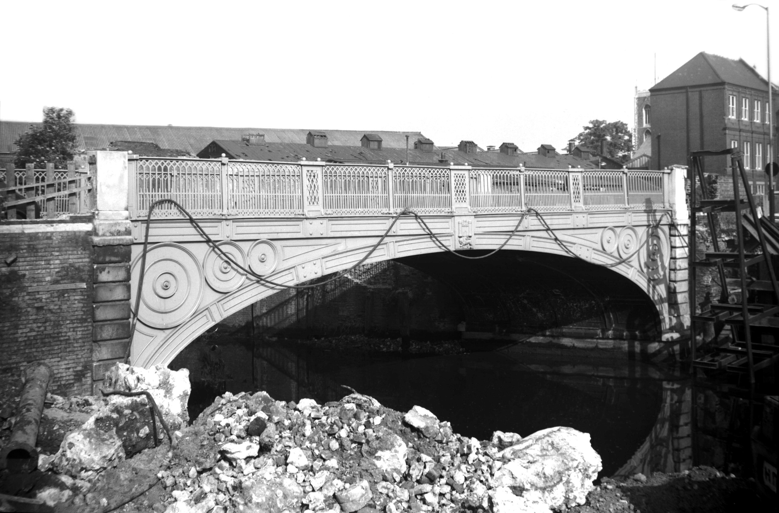
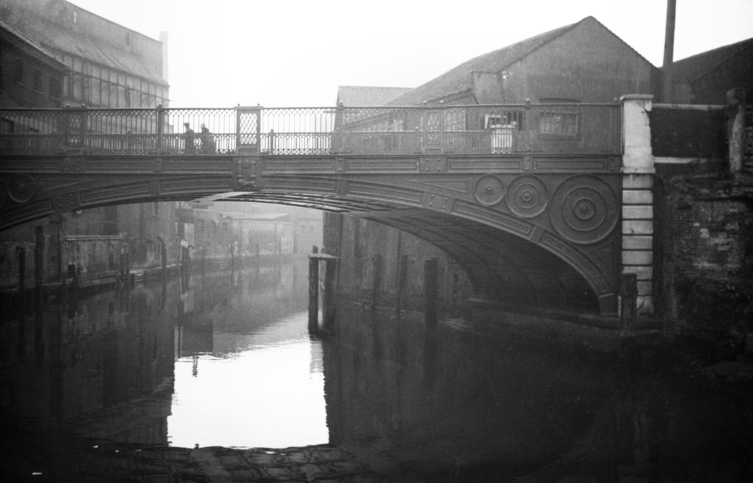
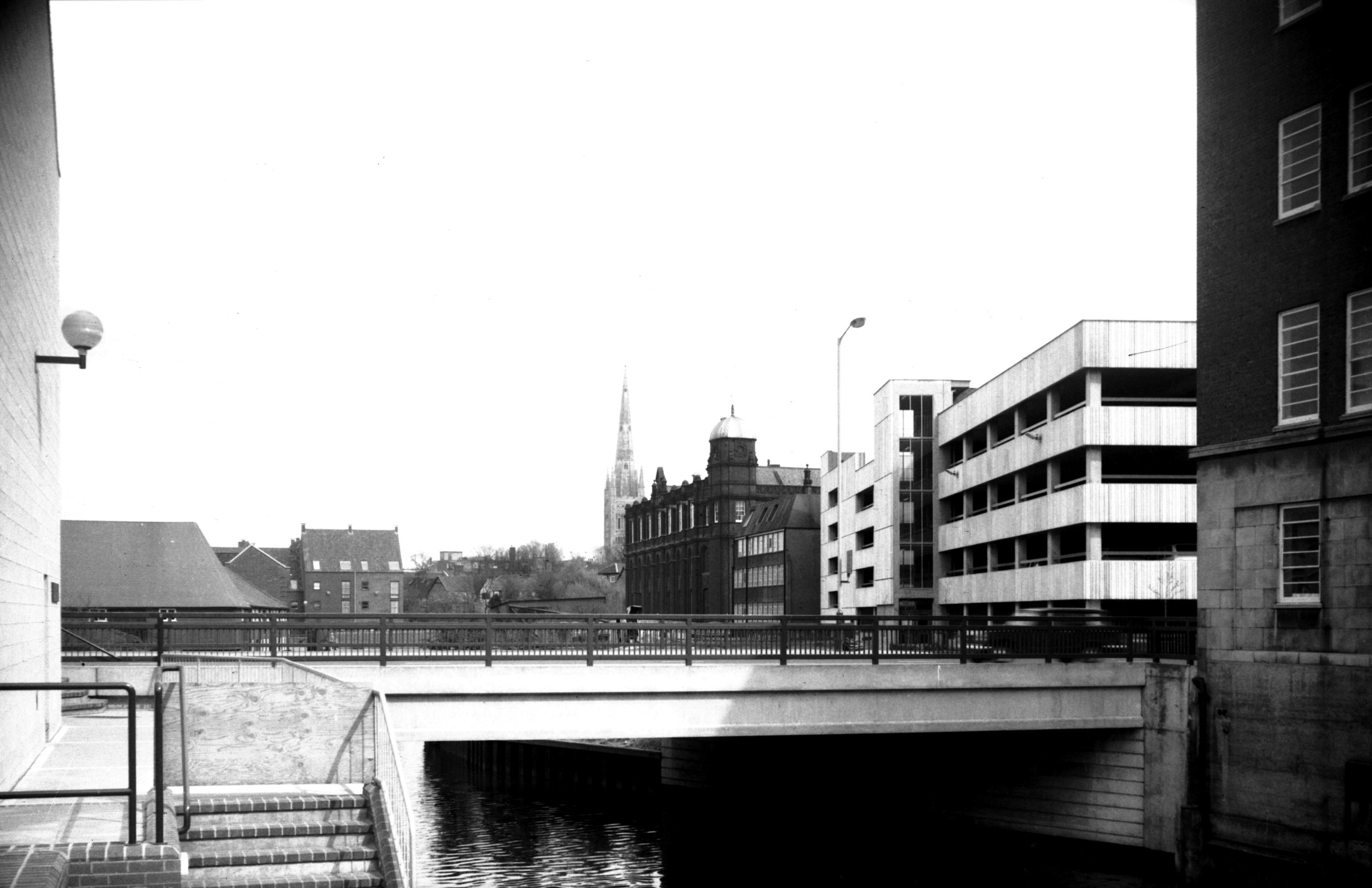
Wensum Duke's Palace Bridge view upstream [5318]
1972-06-30
The old Duke's Palace Bridge, until 1972 carried the
street over the Wensum. No previous bridge had occupied
the site, but by early in the 19c the need was felt for a
more direct link between the north of the city and the
market place. In September and October 1819, therefore,
meetings presided over by the Mayor were held at the
Guildhall to discuss the matter. There was a minor
setback when a majority voted against the proposal, but
at a further meeting at the end of November it was
announced that £7,000 of the proposed £9,000 had been
subscribed, raised by shares of £25 each, which left the
way clear for promoting a Bill in Parliament. On 8th July
1820, the Bill had been passed by both Houses and on 28th
August 1821, Alderman T.S.Day laid the foundation stone.
The bridge, originally a toll bridge, was opened to
traffic during the following year.
The new road thus formed, built across the site of the
old palace of the Dukes of Norfolk, linked Charing Cross
and St John Maddermarket with Pitt St and St Augustine's.
The bridge, adorned on either aide with the city's coat
of arms had a skew-span of approximately 50 feet.
In 1839 a Bill was promoted in Parliament to provide,
among other things, for the freeing of this bridge and
those at Carrow and Thorpe (Foundry bridge). Four years
later the local inhabitants were still agitating for this
to be done, and it was not until 1855 that the tolls were
lifted; a celebratory dinner was held at the adjacent
Duke's Palace inn to mark the event.
By the 1930s the bridge was beginning to show its age,
and a weight limit of twelve tons was imposed. At this
time, too, with the city's traffic becoming increasingly
congested, plans were drawn up for a major road artery
running from north to south through the centre of the
city. This would have involved widening St Augustine's,
Pitt St and Duke St, with a new realigned bridge linking
up with Exchange St, the Market Place and St Stephen's.
Although apparently promoted by City Engineer Horace
Rowley in the 1945 City of Norwich Plan, this
arterial road idea was eventually superseded by the
"ring and loop" scheme based on the Inner Link
road, devised to preserve as much as possible of the
city's historic central area.
In May 1972, it was found necessary to reduce the weight
limit on the 150-year-old bridge to three tons. A few
months later Duke St was temporarily closed, the old
bridge dismantled, and a new and wider one erected in its
place. Supported by 15 concrete beams, each 65 feet in
length, the new bridge is of utilitarian design.
The ironwork from one side of the old bridge, which had
been listed as a structure of historic interest, was
re-erected after 20 years in storage, above the entrance
to the Castle Mall car park in Market Avenue. |
|
|
Wensum Duke's Palace Bridge view downstream [0058]
1934-03-24
|
|
|
Wensum Duke's Palace Bridge view downstream [2761]
1938-08-30
|
|
|
Wensum Duke's Palace Bridge view downstream [2762]
1938-08-30
|
|
|
Wensum Duke's Palace Bridge view downstream [5901]
1978-04-25
|
|
|
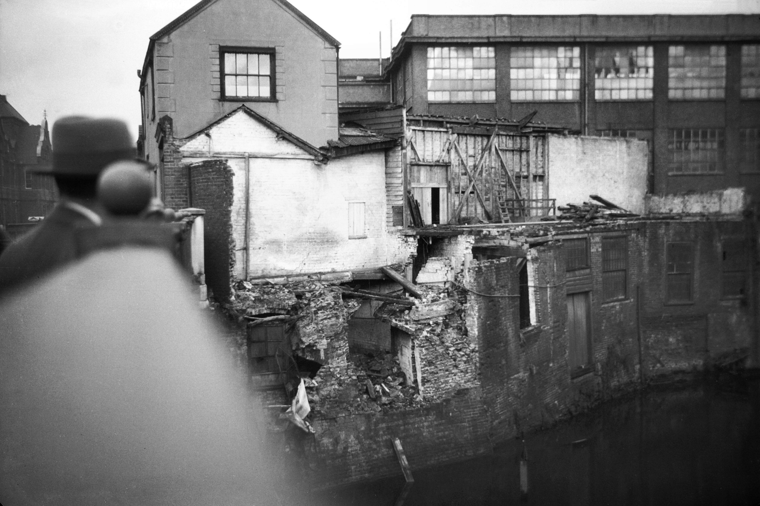
Duke St Butler and Hacon's collapse [B453] 1932-10-00
Premises collapsed into river next to Duke's Palace
bridge. Butler and Hacon were corn merchants. |
|
|
Duke St 23 former Moon and Stars PH [5131] 1967-04-01
|
|
|
Duke St 25 to 31 [6555] 1989-06-23
|
|
|
Duke St 43 to 59 [6554] 1989-06-23
|
|
|
Duke St 67 air raid damage [3754] 1948-09-10
Timber frame revealed by air raid. See also 34 to 36 Muspole St. |
|
|
Duke St 69 to 89 former Whip and Nag PH [5903]
1978-04-25
Formerly 31 to 33 Muspole St and 1 to 3 Pitt St. See Pitt St for earlier photos. |
|
|
Duke St 69 to 89 courtyard NE corner [5895]
1978-04-19
Restored in 1978. |
|
|
Duke St 69 to 89 courtyard SW corner [5894]
1978-04-19
|
|
|
Duke St 69 to 89 courtyard west side [5893]
1978-04-19
|
| |
West
side |
|
|
Duke St 4 Electricity works floodlit [1633]
1937-05-13
Municipal offices until 1938. Electricity department. |
|
|
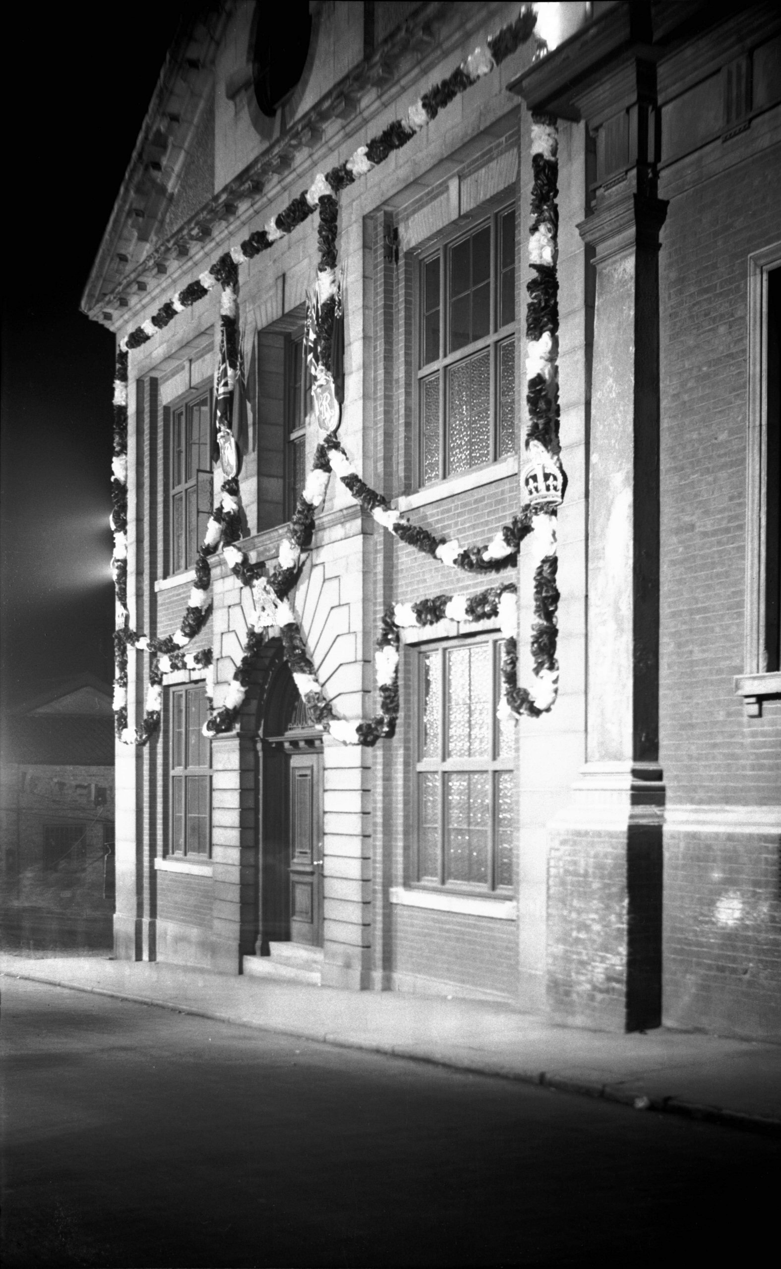
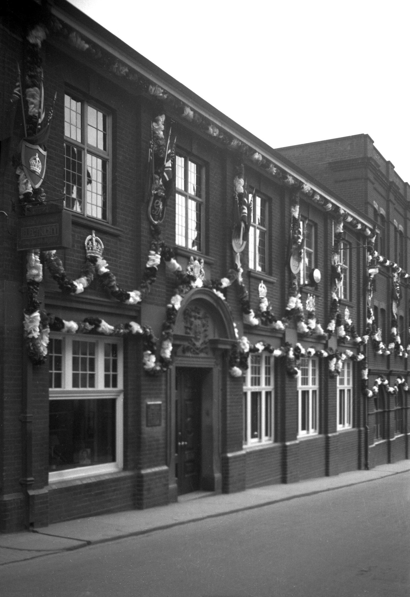
Coronation Duke St Electricity works [1569]
1937-05-09
1937 coronation decorations. |
|
|
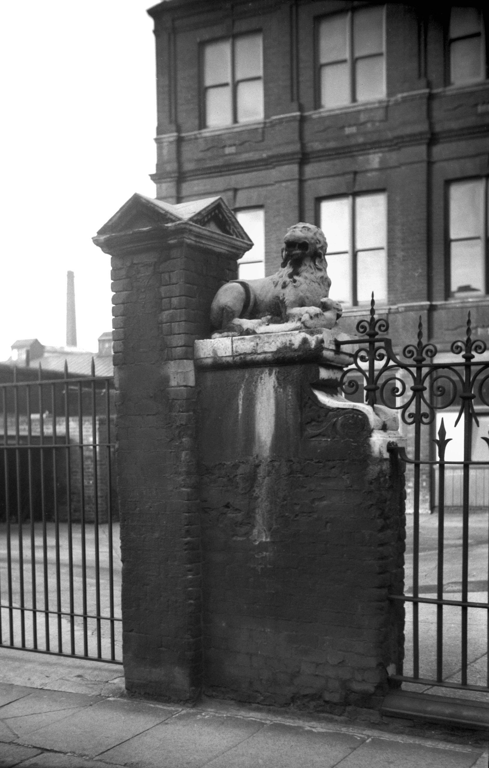
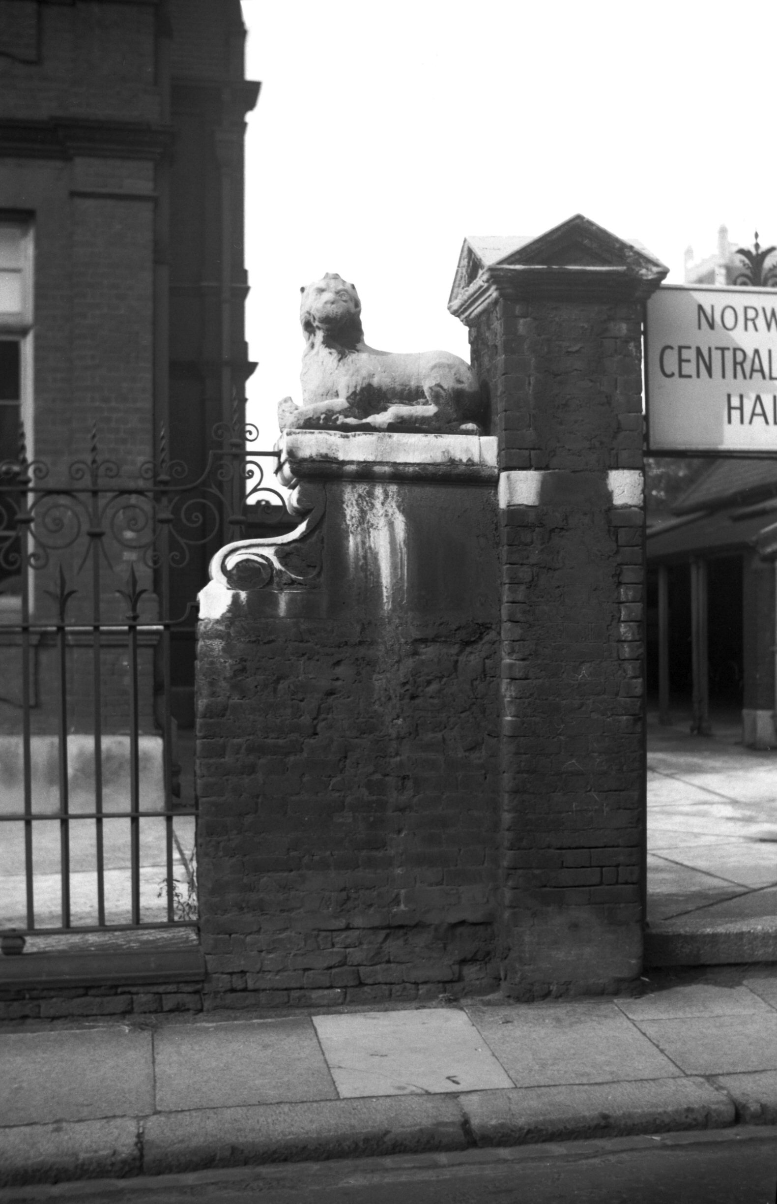
Duke St Higher Grade School carved lion L [4395]
1955-09-26
Further north on Duke St, what was built in 1888 by the
Norwich School Board as a higher grade or municipal
secondary school still stands at the corner of Colegate;
it is now put to other educational uses. Here until 1958
two stone "lions couchant" guarded the
entrances, each one perched high above the street on a
brick and stone plinth. They were not carved especially
for the school, however, but were considered to be of 17c
origin and to have come from the Duke of Norfolk's palace
on the other side of the river. In between times they had
flanked the entrance to the Duke's Head inn, on the site
of which the school was built.
In 1958, because the brick piers on which they were
mounted were showing signs of decay, the lions were taken
down to be cleaned and put into store awaiting transfer
to some other appropriate location. I have been unable to
discover whether they are still in store or have been
found another home. I am tempted to think of the fate
threatened to the family portraits in Gilbert and
Sullivan's Ruddigore, that if they didn't behave
themselves they would be given to the nation and
"nobody would ever see them again". |
|
|
Duke St Higher Grade School carved lion R [4389]
1955-09-24
|
|
|
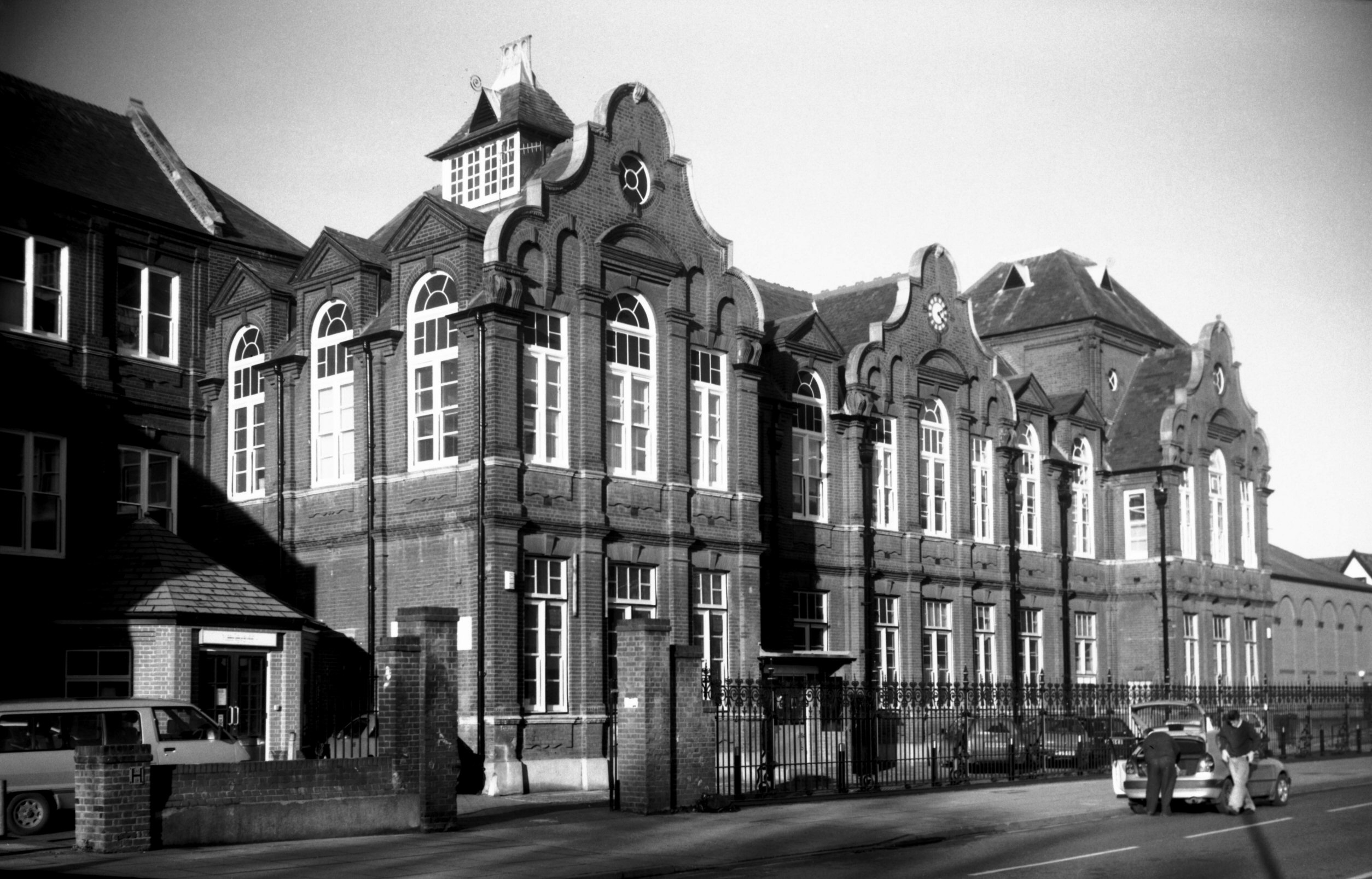
Duke St Higher Grade School former [7726] 2000-02-02
Opened 25th October 1889, designed by Mr J.H.Brown,
architect to the School Board, built by J.Youngs and son.
|
|
|
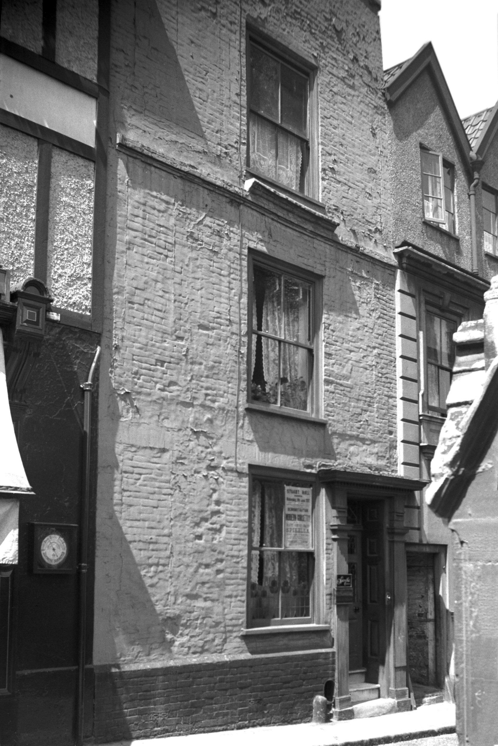
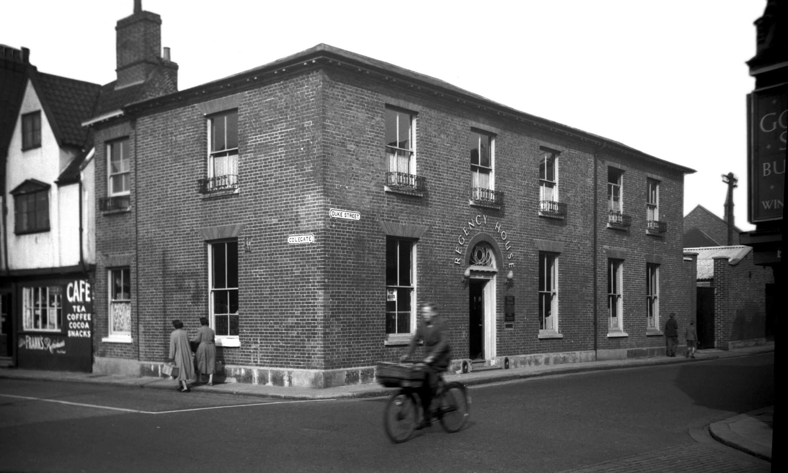
Duke St 34 Regency House [4388] 1955-09-24
|