|
Calvert St: |
| |
From
Colegate to Botolph St
passing Cross Lane, Golden
Dog Lane
East side |
|
|
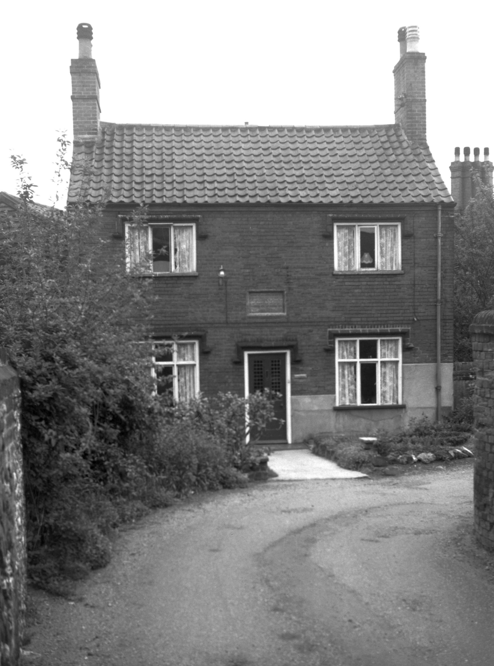
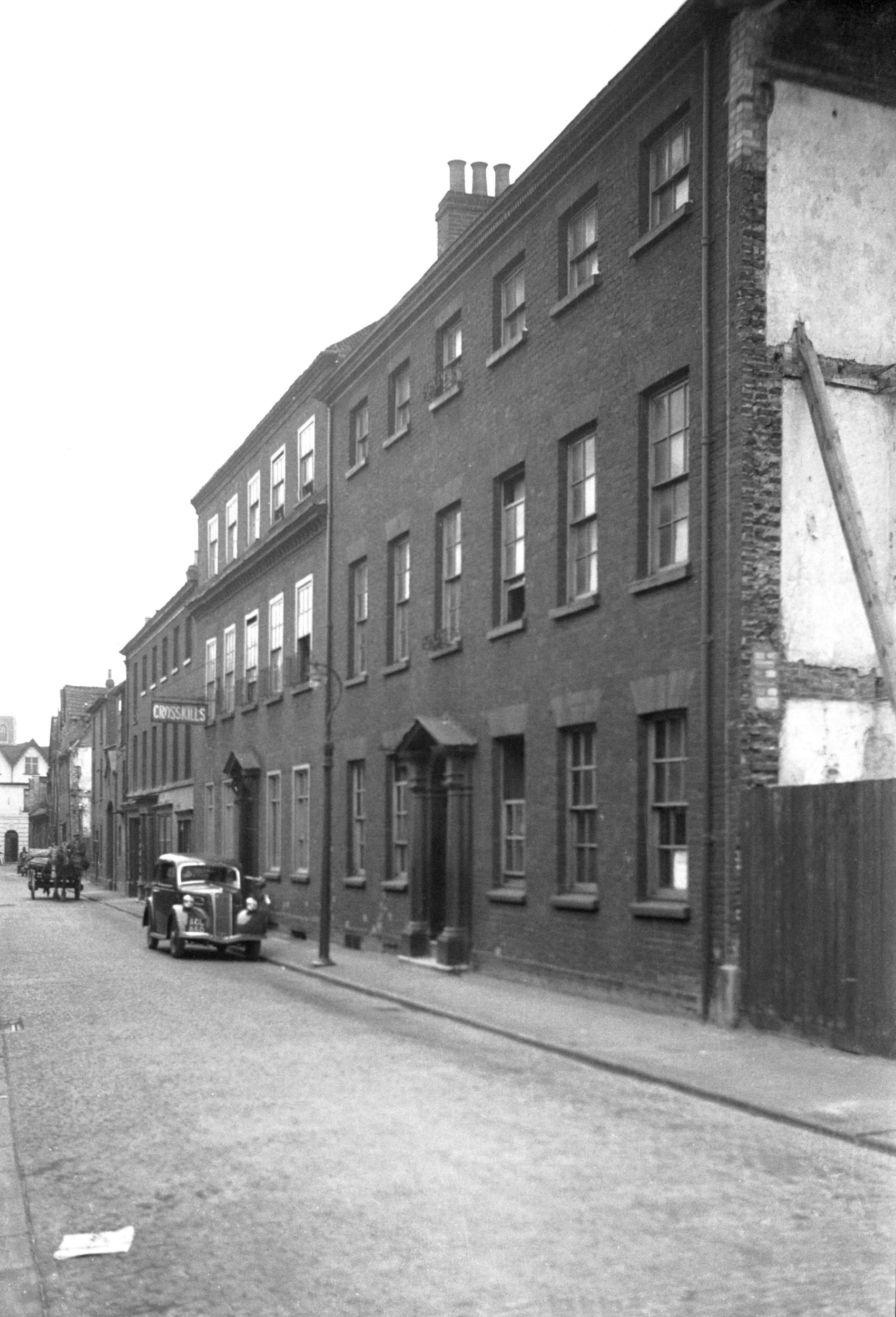
Calvert St 1 north side [0830] 1936-03-24
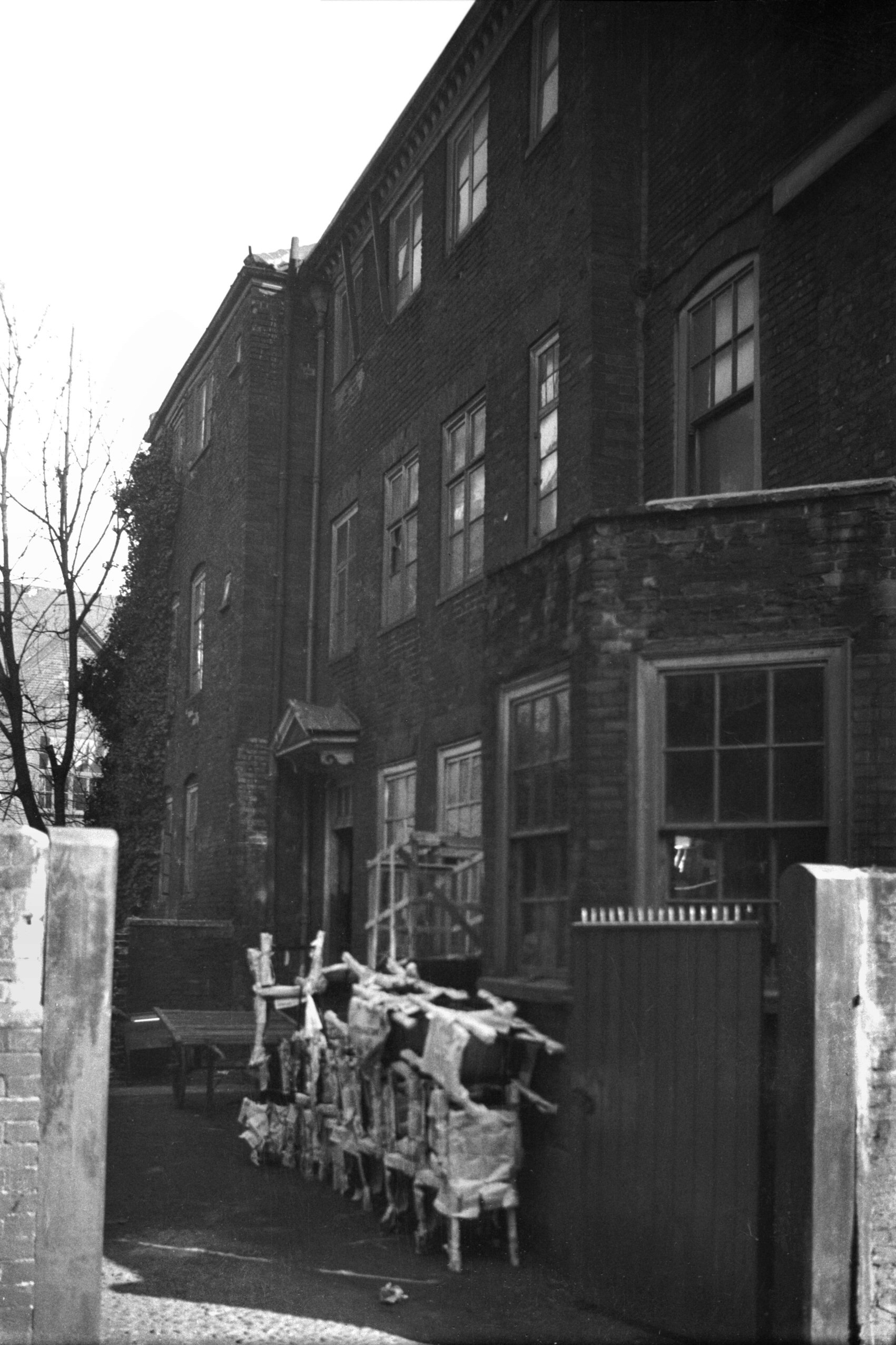
The three-storey mansion at No 1 dates from the late 17c
or early 18c. It is of brick and tile construction with
rusticated quoins, and on the north side a hooded
doorway. In June 1975 when its restoration was well
advanced, a fire swept through the building severely
damaging the interior and destroying the staircase, which
was its main feature. Further restoration was
successfully carried out and the building has now been
converted into a number of flats. |
|
|
Calvert St 1 west side [3264] 1939-09-17
|
|
|
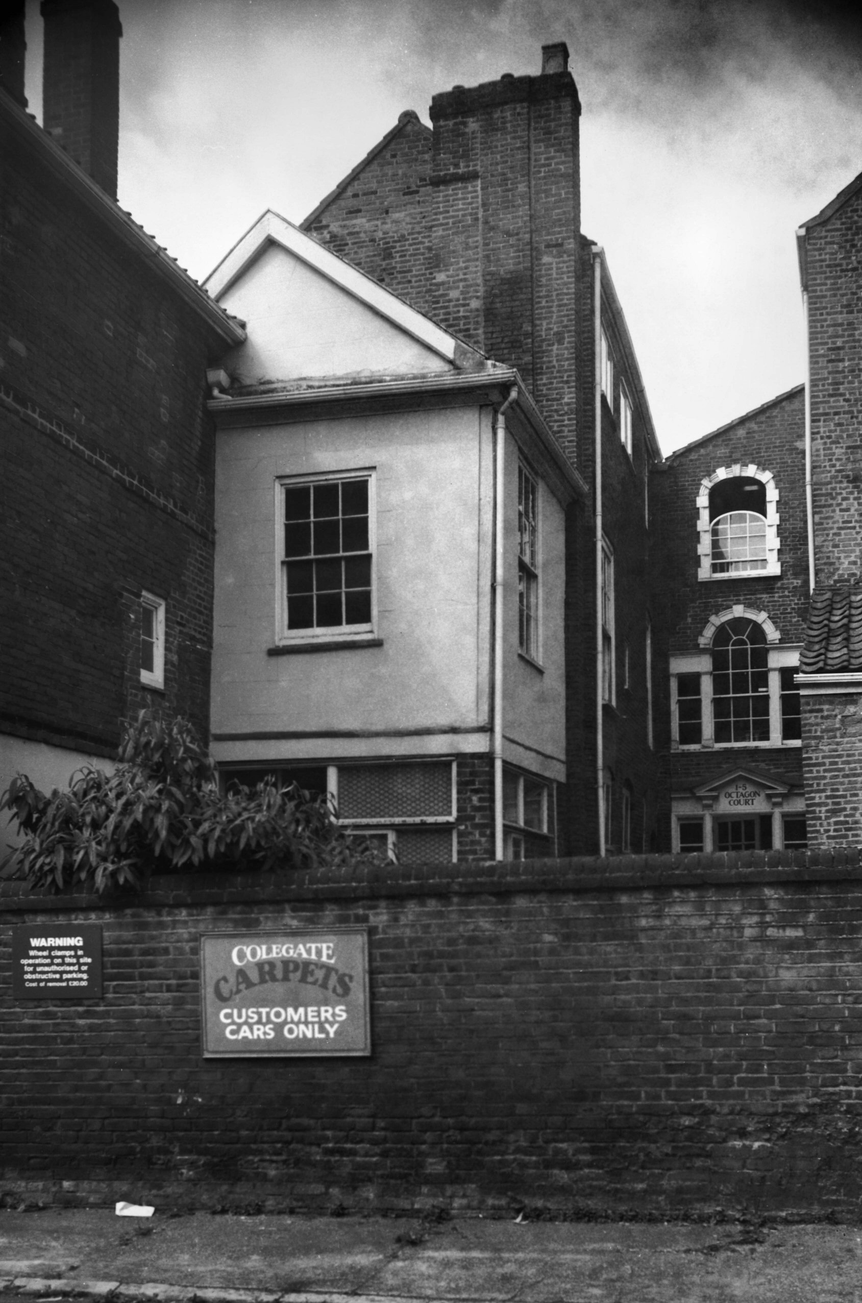
Calvert St 1 east side Octagon Court [6611]
1990-06-16
|
|
|
Calvert St 3 south side [1441] 1936-09-22
|
|
|
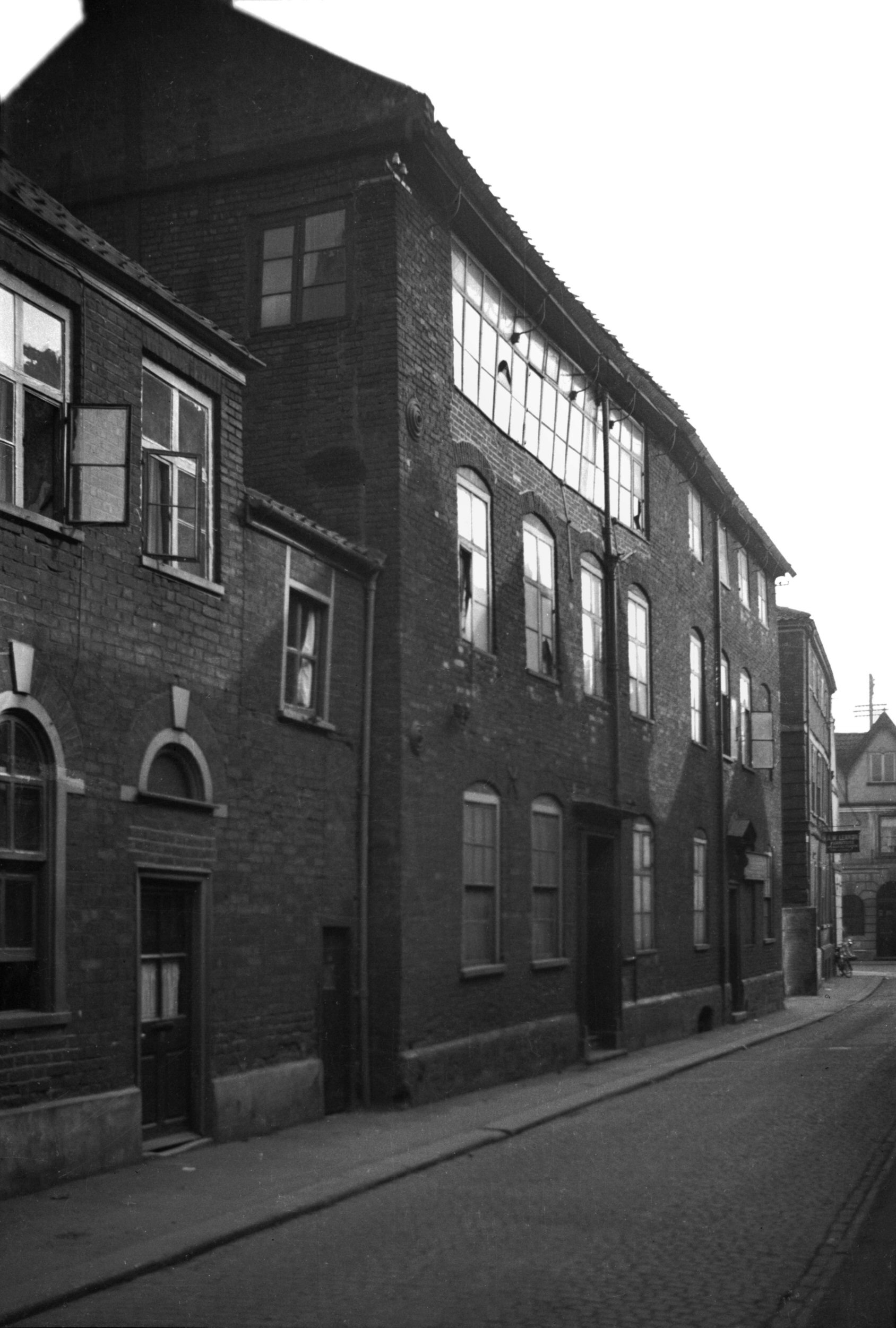
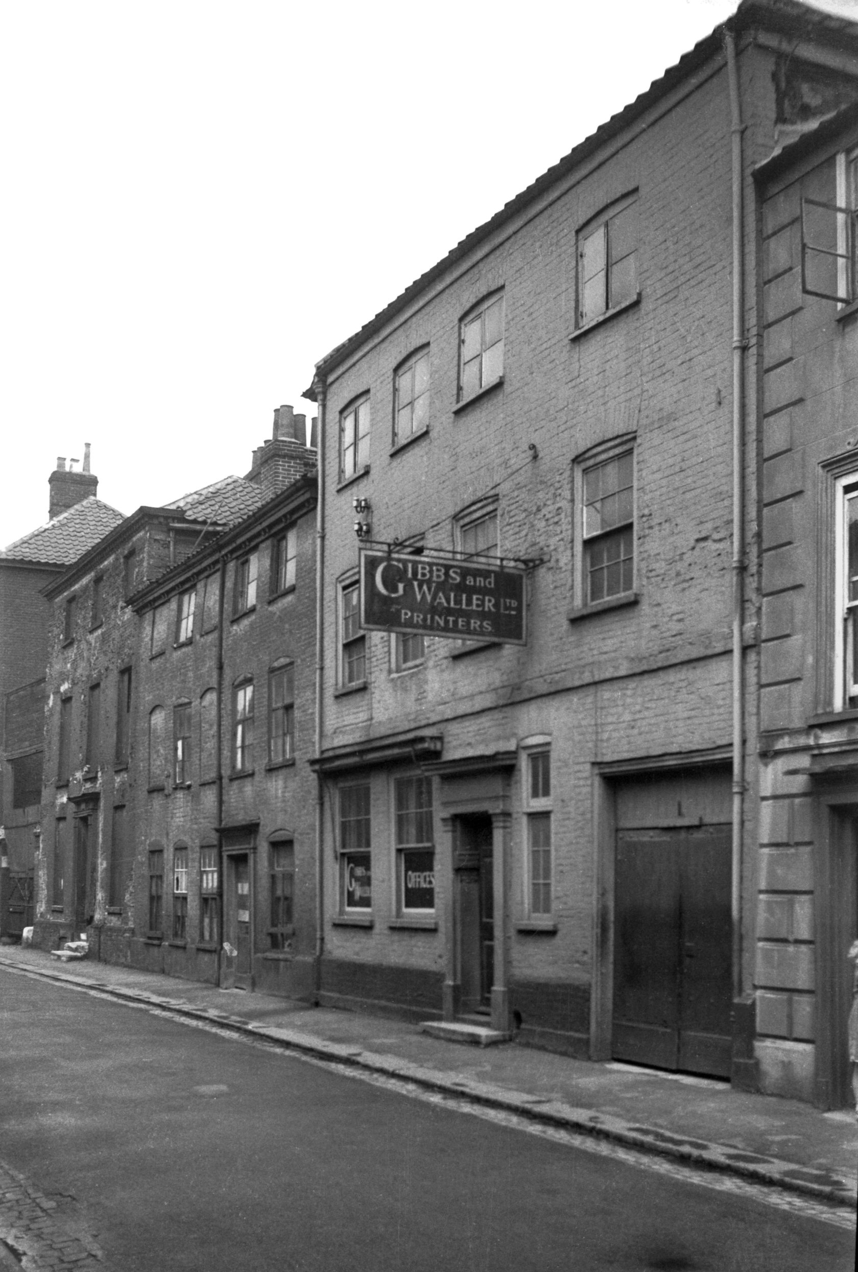
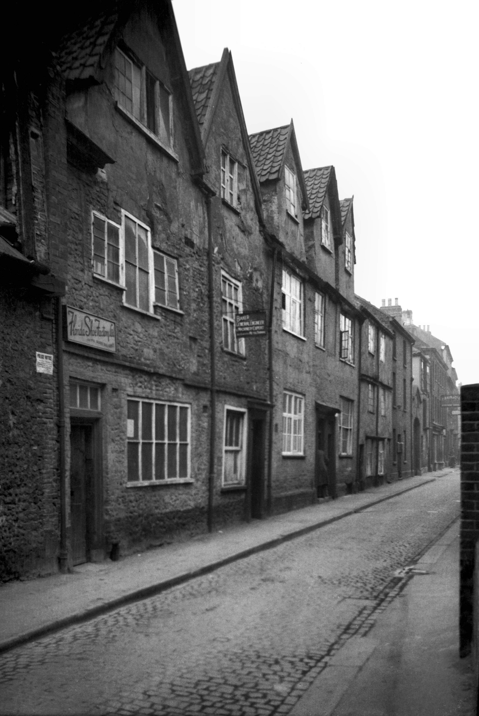
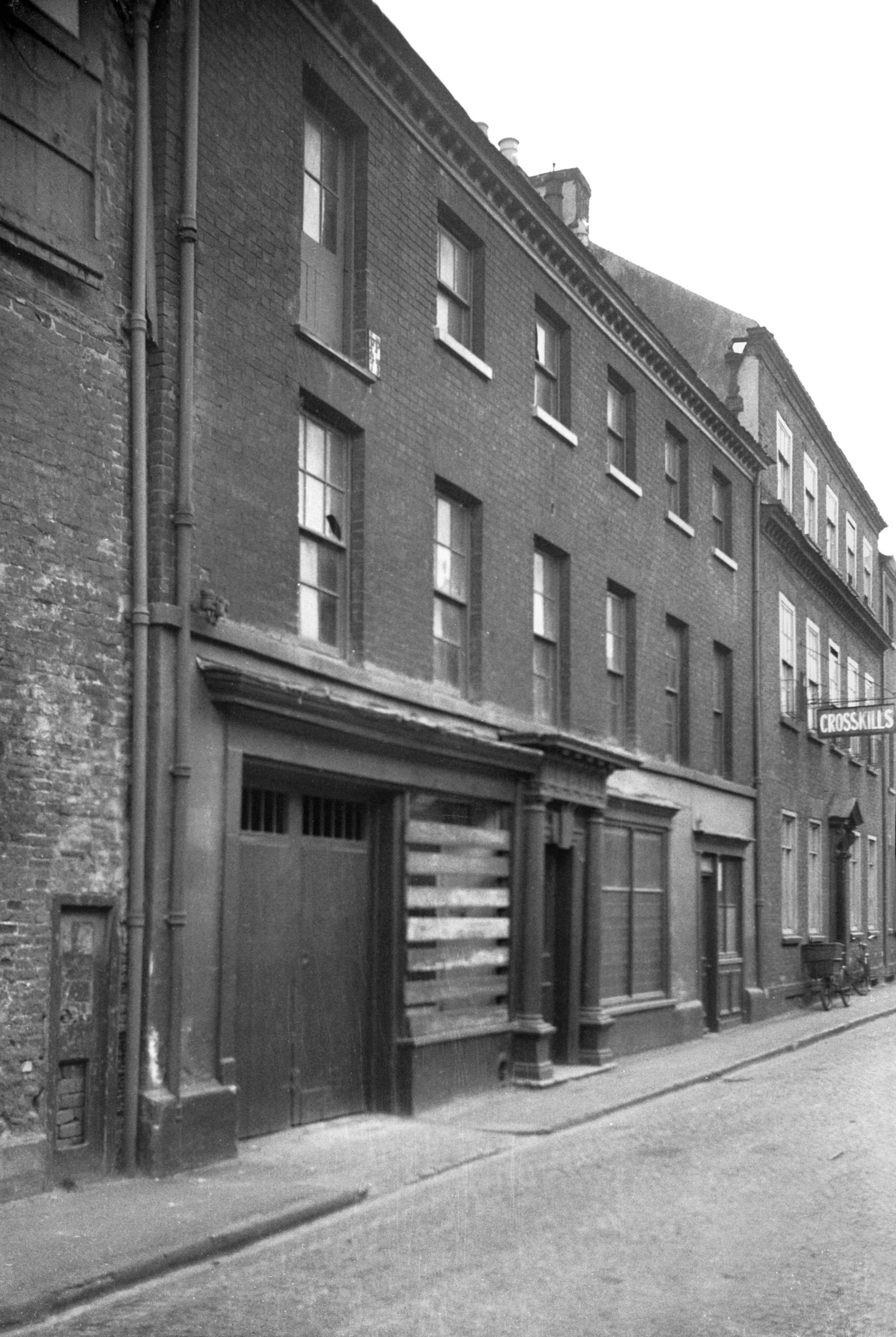
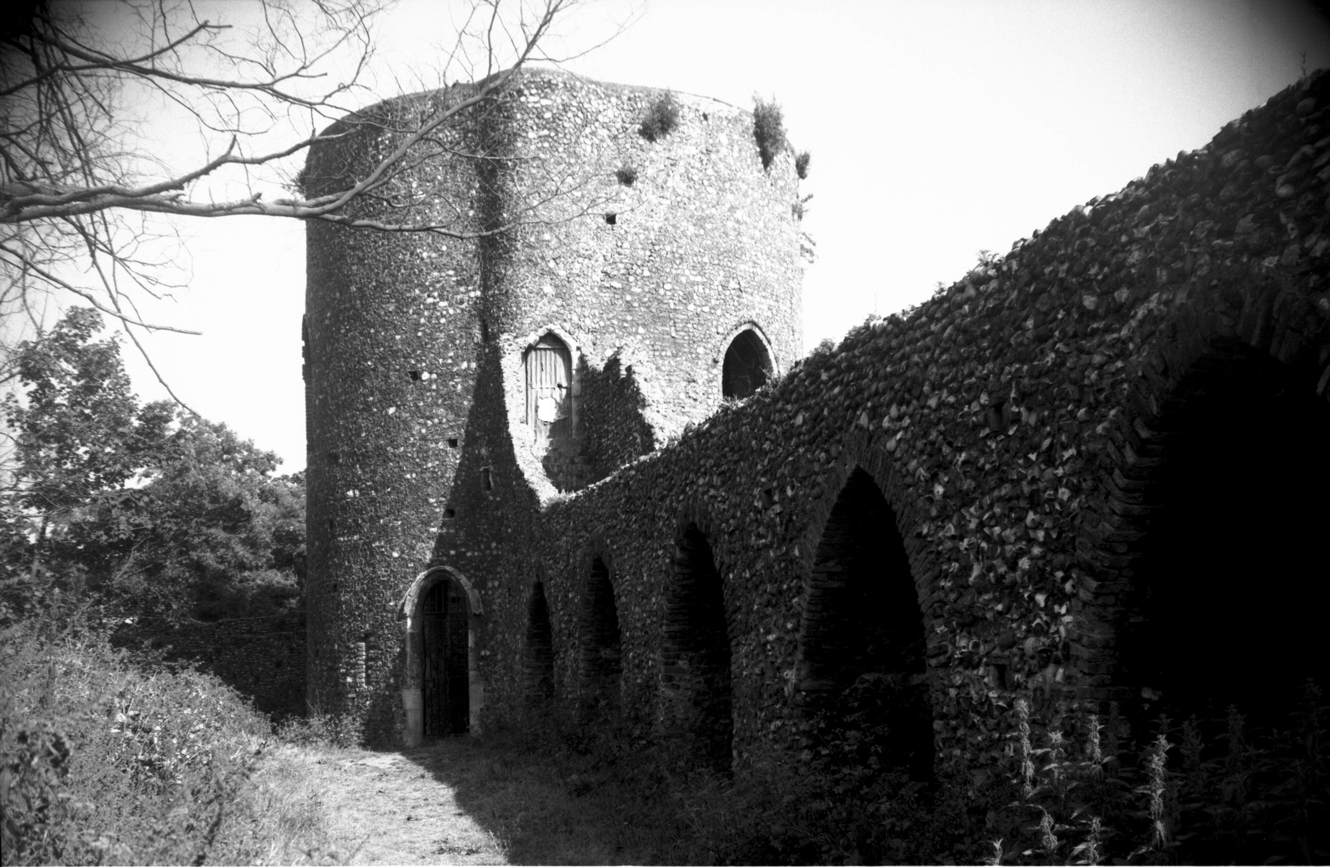
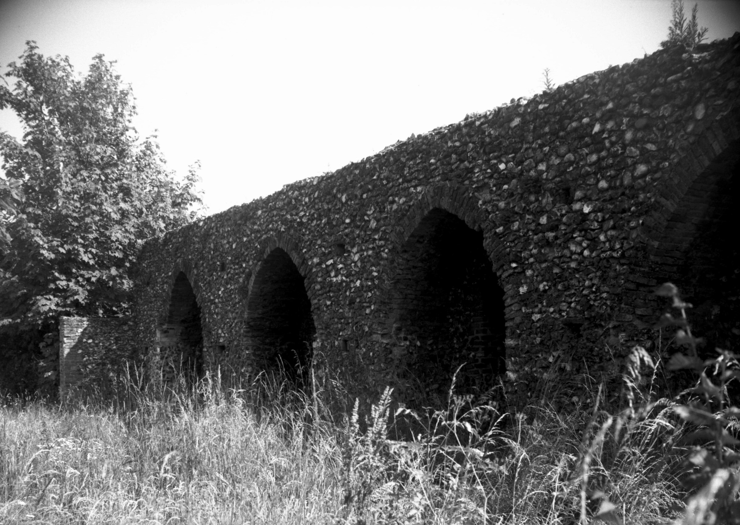
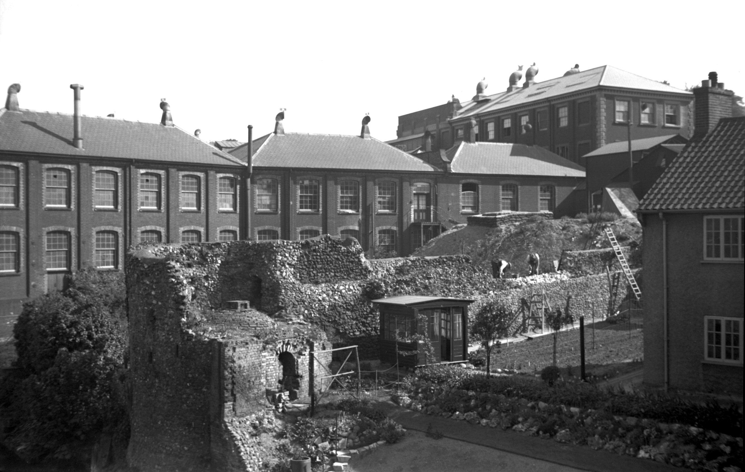
Calvert St 3 to 5 west side [0821] 1936-03-19
Nos 3 and 5 together formed a large building of about the
same age as its neighbour, from which a small courtyard
separated it. It seems to have been one house originally,
with a workroom in the northern half of the third storey
lit by a large thoroughlight (weavers') window, but the
window may have been put in at a later date. On the south
side was a tall semi-circular headed archway, extending
through two storeys, which before it was blocked probably
gave access to a coach house or stable. Between the wars
the building was a shoe factory, and like many others in
the area was becoming very dilapidated. Its end came when
it fell victim to a firebomb raid, on 2nd August 1942, in
which all but the outer walls were destroyed. These too
were levelled on 5th September that same year when one of
a stick of high-explosive bombs fell in the centre of the
site. |
|
|
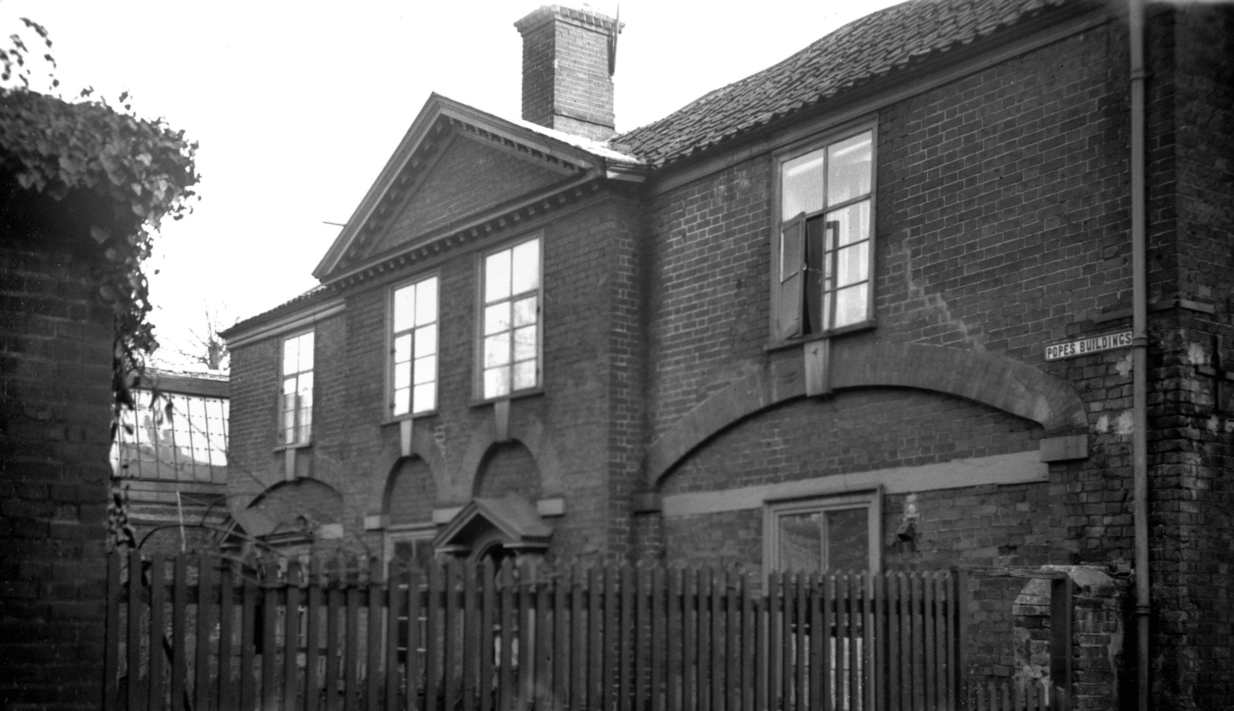
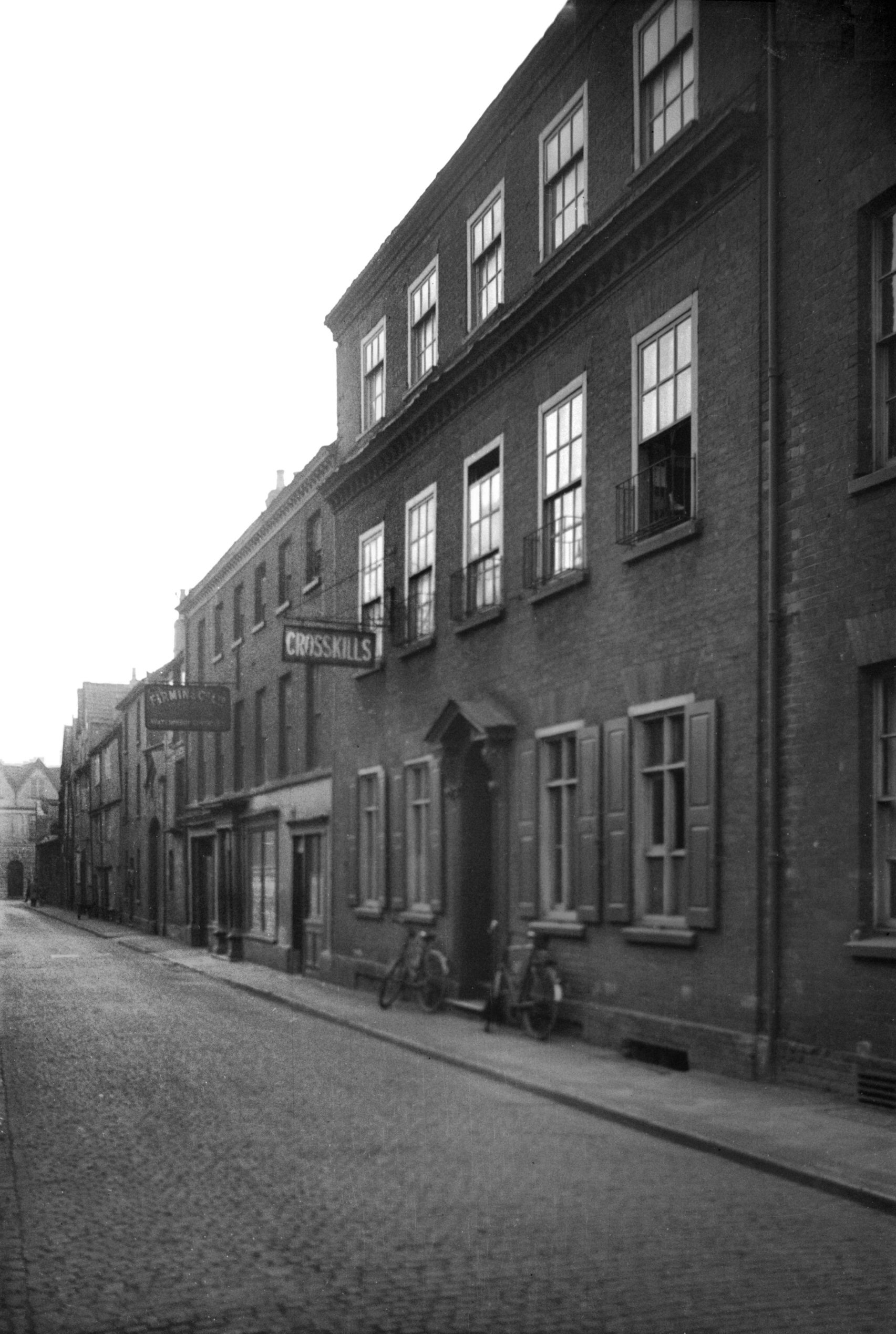
Calvert St Pope's Buildings [2126] 1938-03-06
The street has a number of restored buildings at its
southern end, of the 18c. Among these, on the eastern
side, may be mentioned Pope's Buildings, a pair of coach
houses which in the early 1970s the City Council restored
from an almost derelict condition, converting them into
eight dwellings. |
|
|
Calvert St 7 to 9 Pope's Buildings W side [2560]
1938-07-21
|
|
|
Calvert St 11 [2559] 1938-07-21
|
|
|
Calvert St 49 to 51 [2551] 1938-07-17
|
|
|
Calvert St 51 to 55 [2678] 1938-08-03
|
|
|
Calvert St 57 [4667] 1962-06-11
|
|
|
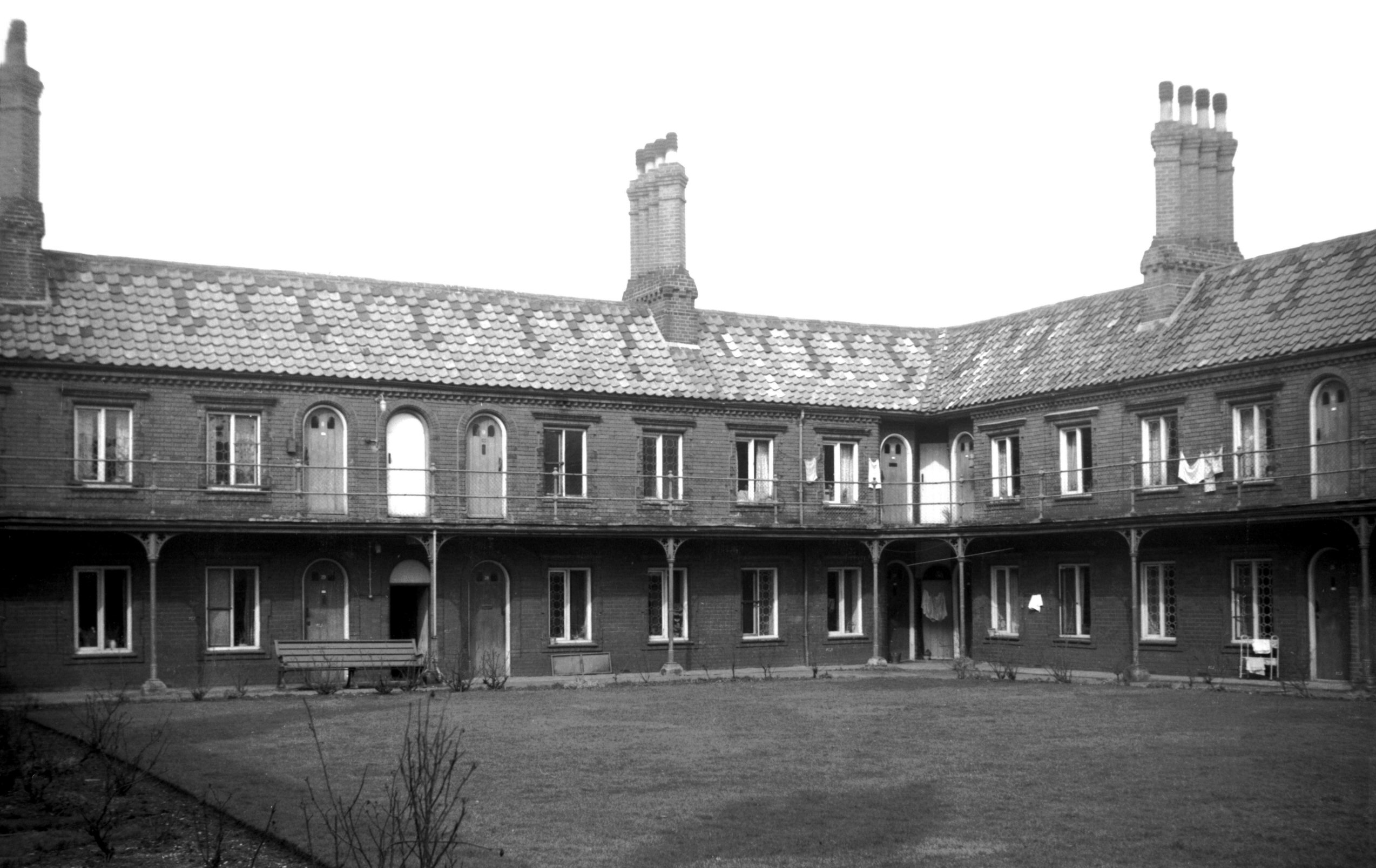
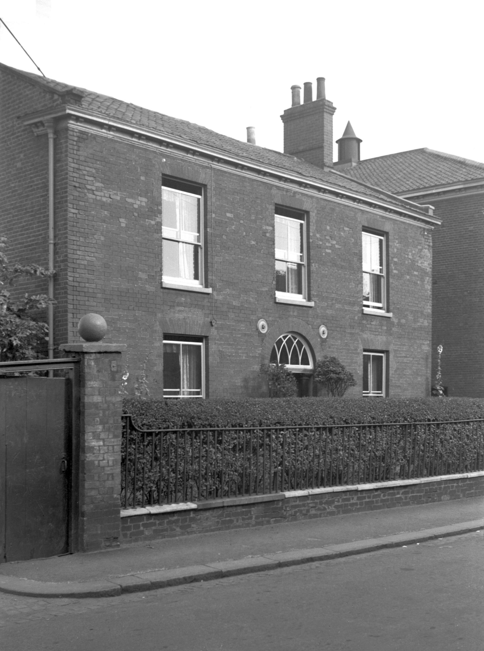
Calvert St Doughty's Hospital [4660] 1962-03-28
Founded by William Doughty under the terms of his Will
dated 1687. The present buildings date from 1869. |
|
|
Calvert St Doughty's Hospital matron lodge [4666]
1962-06-11
|
|
|
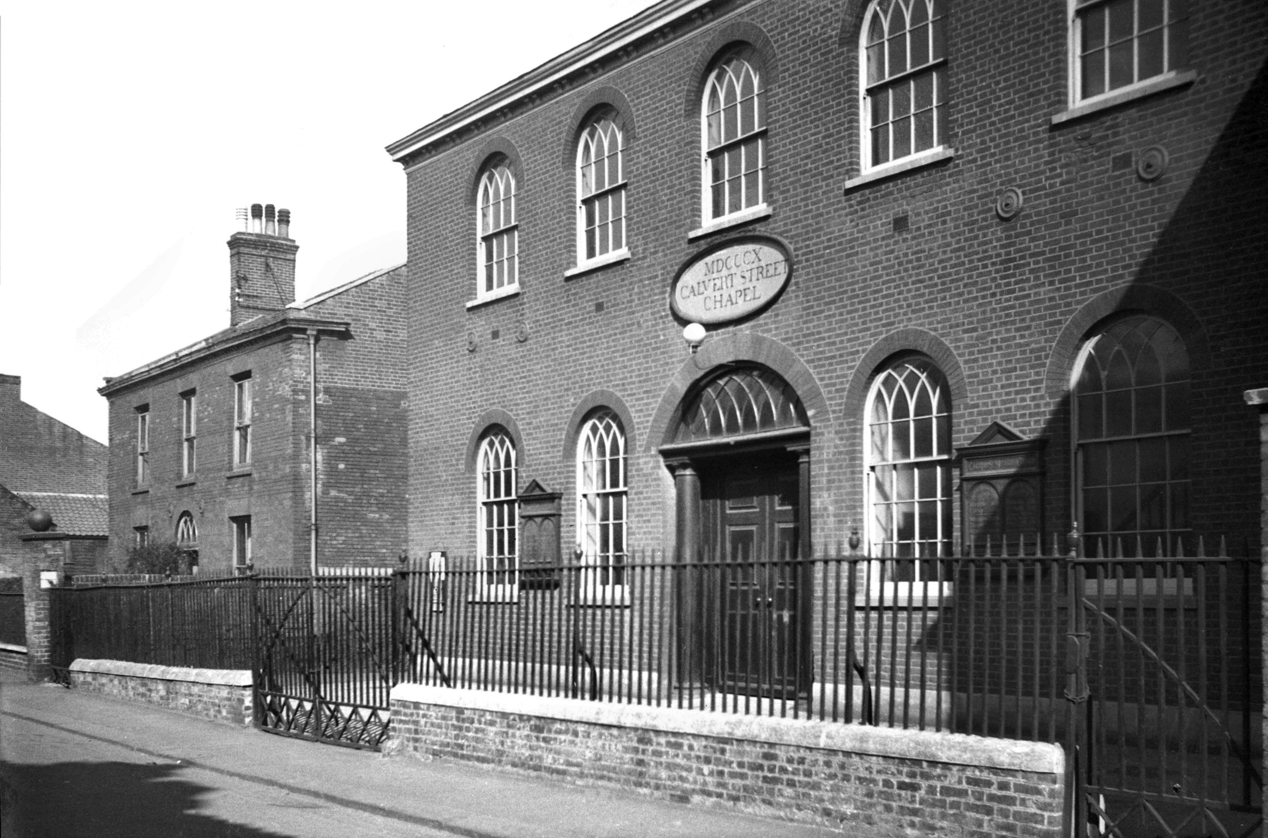
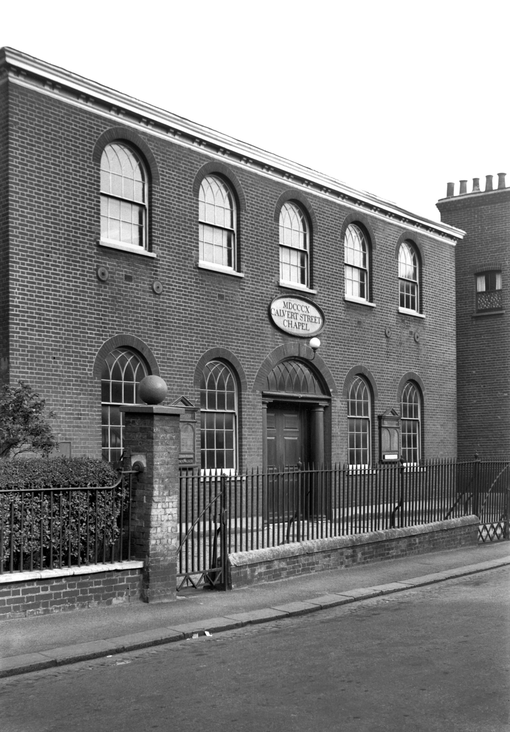
Calvert St Methodist chapel and manse [0825]
1936-03-24
A tragic loss from Calvert St was its Methodist Chapel,
built in 1810, as boldly declared by an oval-shaped stone
plaque above its main entrance. The chapel closed after
the morning service on Sunday, 26th June 1966, and all
traces had been swept away by mid-August. Closure came
not because the church was redundant but because it had
to make way for the Inner Link road.
In a booklet published in 1961 to commemorate the
church's 150th anniversary, the late Mr W.W.Johnson gave
an interesting account of its history. Designed by an
unknown architect, the building, which was of red brick,
was lit by a double row of round-headed windows having
sashes fitted with interlacing glazing bars typical of
the period. Its central doorway was recessed, with Tuscan
pillars supporting an elliptical fanlight. Inside, a
panelled gallery extended round all four walls, with an
organ at the east end, below which was the pulpit and
holy table. Mr A.F.Scott (architect of Chamberlin's
clothing factory in Botolph St and Marks and Spencer's in
Rampant Horse St) designed a new ceiling that was erected
in 1895. At the same time a new wooden floor was laid,
replacing the original brick paving, while new seating
took the place of the old box pews.
It was doubly unfortunate that the building had to go,
first, of course, from the point of view of the
congregation, and secondly from the architectural aspect.
A well-known local architect and antiquary, the late
Stanley Wearing, said on several occasions that although
the Calvert St Chapel was simple it was of fine design,
and in his opinion should be grouped with the Old Meeting
House in Colegate and the nearby Octagon Chapel as a
“trio of distinctive historic churches of
non-conformity in Norwich”. |
|
|
Calvert St Methodist chapel [3249] 1939-08-13
|
|
|
Calvert St 69 [3250] 1939-08-13
|
| |
West
side |
|
|
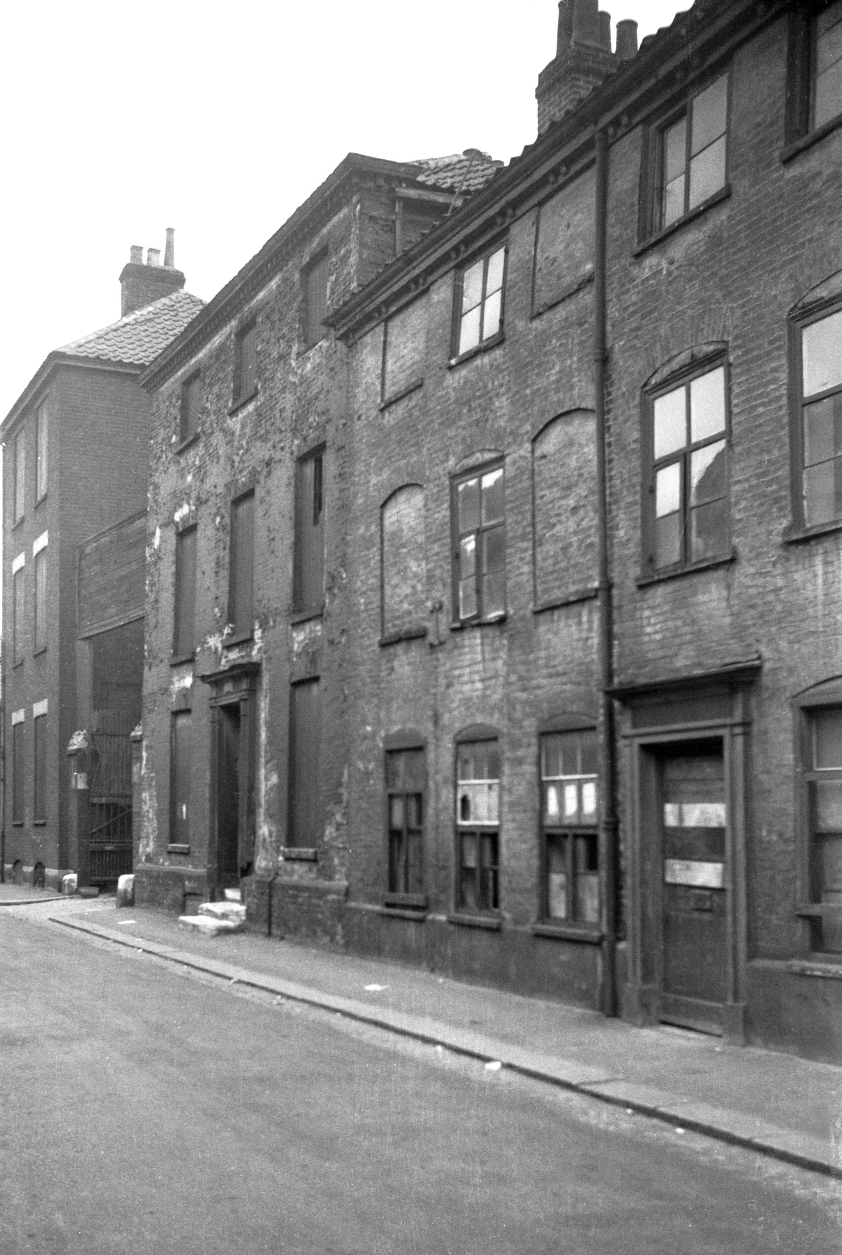
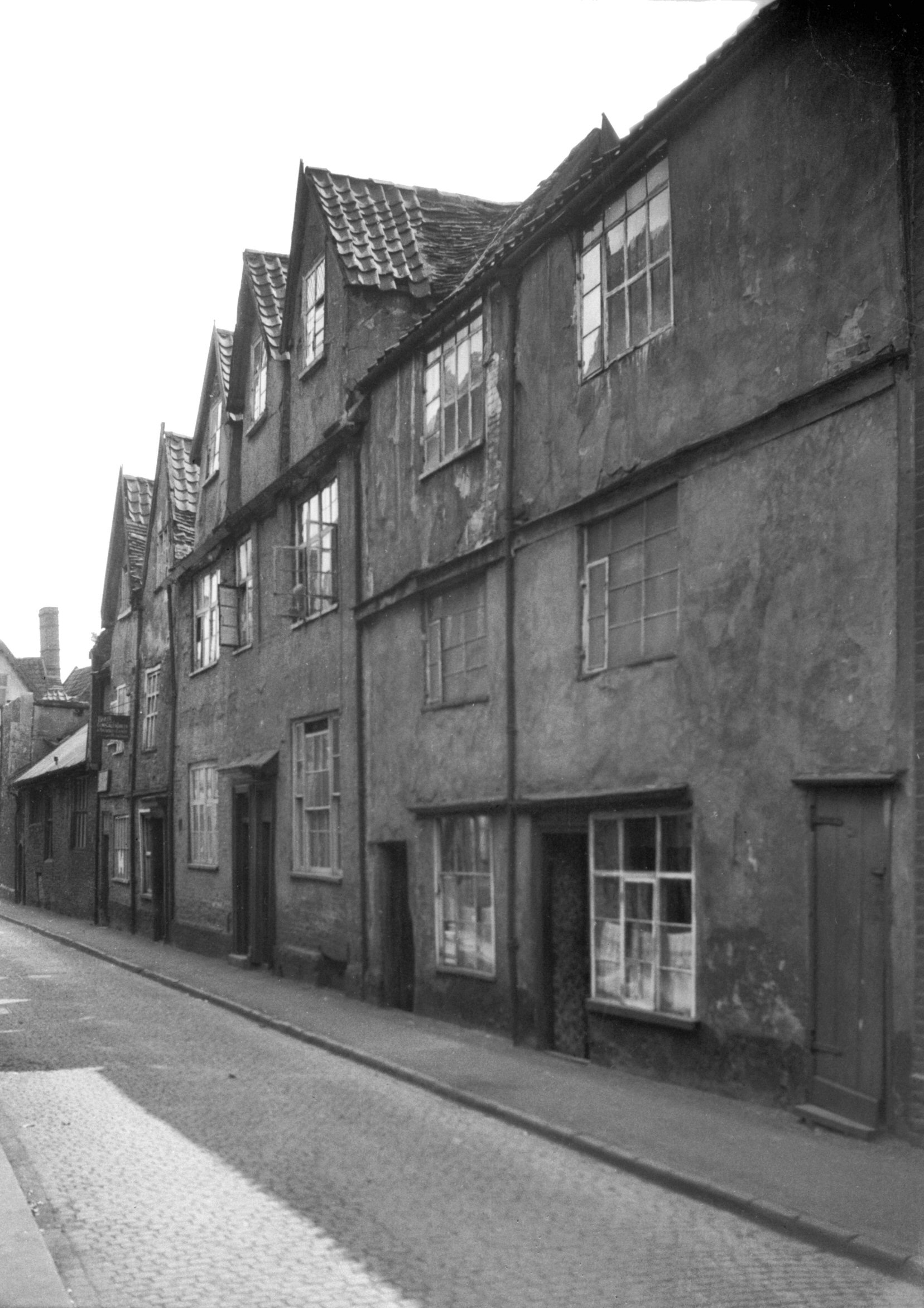
Calvert St 2 to 10 view NW [0807] 1936-03-17
The street has suffered many losses. Near to Colegate
were Nos 2-10, casualties of an air raid during the
morning of 5th September 1942. These were Tudor houses
built of flint rubble and brick, and although they were
not well maintained their gabled roofline gave
considerable character to this entrance to the street.
The new flats that now occupy this site, extending behind
Bacon House through to St George's St, are known as
Lowe's Yard after the original yard here, which was
demolished in 1937. |
|
|
Calvert St 2 to 10 view SW [1692] 1937-06-06
|
|
|
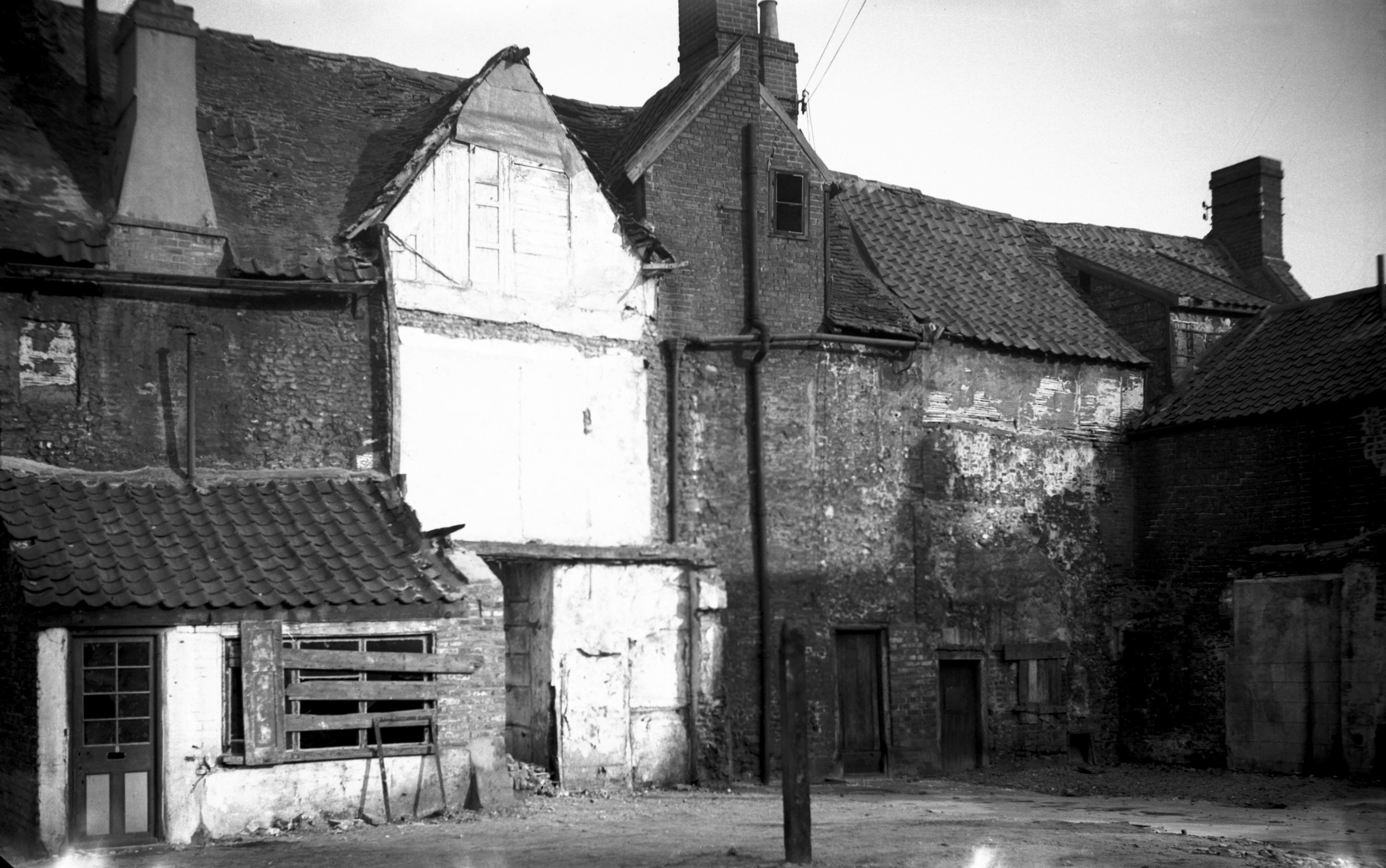
Calvert St 2 to 6 rear from Lowes Yard [2125]
1938-03-06
|
|
|
Calvert St 16 Georgian doorway [3211] 1939-08-07
|
|
|
Calvert St 16 to 18 [2677] 1938-08-03
|
|
|
Calvert St 18 to 20 [0819] 1936-03-19
|
|
|
Calvert St 20 [6378] 1986-05-24
|
|
|
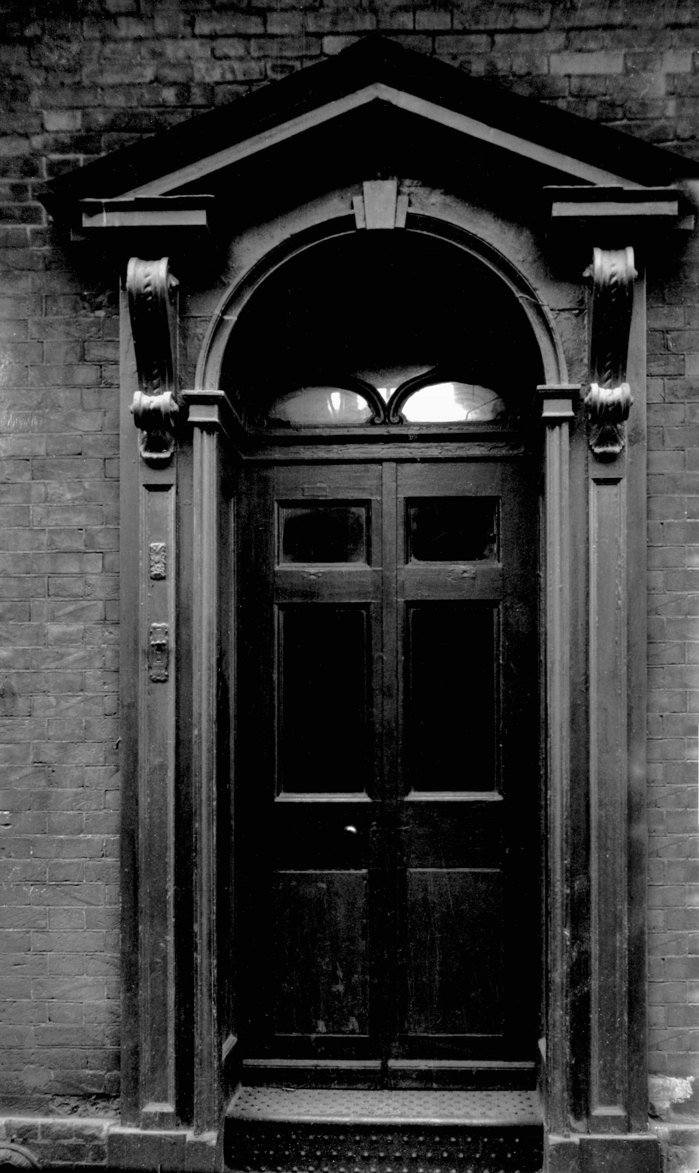
Calvert St 20 Georgian doorway [2128] 1938-03-06
|
|
|
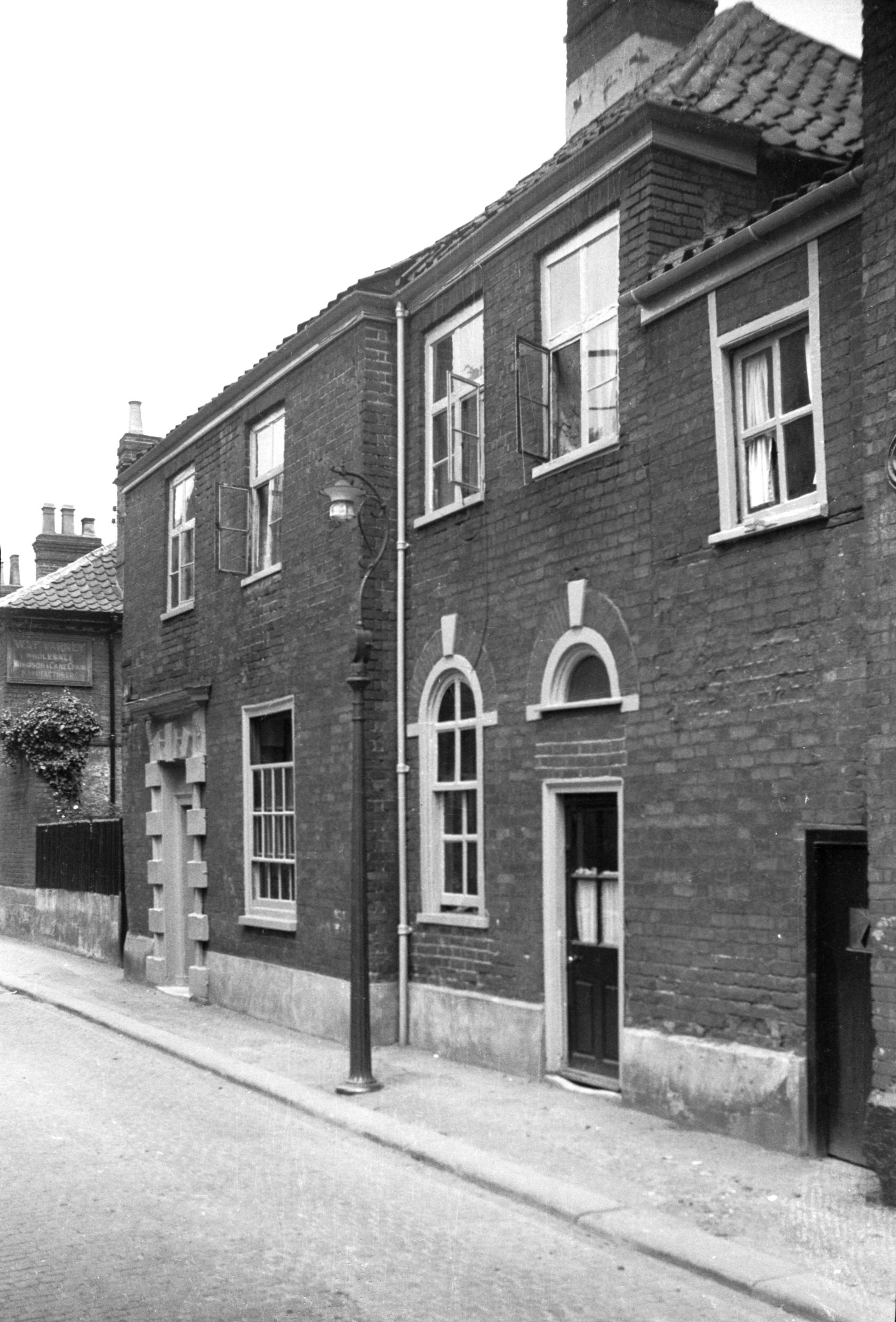
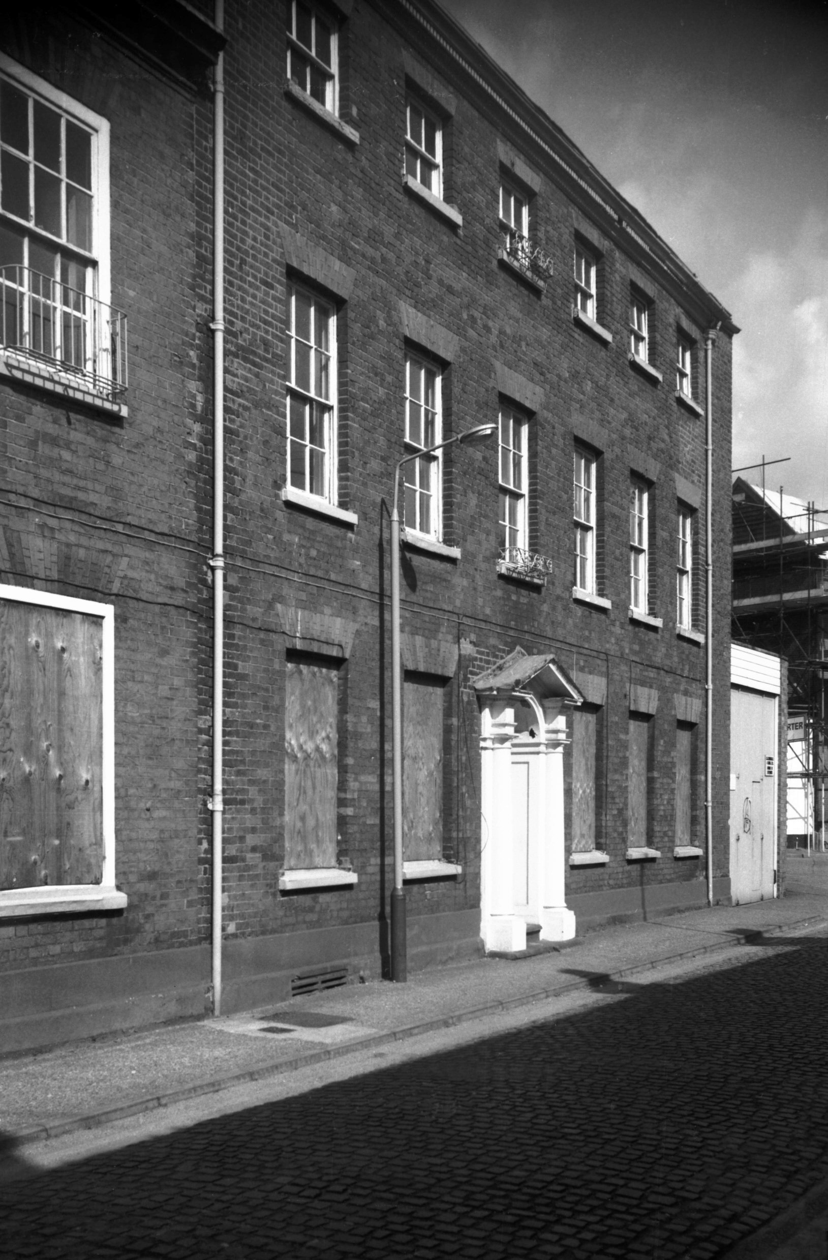
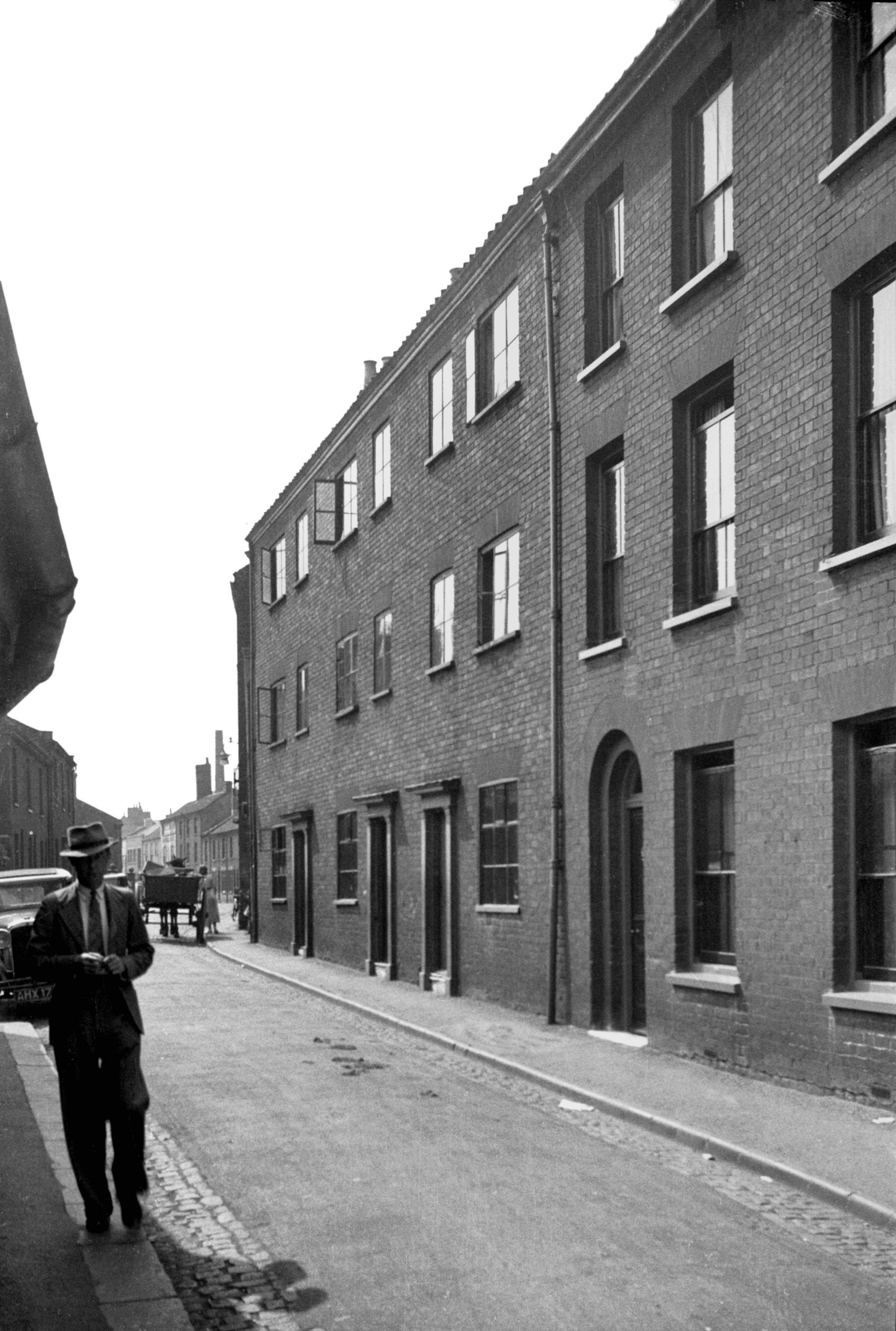
Calvert St 20 to 22 [2676] 1938-08-03
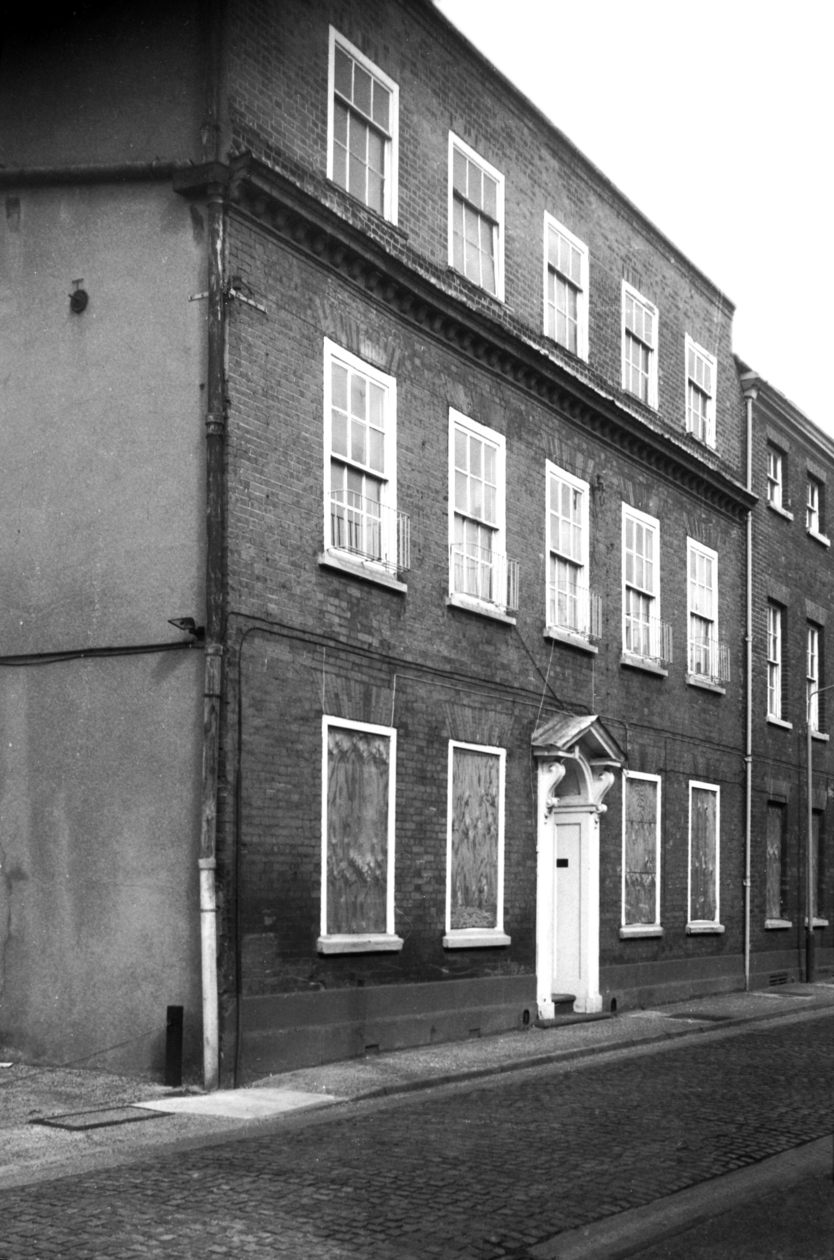
According to Ralph Mottram, Calvert St, which now
terminates at St Crispin's Rd, was named after the local
proprietor "Count Calvert", whose mansion lay
there. In the early part of the 18c however, the
historian John Kirkpatrick wrote that it was Doughty's
Hospital St and previously Snaylegate, then Snackegate,
though he ventured no opinion as to the derivation of the
latter names.
The district hereabout seems to have reached its zenith
as a prosperous residential area when in the 18c many new
mansions were built and others modernised. Many have now
gone but Nos 20 and 22, until recently commercially
occupied, still survive to give an idea how the place
formerly looked. |
|
|
Calvert St 22 [6379] 1986-05-24
|
|
|
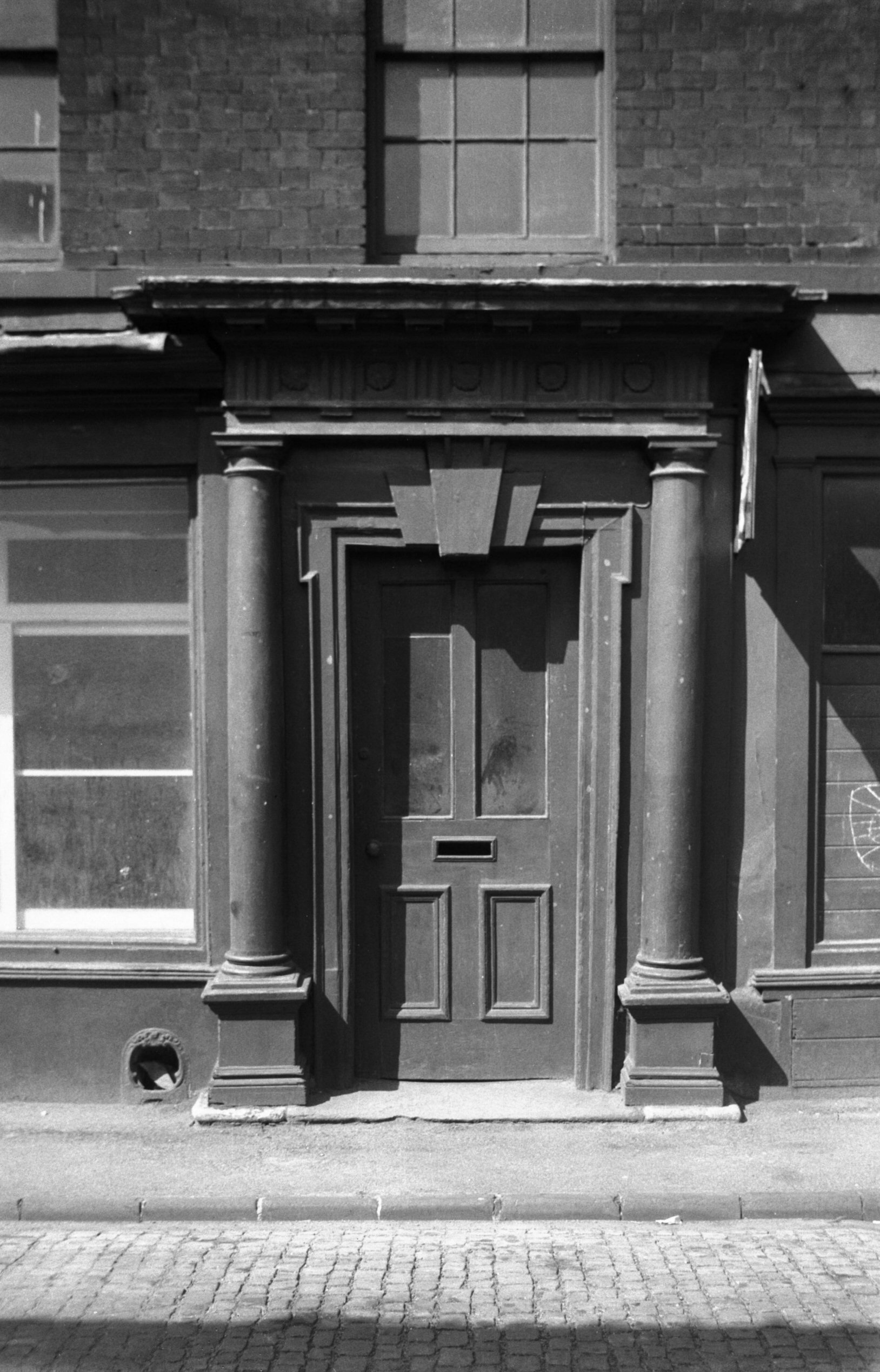
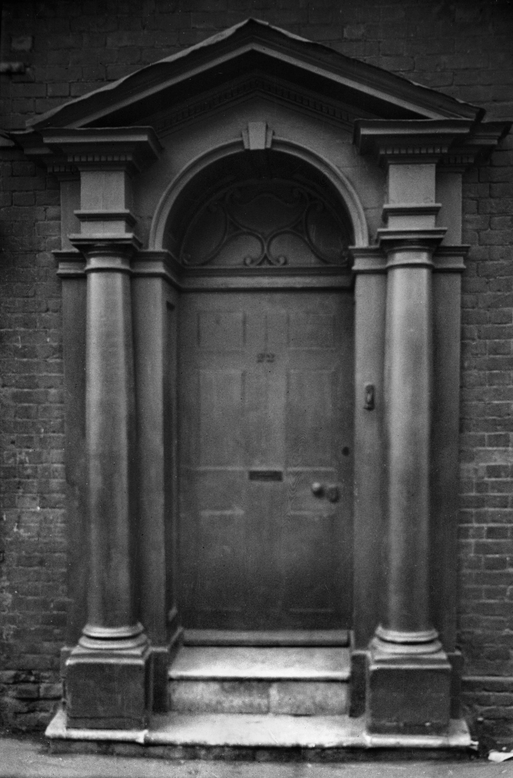
Calvert St 22 Georgian doorway [0446] 1935-04-14
|
|
|
Calvert St 28 to 30 [0836] 1936-03-31
|
|
|
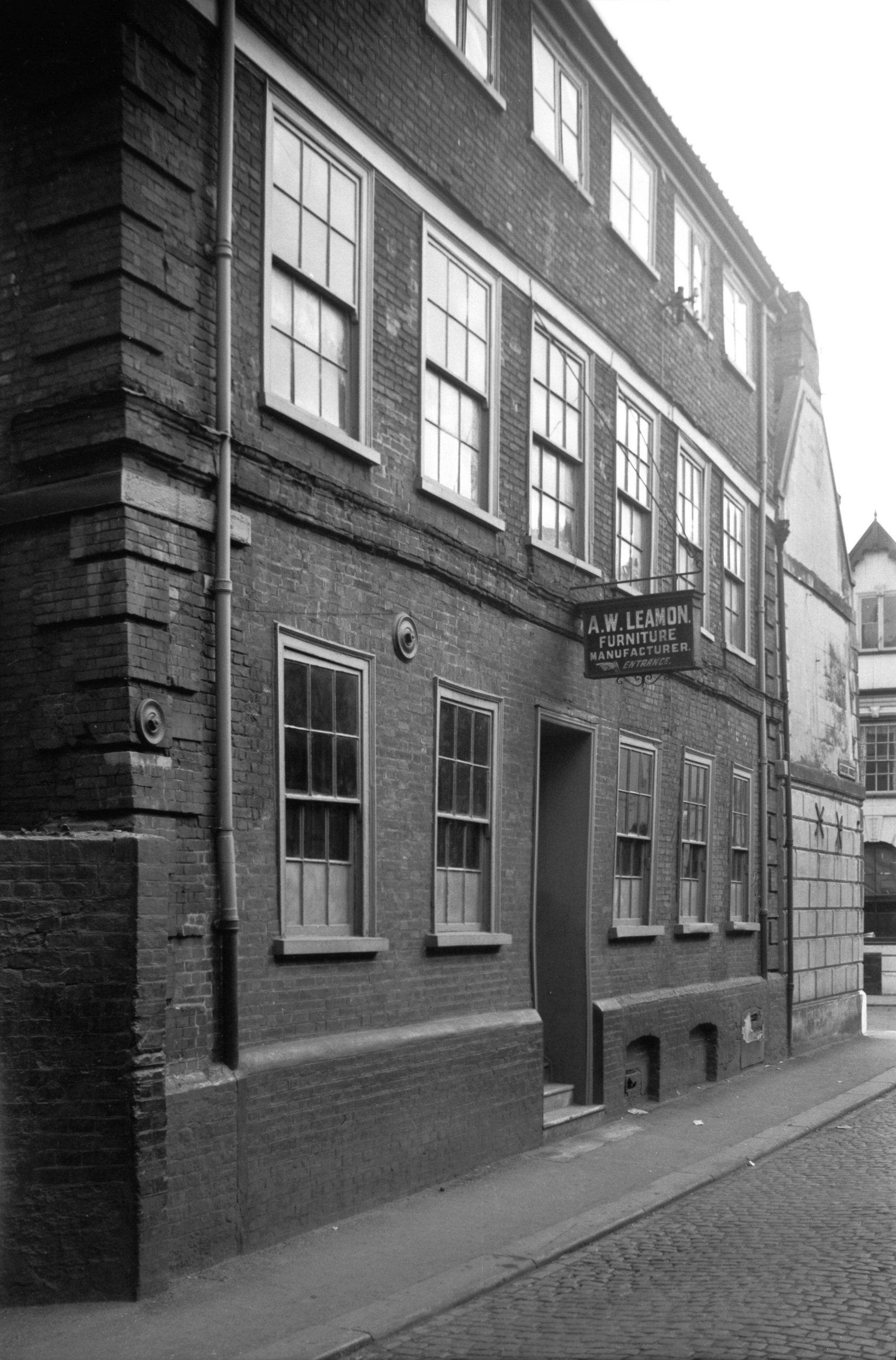
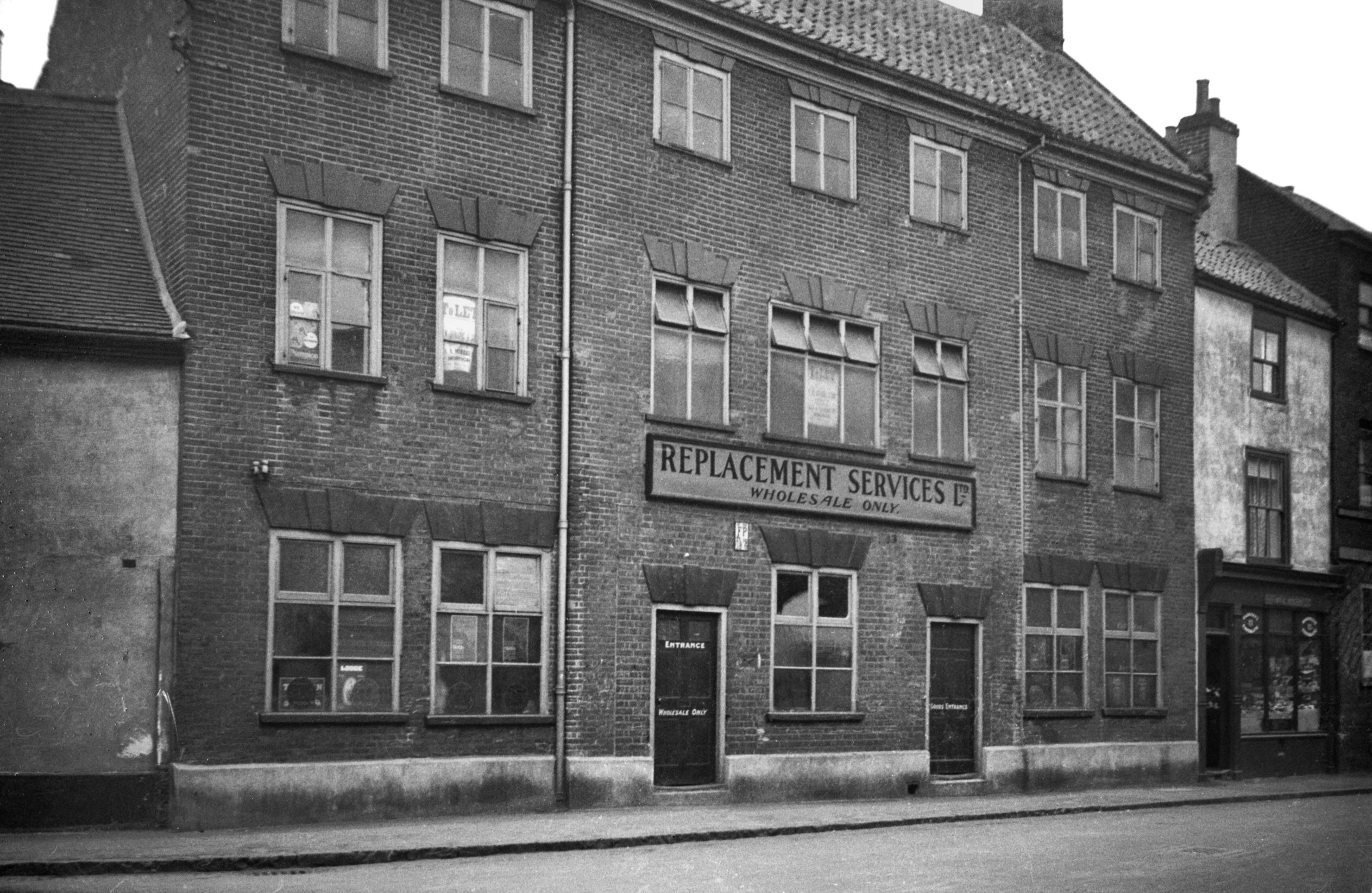
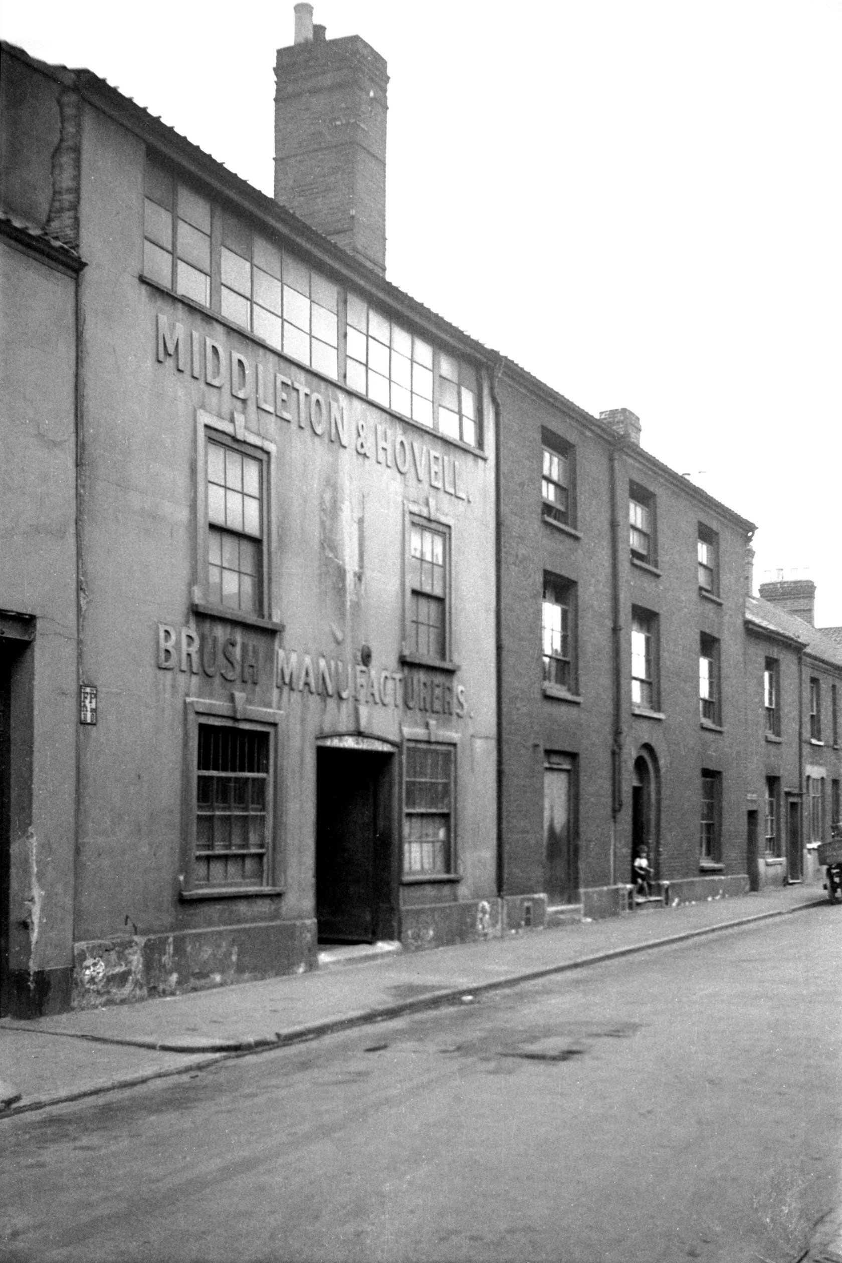
Calvert St 52 to 54 with weavers' window [2682]
1938-08-03
On west side between King's Head Lane and Green Lane was
another building with a weavers' window. Its front had
been faced with plaster, with raised lettering declaring
it to be the factory of Middleton and Hovell, Brush
Manufacturers. This it had long ceased to be when my
photograph was taken in 1938. In 1883, however, Middleton
and Hovell were listed at this address as horsehair cloth
manufacturers.
Describing the trade of horsehair weaving in Norwich
early in the 20c, C.B.Hawkins stated that it occupied
perhaps 400 people, of whom only a few would be men. This
presumably would have included outworkers, of whom there
were 168 registered in 1909. The cloth was described as
being made on a hand-loom with cotton warp and hair weft;
horsehair weaving was largely a home industry, although
one employer had then recently installed a few power
looms. Hawkins added: "In the older quarters of the
city an observer can still hear the peculiar click-clack
of the hand-looms, and if he happens to be in Calvert St
or Peacock St, where the houses date back to the 18c, he
has a perfect example or what industrial Norwich was 150
years ago." |
|
|
Calvert St 92 to 98 [2688] 1938-08-05
|
|
|
Calvert St 110 to 112 [2690] 1938-08-05
|
|
Canary Way: |
| |
From
Carrow Rd to Koblenz Avenue |
|
|
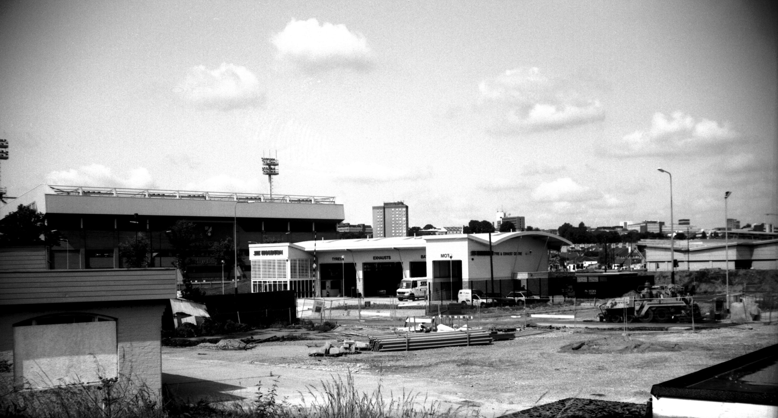
Canary Way Holburn tyres Riverside site [7643]
1999-06-30
The first business to open on the Riverside redevelopment
site. |
|
Carrow Hill: |
| |
From
King St to Bracondale |
|
|
Carrow Hill lower slope view north [0009] 1934-01-08
|
|
|
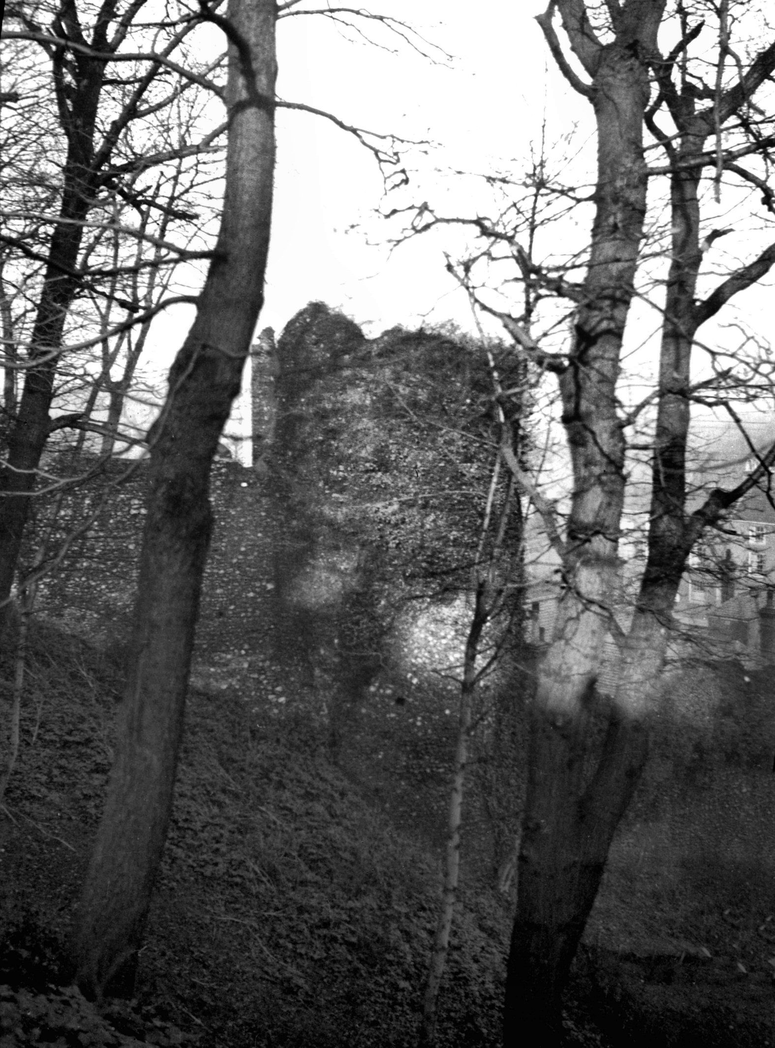
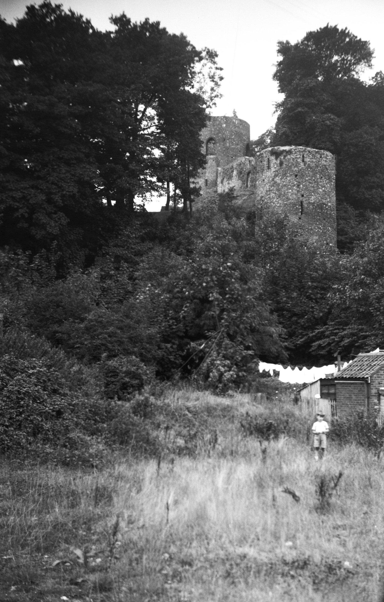
Wilderness Tower from King St [B095] 1931-00-00
|
|
|
Wilderness Tower and Black Tower [2190] 1938-03-21
|
|
|
Wilderness Tower and Black Tower [4361] 1955-08-20
|
|
|
Wilderness Tower from Carrow Hill [3621] 1946-04-19
|
|
|
Wilderness Tower north side from Alan Rd [2189]
1938-03-21
|
|
|
Wilderness Tower from Way under the Walls [4905]
1965-05-01
|
|
|
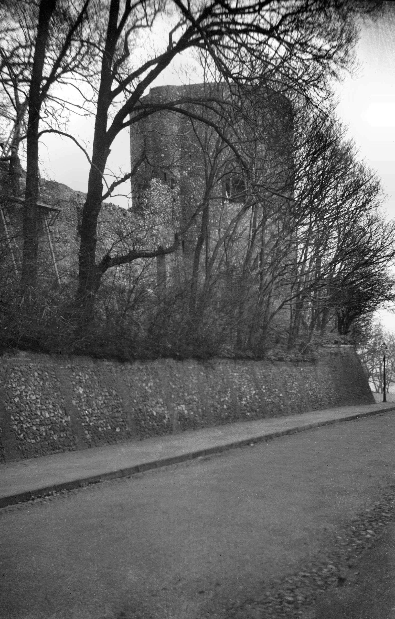
Black Tower view west from Carrow Hill [4779]
1964-06-27
|
|
|
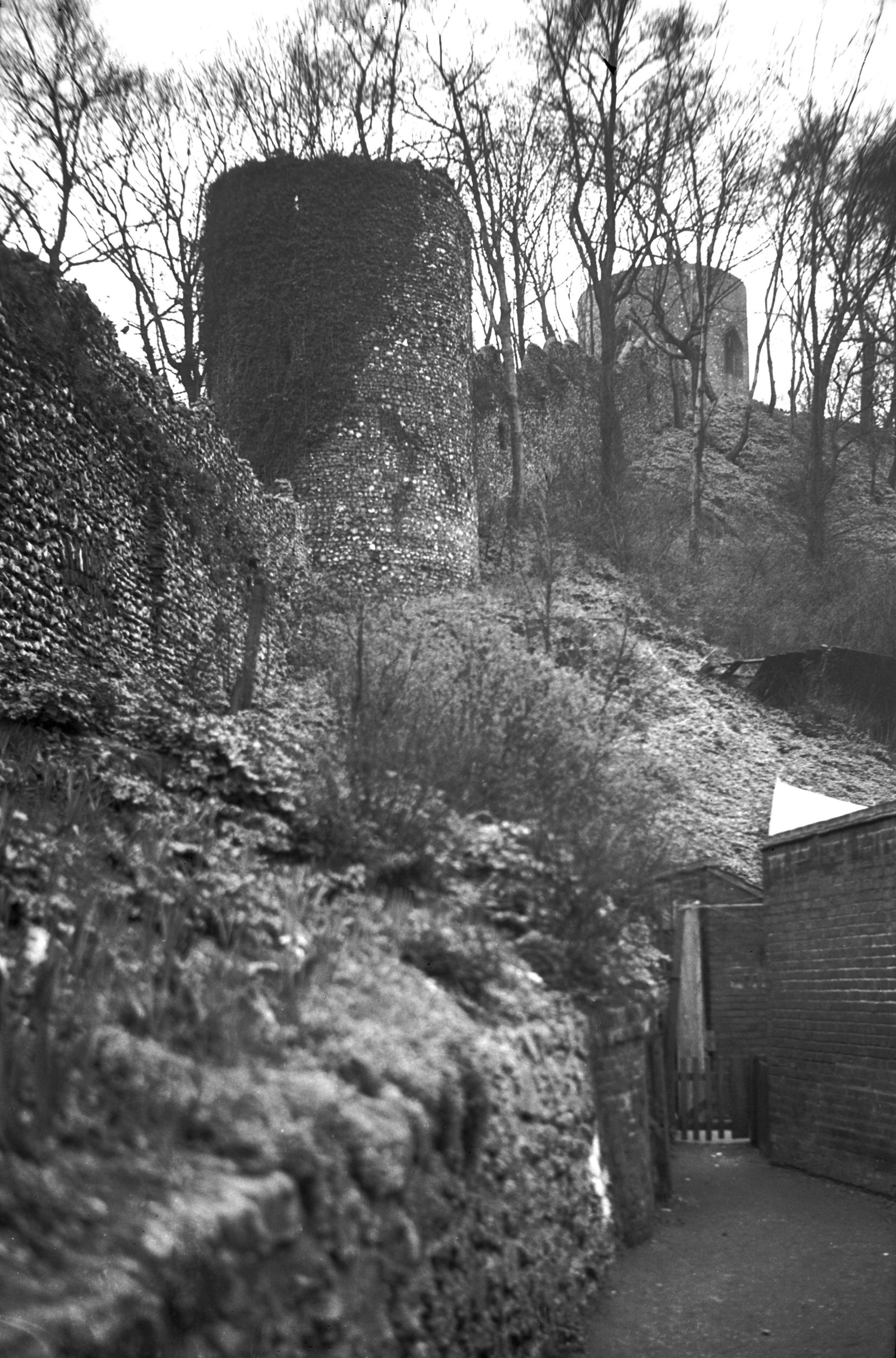
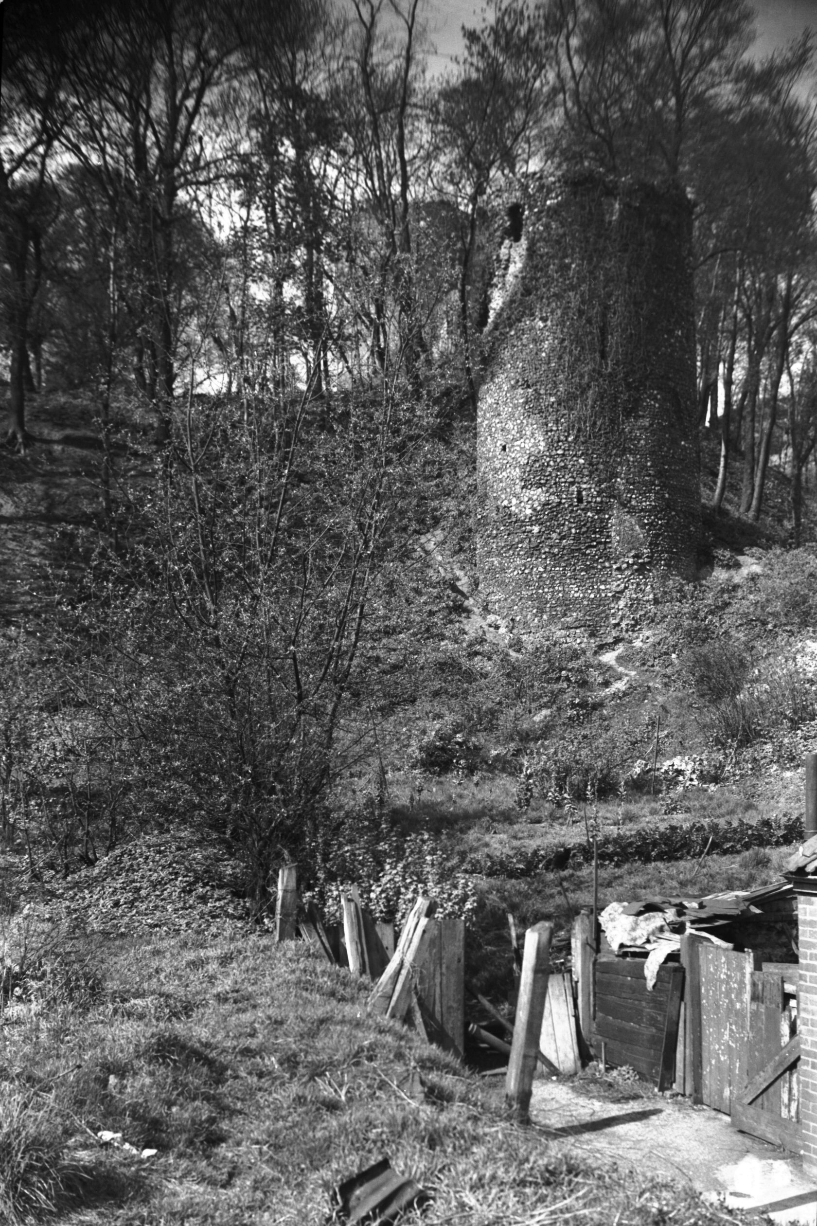
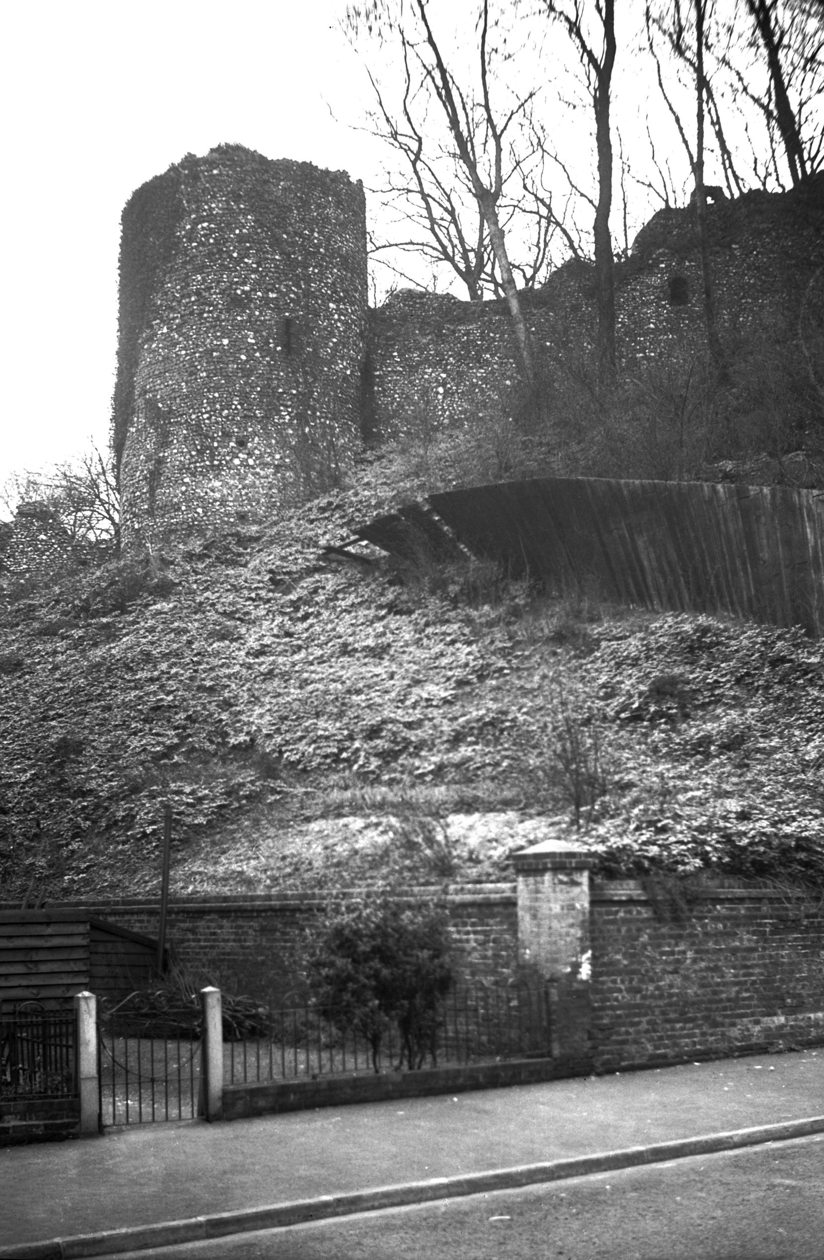
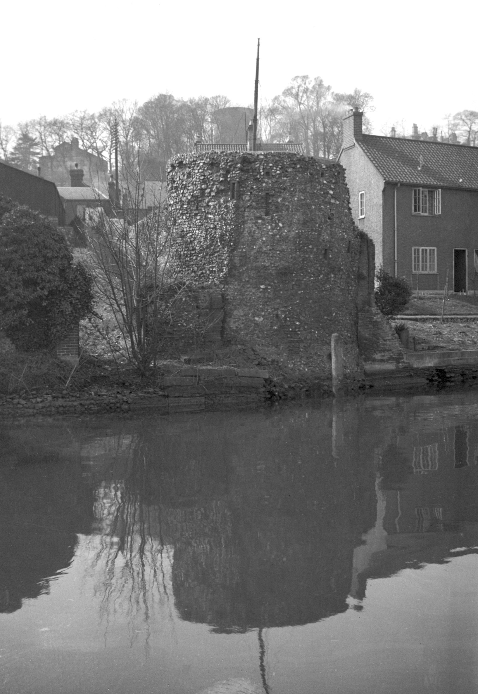
Black Tower and wall view south [6207] 1981-07-07
Also known as the Snuff Tower or the Duke of Buckingham's
Tower. |
|
|
Black Tower and wall view south [0051] 1934-03-08
|
|
|
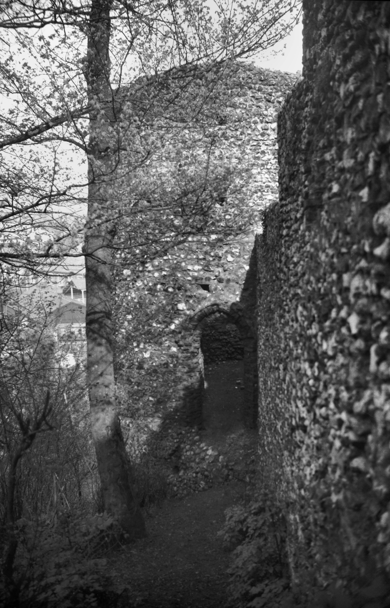
Black Tower doorway onto wall walk [0052] 1934-03-08
|
|
|
Black Tower doorway onto wall walk [6215] 1981-07-21
|
|
|
Black Tower view NE from Carrow Hill [B811]
1933-12-05
|
|
|
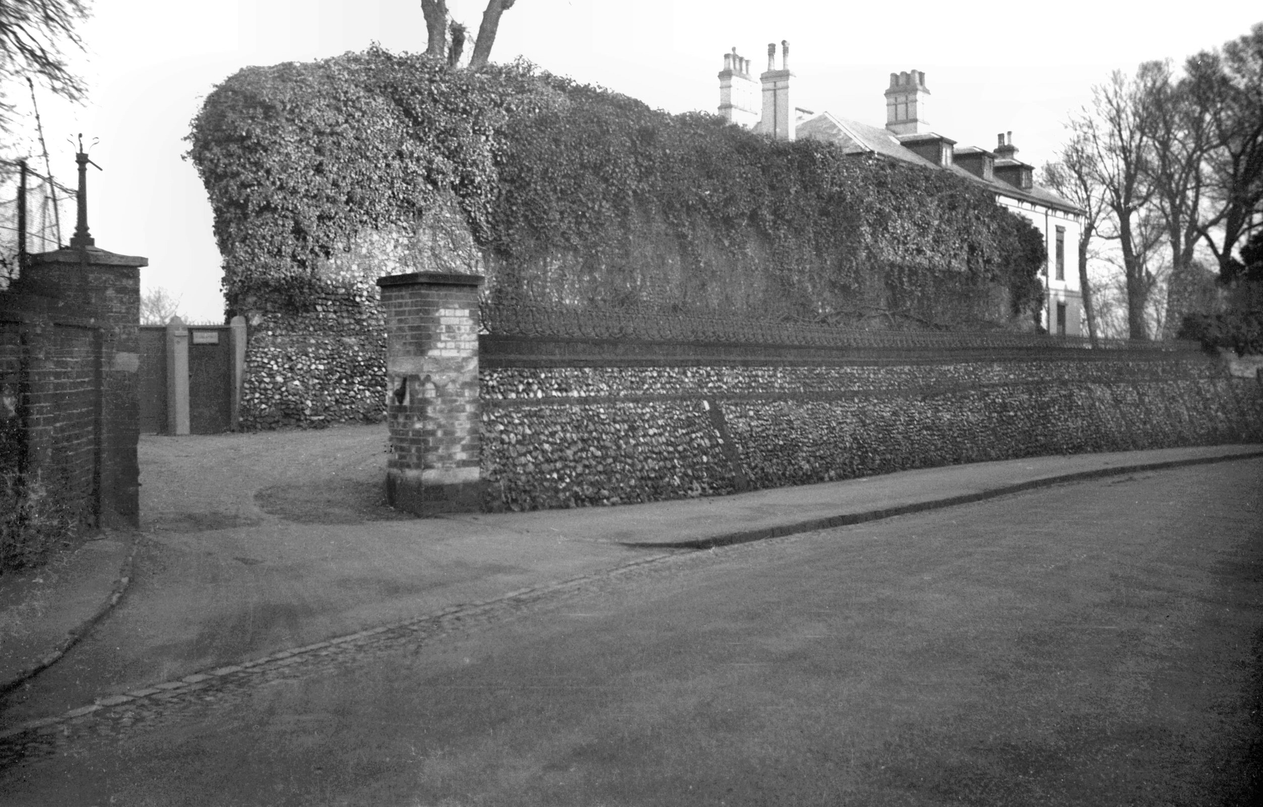
Carrow Hill 2 from outside city [0386] 1935-03-12
At crest of hill. |
|
|
Carrow Hill 2 wall view NE [0017] 1934-01-21
At crest of hill. |
|
|
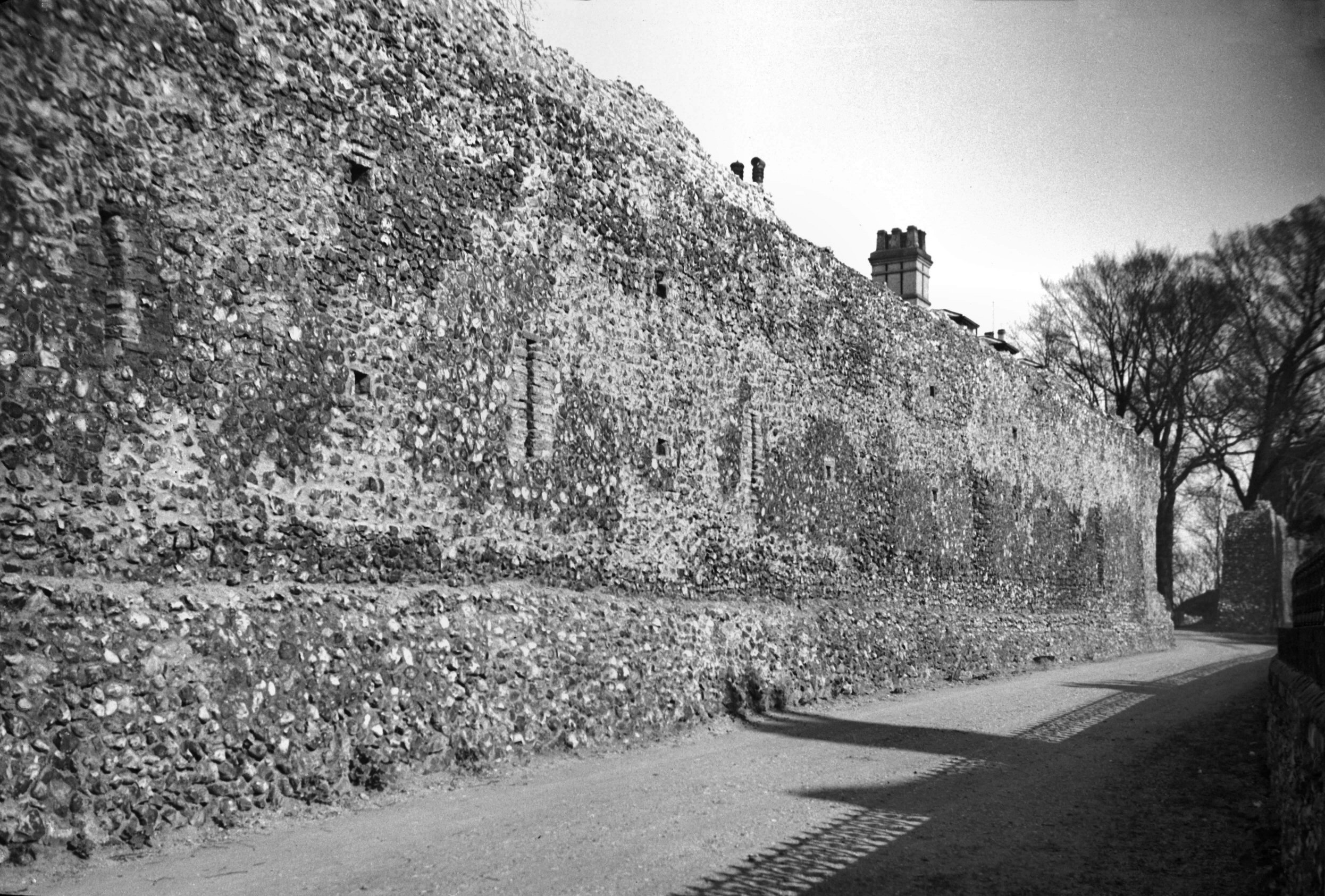
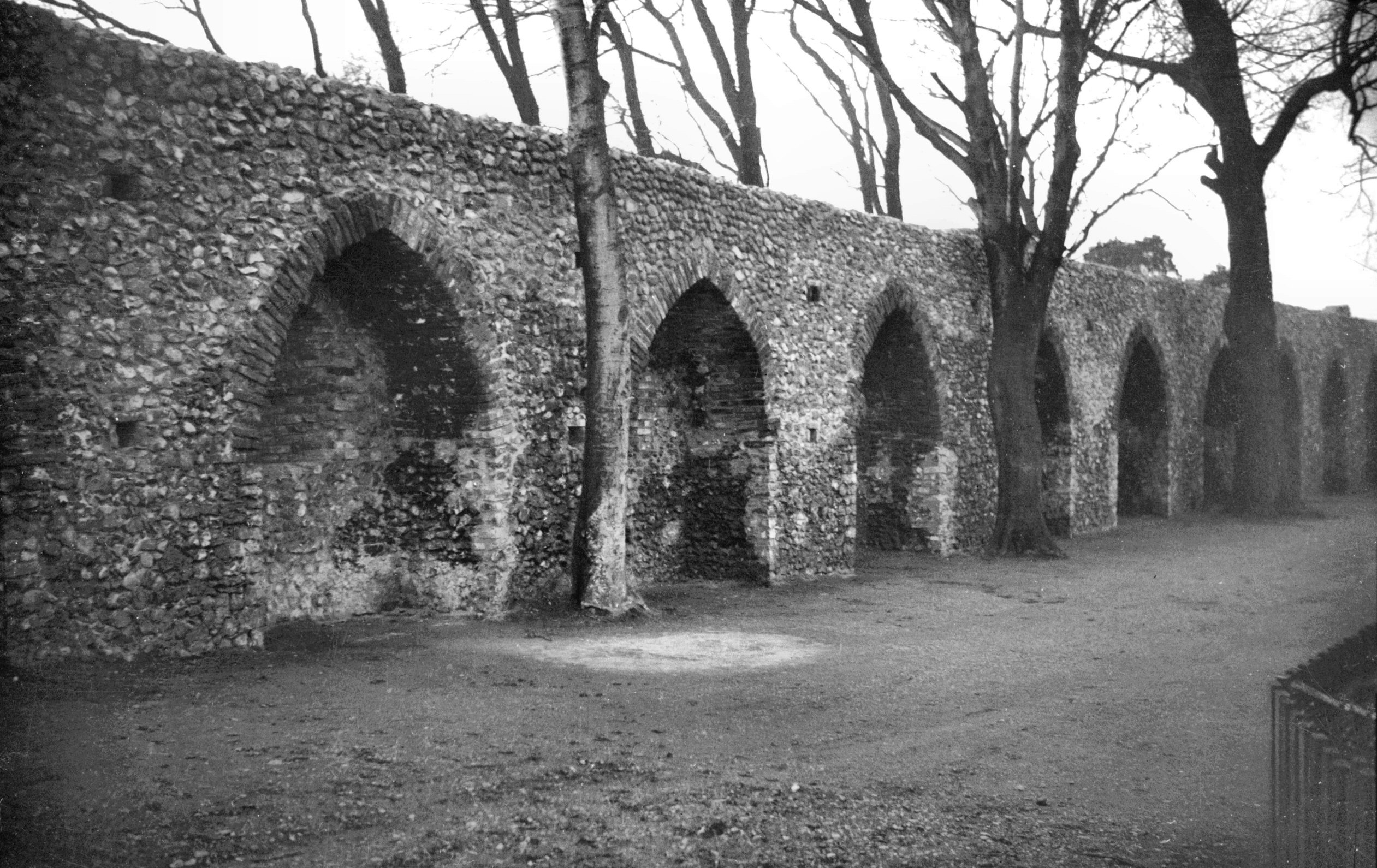
Carrow Hill arched recesses in wall [0053] 1934-03-08
|
|
|
Carrow Hill wall from inside city [6206] 1981-07-07
At crest of hill. |
|
Carrow Rd: |
| |
From
King St to Thorpe Rd
passing Riverside, Wherry
Rd, Koblenz Avenue, Hardy
Rd |
|
|
Carrow Rd at King St [0050] 1934-03-04
|
|
|
Western boom tower from Carrow Bridge [B094]
1931-00-00
|
|
|
Western boom tower from Carrow Bridge [0094]
1934-05-17
A Windlass for winding the boom or chain was contained in
the western tower. This prevented the unauthorised entry
of rivercraft and assisted the collection of tolls. |
|
|
Western boom tower and cinder oven view SE [3414]
1940-05-16
Colman's factory behind. |
|
|
Western boom tower from Wensum east bank [0060]
1934-03-25
|
|
|
Wensum Carrow stone abutment of old bridge [4875]
1964-10-10
|
|
|
Wensum Carrow bascule bridge from Riverside [B602]
1933-06-28
|
|
|
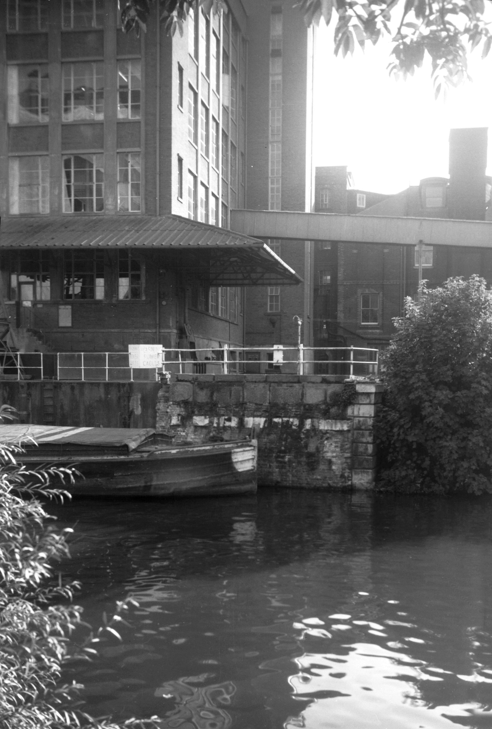
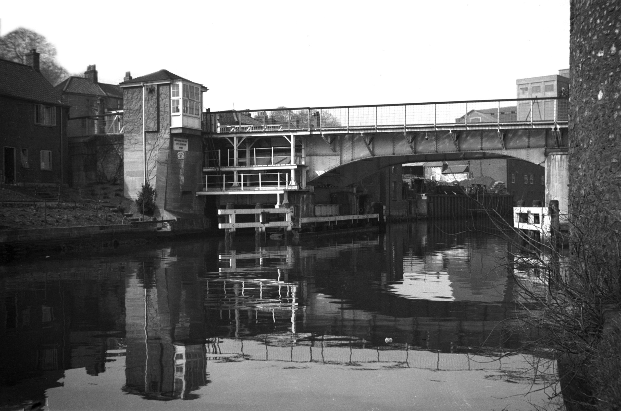
Wensum Carrow bascule bridge south side [0061]
1934-03-25
The original bridge was erected in 1810 about 500 feet
downstream from the present structure, and linked Carrow
Hill directly with the north-eastern end of Carrow Rd. It
had an iron elliptical arch of 50 foot span; designed by
A.Brown; cast by J.G.Aggs; stonework by Athow and de
Carle and brickwork and abutments by N.Wyeth. It was
rebuilt largely of wood in 1833 as a drawbridge. The
present bridge by the football ground and new swimming
pool was built by J.Butler and Co of Leeds as a
single-leaf roller bascule, and was opened by the Prince
of Wales on 27th June 1923. |
|
|
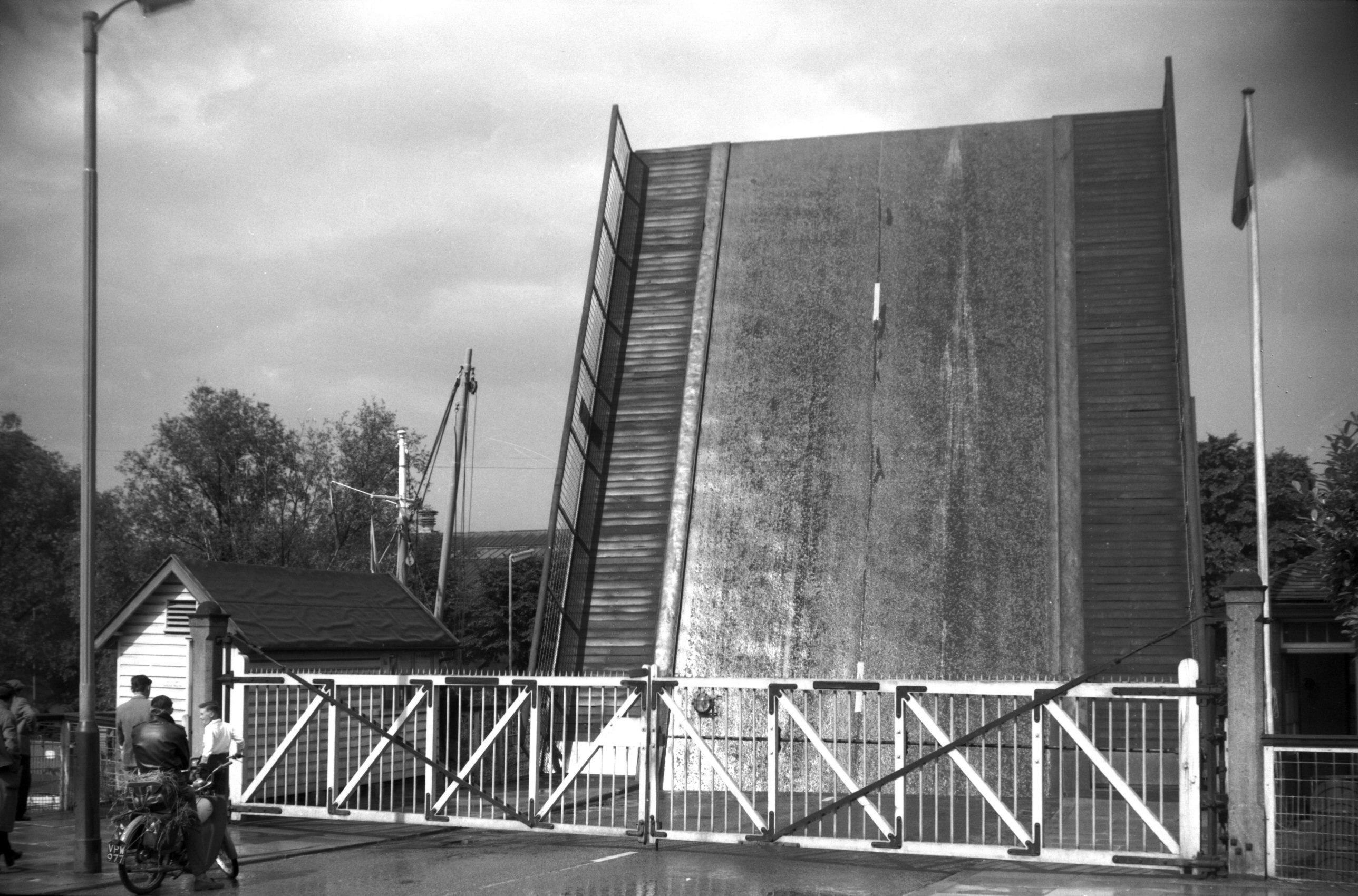
Wensum Carrow bascule bridge road barrier [4695]
1962-07-21
|
|
|
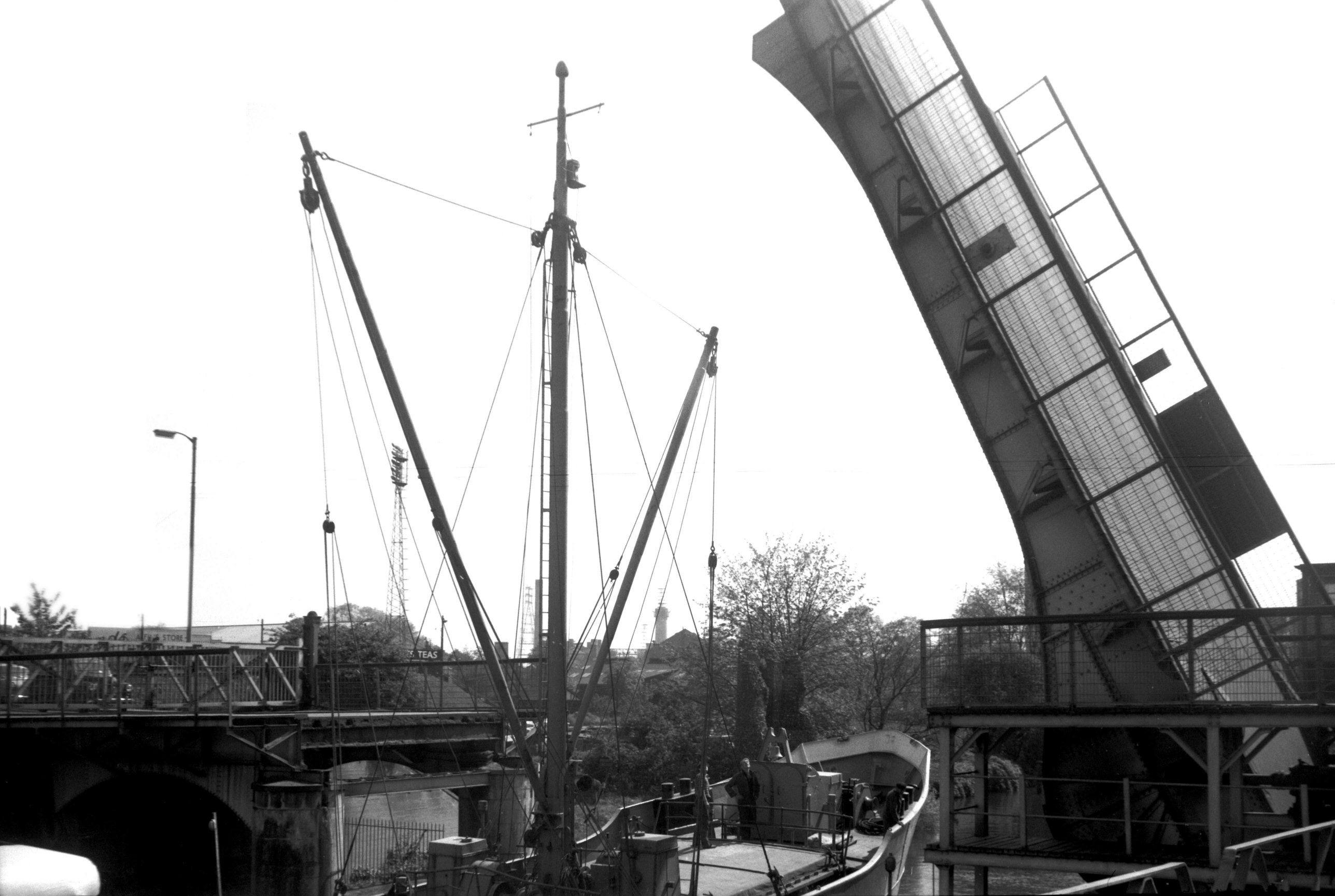
Wensum Carrow bascule bridge open for ship [4765]
1964-05-09
|
|
|
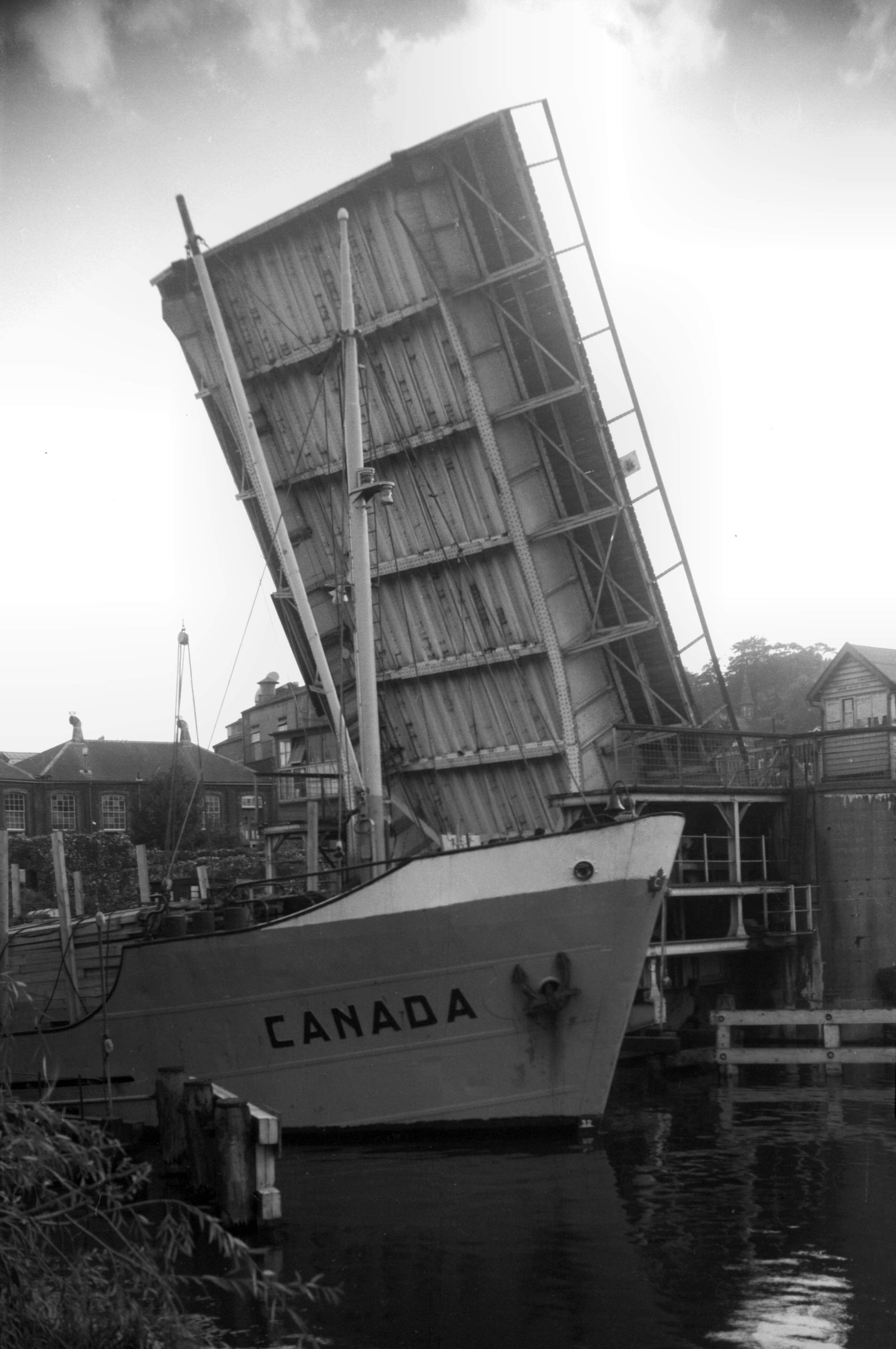
Wensum Carrow bascule bridge open to Canada [4874]
1964-10-10
|
|
|
Devil's Tower eastern boom Carrow view S [0031]
1934-02-11
|
|
|
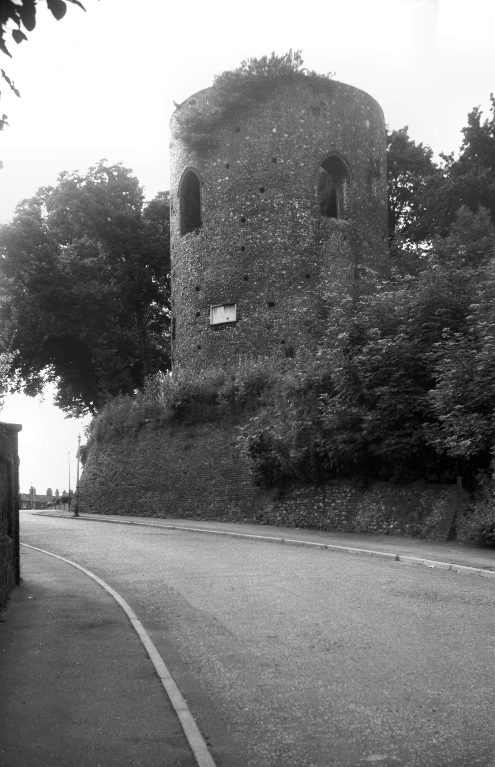
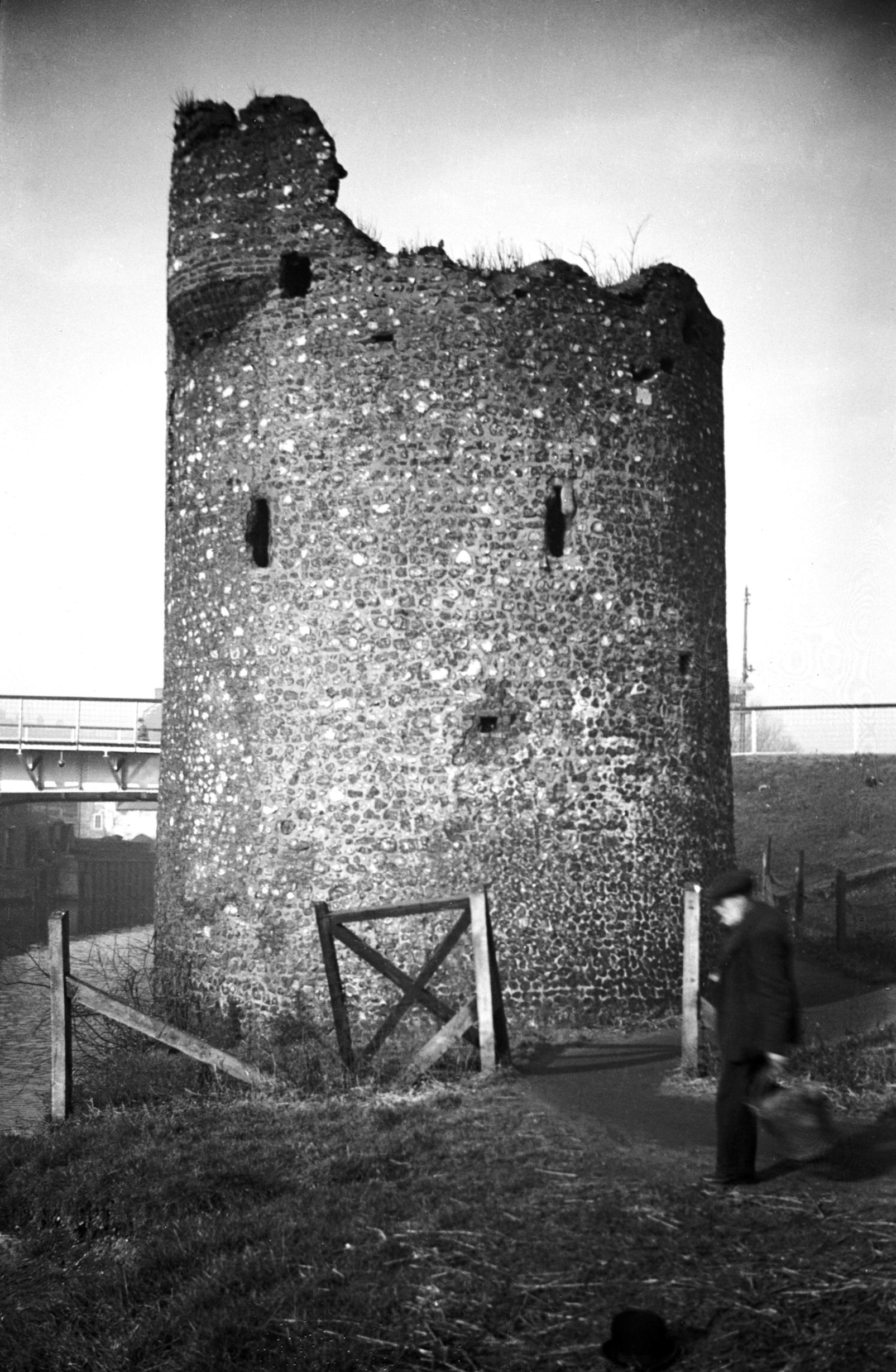
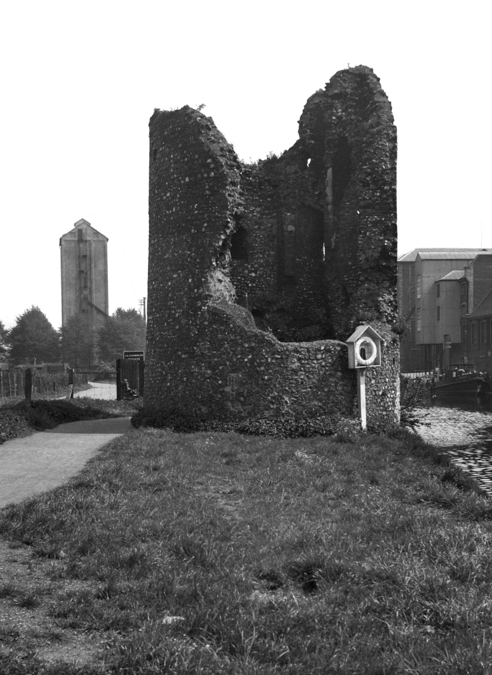
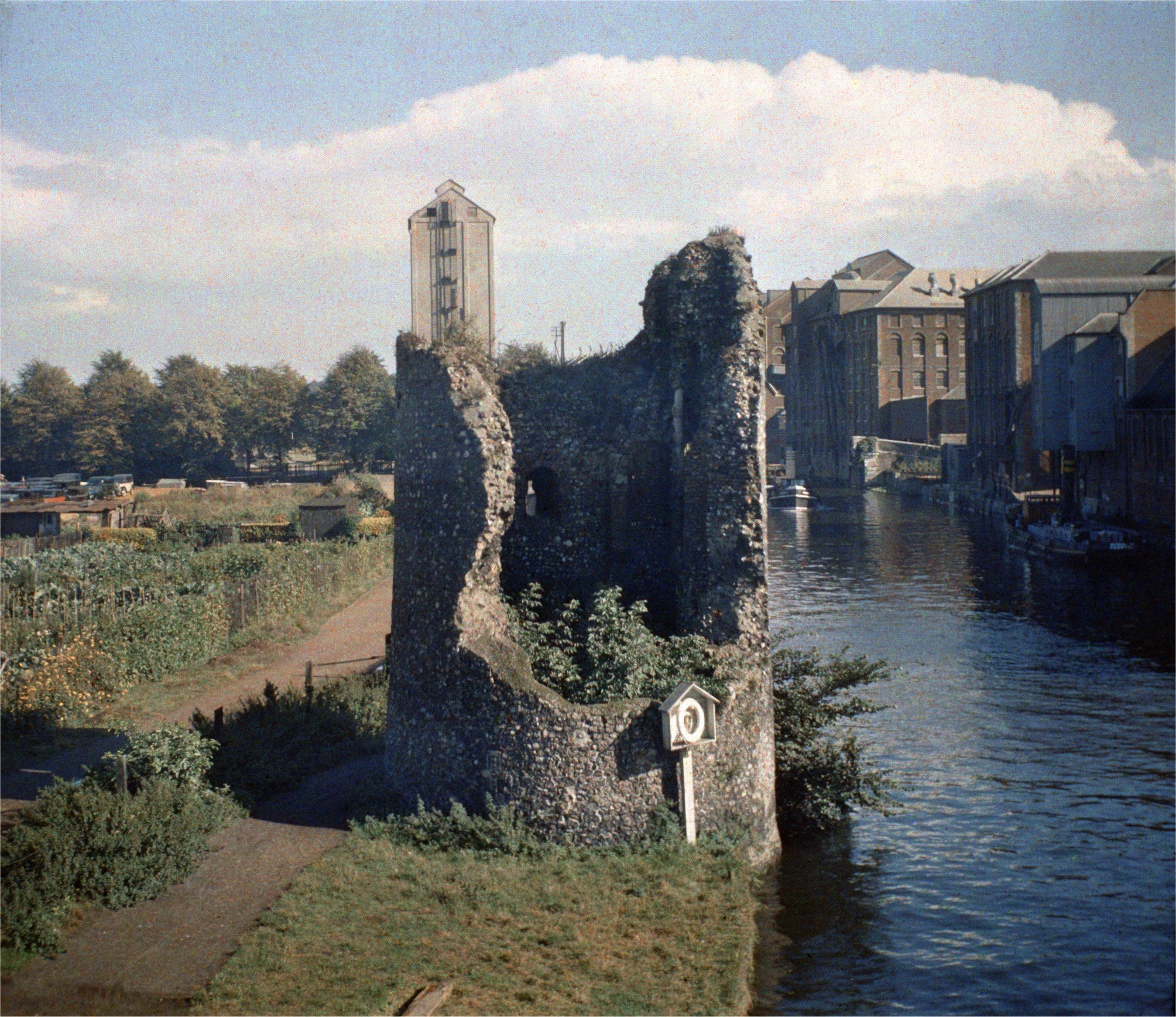
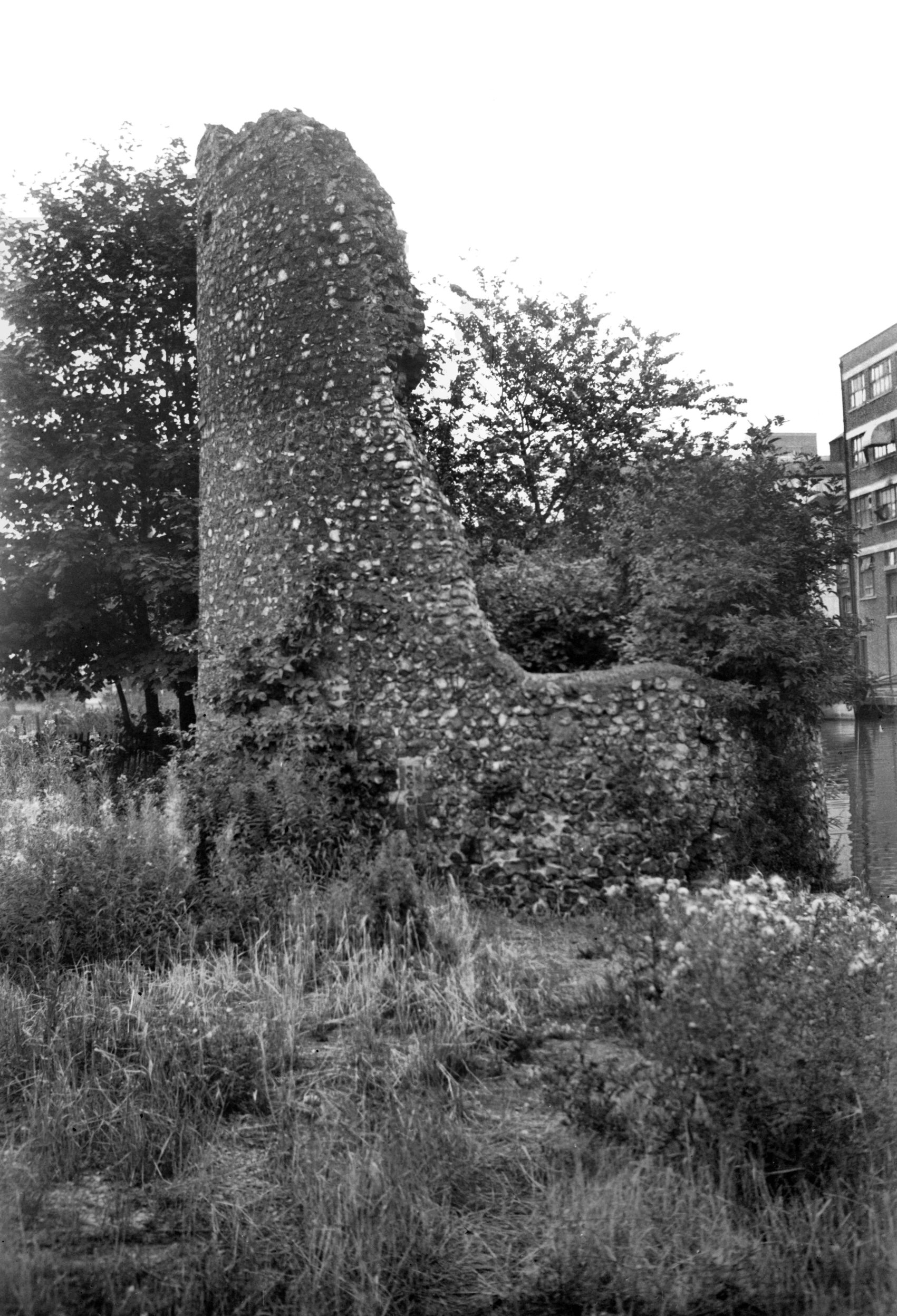
Eastern boom tower from below Carrow Bridge [0095]
1934-05-17
The building of the City Walls was commenced in 1294 and
finished during the first half of the 14c. In 1342
Richard Spynk contributed towards their completion. They
proved ineffective in repelling the enemy at the time of
Litester's Rising in 1381 and Kett's Rebellion in 1549,
but were more useful in the collection of tolls due to
the city, as well as in helping to prevent the spread of
infection during the great plagues of the 17c. |
|
|
City Walls Eastern boom tower COLOUR [0758]
1935-09-14
|
|
|
Eastern boom tower view SE [4359] 1955-08-20
Known as the Devil's Tower. |
|
|
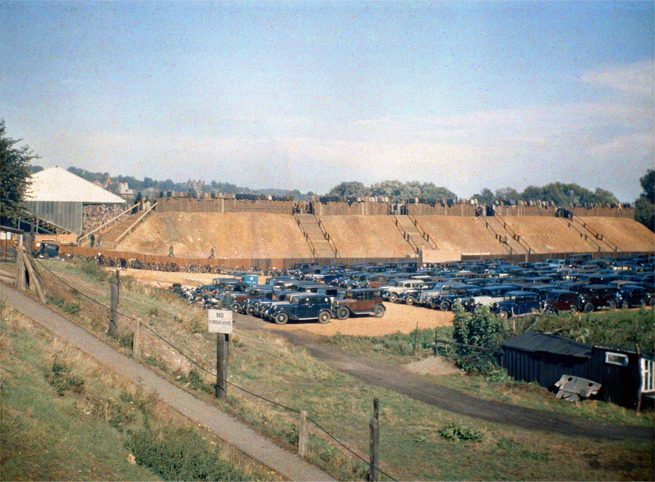
Carrow Rd football ground car park COLOUR [0759]
1935-09-14
|
|
|
Carrow Rd at Kerrison Rd [0040] 1934-02-22
|
|
|
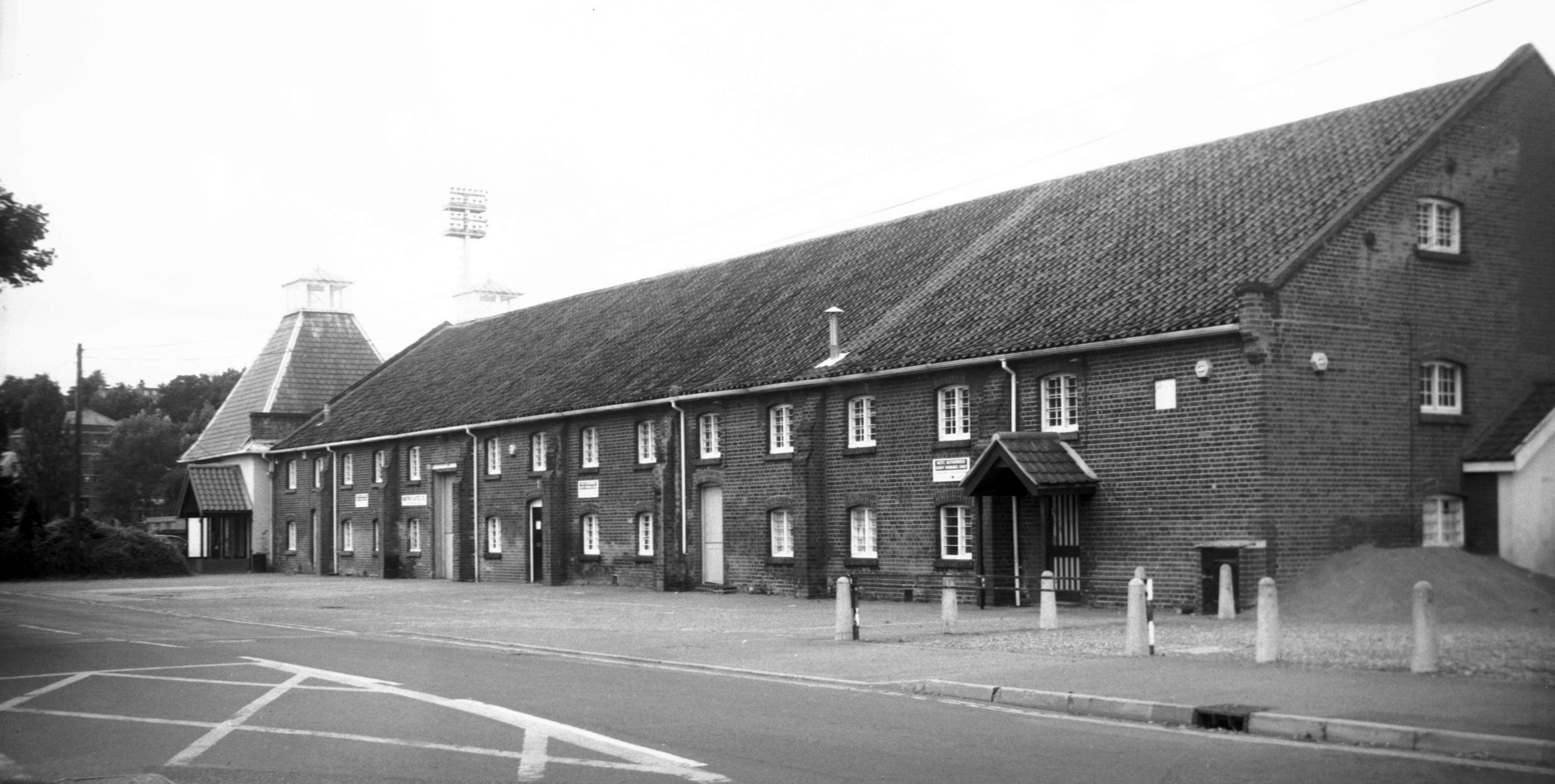
Carrow Rd former maltings buildings S front [7843]
2001-09-01
The white square above and right of the east porch is a
stone inscribed "C.B. 1824". |
|
|
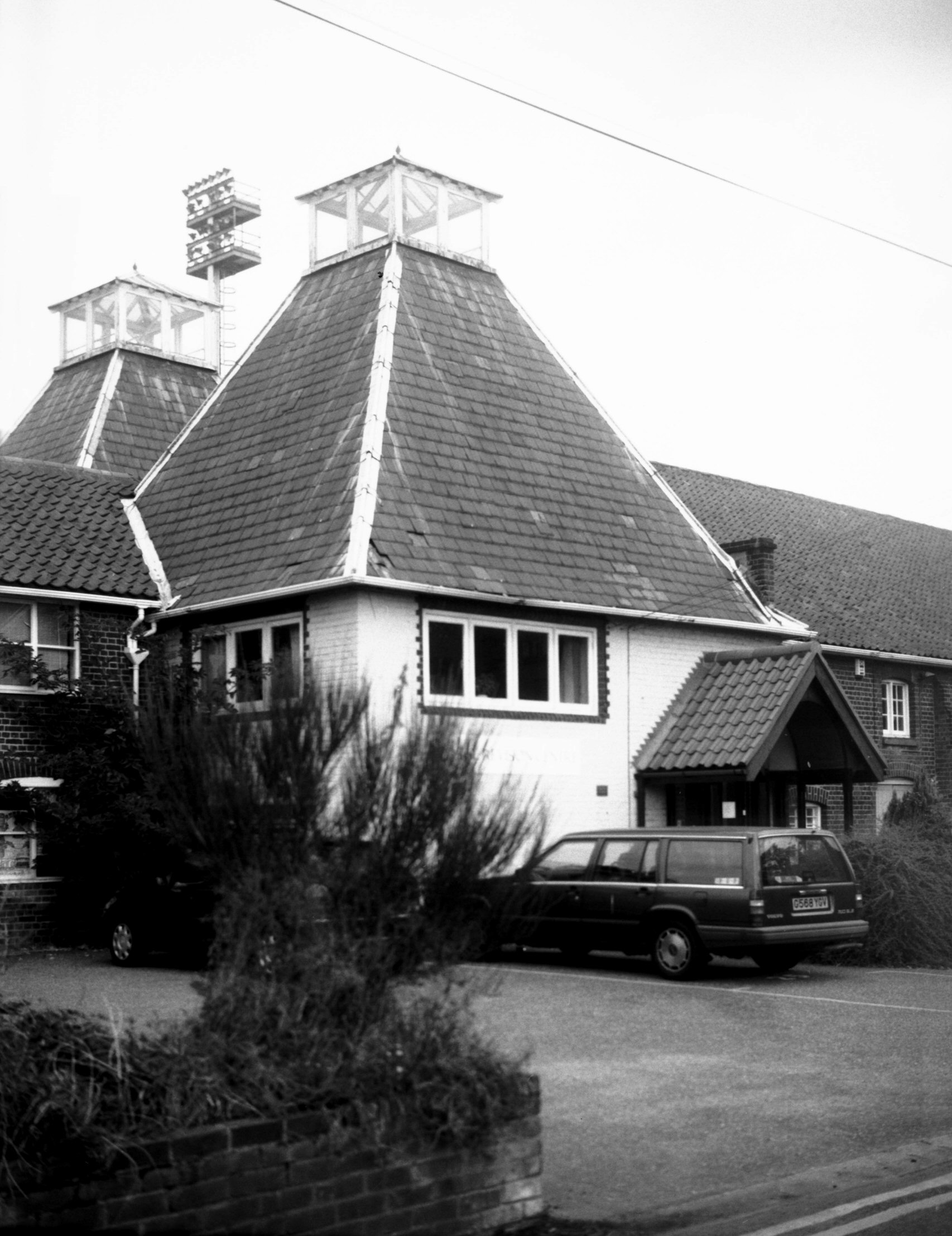
Carrow Rd former maltings buildings W end [7842]
2001-09-01
|
|
|
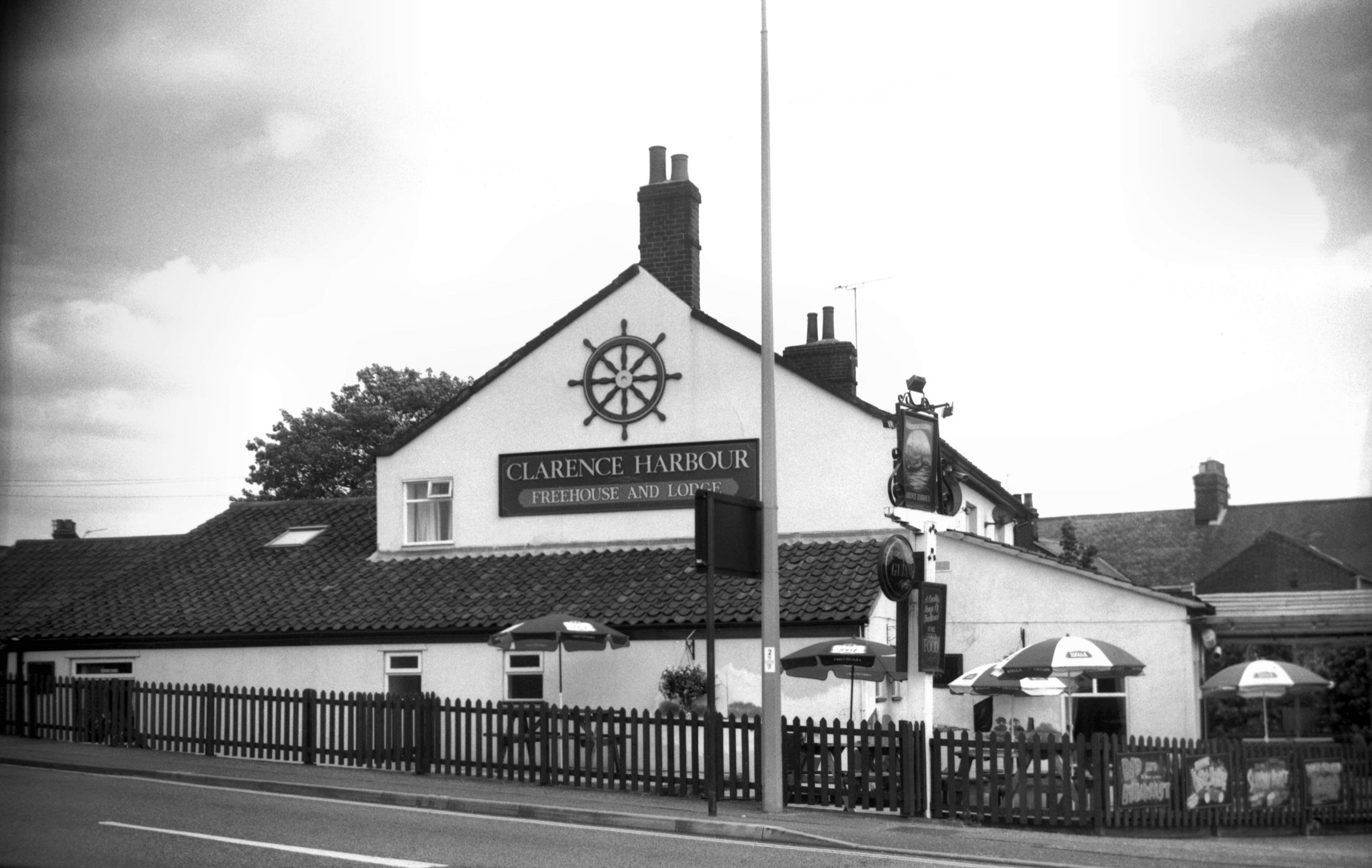
Carrow Rd 81 Clarence Harbour PH [7887] 2002-06-29
|
|
|
Carrow Rd view NW cleared Riverside site [7471]
1997-08-07
Football ground to left. |
|
|
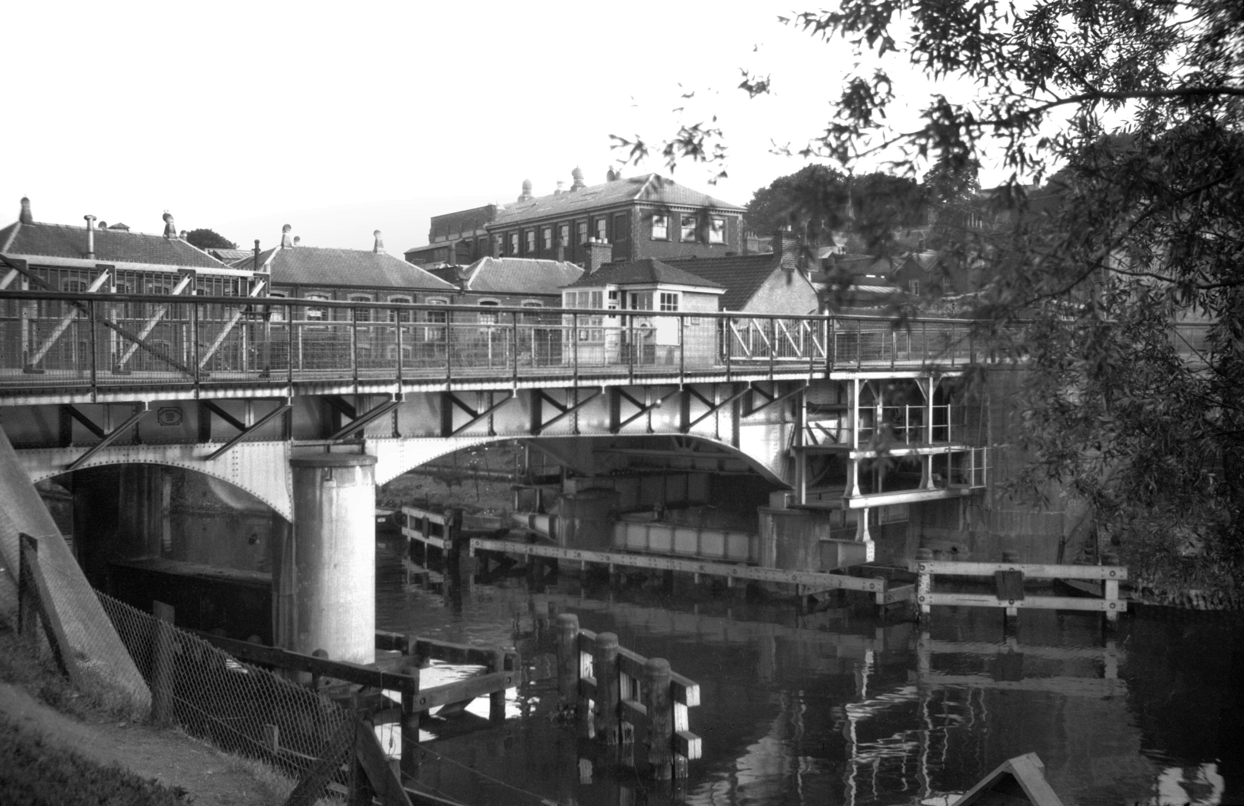
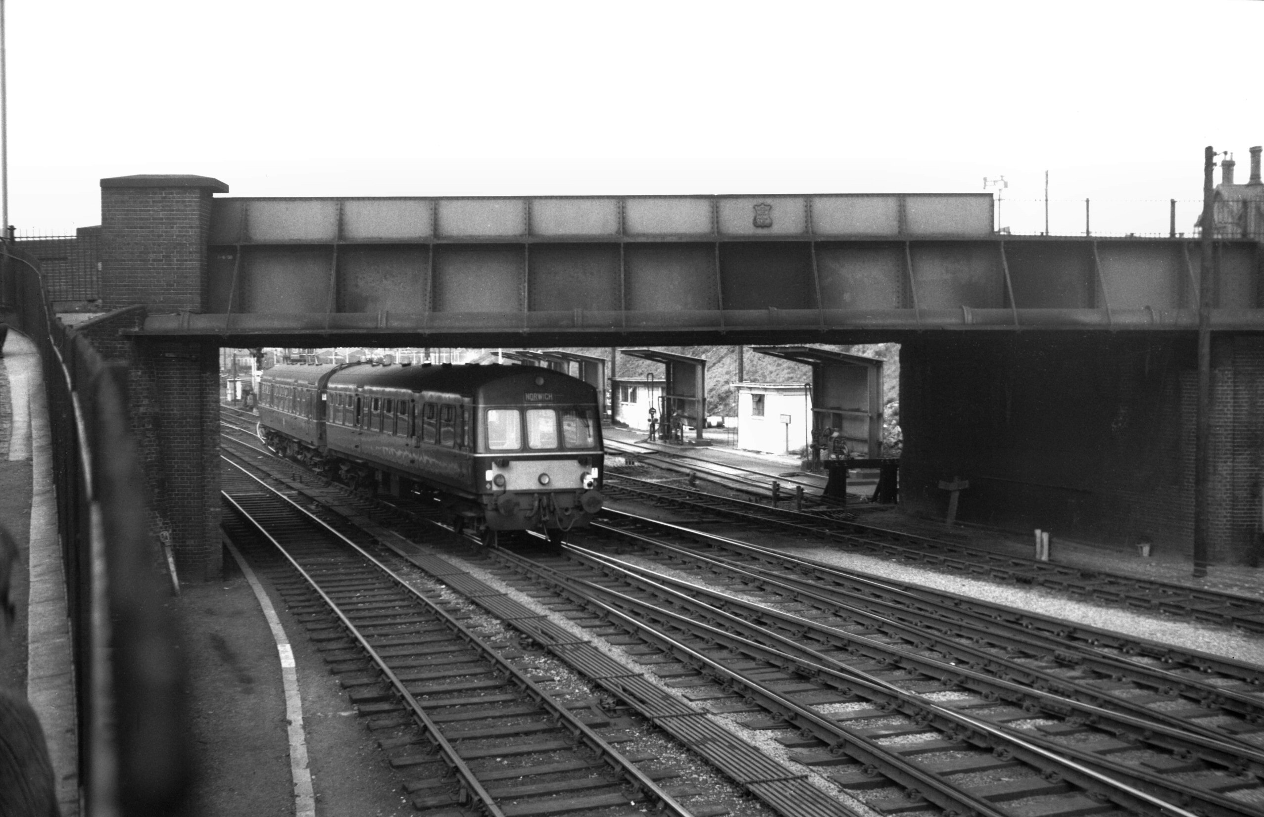
Carrow Rd rail bridge [4760] 1964-04-25
Built 1892 by Josiah Westwood and Co. |
|
|
Carrow Rd temporary footbridge over railway [4876]
1964-11-28
|
|
|
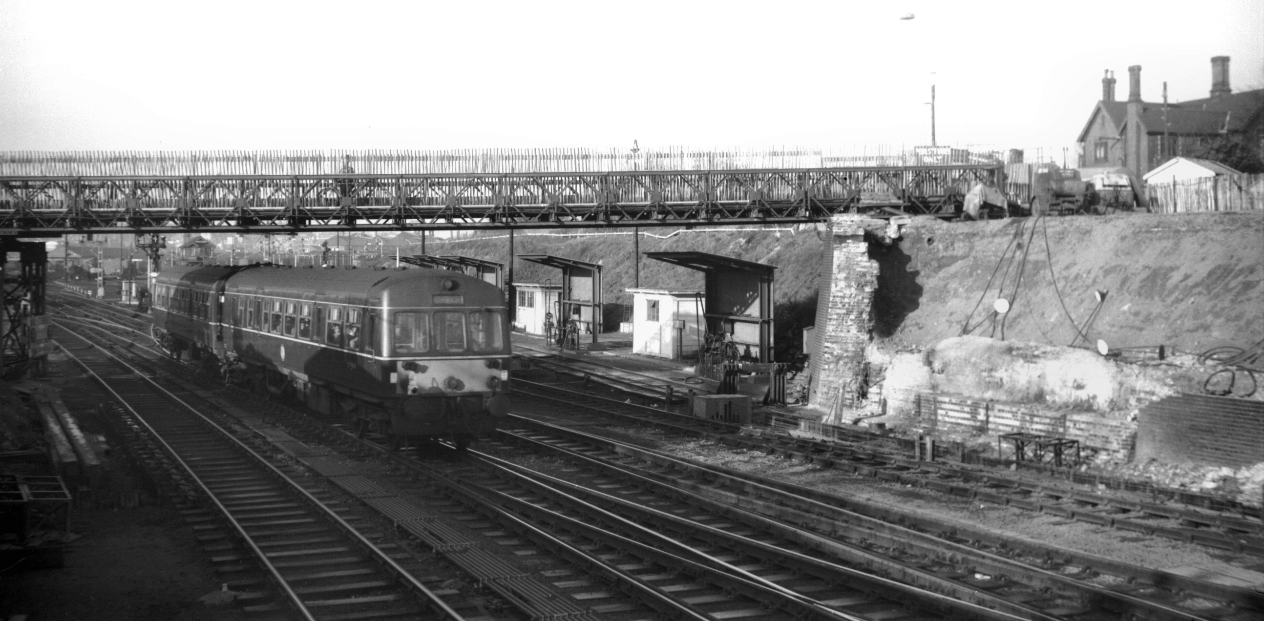
Carrow Rd rail bridge SE side [6214] 1981-07-21
|
|
|
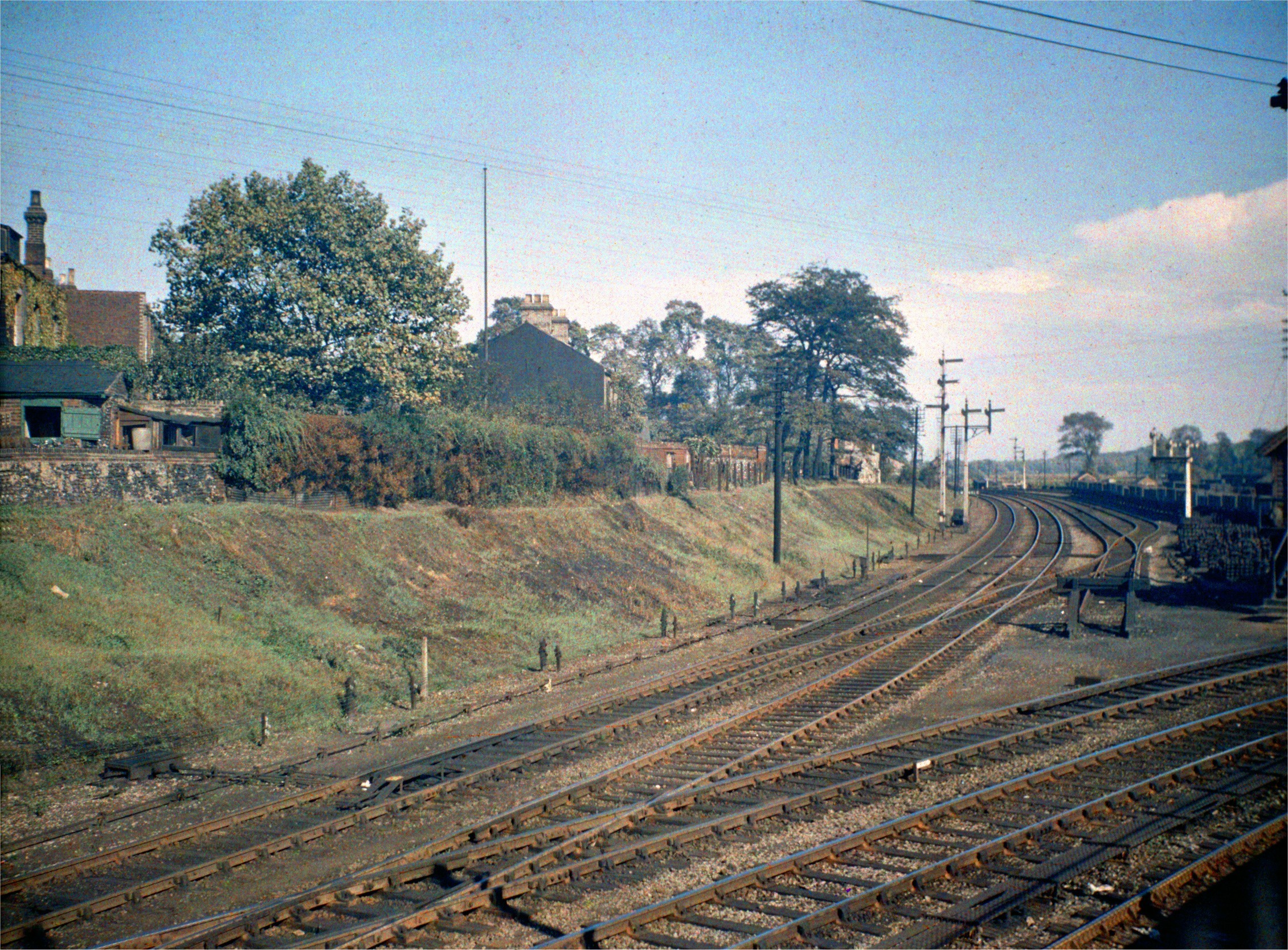
Carrow Rd view of railway junction COLOUR [0760]
1935-09-14
|
|
|
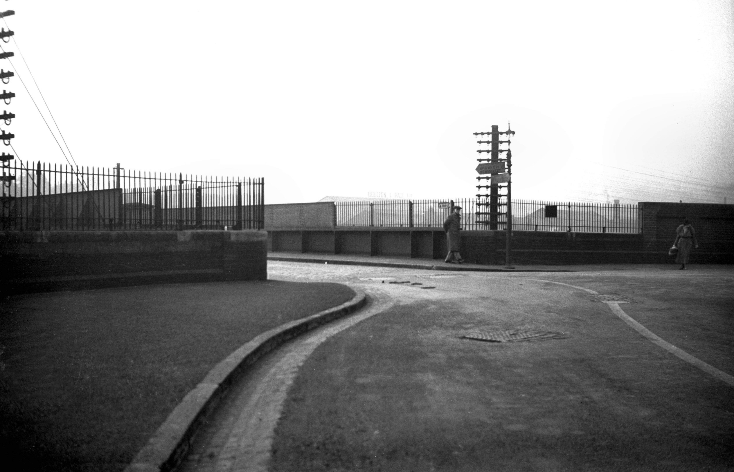
Carrow Rd at Clarence Rd bridge over rail [0041]
1934-02-22
|
|
|
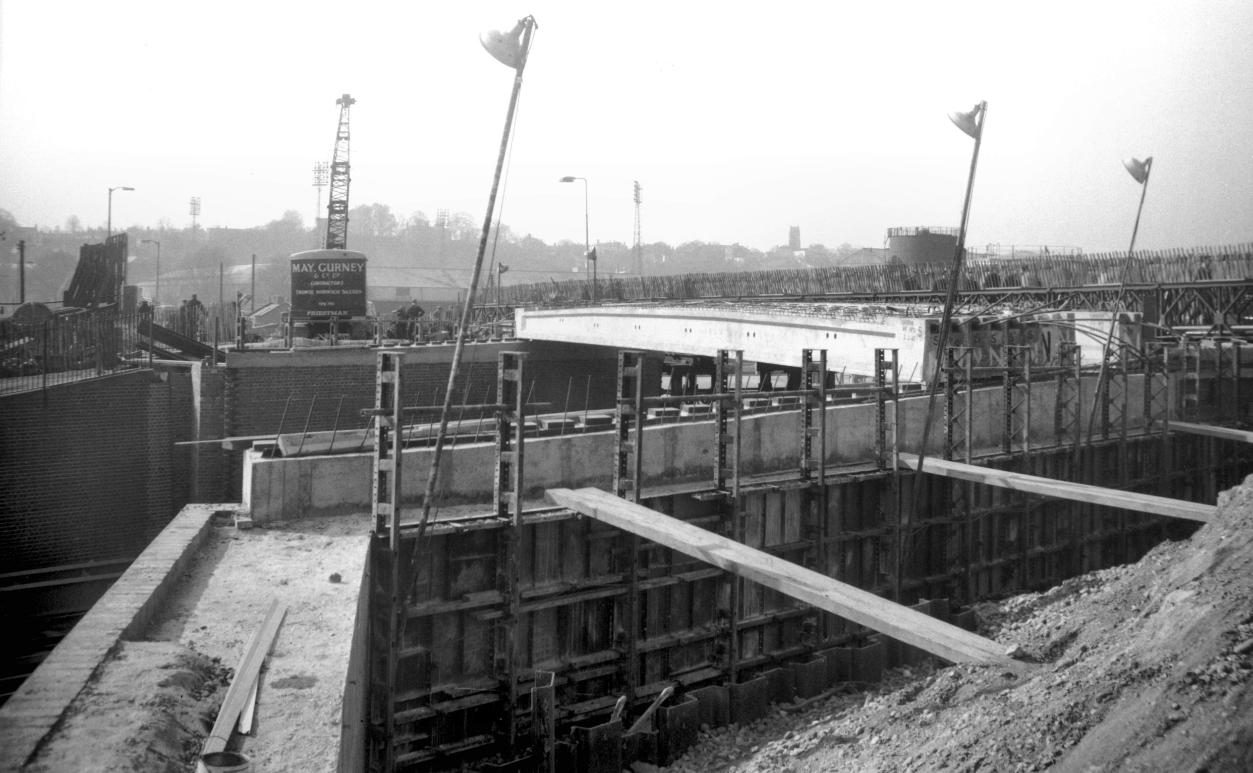
Carrow Rd rail bridge reconstruction [4885]
1965-03-13
|
|
|
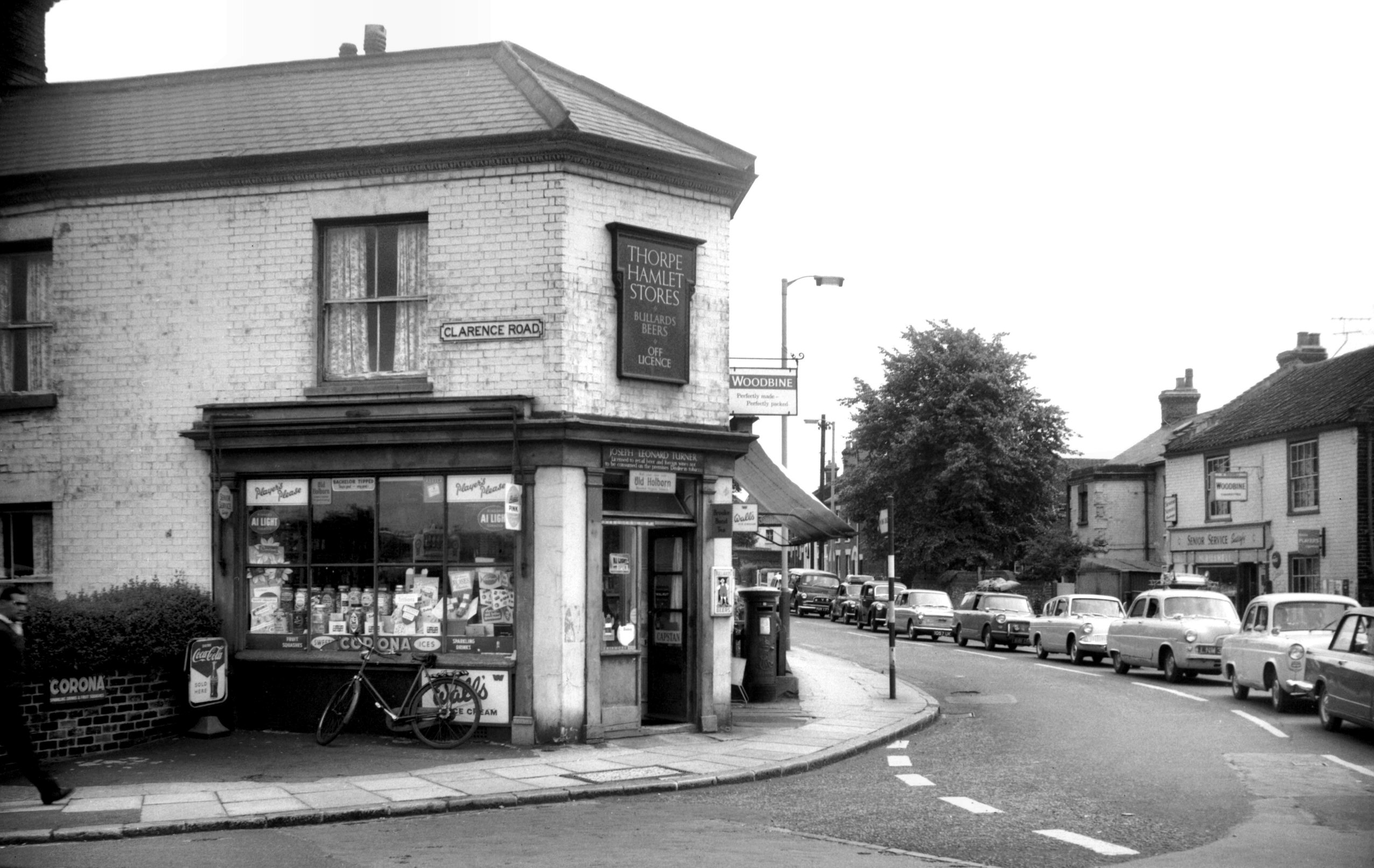
Carrow Rd Clarence Rd Thorpe Hamlet Stores [4805]
1964-08-08
In 1964-65 work went ahead in replacing the bridge
spanning the railway at Carrow Rd (built 1892 by Josiah
Westwood and Co). The need had long been felt for a wider
structure, and one placed at as less acute angle to the
traffic flow. At the same time its height was raised
several feet to allow for future electrification of the
railway. The "Thorpe Hamlet Stores", at the
junction of Carrow and Clarence Rds, was demolished to
make space for the improvement. |