|
Earlham Grove: |
| |
From
Earlham Green Lane (Earlham Rd) |
|
|
St Elizabeth's Earlham from Earlham Grove [4694]
1962-07-08
Chapel of Ease to St Anne. |
|
|
St Elizabeth's Earlham Earlham Grove [6755]
1992-02-26
Built 1991-2 to replace St Anne's Chapel of Ease. |
|
Earlham Rd: |
| |
From
Grapes Hill / St
Giles' St / Unthank Rd towards Colney
passing Heigham Grove, West
Pottergate, Heigham Rd, Belvoir
St, Park Lane, Colman
Rd, Farrow Rd, Gipsy
Lane, (Earlham Grove), (Tollgate Way)
North side |
|
|
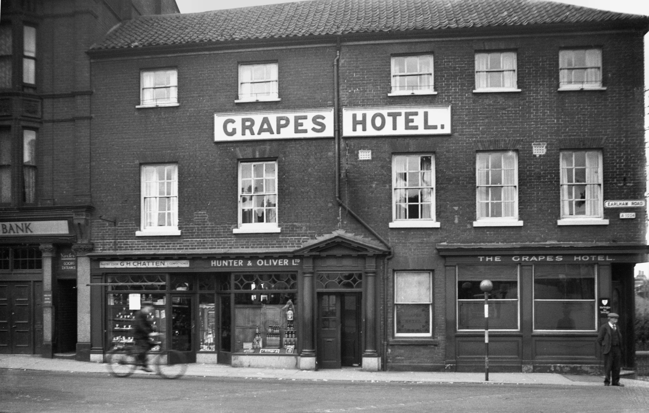
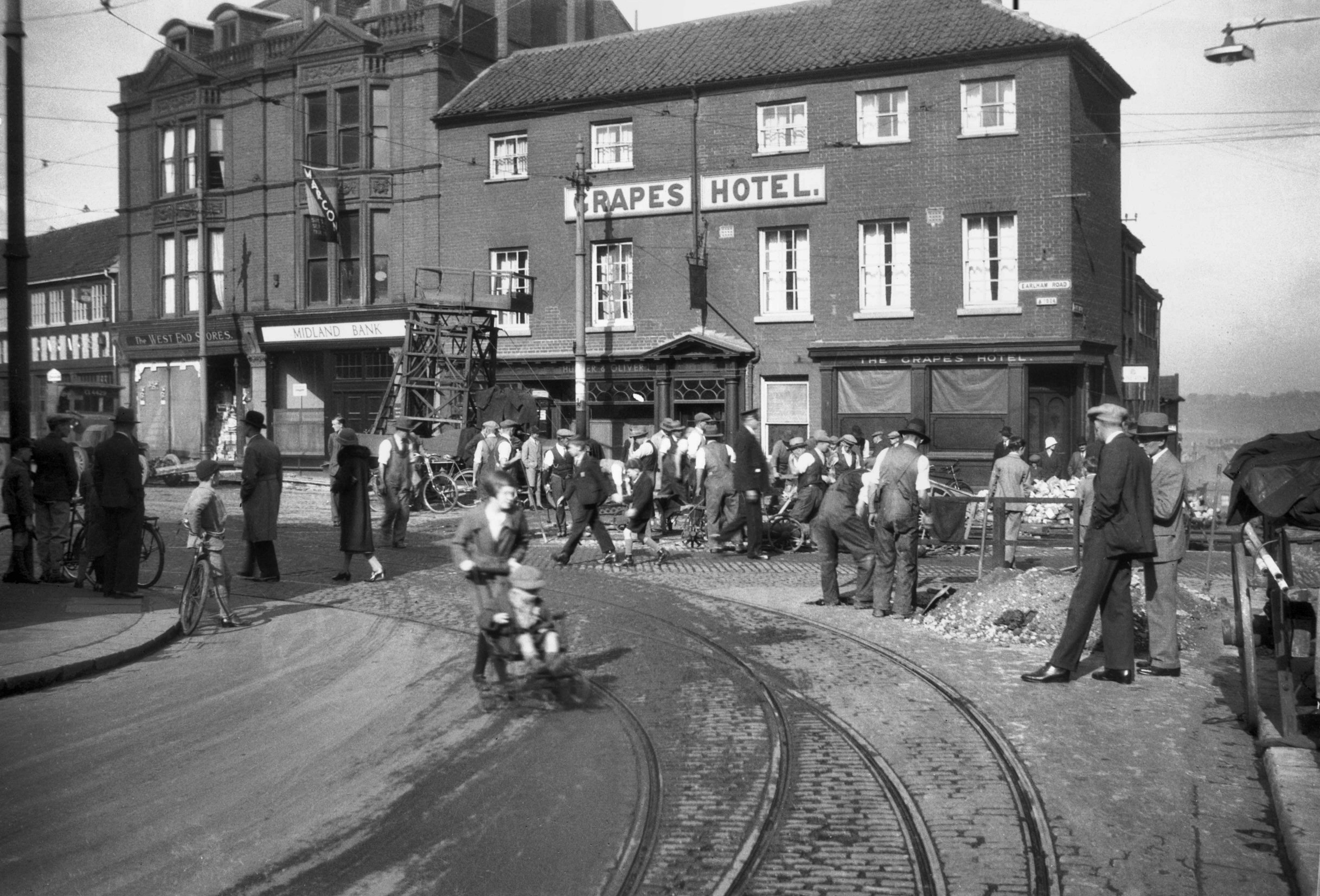
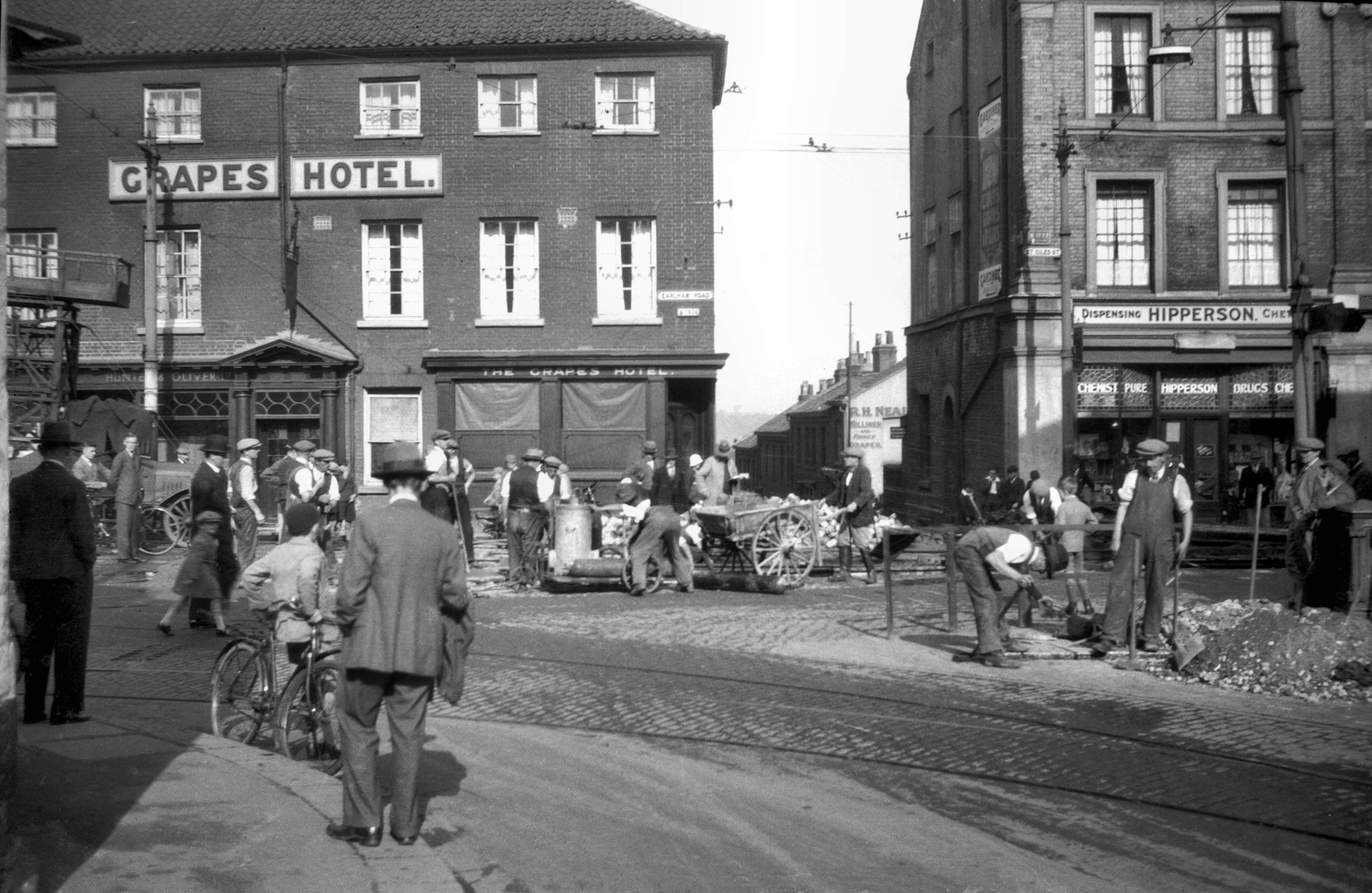
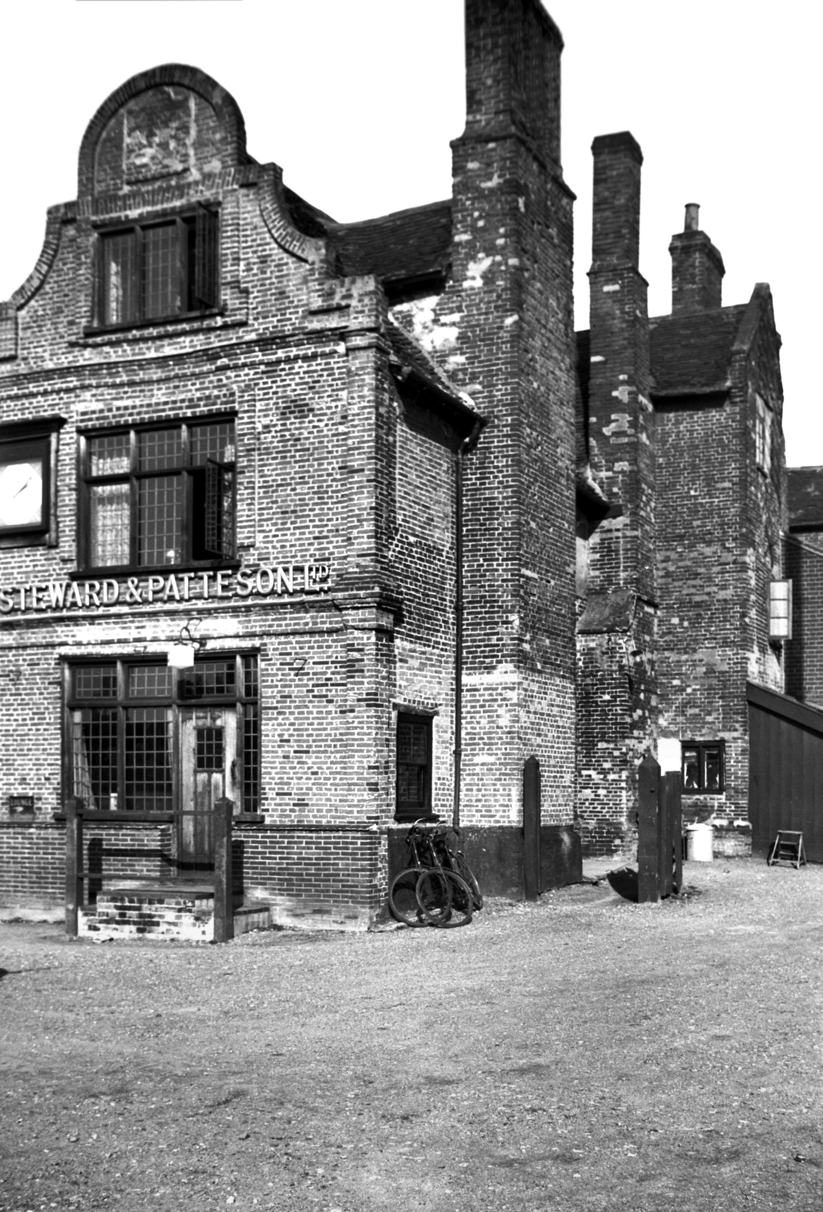
Earlham Rd 1 Grapes Hotel [1825] 1937-07-28
|
|
|
St Giles' St laying track from Chapel Field [B793]
1933-10-08
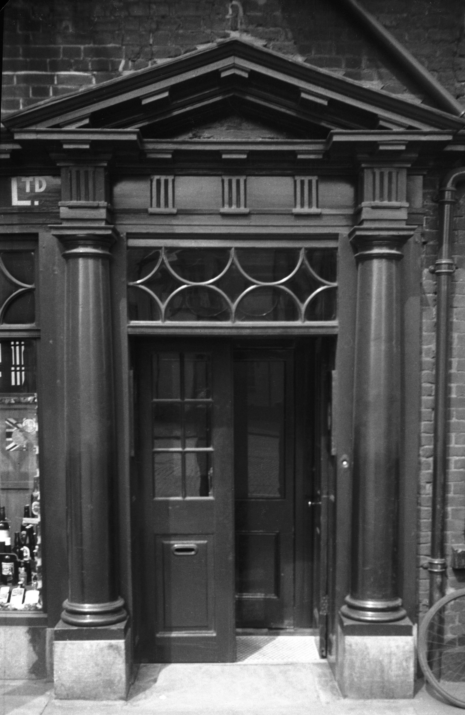
By St Giles' Gate in the district of Heigham stood the
Grapes Hotel, a late Georgian house that had undergone
various alterations at different times. Perhaps the most
drastic was the insertion of shop fronts on either side
of the original pillared doorway.
During the raids of the 27th-29th April 1942, the upper
floors of the building were gutted, but the ground floor
was saved and continued in use until a few years after
the war, when a new building (not a hotel) was built. A
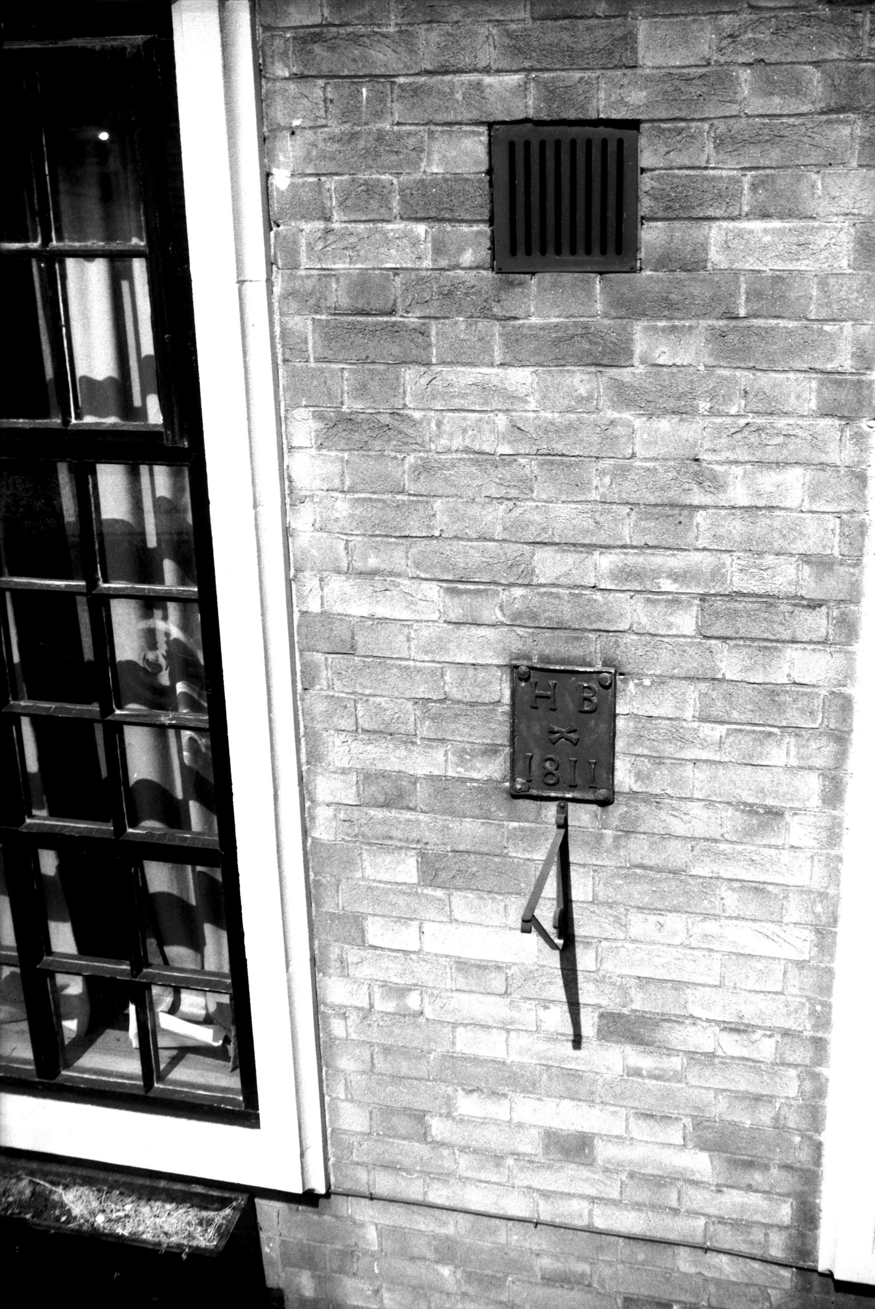
small lead plate transferred from the old house and dated
1811 marked the boundary of the then parish of Heigham St
Bartholomew. It carries the initials "H.B." and
the saint's symbol of a knife, with which he is said to
have been flayed alive. The plate is unique in being the
only one of its kind marking a parish outside the city
walls. The post-war building was itself replaced in 2006.
The tall building to the left of the Grapes dated from
late Victorian times. While the half occupied by the
Midland Bank was not greatly damaged in the raids, the
other half, then occupied by Yaxley's wireless shop but
previously by the West End Grocery Stores, was burned
down completely.
My photograph was taken on Sunday morning, 8th October
1933, when workmen were renewing the tram track, unaware
that the whole system was to be abandoned little more
than two years later. |
|
|
St Giles' St laying track from Tuns Inn [B794]
1933-10-08
At St Giles' Gates the Unthank Rd and Earlham Rd routes
converged with the route via Chapel Field North and
Theatre St. The latter was used only by the outward bound
early morning services to avoid parked vans delivering
goods to the Market at that time. |
|
|
Earlham Rd 1 Grapes Hotel Georgian doorway [0512]
1935-05-05
|
|
|
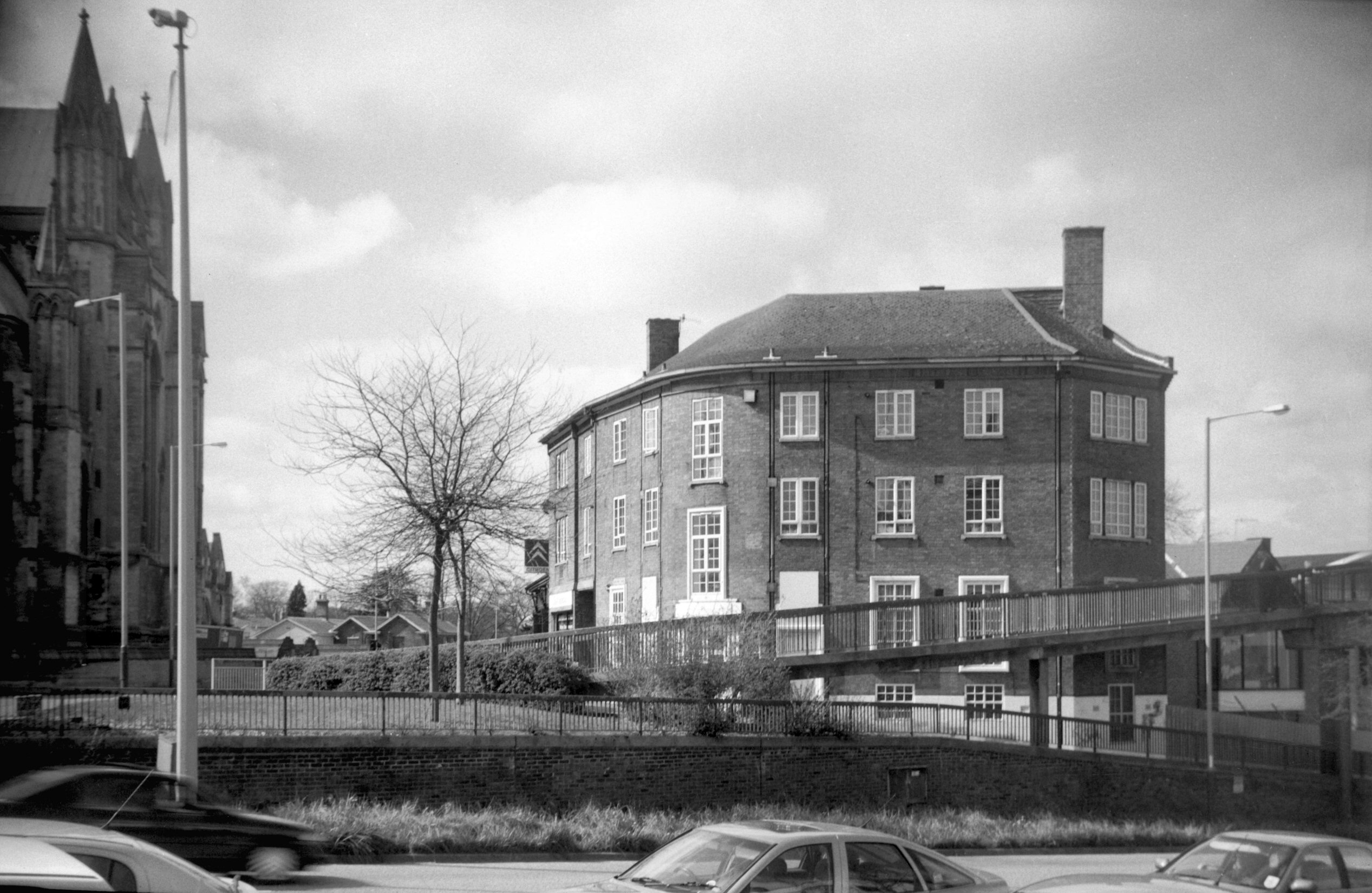
Earlham Rd 1 Grapes Hotel [7928] 2003-04-05
|
|
|
Earlham Rd 1 boundary plates [6618] 1990-07-03
Boundary of Heigham St Bartholomew in 1811. Affixed to
the former Grapes Hotel. Unique in being the only one
outside the city wall. |
|
|
Earlham Rd Jewish synagogue [6468] 1987-06-01
Built 1968. |
|
|
Earlham Rd 9 Bircham House [6532] 1989-03-20
|
|
|
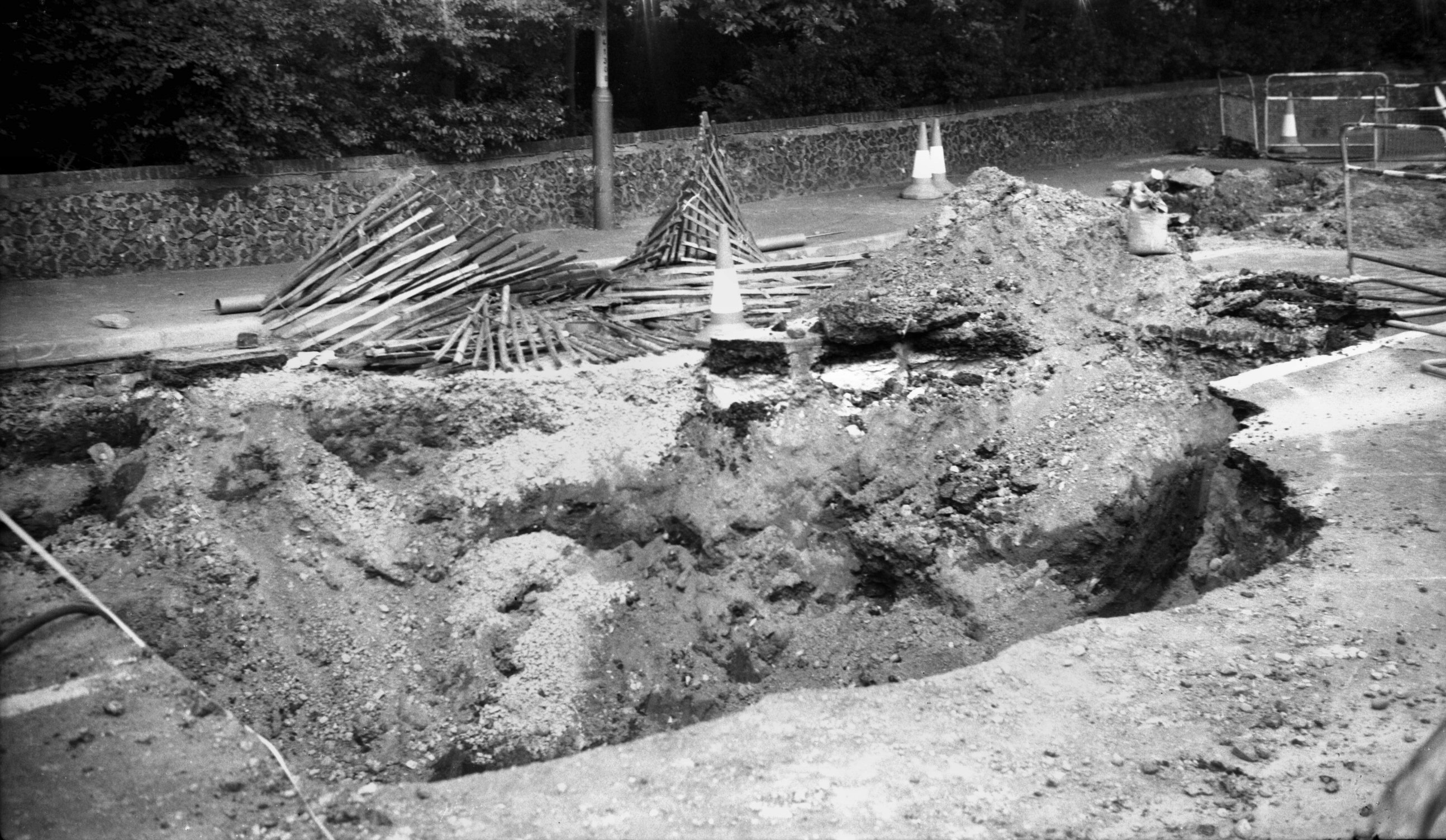
Earlham Rd subsidence near Paragon Place [6496]
1988-04-18
In various places around the city, tunnels were dug in
mediaeval times to obtain flint and chalk for building
purposes. Those at Earlham Rd near St Giles' Gates were
rediscovered in 1823. Over the years a number of
subsidences have occurred, one - on 3rd March 1988 -
involving a bus. |
|
|
Earlham Rd 21 The Dingle [6497] 1988-04-22
|
|
|
Earlham Rd subsidence near Distillery St [6503]
1988-07-29
Not long after the famous bus incident, a subsidence on
26th July affected the roadway about 200 yards west of
the previous one and led to the closure of the road
between Heigham Grove and the Roman Catholic Cathedral
for many months. |
|
|
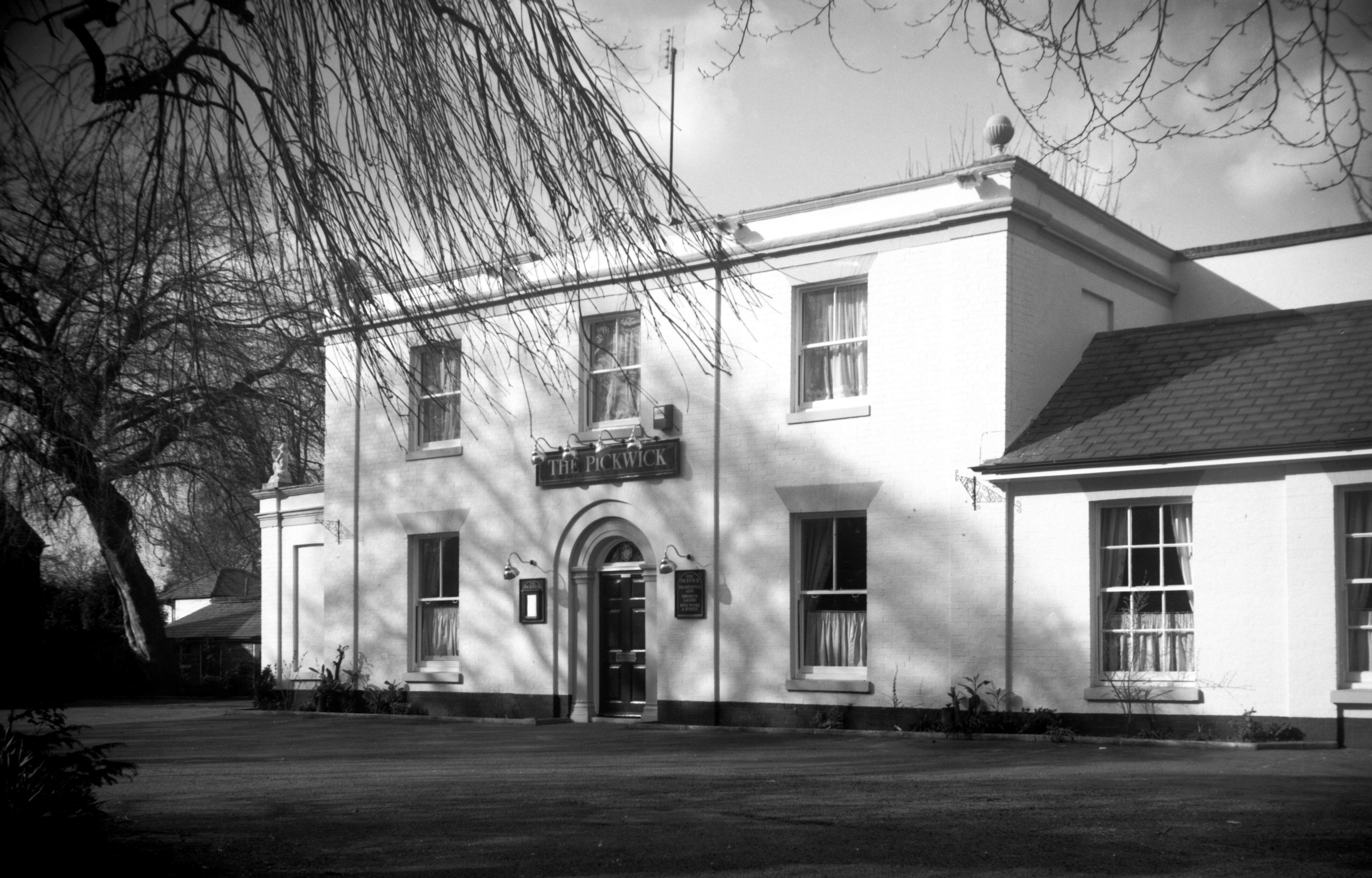
Earlham Rd 41 Pickwick PH [6531] 1989-03-20
|
|
|
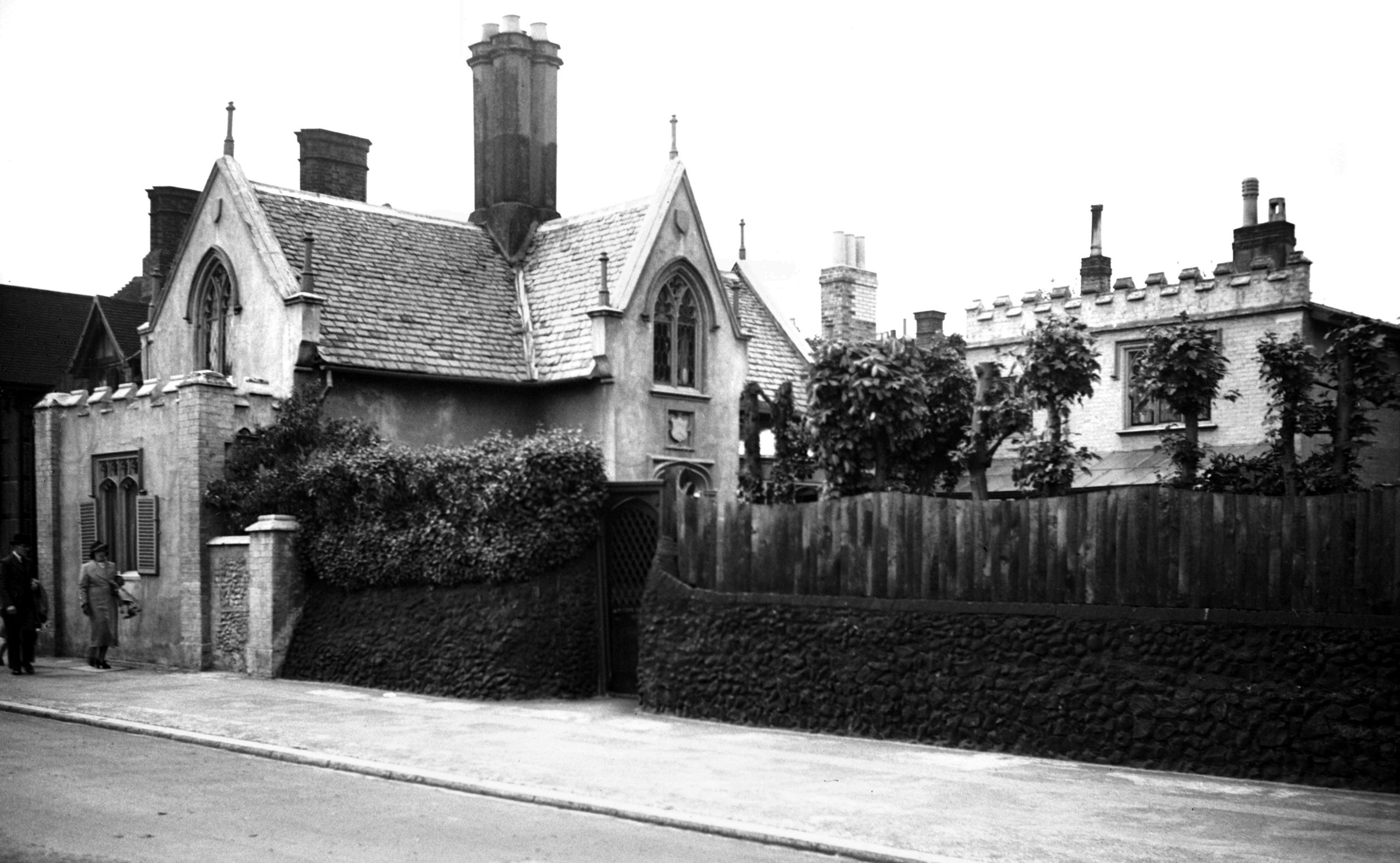
Earlham Rd 129 Curfew Lodge gothic [2433] 1938-05-29
Victorian Gothic. |
|
|
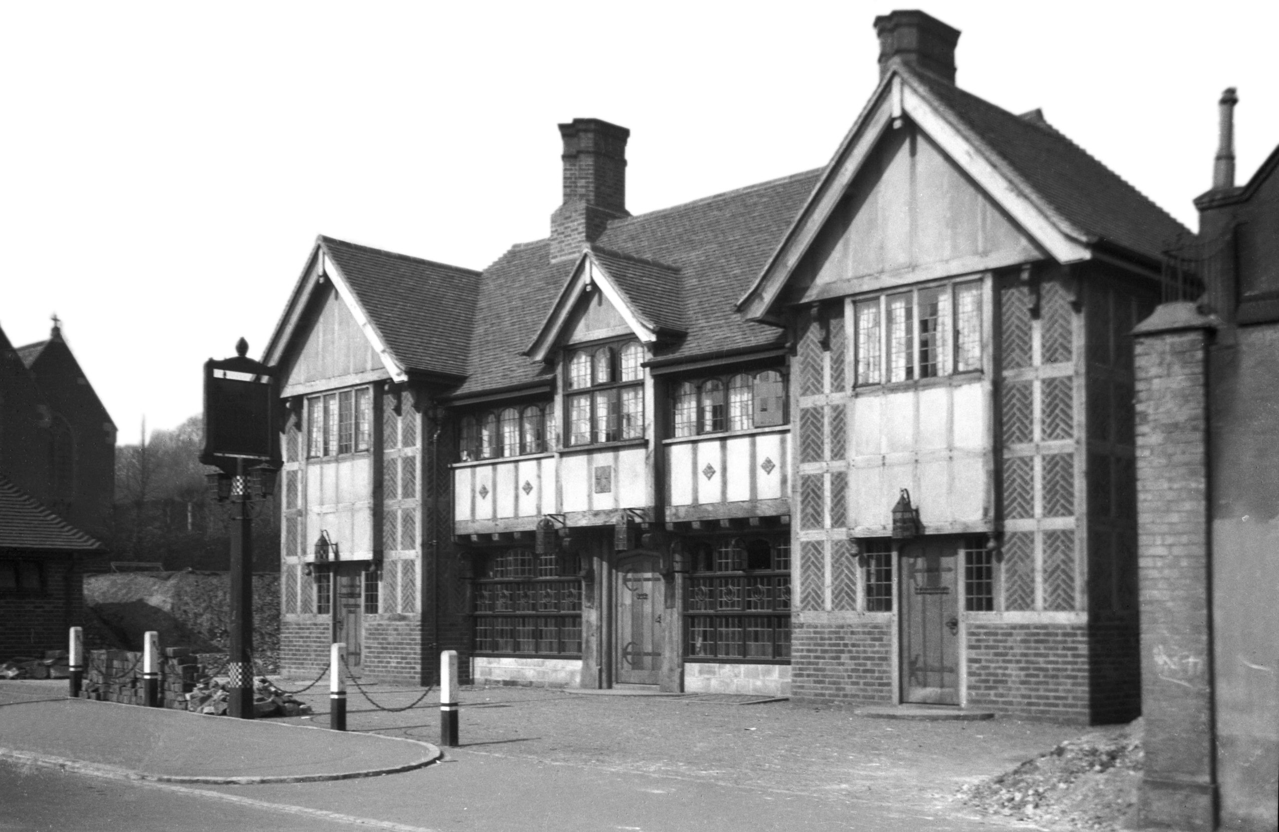
Earlham Rd 131 Mitre PH [B510] 1933-03-28
|
|
|
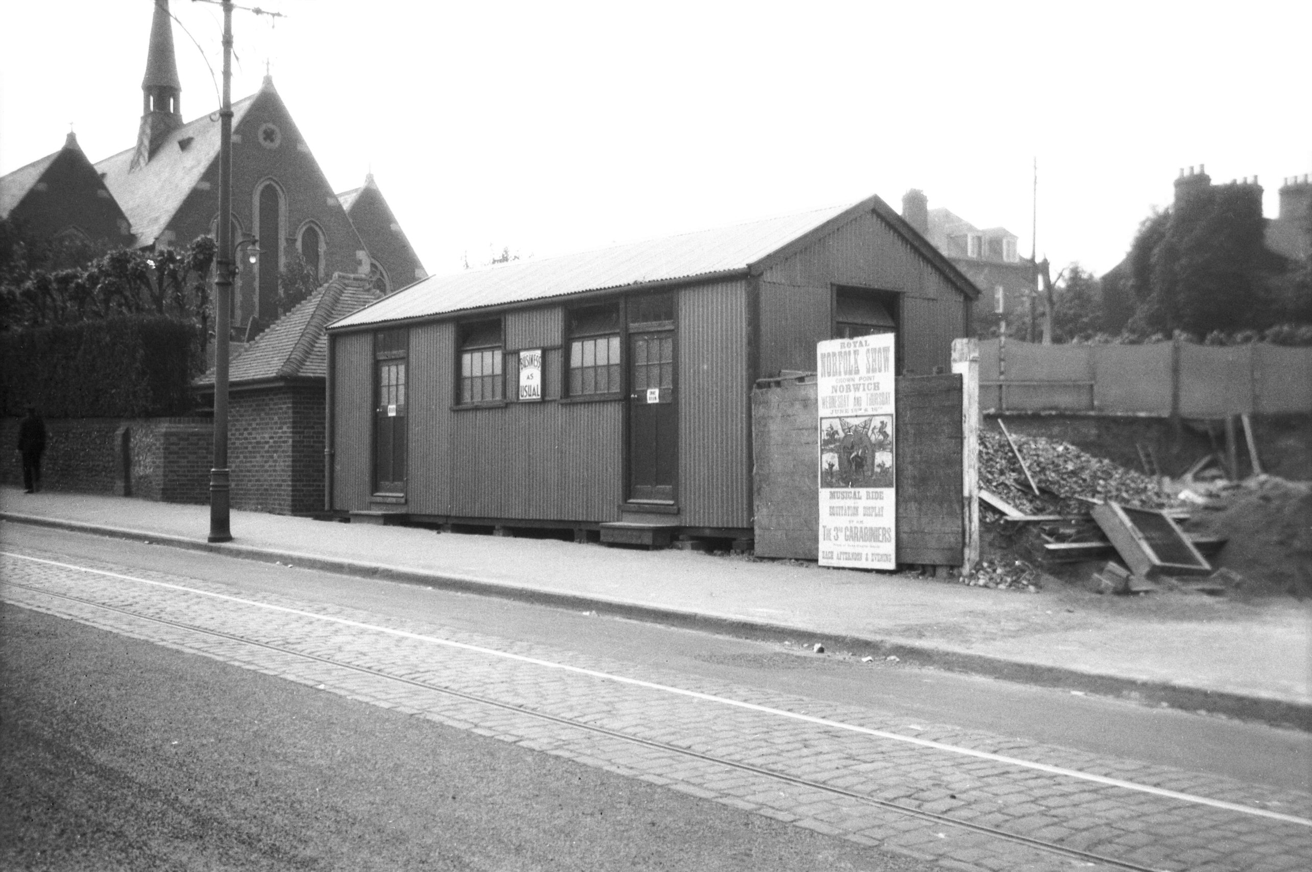
Earlham Rd 131 Mitre PH temporary building [B320]
1932-06-12
During reconstruction. |
|
|
St Thomas' Heigham from Earlham Rd [4685] 1962-06-30
Built 1888 of red brick in Gothic style, architect Ewan
Christian. Gutted by fire during 1942 air raid and
reconstructed 1952. |
|
|
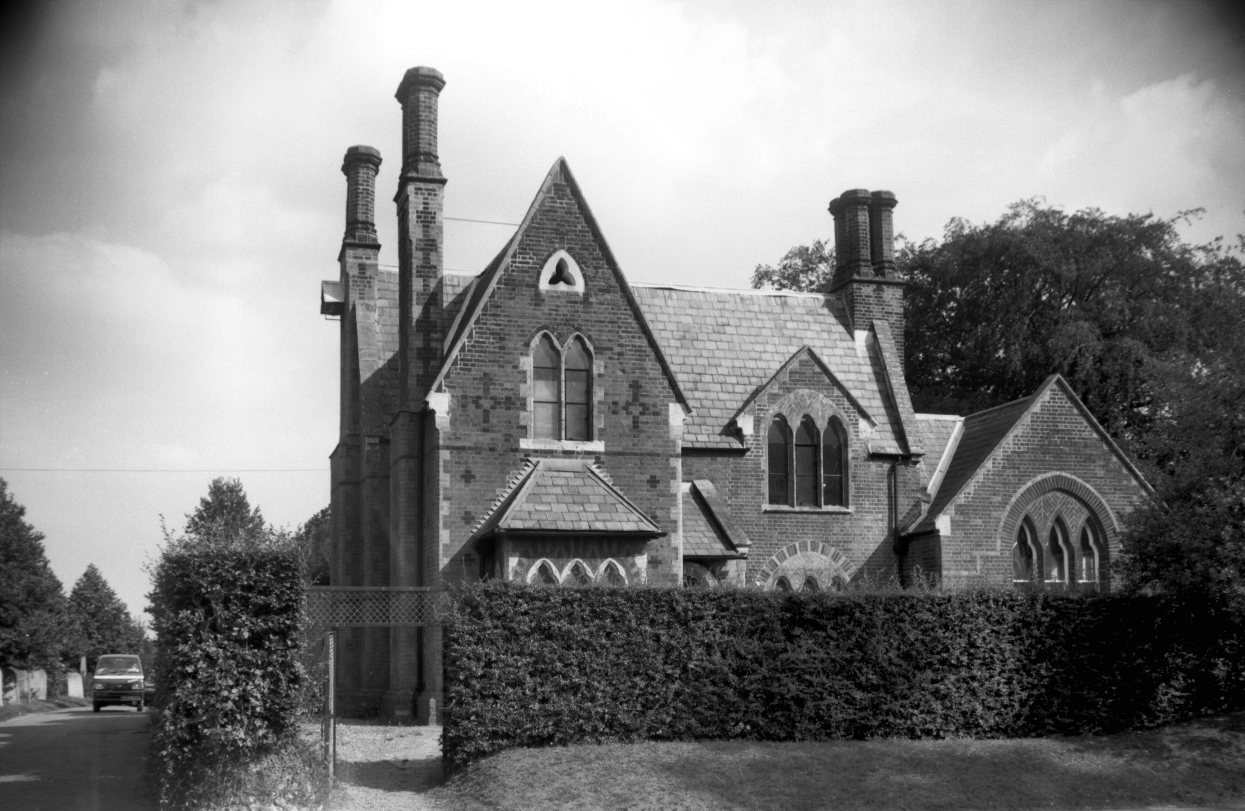
Earlham Rd Cemetery South Lodge [7483] 1997-09-10
See also Bowthorpe Rd for the
cemetery. |
|
|
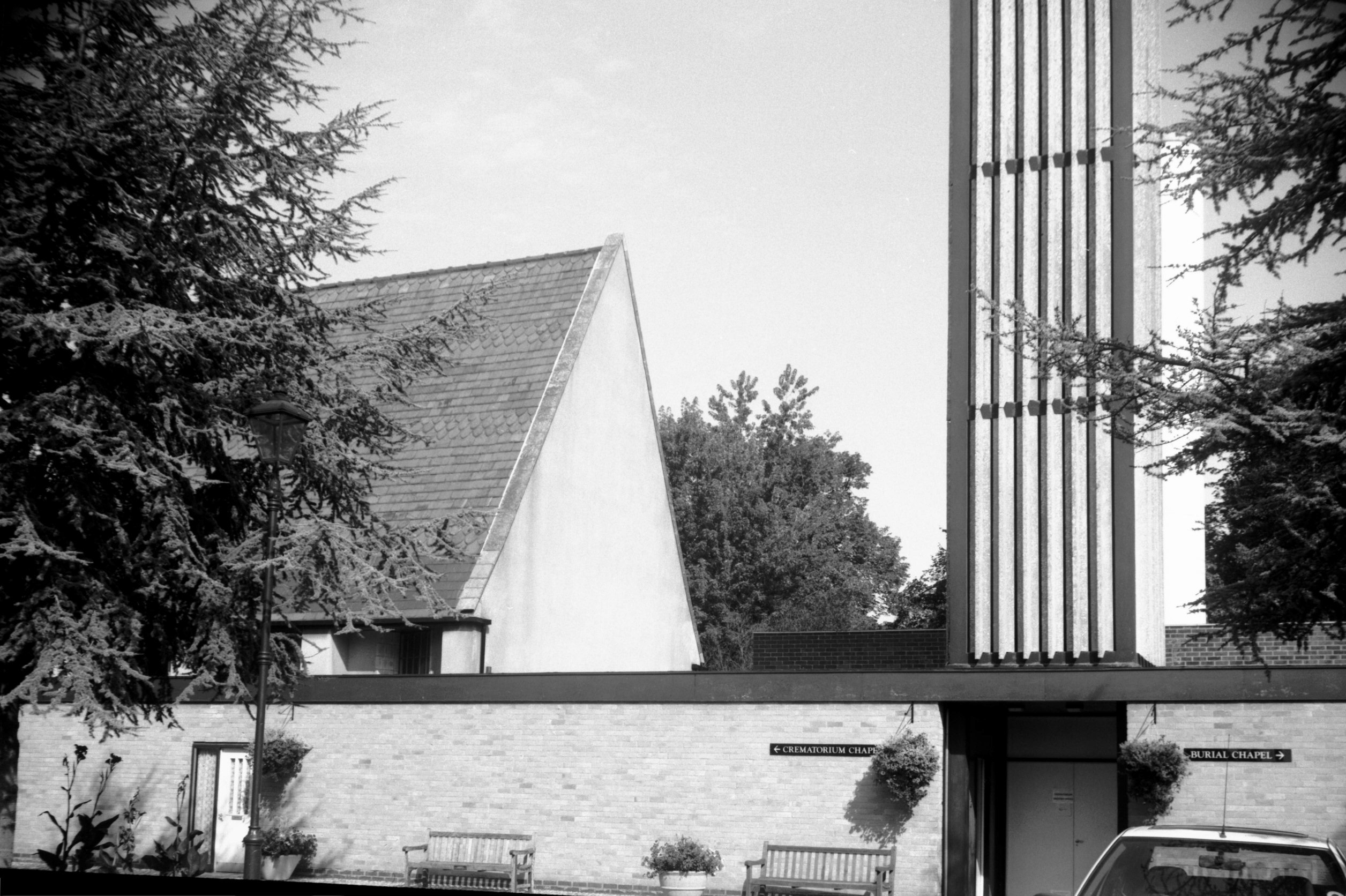
Earlham Rd Cemetery crematorium [7479] 1997-08-26
Built 1963-64 incorporating the two Victorian mortuary
chapels. Part of the former Free Church chapel (left of
picture) is now the Crematorium Chapel. |
|
|
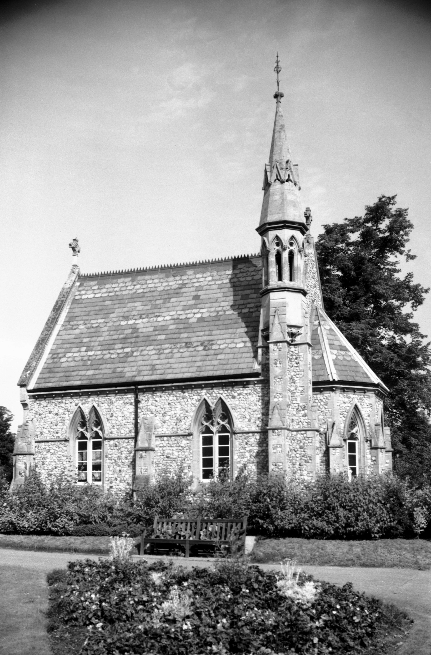
Earlham Rd Cemetery RC mortuary chapel [7480]
1997-08-26
|
|
|
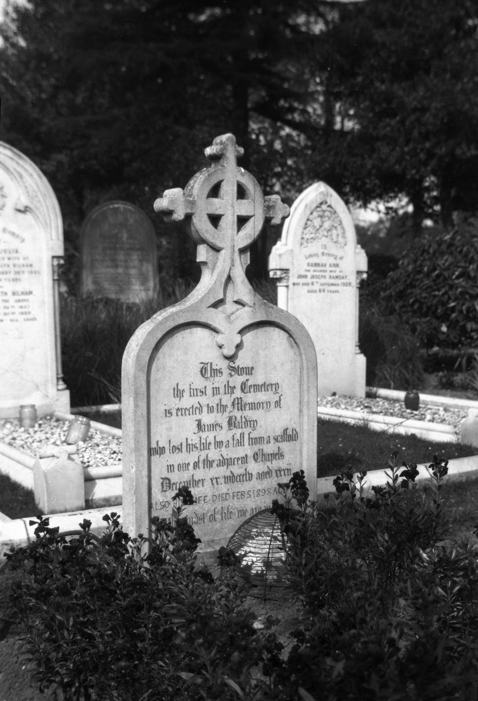
Earlham Rd Cemetery first stone J Baldry [B534]
1933-04-14
J Baldry, died 1855. |
|
|
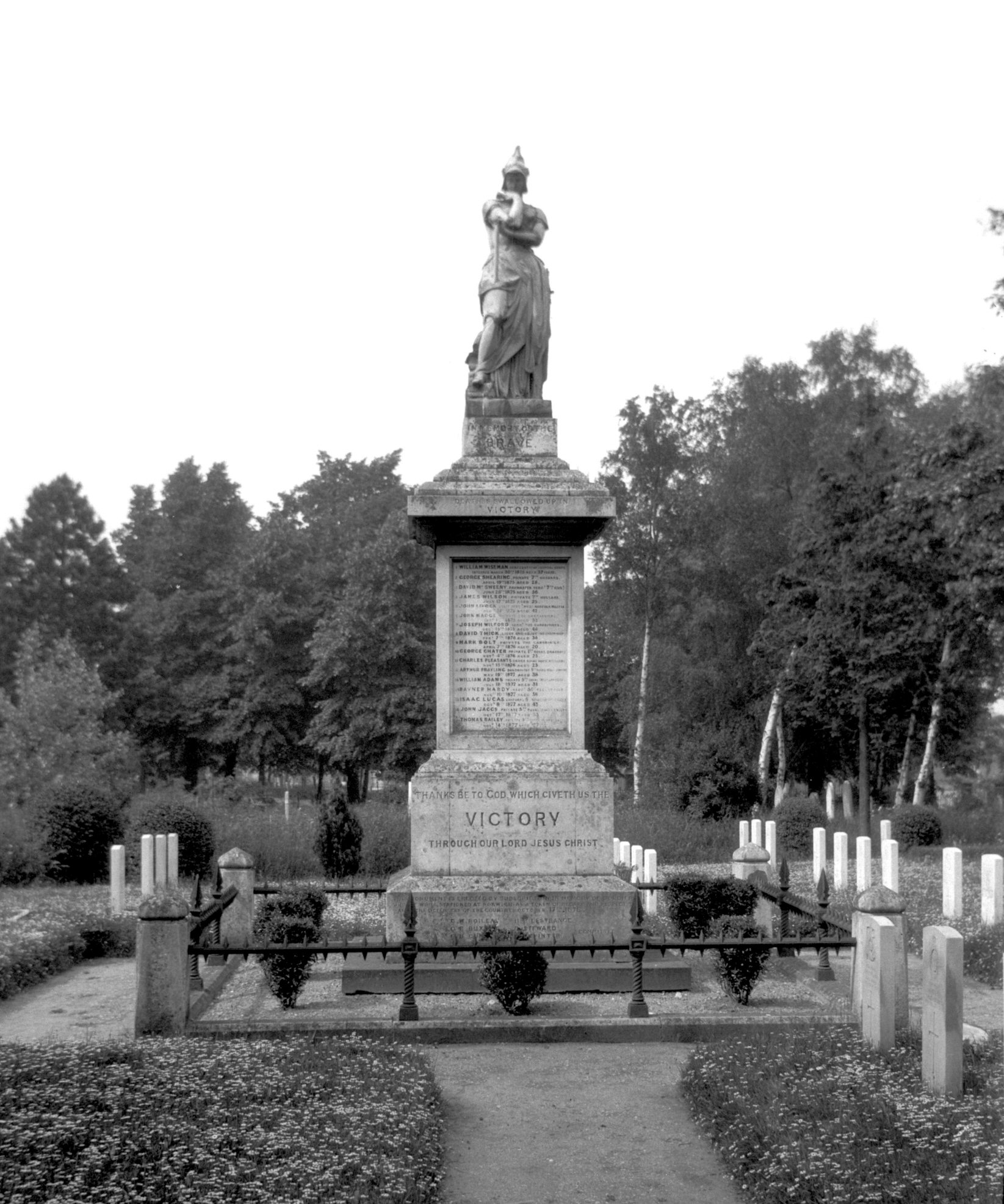
Earlham Rd Cemetery barrack soldiers dying [B318]
1932-06-12
Memorial to soldiers dying at Norwich Barracks. Unveiled
by Lord Waveney 17th October 1878. |
|
|
Earlham Rd Cemetery military memorial [B319]
1932-06-12
|
|
|
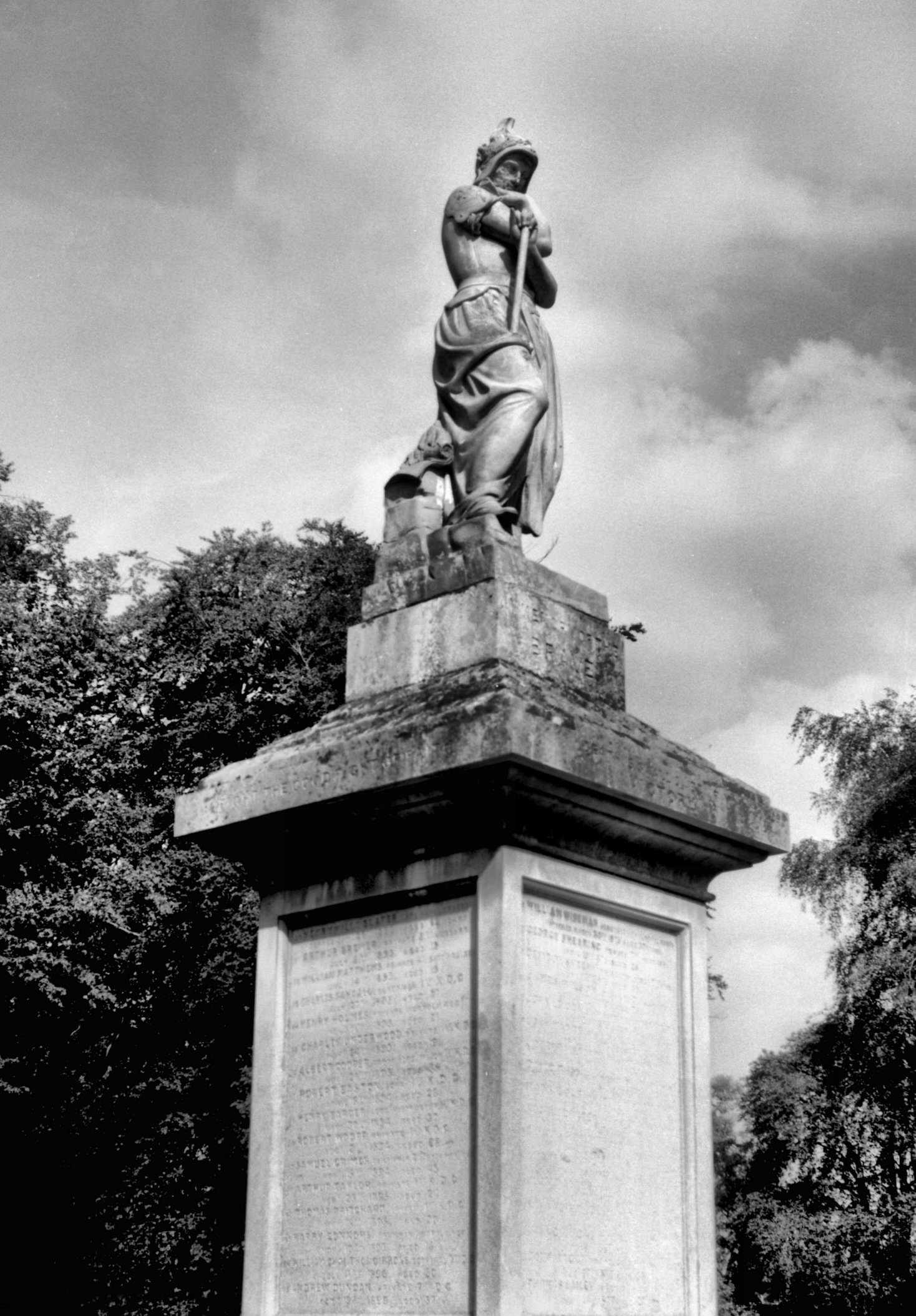
Earlham Rd Cemetery Spirit of the Army [7481]
1997-09-10
Figure on finial of terracotta. Named by designer John
Bell. |
|
|
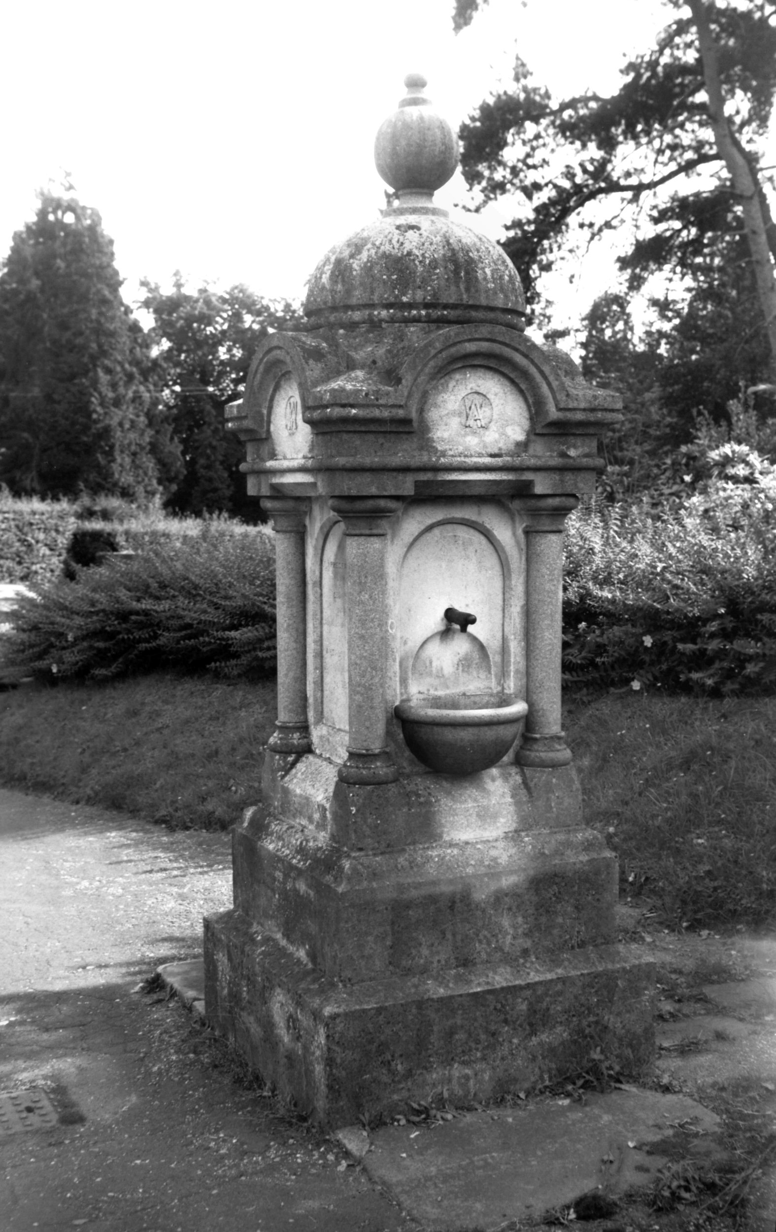
Earlham Rd Cemetery drinking fountain [7482]
1997-09-10
"Presented/ by the/ Chairman/ of the/ Burial Board
Committee/ Alderman/ Ambrose Winter/ 16th August/
1892". |
|
|
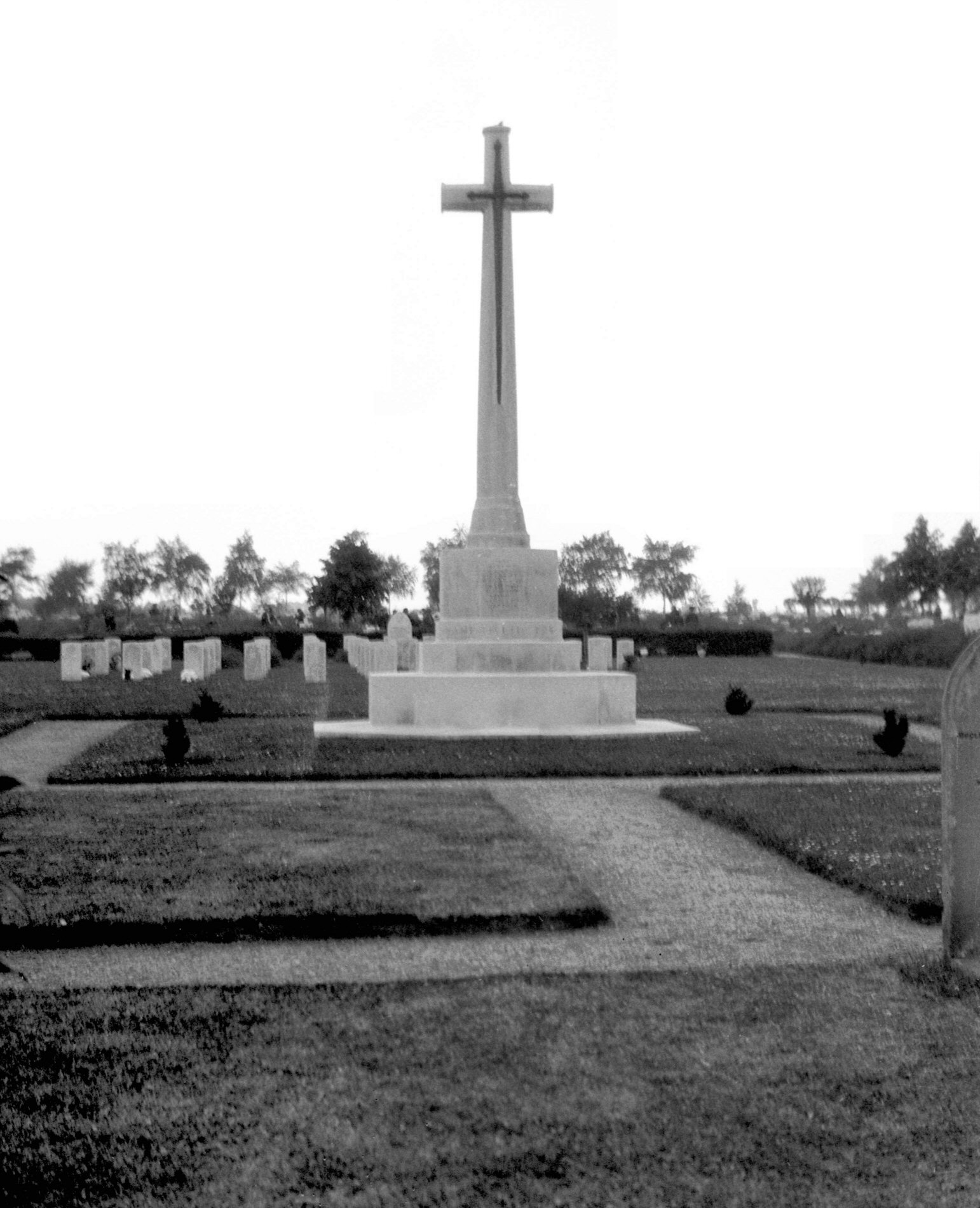
Earlham Rd Cemetery Garden of Remembrance [7715]
1999-11-27
|
|
|
Earlham Rd 367 Volunteer PH [2434] 1938-05-29
|
|
|
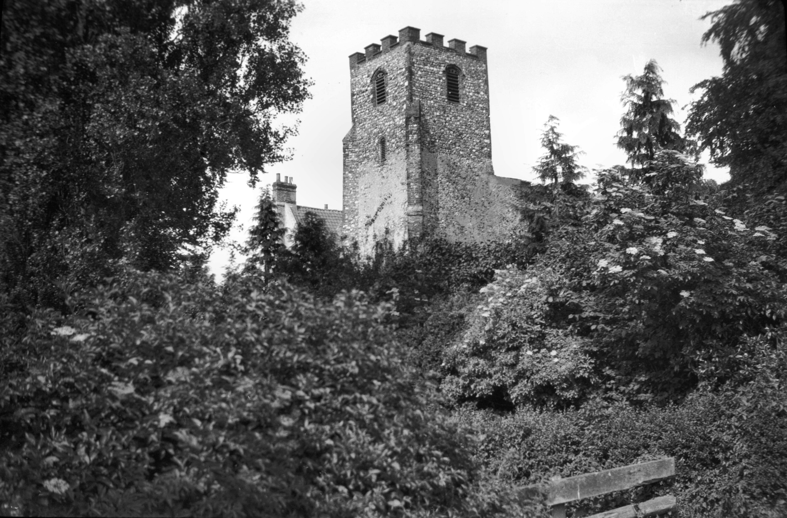
St Mary's Earlham tower from SW [B587] 1933-06-11
From Earlham Rd. |
|
|
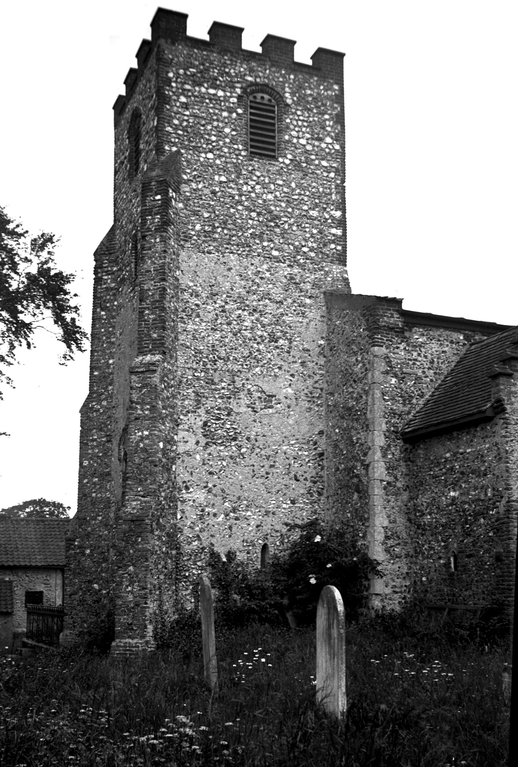
St Mary's Earlham tower south side [2450] 1938-06-11
|
|
|
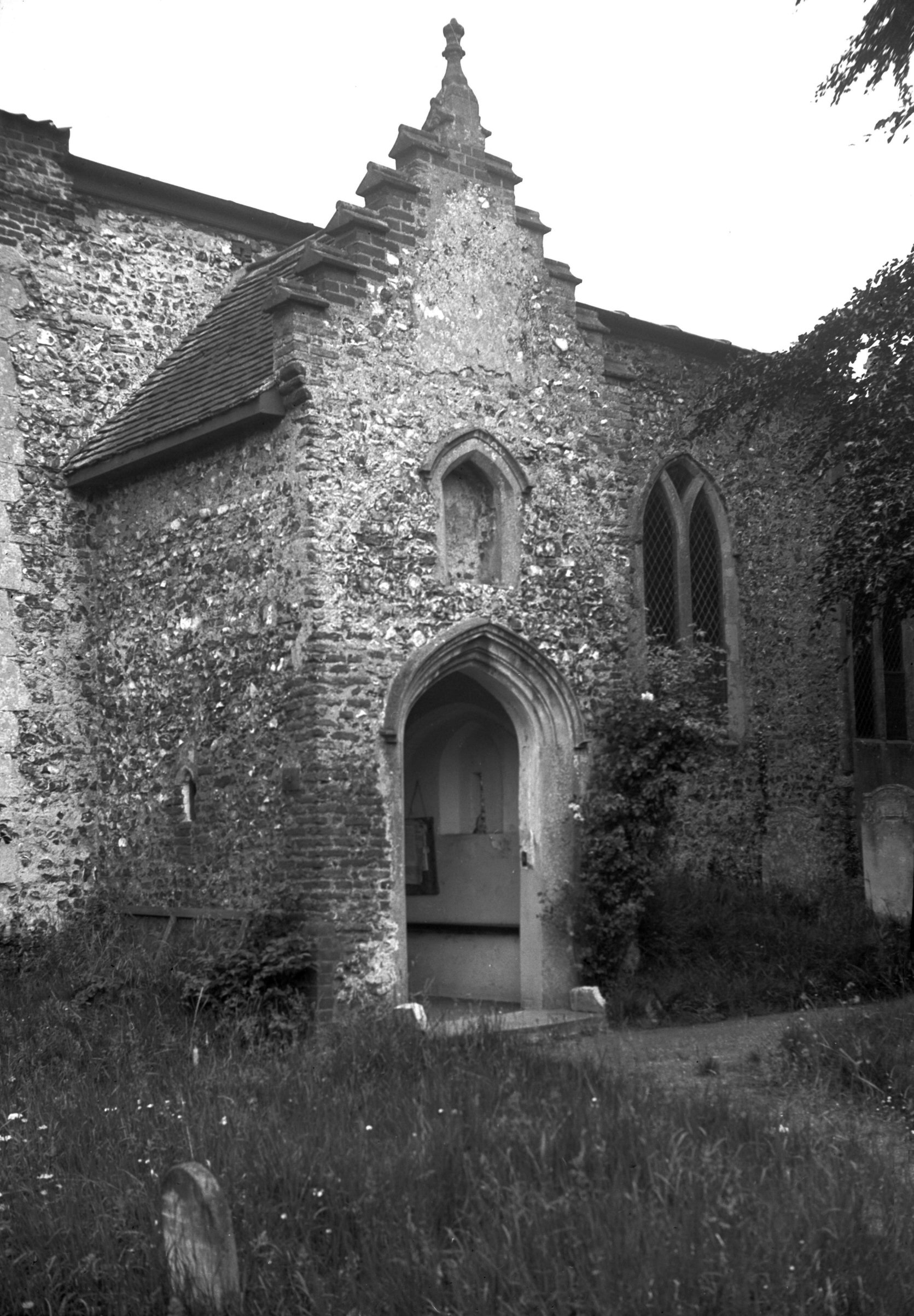
St Mary's Earlham south porch [2449] 1938-06-11
|
|
|
St Mary's Earlham interior view east [2443]
1938-06-11
The walls are mainly Early English with Decorated and
Perpendicular windows inserted. Modern roofs and benches. |
|
|
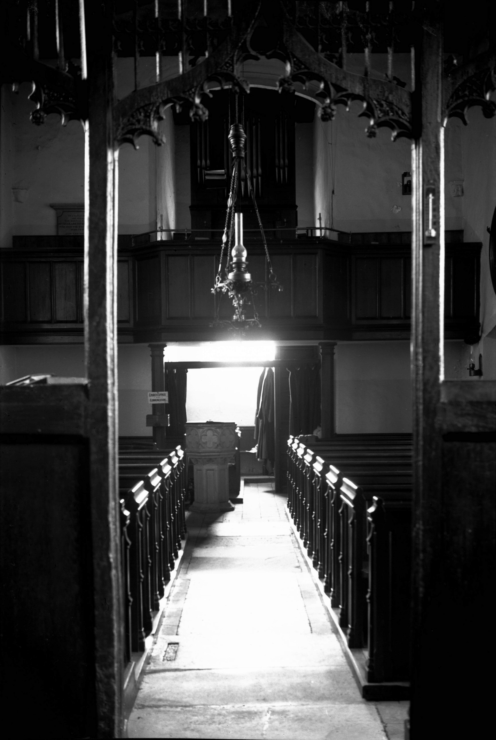
St Mary's Earlham interior view west [2444]
1938-06-11
|
|
|
St Mary's Earlham interior north transept [2446]
1938-06-11
|
|
|
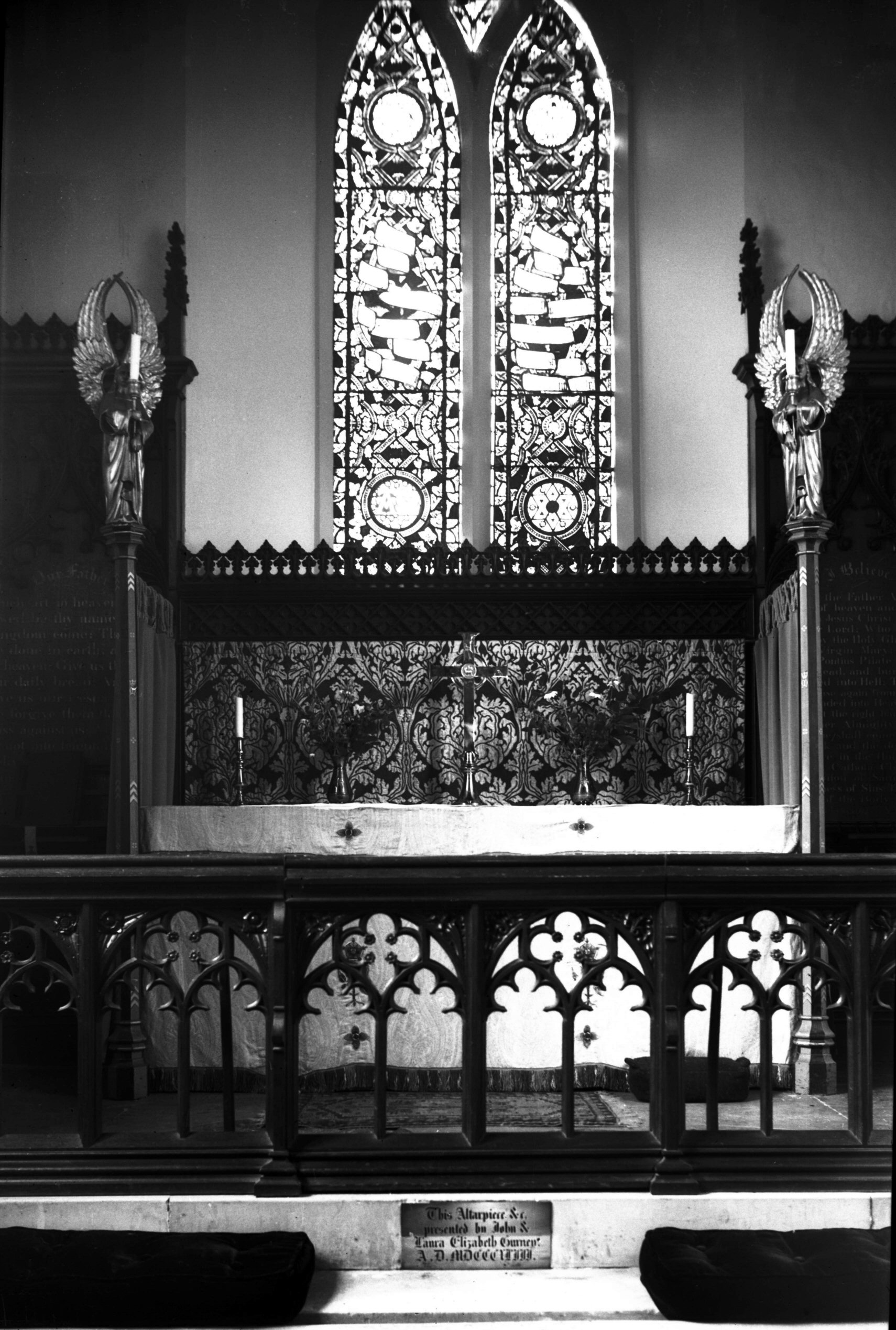
St Mary's Earlham altar [2448] 1938-06-11
Presented by John and Laura Gurney 1843. |
|
|
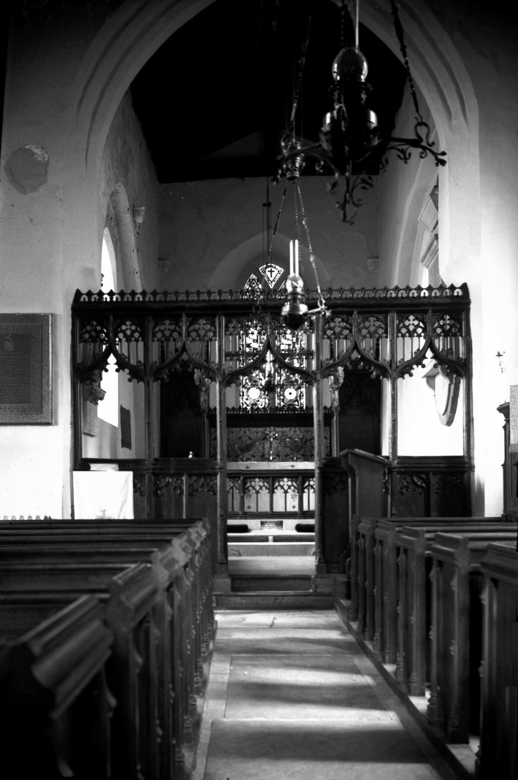
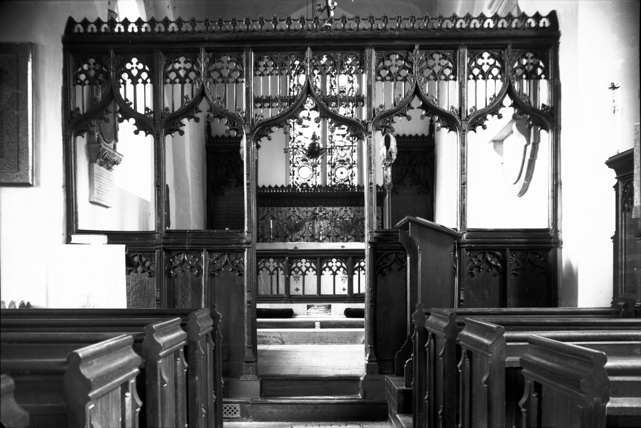
St Mary's Earlham 15c screen [2447] 1938-06-11
Square-headed screen with cusped and crocketted ogee
arches having painted and varnished tracery. |
|
|
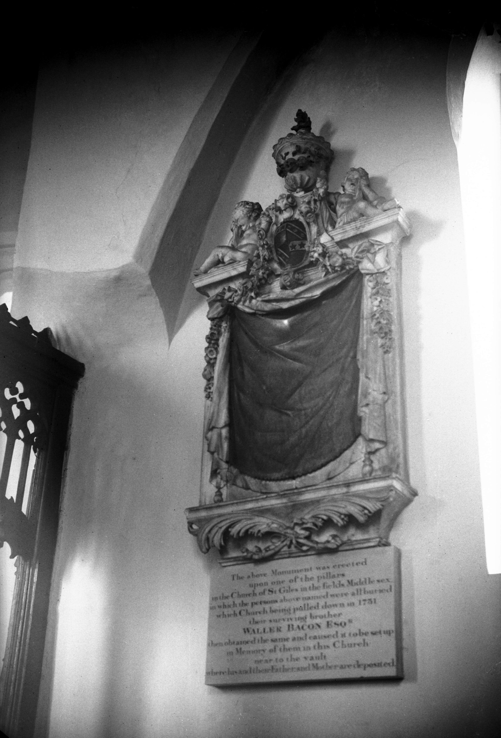
St Mary's Earlham Bacon family monument [2445]
1938-06-11
Formerly in the church of St Giles' in the Fields
Middlesex but transferred to Earlham by Mr Waller Bacon
on the former church being demolished in 1731. |
| |
South
side |
|
|
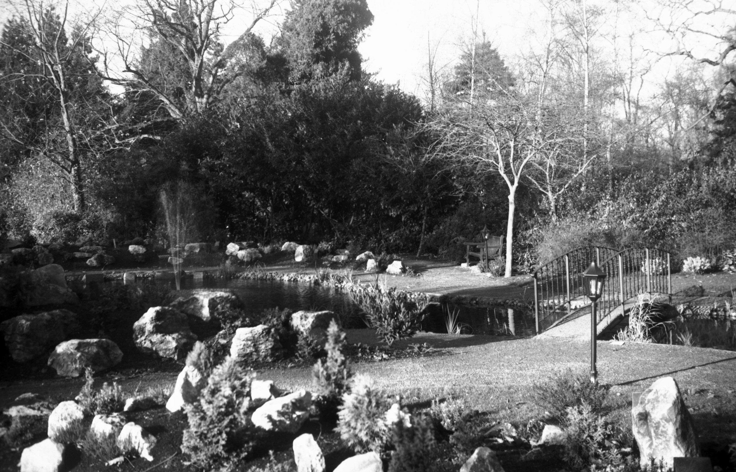
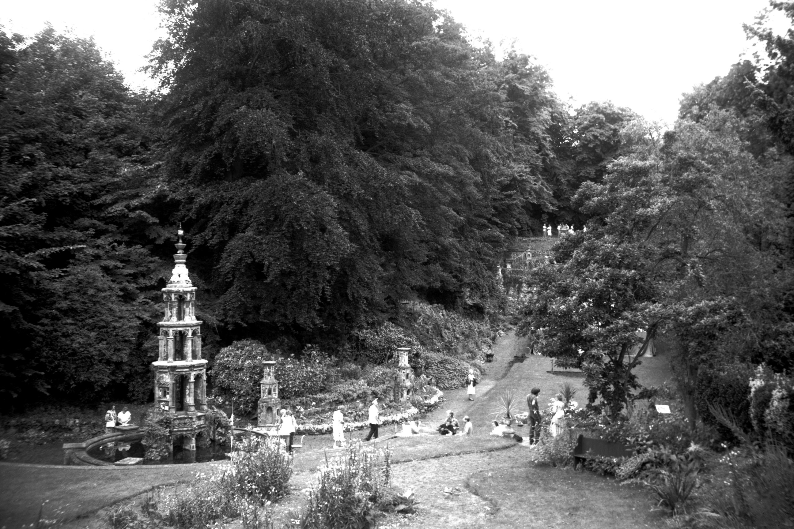
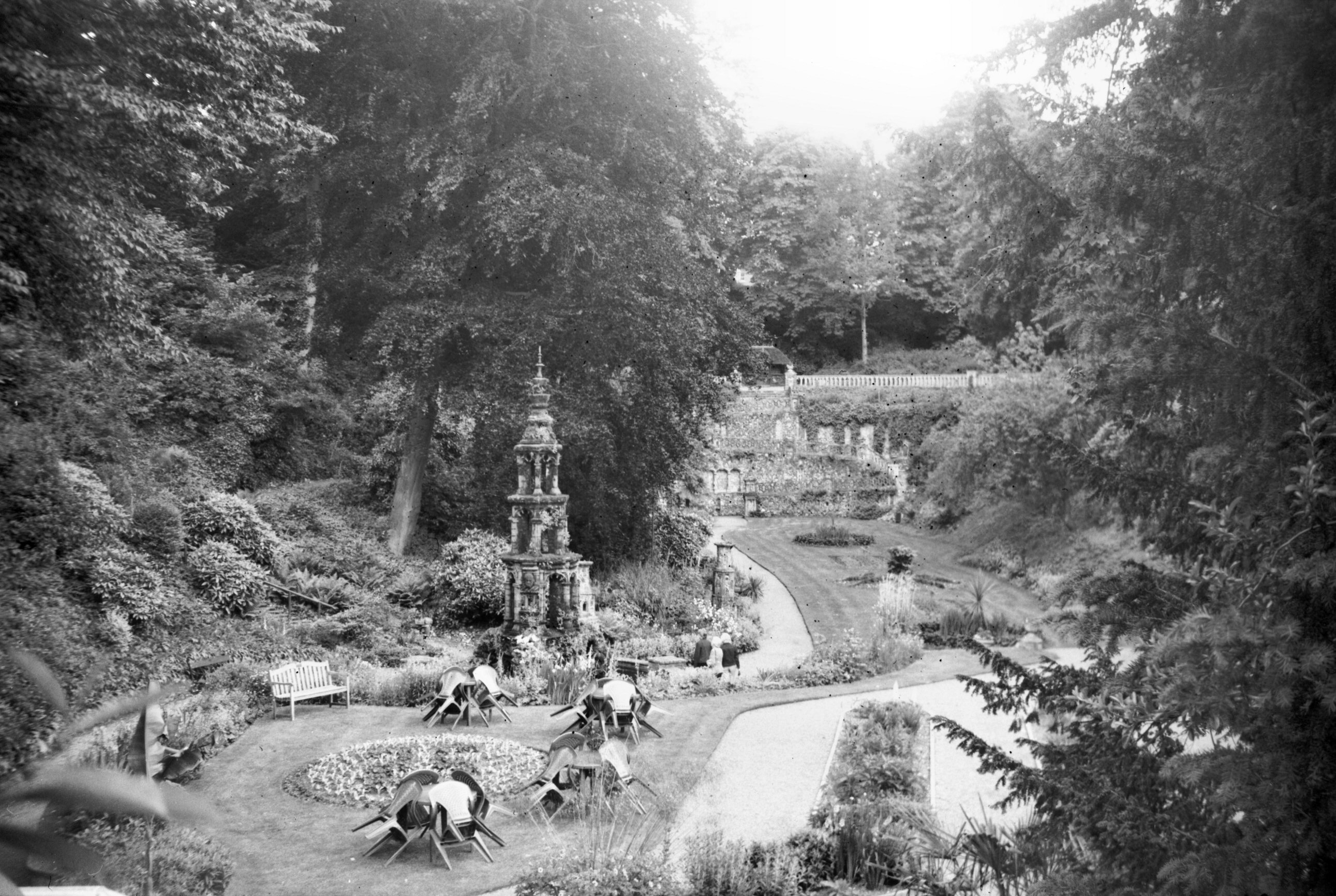
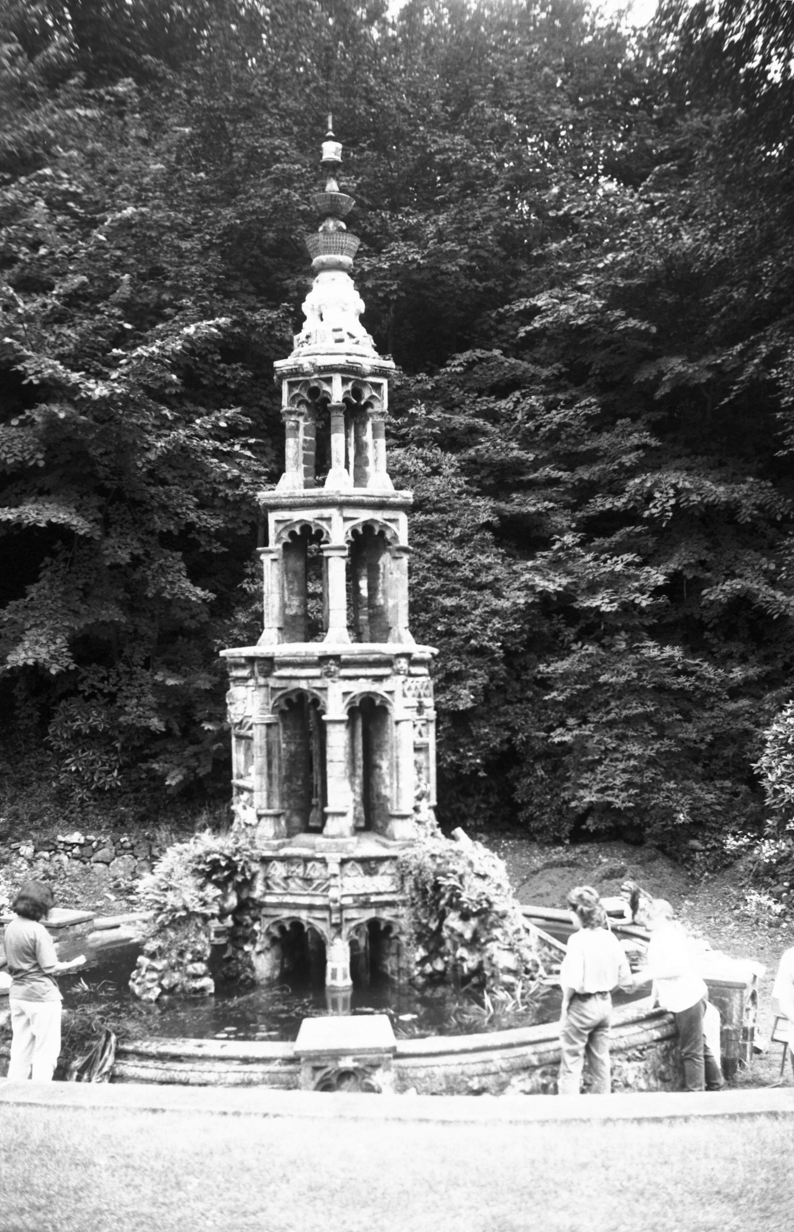
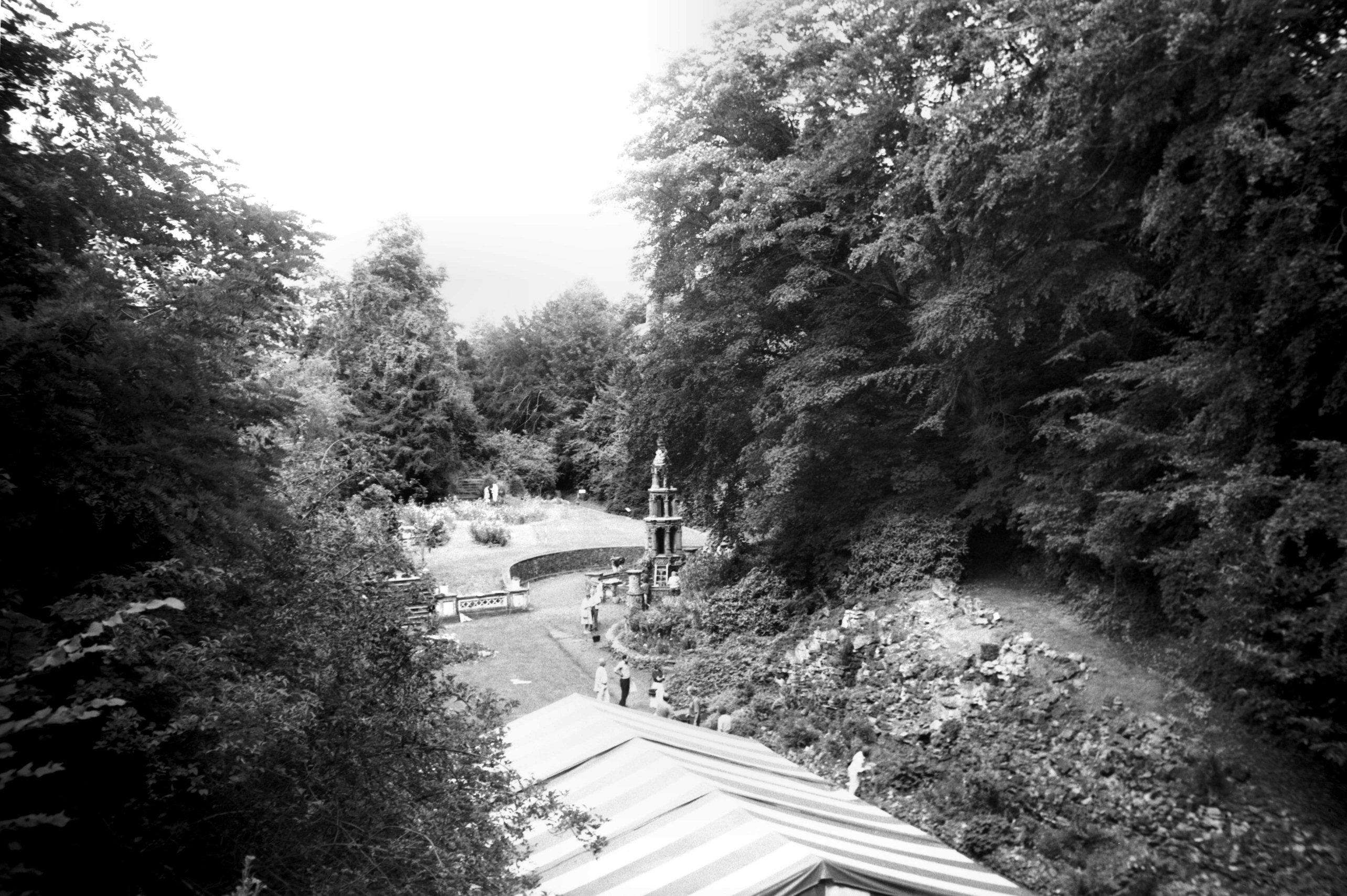
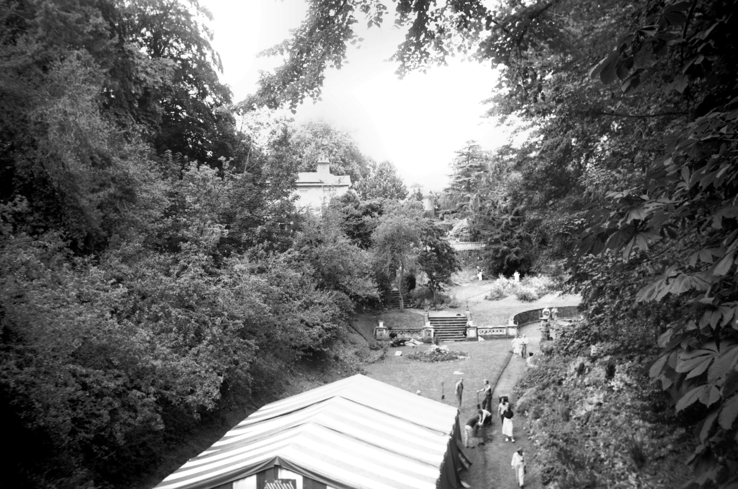
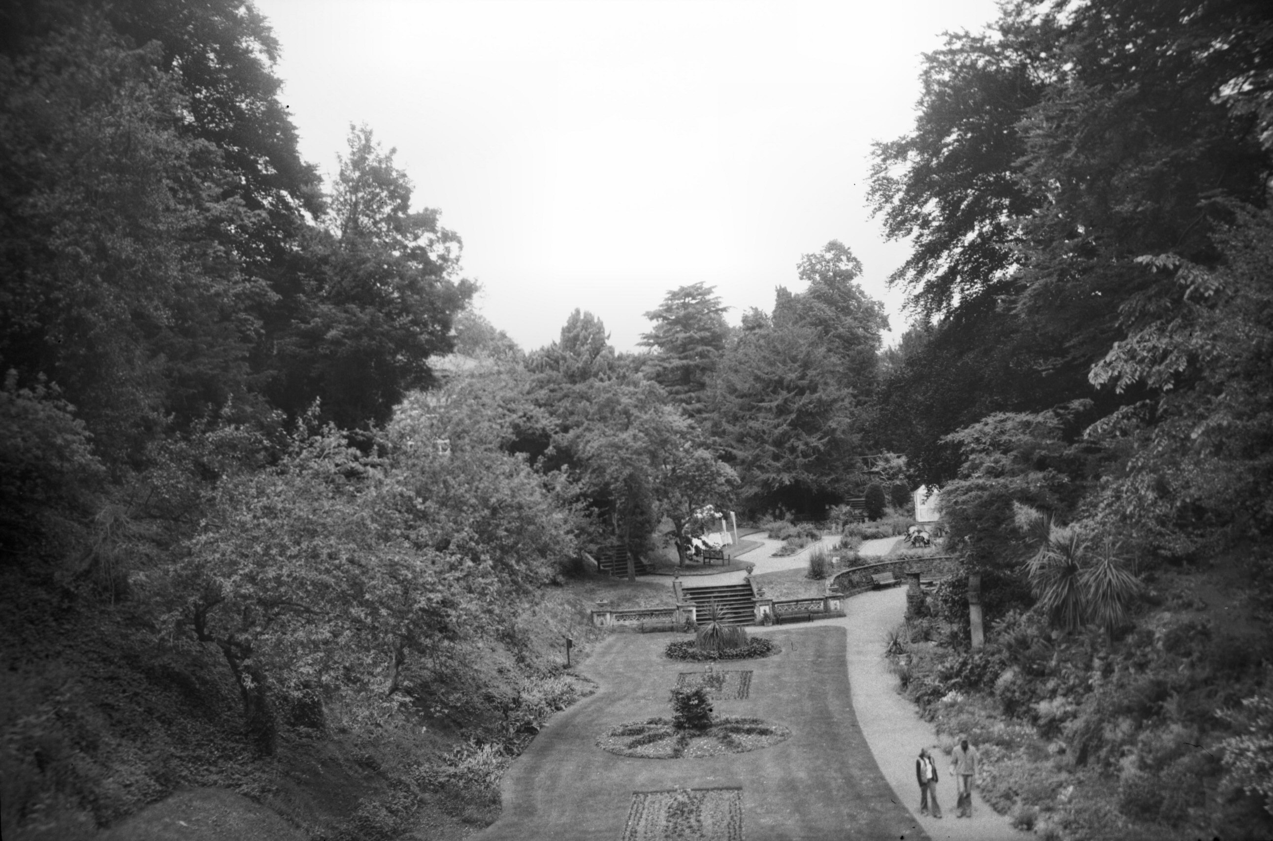
Earlham Rd 4 Plantation Garden house front [6888]
1992-07-26
Henry Trevor, Victorian Baptist and Cabinet maker, took
over the lease of 4 Earlham Rd and built the house in
1856, and between that date and 1891-92 created the
Plantation Garden round it. The site was originally a
chalk quarry. |
|
|
Earlham Rd 4 Plantation Garden general view [6887]
1992-07-26
From the west terrace, showing the fountain and the two
ornate piers which flanked the now vanished propagating
house. |
|
|
Earlham Rd 4 Plantation Garden from bridge [7956]
2005-06-12
|
|
|
Earlham Rd 4 Plantation Garden fountain [6884]
1992-07-26
|
|
|
Earlham Rd 4 Plantation Garden view north [6885]
1992-07-26
|
|
|
Earlham Rd 4 Plantation Garden view north [6886]
1992-07-26
|
|
|
Earlham Rd 4 Plantation Garden view N [7958]
2005-06-12
|
|
|
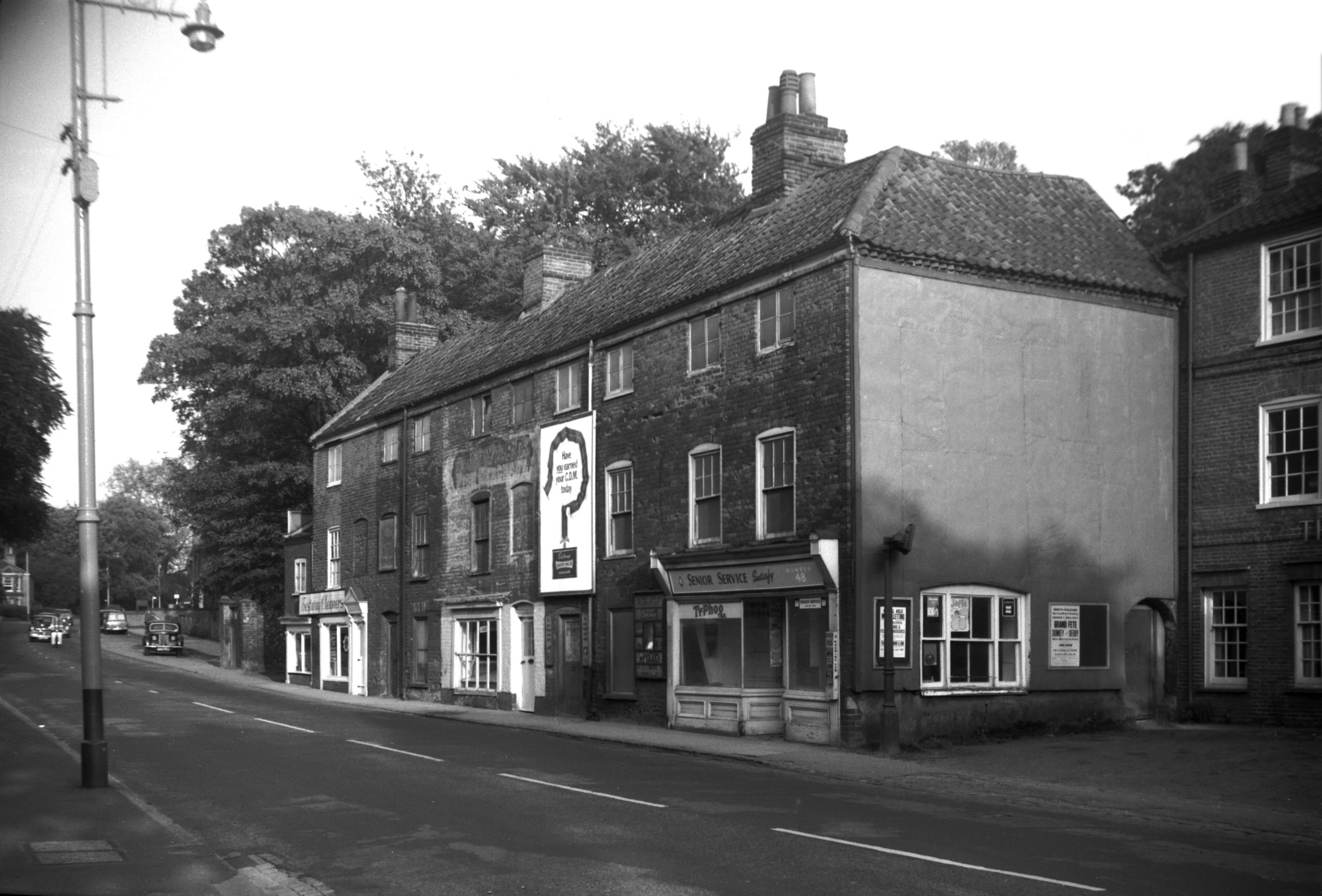
Earlham Rd 40 to 48 [5139] 1967-05-16
|
|
|
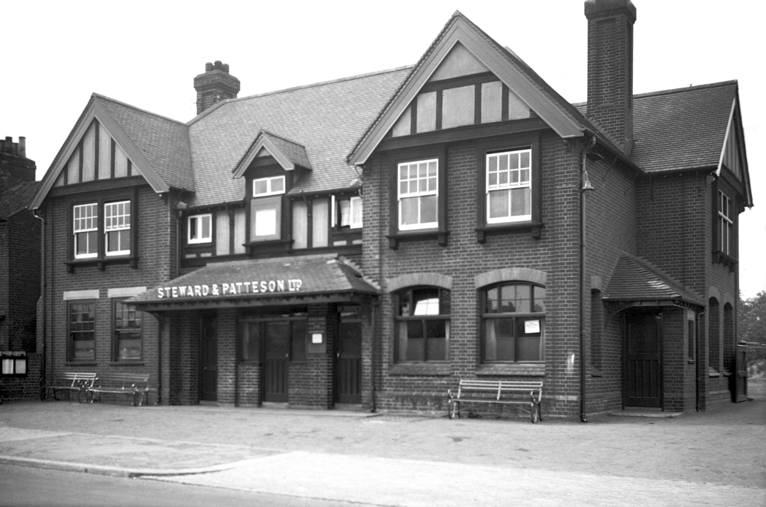
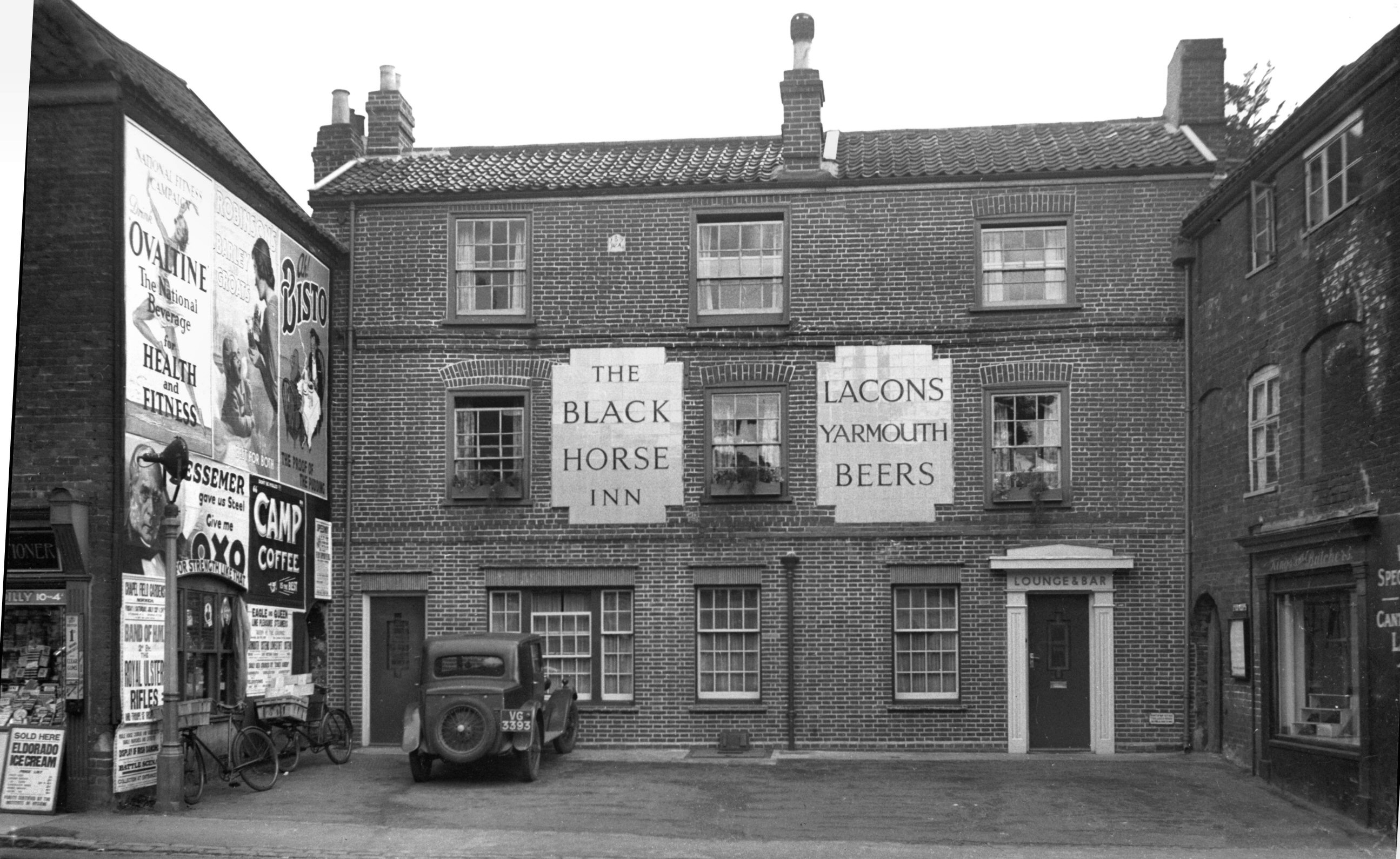
Earlham Rd 50 to 52 Black Horse PH [1826] 1937-07-28
|
|
|
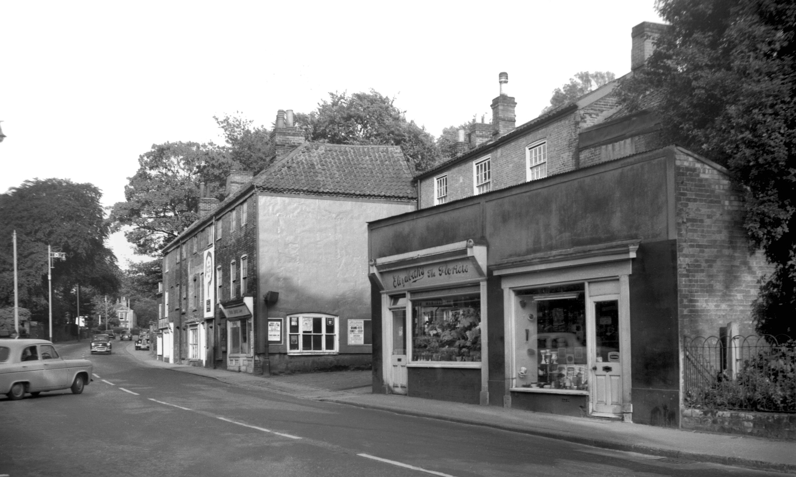
Earlham Rd 54 to 56 [5140] 1967-05-16
|
|
|
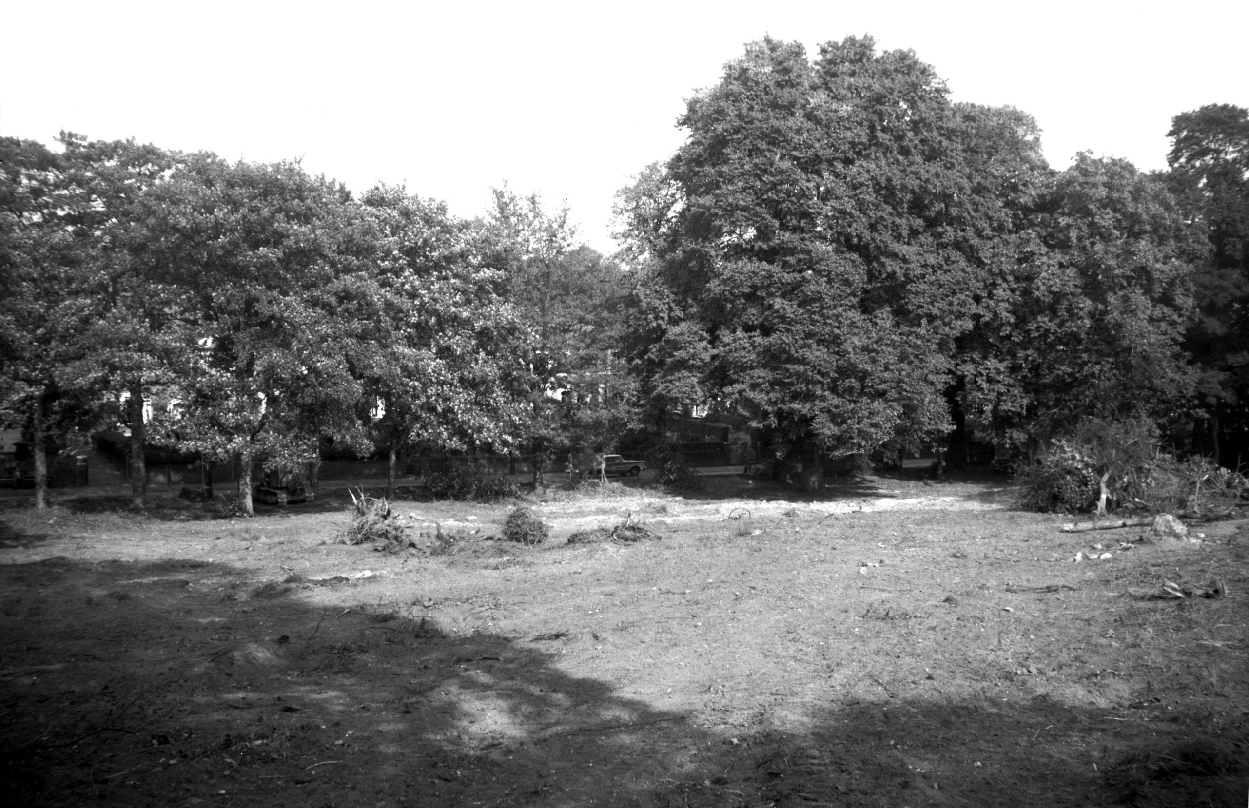
Earlham Rd 170 Earlham House grounds [4586]
1960-10-02
Pictured 1960 after the house had been demolished and
before the erection of a shopping complex. |
|
|
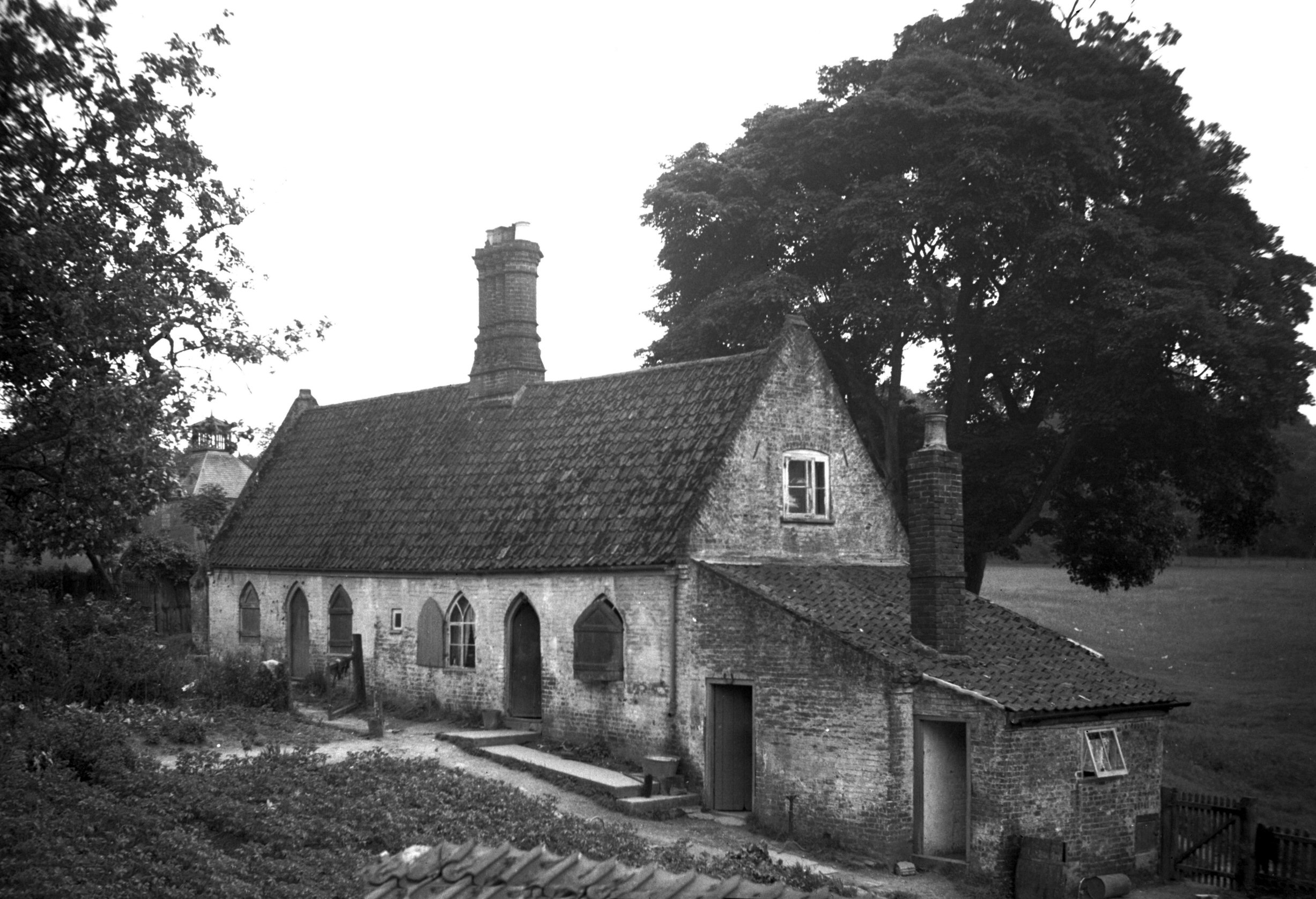
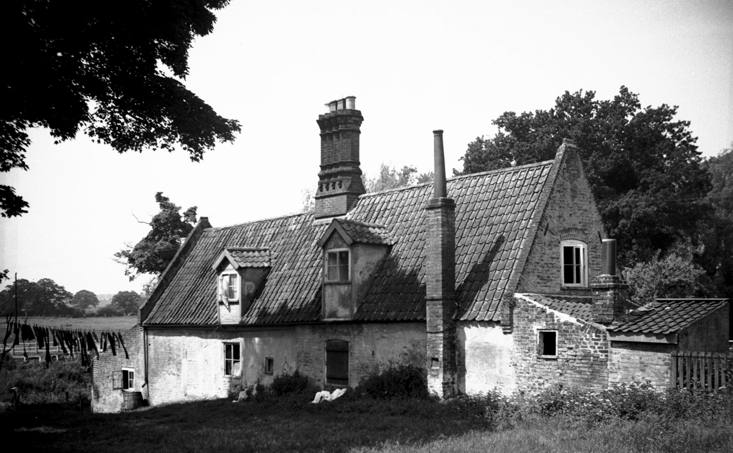
Earlham Rd Earlham Bridge cottages N side [1729]
1937-06-22
At the other and of Earlham Rd in 1937 I photographed
Earlham Bridge Cottages, a pair of semi-detached
dwellings picturesquely situated in a corner of Earlham
Park opposite St Mary's church. Of modest size, they
consisted mainly of ground-floor accommodation, with
additional rooms in the roof space lit by two small
dormers on the south side and a window in each gable end.
Today they would be called chalet bungalows. The windows
and doors on the north side had pointed arches in
"Churchwarden Gothic" style - a popular feature
during the first half of the 19c - while the tall central
chimneystack had shafts of moulded brick such as might
have come from the Costessey brickfields.
At the time of my photograph the Norwich Society was
expressing the hope that the cottages might be made fit
by careful conservation and the addition of modern
amenities, but the idea was not taken up and demolition
eventually followed. |
|
|
Earlham Rd Earlham Bridge cottages S side [1730]
1937-06-22
|
|
|
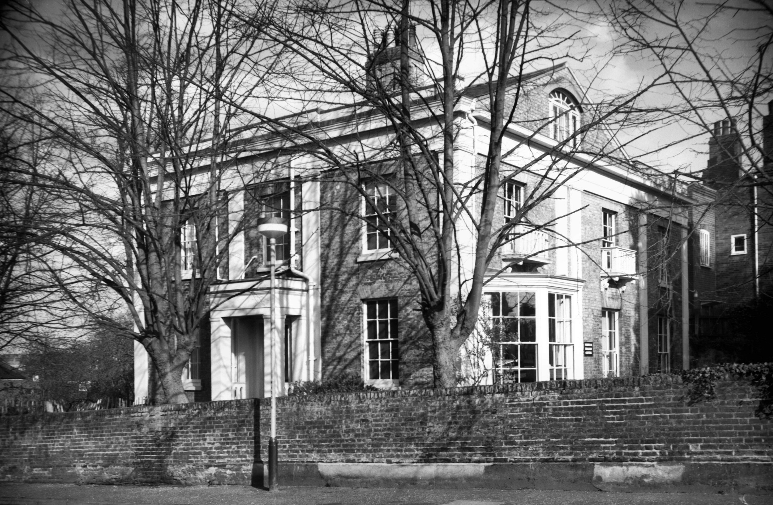
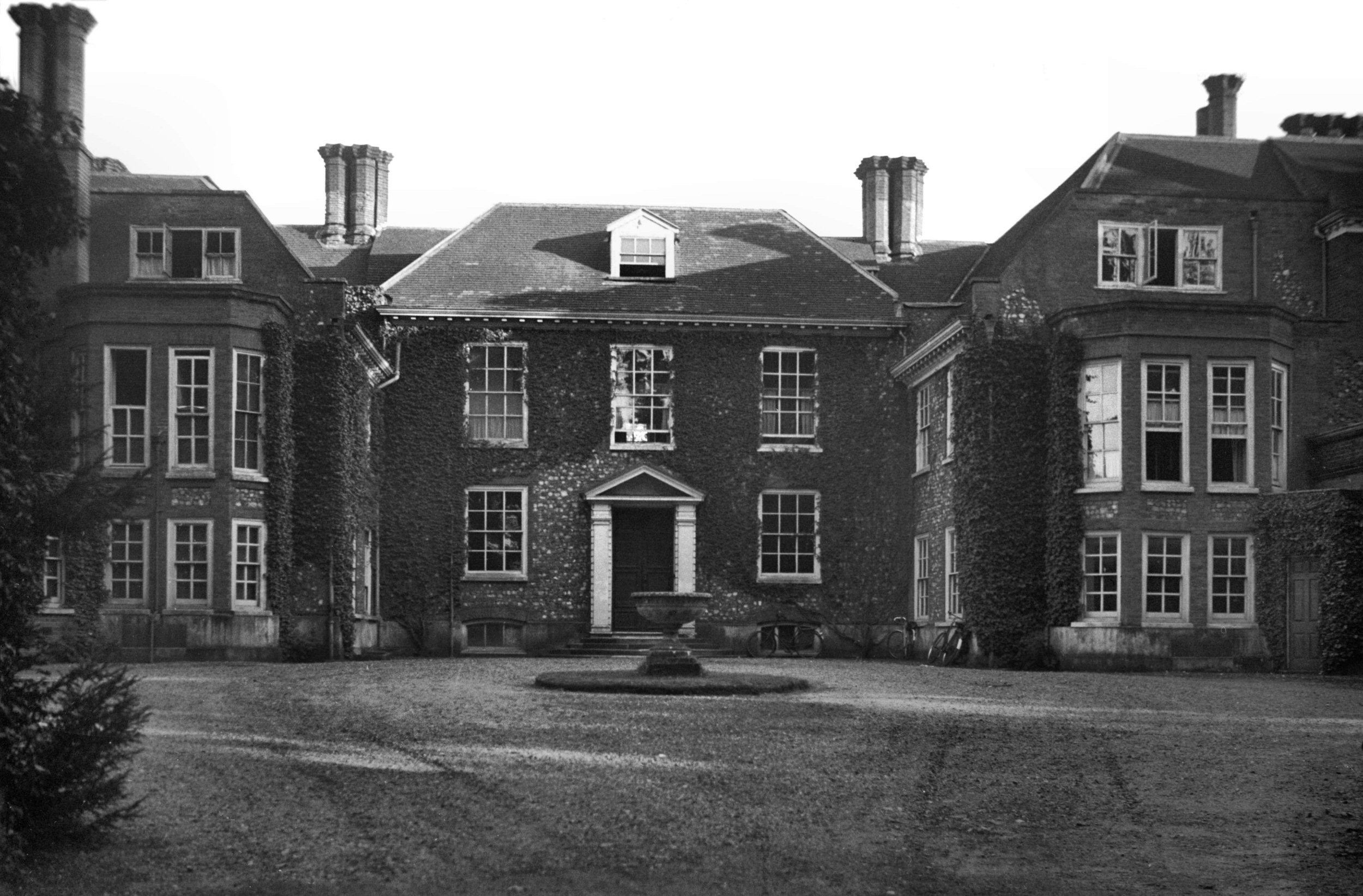
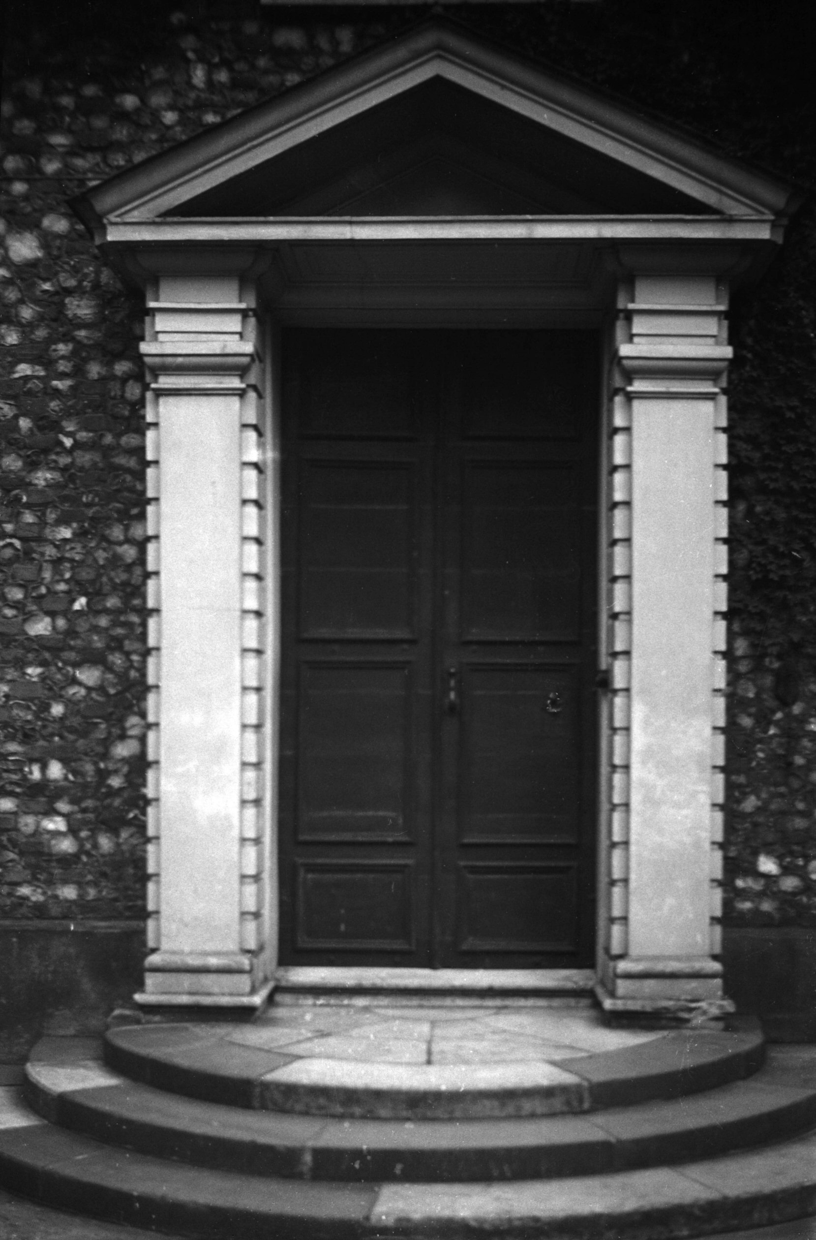
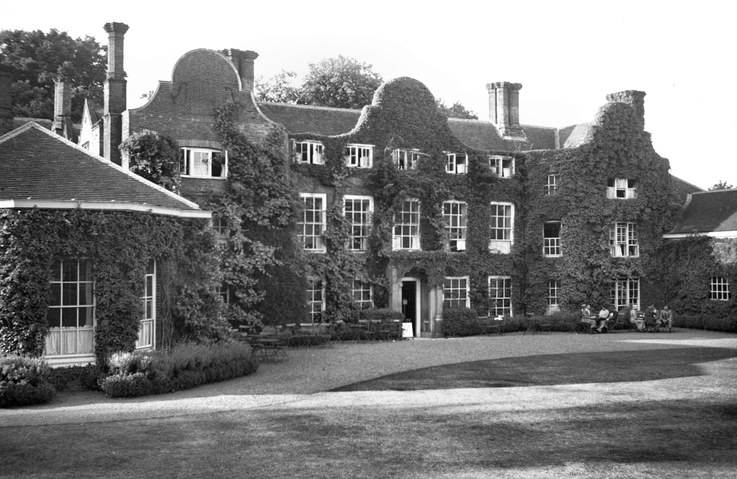
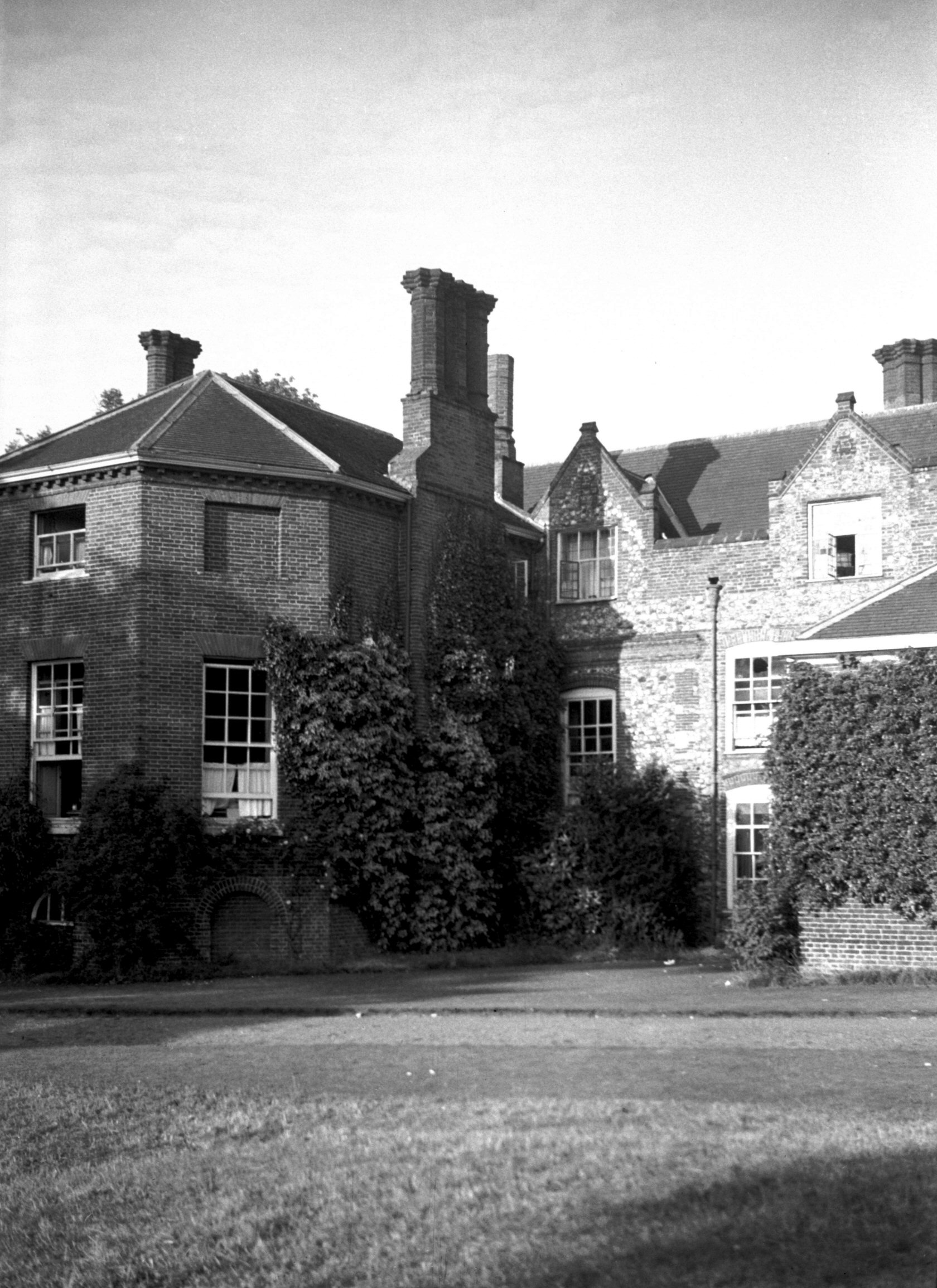
Earlham Rd Earlham Hall north front [0632] 1935-08-10
Built by Roger Houghton in the mid-17th century, it later
passed to Sergeant Waller, who, dying about 1685 left it
to his daughter Elizabeth, married to Francis Bacon.
Thence also by marriage, it passed to the Frank family,
remaining with them until its purchase by Norwich
Corporation in 1925. The Hall is chiefly famous as the
home of the Quaker Gurneys of whom John Gurney was the
first to become tenant about 1786. The family occupied
the property, not as lessees, but as annual tenants for
109 years. Elizabeth Fry the philanthropist was one of
John Gurney's daughters. |
|
|
Earlham Rd Earlham Hall Georgian doorway [0631]
1935-08-10
|
|
|
Earlham Rd Earlham Hall south front [1859] 1937-08-08
|
|
|
Earlham Rd Earlham Hall west side [1860] 1937-08-08
|
|
|
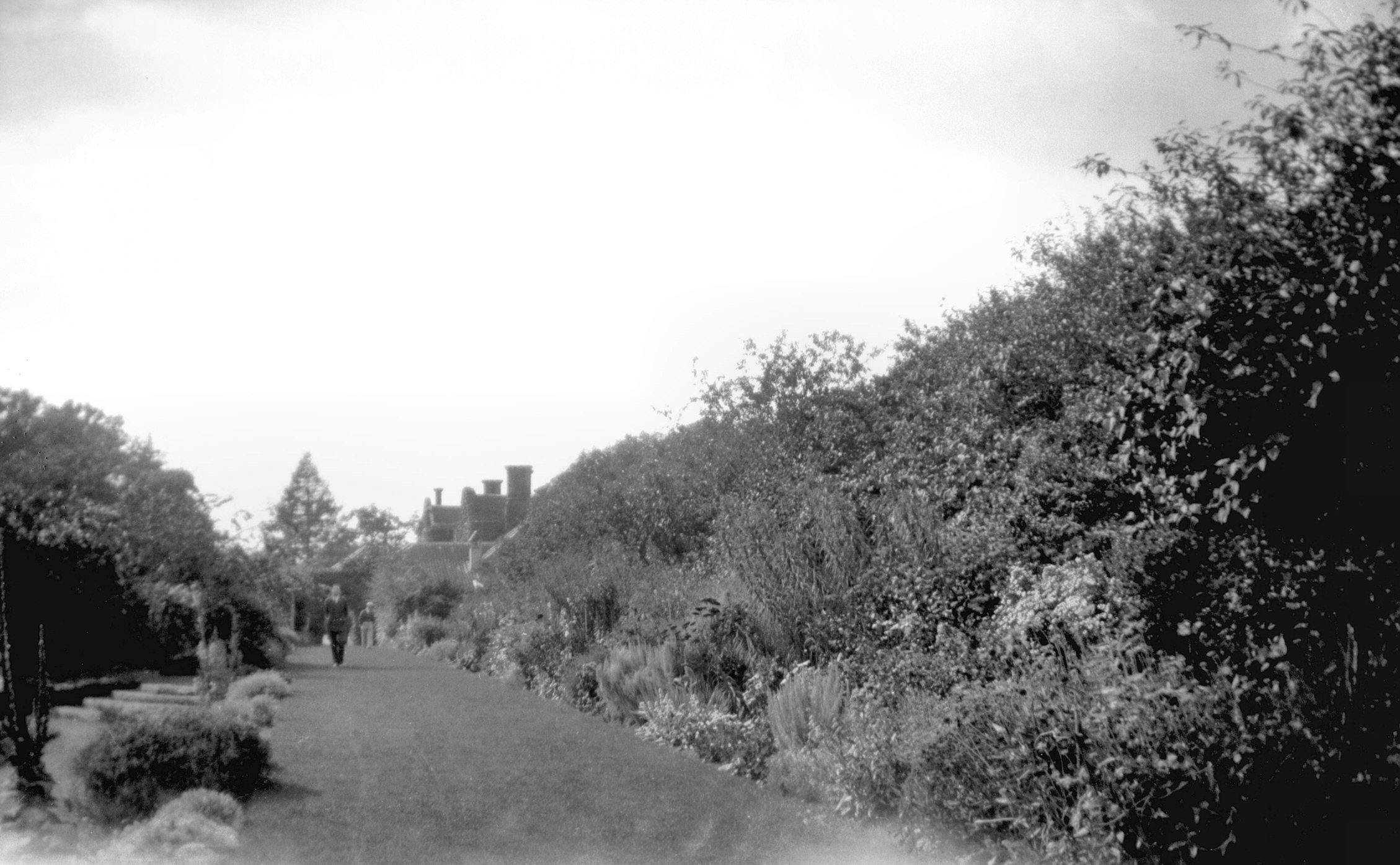
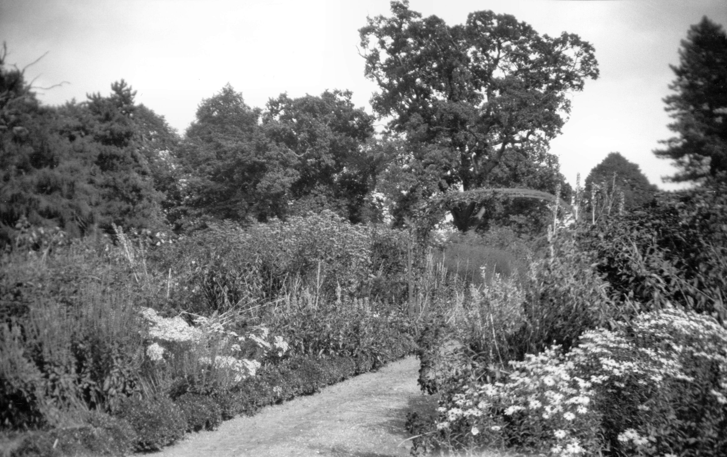
Earlham Park border view west to hall [B168]
1931-00-00
|
|
|
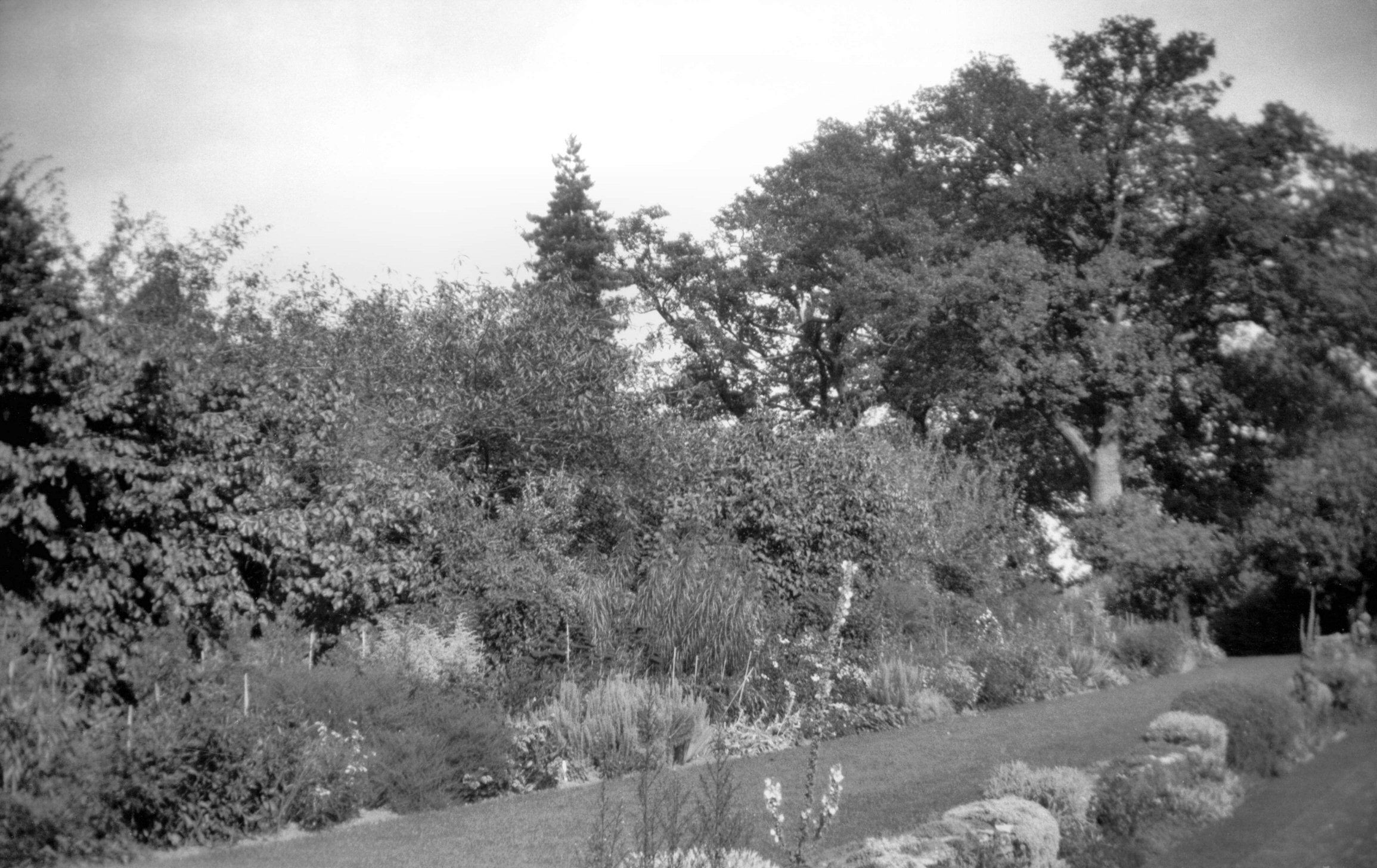
Earlham Park herbaceous border [B167] 1931-00-00
|
|
|
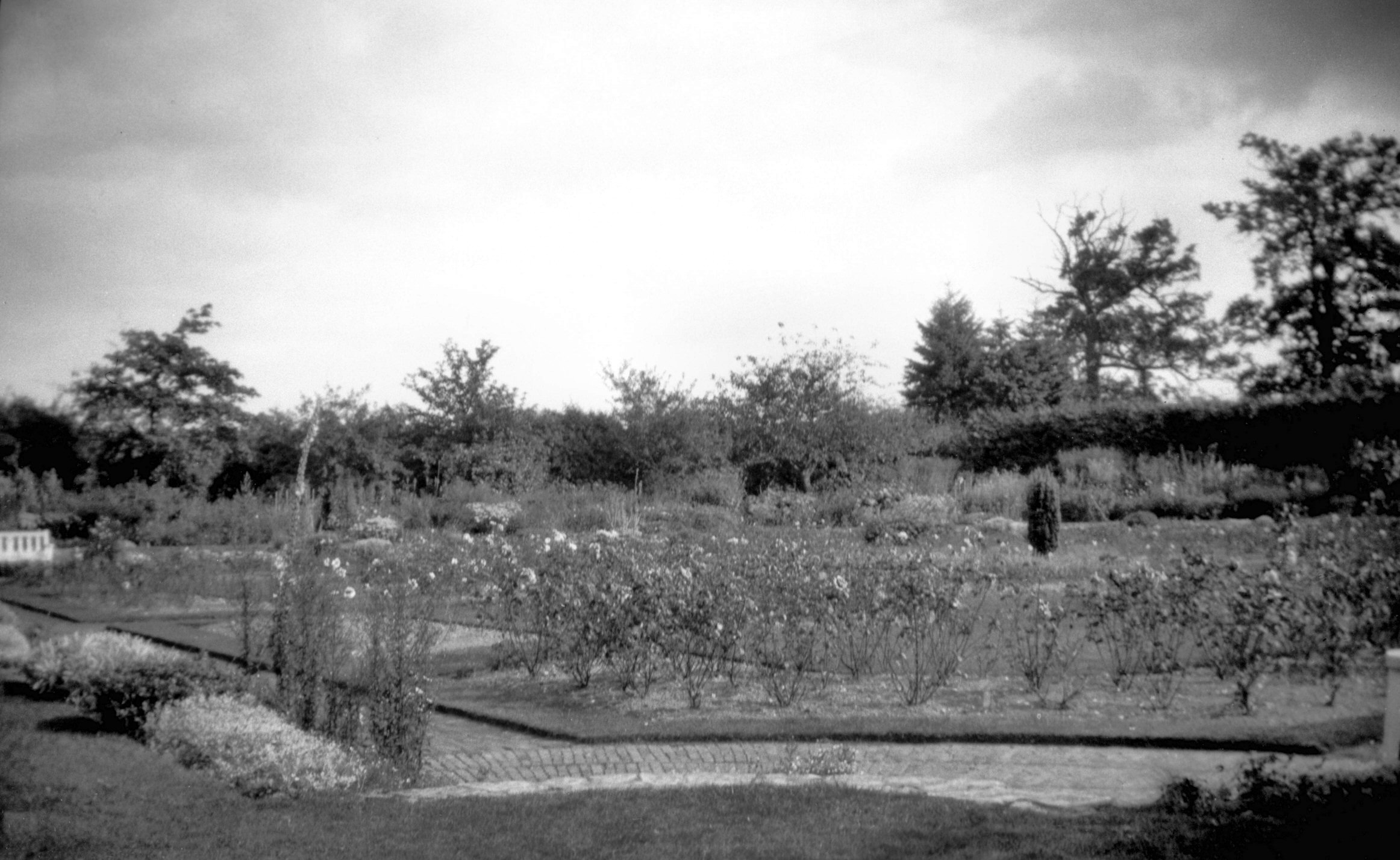
Earlham Park kitchen gardens [B165] 1931-00-00
Purchased by Norwich Corporation for civic purposes in
1925, these were the old-world gardens of the Country
House estate long associated with the Gurneys. |
|
|
Earlham Park rose garden [B166] 1931-00-00
|
|
|
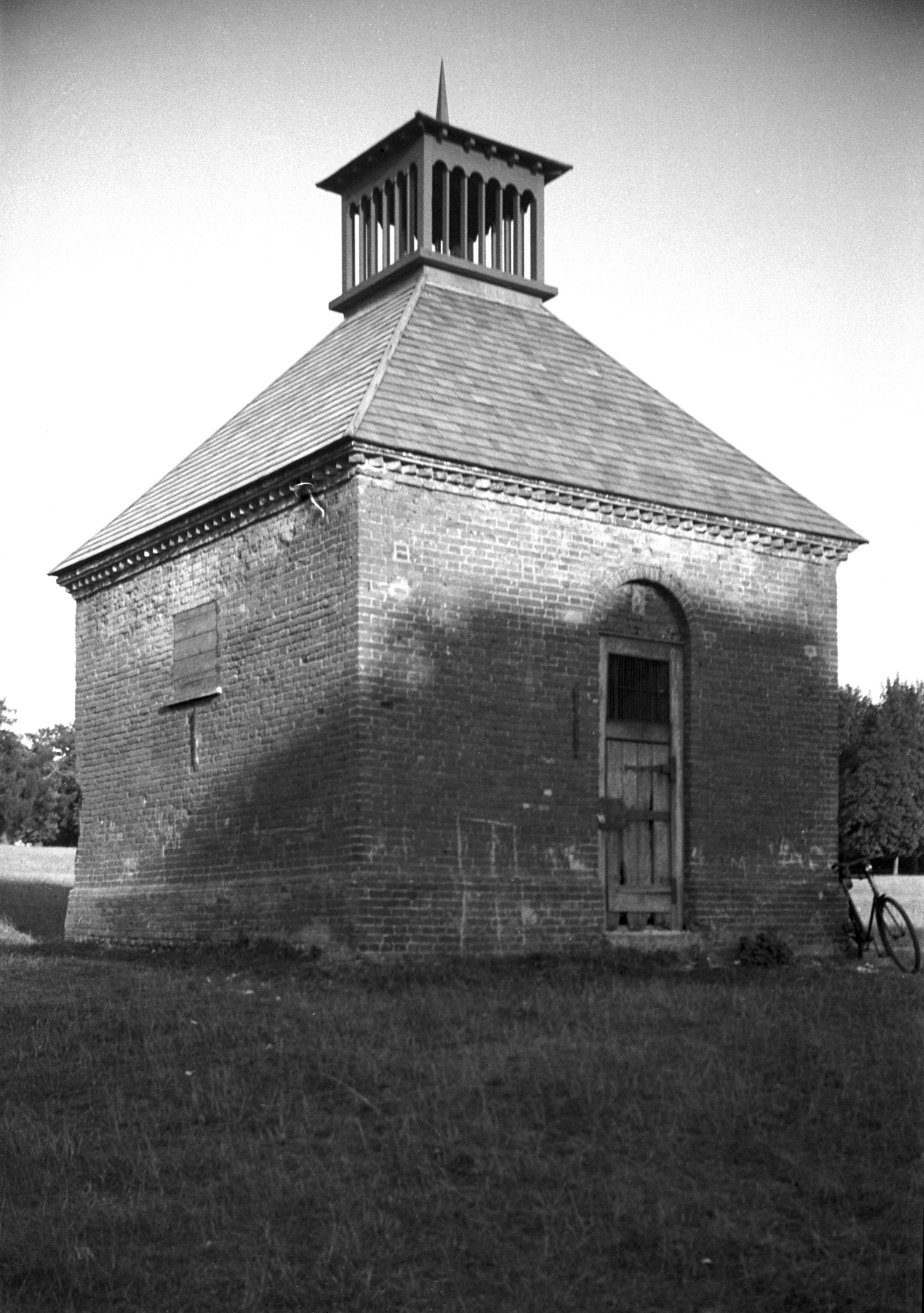
Earlham Rd Earlham Park dovecote [0633] 1935-08-10
|
|
|
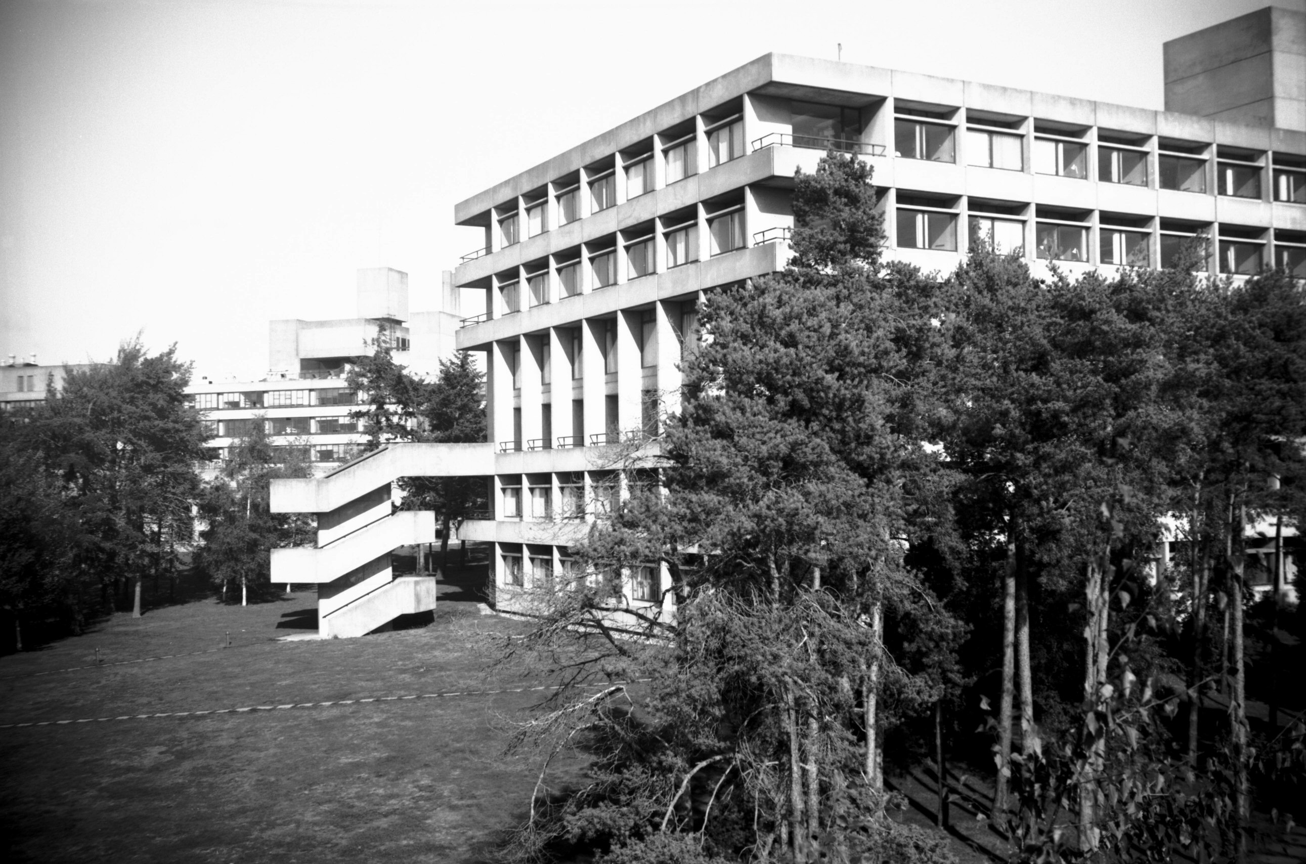
University Library [6655] 1990-10-04
University of East Anglia, built 1965, architect Denys
Lasdun. |
|
|
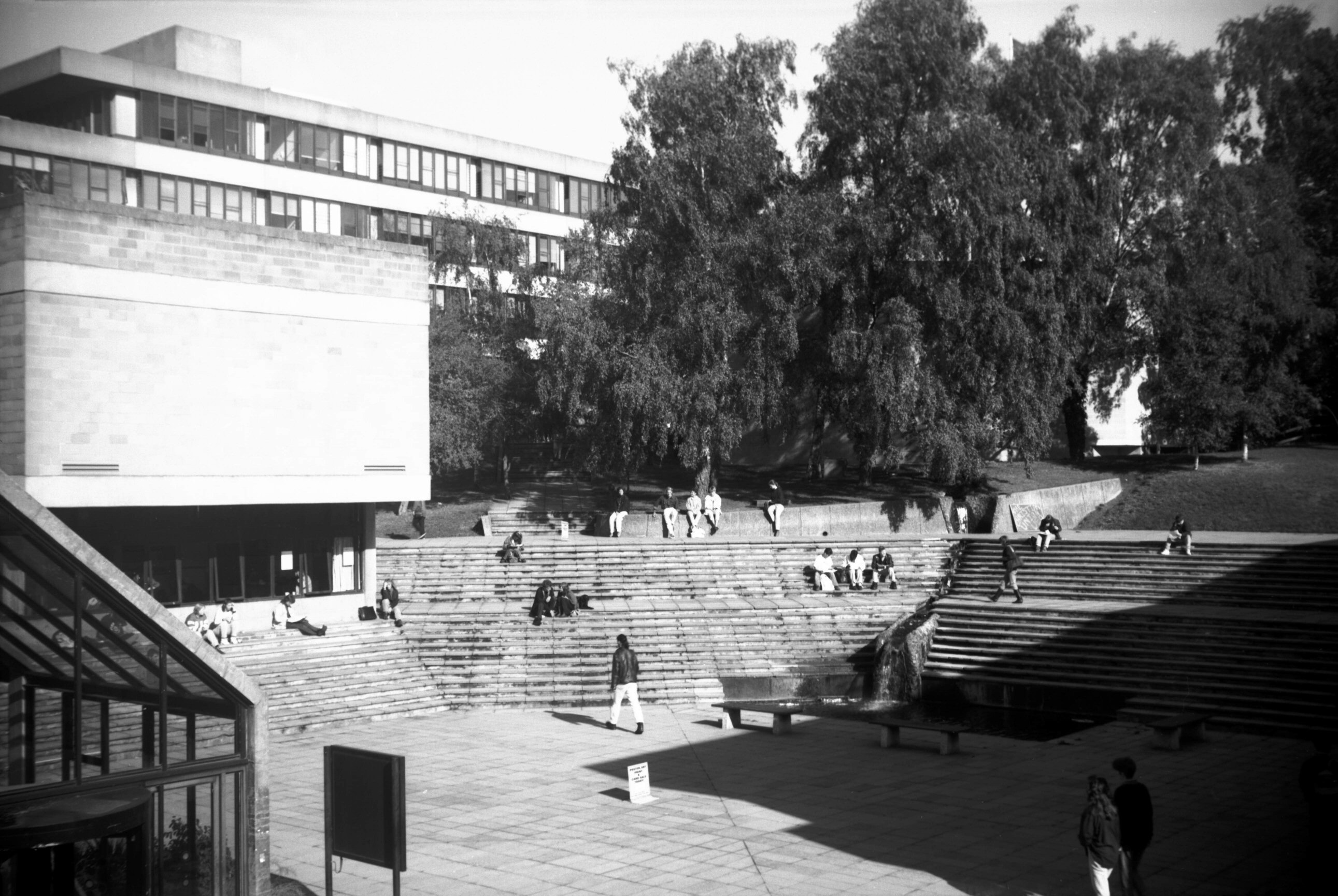
University central court and waterfall [6656]
1990-10-04
|
|
|
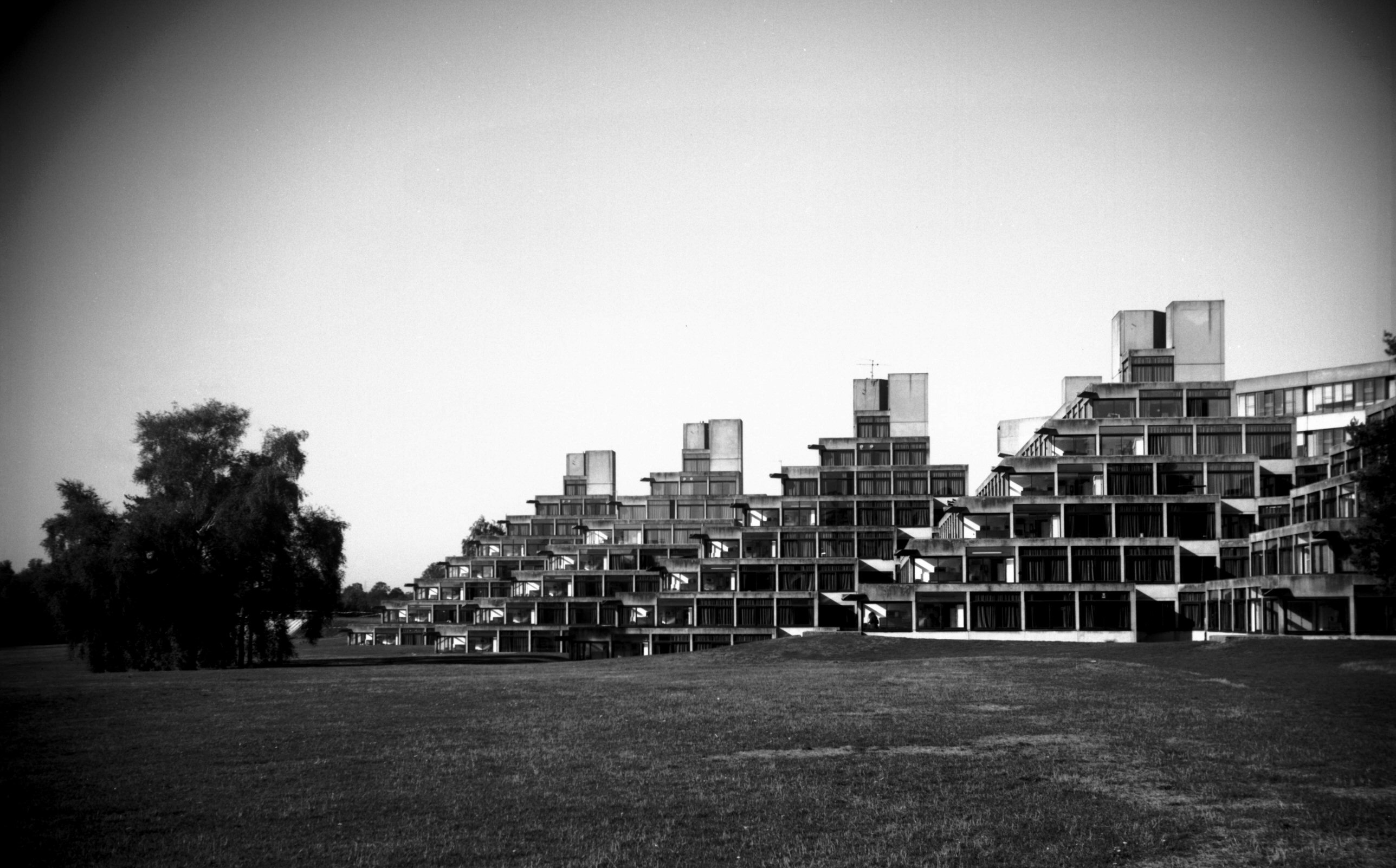
University Norfolk Terrace residences [6652]
1990-10-04
|
|
|
University Sainsbury Centre from south [6653]
1990-10-04
Sainsbury Centre for Visual Arts, built 1976-77,
architects Norman Foster and Kho Liang Ie. |
|
|
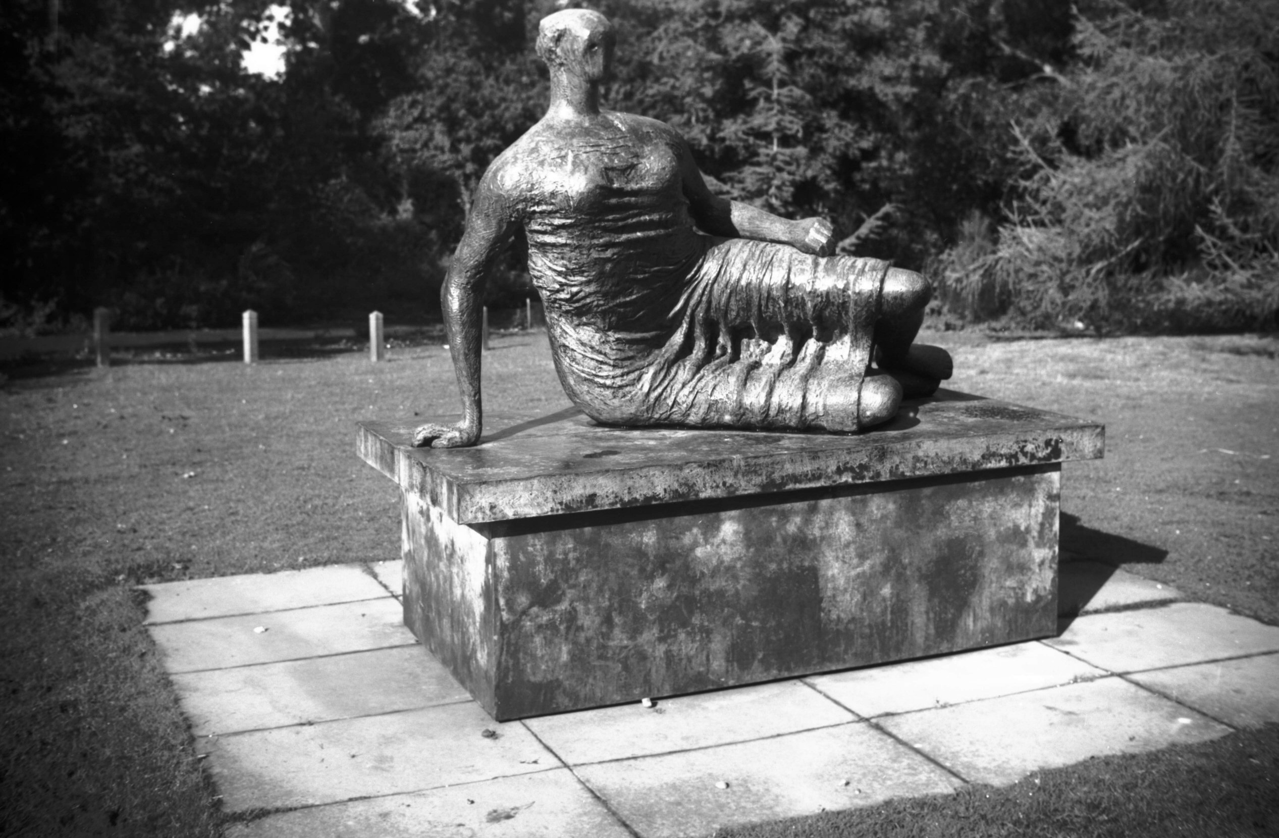
University Henry Moore sculpture [6654] 1990-10-04
Bronze. Sainsbury Centre for Visual Arts. |
|
|
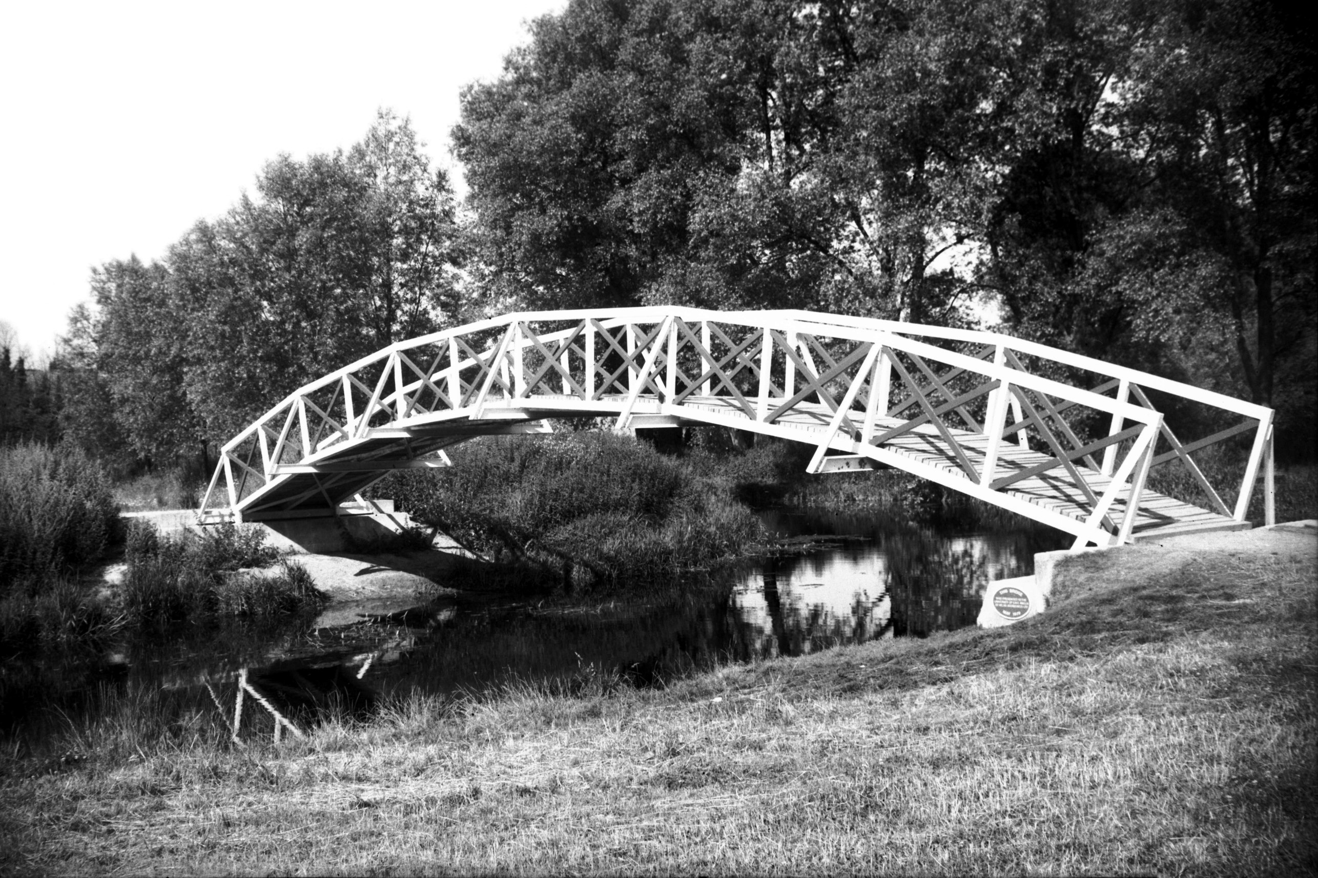
Yare Earlham Park steel footbridge [6022] 1979-07-26
Constructed by Atlas Aggregates Ltd to give access to the
newly formed University Broad. It was opened to the
public on 21st May 1979. |
|
|
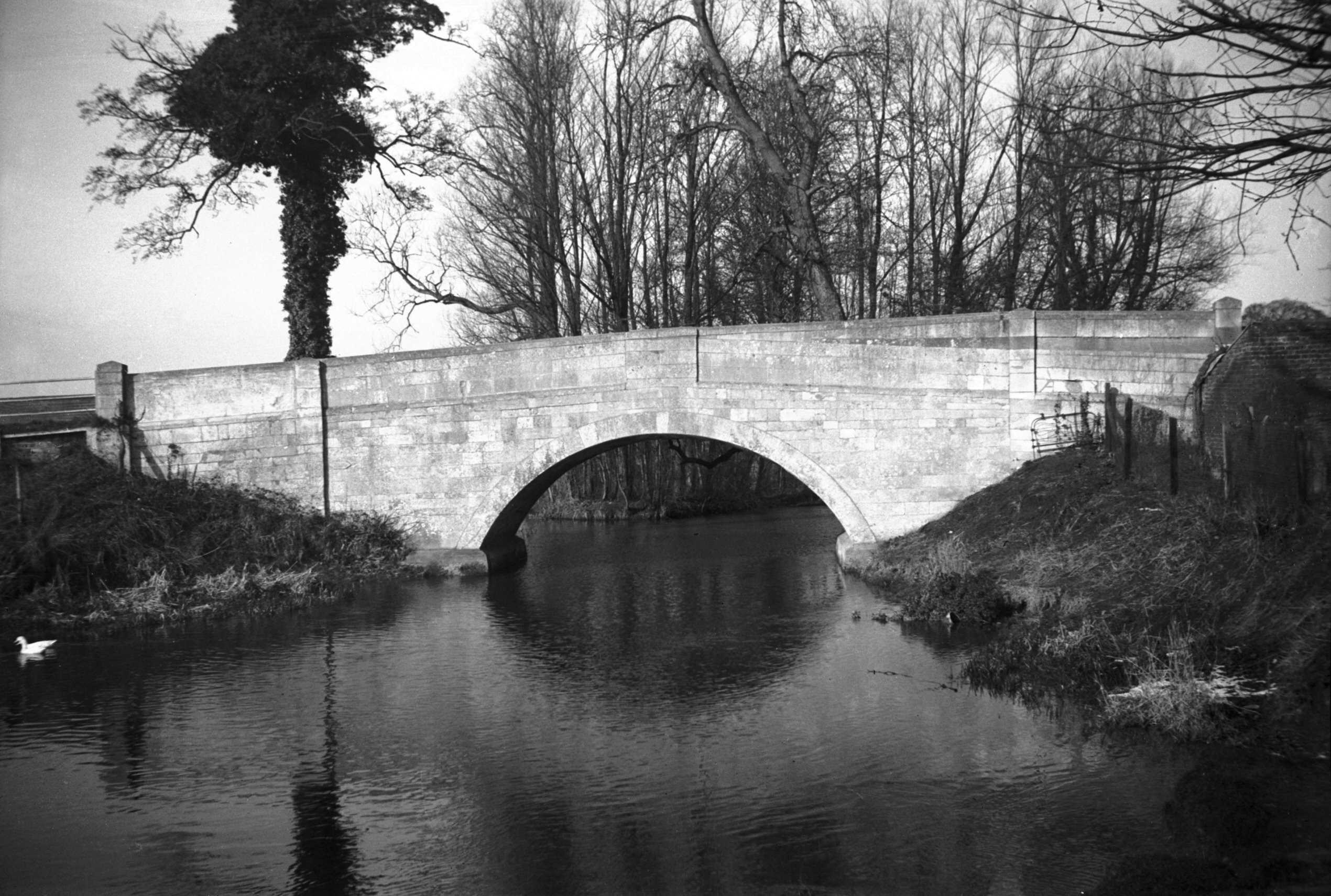
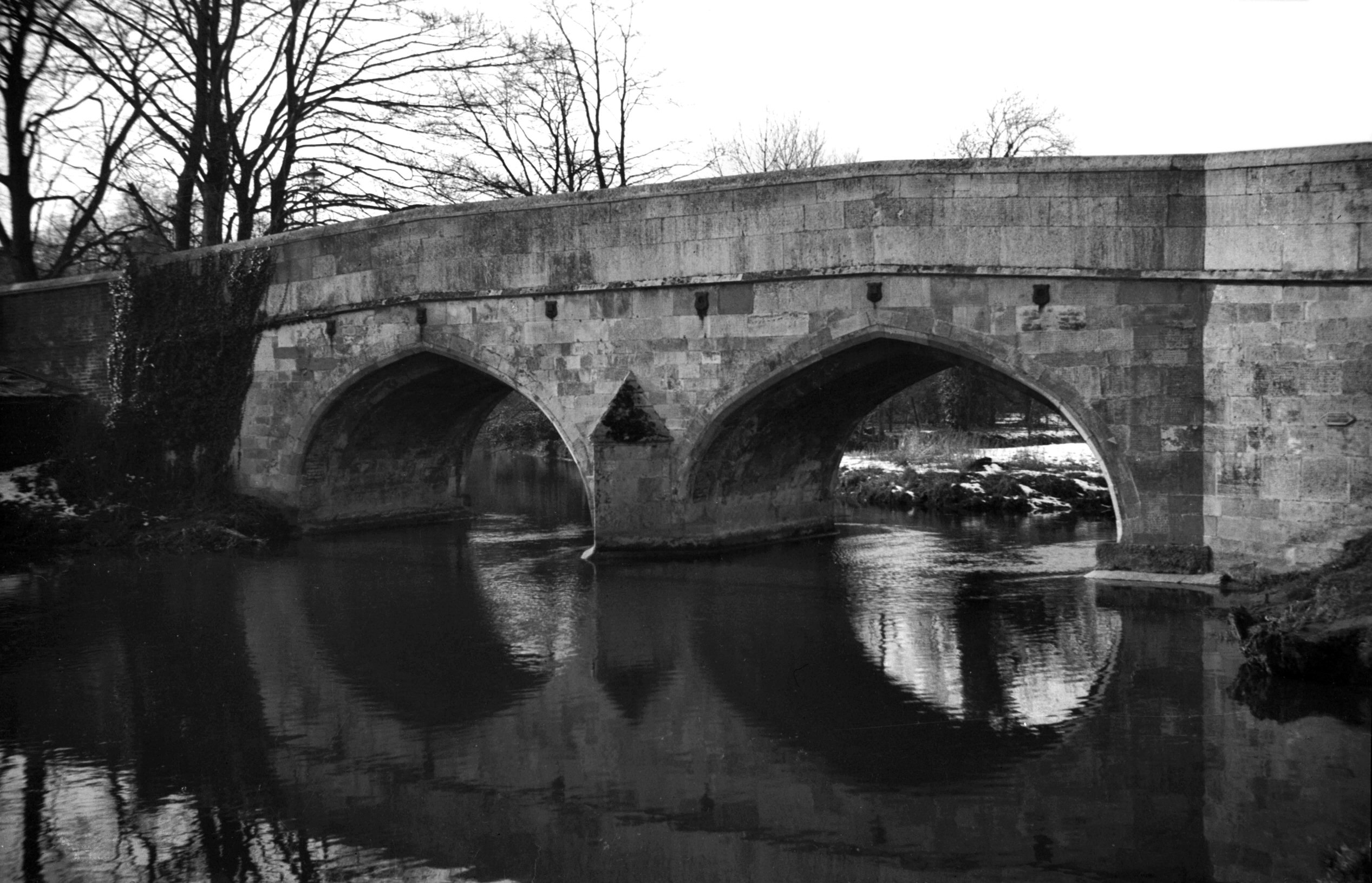
Yare Earlham Bridge south side [0046] 1934-03-01
Although for much of its length to the south and west of
Norwich the River Yare forms the boundary between city
and county, here at Earlham the city encroaches for some
yards beyond the bridge, perhaps because the river has
taken a different course at this point since the boundary
was fixed. Nevertheless, under the Tonnage Act of 1726
the county undertook to see to the maintenance and repair
of the bridge here, along with those at Cringleford,
Harford and Old Lakenham. Later on the railway company
took over Old Lakenham Bridge, after raising the road to
make a better approach to their adjoining bridge over the
Norwich-Ely-Peterborough line.
Of Earlham Bridge, the historian Francis Blomefield had
this to say, that it: "was built of Stone in 1502,
by the Will of Tho. Bachcroft of Little Melton, who gave
his Estate to be sold for that Purpose, and to make a
Stone Cross by it, and put on it a Scripture, desiring
the Passengers to pray for his Soul, and the Souls of
Margaret his Wife, his Father's and Mother's, and of Tho.
Northwold and Margaret his Wife. It was rebuilt in 1579,
and now again in 1744."
An even earlier bridge here is mentioned by name in 1461
in the draft of a charter setting forth the city
boundaries.
The 1744 bridge comprised a single arch of stone, with
the road sloping gently down from east to west. By 1961
its narrow width had rendered it quite inadequate to take
the considerable increase in road traffic, and plans were
drawn up to replace it. The new bridge, with both a wider
carriageway and increased river span, was completed and
opened to traffic by the beginning of 1964; the old
bridge, which remained standing a few yards to the north,
was fenced off, but it was not to remain so for long.
Because of vandalism and natural deterioration, as well
as the high cost of maintenance that its retention would
have entailed, it fell beneath the combined onslaught of
a dragline and ball and chain in August 1971. |
|
Eaton St: |
| |
From
Newmarket
Rd towards Cringleford
passing Church Lane Eaton
North side |
|
|
Yare Earlham Bridge south side [4775] 1964-06-27
|
|
|
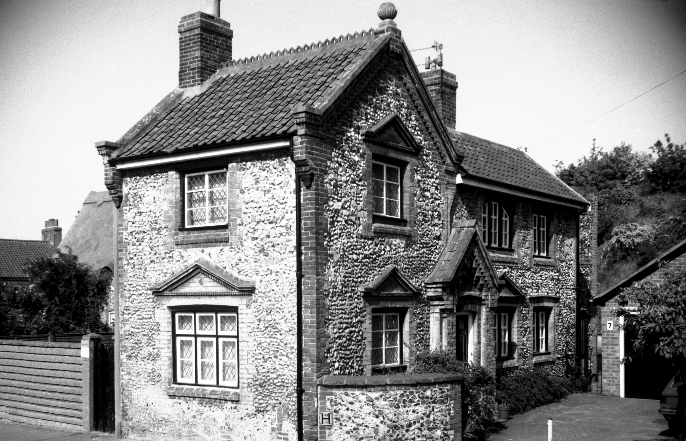
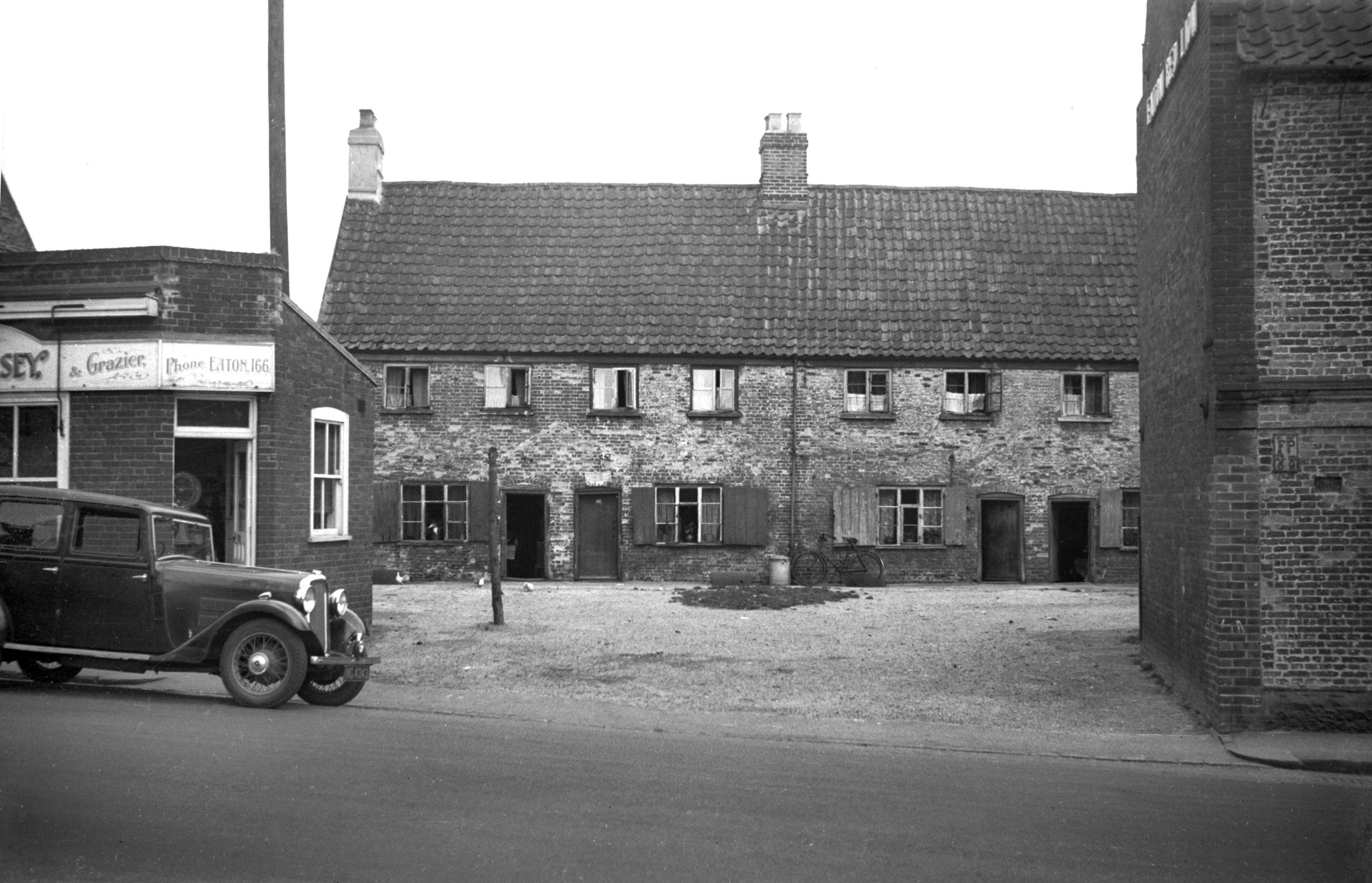
Eaton St 7 [6783] 1992-05-16
|
|
|
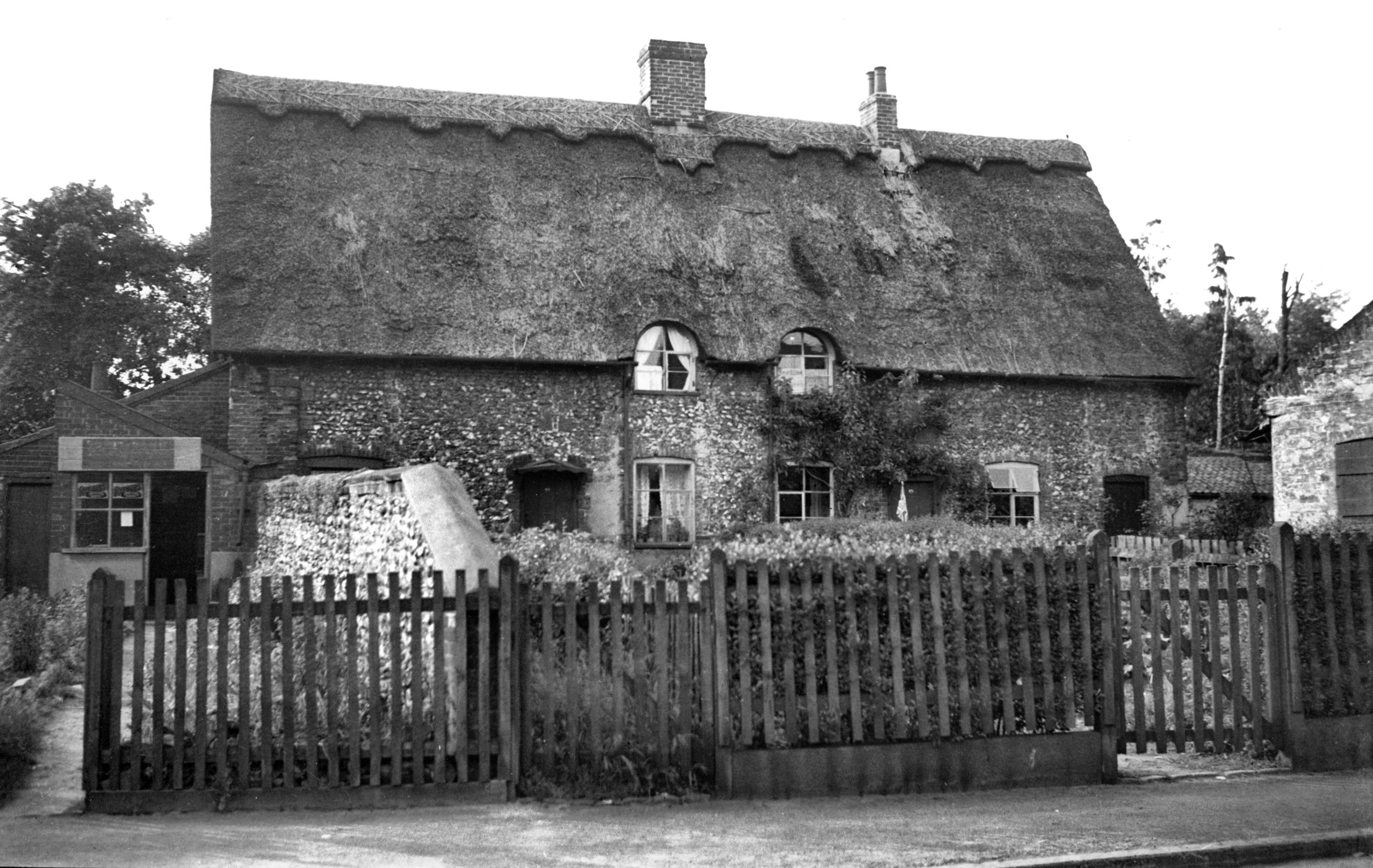
Eaton St NW side thatched house [1659] 1937-05-31
|
|
|
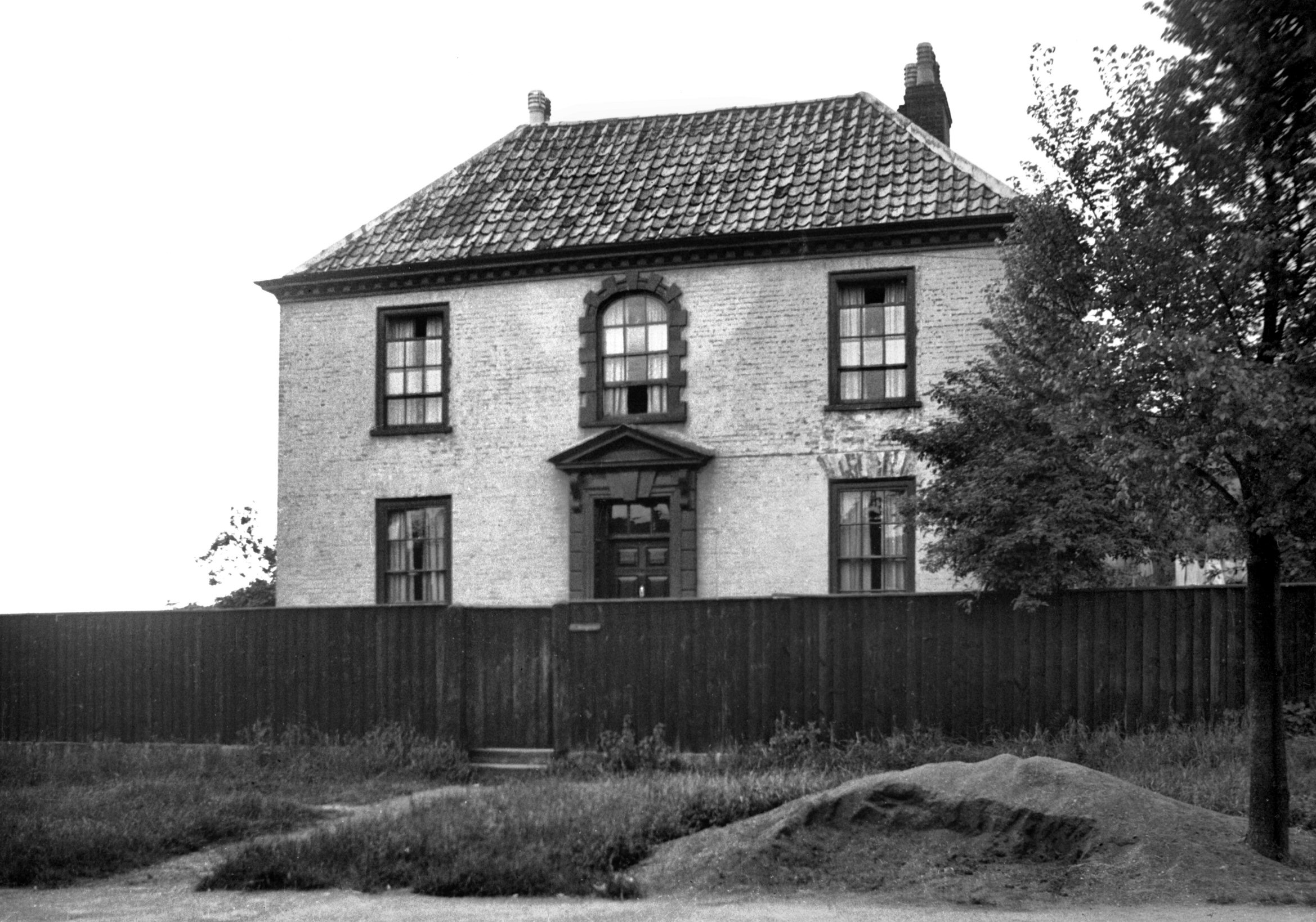
Eaton St NW side Georgian house [1664] 1937-05-31
|
|
|
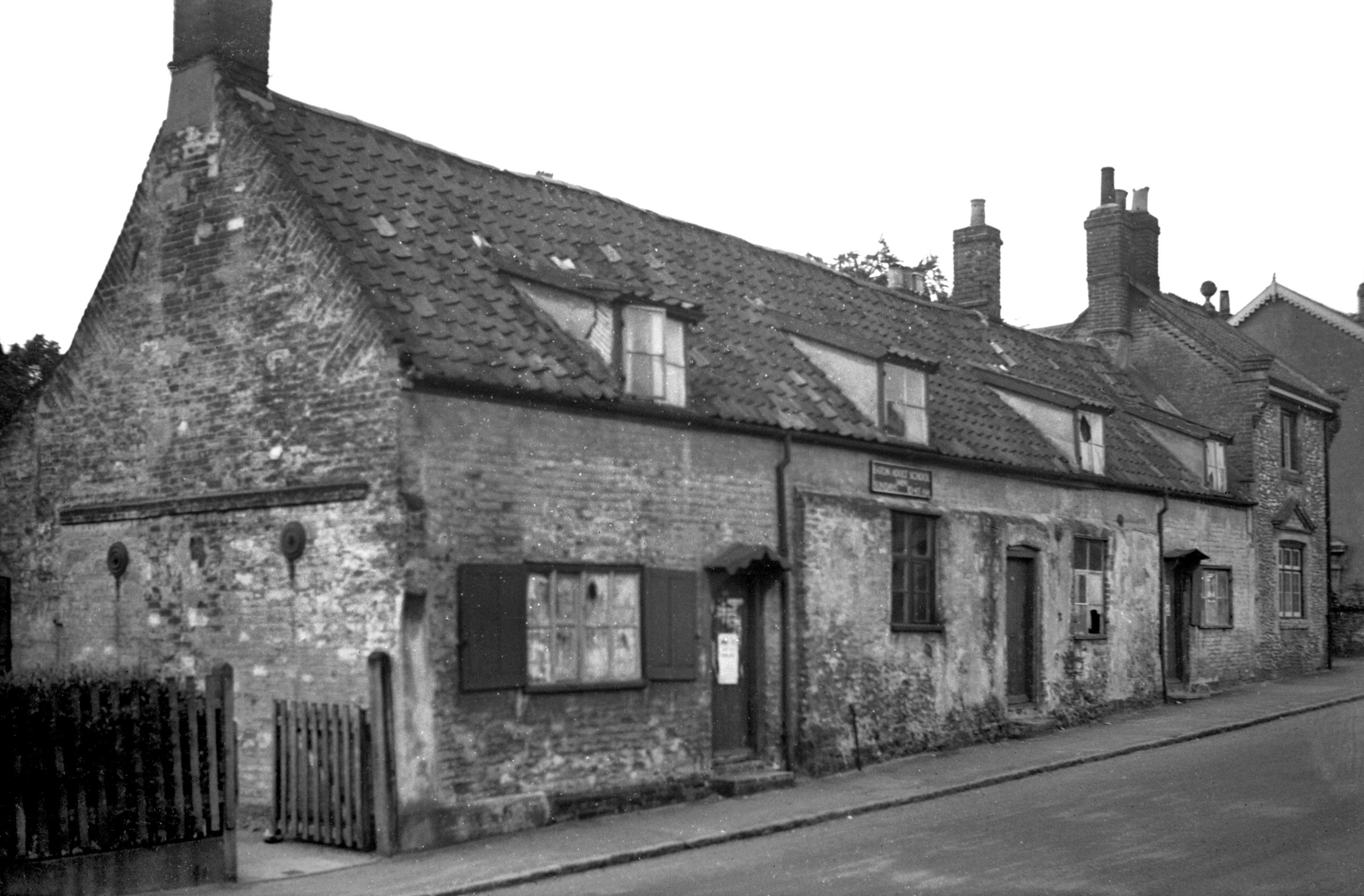
Eaton St NW side old cottages [1658] 1937-05-31
|
|
|
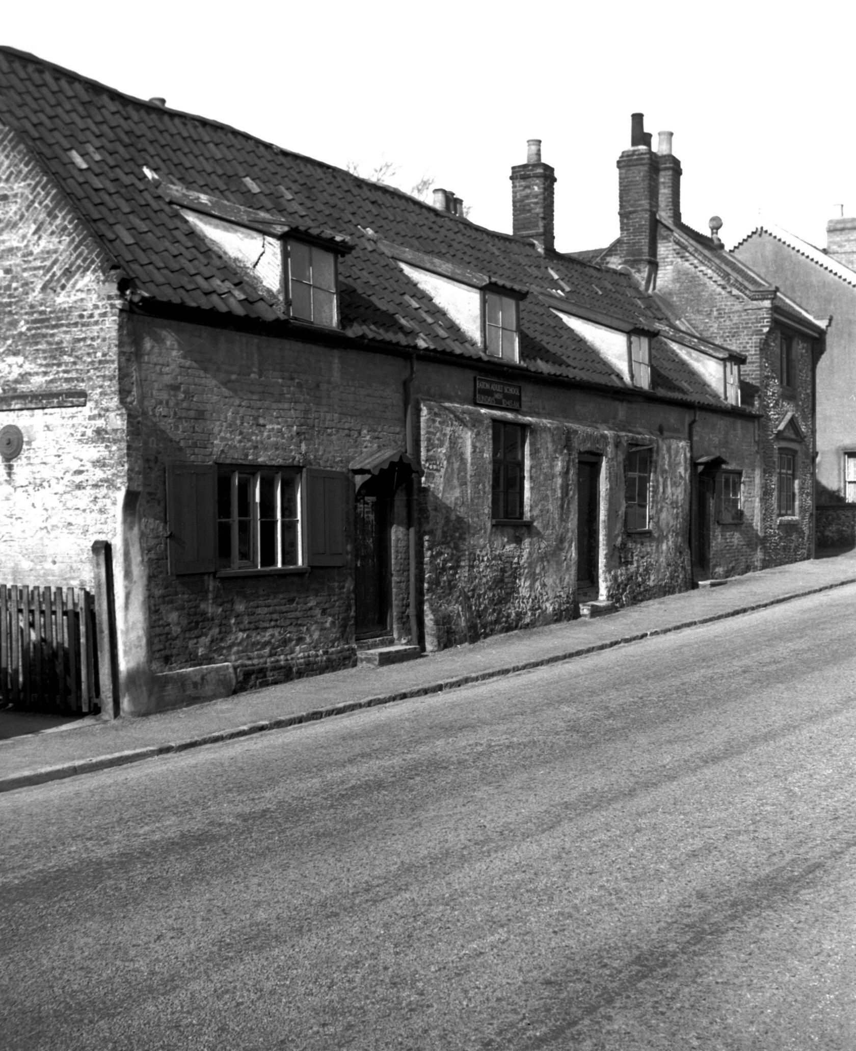
Eaton St NW side old cottages [2887] 1939-03-03
|
| |
South
side |
|
|
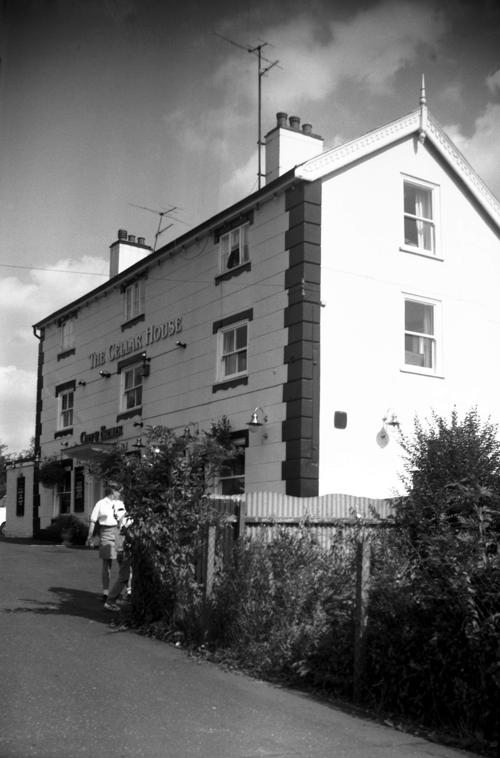
Eaton St 2 Cellar House PH [6521] 1988-08-26
|
|
|
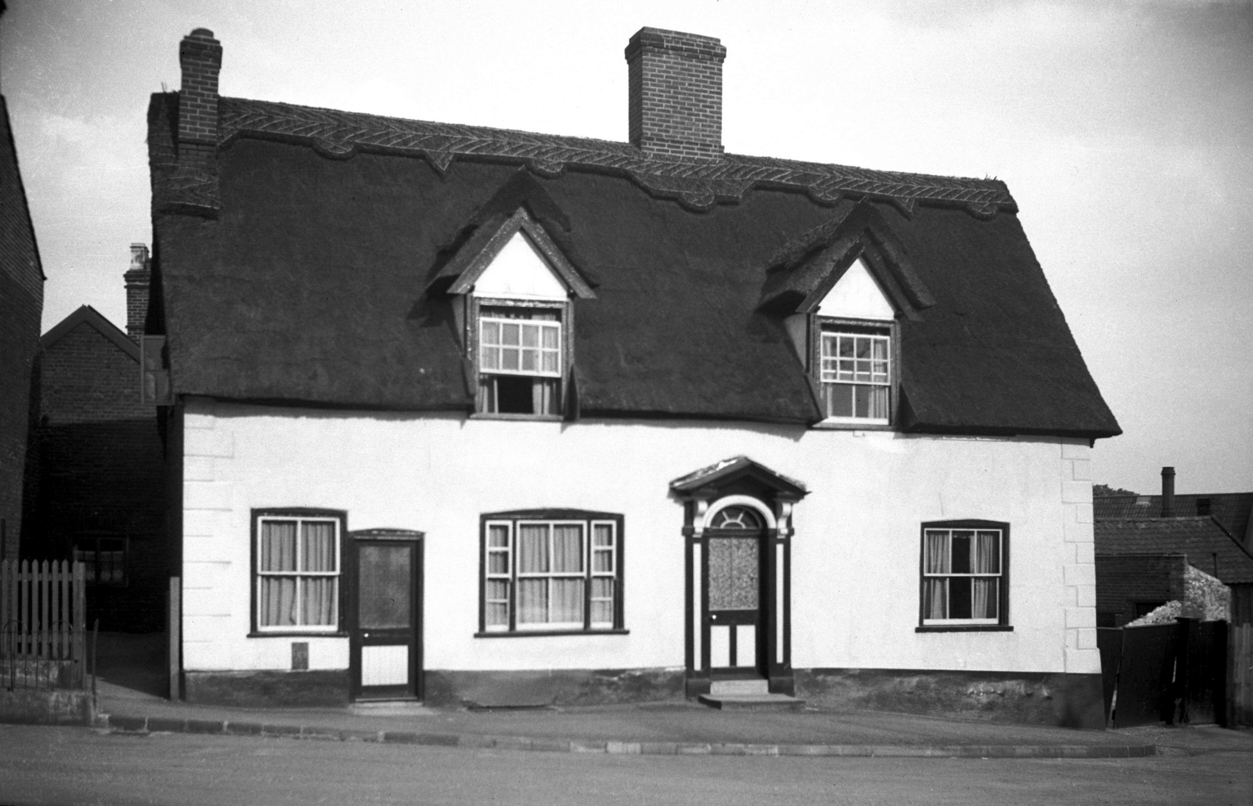
Eaton St Church Lane thatched cottage [1660]
1937-05-31
|
|
|
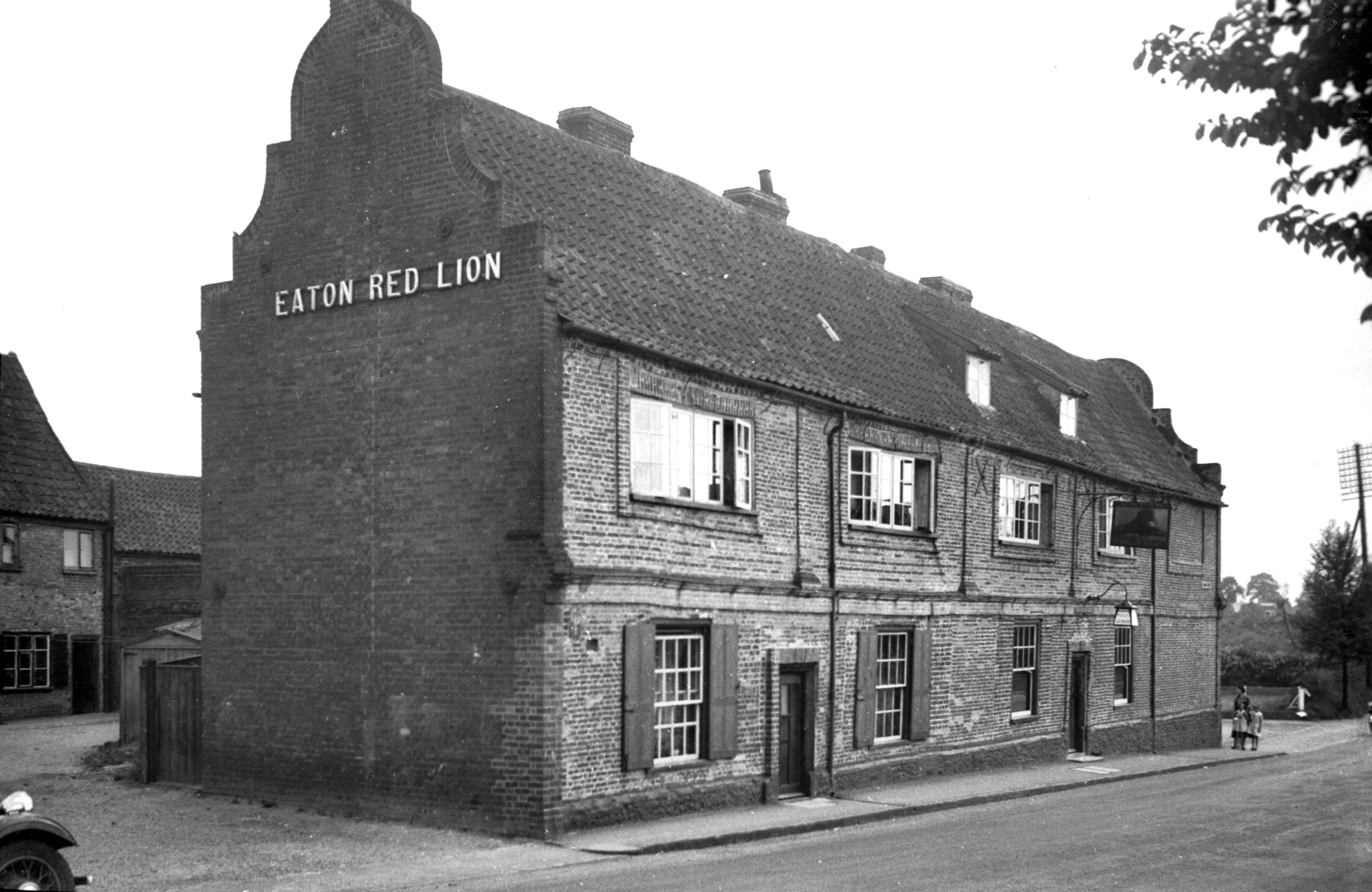
Eaton St 52 Red Lion PH [1663] 1937-05-31
|
|
|
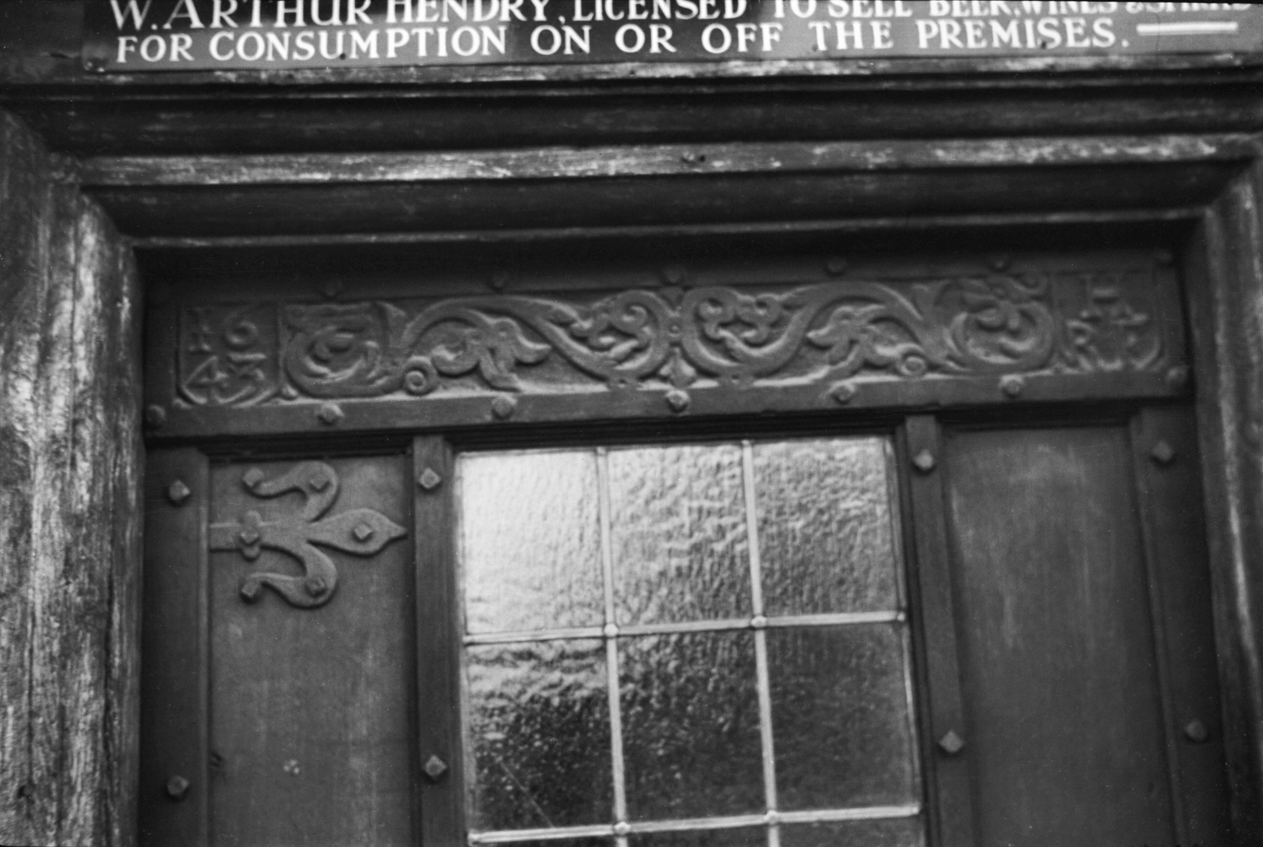
Eaton St 52 Red Lion PH doorway lintel [2885]
1939-03-03
The carved lintel above the doorway dated 1643 with
initials "R.F.H." of Robert Holmes, Sheriff of
Norwich 1646 who had a brewery and malting house here. |
|
|
Eaton St 52 Red Lion PH west side [2886] 1939-03-03
|
|
|
Eaton St Red Lion Yard rear old cottages [1662]
1937-05-31
|
|
|
Yare Cringleford Bridge east side [0047] 1934-03-01
Constructed 16c. Of previous structures we have little
information. A bridge here is mentioned in a will of
1272, and in 1519 a flood broke down the bridge then
here. This was probably when the present bridge was
erected. Built of stone it has two four-centred arches
spanning a distance of 54 feet with a width of 15 feet
between the parapets. |
|
|
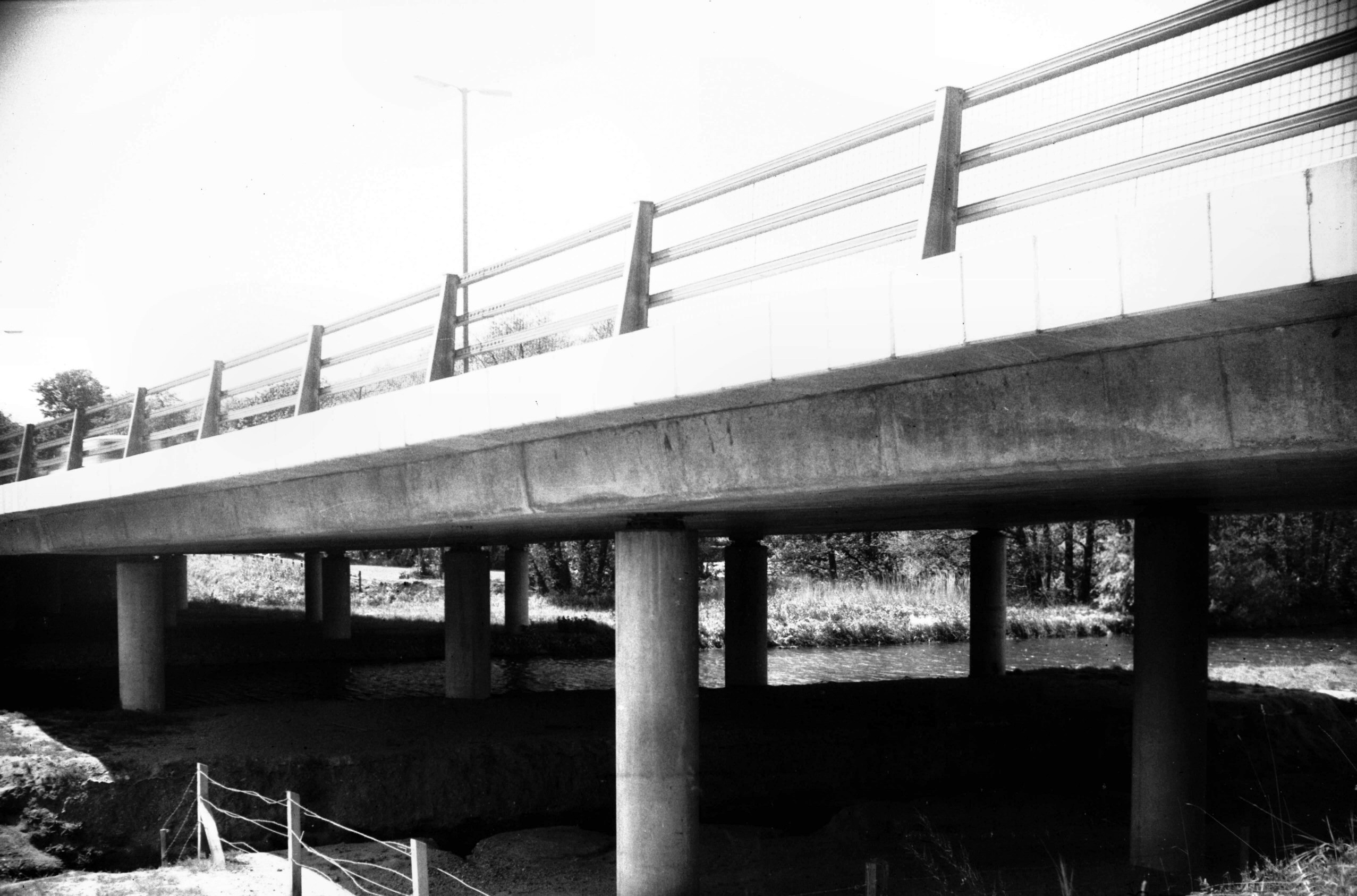
Yare Cringleford Bypass Bridge [5904] 1978-05-25
Over a period of many years Cringleford bridge was
totally inadequate for the volume of traffic carried by
the A11 trunk road (Norwich to Newmarket) and in 1975
Eaton and Cringleford were bypassed, the road crossing
the river higher upstream by a bridge of reinforced
concrete. |
|
Eleanor Rd: |
| |
From
Grove Walk |
|
|
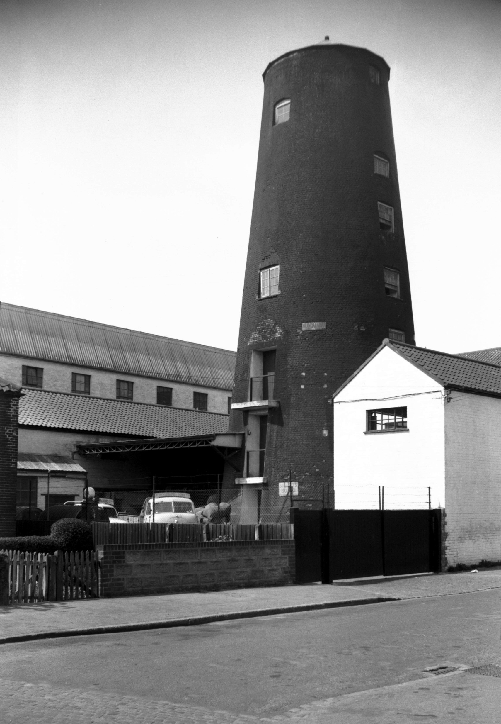
Eleanor Rd Lakenham Peafield Mill [4439] 1956-05-21
The tower mill was first introduced about 1500 and
rapidly became a familiar feature of the countryside.
This one at Lakenham, built in 1824, had a brick tower
which contained the machinery. Standing 80 feet high and
of eight storeys, its walls were 4 ft 6 ins thick at the
base. Above it was the cap, fly wheel and sails, the
latter nearly 100 feet in span. This superstructure
rotated on a steel track with steel runners to keep the
sails facing the wind. In about 1914-15 the sails came
off, after which electric power was installed, but the
tower continued to be used as a silo for grain. |
|
|
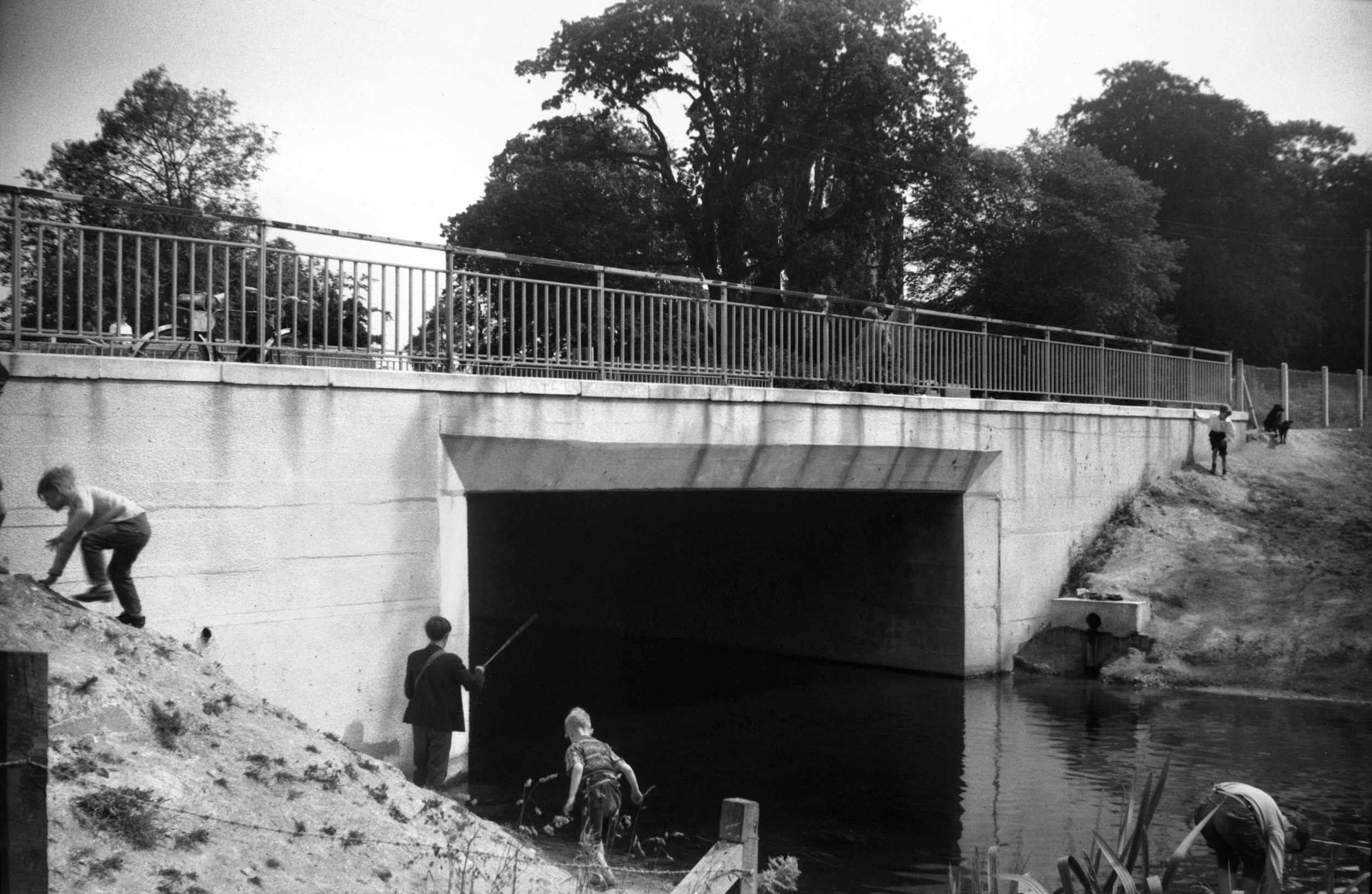
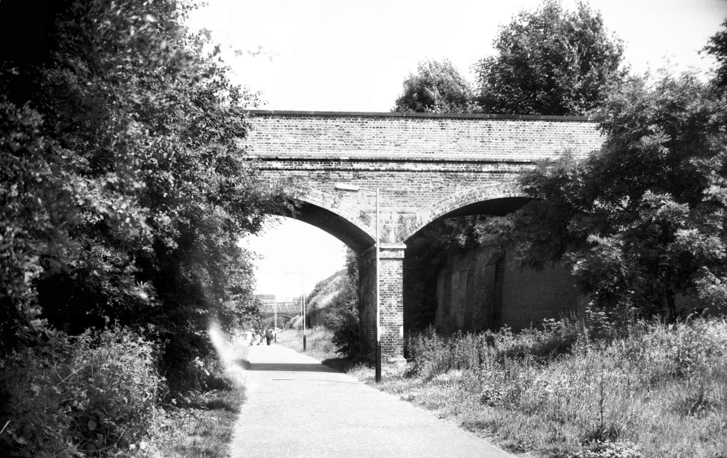
Eleanor Rd bridge over Lakenham Way [7832] 2001-06-26
Site of former railway line from Victoria station to
junction with main London line. |