|
Haymarket: (Hay Hill) |
| |
From
Market
Place / White Lion St to Orford Place and William Booth St and St Peter's St |
|
|
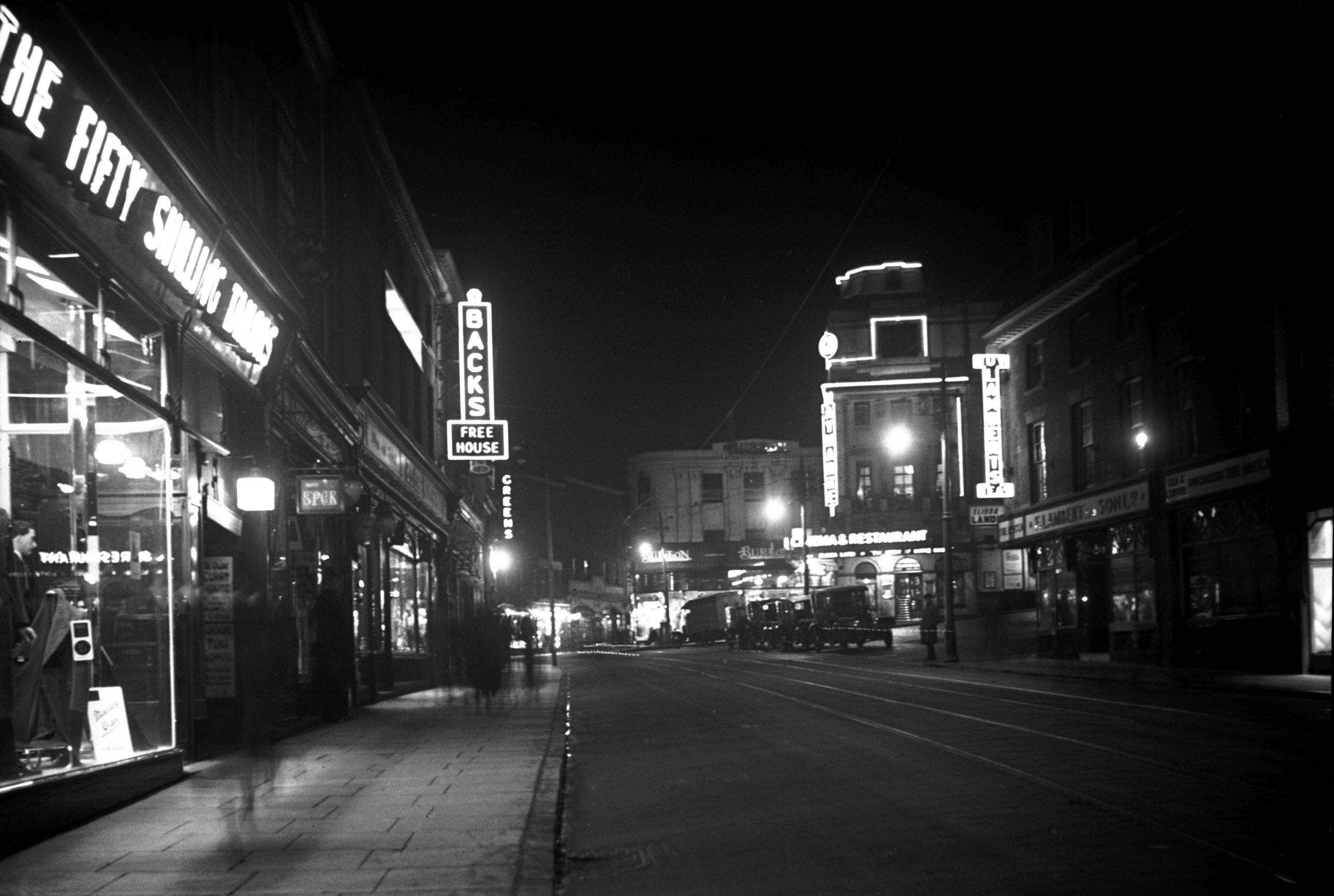
Haymarket view south from White Lion St [0364]
1935-02-20
|
|
|
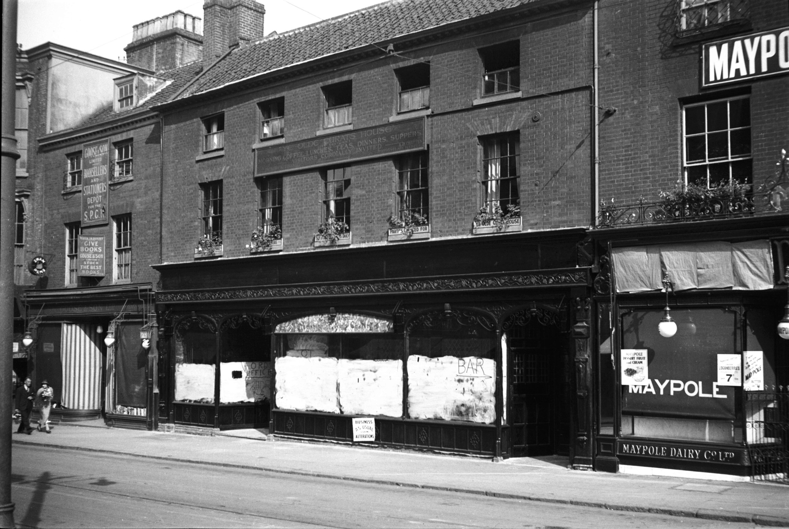
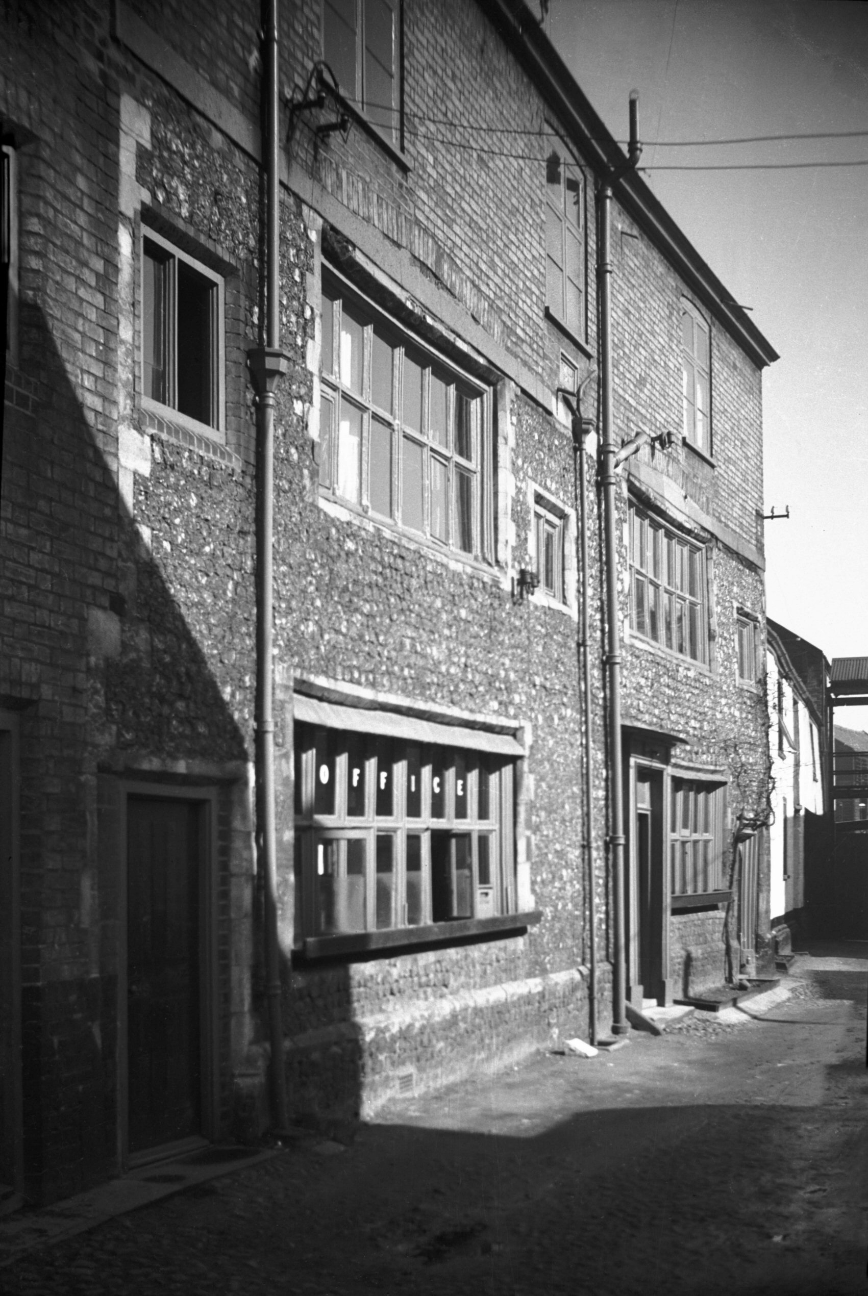
Haymarket 2 to 4 Curat House Back's wine [0293]
1934-09-16
3 and 4 Back's Wine Room and the Curat House. Named after
John Curat, Sheriff 1529, who probably built the mansion
and certainly lived there. The rooms are oak panelled. |
|
|
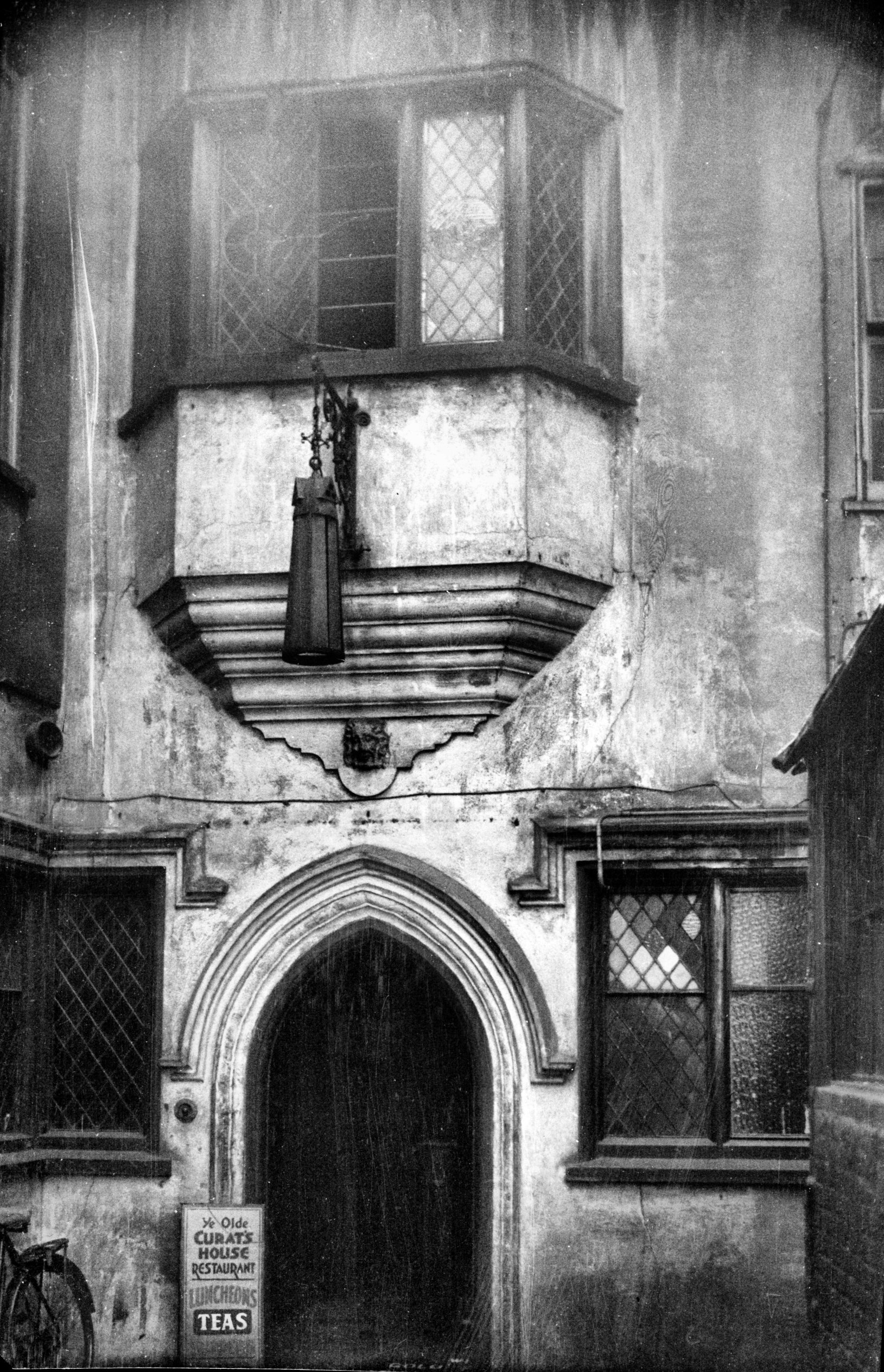
Haymarket 3 courtyard of Curat House [1340]
1936-08-29
|
|
|
Haymarket 11 Haymarket Chambers [6680] 1991-05-14
Erected 1902, architect George Skipper. |
|
|
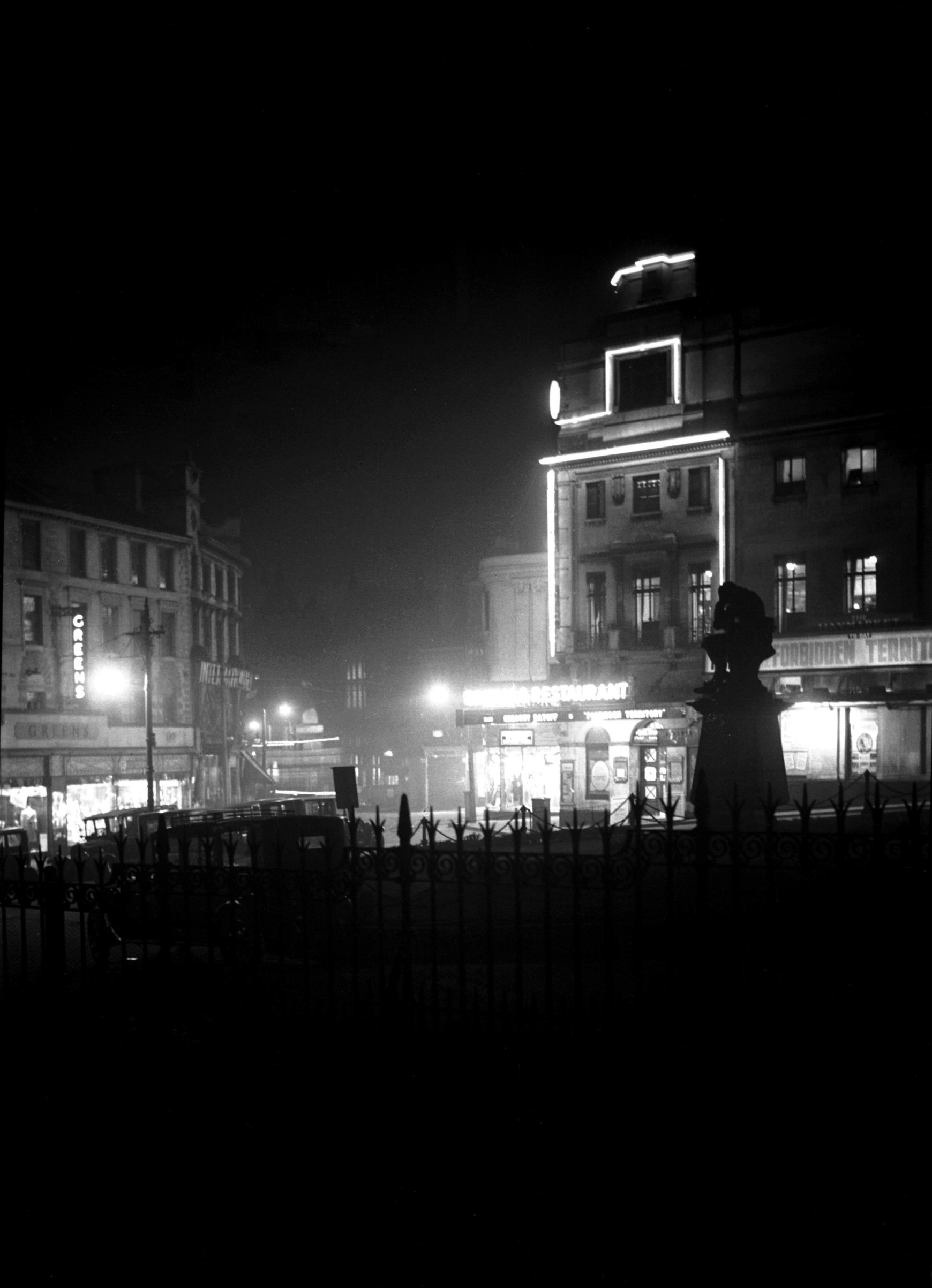
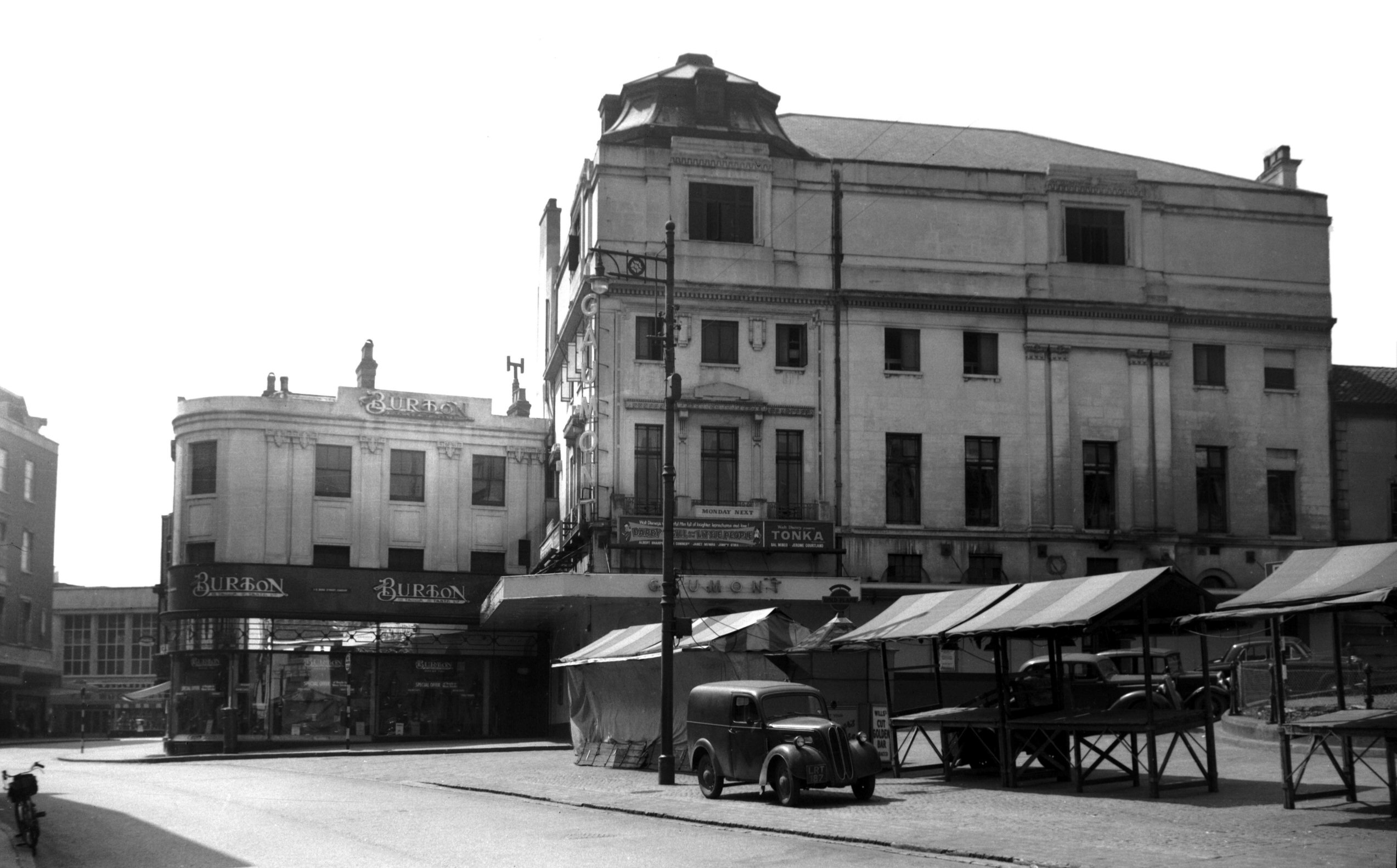
Haymarket Picture House night illumination [0316]
1934-11-20
The Haymarket Picture House (latterly known as the
Gaumont Cinema) opened in 1911, was enlarged in 1921
(architect J.Owen Bond) and again in 1929. Demolished
1959. |
|
|
Haymarket Picture House latterly Gaumont [4505]
1959-07-26
|
|
|
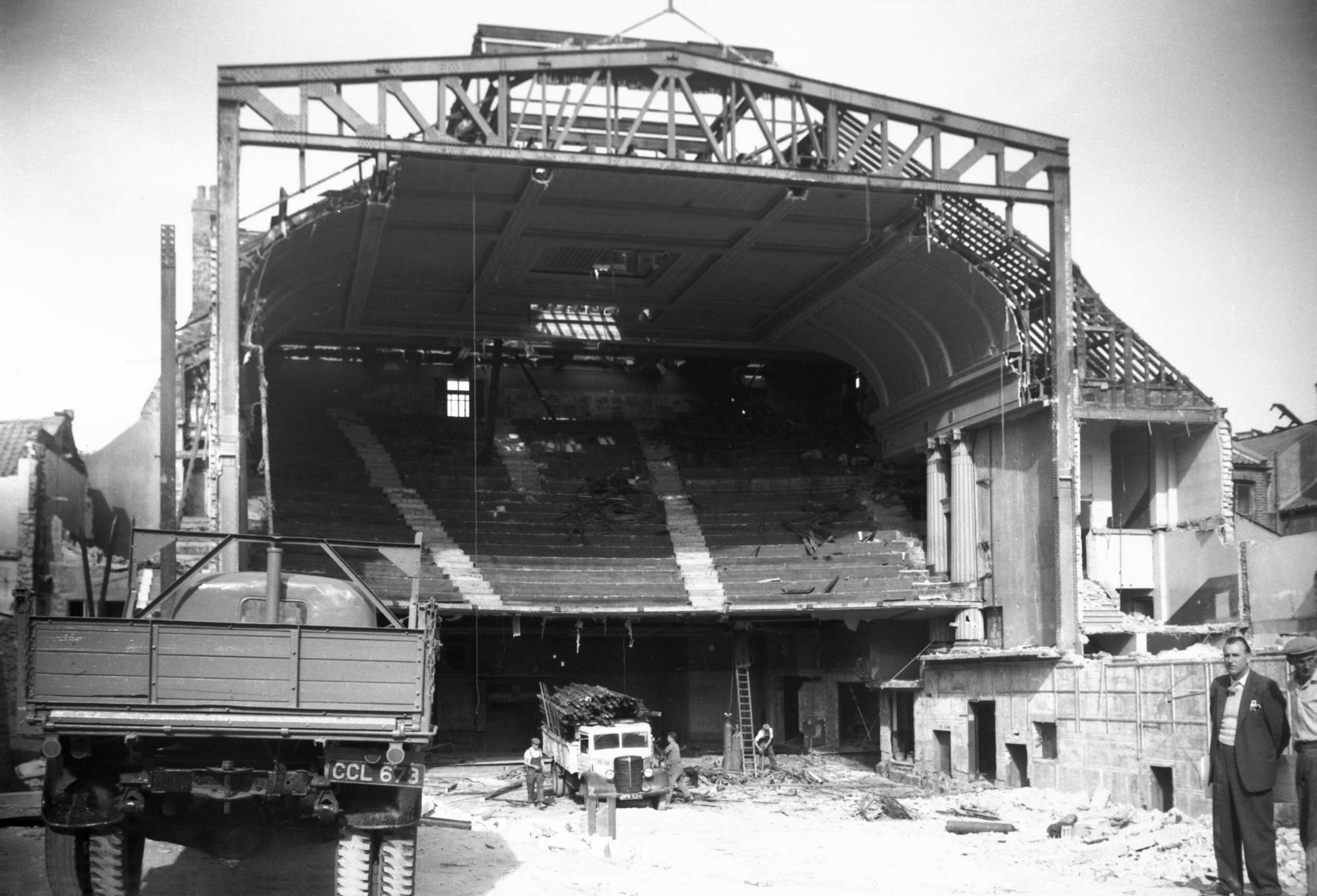
Haymarket Picture House part demolished [4537]
1959-09-28
|
|
|
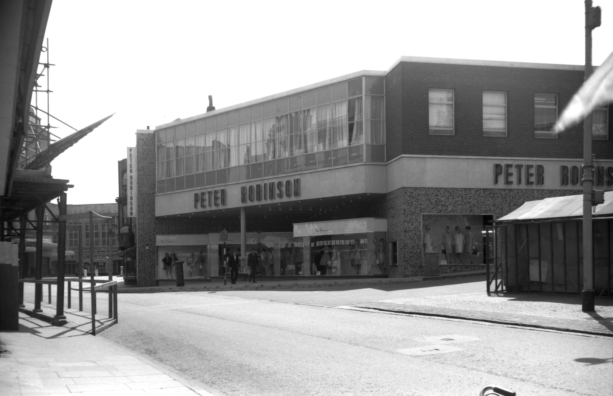
Haymarket Peter Robinson's store [4676] 1962-06-17
|
|
|
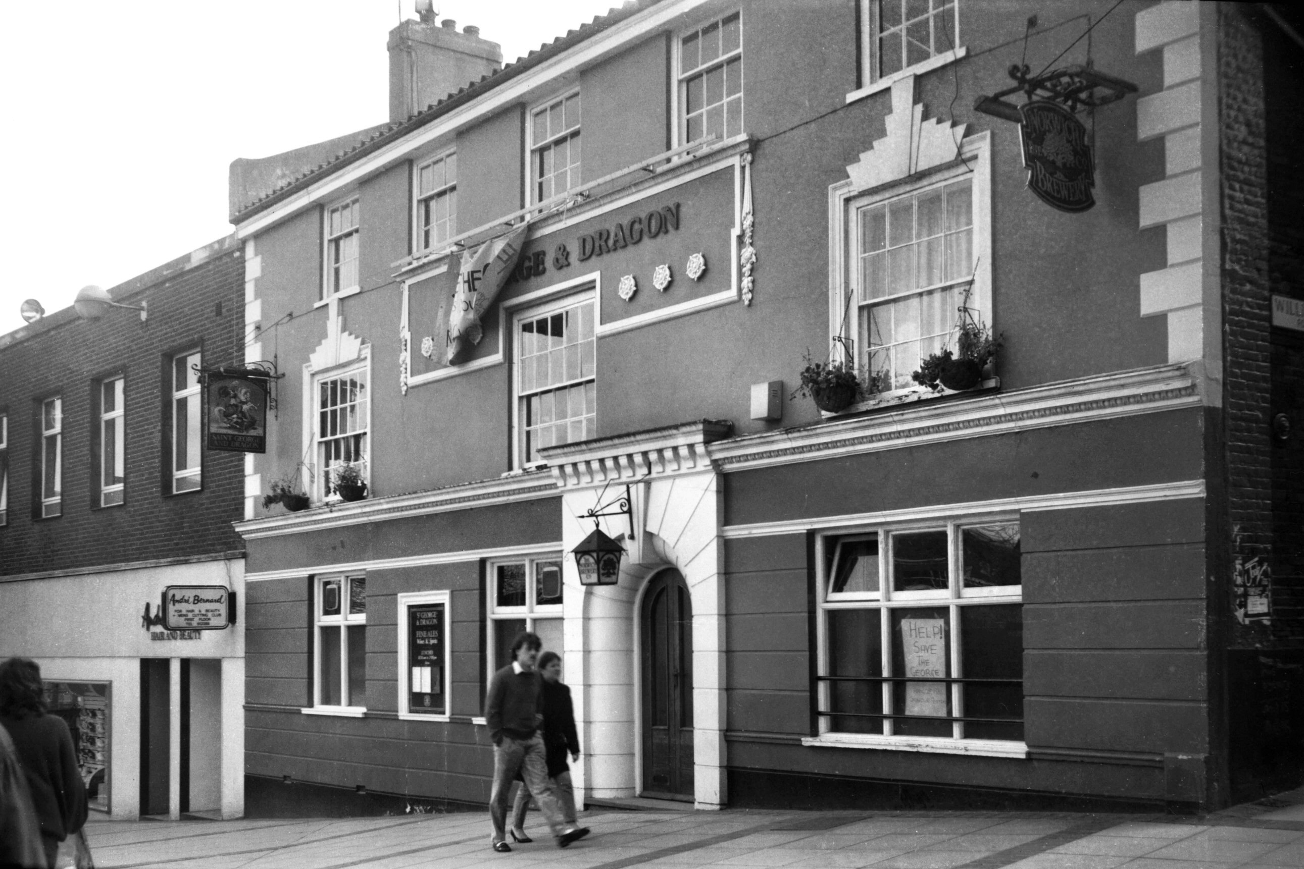
Haymarket 18 St George and Dragon PH [6493]
1988-04-12
For stables at rear see William
Booth St. |
|
|
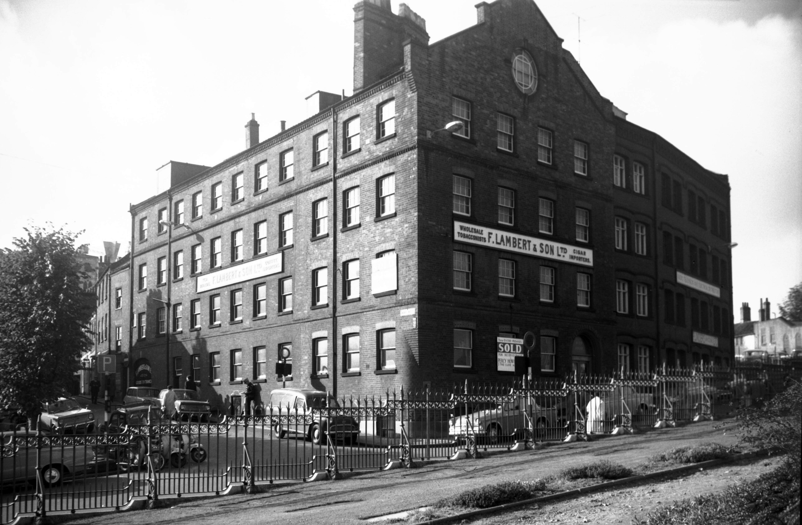
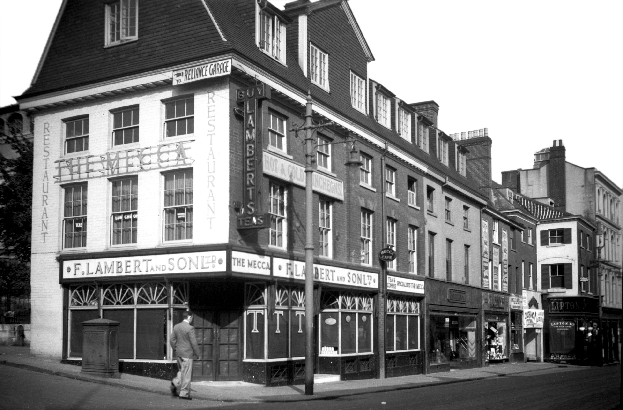
Haymarket Lambert's warehouse [B302] 1932-06-00
Tea and tobacco warehouse, Hay Hill, 19c. |
|
|
Haymarket Lambert's warehouse [5103] 1966-10-15
|
|
|
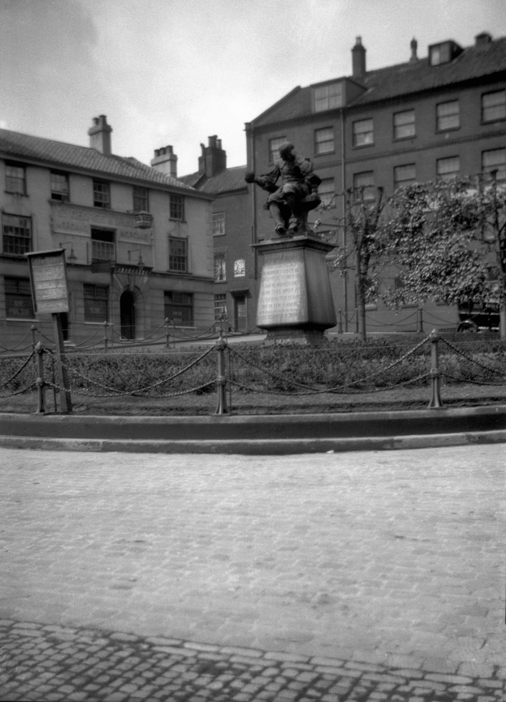
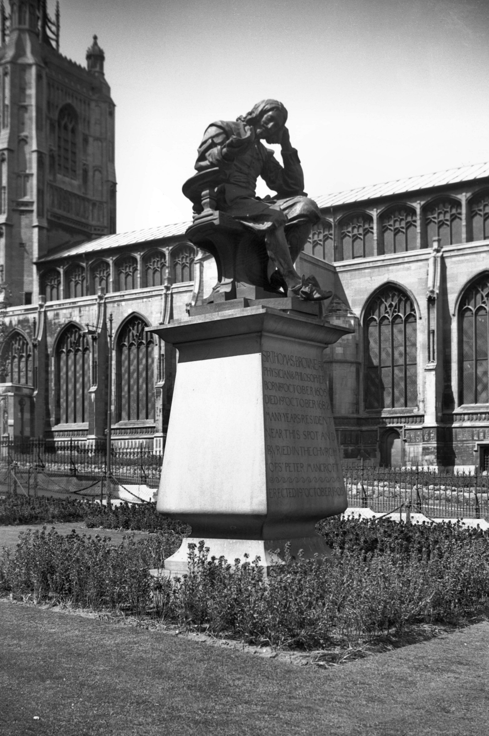
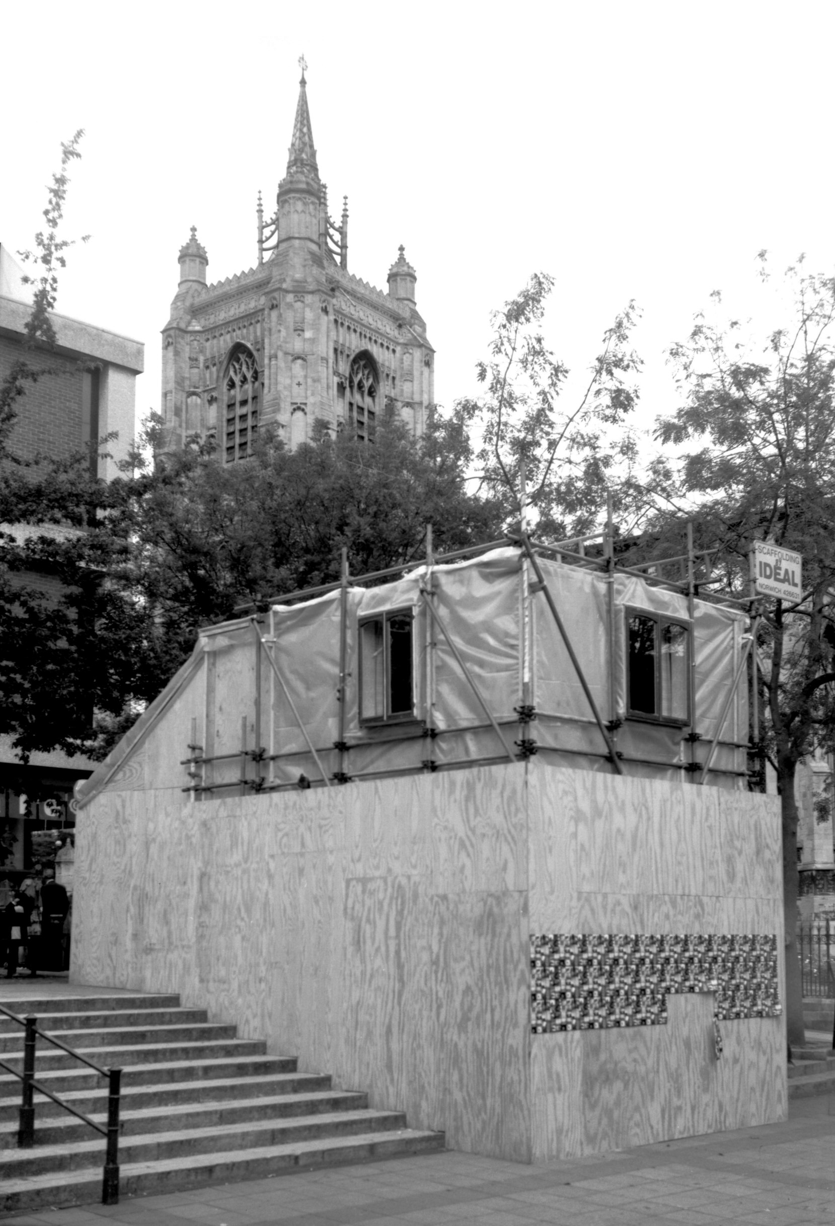
Haymarket Thomas Browne statue [2369] 1938-05-05
Erected in Haymarket 19th October 1905. |
|
|
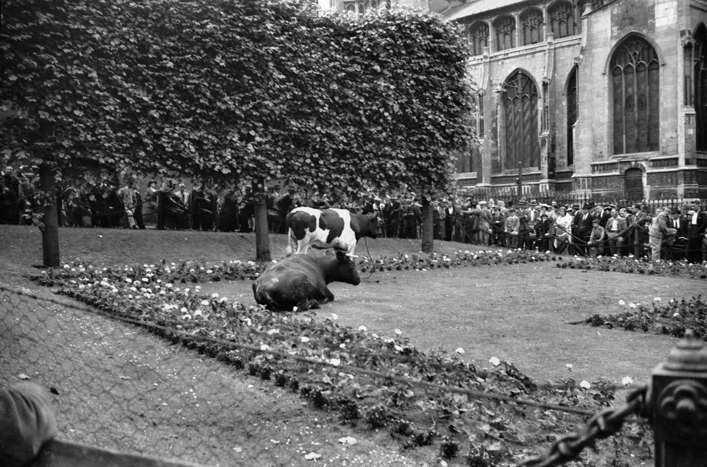
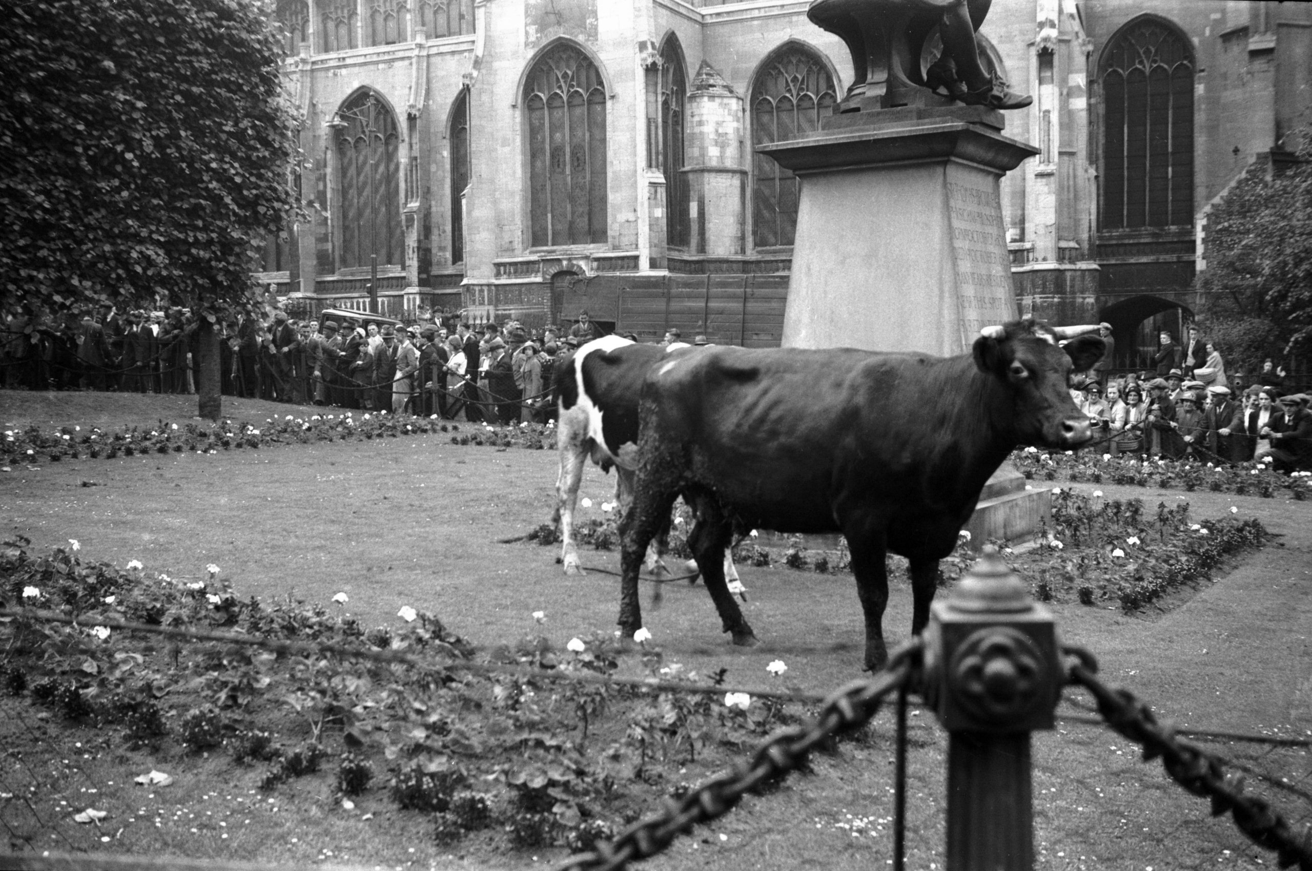
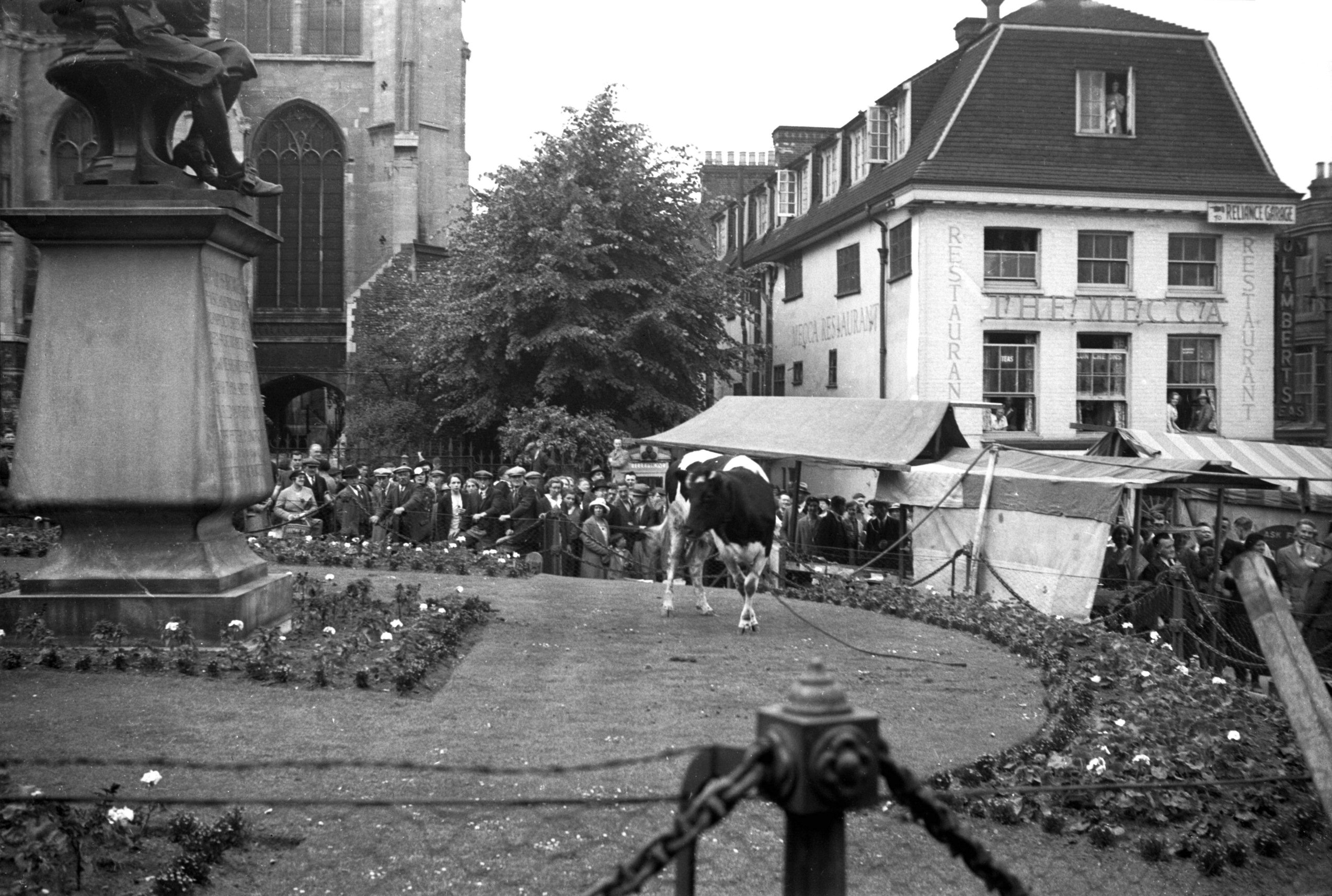
Haymarket escaped cattle 1 [1733] 1937-06-26
|
|
|
Haymarket escaped cattle 2 [1735] 1937-06-26
The Haymarket was described by the historian John
Kirkpatrick "as being the place where the Carts and
Waggons which bring Hay to the City for sale do stand,
expecting buyers". It is now many years since hay
was last sold here, the name now conjuring up, for older
citizens at least, happy memories of the picture house of
that name. First opened in 1911, it was twice enlarged -
in 1921 and 1929. After the war, however, with the advent
of television and other distractions, attendances
dwindled, leading to its closure and finally to its
demolition in 1959.
Perhaps the greatest change here in recent times took
place in 1972 when the garden and lawn surrounding Sir
Thomas Browne's statue were replaced by a paved concourse
with seats and a "water feature". The pleached
lime trees that had formed an effective screen to a 19c
warehouse had earlier been cut down, other trees being
planted instead on the north side flanking St Peter
Mancroft churchyard.
One vivid memory is recalled by this photograph. On 26th
June 1937, some cattle on their way from the old cattle
market stampeded from Orford Hill. Their headlong career
ended within the protective chains of the garden, but a
further hour elapsed before they could be persuaded to
enter the float that had been brought round for them to
resume their journey. |
|
|
Haymarket escaped cattle 3 [1734] 1937-06-26
|
|
|
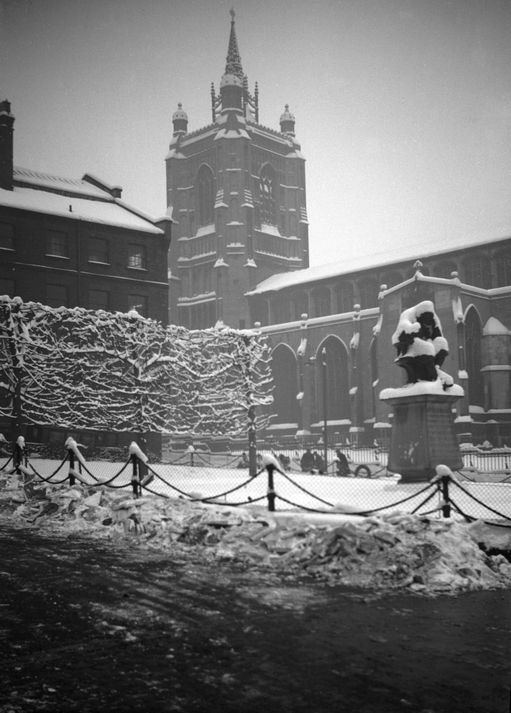
St Peter Mancroft from Haymarket heavy snow [2866]
1938-12-22
|
|
|
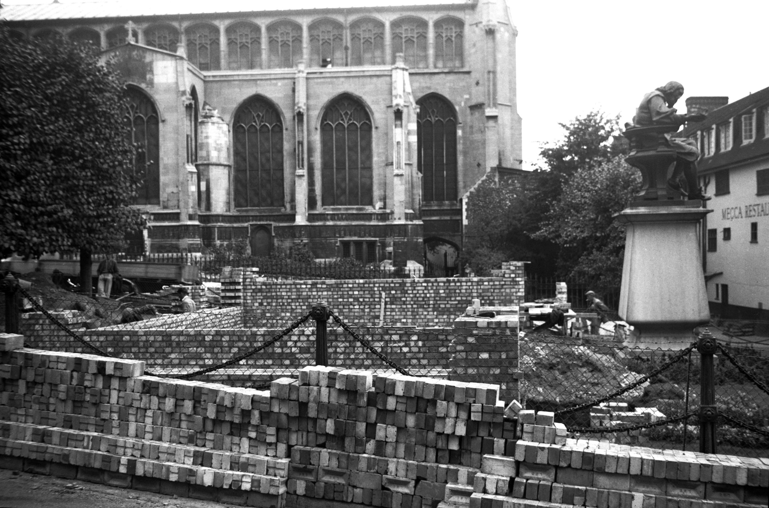
Haymarket air raid precaution brick shelter [3268]
1939-09-20
Surface shelter. |
|
|
Haymarket Thomas Browne shrouded as art [7566]
1998-07-19
|
|
|
Haymarket 19 to 23 [1422] 1936-09-20
|
|
|
Haymarket 21 to 24 rear from Weavers Lane [6704]
1991-07-07
|
|
|
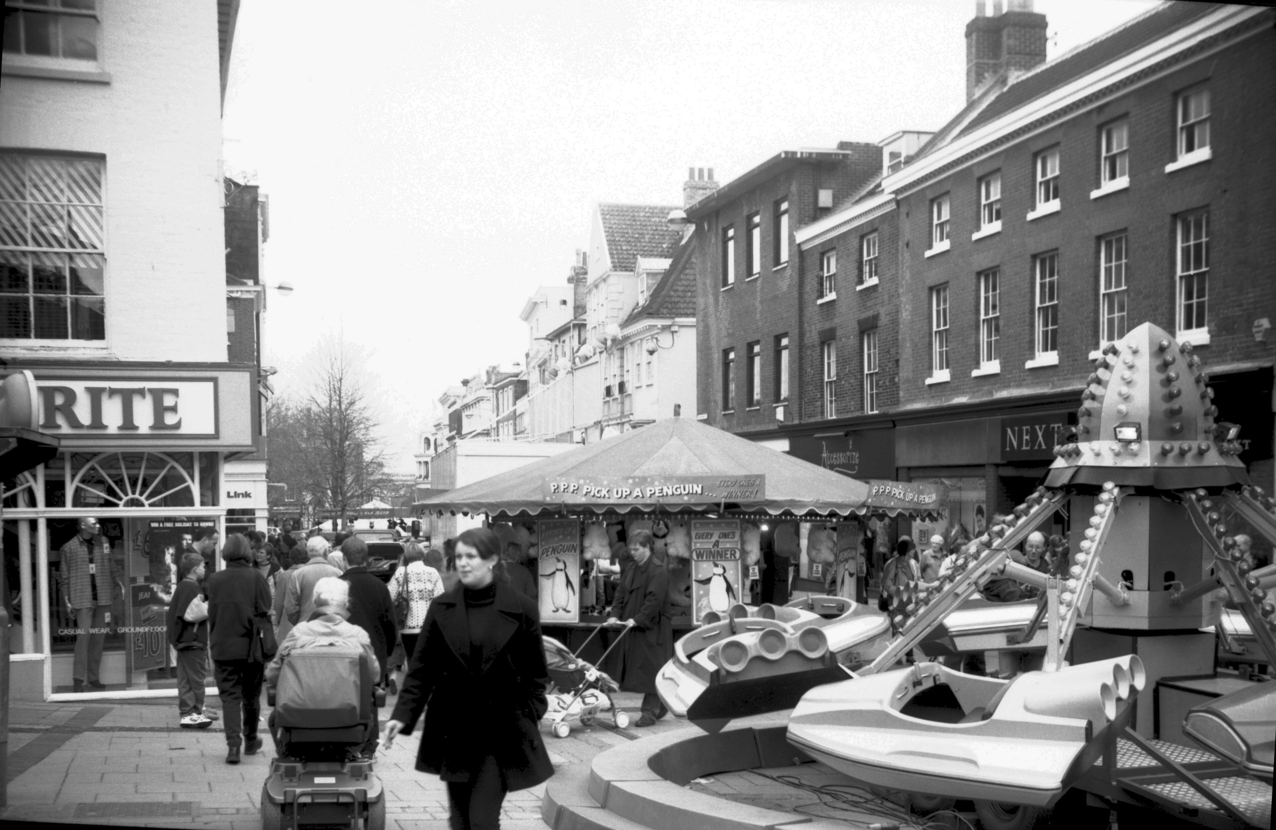
Haymarket Easter fair view north [7438] 1997-03-29
|
|
Heartsease Lane: |
| |
From
Harvey Lane / Plumstead
Rd to Gurney Rd / Mousehold
Lane / Salhouse Rd
passing Rider Haggard Rd, Valley
Drive |
|
|
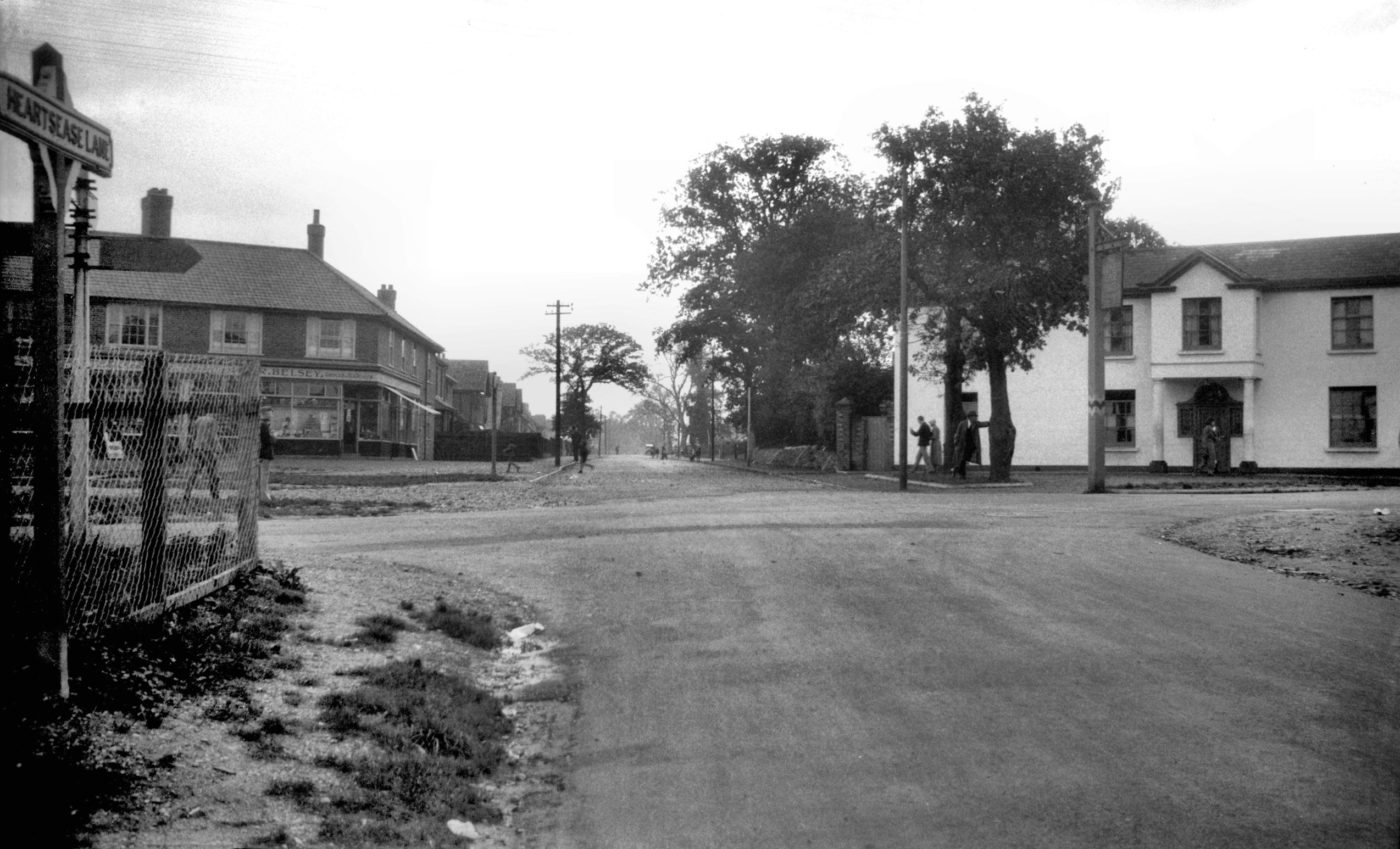
Heartsease Lane at Plumstead Rd [B792] 1933-10-08
Harvey Lane beyond. |
|
|
Heartsease Lane surface drainage [4227] 1953-10-25
By Orchard Close. |
|
|
Heartsease Lane at Valley Drive view NW [4228]
1953-10-25
|
|
|
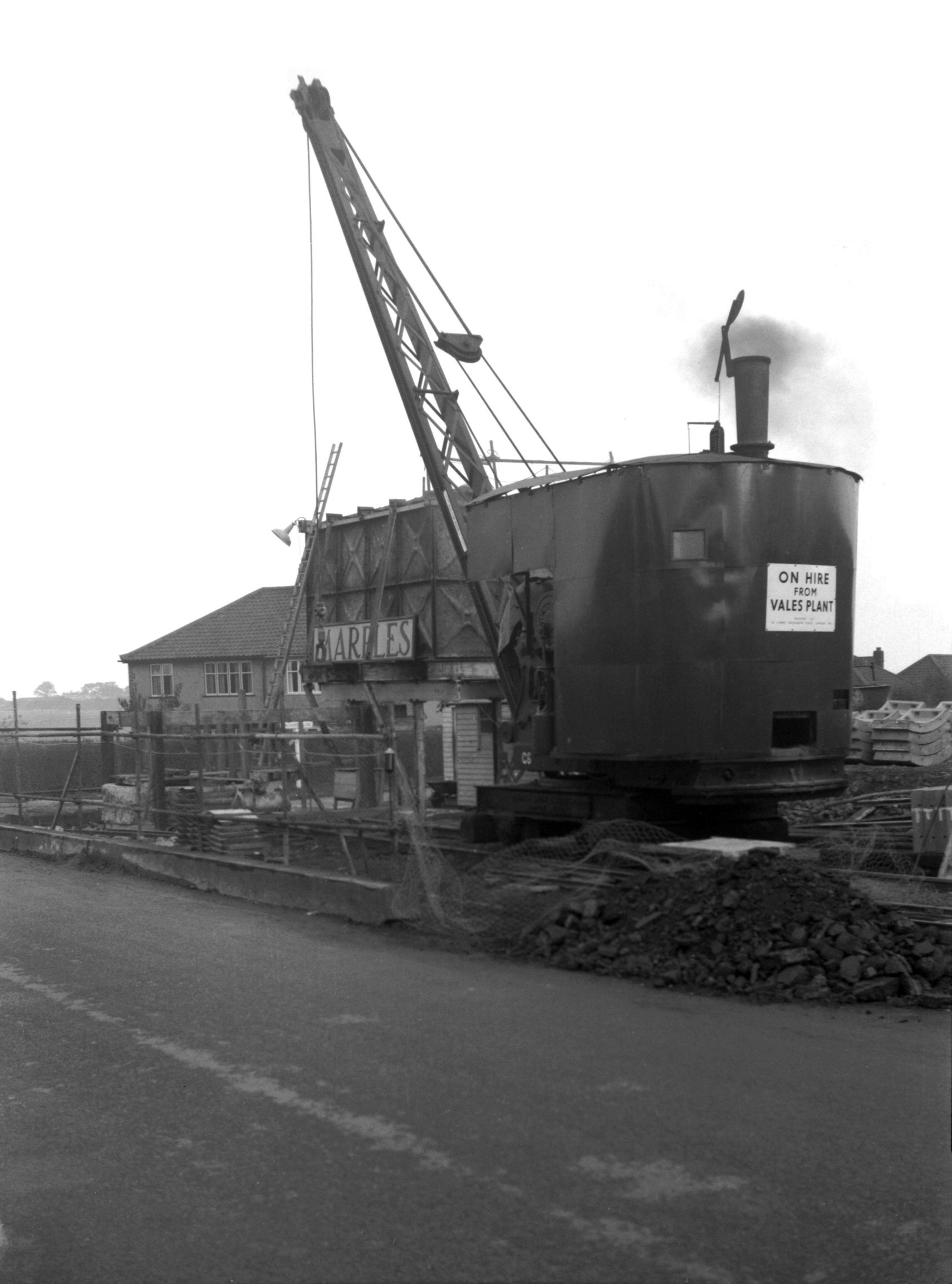
Heartsease Lane drainage contractors' huts [4232]
1953-10-25
On west side of Heartsease Lane. |
|
|
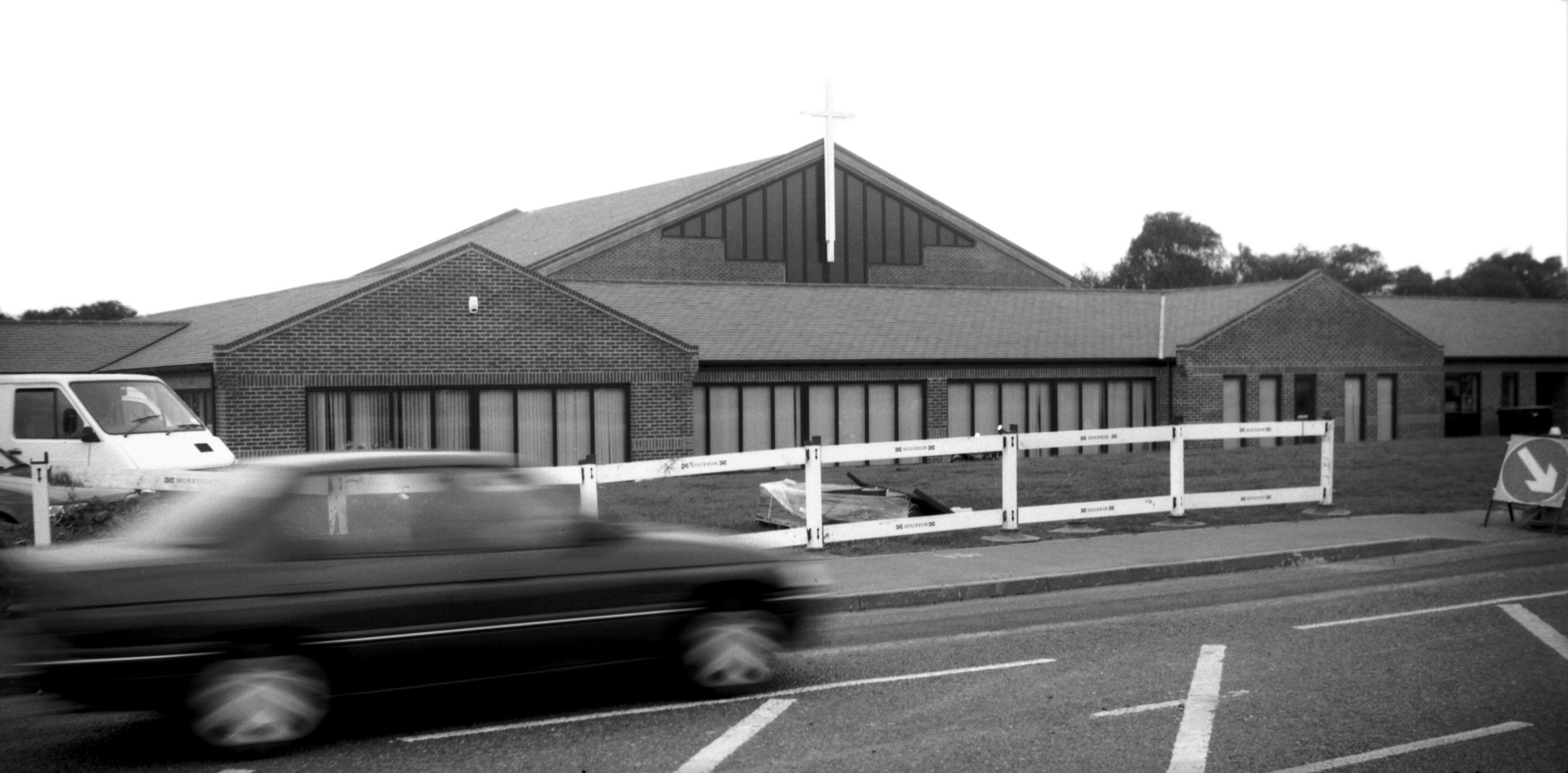
Heartsease Lane Mount Zion church [7588] 1998-09-27
Opened 1996, architects Dennis Black Associates. |
|
|
Heartsease Lane at Salhouse Rd view NW [4233]
1953-10-25
|
|
|
Heartsease Lane at Salhouse Rd view SE [4231]
1953-10-25
|
|
Heigham Grove: |
| |
From
Earlham Rd |
|
|
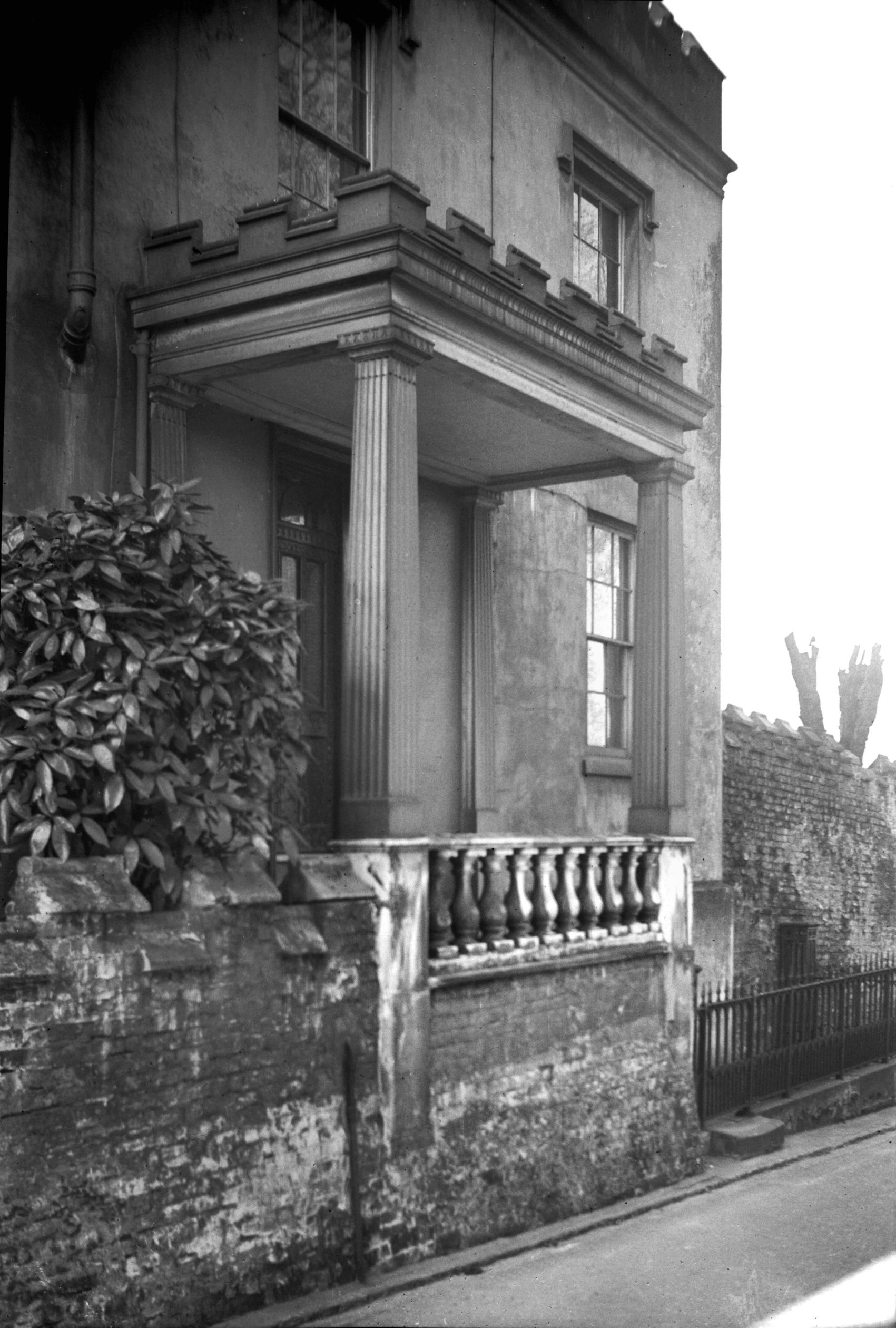
Heigham Grove 1 [1803] 1937-07-18
During the 19c this was the property of Joseph Gray, an
upholsterer, who purchased it in 1831. |
|
|
Heigham Grove 1 Georgian portico [2099] 1938-03-03
|
|
|
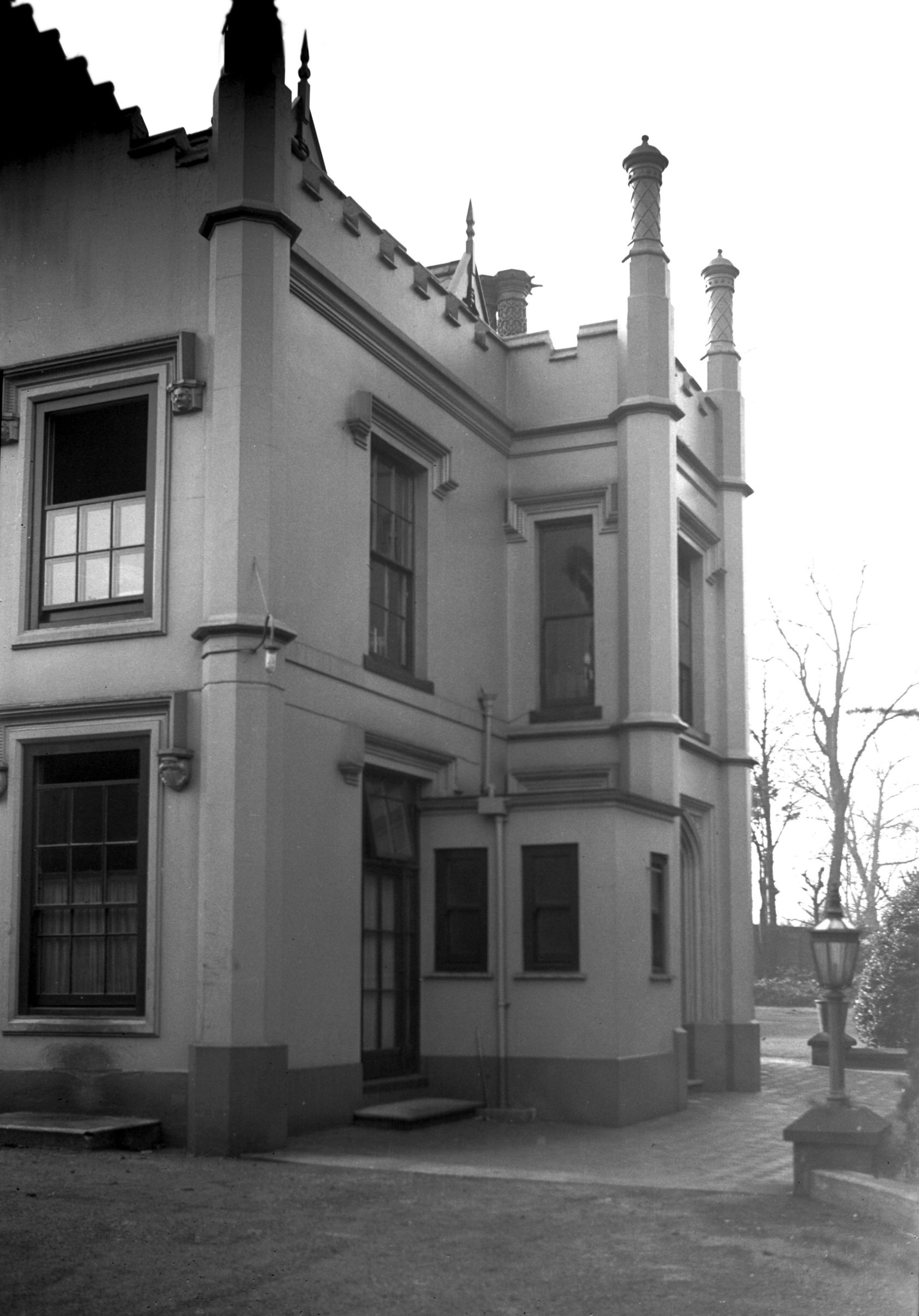
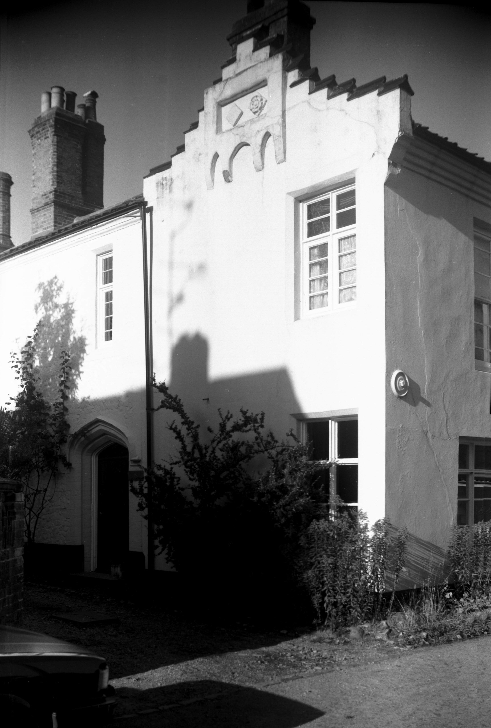
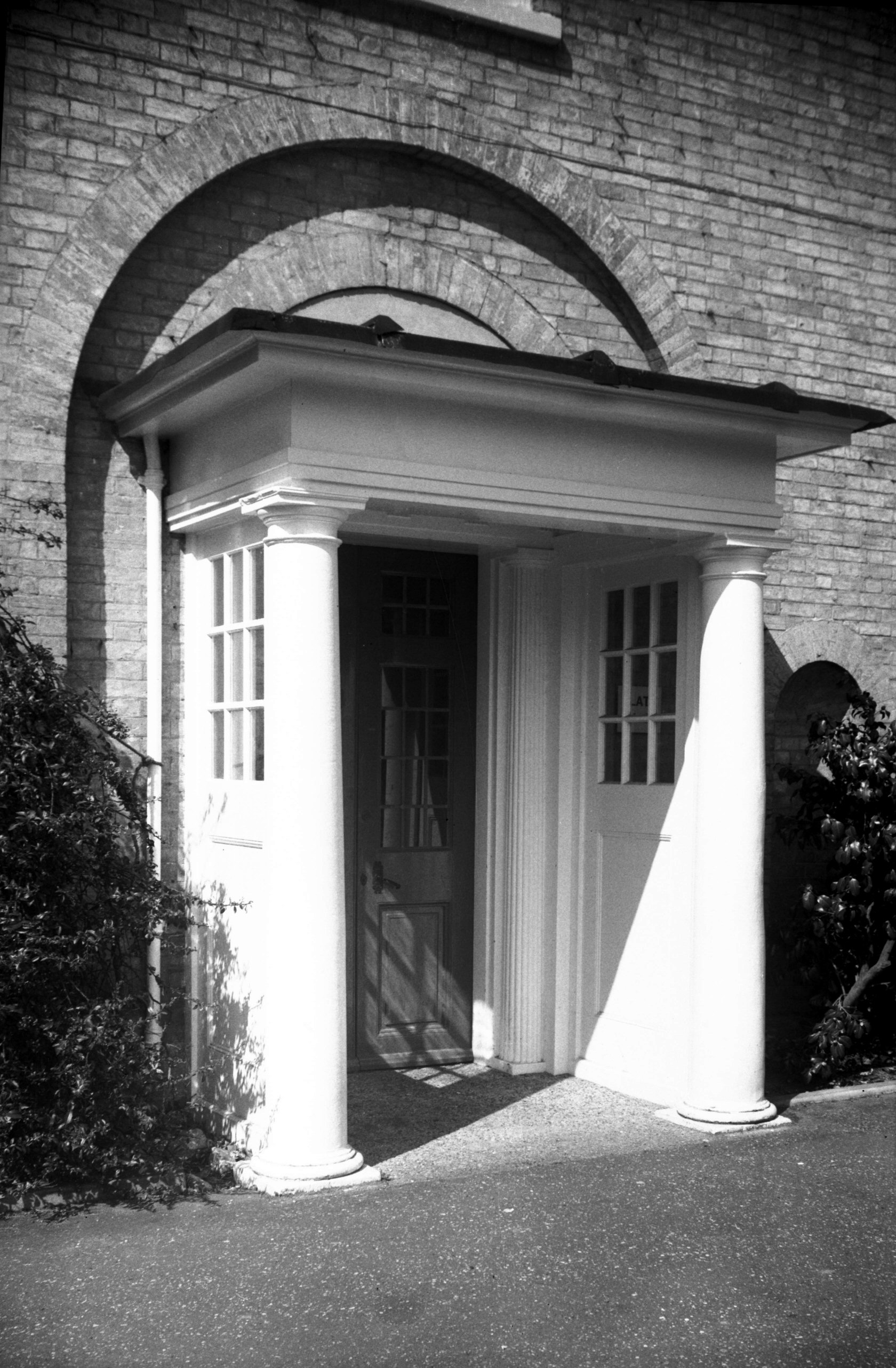
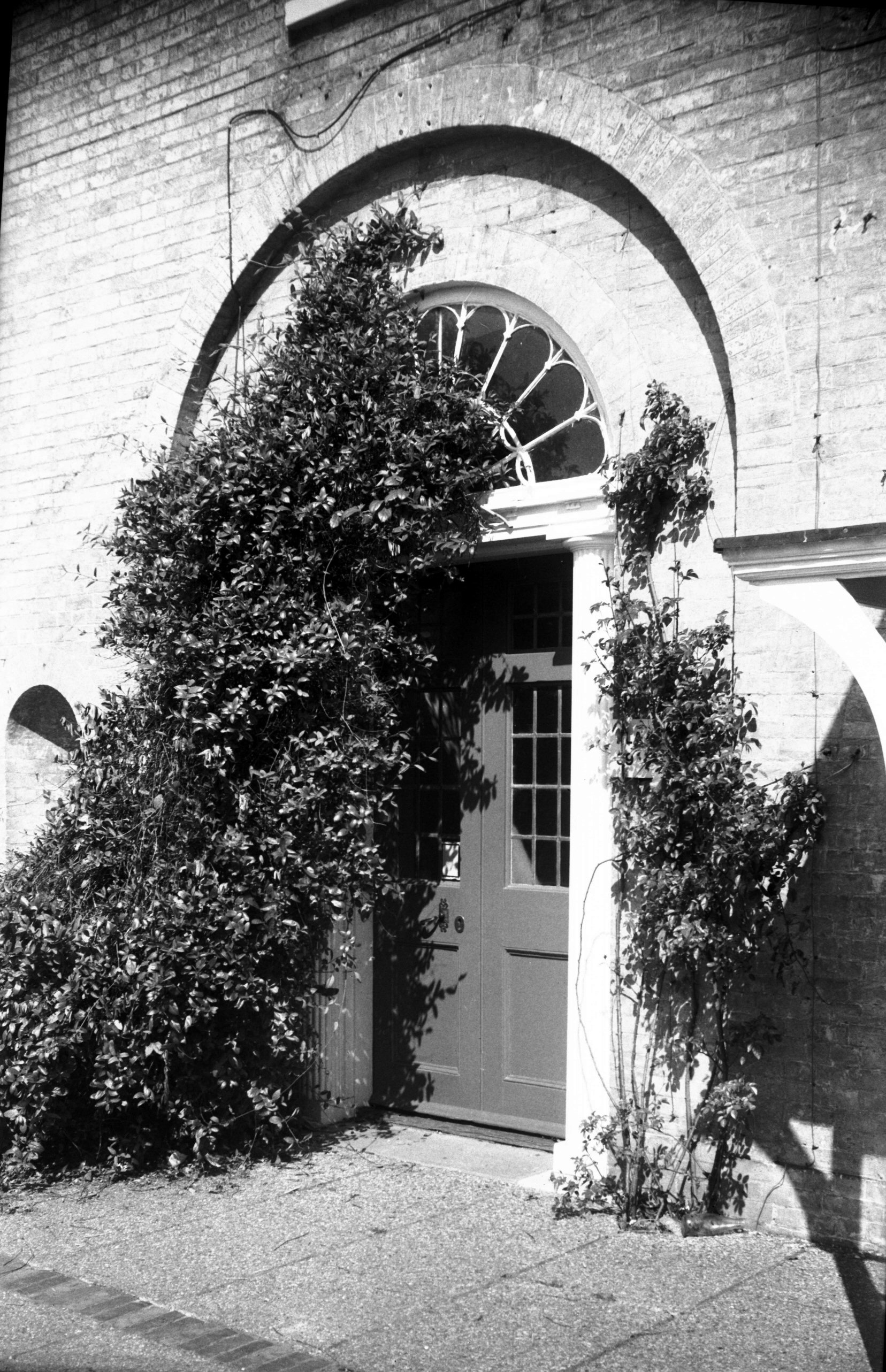
Heigham Grove Heigham Grove House from NE [2109]
1938-03-04
Just beyond the site of St Giles' Gate, on the south side
of Earlham Rd, is Heigham Grove, a picturesque wooded
slope on which stood Heigham Grove House, purchased for
£3,200 in April 1925, by the City Council for conversion
into the City Maternity Home.
The estate was originally designed by a Mr Adams,
stonemason, of Chapel Field Rd, and was an interesting
example of the Gothic revival which became manifest
during the early part of the 19c. The house itself
resembled an Elizabethan manor, having a projecting porch
extending through both storeys, battlemented parapets,
crow-stepped gables and a slim octagonal buttress at each
angle terminating with a lofty round finial. The walls
were cement rendered, the finials and cylindrical chimney
shafts being moulded with geometrical designs. To
complete the picture, grotesque heads formed label stops
on either side of certain of the windows.
The grounds were also fitted up in a sham-antique style.
Surrounded by a lofty battlemented wall of brick,
complete with massive iron gates and supporting pillars,
they contained a "folly", a "ruined"
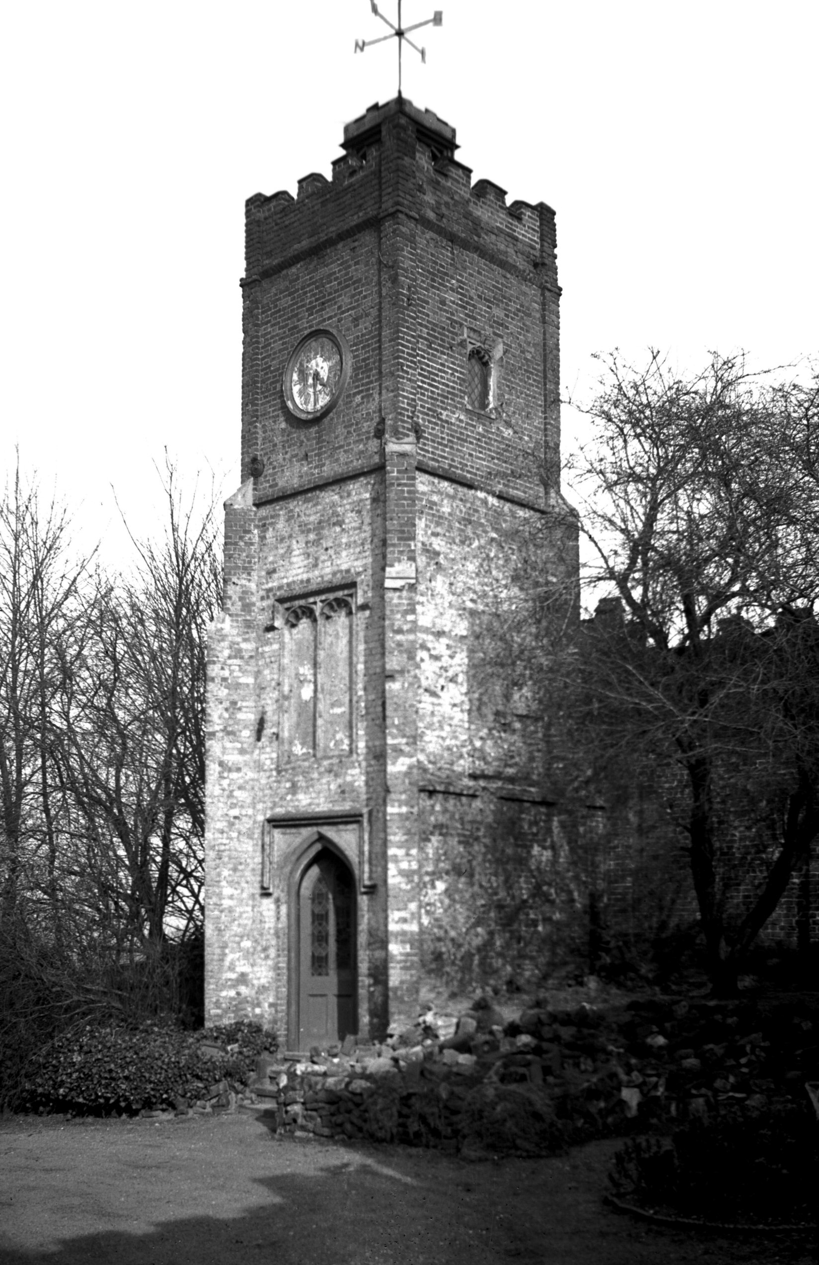
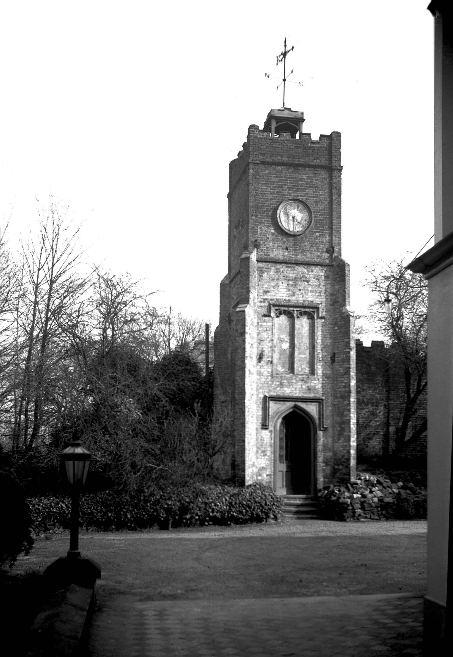
Gothic arch, and at the top of the slope adjacent to the
house was a square brick clock tower of three stages
surmounted by a small wooden bell-cot and weathervane. It
is said that at one time a series of busts of Roman
emperors provided further adornment.
A certain brick pillar, which marked the boundary between
Heigham Grove House and No 1 Heigham Grove, was the cause
of some dissension between the two neighbours Joseph Gray
(who had purchased No 1 in 1831 and to whom the pillar
belonged) and Henry Chamberlin. The former agreed to
leave the pillar uncoloured as it "would disfigure
his [Mr Chamberlin's] arch entrance to have part brick
and part coloured". Several years later (in 1853)
when Mr Charles Winter was the occupant of Heigham Grove
House he coloured the pillar, thinking it to be part of
his property. In consequence Mr Gray "with his [Mr
Winter's] knowledge...placed a stone in it on the west
side marked 'J.Gray 1831'. Adams, stonemason, made and
fixed it".
The boundary wall with its heavy iron gates was removed
when Earlham Rd was widened at this point, and on 27th
June 1942, Heigham Grove House itself was destroyed by
enemy action; an air raid warden, Mr Thomas Bright,
unfortunately lost his life. |
|
|
Heigham Grove House clock tower [2107] 1938-03-04
|
|
|
Heigham Grove House clock tower from NW [2108]
1938-03-04
|
|
|
Heigham Grove St Ouen [6526] 1988-08-29
|
|
Heigham Rd: |
| |
From
West
Pottergate / Earlham Rd to Dereham Rd |
|
|
Heigham Rd former tram standard [7787] 2000-11-24
Corner of West Pottergate. Though now supporting a
street lamp, it is the sole survivor of its kind in the
city. |
|
|
St Philip's Heigham from Stafford St [4689]
1962-07-01
Built 1870-1 in French 14c style, architect E.Power.
Demolished 1977. |
|
Heigham St: |
| |
From
Barn Rd / Westwick
St to Waterworks Rd
passing Midland St, Russell
St, Nelson St, Mile
Cross Rd
South side |
|
|
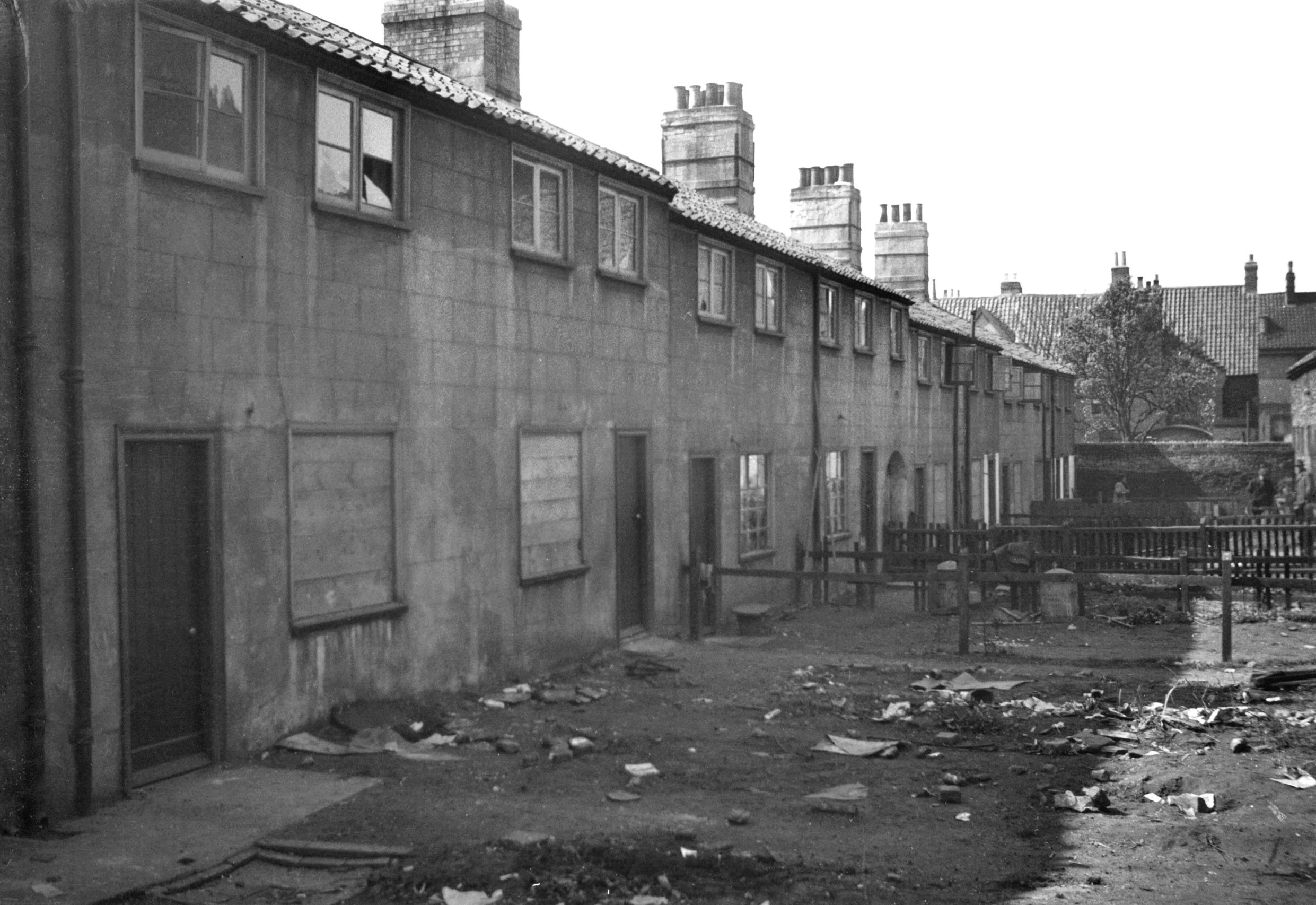
Heigham St Flower in Hand Yard west side [3032]
1939-05-29
|
|
|
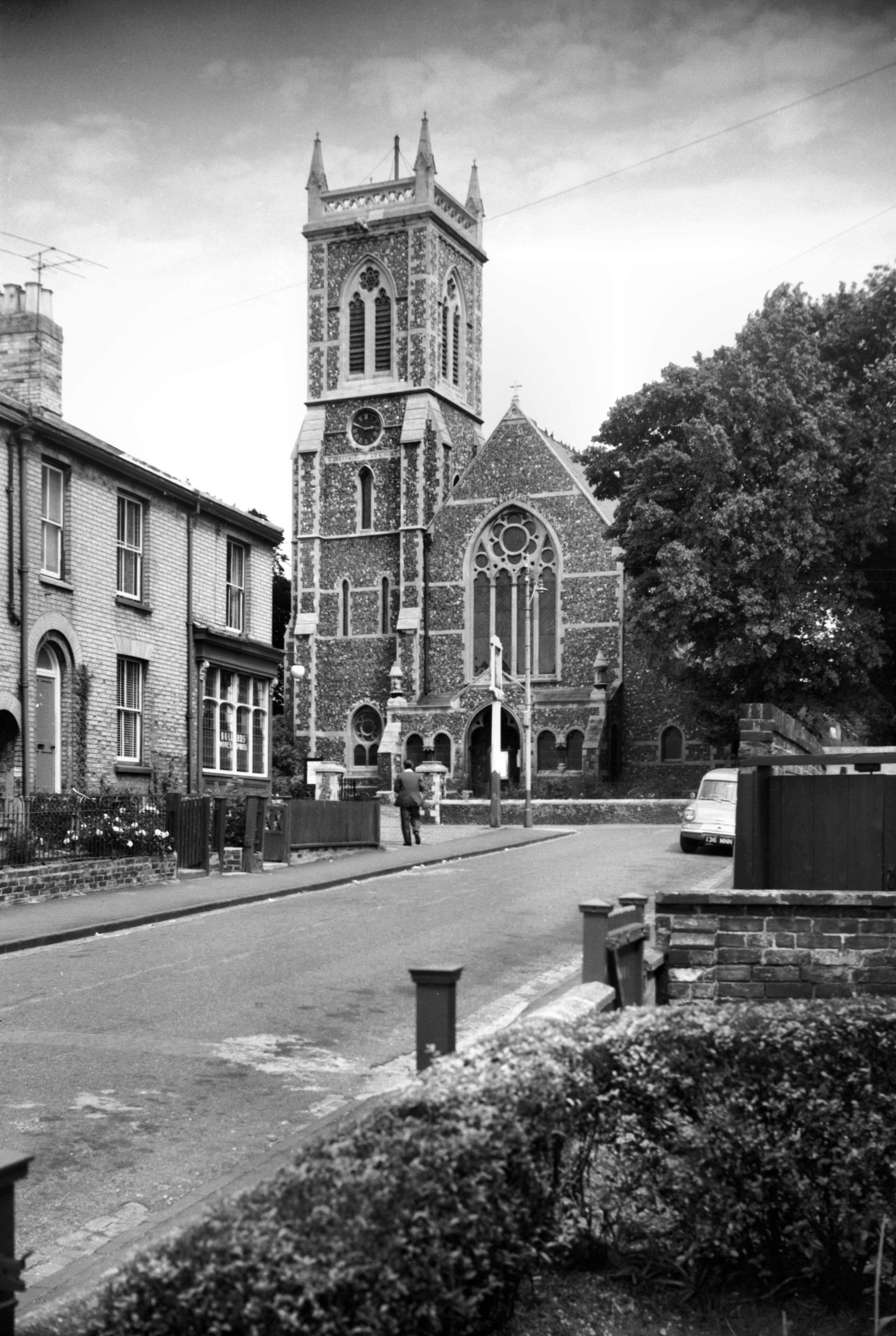
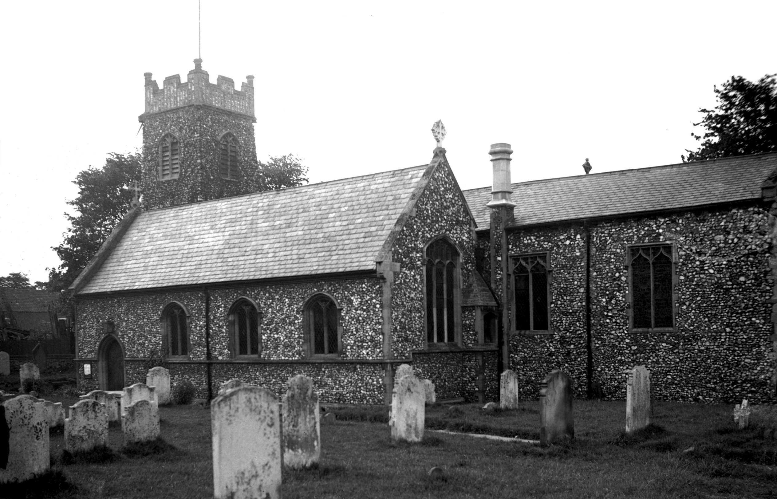
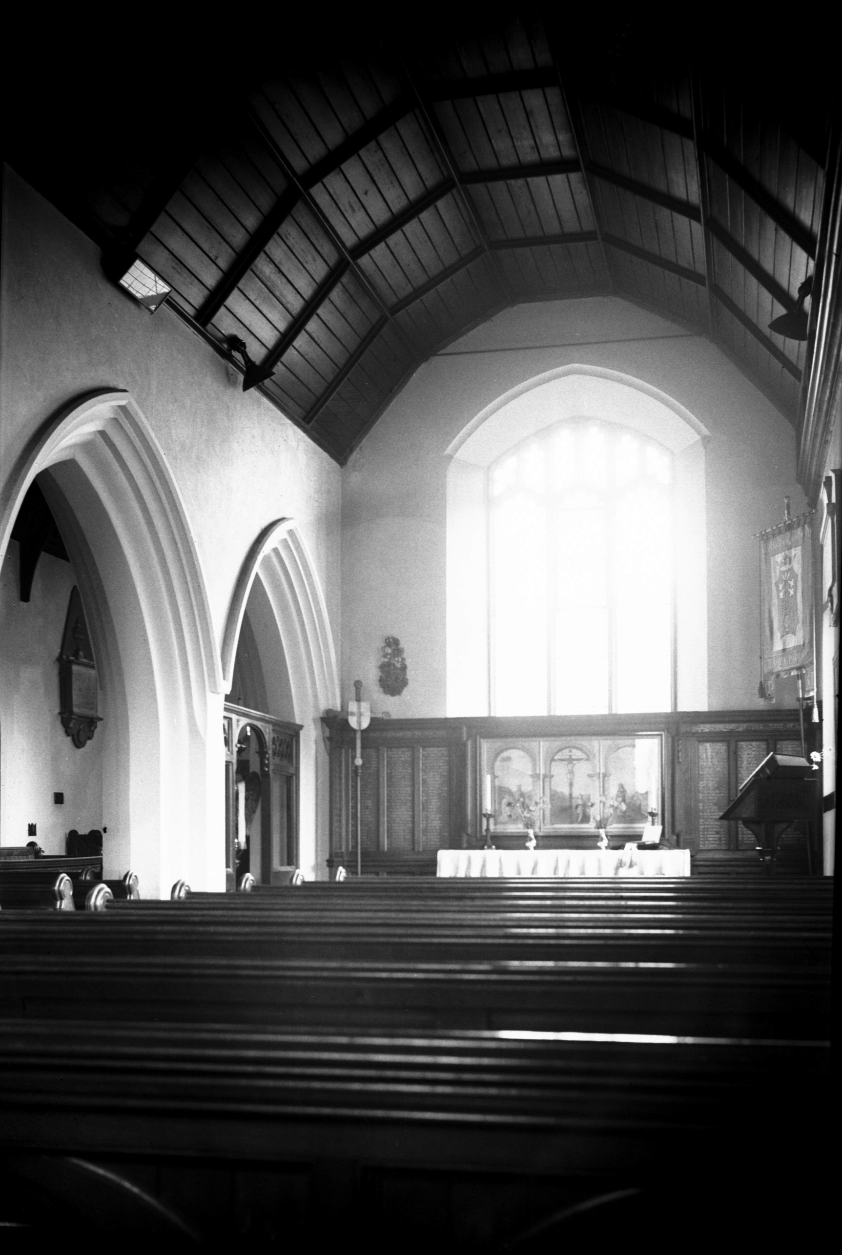
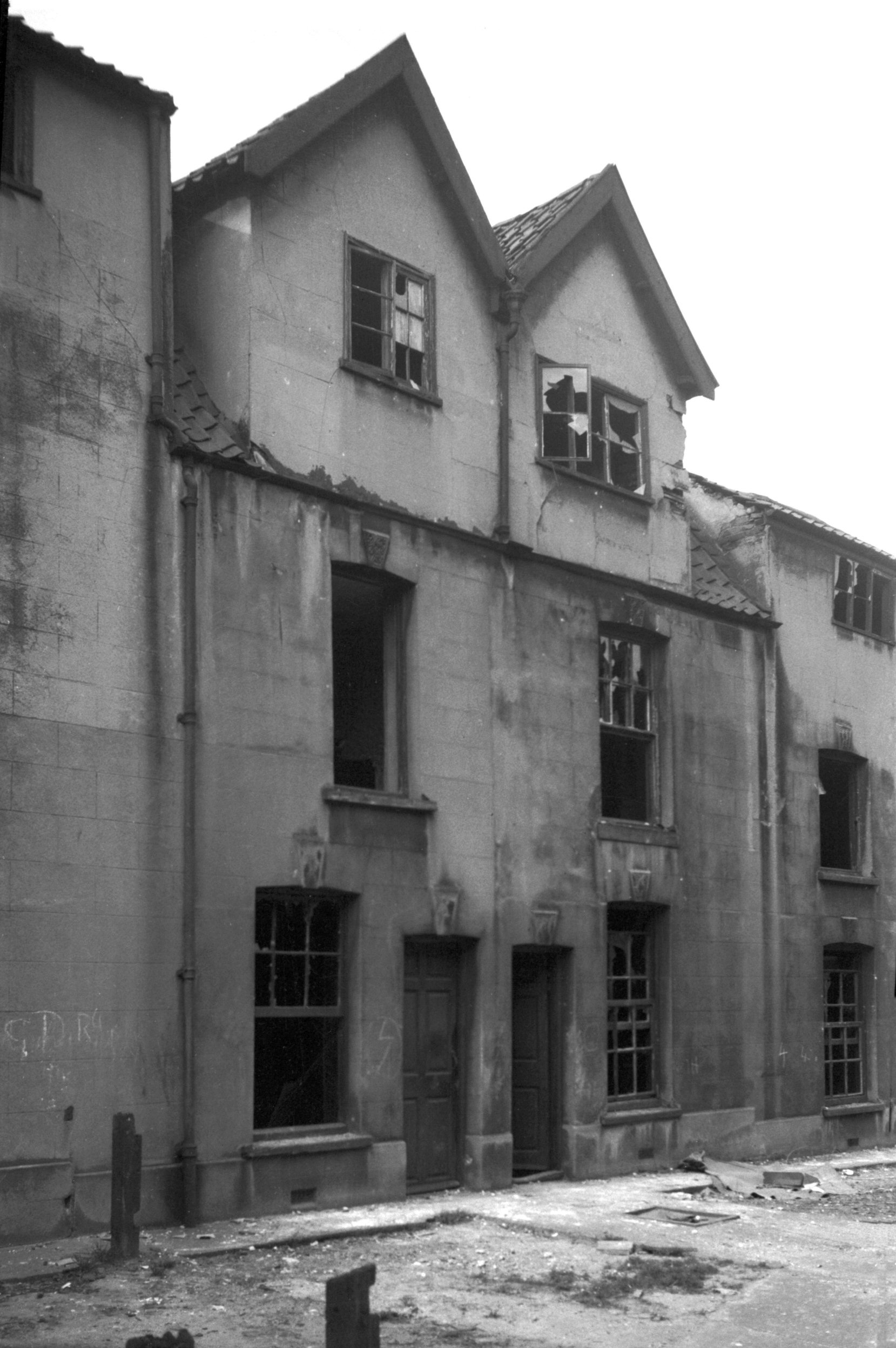
St Bartholomew's Heigham from SE [2423] 1938-05-23
Mainly Perpendicular. The district of Heigham, flanked by
the city on the east and by Earlham on the west, grew
during the 19c from a small village clustered around the
church of St Bartholomew to a large residential suburb.
This growth led to its division into several parishes of
a more manageable size, served by the new churches of St
Barnabas, St Philip, St Thomas and Holy Trinity.
It was unfortunate that the "mother" church of
St Bartholomew, with its continuous history going back
over centuries, should have been the victim of an
incendiary attack during the raid of 29th April 1942. As
it stood at the time of its destruction it consisted of a
square embattled western tower some 44 feet high, in
which were two bells; a nave, without clerestory; north
and south aisles; and a chancel. |
|
|
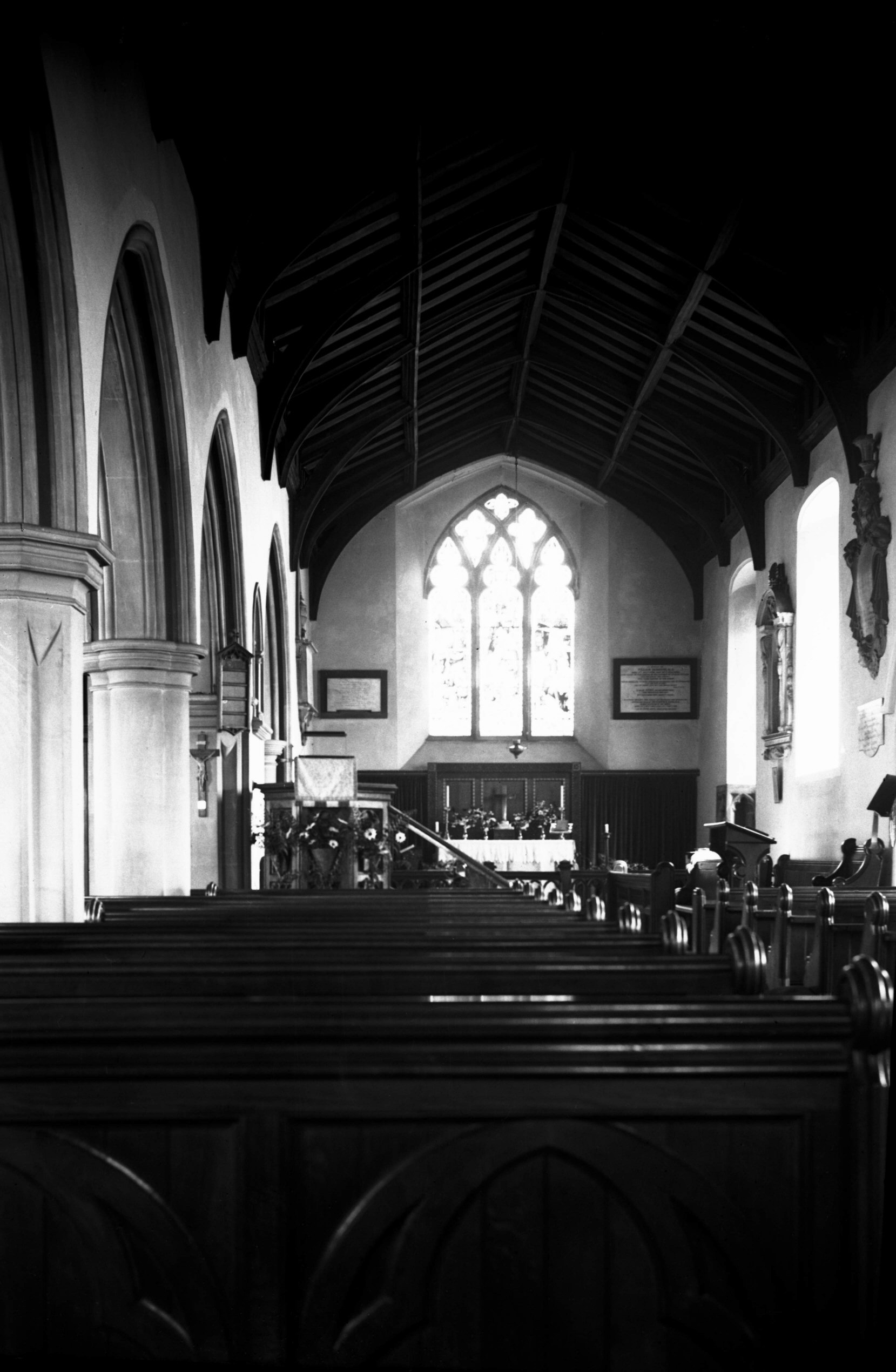
St Bartholomew's Heigham interior view east [2435]
1938-06-10
The nave and chancel were under one continuous roof, of a
simple archbraced type dating from the Victorian
restoration. |
|
|
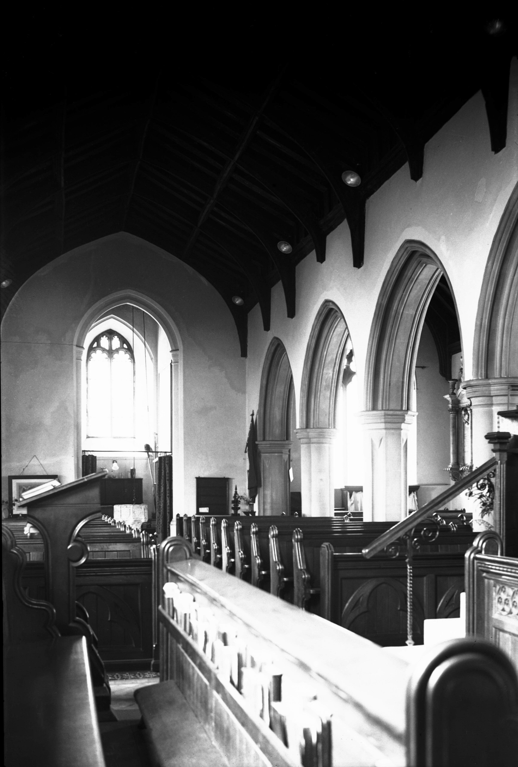
St Bartholomew's Heigham interior view west [2436]
1938-06-10
|
|
|
St Bartholomew's Heigham north aisle [2440]
1938-06-10
Of the aisles, the north one was built in 1878 as a
memorial to Bishop Hall, who died in 1656 while residing
in the nearby house now known as the Dolphin inn. A north
porch and vestry were removed when this work was carried
out. |
|
|
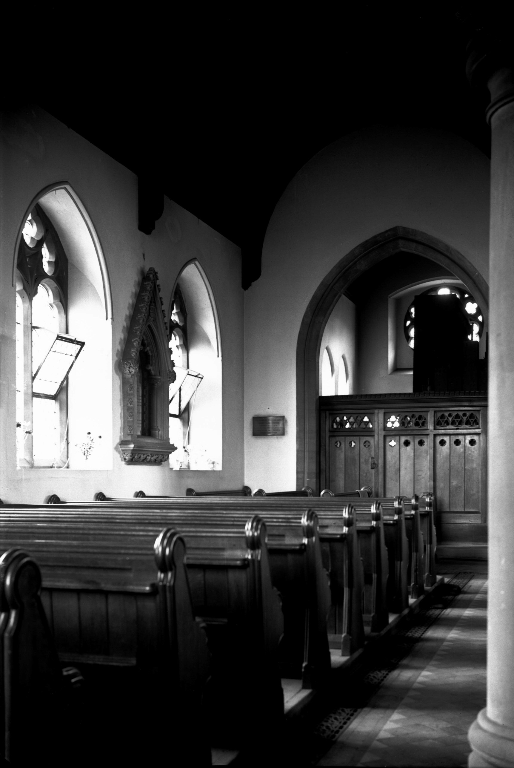
St Bartholomew's Heigham south aisle [2439]
1938-06-10
The main entrance to the church was by a doorway in the
south aisle, near its western end. |
|
|
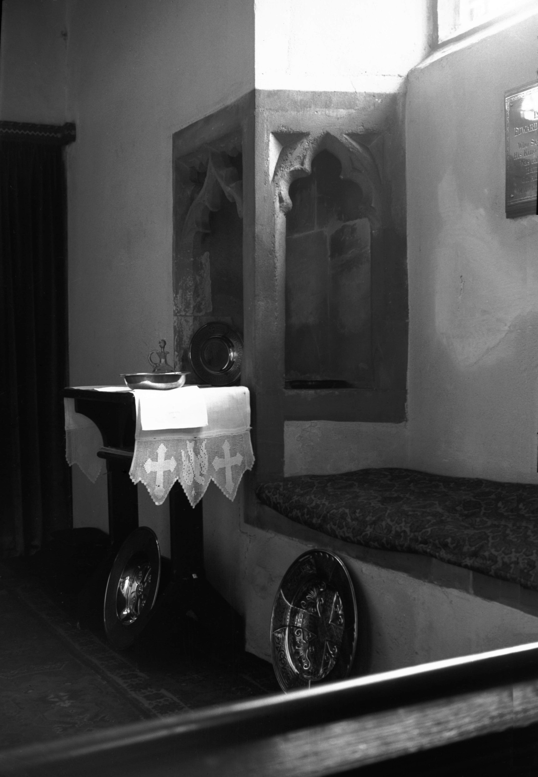
St Bartholomew's Heigham piscina sedilia [2441]
1938-06-10
The sill of the easternmost window in the south wall of
the chancel formed the sedilia, with an angle piscina to
the left. |
|
|
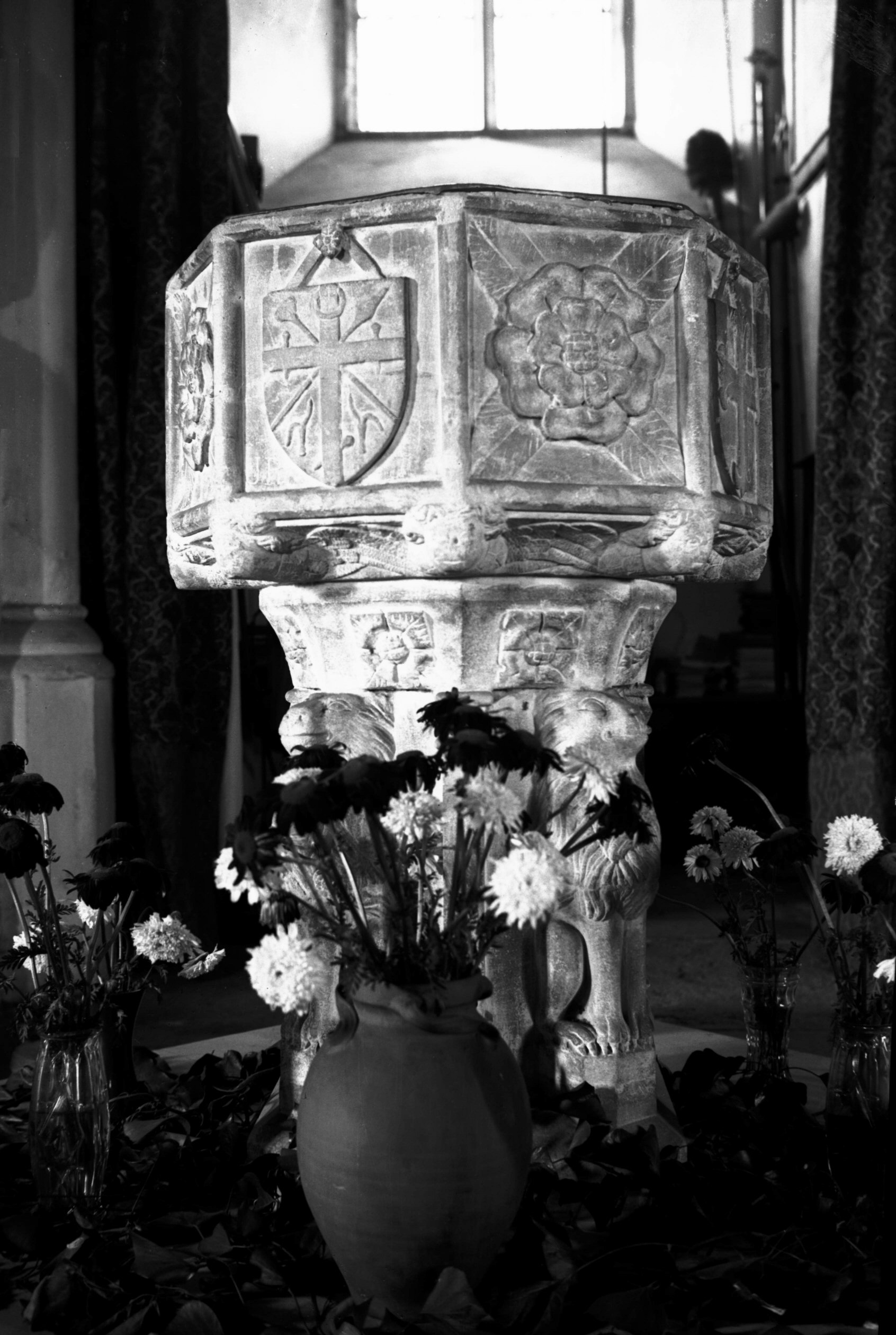
St Bartholomew's Heigham 15c font [2437] 1938-06-10
Most of the furnishings were modern, but the font, split
to pieces in the raid, was of the old East Anglian type
with four lions sejant around the stem. The eight panels
bore the Emblem of the Trinity, Instruments of the
Passion, St George's Cross, and a Cross of Moline,
alternating with Tudor roses. |
|
|
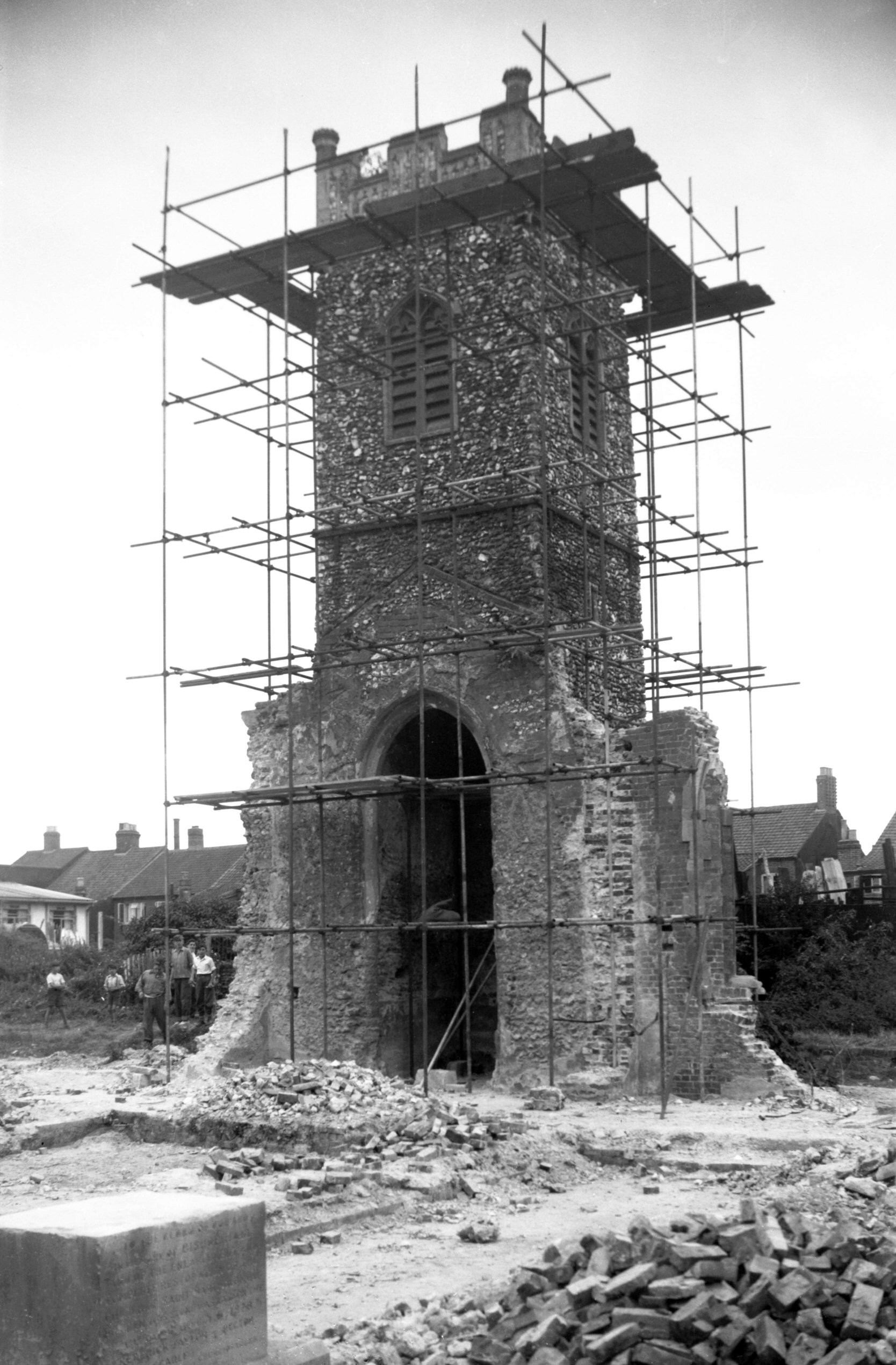
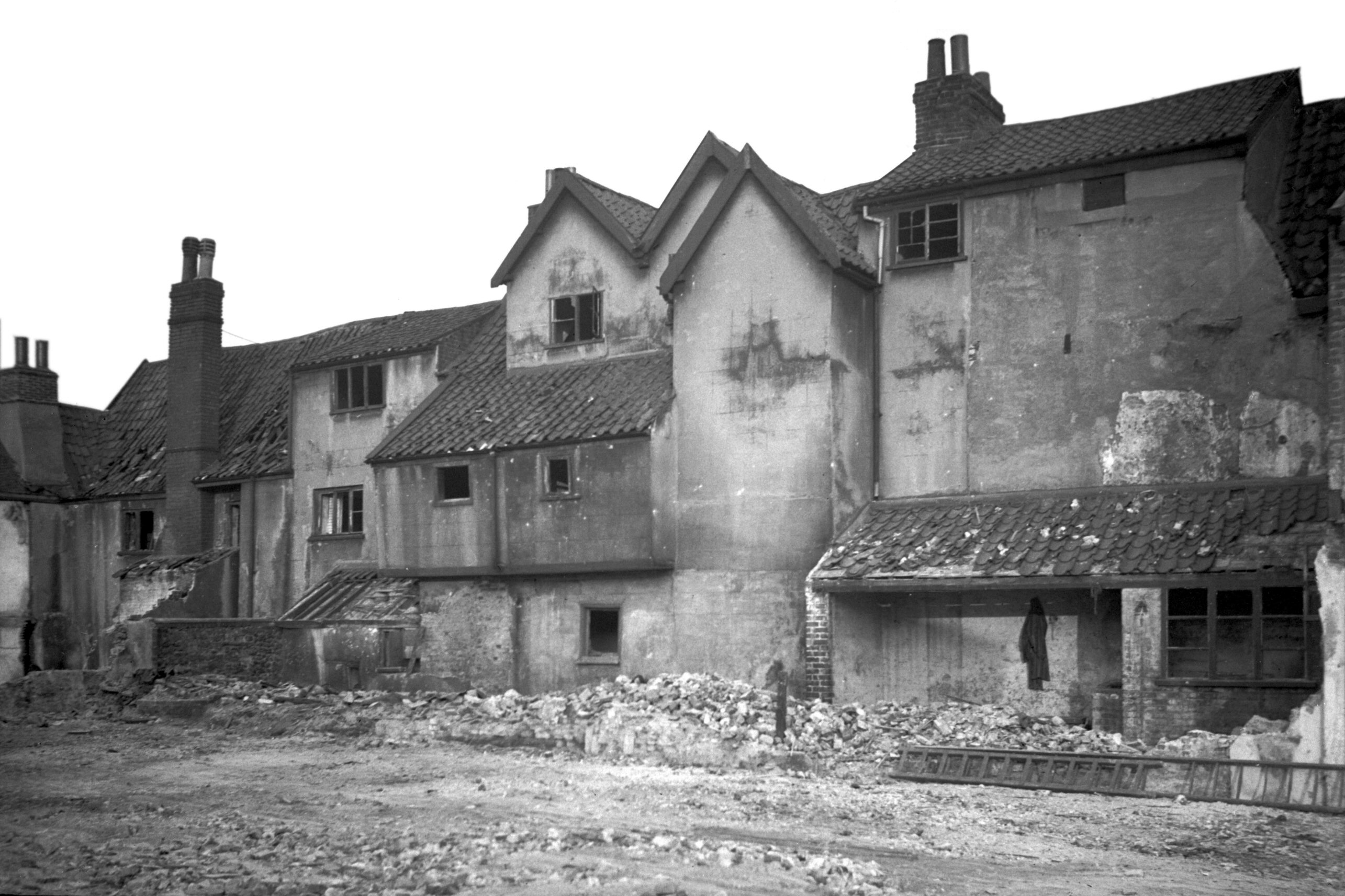
St Bartholomew's Heigham tower conservation [4205]
1953-08-15
The church, including the tower, was completely burnt out
in the raid; only the walls were left standing. The two
bells that had hung in the tower crashed to the ground
and were rendered quite useless; the treble lost its
upper part, and the tenor, falling upside down, had its
canons forced into the top of the bell itself.
Among the monuments existing in 1942 was a tablet on the
south wall of the chancel to the memory of Bishop Hall.
It showed the figure of a skeleton on a black ground
holding in one hand a paper on which was written
"Debemus Morti, Nos Nostraque" and in its other
hand a paper inscribed "Persolvit et Quietus
est". At the foot was the inscription "Josephvs
Hallvs olim humilis Ecclesiae Servus". Other tablets
were to the memory of the Hangar, Haylett, Parr, Robins,
Seaman, Smith and Unthank families.
In 1949 the future of the churchyard and its ruins was
under consideration by the Diocesan Advisory Committee;
services were held in the meantime in the disused Nelson
St Methodist Chapel. Four years later the magistrates
made an order requiring all necessary action to be taken
to make the ruins safe. This meant the demolition of all
but the tower. Within six months the work had been done.
The 44 foot tall tower, which had sustained only slight
exterior damage, was unusual and worthy of preservation,
if only because it had no freestone quoins - a rare
occurrence in East Anglia in a square flint tower. The
tower of Beeston Regis church is another example, but
there the corners are not so carefully constructed as at
Heigham, though larger flints were used.
Repairs to the tower were authorised in January 1976, and
six months later the City Council prepared plans to make
the churchyard into a public open space. No doubt this
had already been foreseen, as on 21st May of the previous
year the remains of Bishop Hall had been exhumed from the
site of the chancel, and taken to be re-interred in the
cloister garth of Norwich Cathedral. |
| |
North
side |
|
|
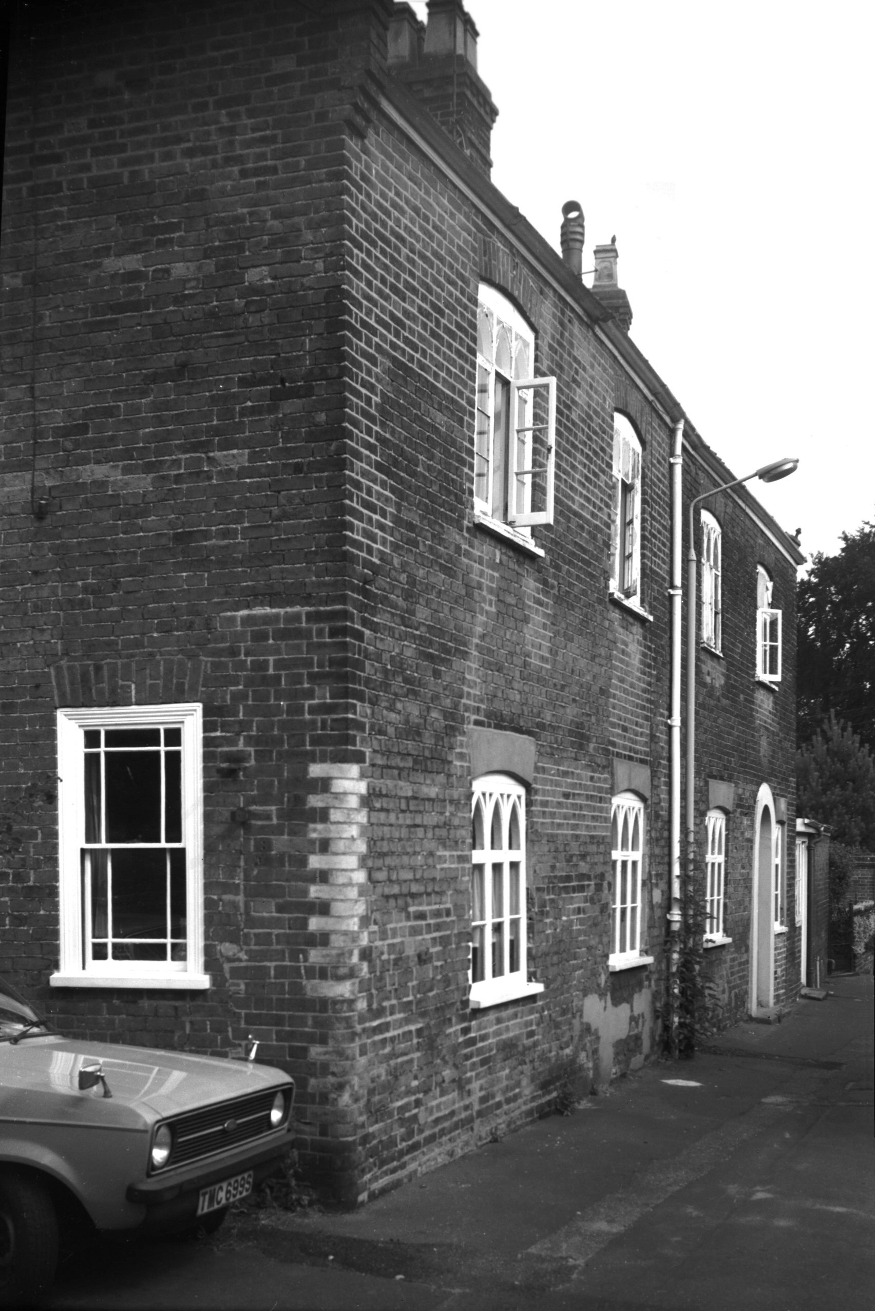
Heigham St 12 view NW [1512] 1937-03-26
The late Tudor age saw the beginning of a movement of the
populace outside the confines of the city walls. There
were two reasons for this: in the first place the walls
were no longer used or required for military purposes,
and secondly the area they bounded was already pretty
fully occupied. One of these early extra-mural properties
was No 12 Heigham St. Much altered as it was during the
course of succeeding centuries, it retained to the last a
fine flint wall with freestone quoins, pierced on two
floors with long ranges of windows, typically Elizabethan
in character and not unlike a manor house of the period.
The third storey, which was of grey brick, was no doubt a
19c addition. |
|
|
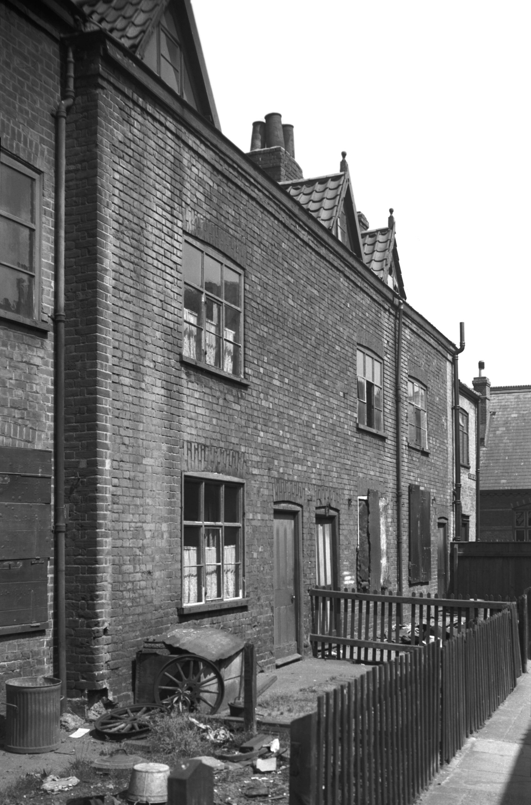
Heigham St Globe Yard west side [1695] 1937-06-06
|
|
|
Heigham St Globe Yard rear [1690] 1937-06-05
|
|
|
Heigham St 14 to 16 [1689] 1937-06-05
|
|
|
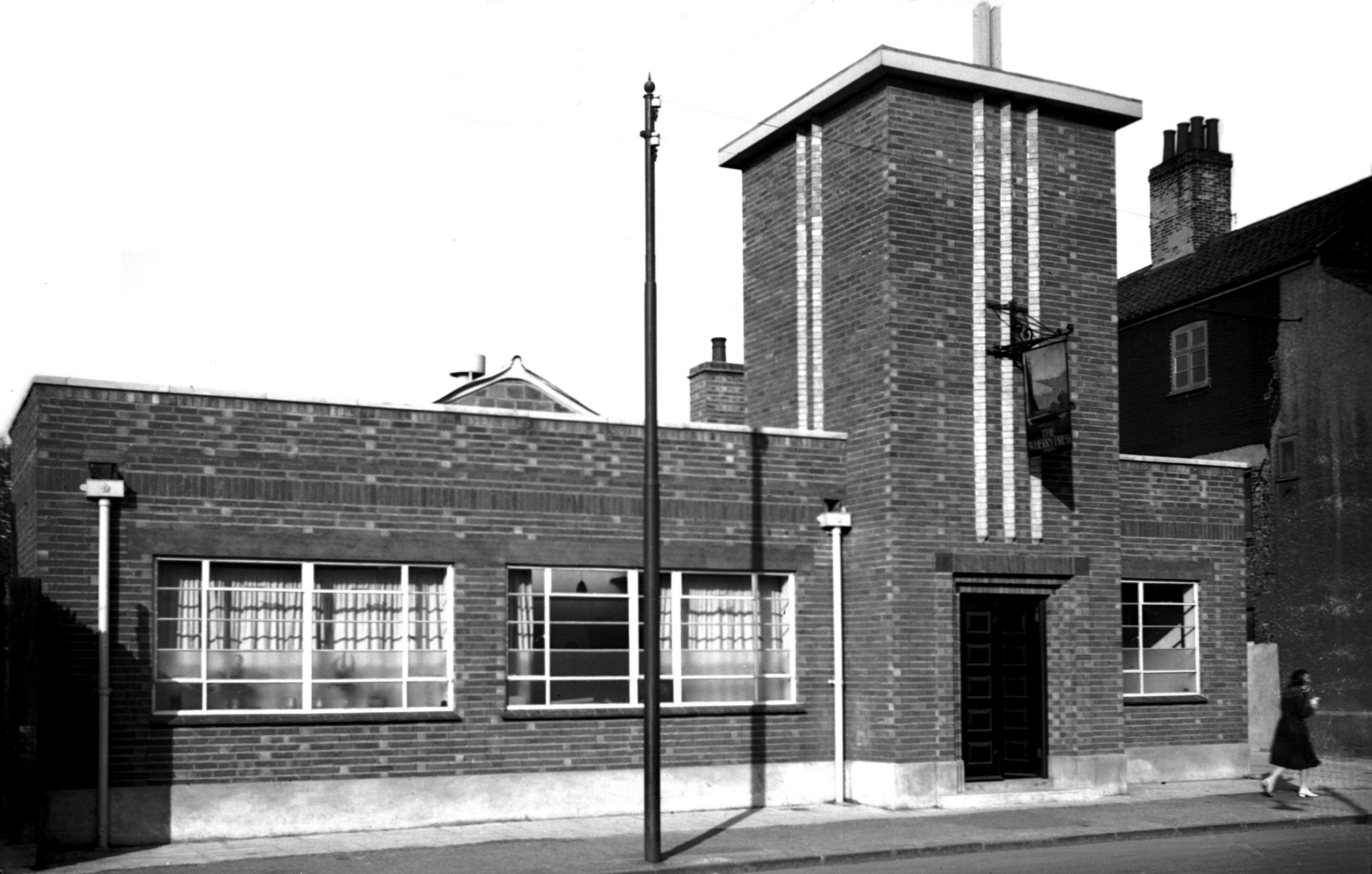
Heigham St 14 Wherry Press [2422] 1938-05-23
Erected 1937. |
|
|
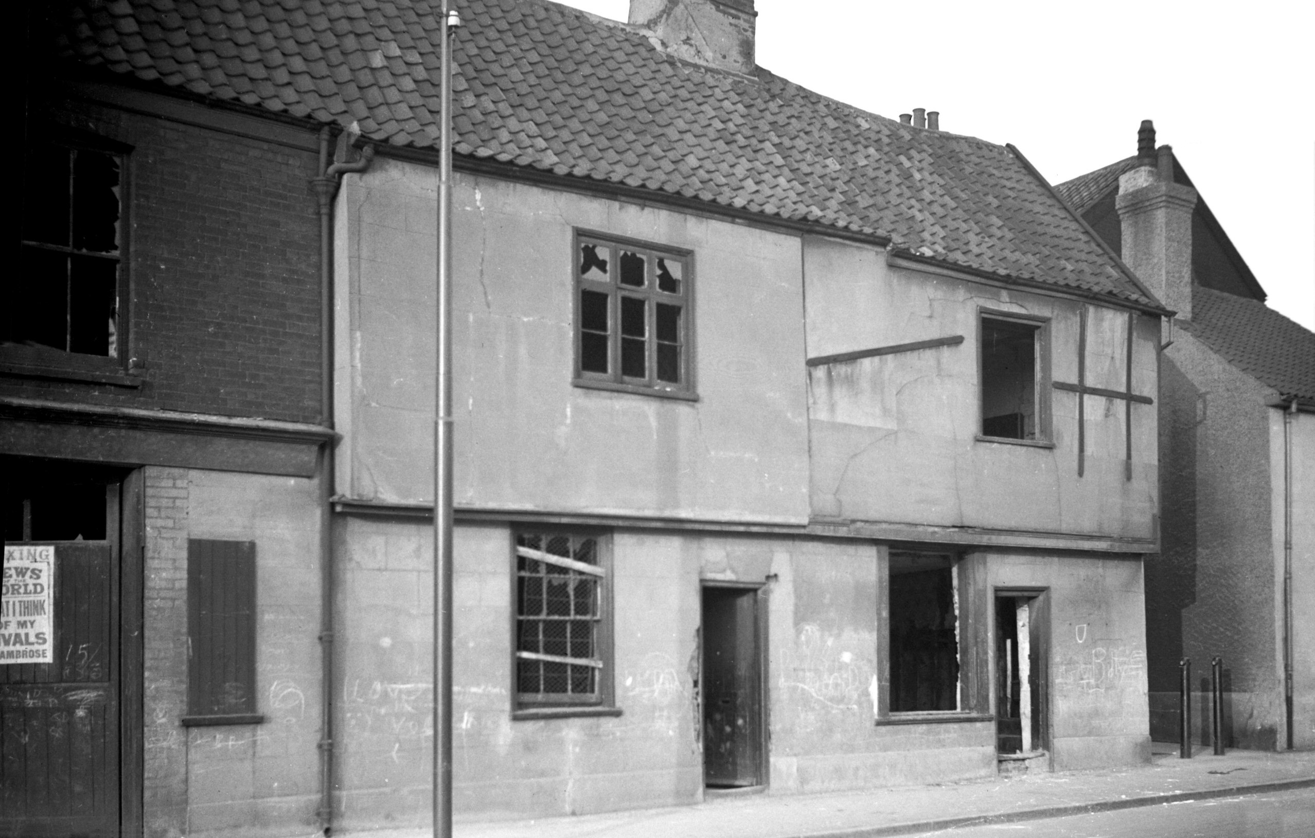
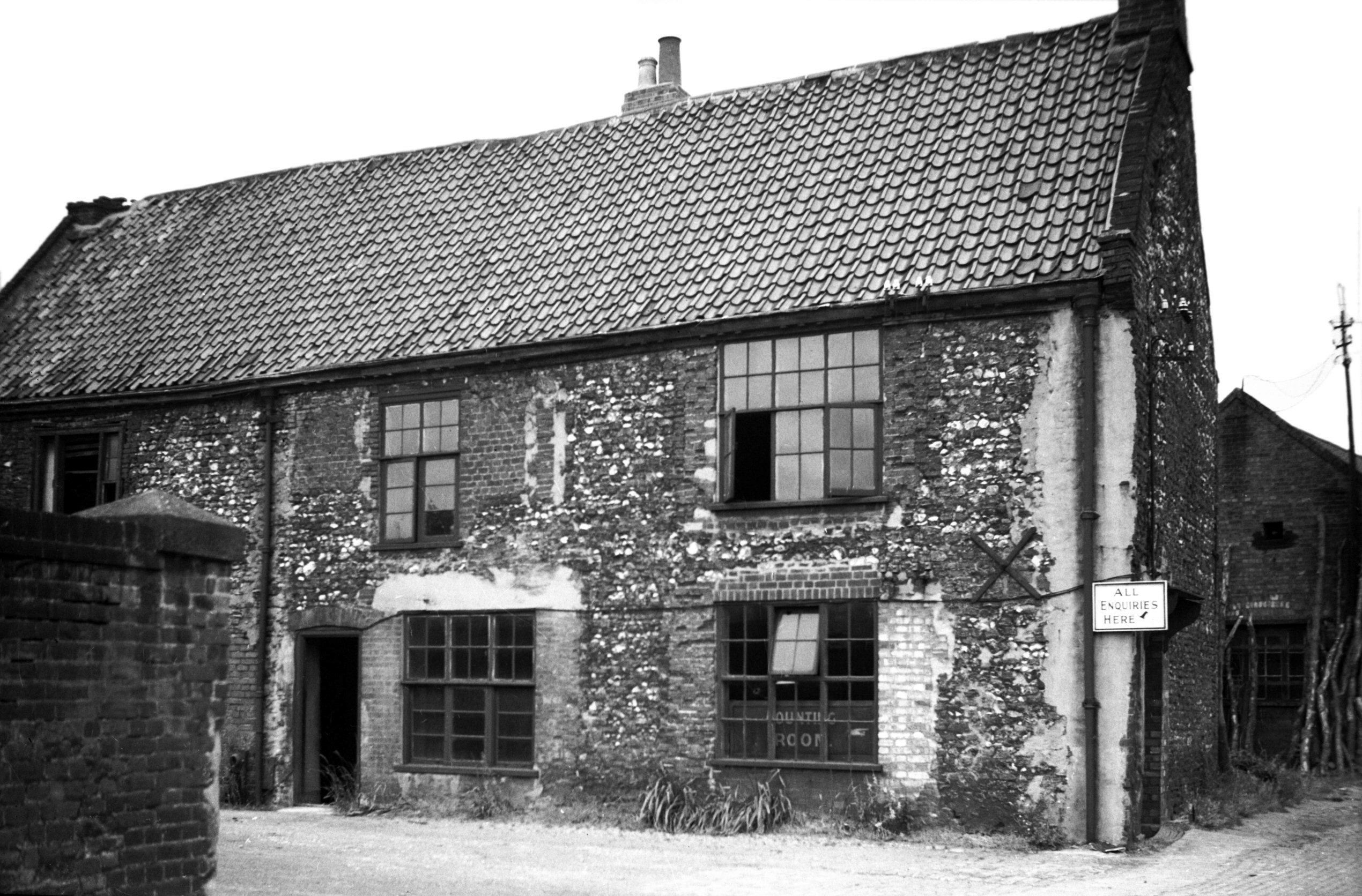
Heigham St 26 former Orchard Tavern [1761] 1937-07-08
Another house of mediaeval origin and built outside the
city proper was No 26 Heigham St. Here, however, the
walls were of a rubble-like quality by no means
displaying such a fine finish as the eastern front of its
neighbour, No 12. During the 19c this building was
licensed as the Orchard tavern, a business that was
transferred to a new building fronting the street in
later years. Both buildings were gutted in the April
raids, as was also No 12. |
|
|
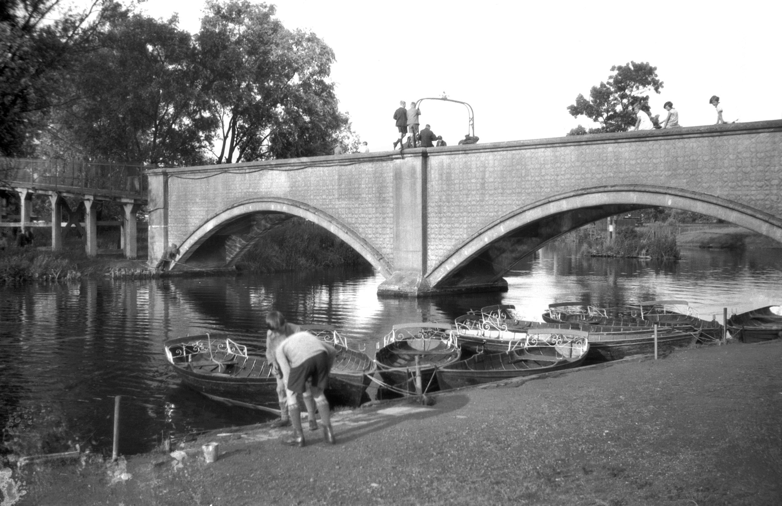
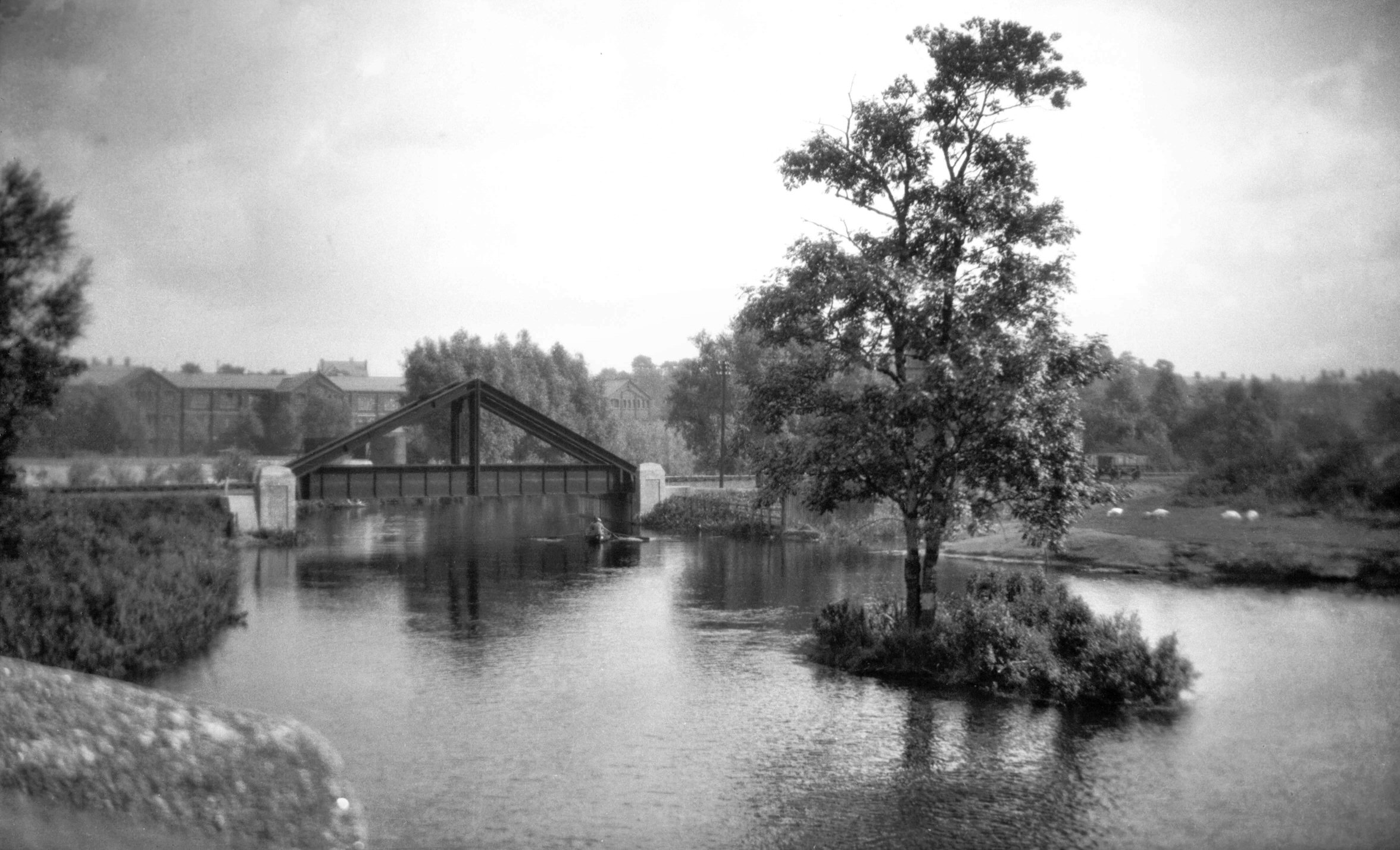
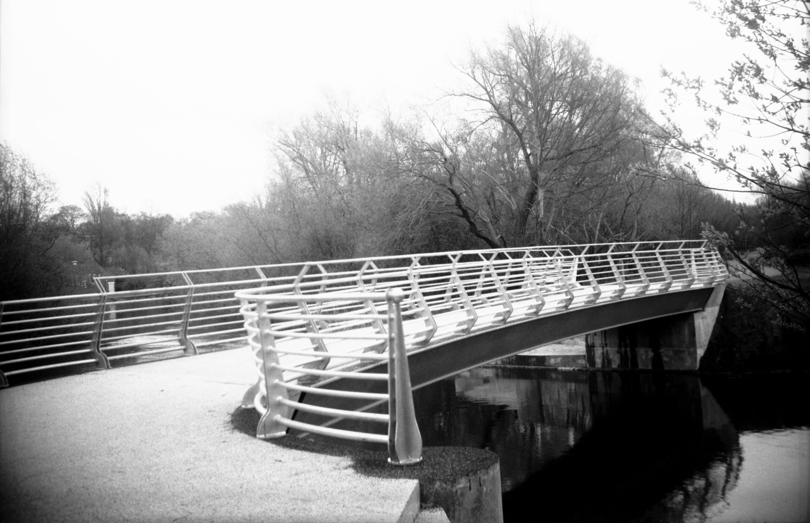
Wensum Dolphin footbridge west side [B620] 1933-07-11
No previous bridge occupied the site but it superseded
and ancient ferry. Built as a result of strong agitation
amongst the people of the district, the City Engineer
pointed out that because of bad approach gradients at the
northern end, the site of the present Mile Cross Rd was a
much better one for a vehicular bridge. Consequently it
is a footbridge only and was opened by the Mayor, Ernest
Egbert Blyth MA LL.D on 15th December 1909. The walkway
is only 6 feet wide and beyond the river bridge (which
has a double span of some 75 feet) is carried upward on
reinforced concrete supports to another bridge spanning
the site of the M and GN Railway line. This has been
described as an early Norwich example of the use of this
material. |
|
|
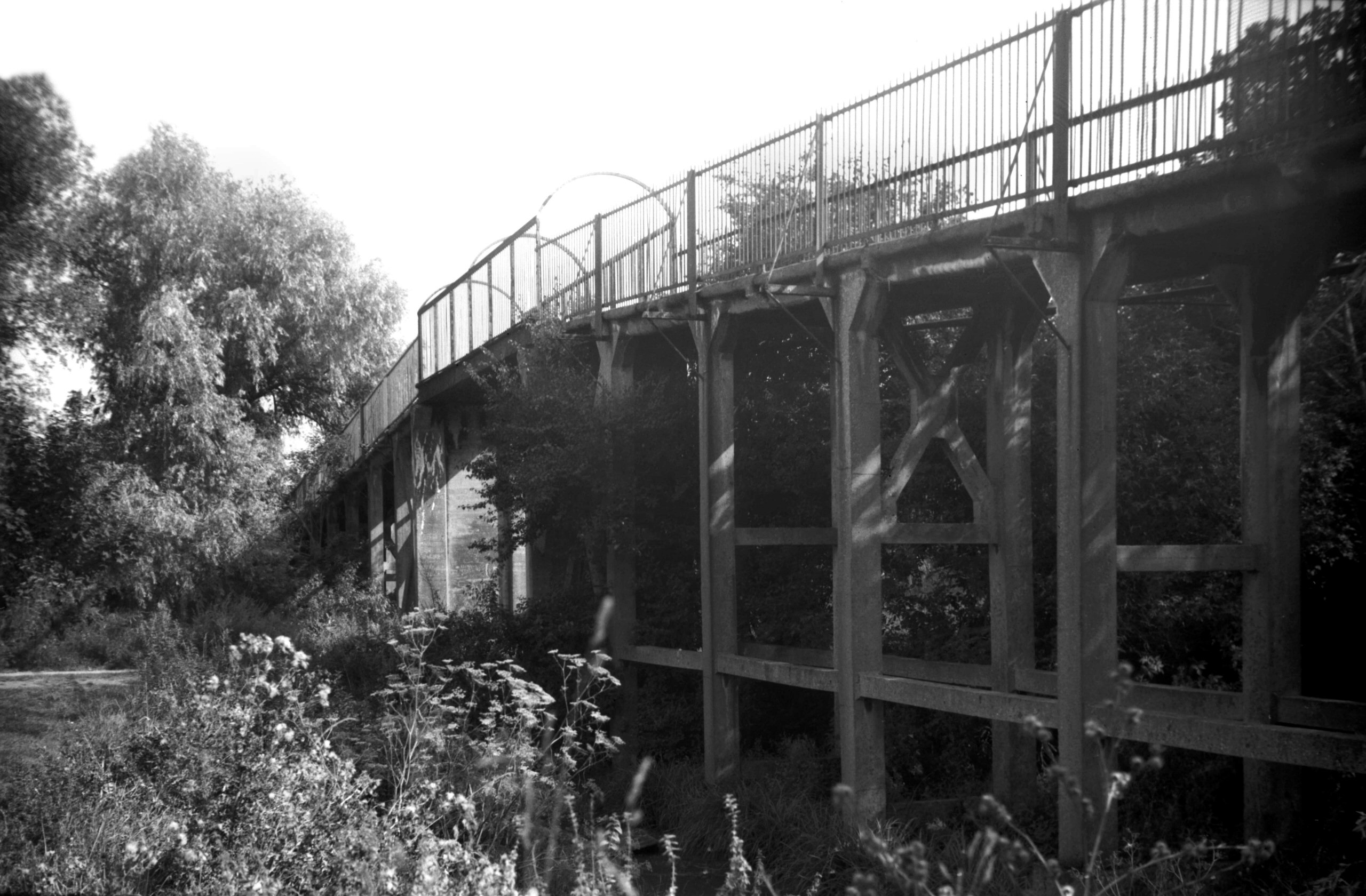
Wensum Dolphin footbridge walkway to river [6580]
1989-09-07
From site of railway line. |
|
|
Wensum M and GN rail bridge from Dolphin Br [B154]
1931-00-00
|
|
|
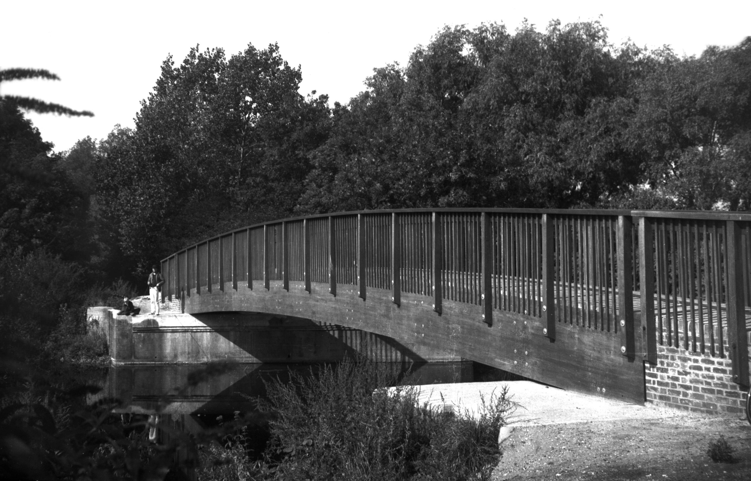
Wensum footbridge on site of M and GN rail [6425]
1986-09-20
Constructed 1986 on the site of an "A" frame
bridge carrying the disused M and GN railway line. |
|
|
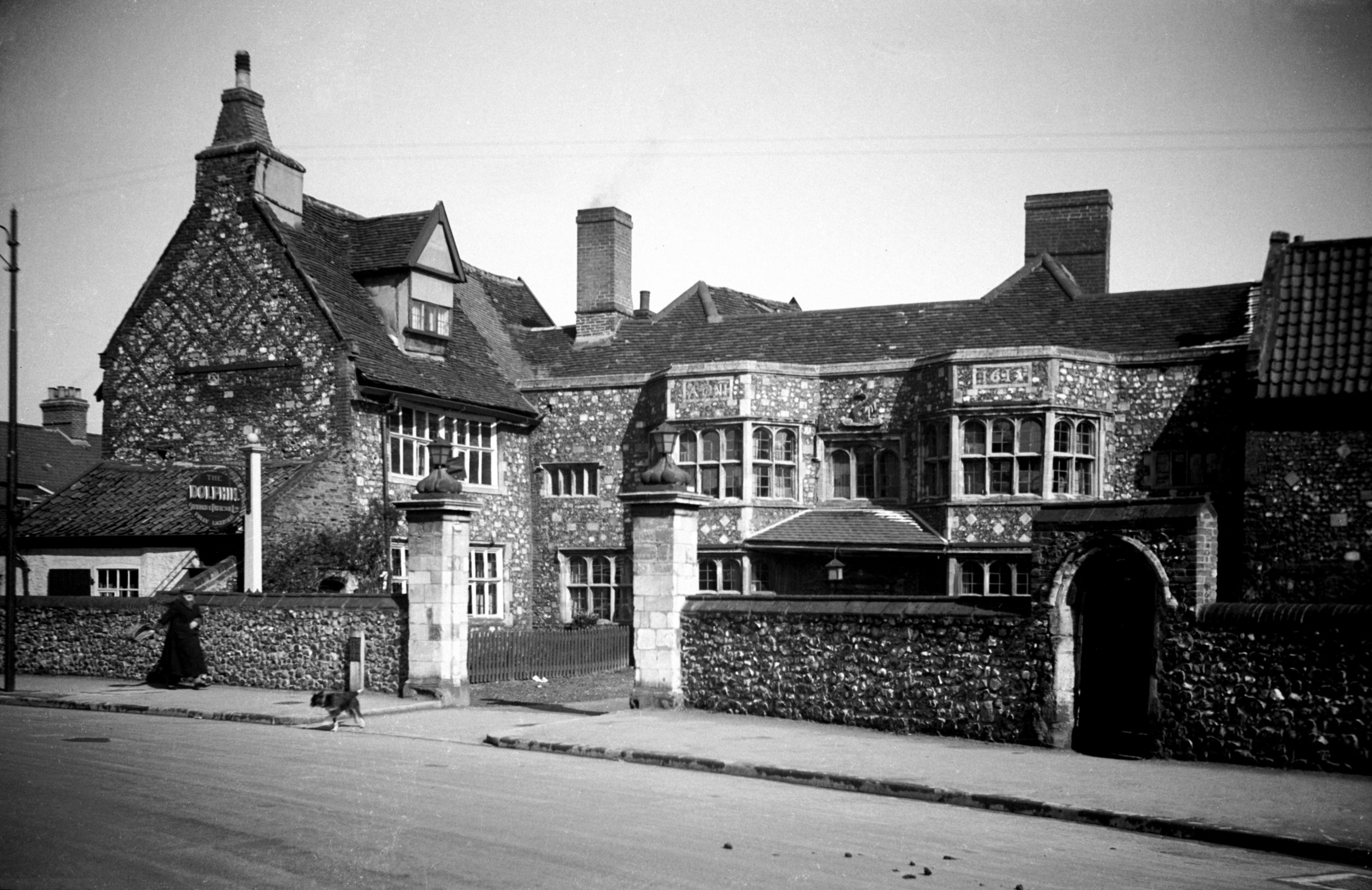
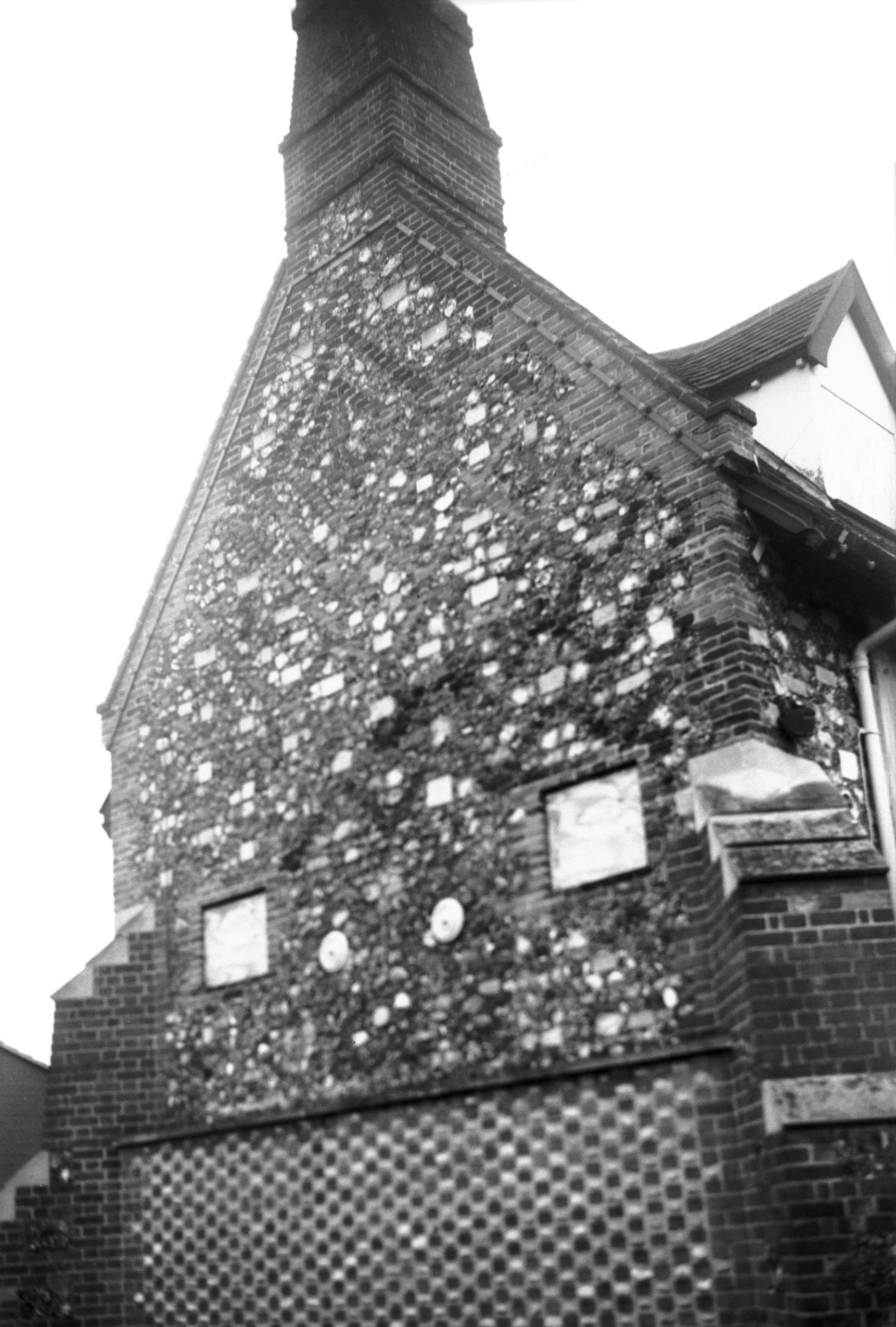
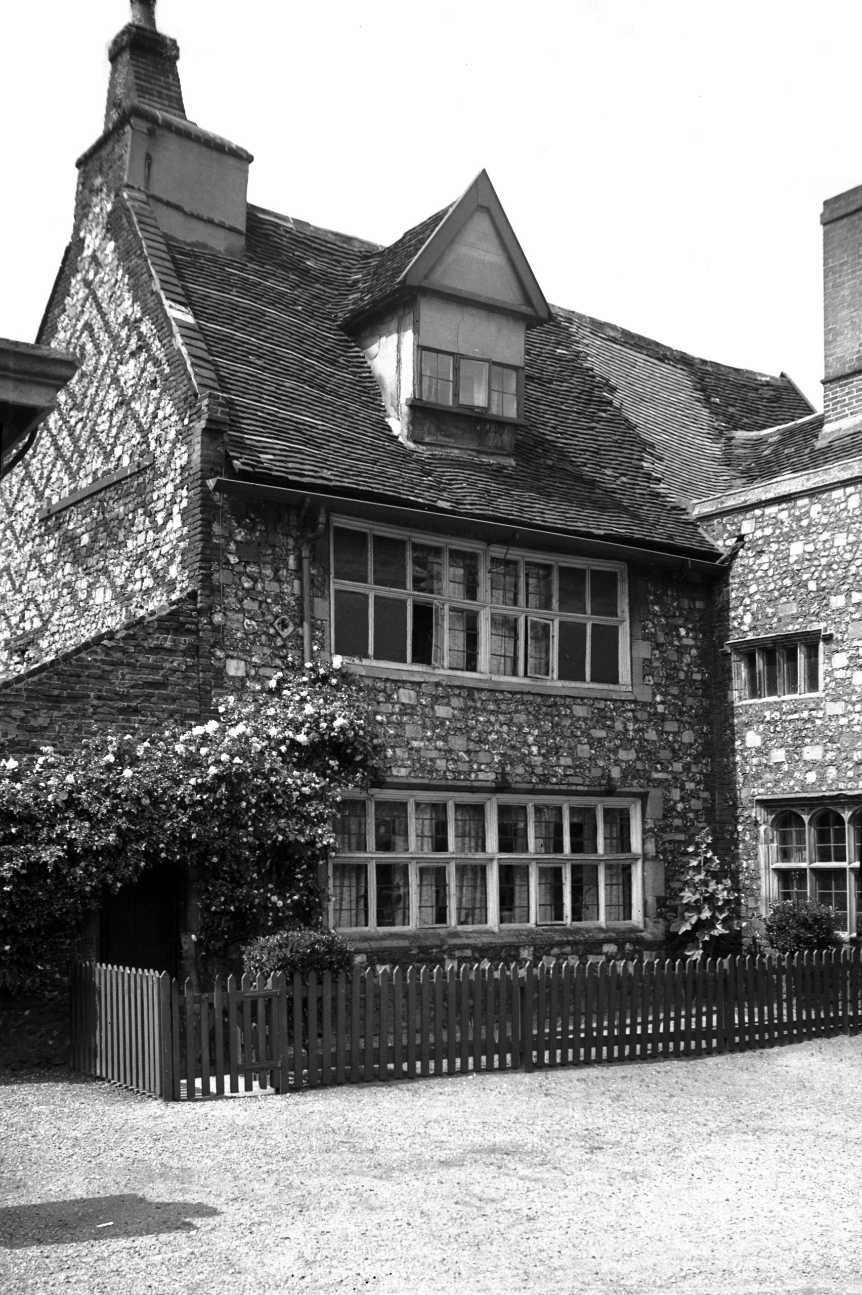
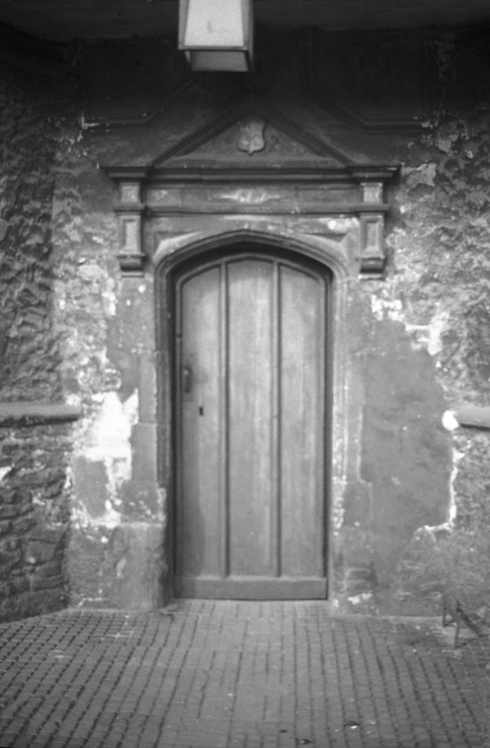
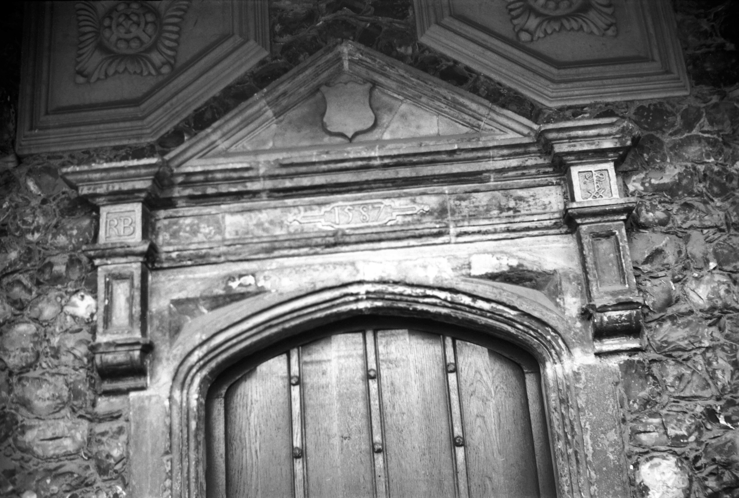
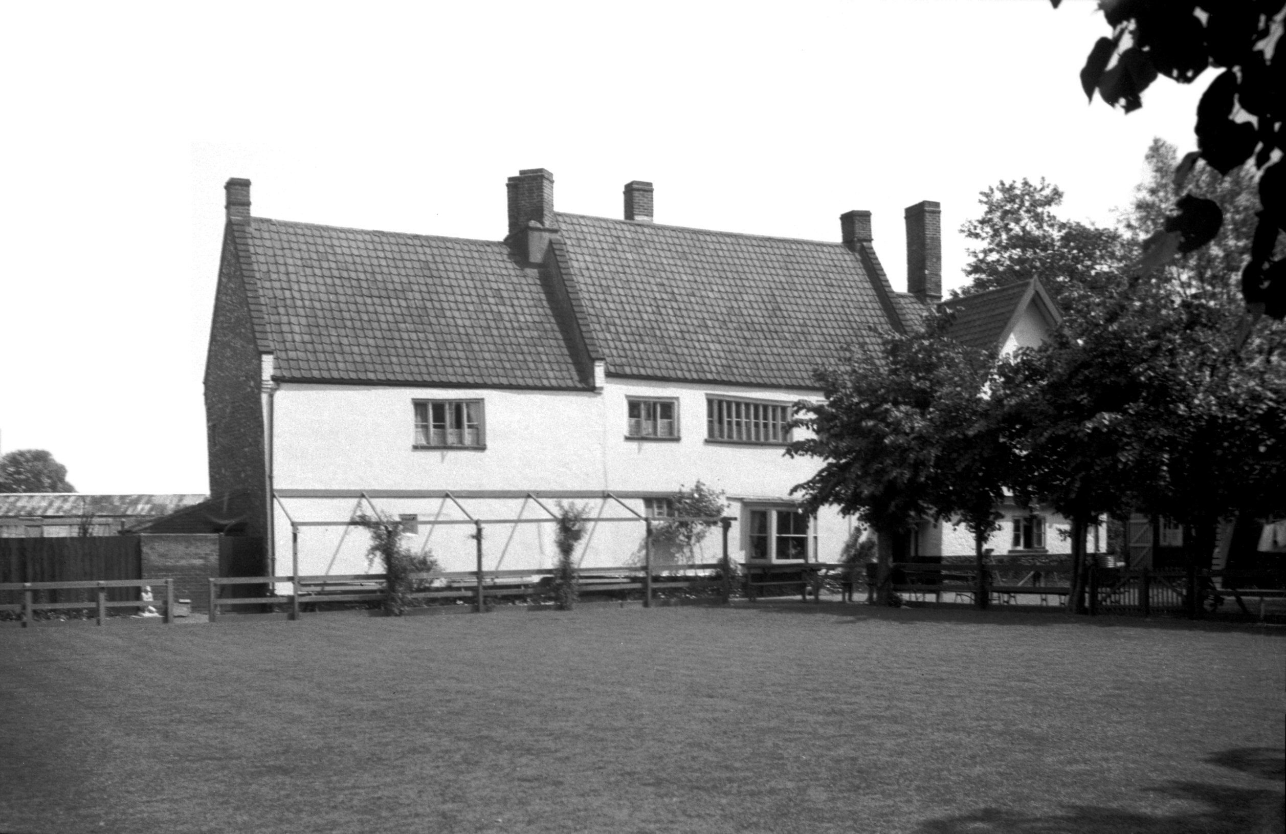
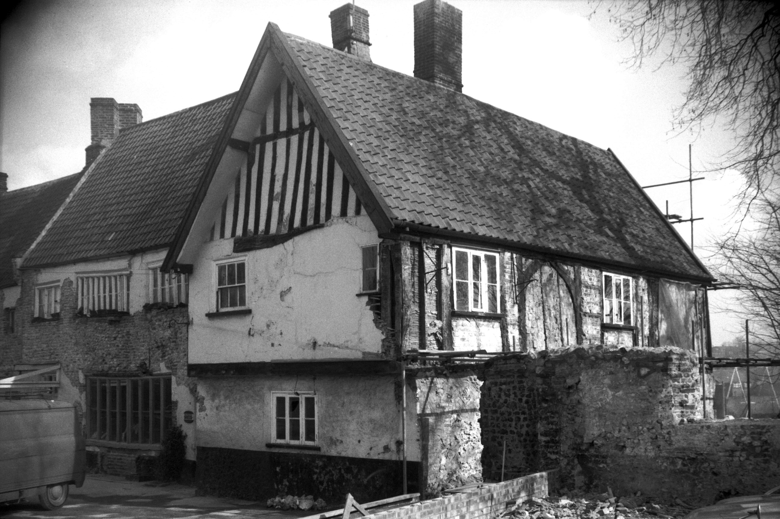
Heigham St 252 Dolphin Inn [1513] 1937-03-26
Originally the residence of Richard Browne, merchant,
whose initials, arms and mark are above the doorway with
date 1587. He was Sheriff in 1595 which date appears in
brick on the west wing gable. The main (south) front has
"A.DN" "1615" abovethe oriels. The
most famous of its past occupants was Joseph Hall, Bishop
of Norwich 1642 to 1656. In 1643 Civil War broke out and
he was forcibly ejected from his Palace. He then took up
residence here, and on his death was buried in the
neighbouring church of St Bartholomew. |
|
|
Heigham St 252 Dolphin Inn north side [1702]
1937-06-08
|
|
|
Heigham St 252 Dolphin Inn south gable [7743]
2000-04-18
Of the west wing. |
|
|
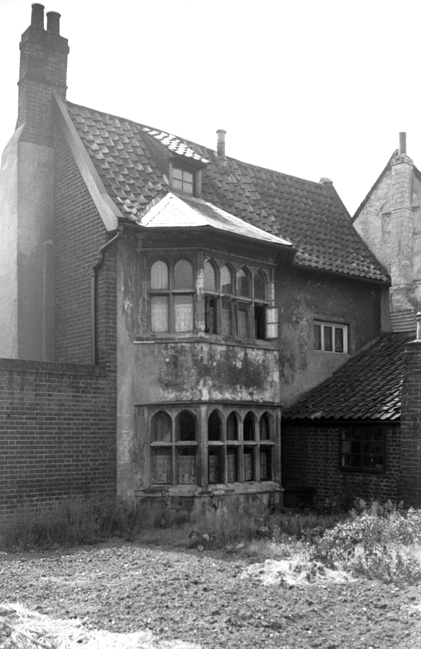
Heigham St 252 Dolphin Inn west wing [2466]
1938-06-17
|
|
|
Heigham St 252 Dolphin Inn 17c doorway [0453]
1935-04-14
|
|
|
Heigham St 252 Dolphin Inn main door head [7744]
2000-04-18
|
|
|
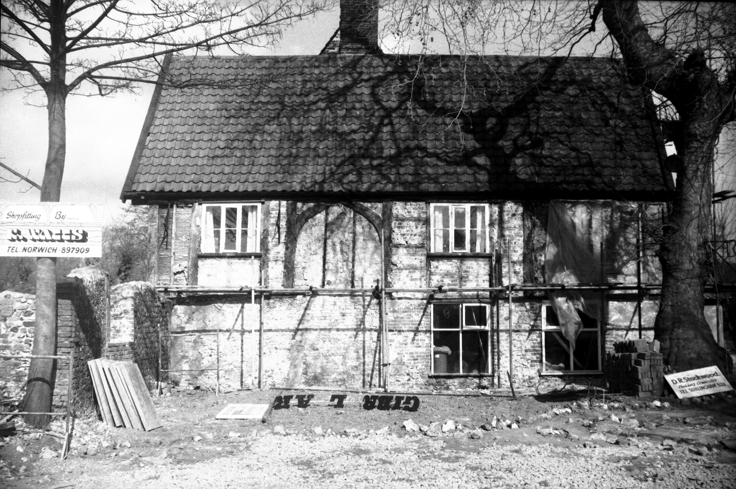
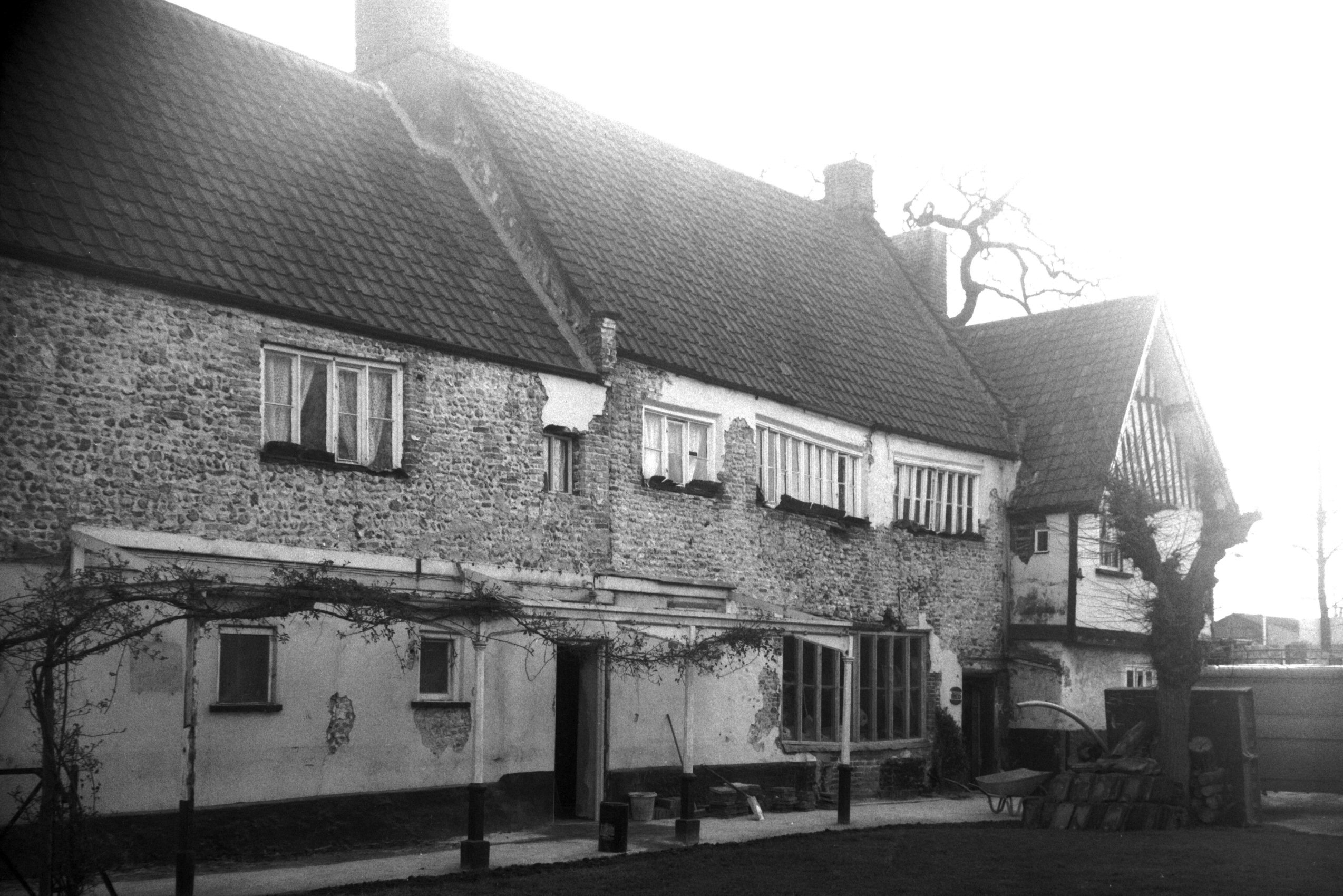
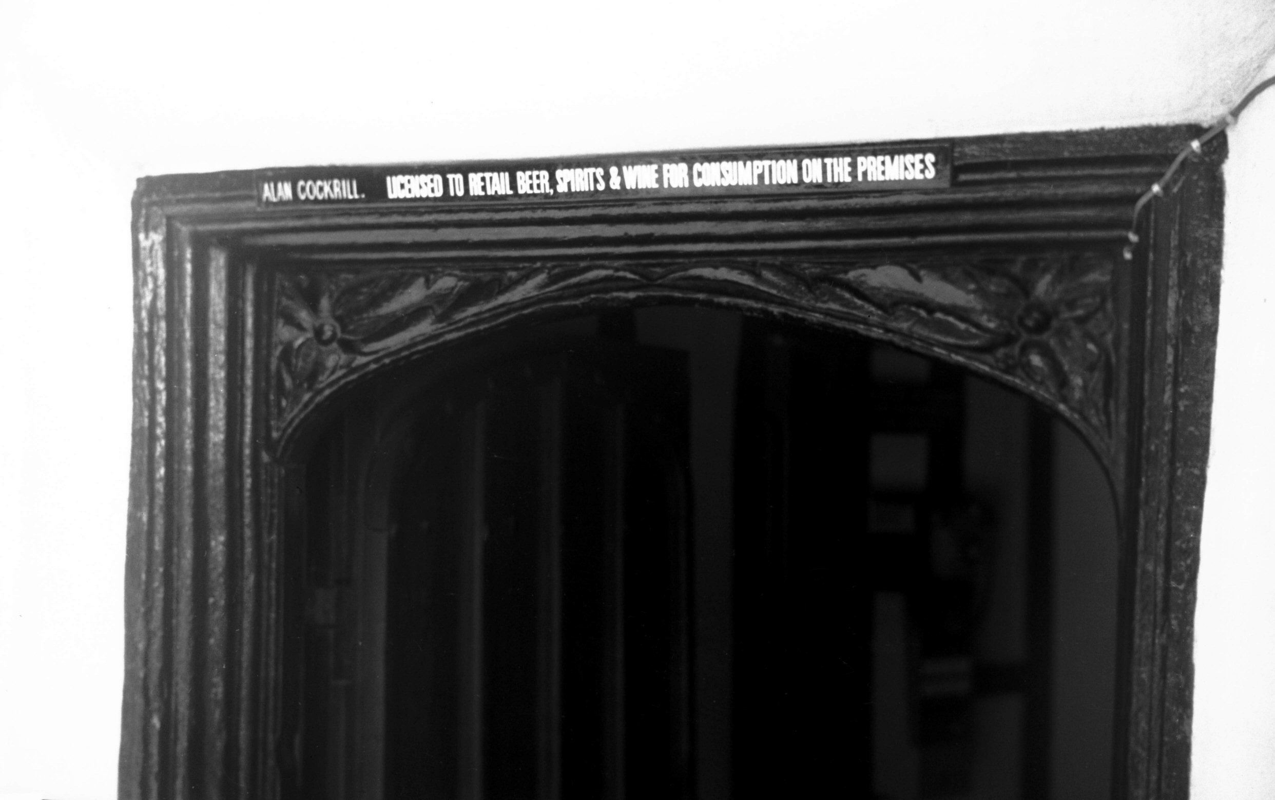
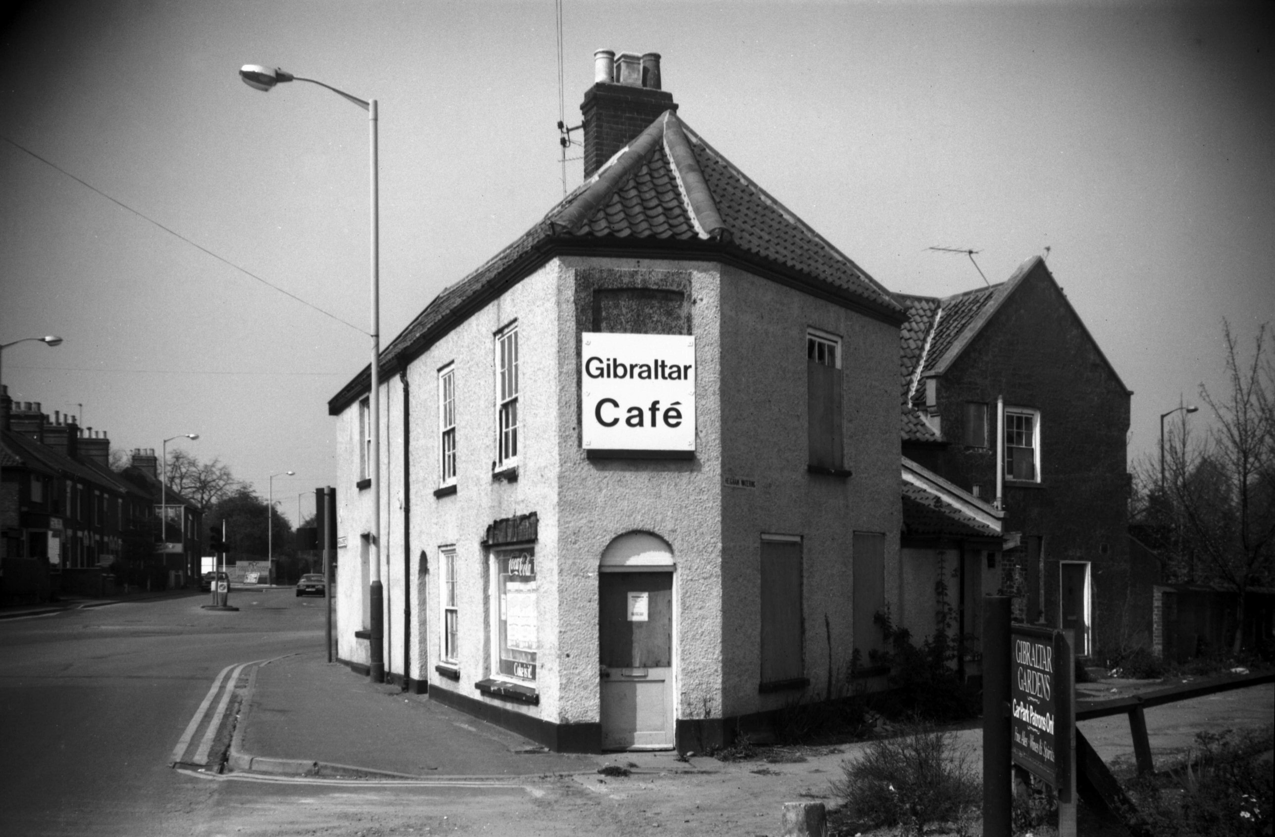
Heigham St 300 Gibraltar Gardens PH W side [1693]
1937-06-06
The pub is three buildings in one. The south end nearest
Heigham St dates from 1475. The old cottage end near the
river is from 1550, and the middle part which houses the
main bar is from 1590. |
|
|
Heigham St 300 Gibraltar Gardens PH S side [5729]
1977-03-12
Renovated 1977. |
|
|
Heigham St 300 Gibraltar Gardens PH SW side [5730]
1977-03-12
|
|
|
Heigham St 300 Gibraltar Gardens PH W side [5731]
1977-03-12
|
|
|
Heigham St 300 Gibraltar Gardens PH lintel [5923]
1978-07-25
16c doorway. |
|
|
Heigham St 290 Heigham Watering entrance [6603]
1990-04-24
|
|
|
Heigham St Dial Square [1701] 1937-06-08
|
|
|
Heigham St 304 to 308 [1699] 1937-06-08
|
|
|
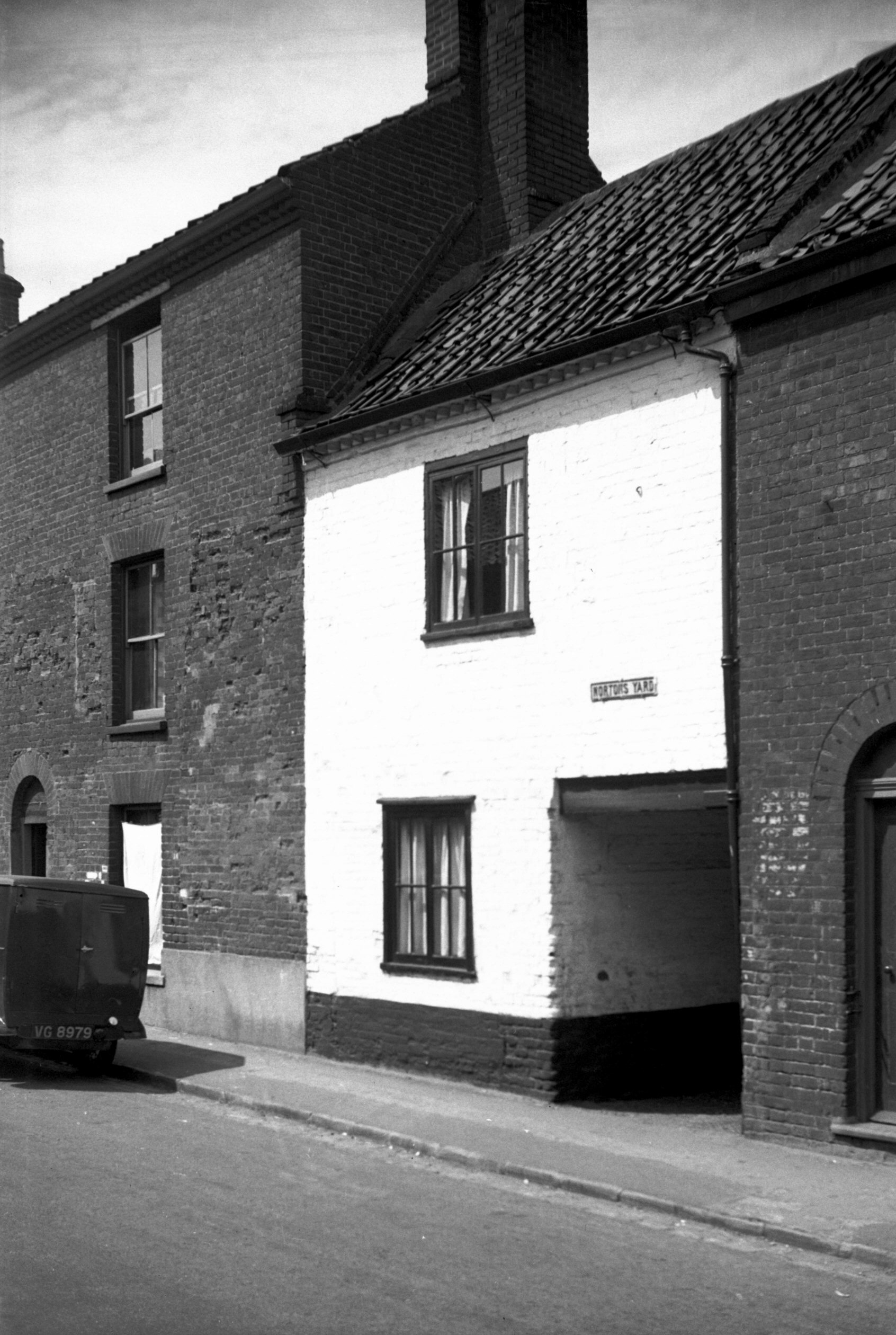
Heigham St 310 Norton's Yard entrance [1700]
1937-06-08
|
|
Hellesdon Mill Lane: |
| |
From
Hellesdon
Rd |
|
|
Hellesdon Mill Lane millrace [6731] 1991-08-25
The mill itself has long since gone but the sluice gates
remain and are used to control the flow of water between
here and the New Mills further downstream. In heavy rain
or during periods of thaw after snow, the gates may be
closed to prevent the danger of flooding in the city, or,
in dry weather, they may be opened more. |
|
|
Hellesdon Mill Lane ancillary building [6732]
1991-08-25
|
|
Hellesdon Rd: |
| |
From
Dereham Rd to Low Rd Hellesdon
passing Hellesdon Mill Lane |
|
|
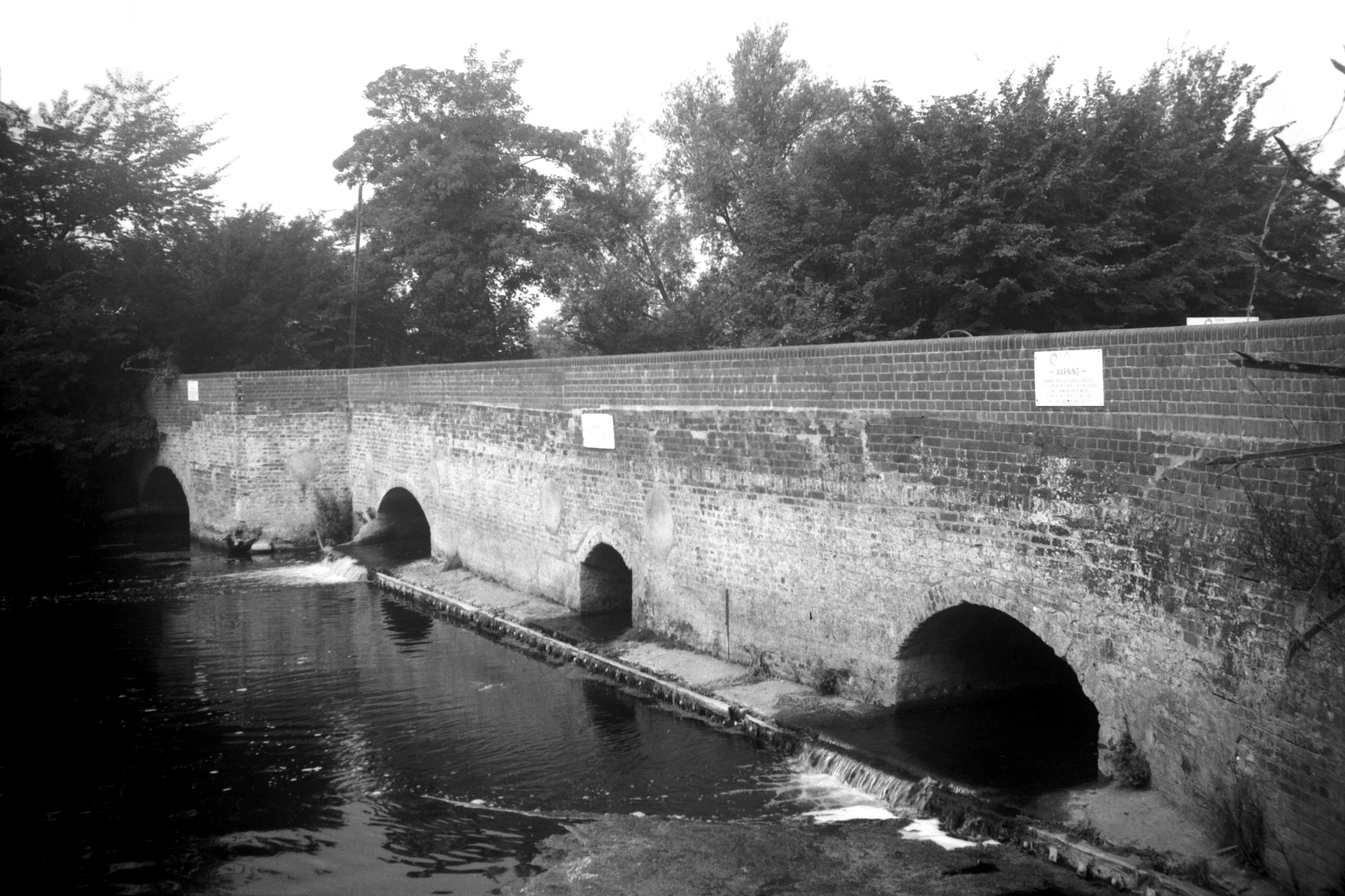
Wensum Hellesdon Bridge west side [B627] 1933-07-16
Except that Hellesdon bridge is mentioned in an account
of the city boundary in 1556, there is little record of
previous structures. The present bridge is a single 40
feet span of cast iron with a width between the parapets
of 12 feet. It was erected by the Corporation in 1819 at
a cost of £1,169, the builder and architect being James
Frost of St Faith's Lane Norwich. At its southern end the
road was built up to a bridge over the adjacent railway
line in the early 1880's but has since reverted to its
original level following the abandonment of the line. |
|
|
Wensum footbridge on site of rail Hellesdon [7742]
2000-04-18
Constructed 2000, replacing the 1986 bridge. |
|
|
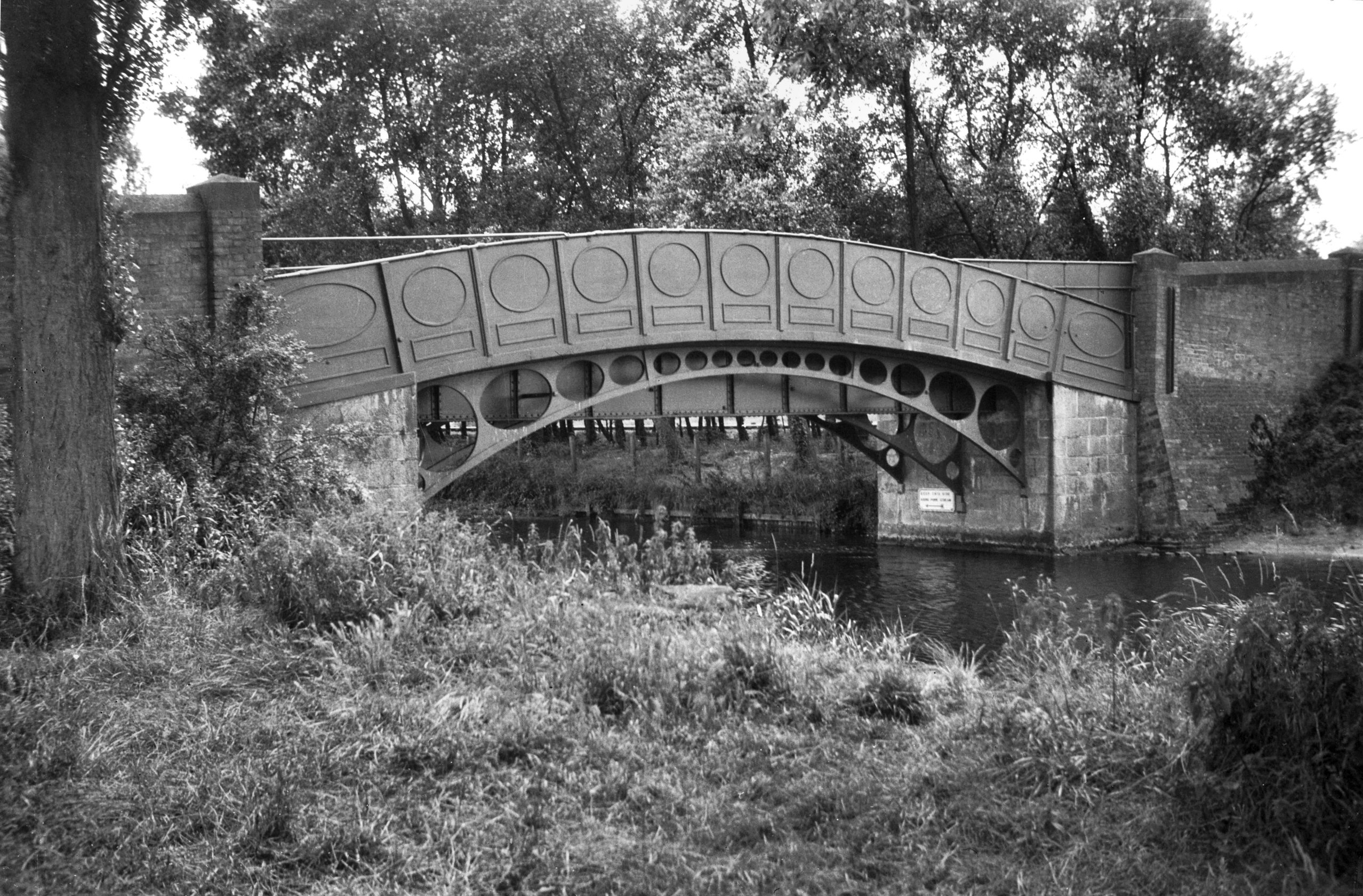
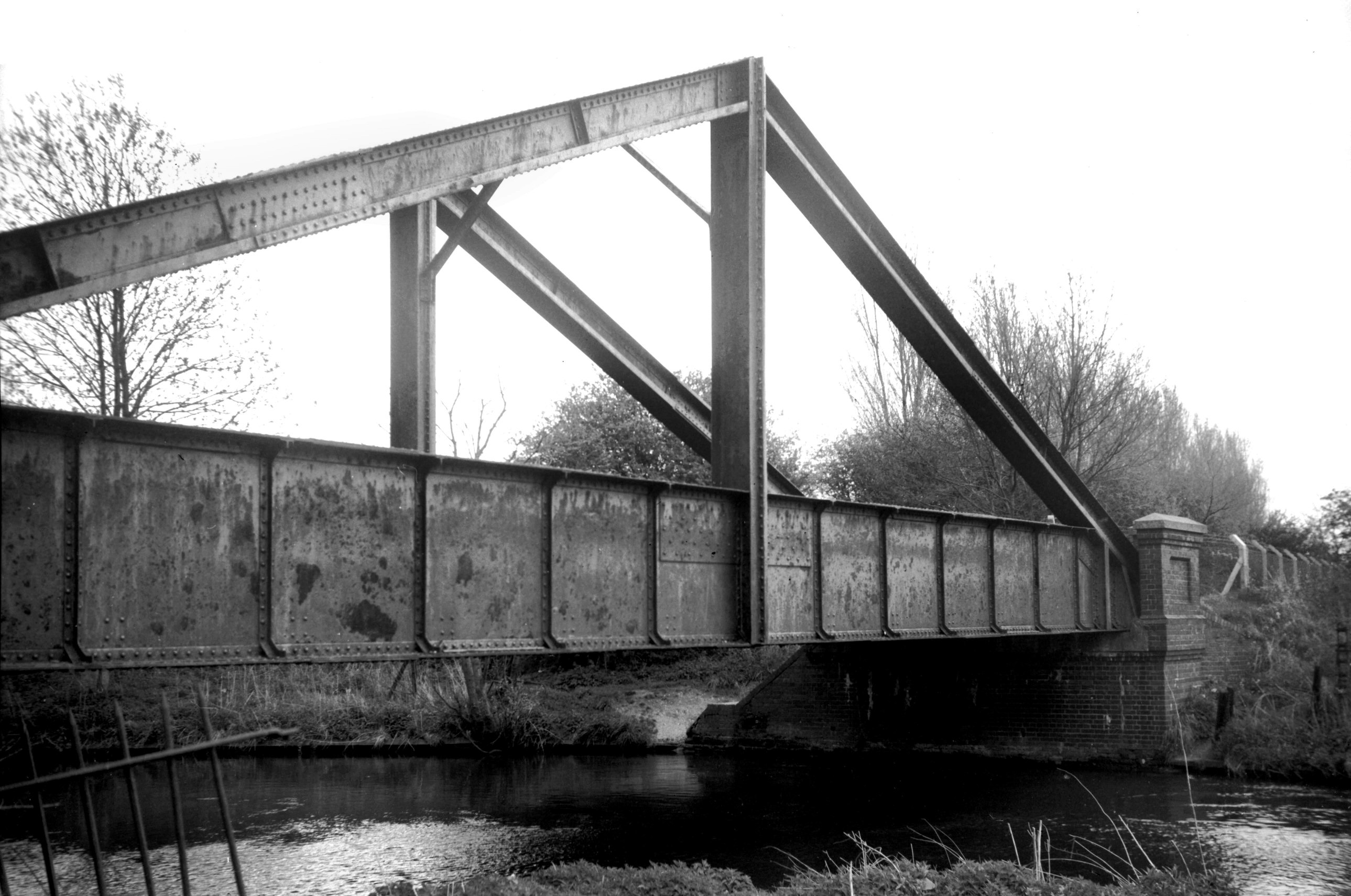
Wensum M and GN rail bridge Hellesdon [6362]
1986-05-08
Three "A" frame bridges were built over the
river Wensum when the Midland and Great Northern railway
constructed a spur line from Melton Constable to their
new City Station near Heigham St, Norwich around 1880.
One was around 500 yards east of Hellesdon Station;
another was a short distance downstream from the Dolphin
footbridge. A third bridge of similar construction was
built a mile or so further on at Drayton. |
|
Hospital Lane: |
| |
From
Hall Rd to City Rd
North side |
|
|
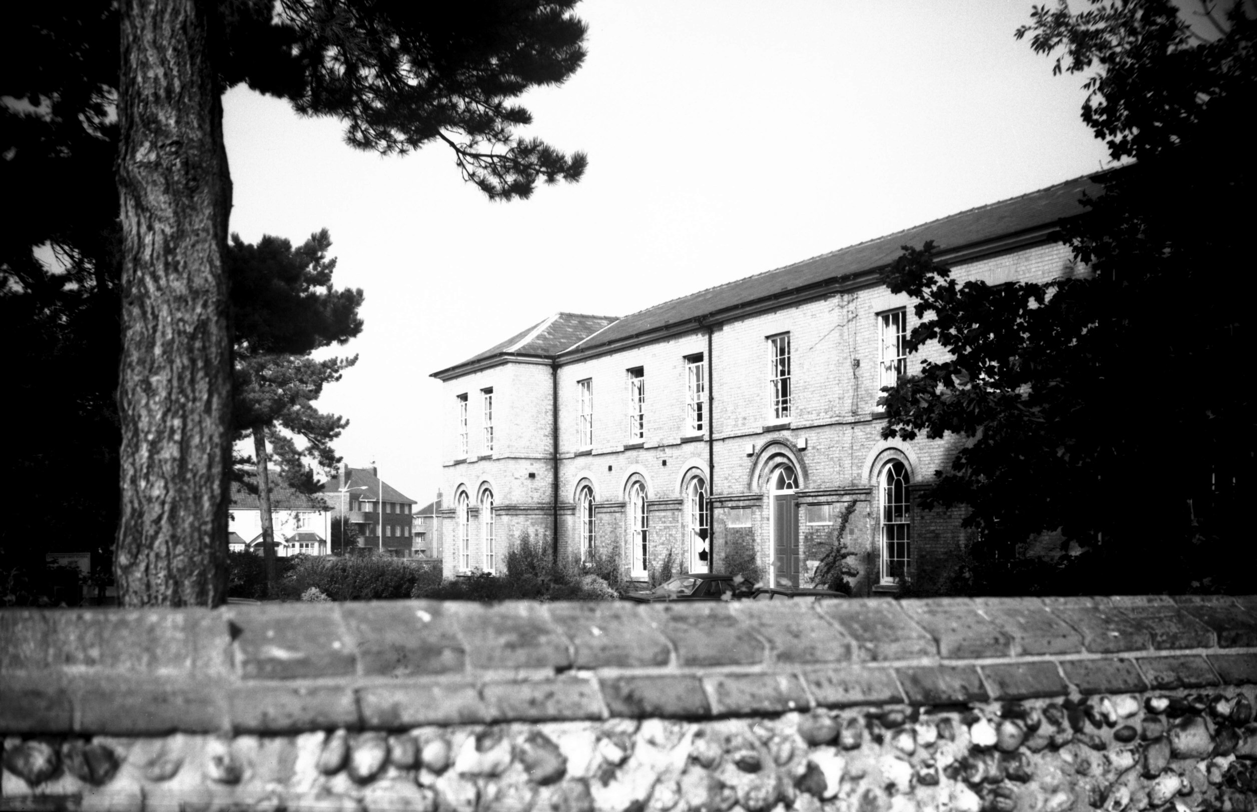
Hospital Lane Lakenham First School [6657] 1990-10-12
Built 1863 as Anguish's Hospital School of Housecraft for
Girls. |
|
Hurd Rd: |
| |
From
Pettus Rd (South
Park Avenue) |
|
|
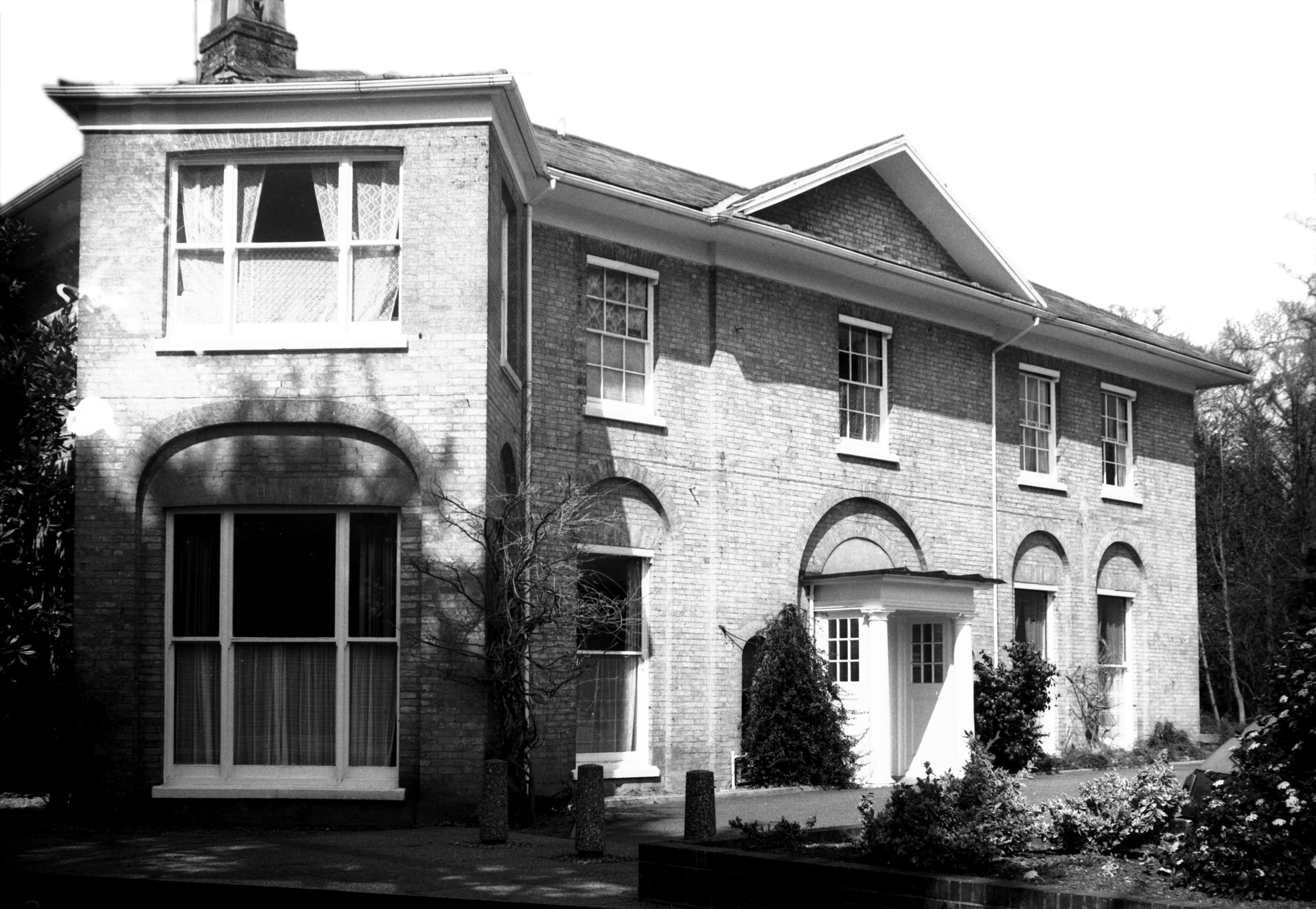
Hurd Rd Eaton Hall south front [6062] 1980-04-12
In 1812 this was the residence of Alderman Jonathan
Davey. |
|
|
Hurd Rd Eaton Hall south side portico [6061]
1980-04-12
|
|
|
Hurd Rd Eaton Hall W side Regency doorway [6063]
1980-04-12
|
|
Ice House Lane: |
| |
From
Bracondale |
|
|
Ice House Lane 1 [6317] 1984-08-16
|
|
Ipswich Rd: |
| |
From
Newmarket
Rd / St Stephen's Rd / Grove
Rd towards Keswick
passing Lakenham Rd, Daniels
Rd, Maid Marian Rd (Tuckswood), Hall
Rd |
|
|
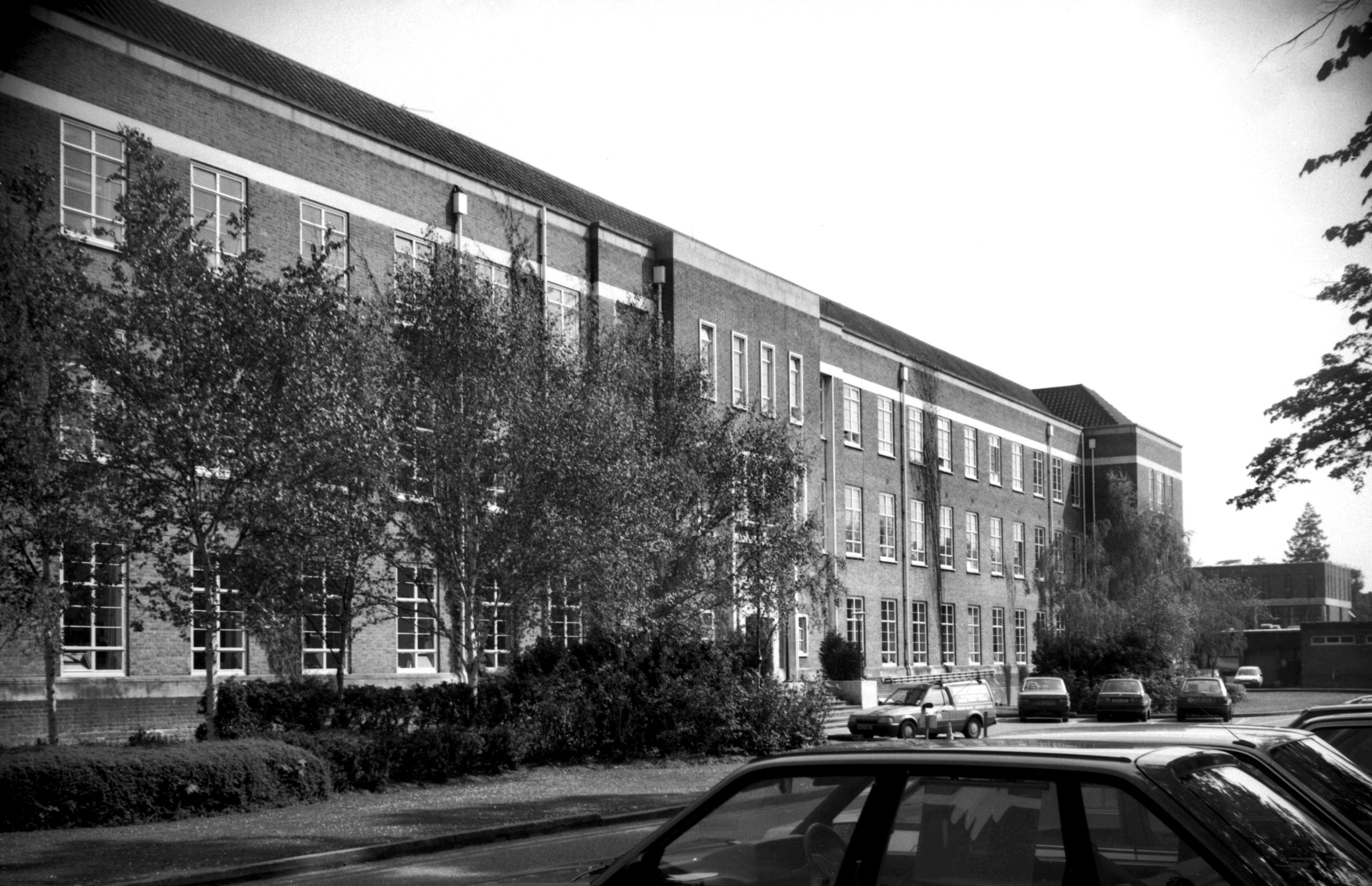
Ipswich Rd City College [6683] 1991-05-20
Opened 8th October 1953, architect J.G.Hannaford. |
|
|
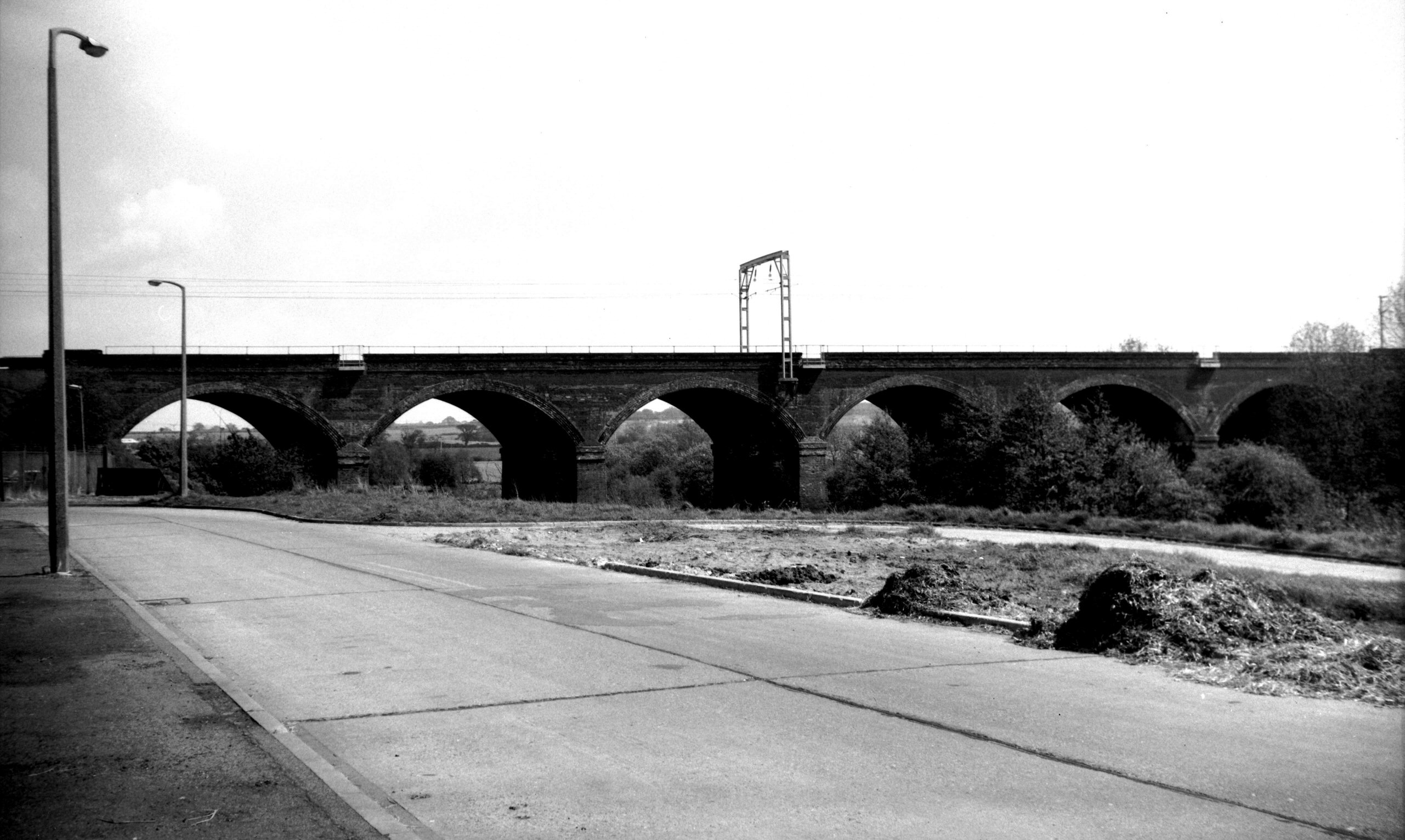
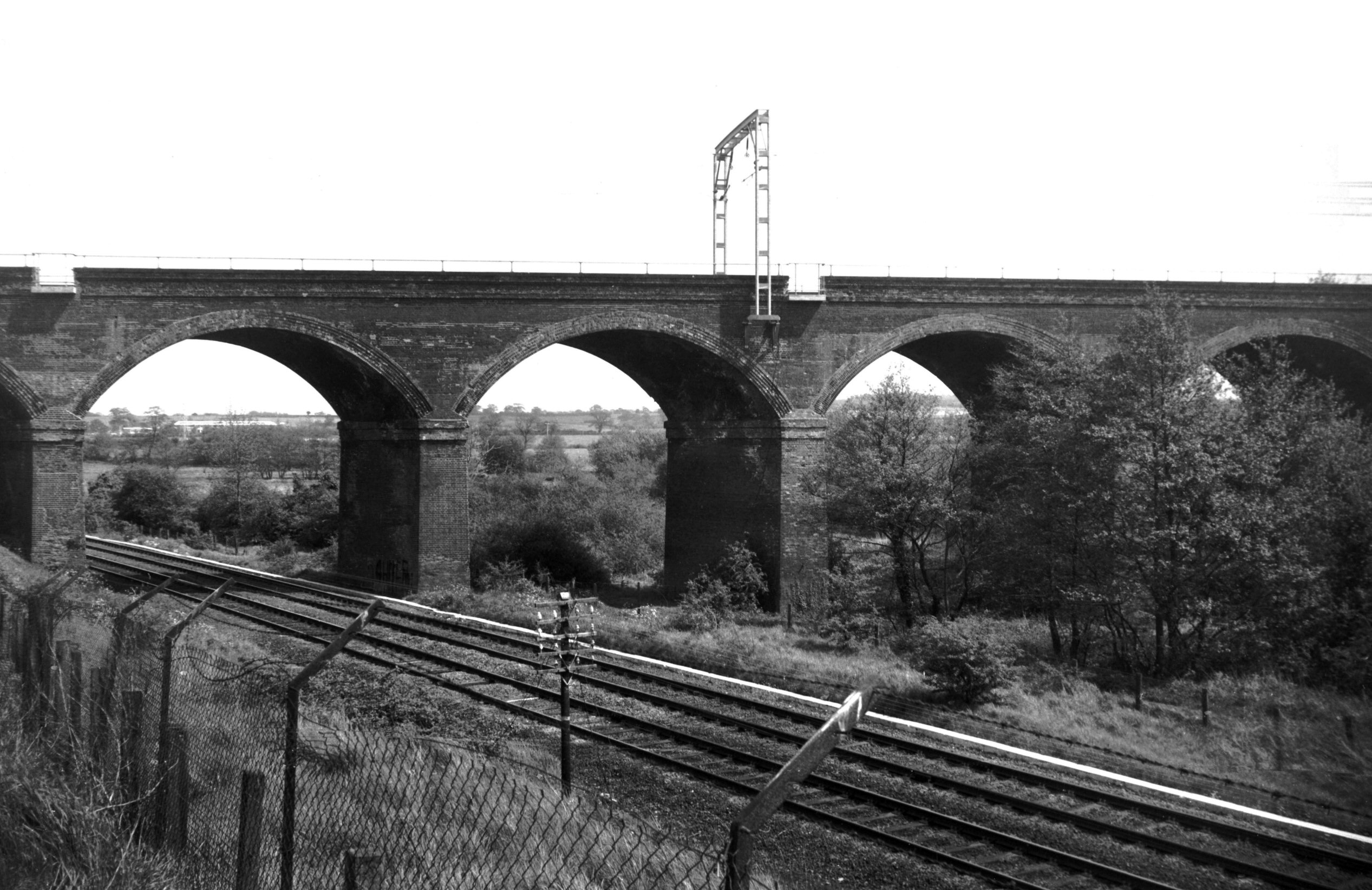
Yare Harford rail viaduct over [6376] 1986-05-19
Of six brick arches carrying the London (Liverpool St)
line over the river Yare and the line to Ely, it was
constructed in 1848-49. |
|
|
Yare Harford rail viaduct over [6377] 1986-05-19
|
|
|
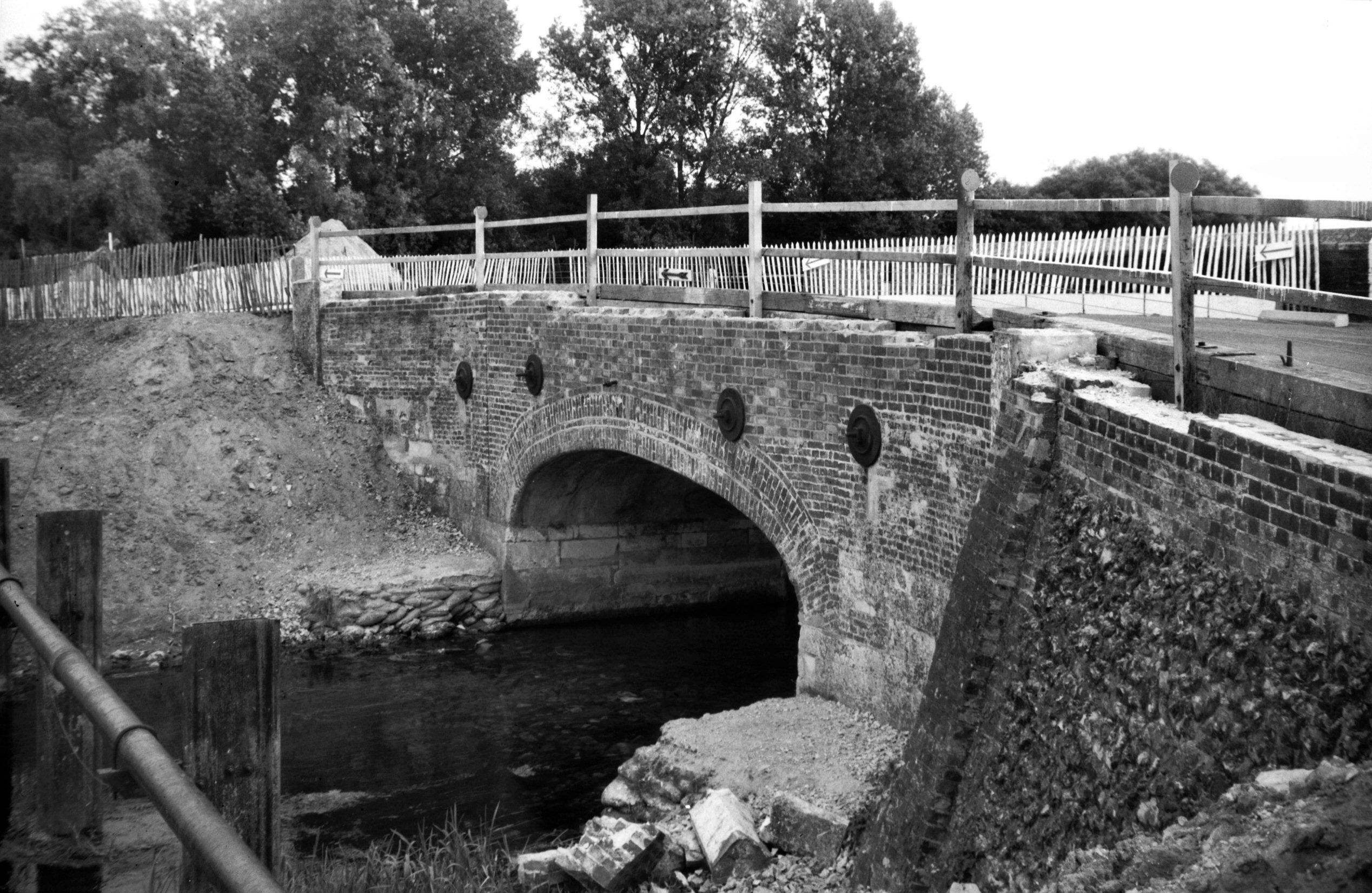
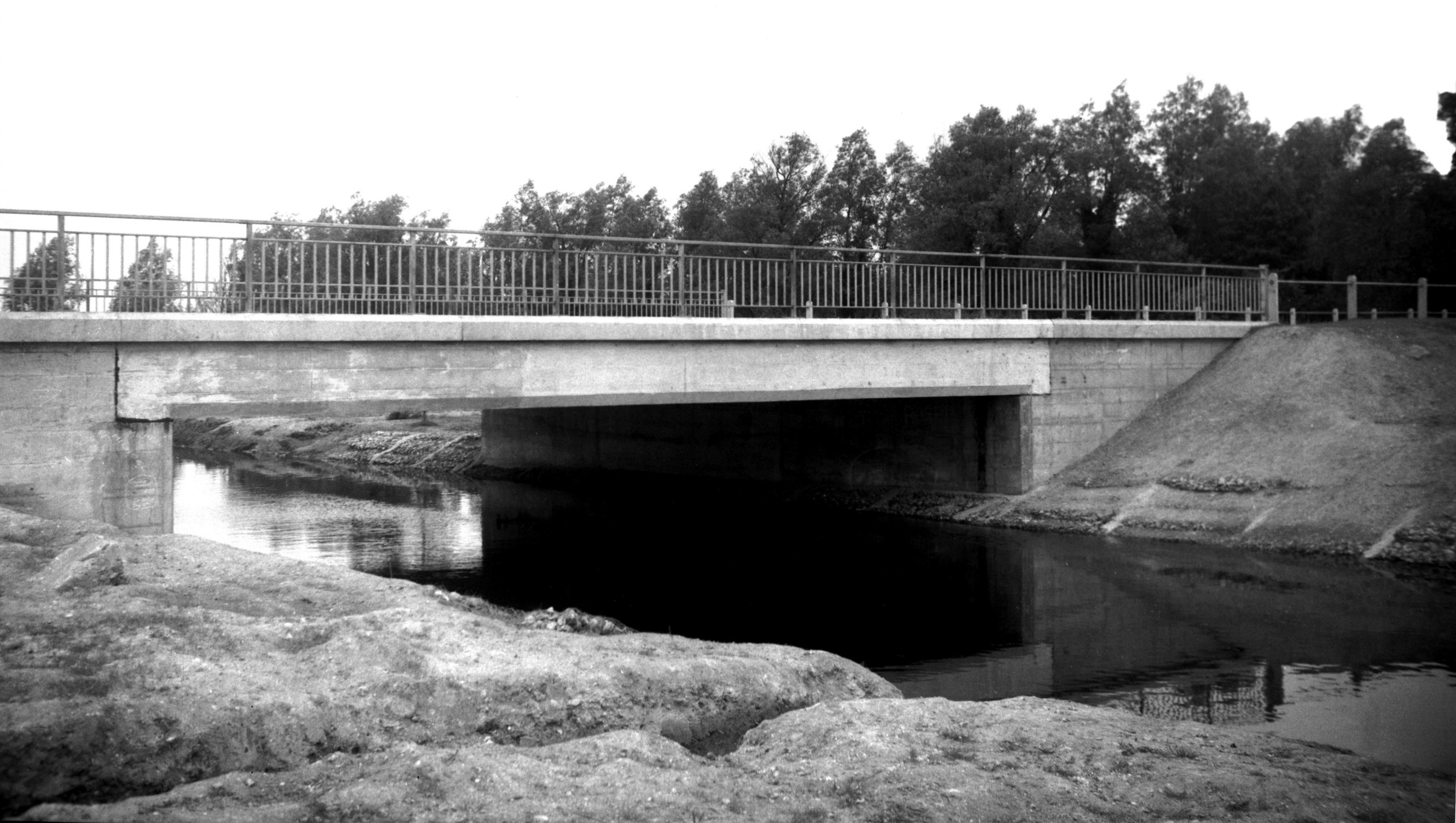
Yare Harford North Bridge west side [B623] 1933-07-11
A member of the de Hereford family is said to have first
built a bridge here in King John's reign. Broken down by
a flood in October 1697 it was rebuilt, but in 1767 a
temporary bridge here was again washed away. In 1832 this
and the adjoining bridge across another arm of the river
were built with a roadway of over 20 feet, the former
bridge having an elliptical brick arch on stone abutments
and the latter having a four-centred arch. Both ridges
becoming weak through heavy traffic (they carried the
trunk road from Norwich to Ipswich) they were demolished
in 1965 and replaced by a wider, single span supported by
beams of reinforced concrete. |
|
|
Yare Harford South Bridge west side [B624] 1933-07-11
|
|
|
Yare Harford South Bridge before demolition [4798]
1964-07-26
|
|
|
Yare Harford Bridge view downstream [4913] 1965-07-10
|
|
Jenkins Lane: |
| |
From
Oak St to Quakers Lane |
|
|
Jenkins Lane south side Oak Terrace [0861] 1936-04-10
|
|
Jessopp Rd: |
| |
From
Colman Rd to College Rd
South side |
|
|
Jessopp Rd United Reformed church [6477] 1987-06-16
Formerly Congregational. Original building opened 1931.
Enlarged 1969. |
|
Kett's Hill: |
| |
From
Bishop
Bridge Rd / Barrack St / Gurney
Rd to Britannia Rd / Plumstead
Rd
passing Spitalfields
North side |
|
|
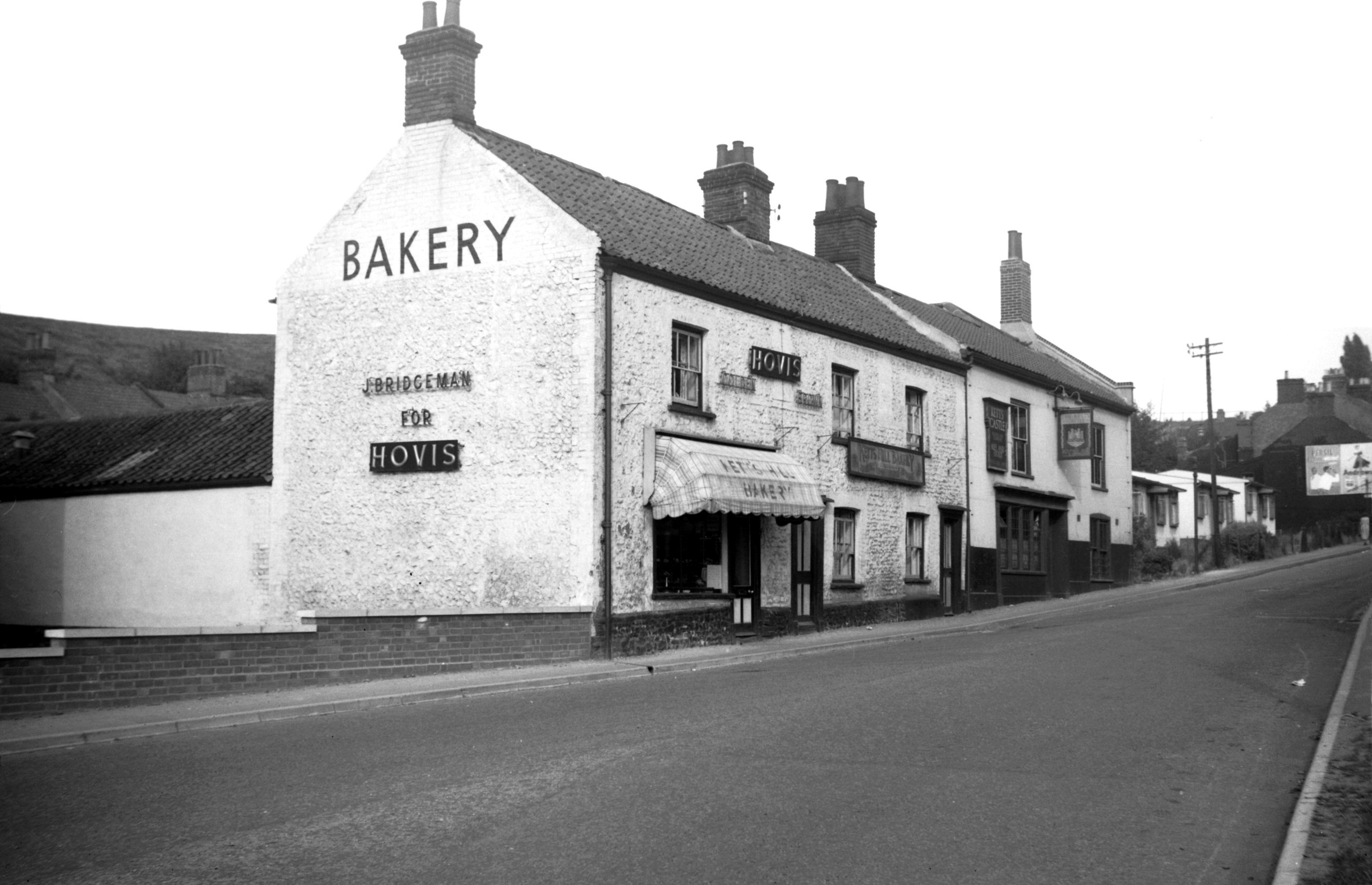
Kett's Hill 25 to 29 Kett's Castle PH [4365]
1955-08-20
|
|
|
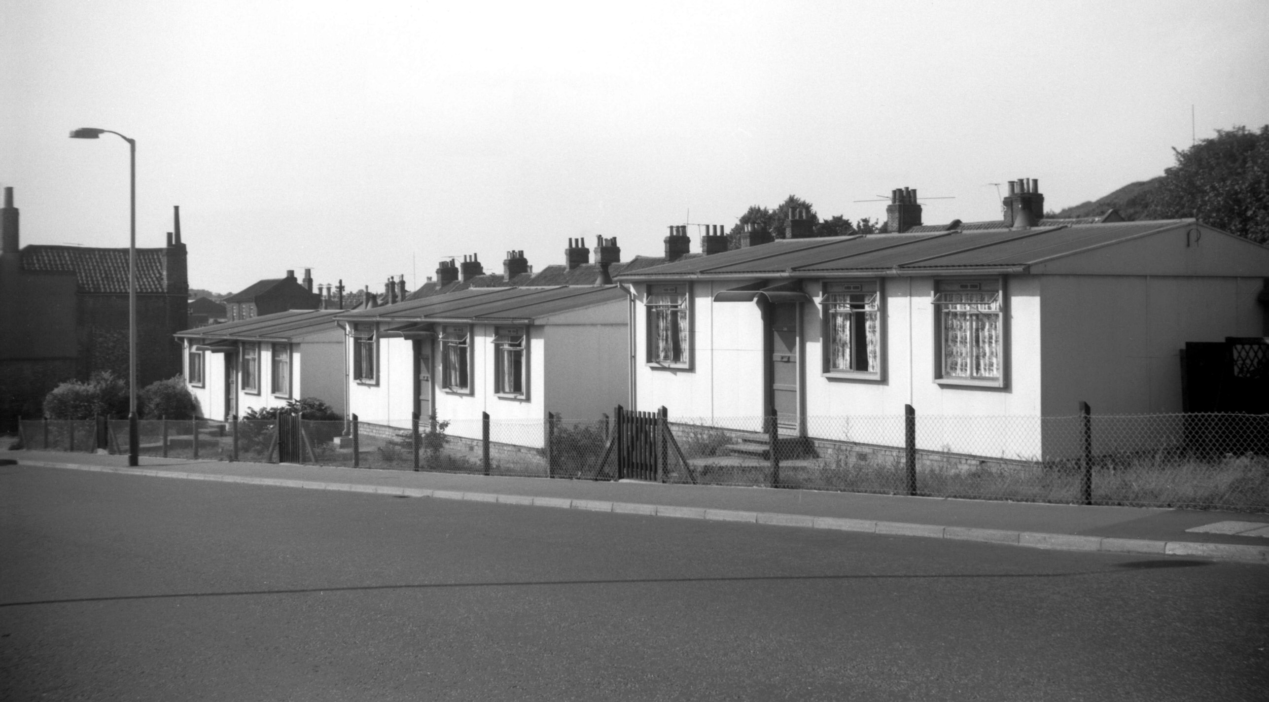
Kett's Hill post-war prefab homes [4707] 1962-09-01
Erected 1947. |
| |
South
side |
|
|
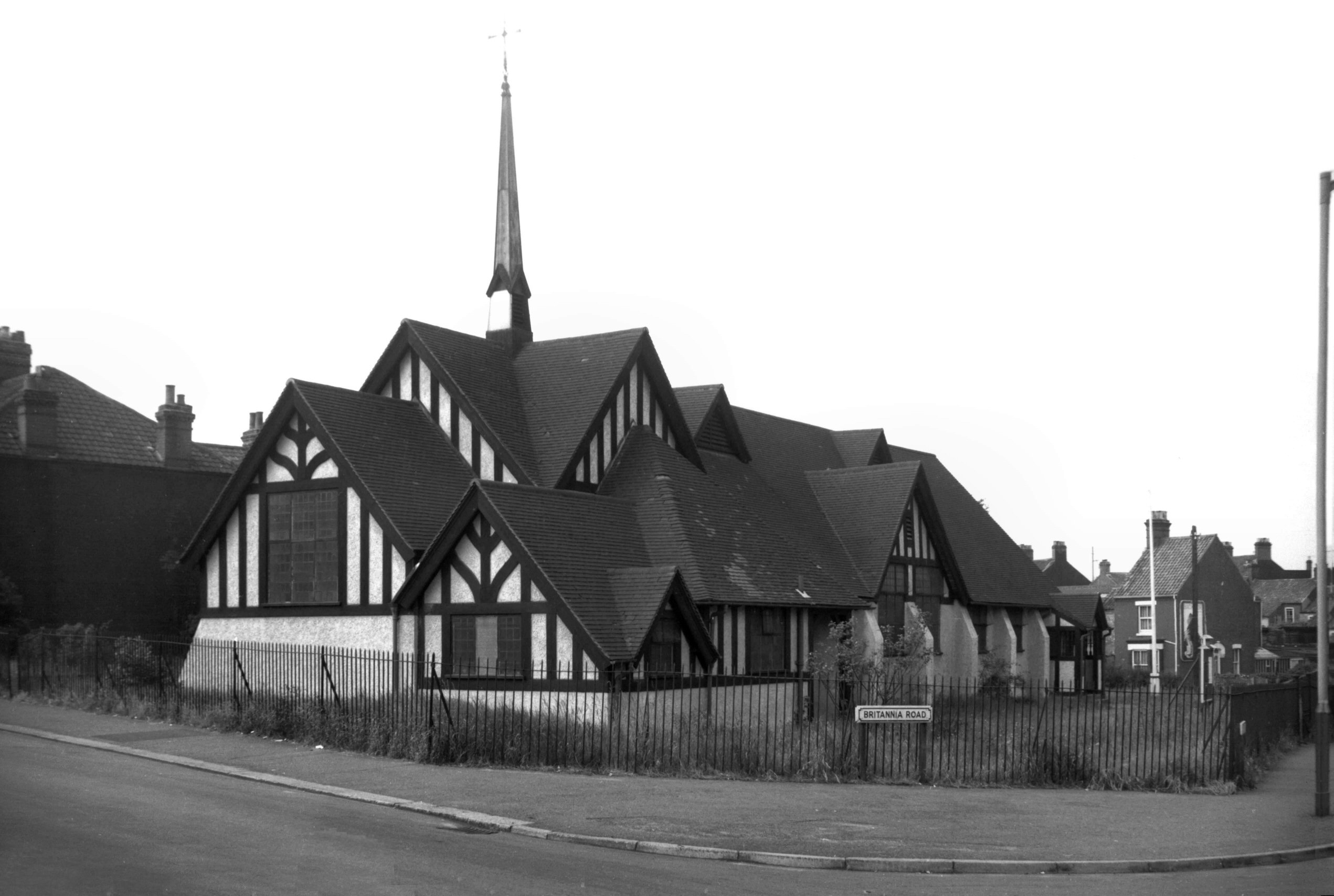
St Leonard's Thorpe Hamlet from Ketts Hill [4692]
1962-07-07
Built 1907 as a Chapel of Ease to St Matthew. Demolished
1981. |