|
St Saviour's Lane: |
| |
From
Magdalen St to Blackfriar's St (formerly Peacock St)
North side |
|
|
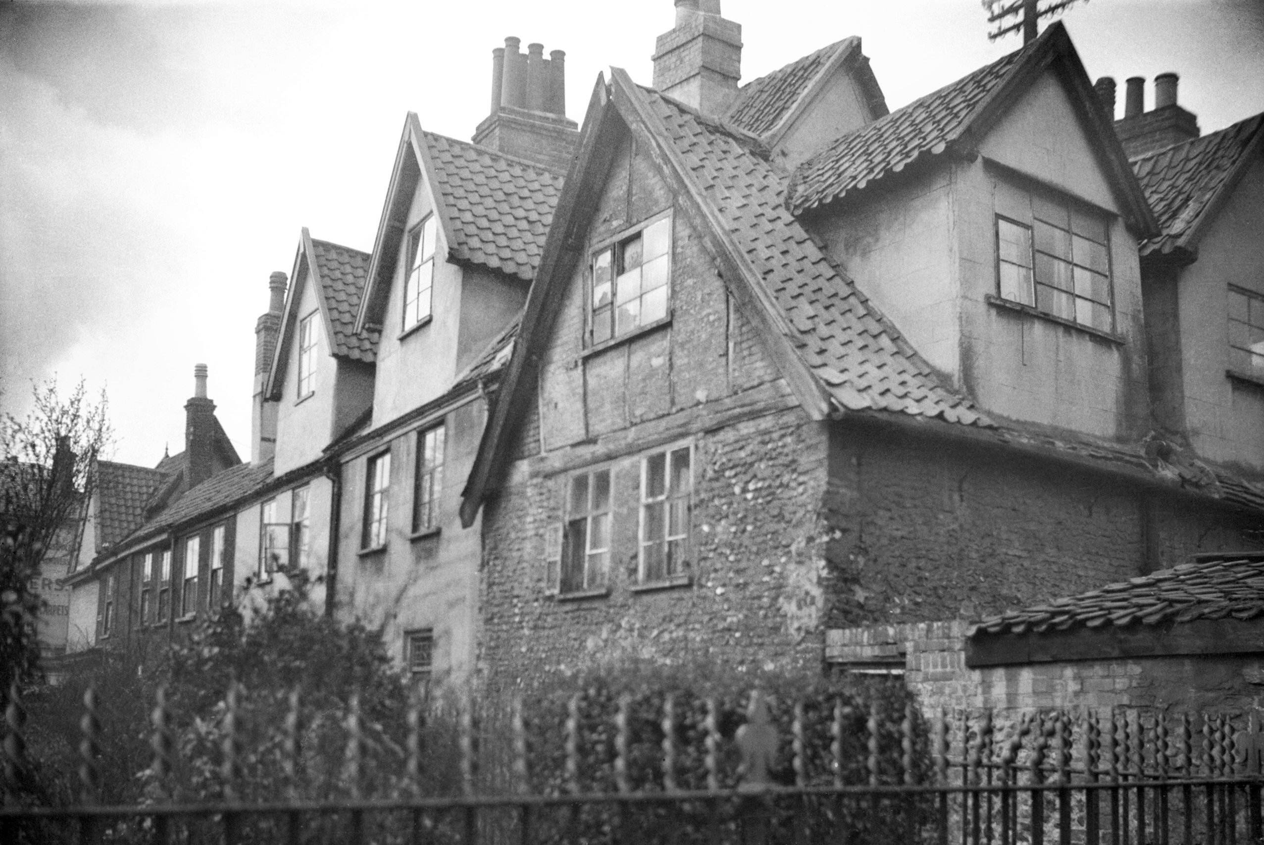
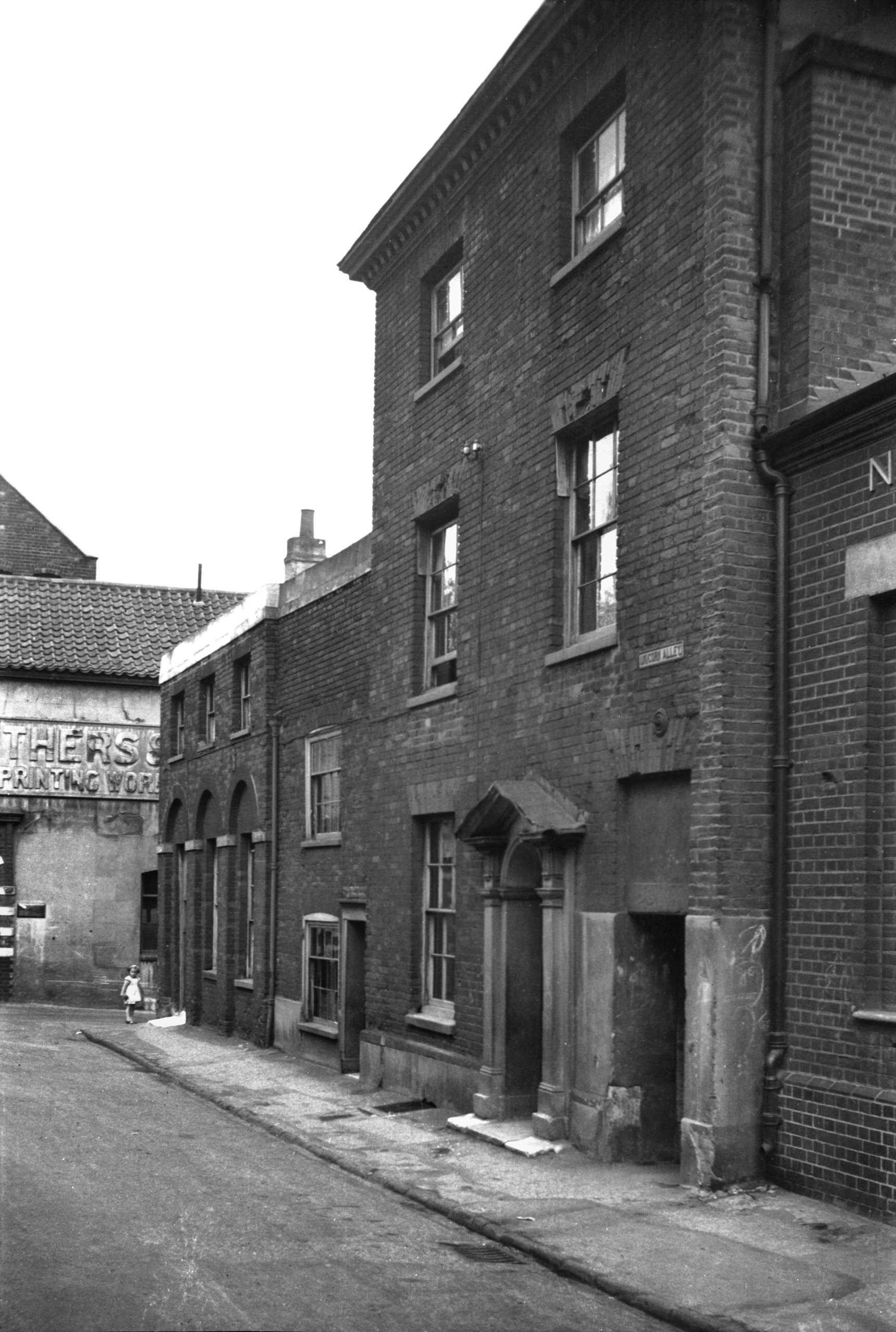
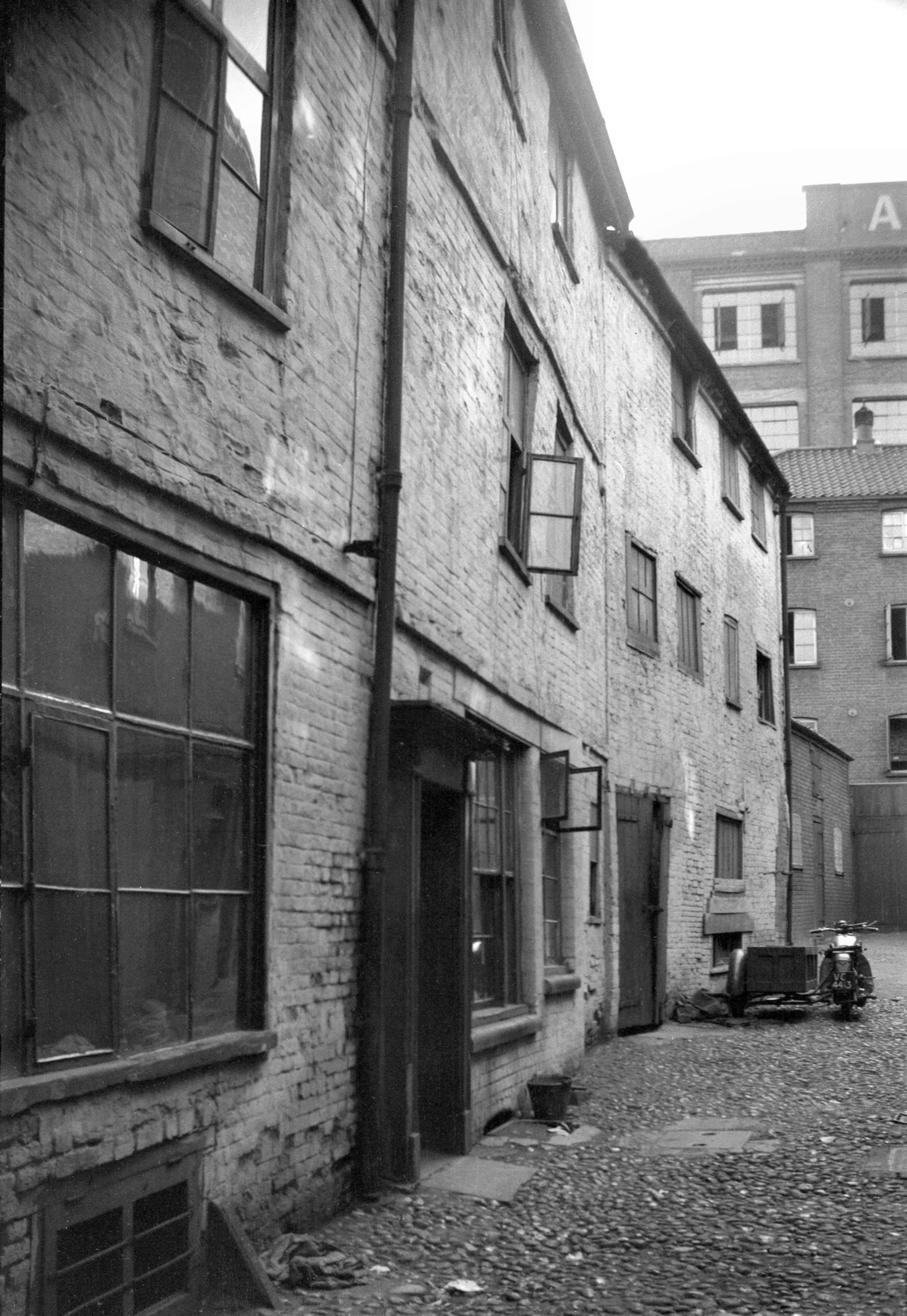
St Saviour's Alley north side [0900] 1936-04-16
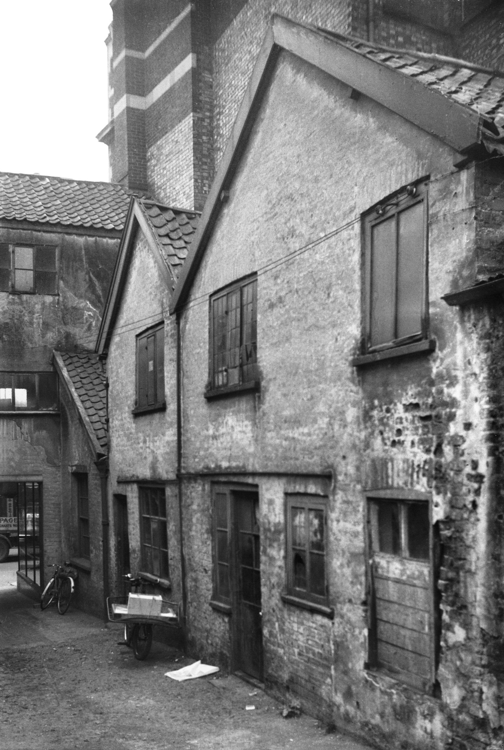
Off St Saviour's Lane. |
|
|
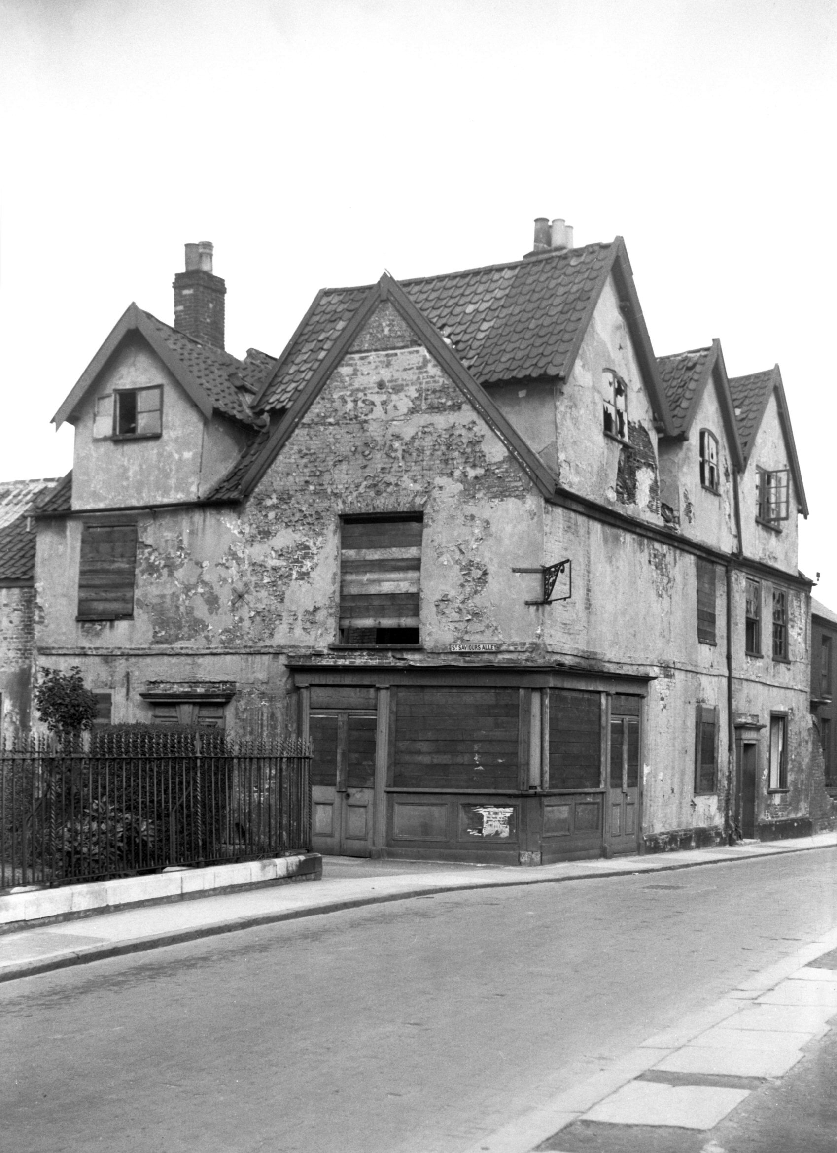
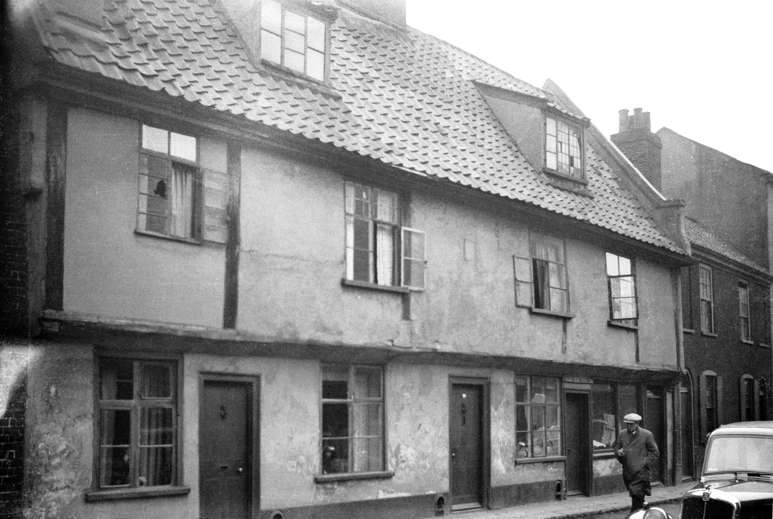
St Saviour's Lane 19 to 21 [3265] 1939-09-17
Former Hope Brewery PH. |
|
|
St Saviour's Lane 19 to 21 south side [0903]
1936-04-16
For 29 St Saviour's Lane see 34 to 36 Peacock St. |
|
|
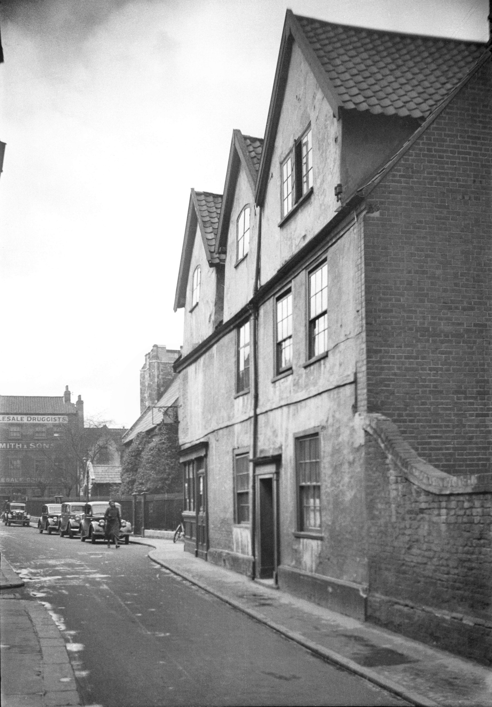
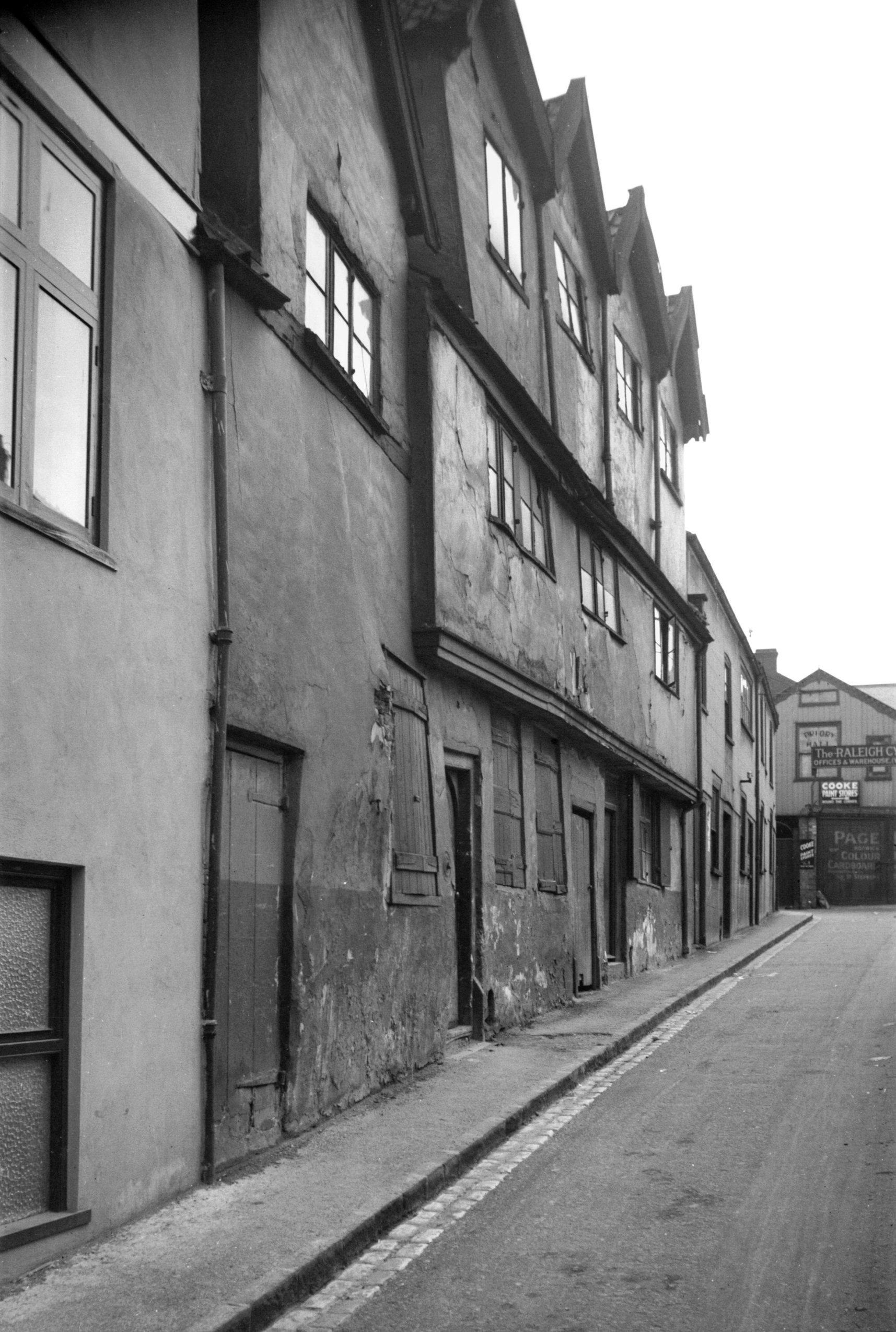
St Saviour's Lane 19 west side from Alley [0904]
1936-04-16
From St Saviour's Alley. |
| |
South
side |
|
|
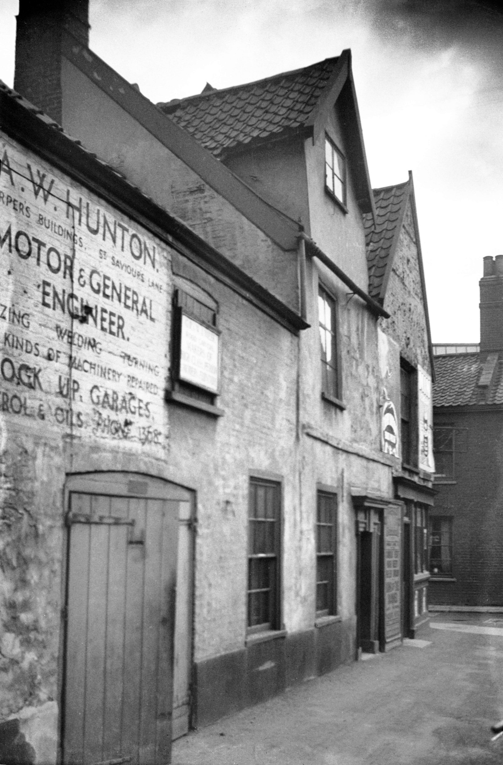
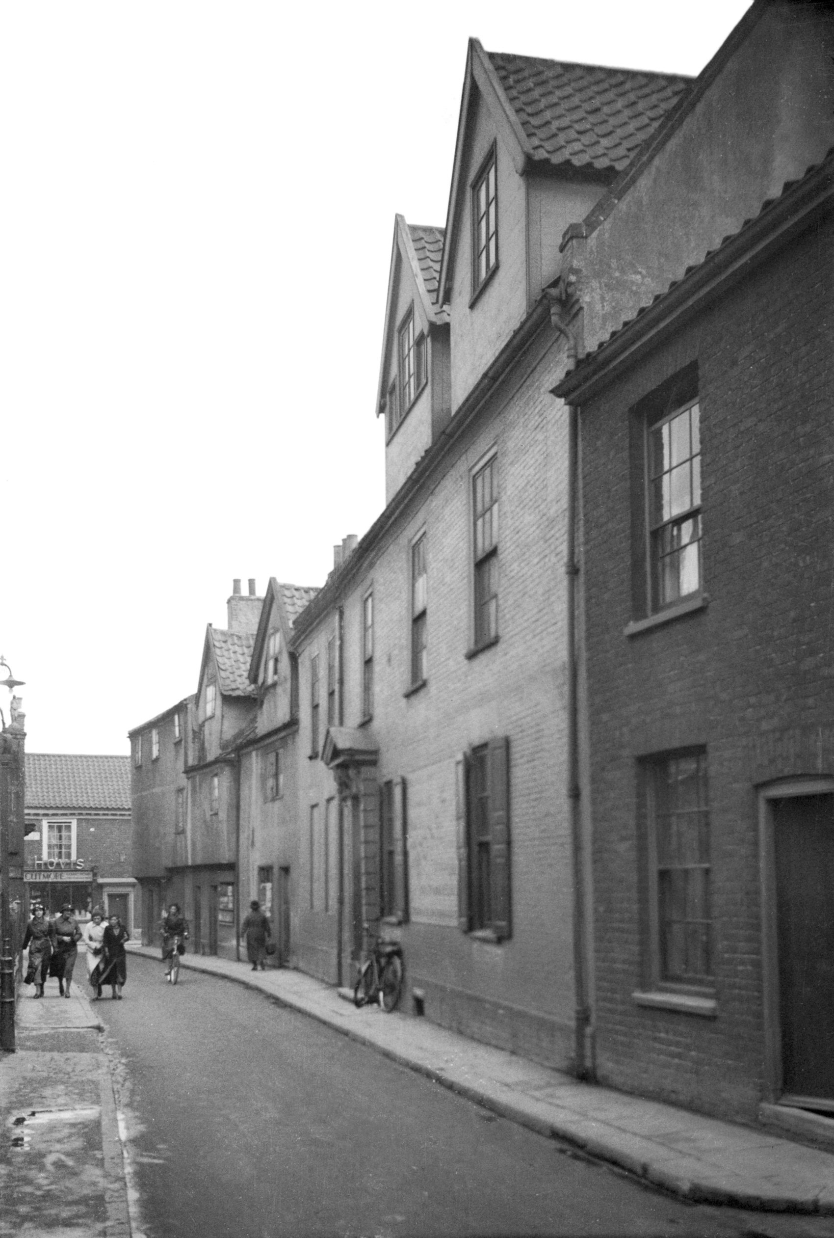
St Saviour's Lane 4 to 10 [0901] 1936-04-16
|
|
|
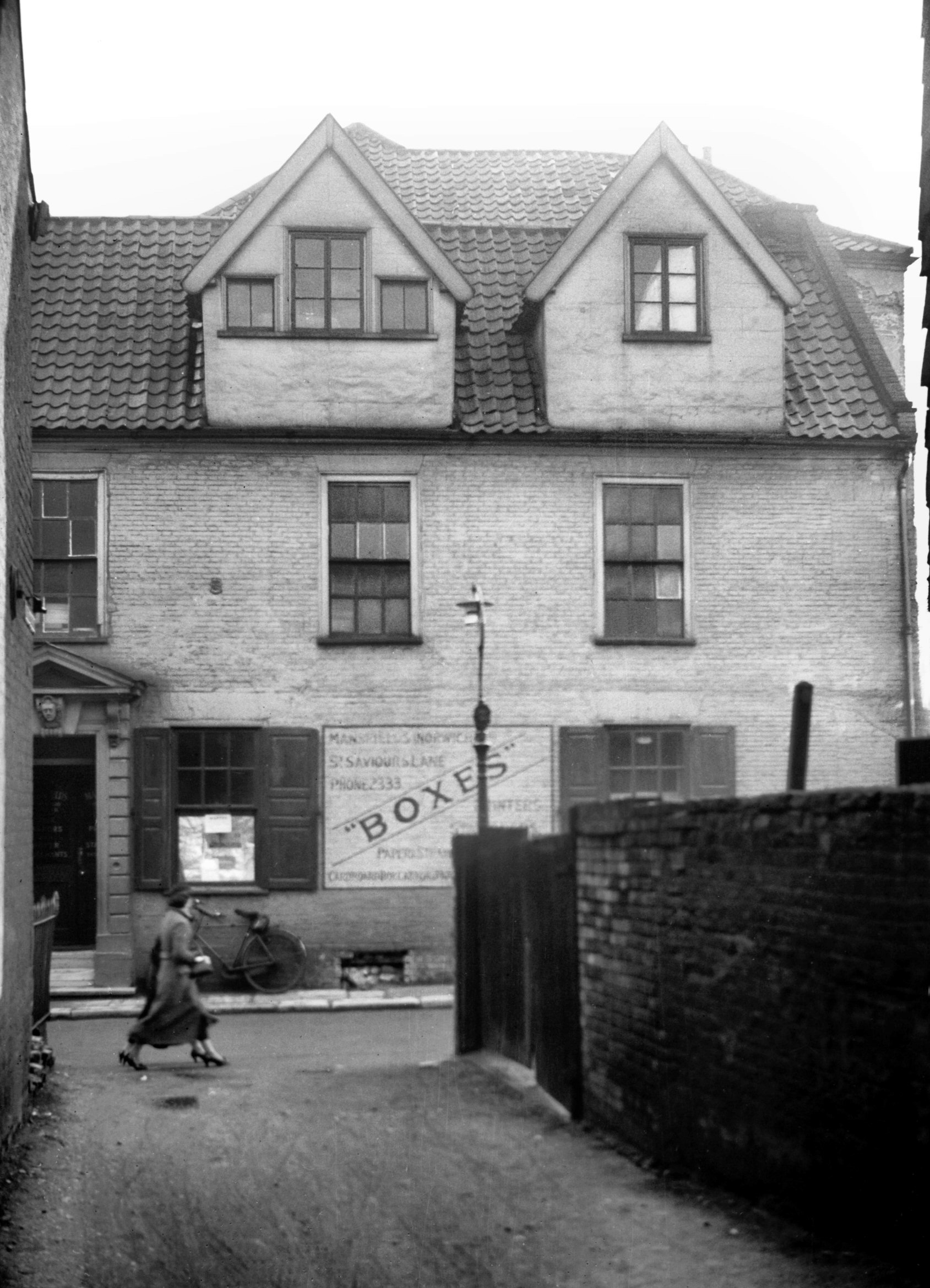
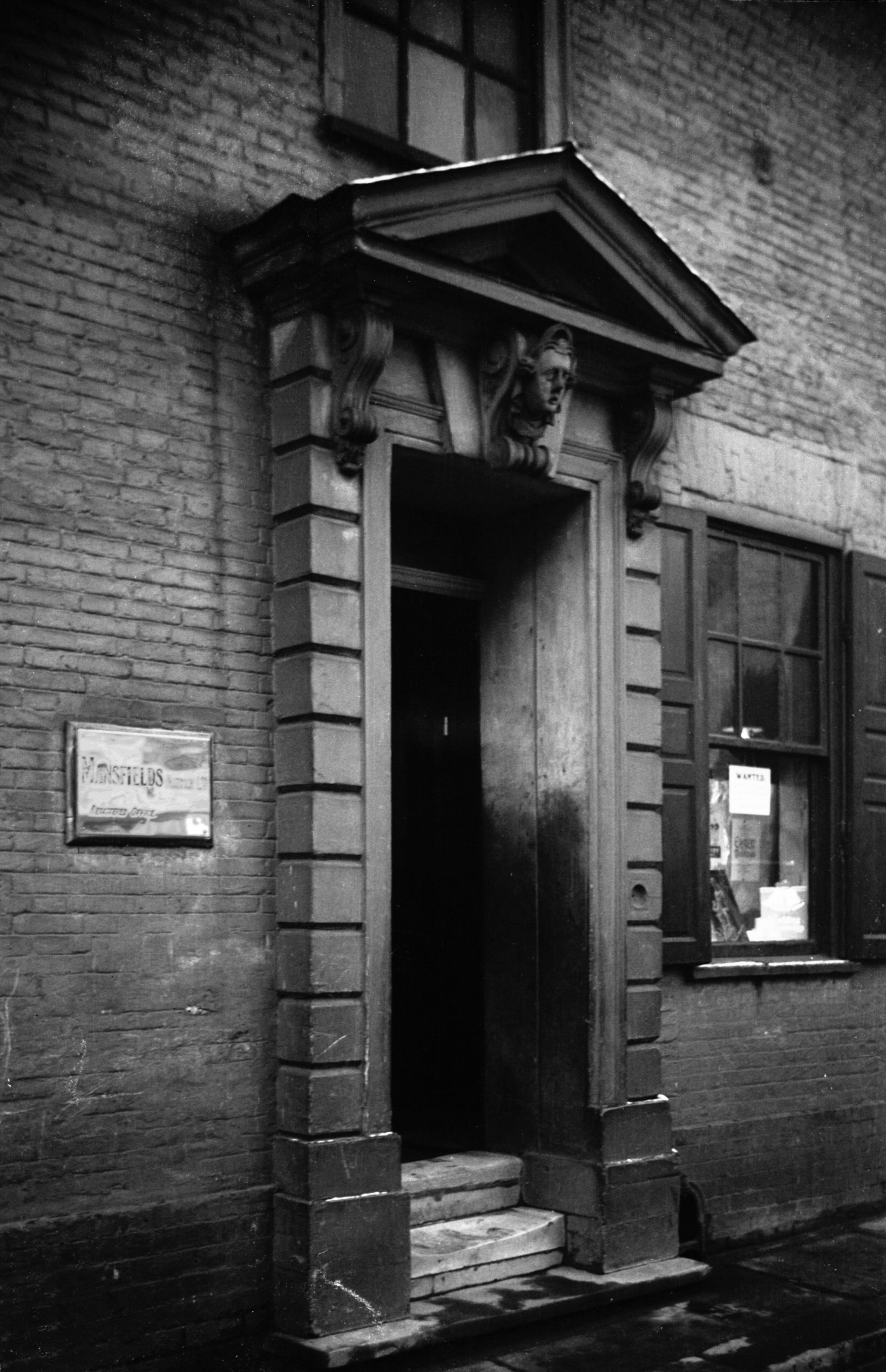
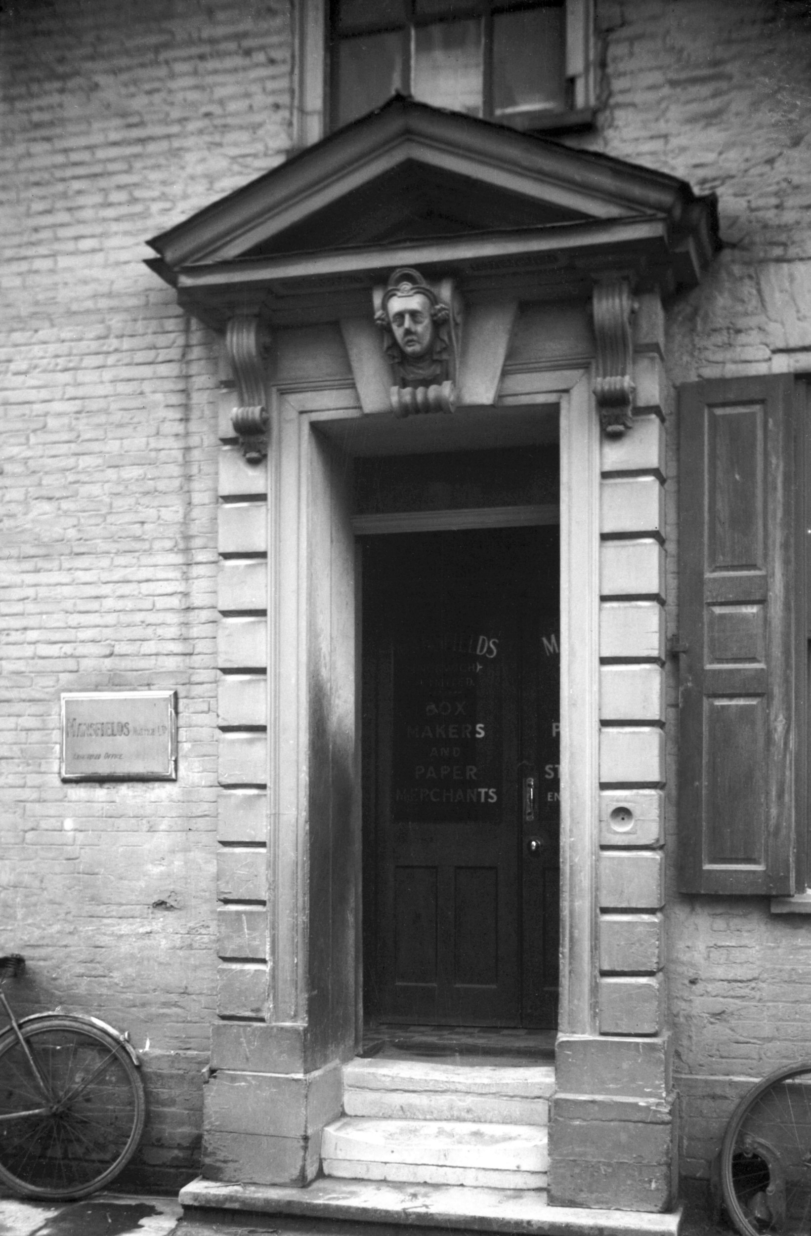
St Saviour's Lane 24 Pendleton House [0902]
1936-04-16
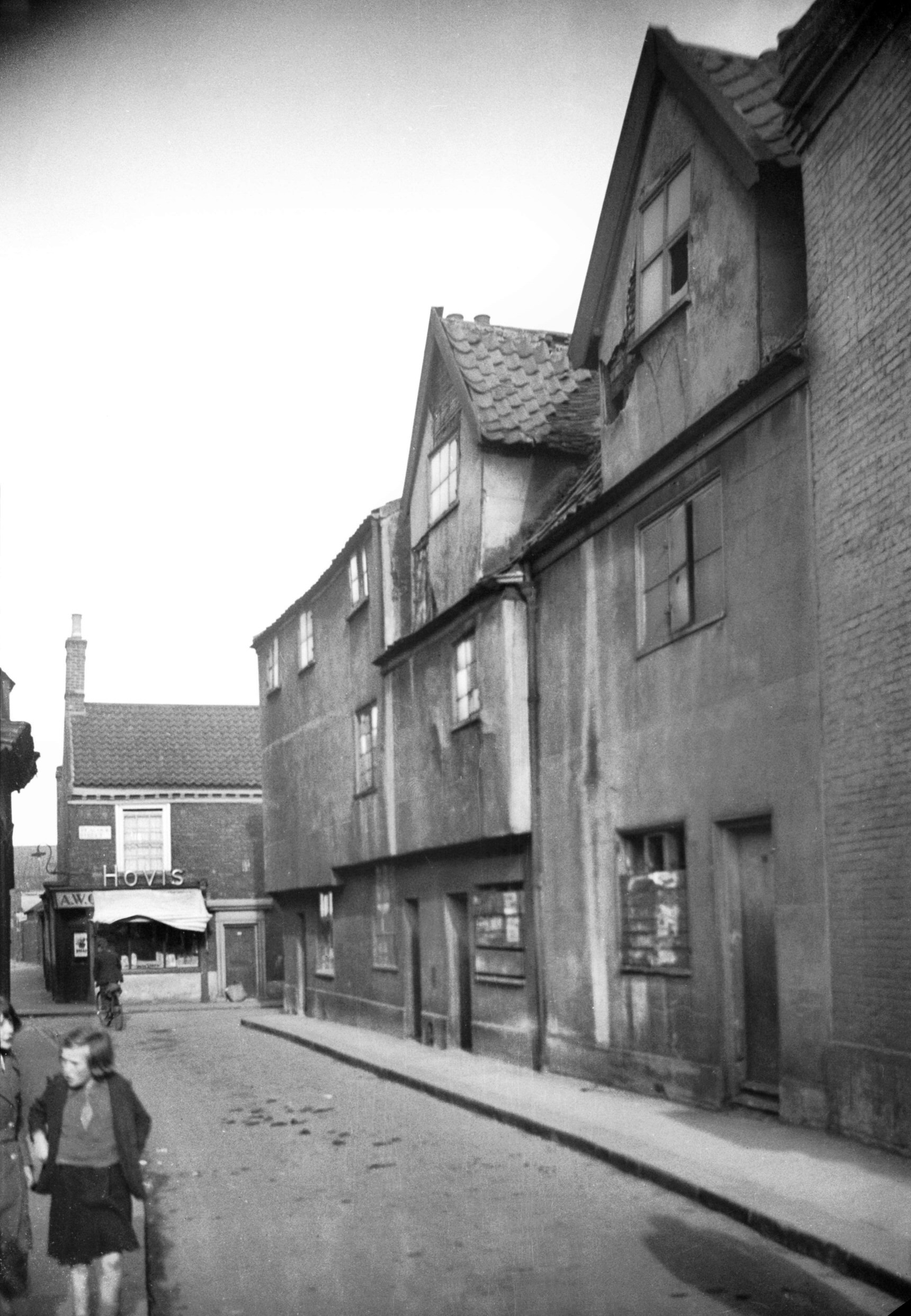
St Saviour's Lane leads off Magdalen St and runs parallel
to St Crispin's Rd. Houses ranging in date from about the
16c to the 19c that formerly lined the lane have all
gone: one side now being used as a public car park and
the other being occupied by High-Tech House, which was
built in 1938 as Mansfields' cardboard box factory.
Before taking over this factory Mansfields had occupied
as their offices No 24, a converted Georgian mansion
called Pendleton House. As in most houses of this period,
the main external feature was the front doorway, in this
case not of wood but of plaster, with rusticated jambs
and consoles supporting a pediment. The door recess was
square-headed with a large keystone moulded into the
shape of a human head above the lintel but below the
pediment. An almost identical doorway, though not quite
so tall, may still be seen at 54 Pottergate.
Pendleton House took its name from Mrs Elizabeth
Pendleton, a widow who owned property here and in St
Stephen's parish in the 17c. The historian Francis
Blomefield gives details of her will, first read in court
on 23rd June 1677, by which the rents from her houses
were to be used for a variety of charitable purposes.
Some of the money was to go towards clothing the poor and
needy with winter garments, while other sums were to be
spent in binding out poor lads or as loans to young
tradesmen. The "overplus of her personals" was
bequeathed to the Girls' Hospital, and under the same
year Blomefield noted "This year, a Ring and several
Diamonds, and £190, the Overplus of the personal estate
or Mrs Eliz. Pendleton, was received by the treasurer [of
the Girls' Hospital] according to her Will". |
|
|
St Saviour's Lane 24 Pendleton House N side [2053]
1937-11-19
|
|
|
St Saviour's Lane 24 Pendleton House W side [2051]
1937-11-19
|
|
|
St Saviour's Lane 24 Georgian doorway [1508]
1937-03-26
|
|
|
St Saviour's Lane 24 Georgian doorway [2052]
1937-11-19
|
|
|
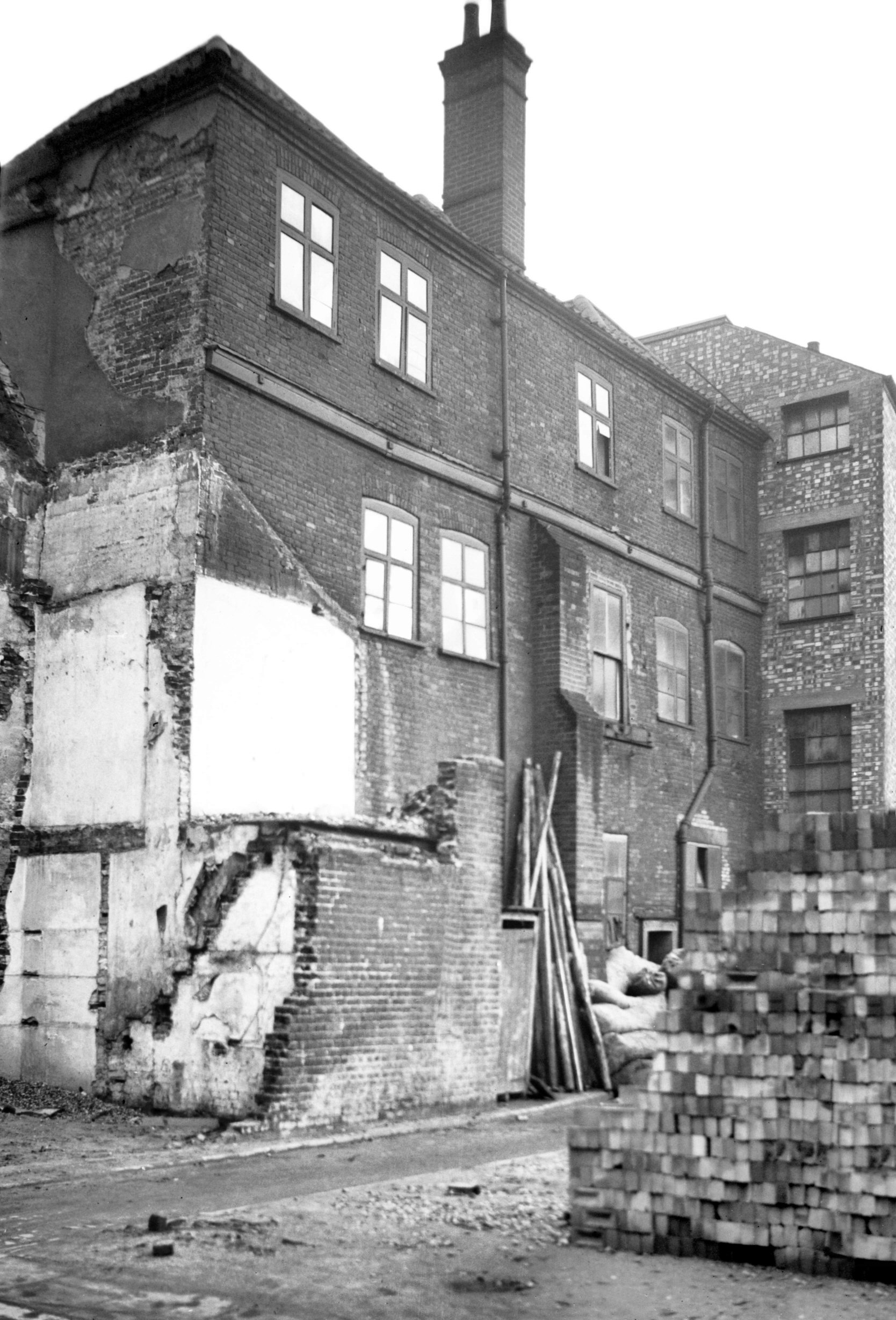
St Saviour's Lane 26 to 32 [0909] 1936-05-01
|
|
St Stephen's Back St: |
| |
From
Coburg St to Malthouse Lane
later part of Malthouse Rd |
|
|
St Stephen's Back St 2 to 4 [1669] 1937-06-03
|
|
|
St Stephen's Back St 48 to 52 [1018] 1936-06-14
|
|
St Stephen's Church Lane: |
| |
From
Rampant
Horse St to Malthouse Lane
later part of Malthouse Rd |
|
|
St Stephen's Church Lane east side [1017] 1936-06-14
|
|
St Stephen's Rd: |
| |
From
Chapel
Field Rd / St Stephen's St / Queen's
Rd to Grove Rd / Ipswich
Rd / Newmarket Rd
North side |
|
|
St Stephen's Rd 1 to 5 and Chapel Field Rd [4732]
1963-07-14
109 to 113 Chapel Field Rd on right. |
|
|
St Stephen's Rd Chapel Field Rd rebuilding [4753]
1964-04-18
|
|
|
St Stephen's Rd 3 to 5 [2978] 1939-05-18
|
|
|
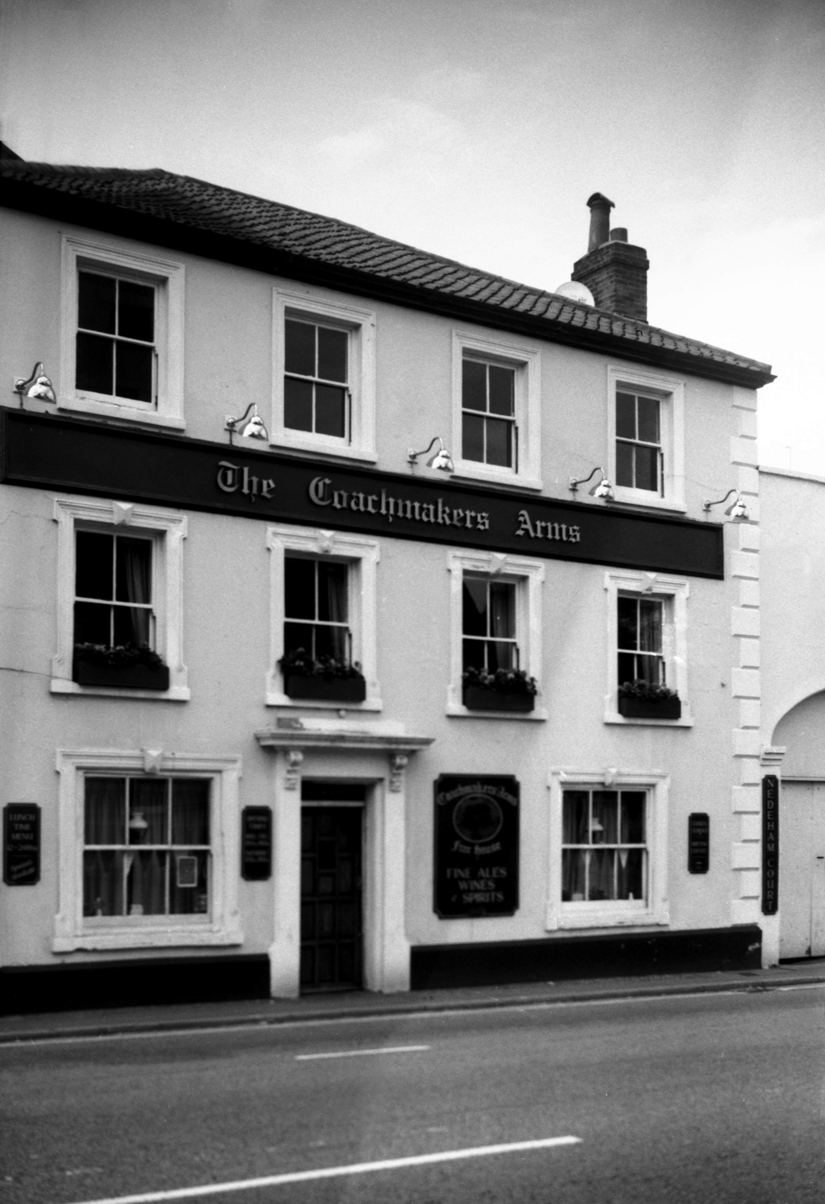
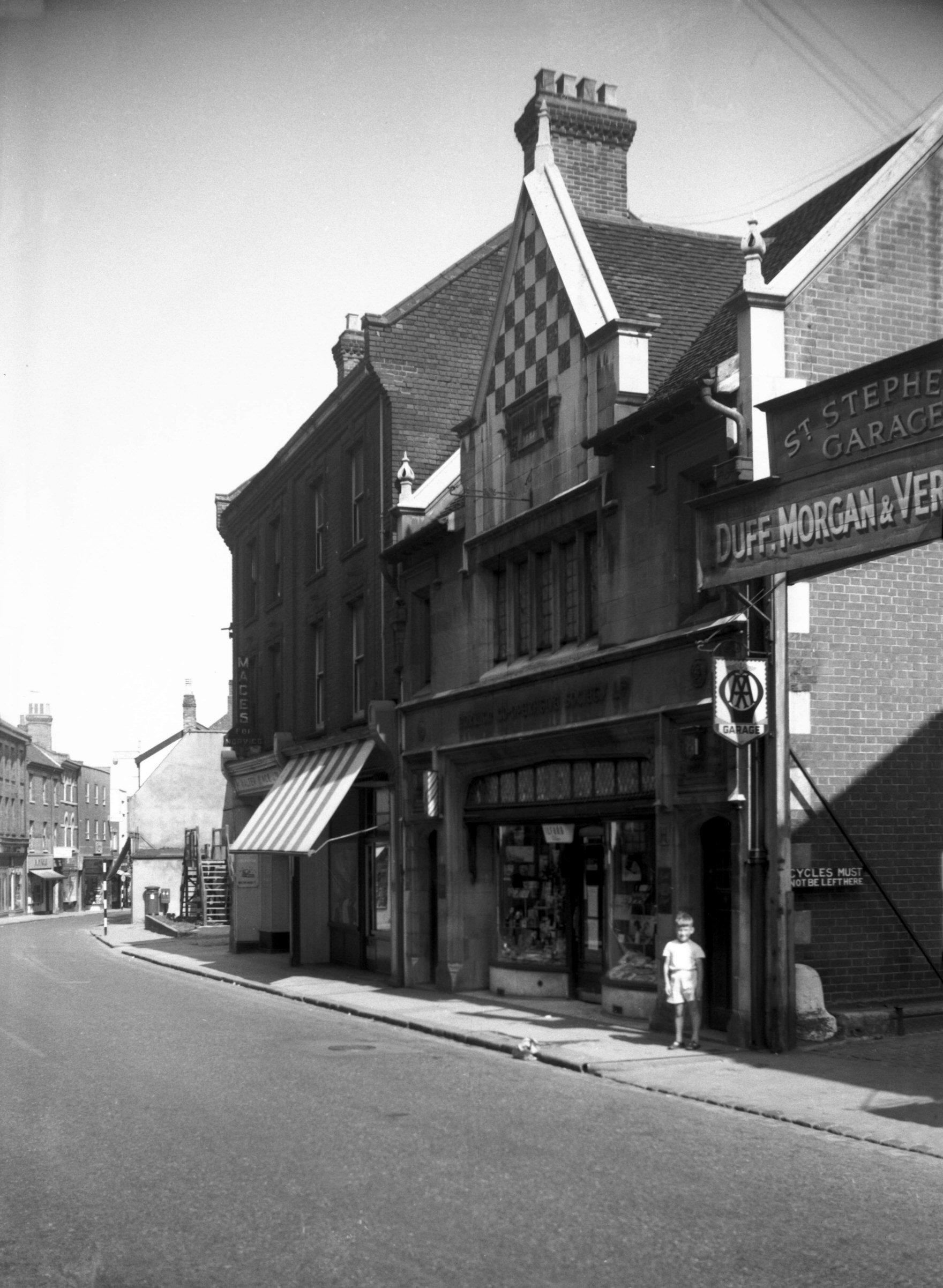
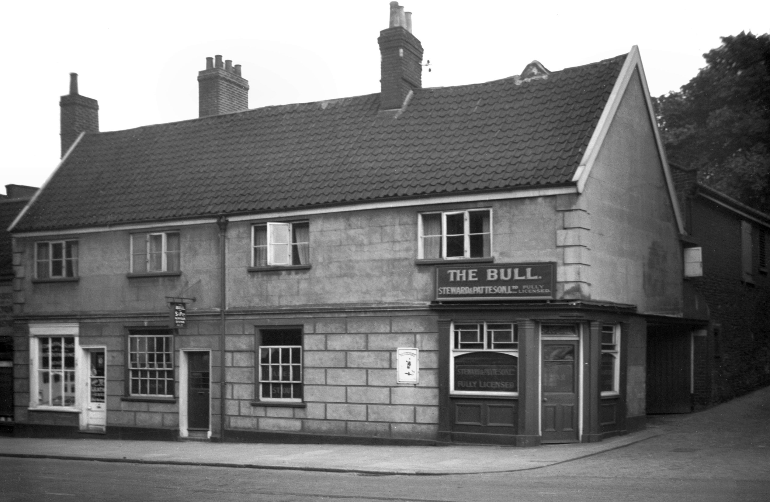
St Stephen's Rd 9 Coachmakers' Arms PH [7562]
1998-07-05
|
|
|
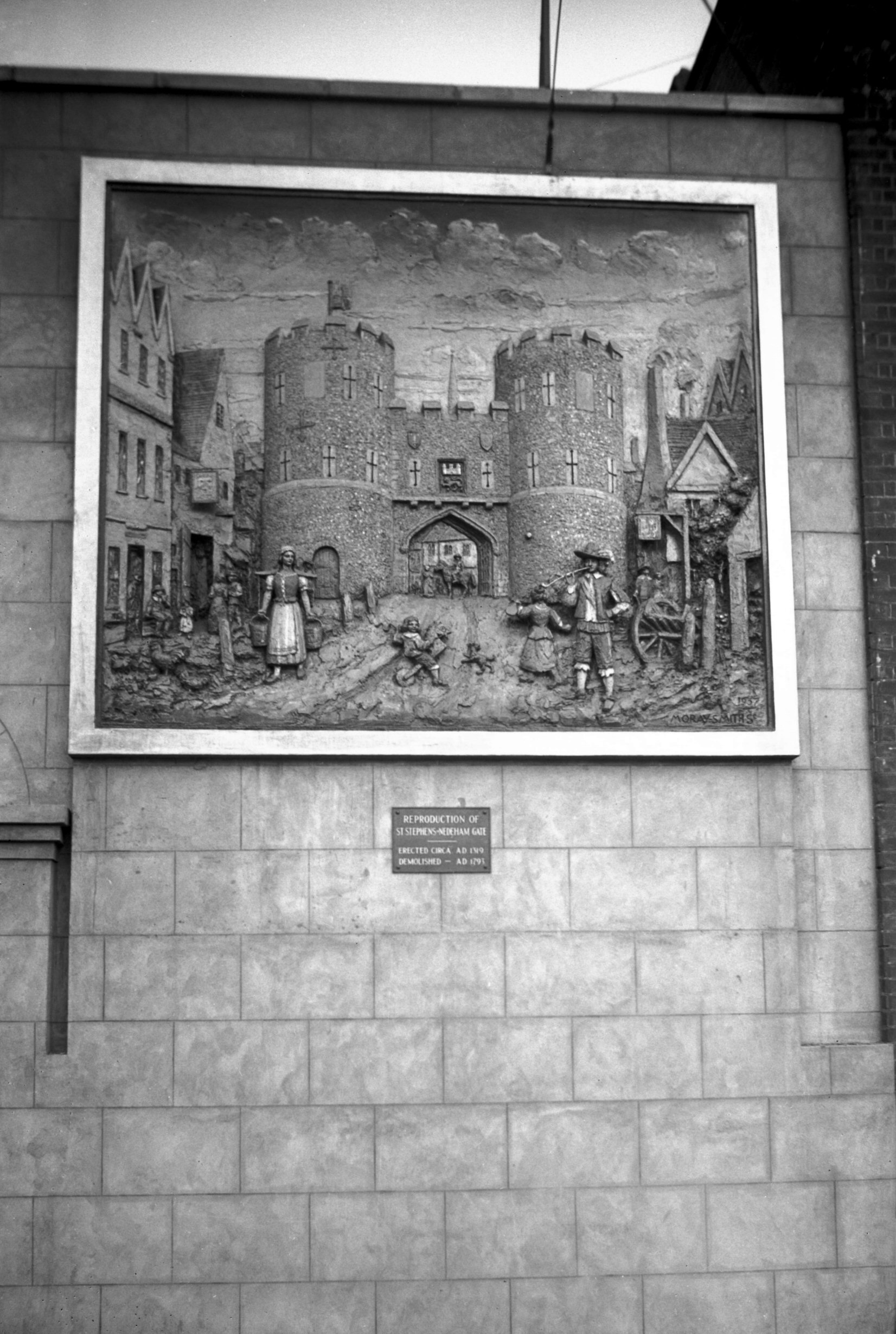
St Stephen's Gate mural sign [2157] 1938-03-13
On the Coachmakers' Arms Inn, St Stephen's Rd. Two panels
depicting St Stephen's and Ber St Gates were executed by
Mr J Moray-Smith, sculptor and painter. Standing on a
scaffolding he built up the panels bit by bit from
buckets of wet concrete. When the moulding and carving
were finished, further time was spent in painting the
panels and applying a coat of varnish to preserve the
colours for years to come. The original pictures used
were those drawn by John Ninham in 1792-3. St Stephen's
Gate was demolished in 1793 and Ber St Gate in 1808. |
|
|
St Stephen's Rd 13 [2058] 1937-11-27
|
|
|
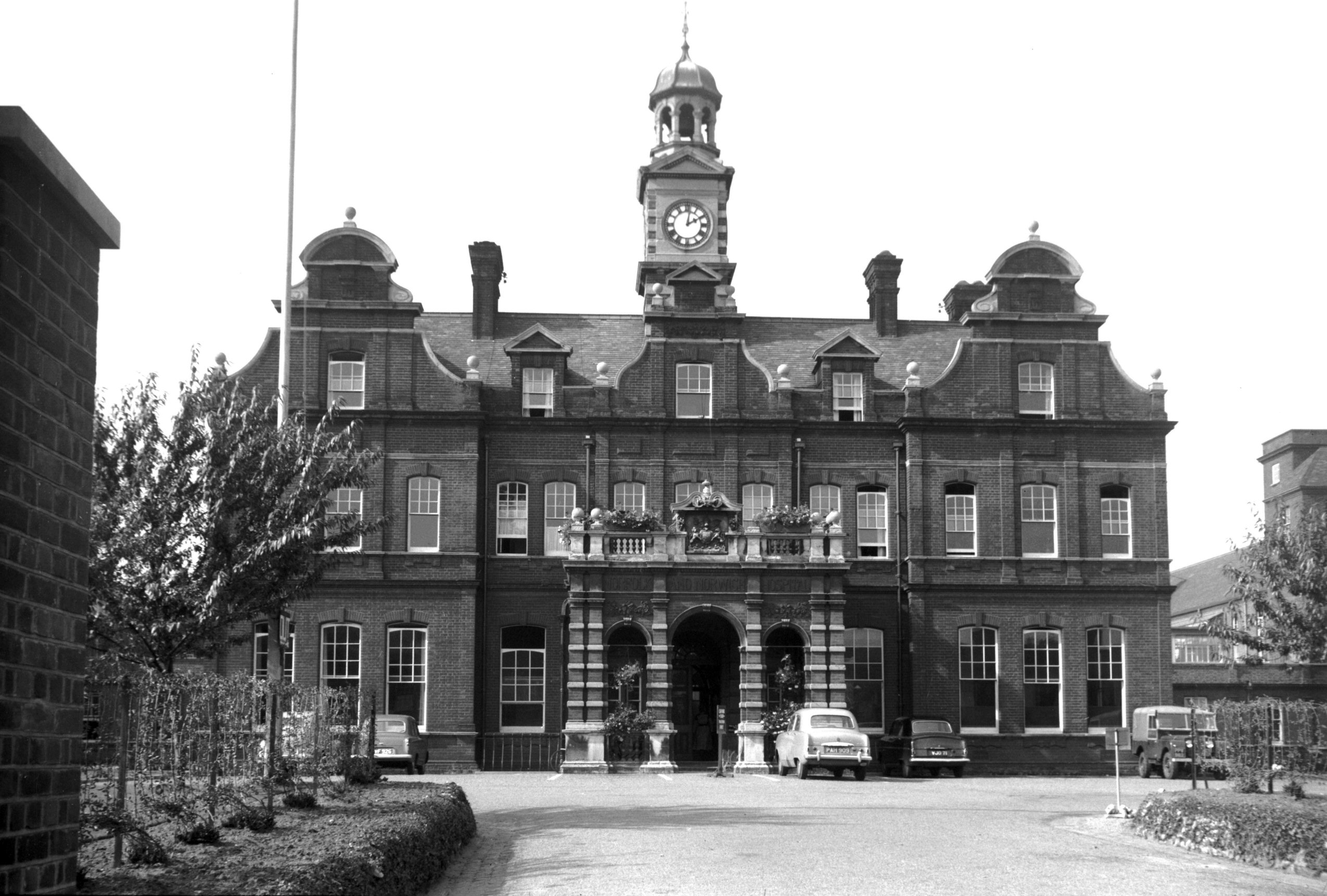
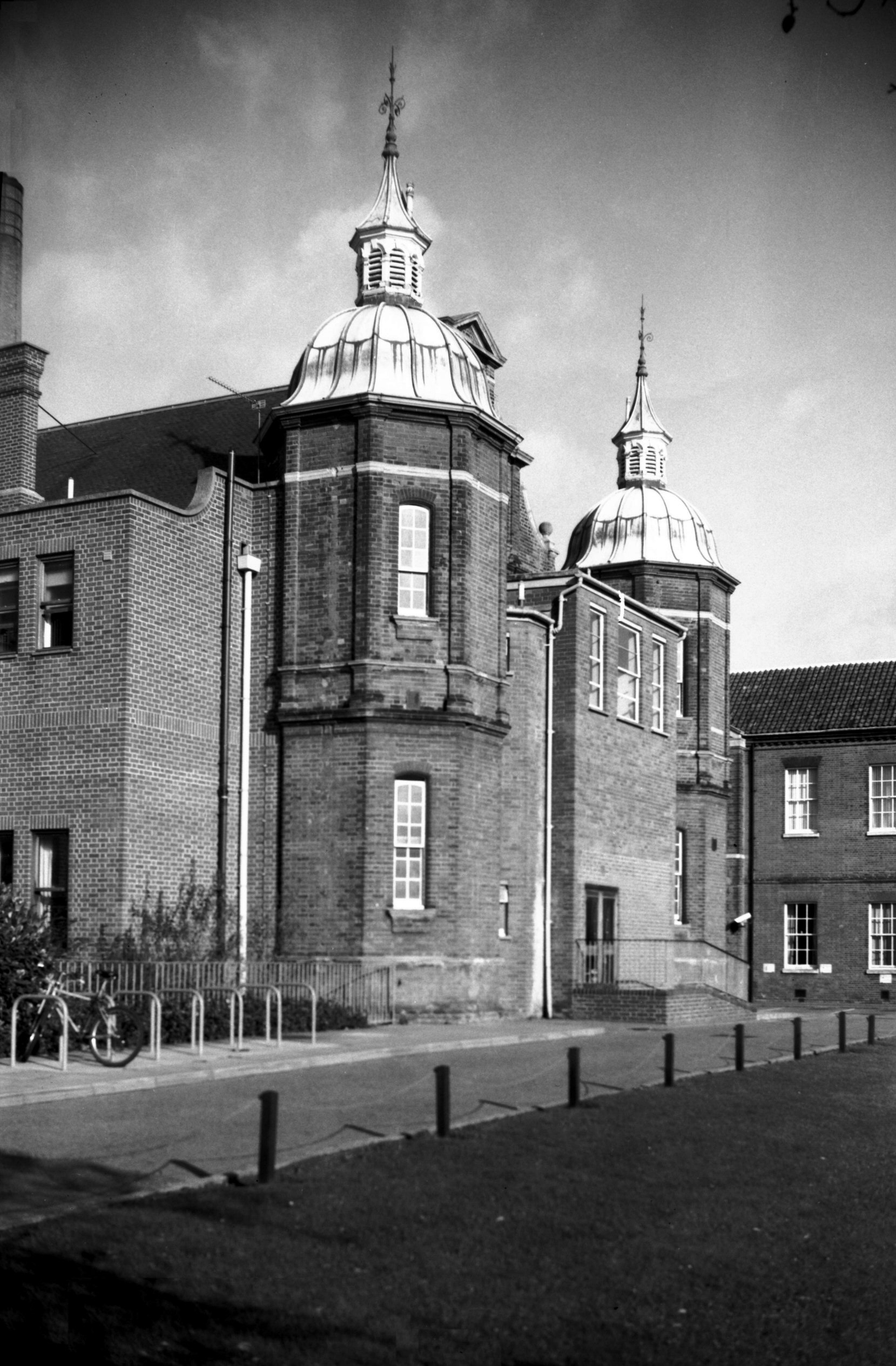
St Stephen's Rd N and N Hospital entrance [4383]
1955-09-19
Central block, erected 1882, architects T.H.Wyatt and
E.Boardman. |
|
|
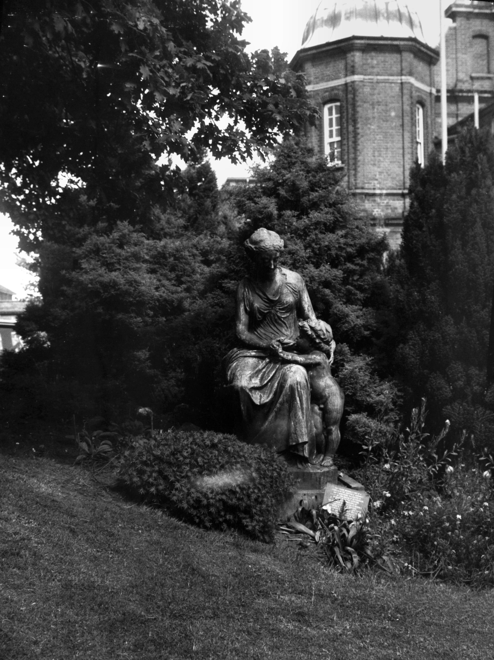
St Stephen's Rd N and N Hospital Charity [6324]
1985-05-31
"Charity" bronze statue by J.E.Boehm originally
the centrepiece of a drinking fountain at
Newmarket-Ipswich Rd junction. Moved to adjacent grounds
of ex-N and N Hospital. |
|
|
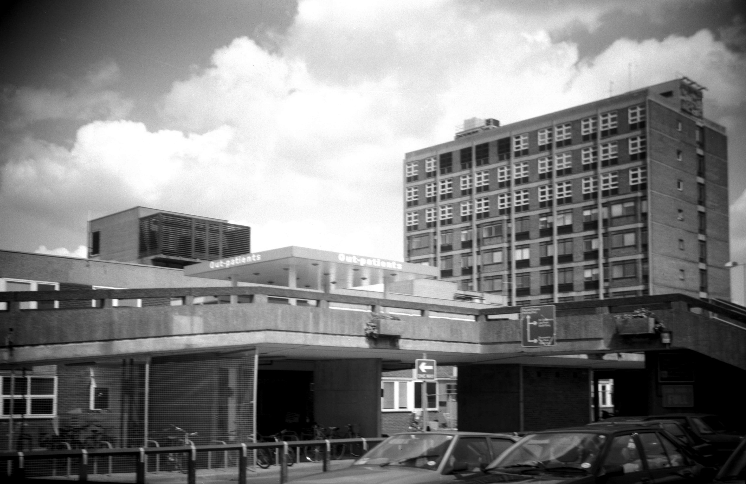
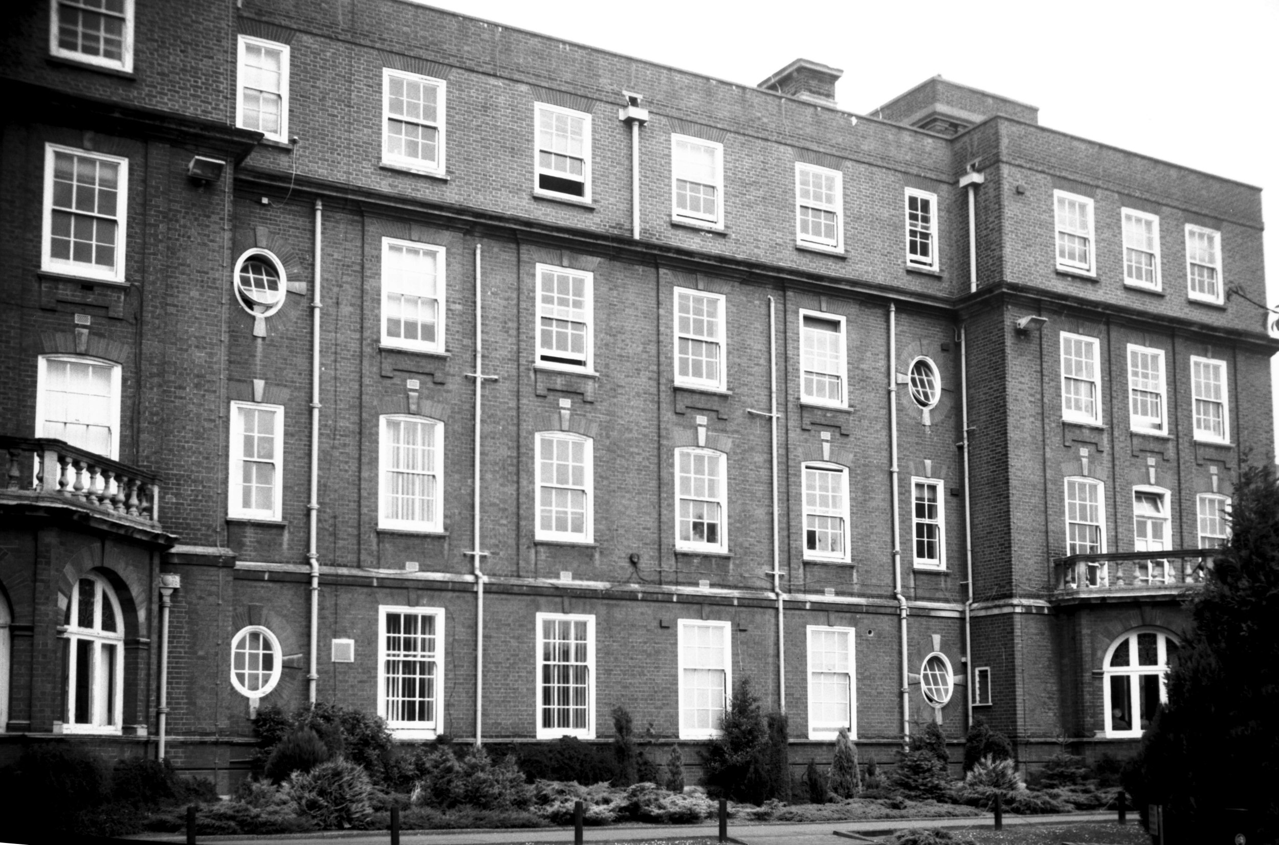
St Stephen's Rd N and N Hospital original [6459]
1987-05-19
|
|
|
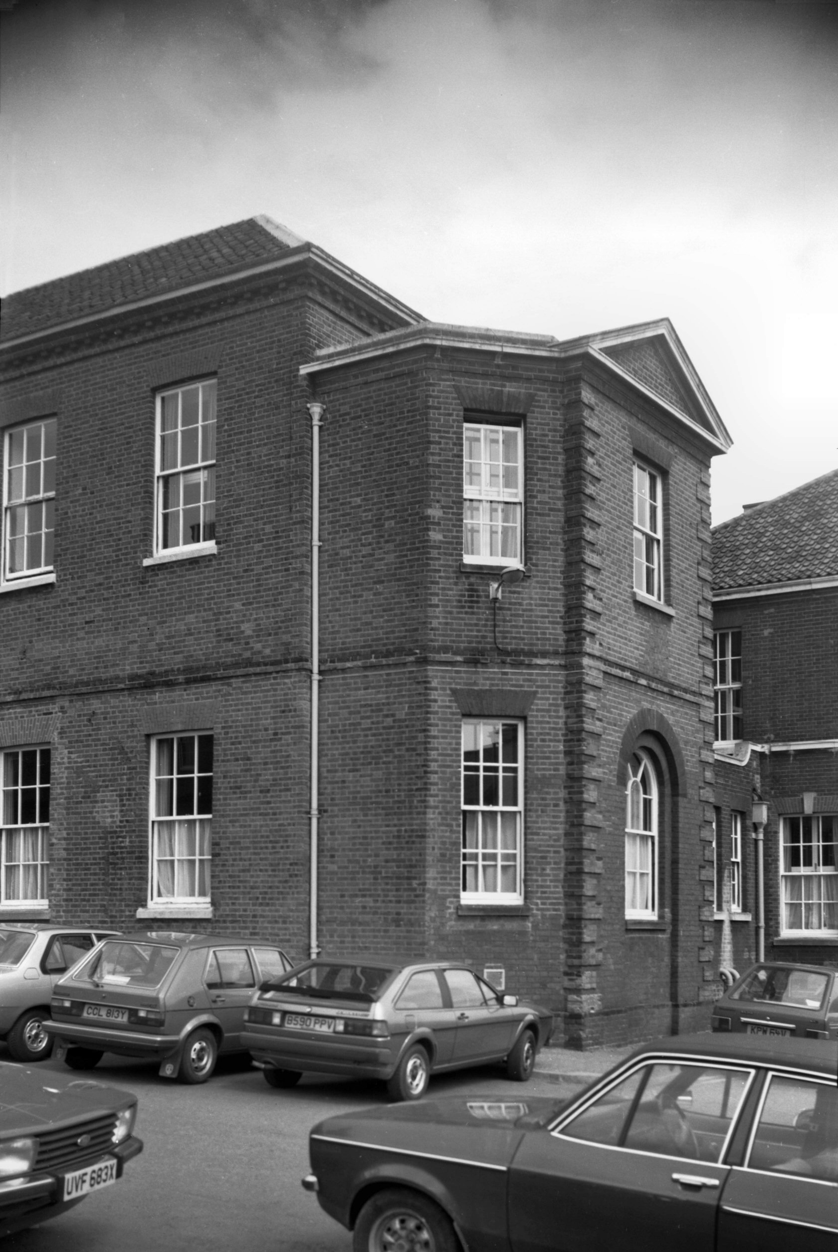
St Stephen's Rd N and N Hospital SW wing [6460]
1987-05-19
Part of original 1771 building incorporated into the
1879-83 outpatient department. |
|
|
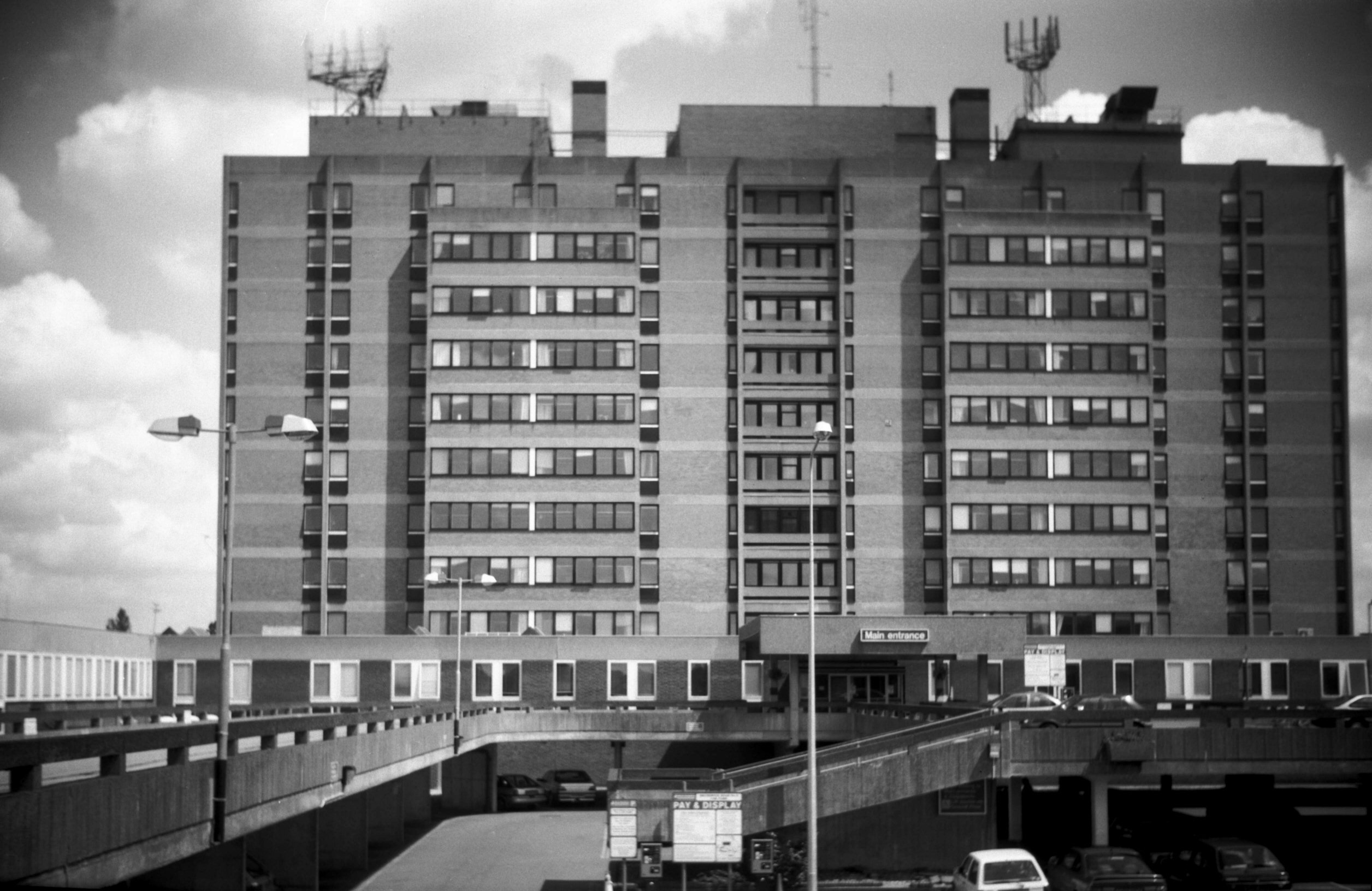
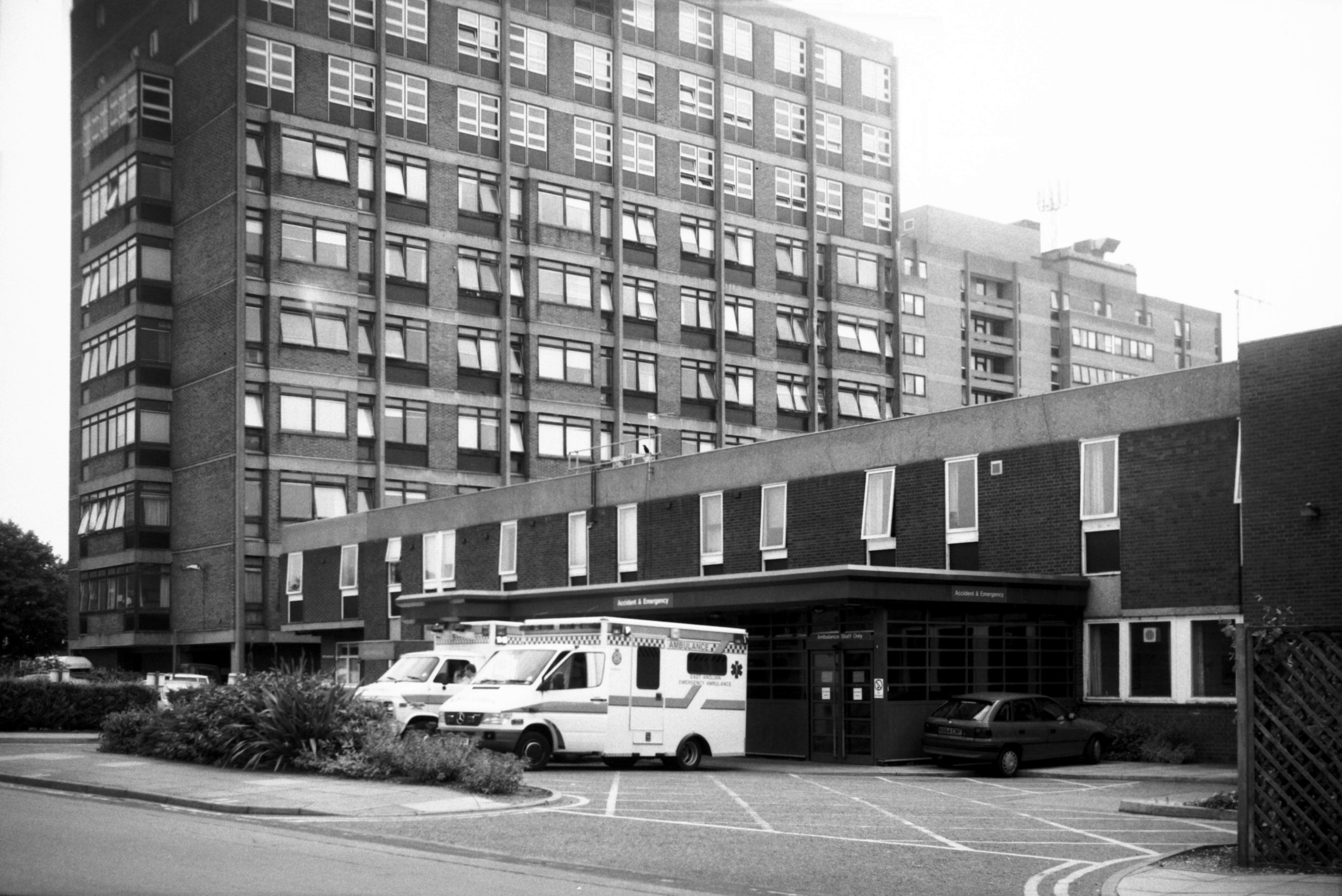
St Stephen's Rd N and N Hospital main block [7355]
1996-07-07
Completed 1974, architect Michael Everitt. |
|
|
St Stephen's Rd N and N Hospital maternity [7356]
1996-07-07
Outpatient department, opened 1971, and Maternity block,
completed 1968. |
|
|
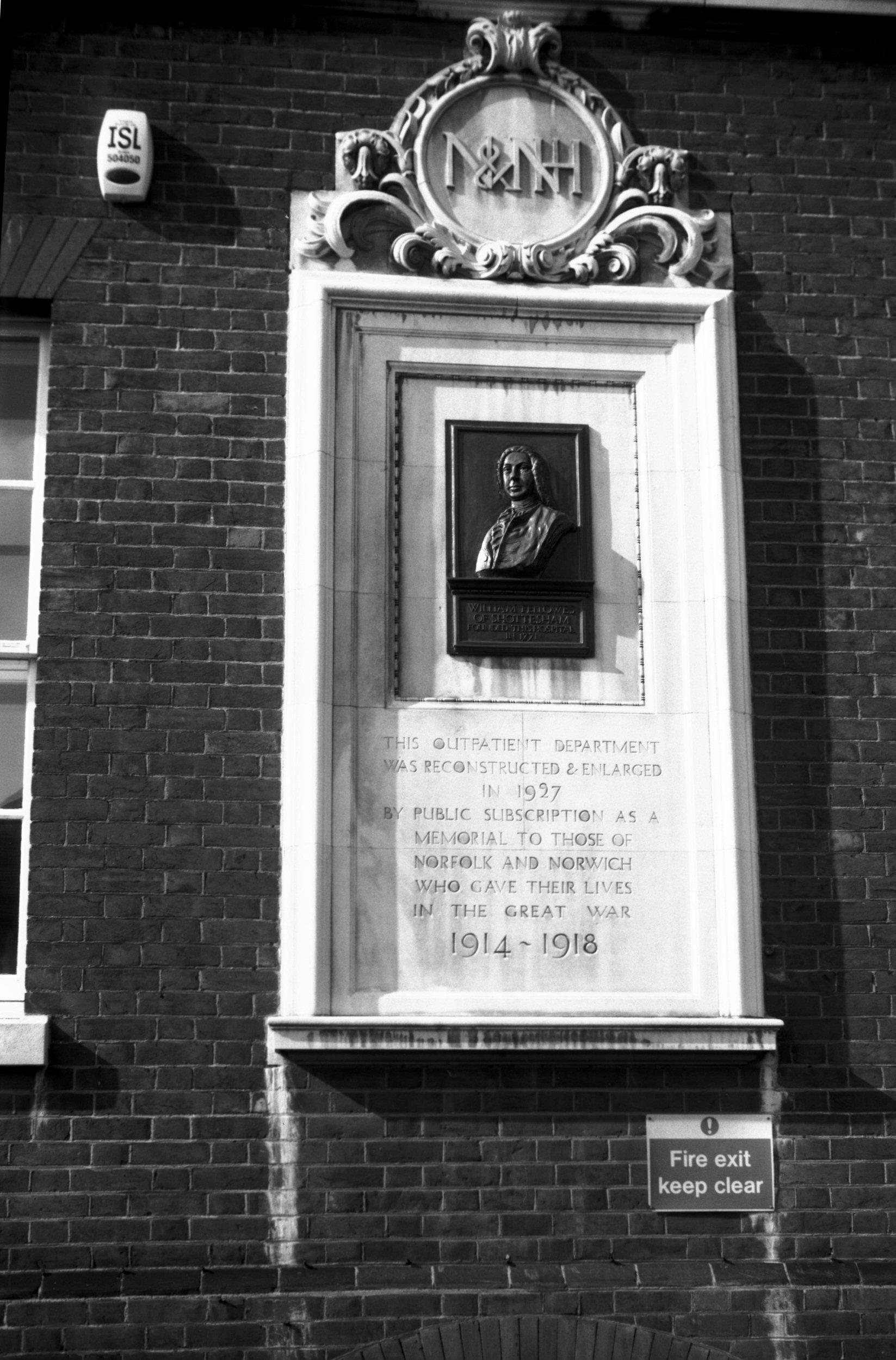
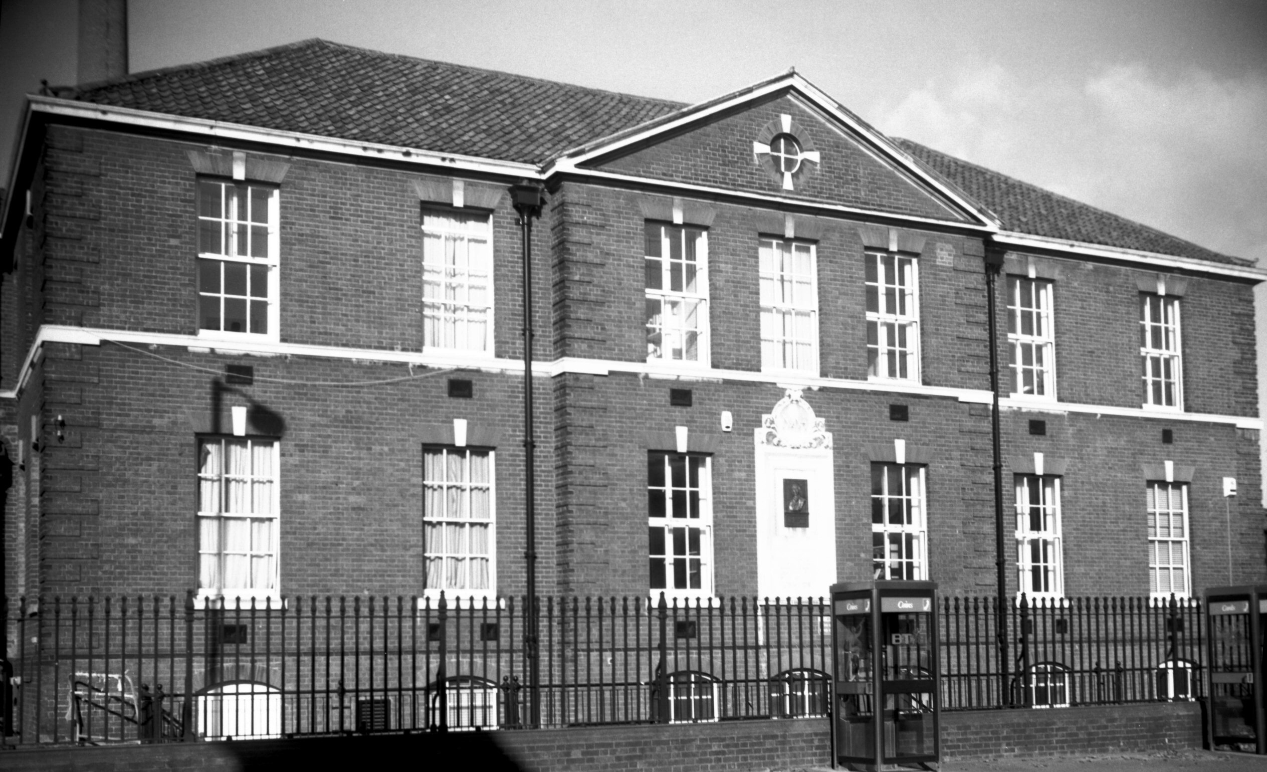
St Stephen's Rd William Fellowes plaque [7592]
1998-10-02
William Fellowes of Shotesham, founder of N and N
Hospital in 1771, with tablet commemorating 1927 opening
of new outpatients department in honour of those who died
in the Great War. |
|
|
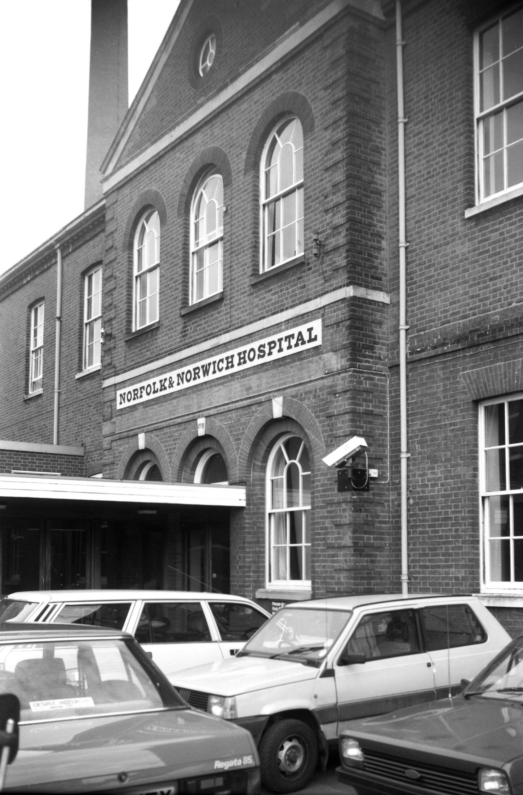
St Stephen's Rd N and N Hospital dispensary [7599]
1998-10-25
Dispensary and visitors' waiting room St Stephen's Rd,
built 1927. |
|
|
St Stephen's Rd N and N Hospital east ward [7600]
1998-10-25
|
|
|
St Stephen's Rd N and N Hospital A and E [7755]
2000-06-16
And maternity tower block. |
|
|
St Stephen's Rd N and N Hospital nurse home [7756]
2000-06-16
Leicester Nurses' home. Opened 1903, architects Boardman
and son. |
| |
South
side |
|
|
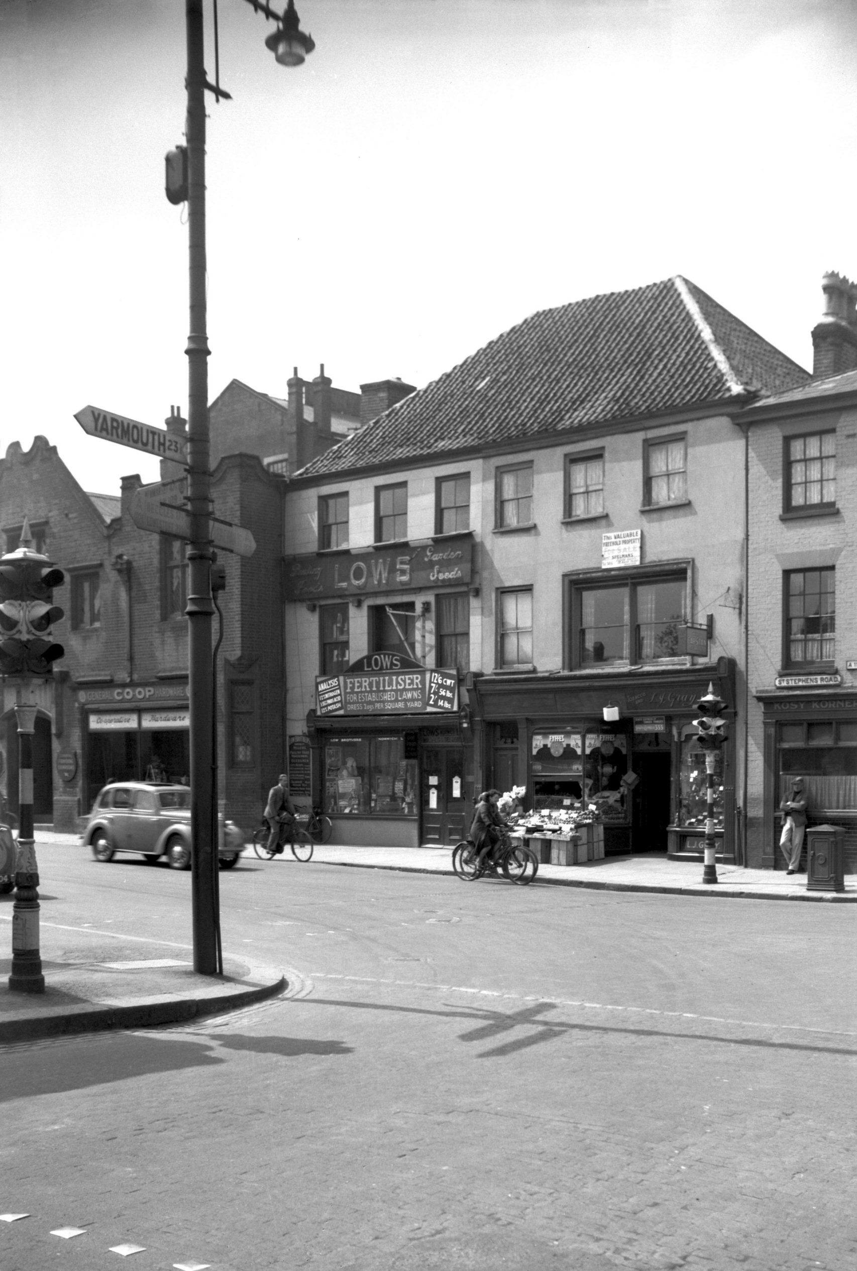
St Stephen's Rd 24 [7561] 1998-07-05
|
|
|
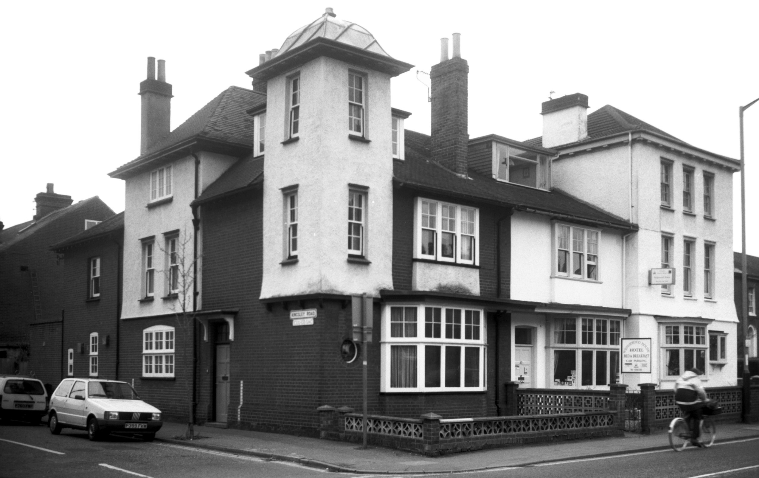
St Stephen's Rd 42 and left Kingsley Rd 2 [7544]
1998-04-22
|
|
|
St Stephen's Rd London Terrace [7422] 1997-01-14
1 to 6 London Terrace. |
|
St Stephen's St: |
| |
From
Rampant
Horse St / Red Lion St / Westlegate to Queen's Rd / St Stephen's Rd / Chapel
Field Rd
passing Surrey St, Coburg
St, (formerly passing Bull Lane)
South side |
|
|
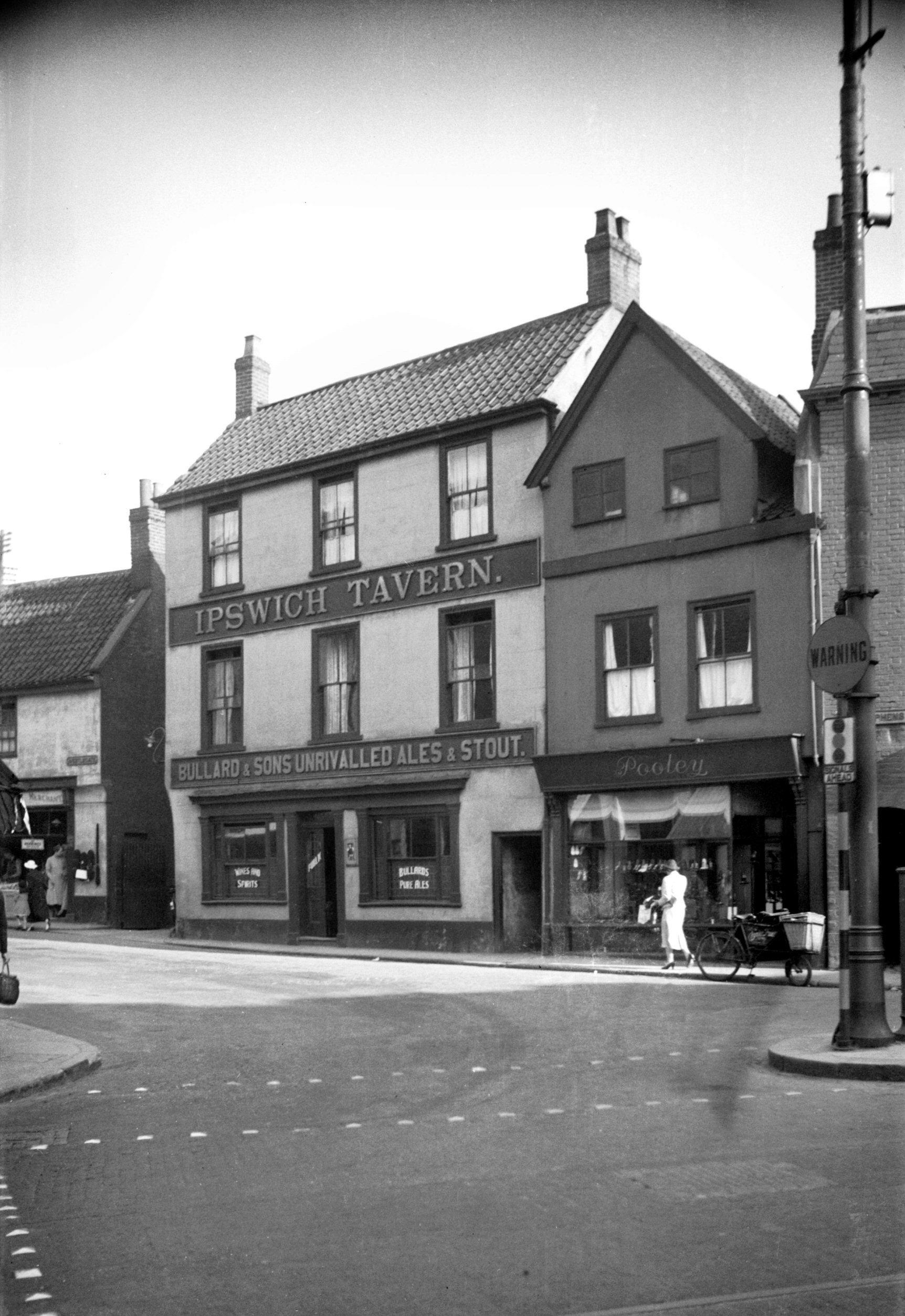
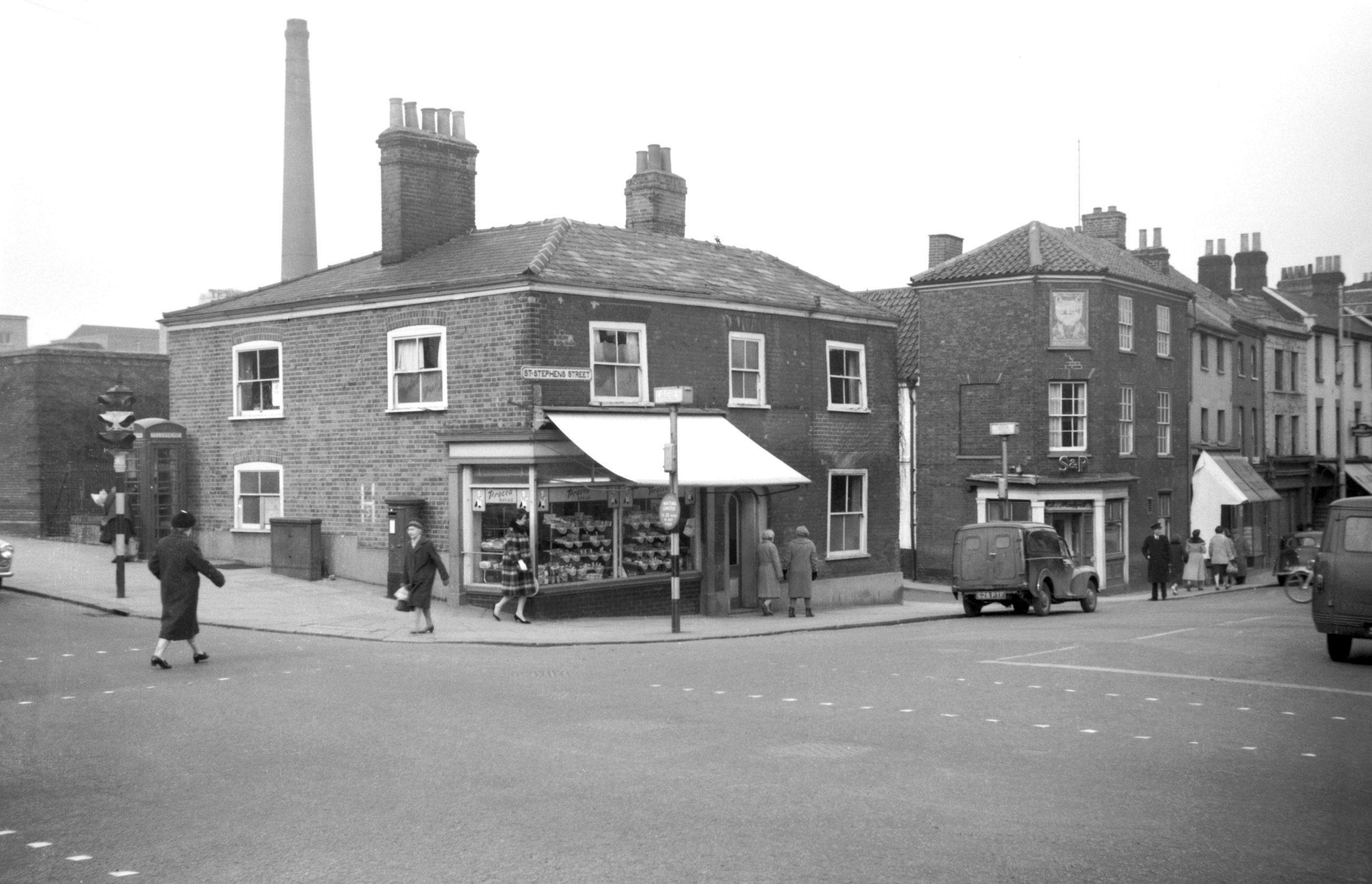
St Stephen's Plain 4 Ipswich Tavern to 5 [1030]
1936-06-16
|
|
|
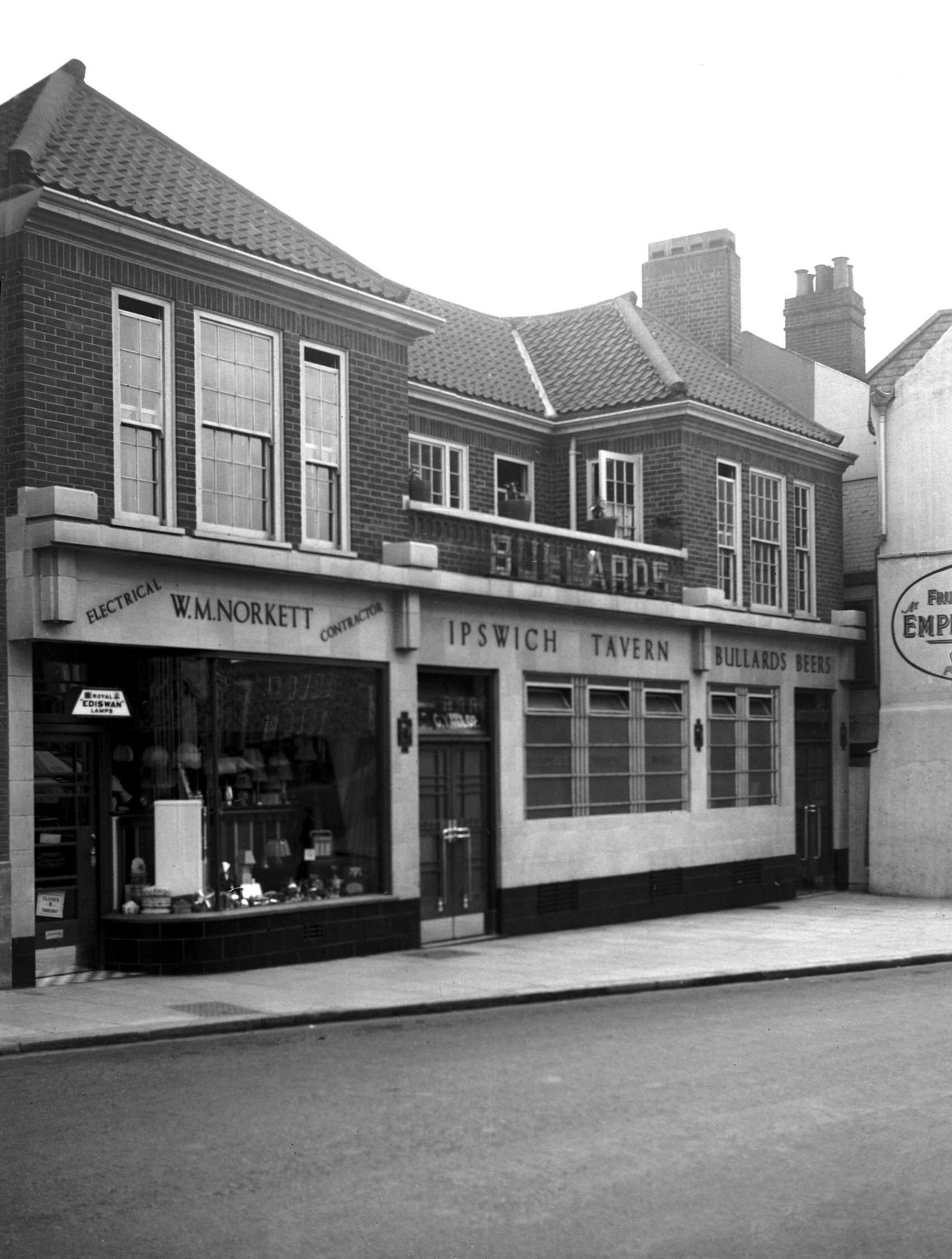
St Stephen's Plain 4 Ipswich Tavern [2512] 1938-06-26
|
|
|
St Stephen's Plain 6 to 7 St Stephen's St 1 [4234]
1953-10-25
1 to 3 St Stephen's St on right. |
|
|
St Stephen's St NE entrance building lines [4646]
1961-09-03
Showing new and old building lines. |
|
|
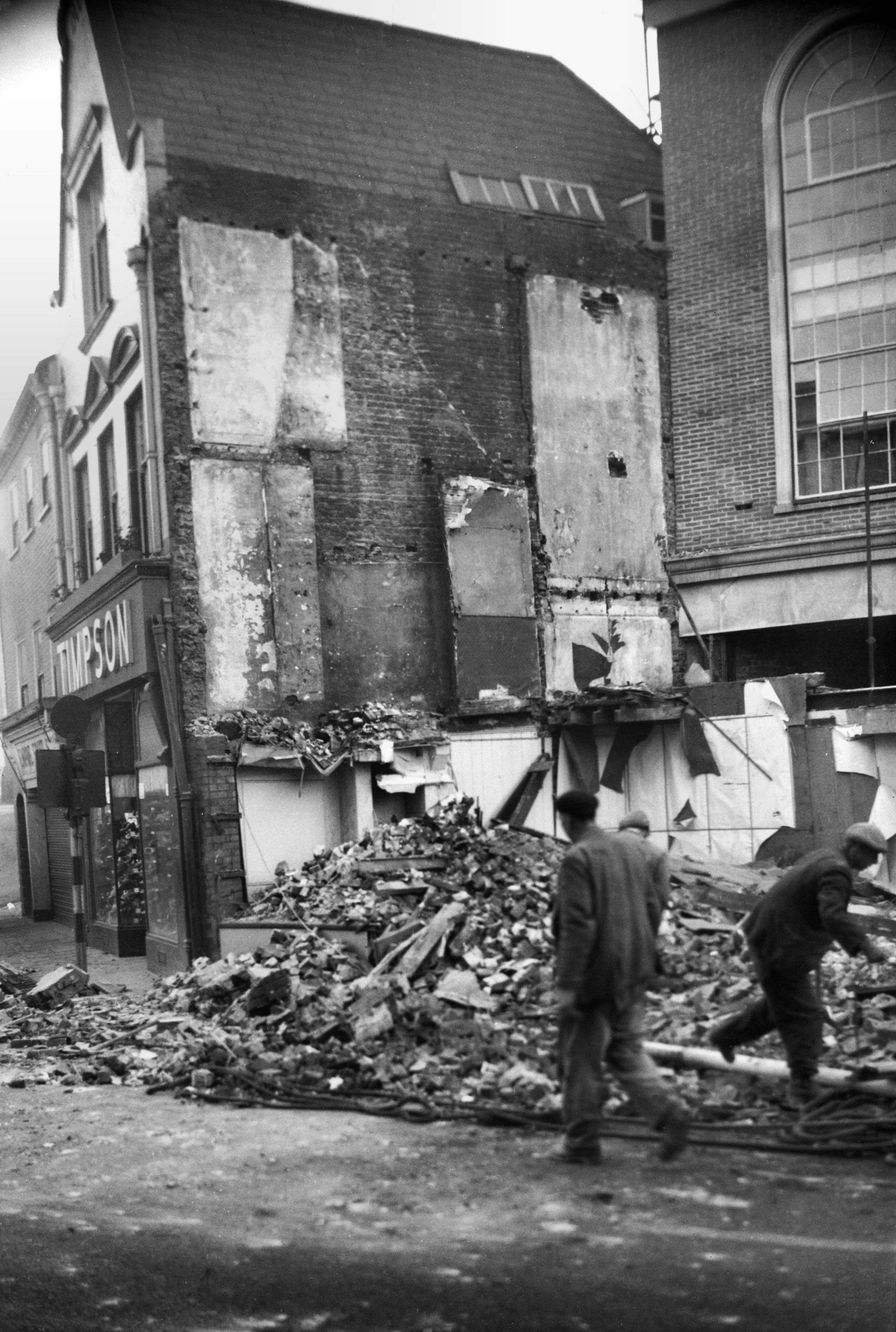
St Stephen's St 1 to 3 [2794] 1938-09-05
3 would be partially destroyed by enemy action. |
|
|
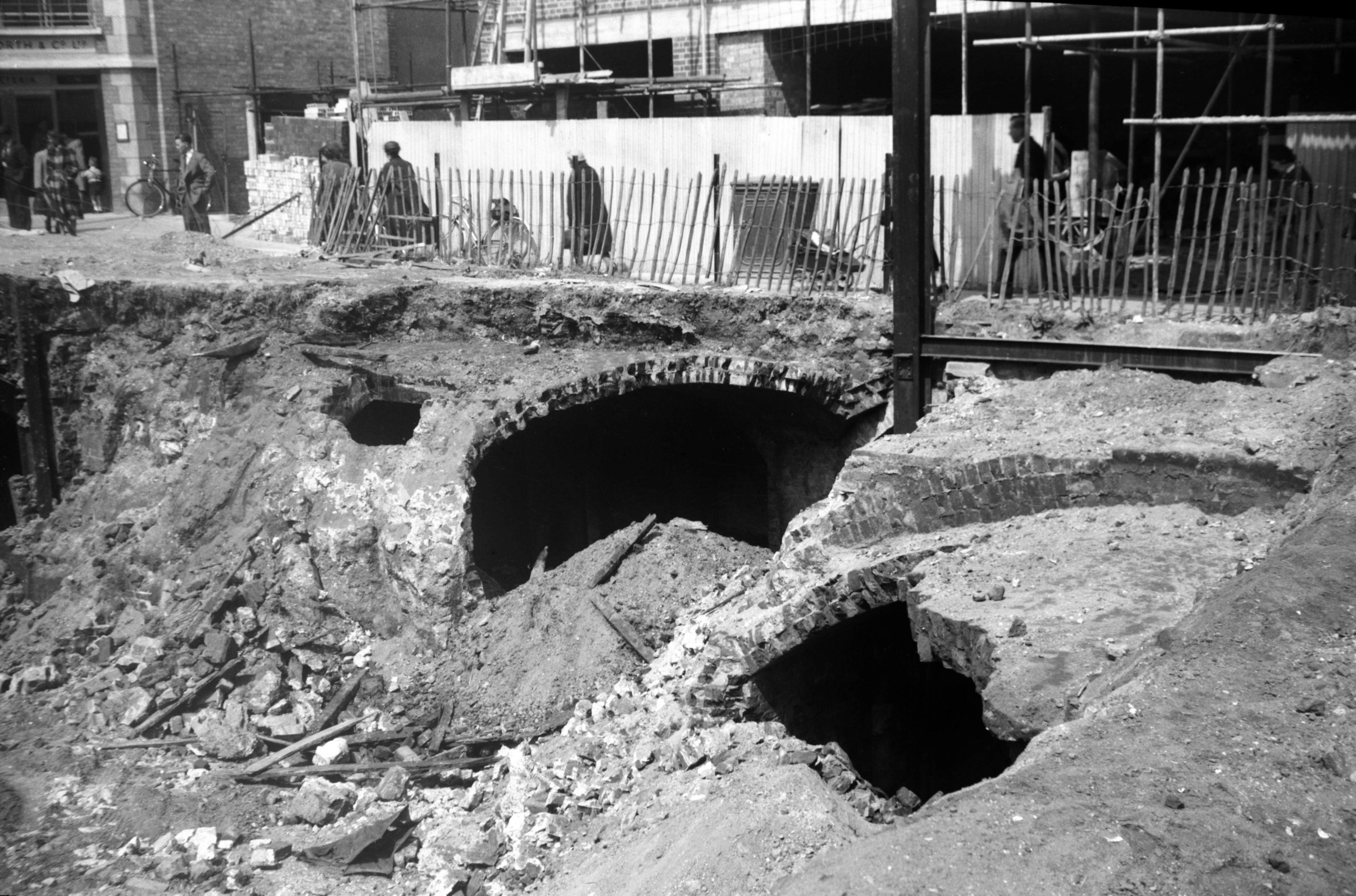
St Stephen's St 1 to 3 demolition [4239] 1953-11-29
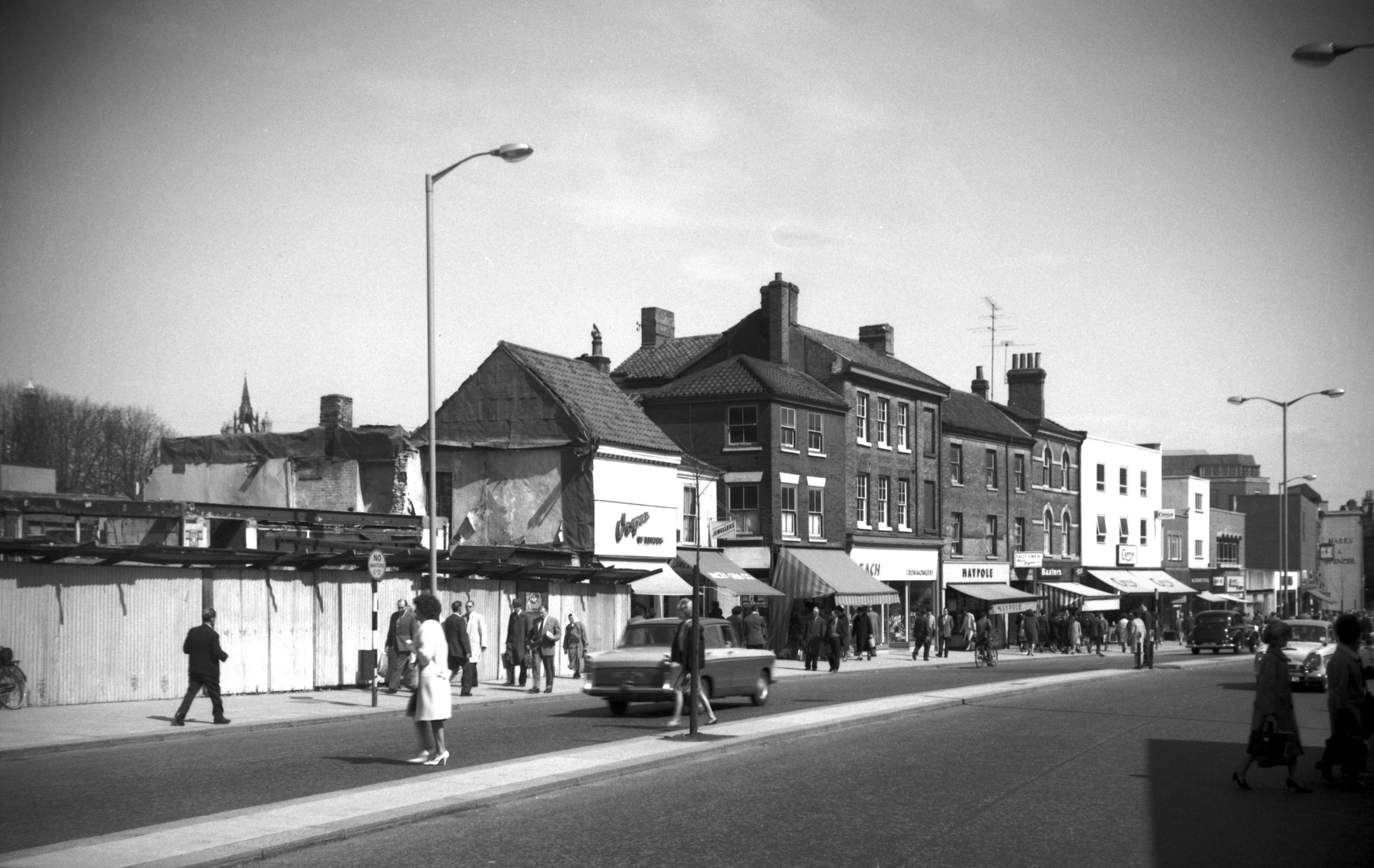
The question of widening St Stephen's St, first arose in
1915, the Great Eastern Railway Company offering the City
Council the sum of £10,000 towards the project. The
railway company wanted a grander approach to its terminus
Victoria Station (more recently the site of Sainsbury's).
The offer, however, was refused (perhaps because of the
war) and in consequence the following year Victoria
Station was closed to all except goods traffic, passenger
trains being diverted to the main terminus at Thorpe.
With the increase in motor transport in the 1930s the
Council began studying the problem in earnest, but
agreement could never be reached on the question of which
side should be set back. On the east side stood the
mediaeval Boar's Head inn and Crown and Angel public
house, while on the west were two large department
stores.
In the end the air raids of April 1942, solved the
problem, the old thatched Boar's Head inn among many
neighbouring buildings providing a vulnerable target.
After these losses, the City of Norwich Plan - 1945
found the street to have "few buildings of
outstanding merit" and proposed that it be provided
with dual carriageways and pavements 15 feet wide - the
new buildings to be controlled in so far as materials,
height and design were concerned. In 1953 a start was
made by widening on the east side at the city end, the
whole scheme being completed in the early 1960s, leaving
nothing to attract the historically minded. |
|
|
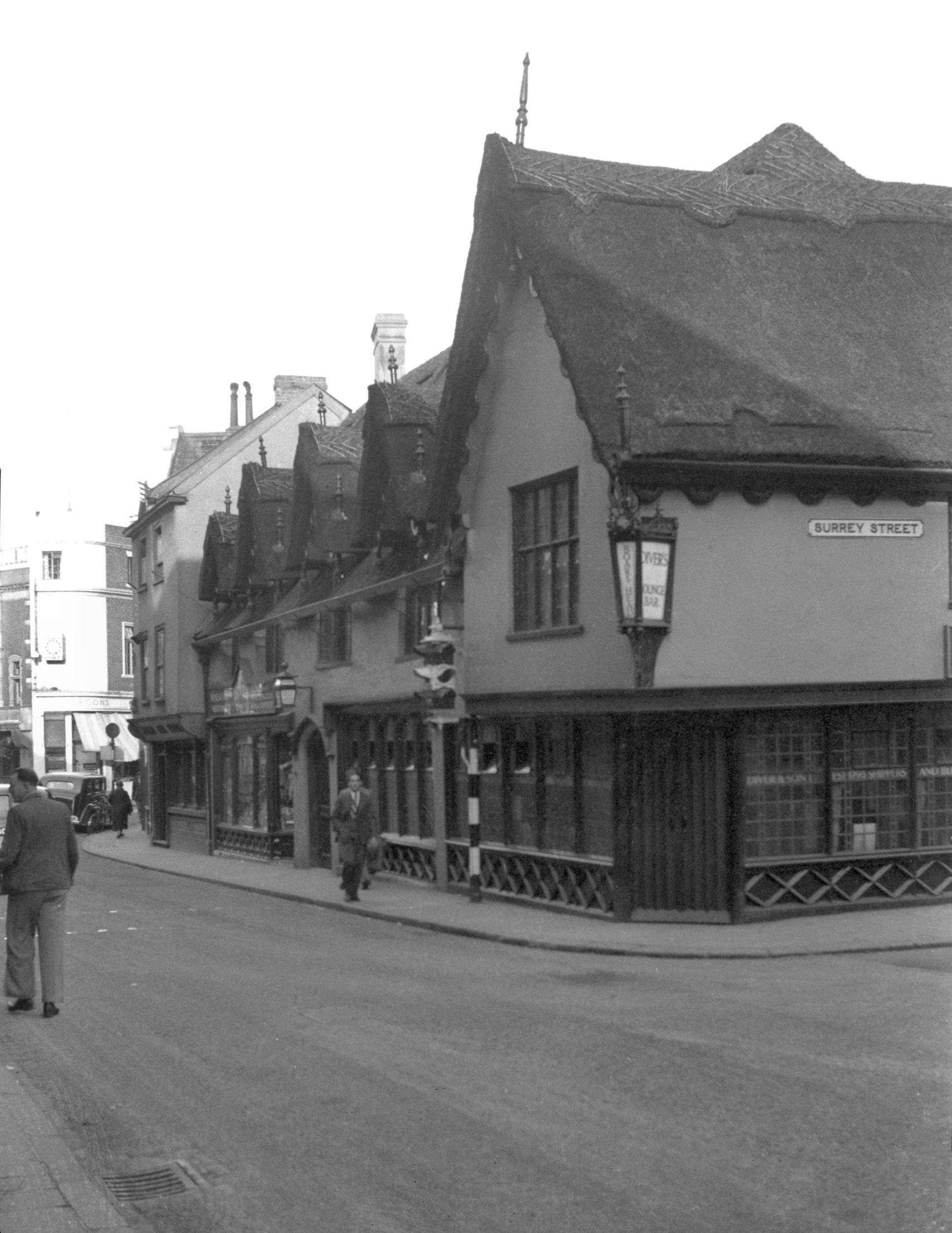
St Stephen's St 5 to 7 Boar's Head Inn [2793]
1938-09-05
Destroyed 1942. See also 2 Surrey
St. |
|
|
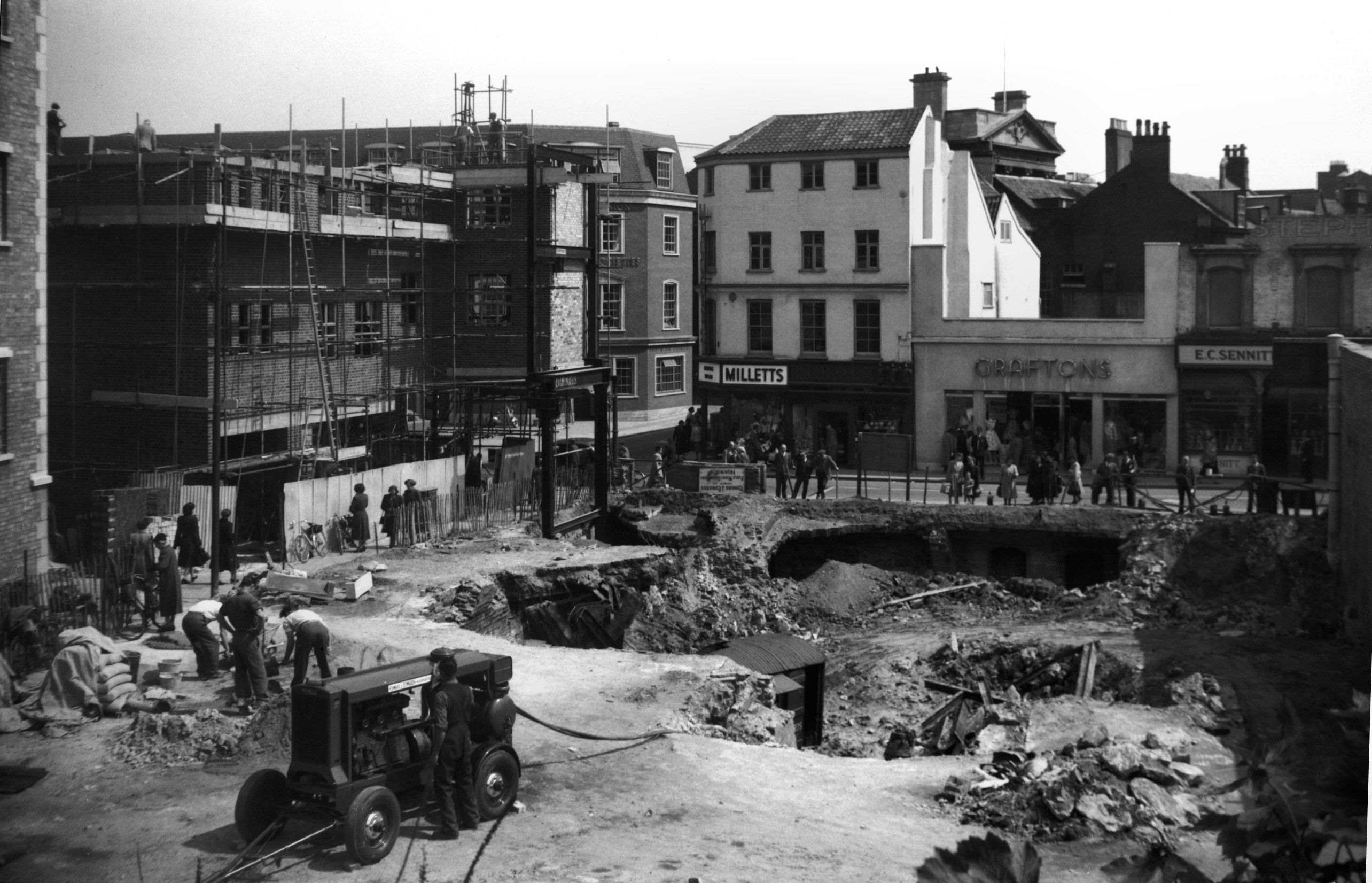
St Stephen's St 9 to 11 from site of 12 [4248]
1954-05-25
View across to Milletts, Purdys, Graftons and Sennitts
from cleared site of 12 to 14. |
|
|
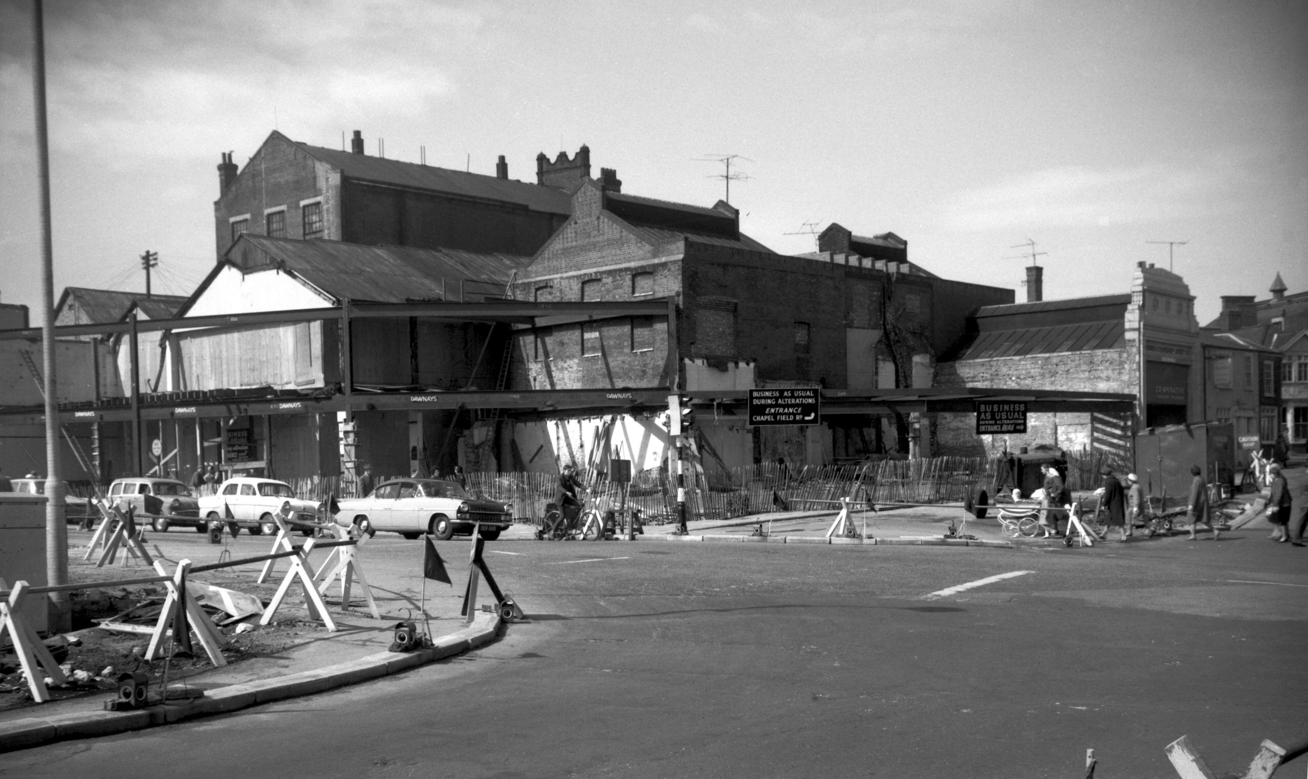
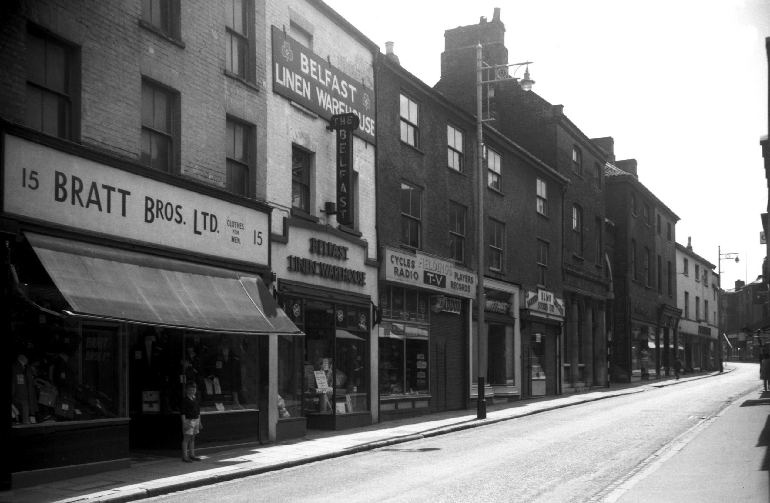
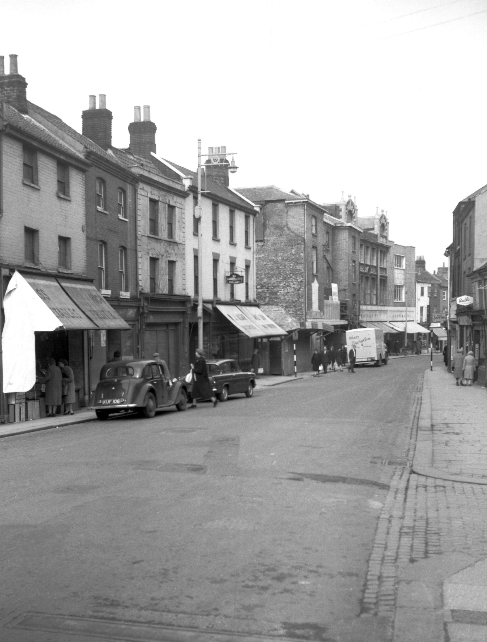
St Stephen's St 15 to 31 [4611] 1961-06-18
Prior to demolition for street widening. |
|
|
St Stephen's St 21 to 25 rear [4684] 1962-06-24
Prior to demolition for street widening. |
|
|
St Stephen's St 25 to 31a [4398] 1955-09-26
|
|
|
St Stephen's St 27 to 29 rear and archway [4683]
1962-06-24
Prior to demolition for street widening. |
|
|
St Stephen's St 35 to 37 [1023] 1936-06-14
37 partially destroyed 29th April 1942. |
|
|
St Stephen's St 39 to 41a [1068] 1936-06-28
Destroyed 29th April 1942. |
|
|
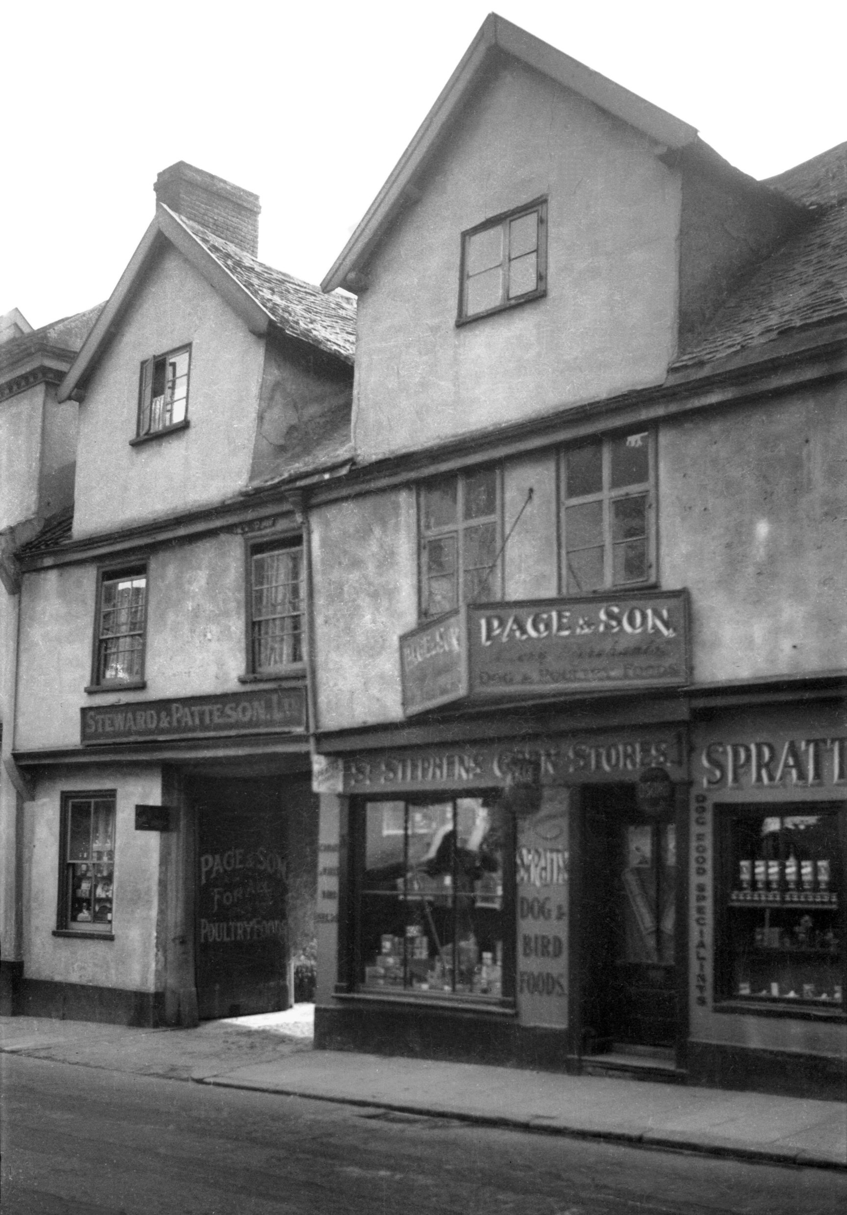
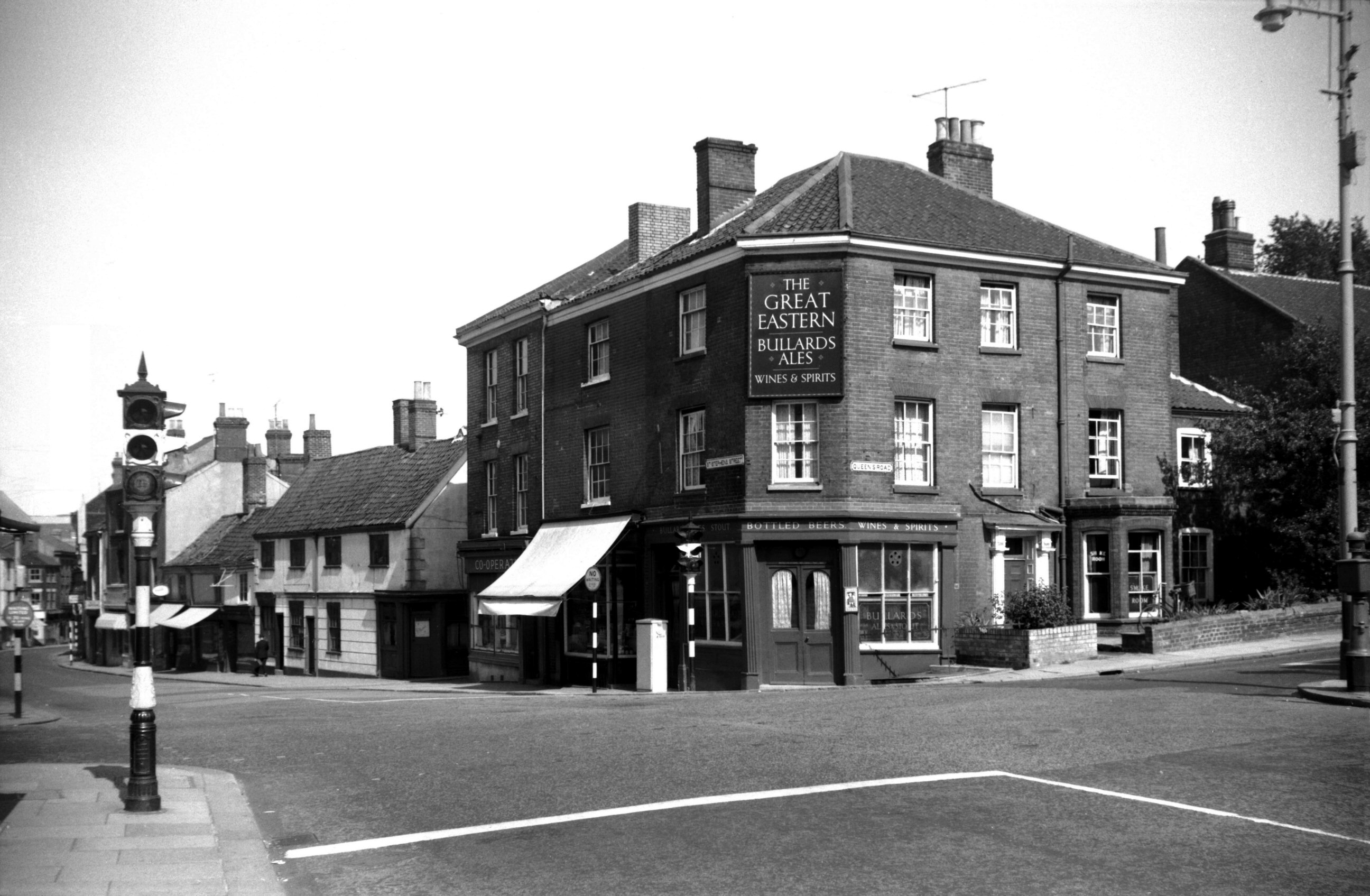
St Stephen's St 41 Crown and Angel PH to 43 [1423]
1936-09-20
Another casualty on 29th April 1942 was the Crown and
Angel inn. This interesting old building, comprising Nos
41 and 43, originally formed one large house but was
divided in its later years into two, the smaller portion
becoming part of the inn and the larger (No 43) Page and
Son's corn store.
It was the late Mr Ernest Kent who first drew attention
to an interesting external feature, a stone bracket that
supported the first-floor jetty at the right-hand end. On
it was a coat-of-arms which Mr Kent made out to be
"Argent, on a fesse Azure, three eagles displayed Or
(for Clere) impaling Argent, a cross moline Gules (for
Uvedale)". From this it was deduced that the
dwelling was erected sometime between 1434 and 1492 as a
town house, possibly on the site of an older building
belonging to the Uvedales, for it was just inside the
city walls and on the highway leading to their country
estates at Tacolneston and Wymondham. Although the
original town house of the Cleres was sited at the Old
Barge inn, King St, the family was for long connected
with St Stephen's district, as is shown by the register
of that parish.
The upper storey of the building with its two substantial
dormers was severely damaged in the blitz of April 1942,
and the whole house was demolished four years later. The
stone bracket with the coat-of-arms was transferred for
safe keeping to one of the city's museums. |
|
|
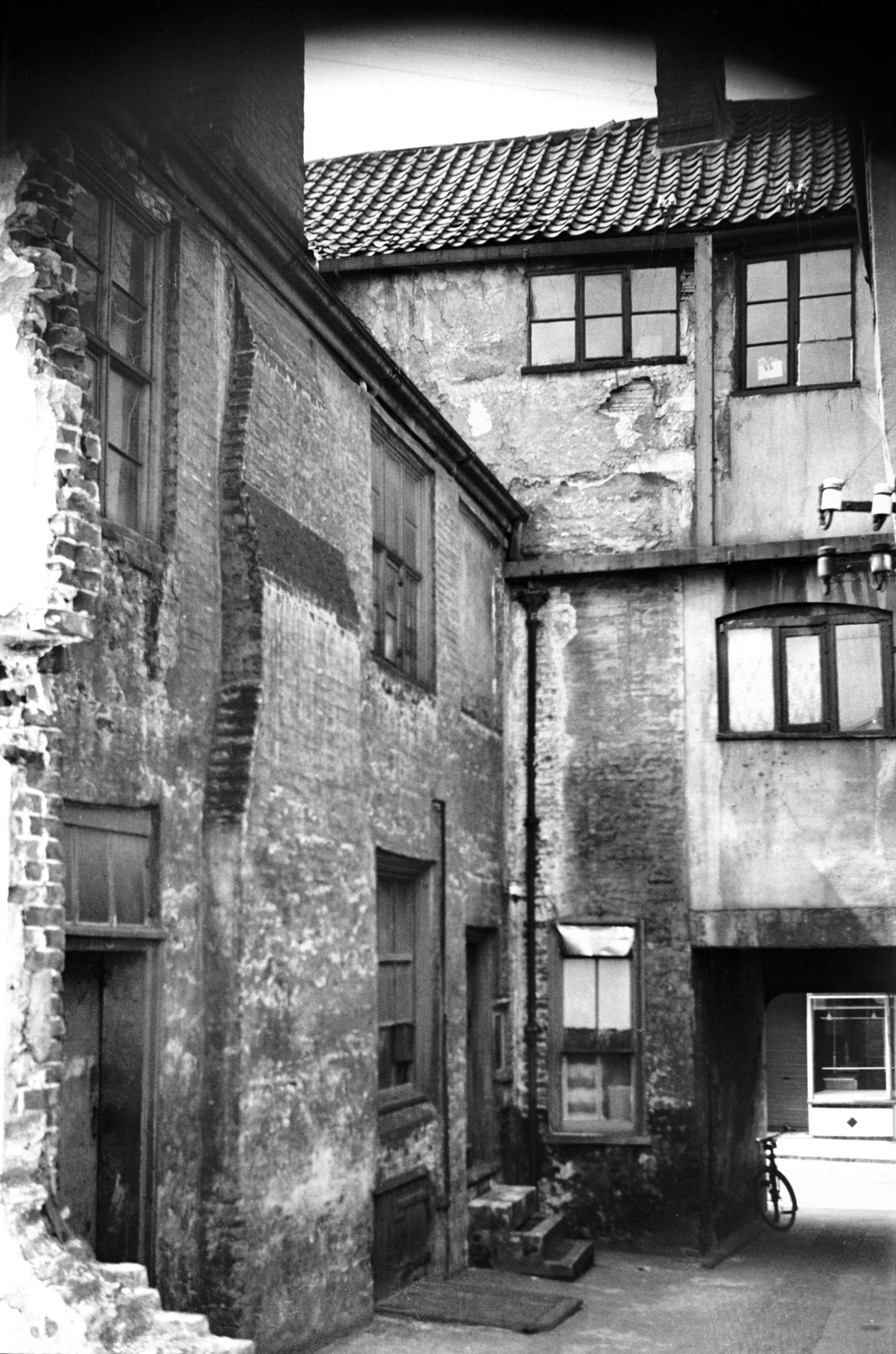
St Stephen's St 41 rear [1649] 1937-05-23
|
|
|
St Stephen's St 41a rear Browne's Court [1650]
1937-05-23
|
|
|
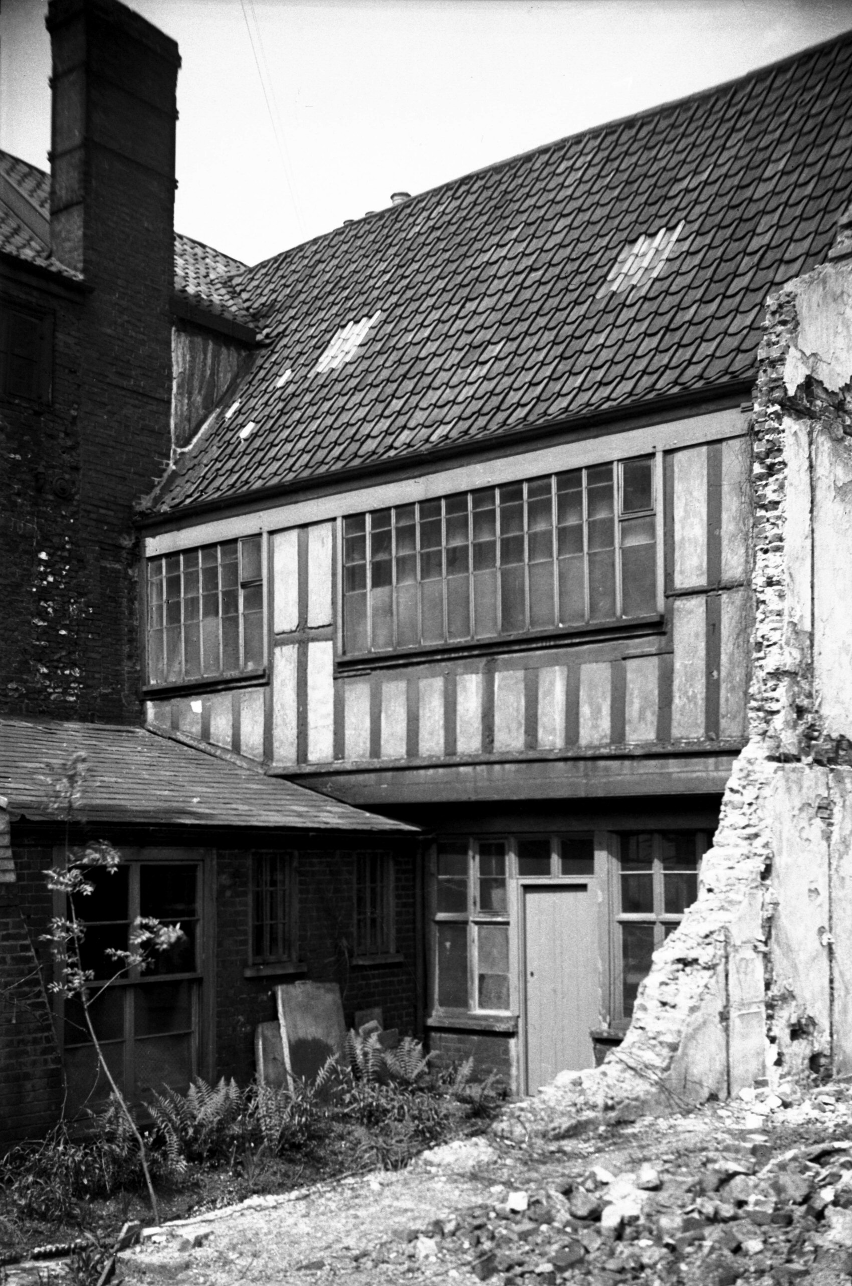
St Stephen's St 43 rear [1020] 1936-06-14
A stone bracket on the front of this house bore the Arms
of Clere impaling Uvedale. From this it is deduced than
the house was built between 1434 and 1492 by the Cleres
on the site of an older building belonging to the
Uvedales. |
|
|
St Stephen's St 45 to 51 [4639] 1961-08-27
Prior to demolition for street widening. |
|
|
St Stephen's St Wheatsheaf Yard [4612] 1961-06-18
Between 51 and 53. Prior to demolition for street
widening. |
|
|
St Stephen's St 63 to 75 Great Eastern PH [4638]
1961-08-27
Prior to demolition for street widening. Site of St
Stephen's Gates. |
|
|
St Stephen's St 65 to 75 [4613] 1961-06-18
Prior to demolition for street widening. |
|
|
St Stephen's St 69 Bull PH [1026] 1936-06-14
Former St Stephen's Almshouses. |
|
|
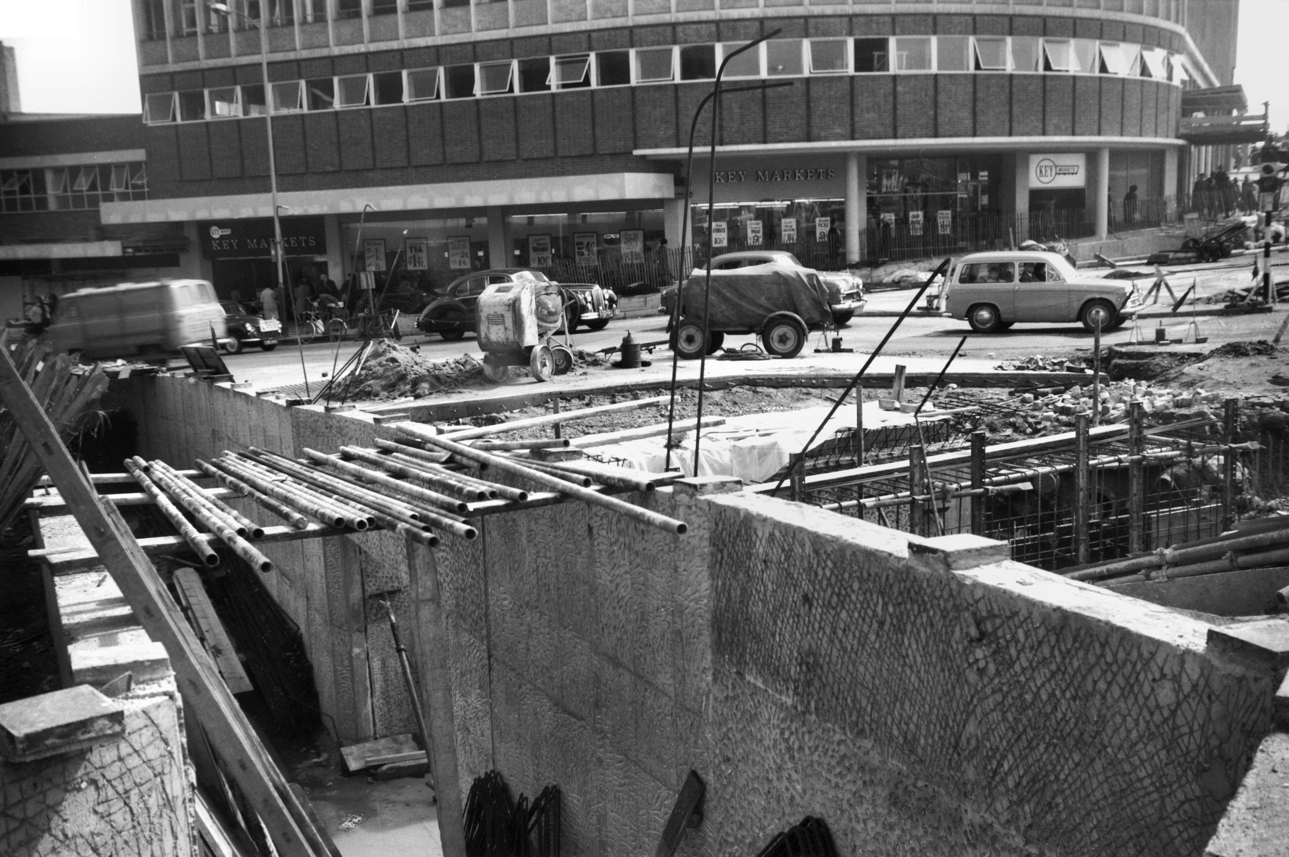
St Stephen's Chapel Field Rd subway trench [4754]
1964-04-18
Key Markets supermarket behind. |
| |
North
side |
|
|
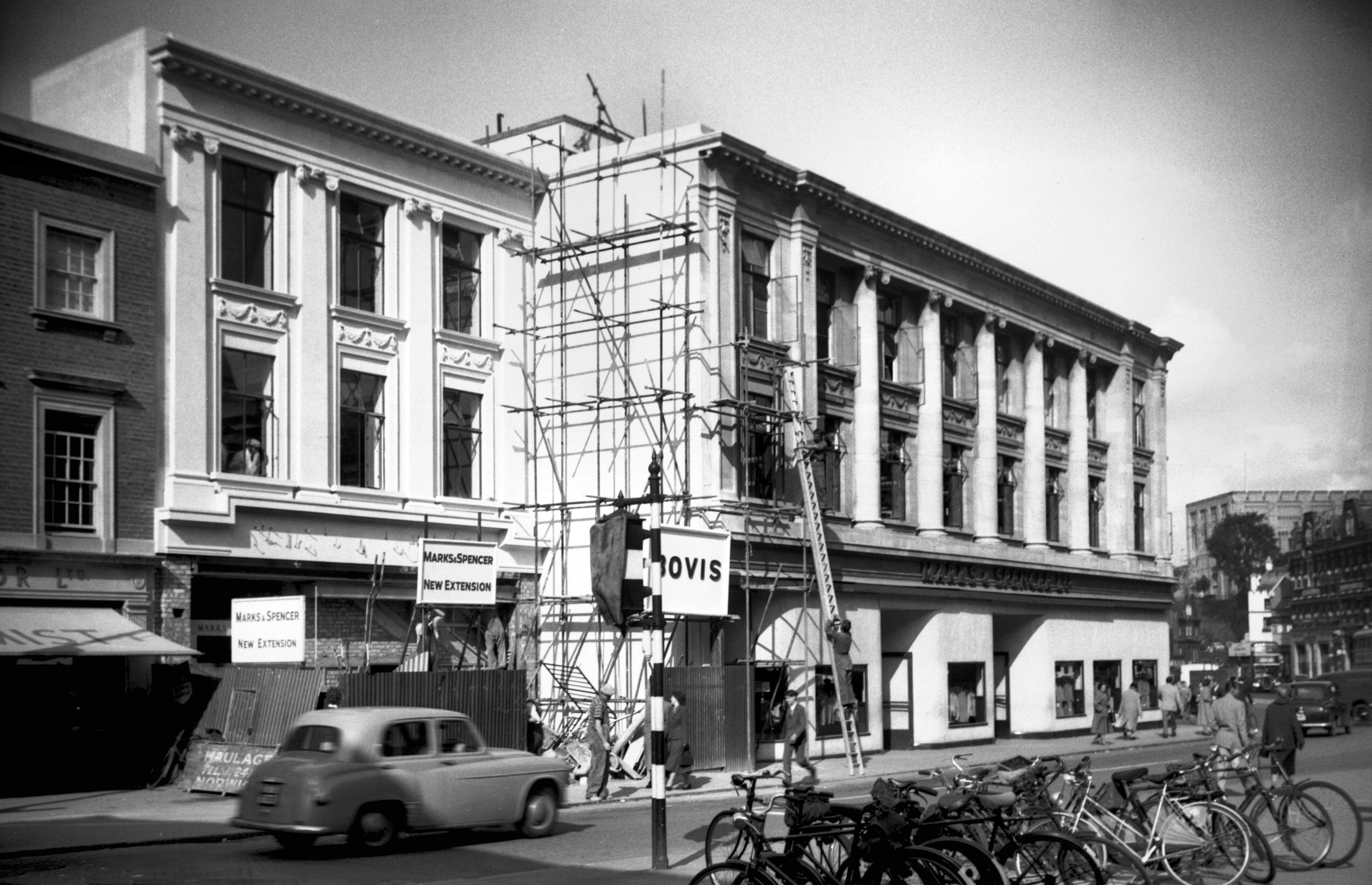
St Stephen's St 2 to 6 Marks and Spencer [4400]
1955-09-26
8 to 20 St Stephen's St were destroyed by enemy action in
1942 and when the premises were rebuilt the line was set
back a few feet to improve the entrance at this end. It
was also proposed to arcade below 2 to 4 to widen the
road there, but the estimated cost proved prohibitive and
that part of the scheme was abandoned. |
|
|
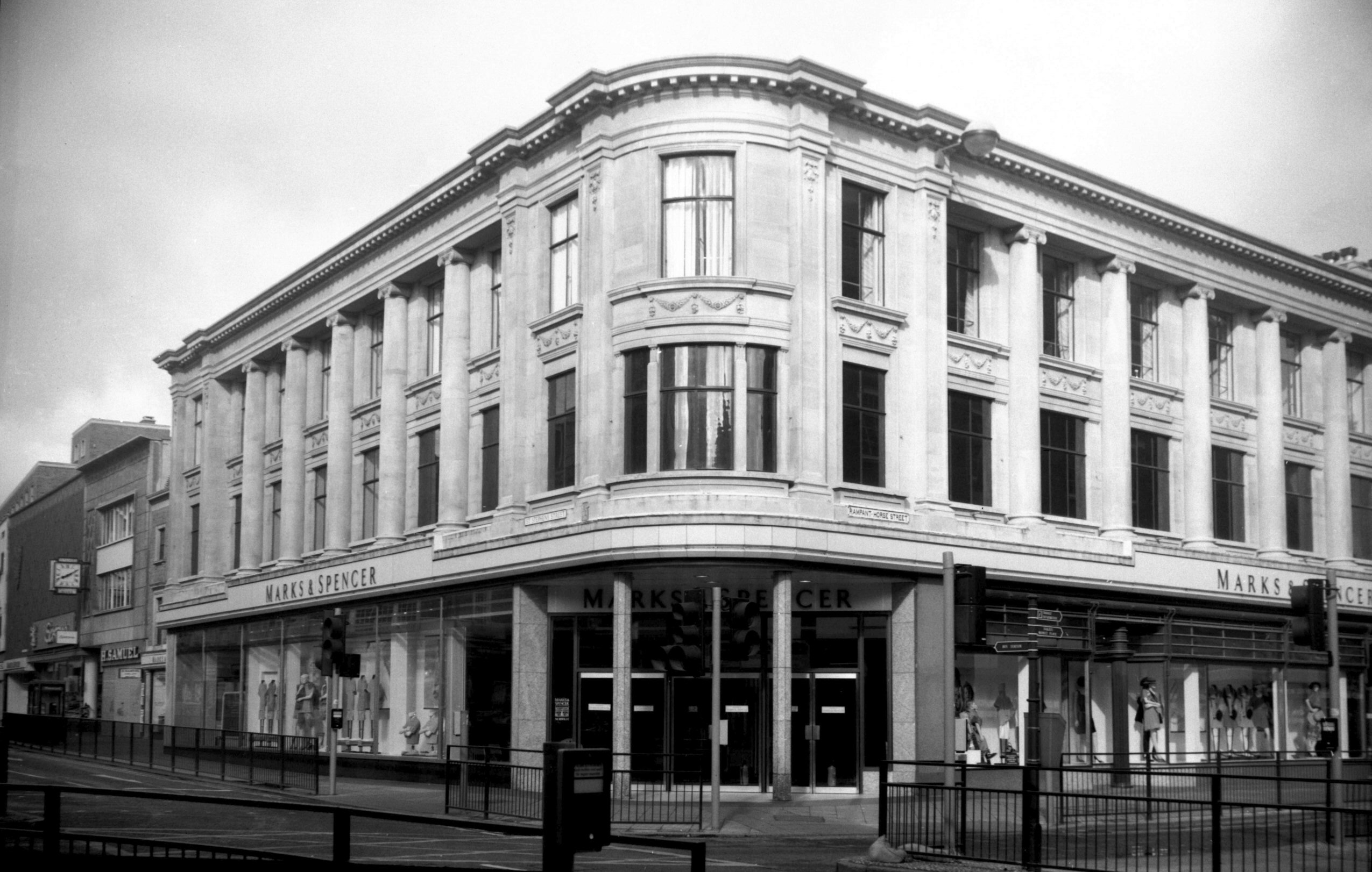
St Stephen's St Marks and Spencer's store [6695]
1991-06-09
Originally built for Bunting's in 1912, architect
A.F.Scott. An early example of reinforced concrete. The
attic storey of hanging tiles was destroyed in an air
raid in 1942 and never replaced. |
|
|
St Stephen's St 6 [2773] 1938-09-02
|
|
|
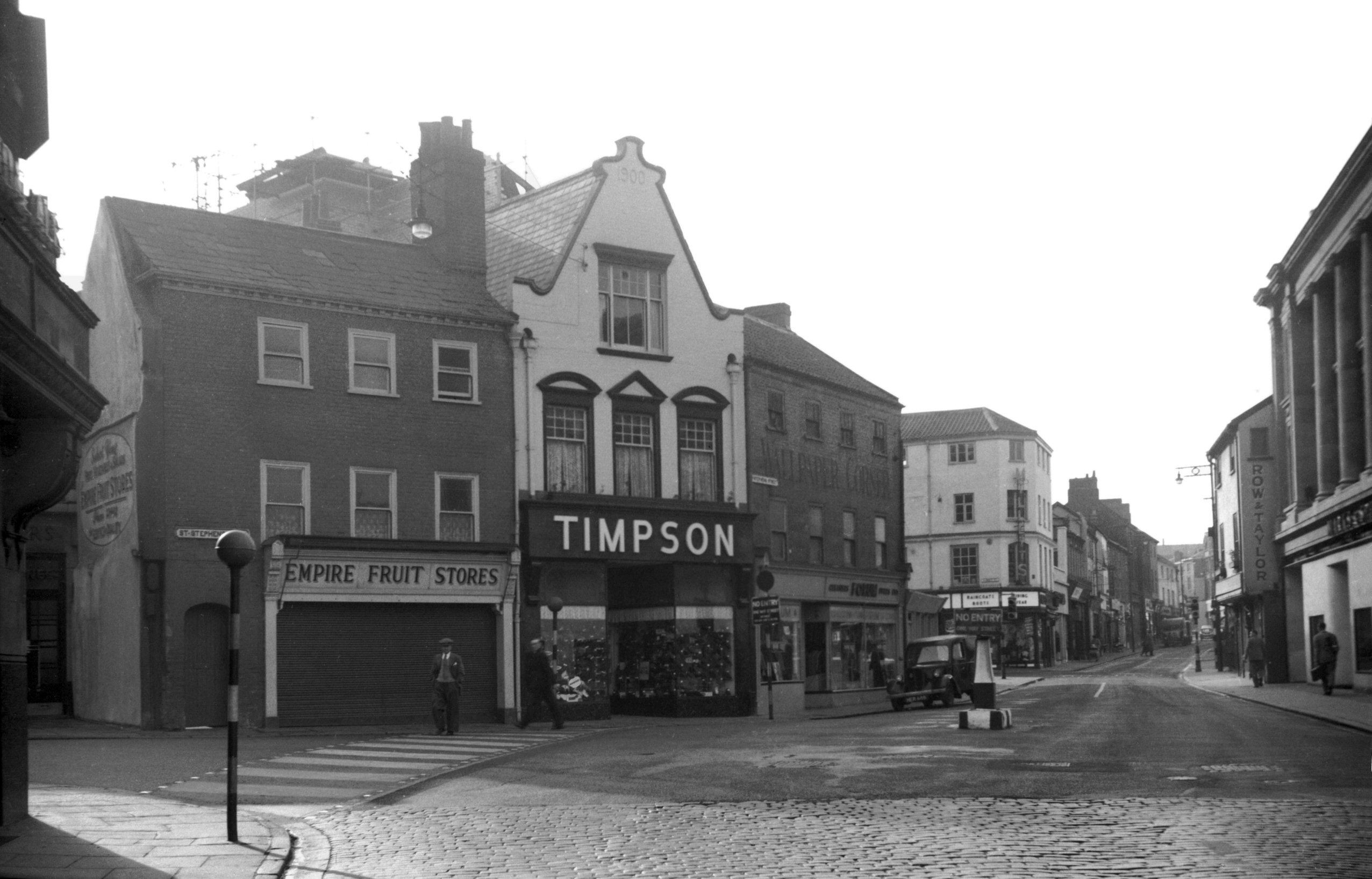
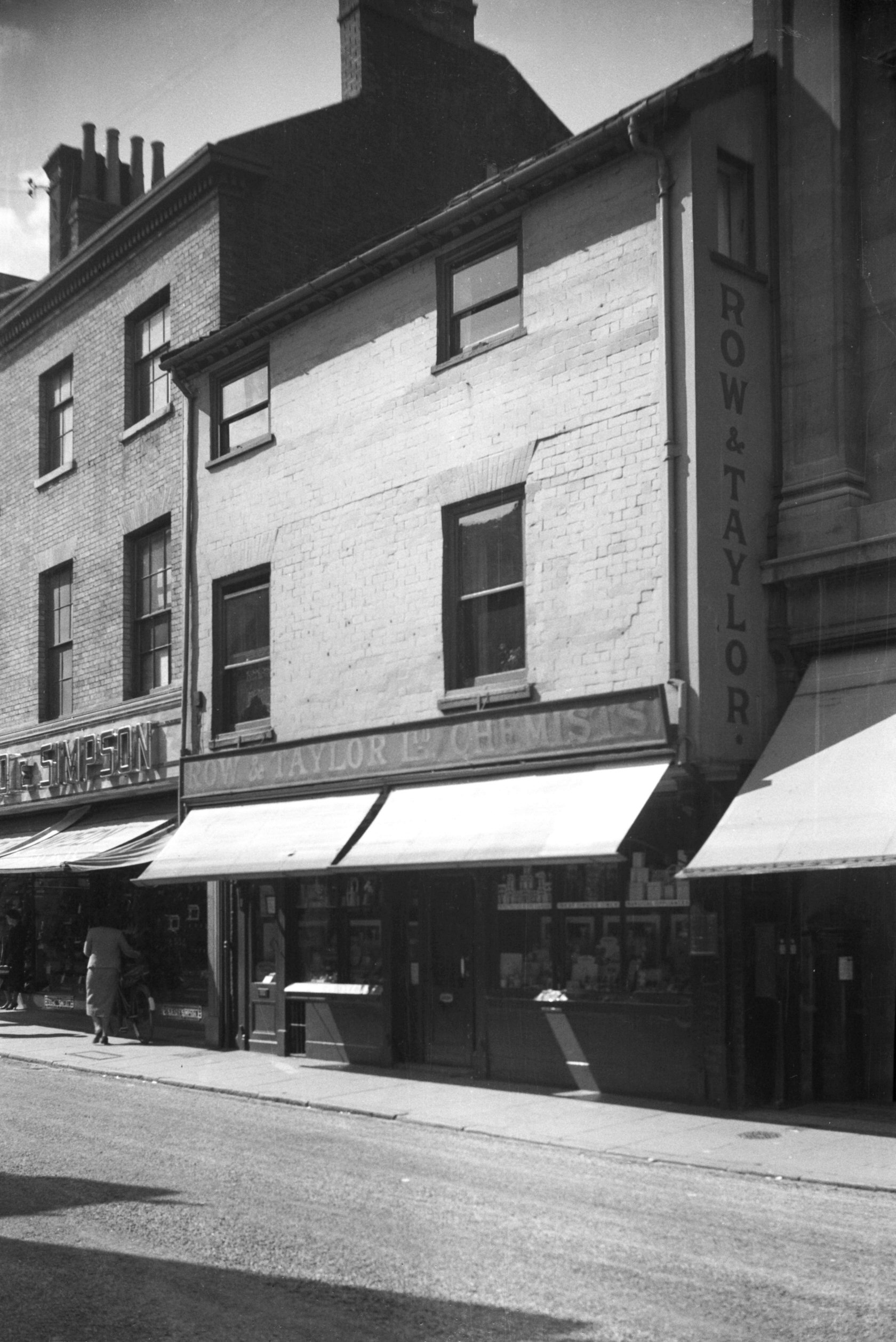
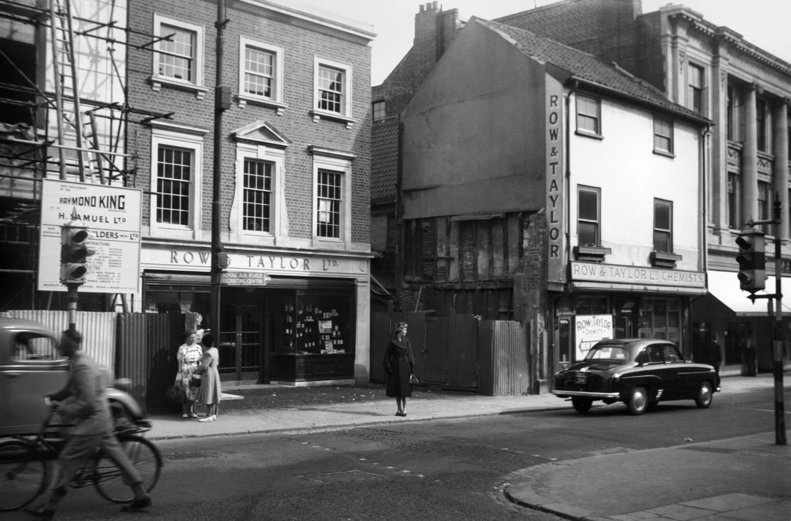
St Stephen's St 6 to 8 Row and Taylor [4261]
1954-06-23
Old and new premises of Row and Taylor. |
|
|
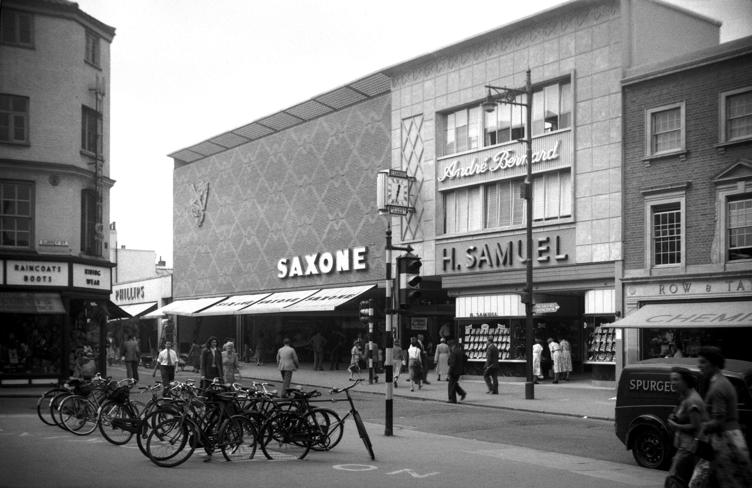
St Stephen's St 8 to 12 after completion [4373]
1955-09-01
Saxone and H.Samuel. |
|
|
St Stephen's St Barwell's Court view east [4399]
1955-09-26
|
|
|
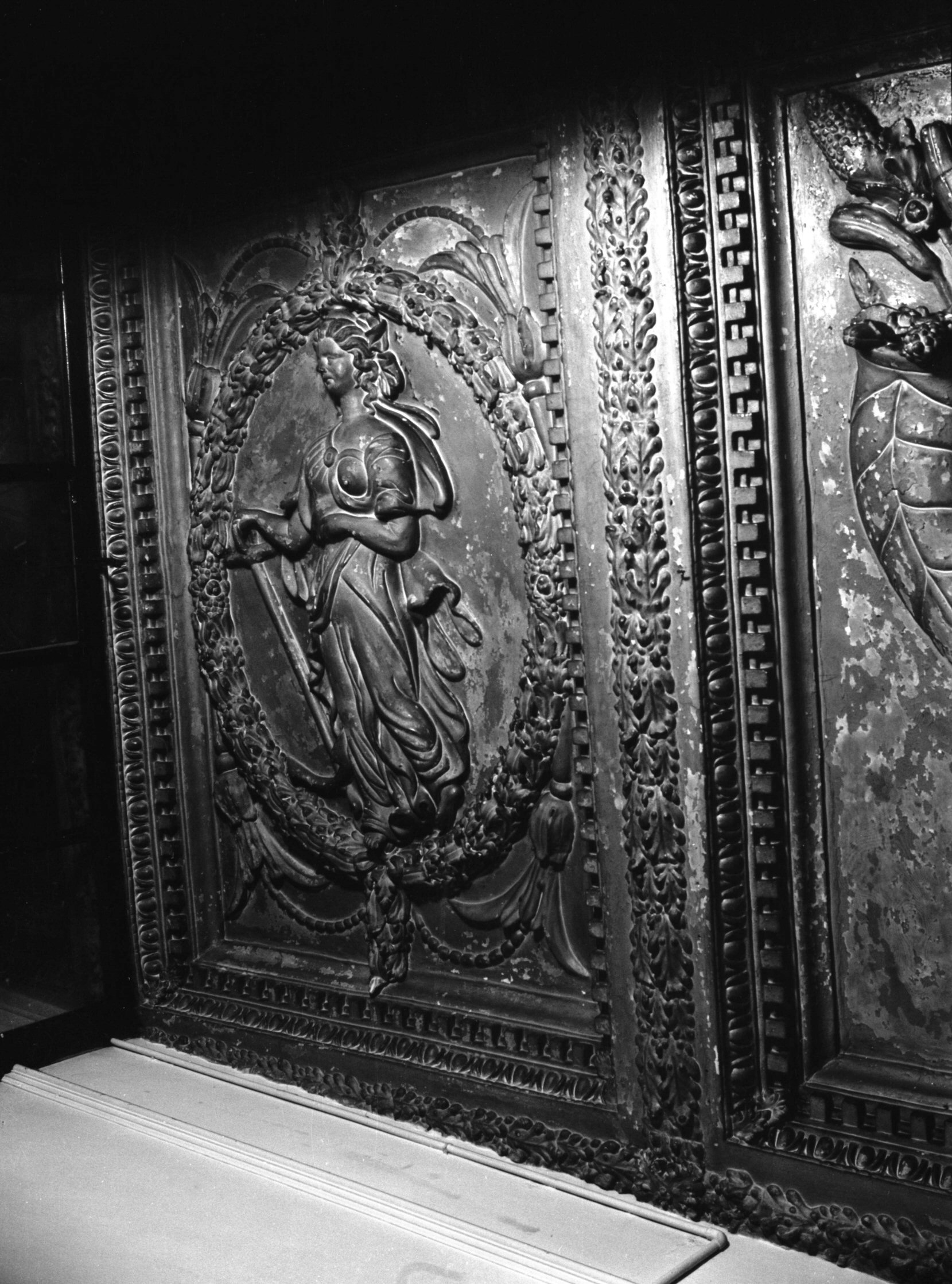
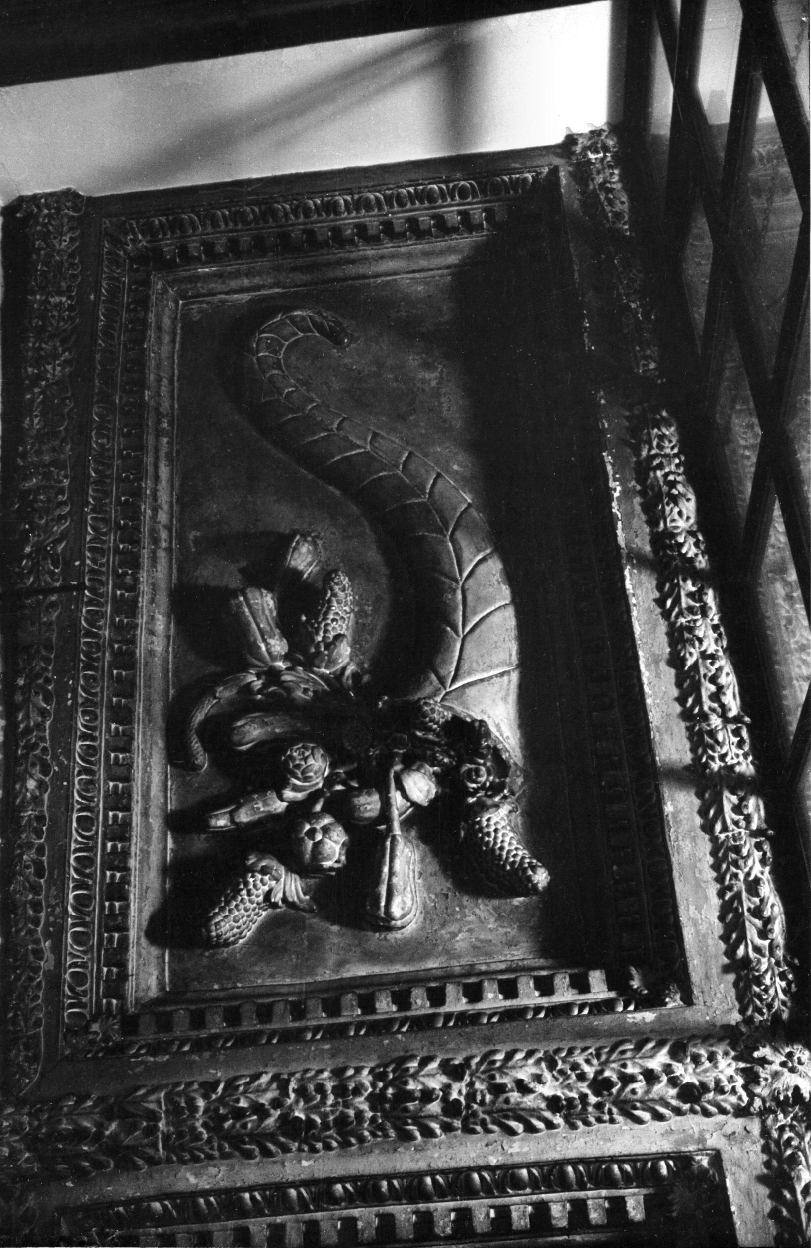
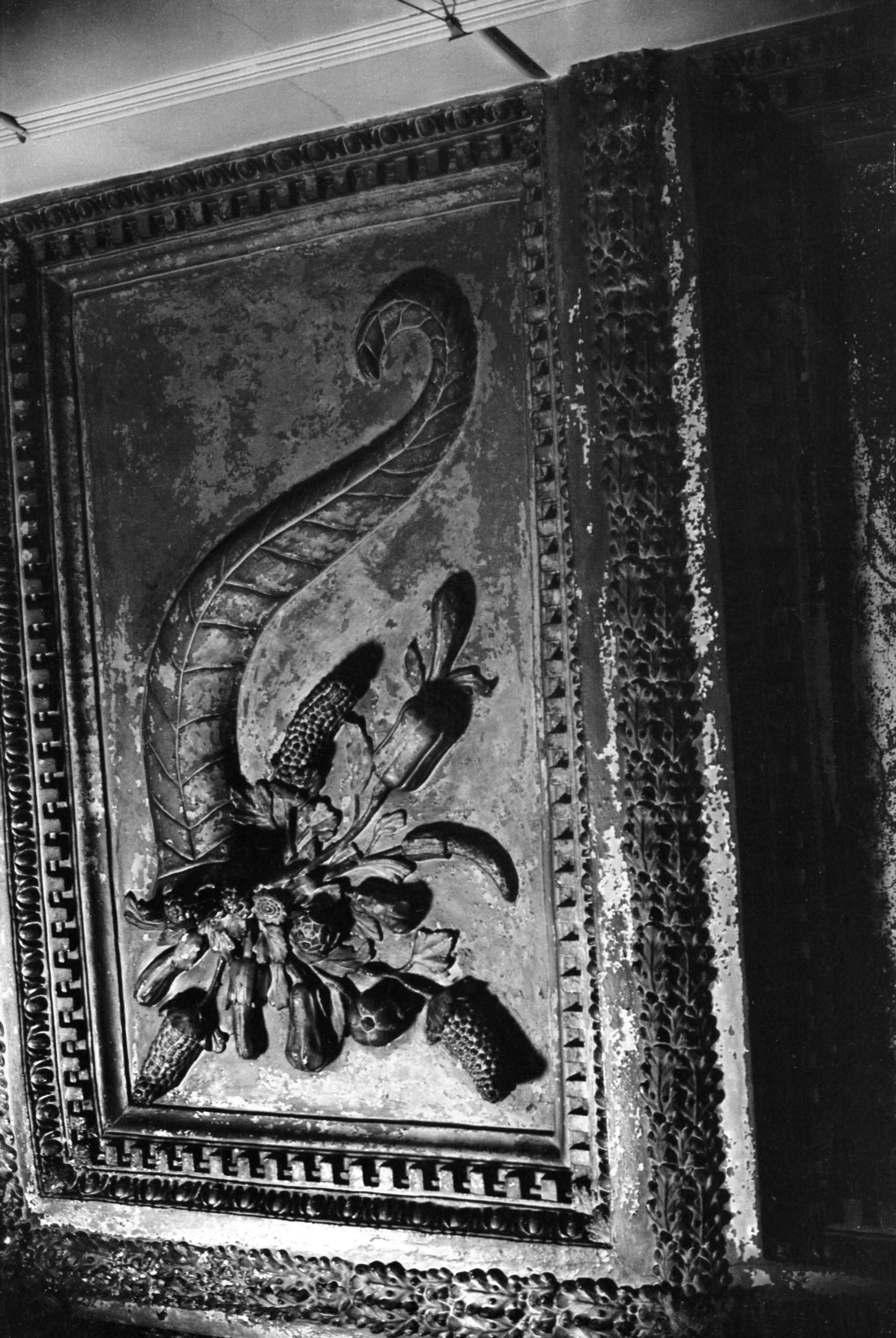
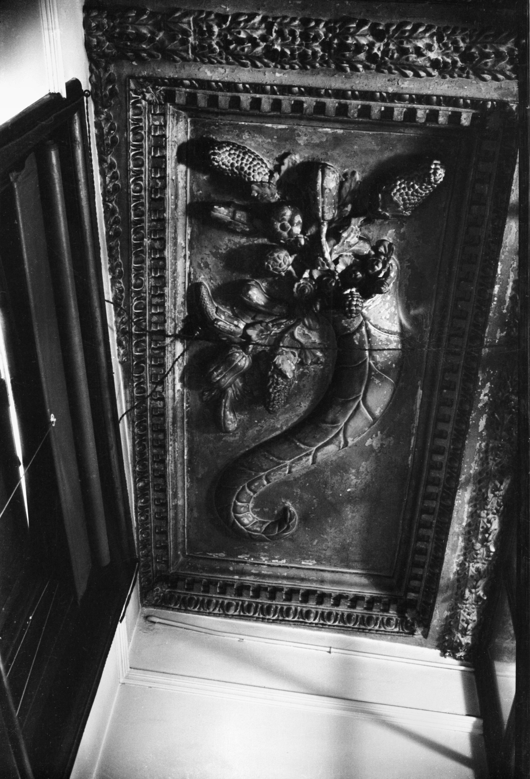
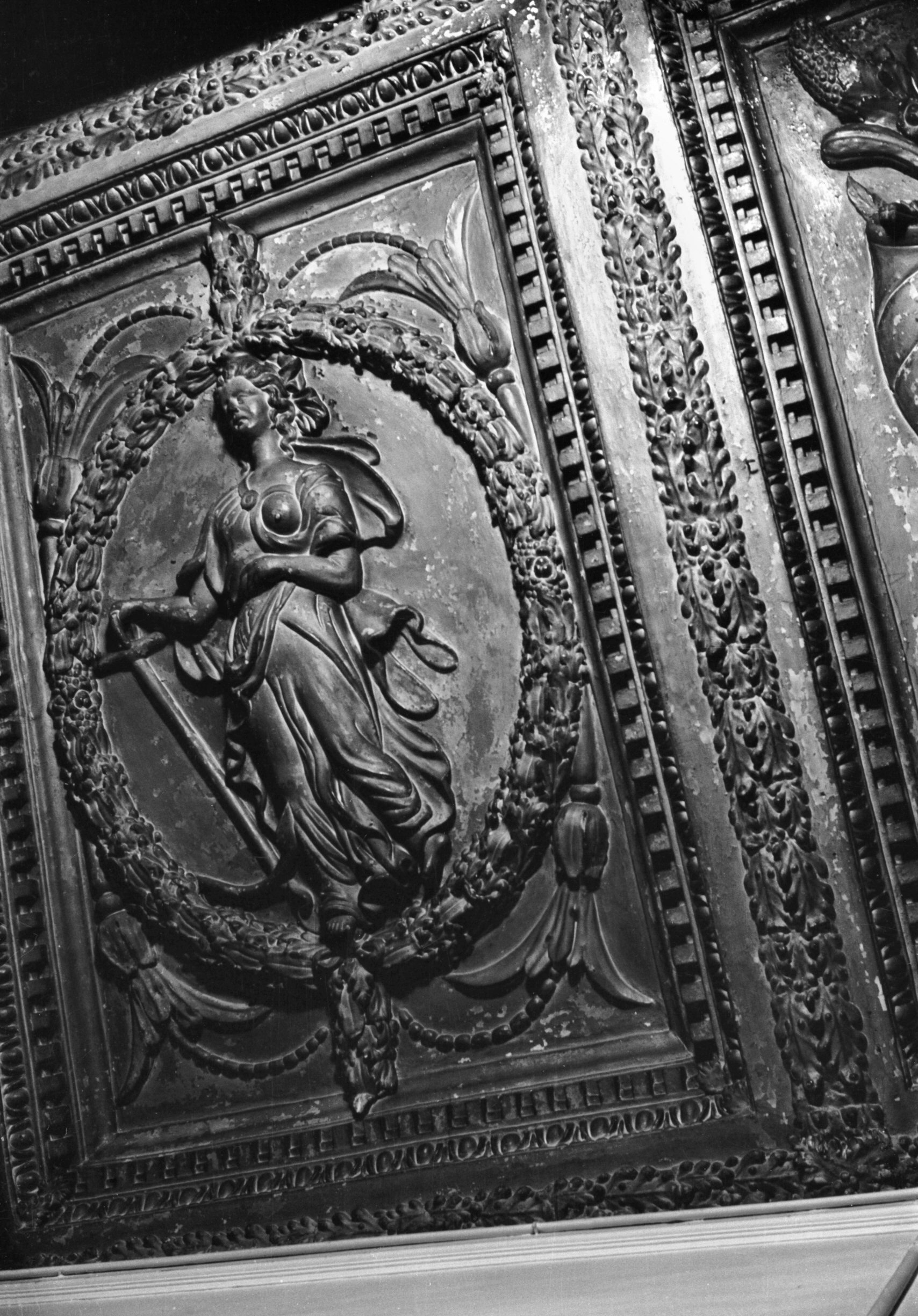
St Stephen's St 12 17c ceiling panel 6 [3495]
1940-08-23
Also lost in the war was 12 St Stephen's St, the premises
of Barwell's the wine merchants. This contained a
little-known feature, a magnificent 17c plaster ceiling.
This ceiling had existed in the house formerly occupying
the site, but was considered to be of such importance
that when the premises were rebuilt towards the end of
the 19c it was raised several feet and a new room built
around it. Beams adorned with a moulding of oak leaves
divided it into eight rectangular panels, four of which
displayed large cornucopias figured in high relief. Of
two others, each had a female figure, one holding an
anchor symbolising Hope, while the other carried a book
and a lamp (probably for Knowledge). The remaining two
panels were blank.
Details concerning houses previously on this site and
their occupants were given in East Anglian Notes and
Queries Vol.9 by "A.E.R.", in a footnote to
a paper on the account books of St Stephen's Church and
parish. Among the earliest recorded owners was Thomas de
Bokenham, Mayor in 1479 and 1486, who sold the property
to Robert de Burgh, Sheriff in 1494 and Mayor in 1504.
One of these probably built part of the cellars, which
survived until 1942, while the latter built the Tudor
mansion. Thomas Petingale bought the property in 1547 and
sold it to Nicholas Baker, Alderman, who held it from
1576 to 1626. Here there was a break in succession; built
into the property was a stone inscribed with the initial
W./J.s F. and the date 1668, which is thought to be about
the time the Tudor house was much altered. Later owners
or occupiers included Francis Tavernier,
"Oylman" of London, Alderman Goodman and
Parrott Hanger, all in the 18c, followed by Colonel Knipe
Gobbett and then the Barwells. The site was later
occupied for many years by the Saxone Shoe shop, and
later Superdrug's. |
|
|
St Stephen's St 12 ceiling 1 cornucopia [3499]
1940-08-23
|
|
|
St Stephen's St 12 ceiling 2 Knowledge [3494]
1940-08-23
|
|
|
St Stephen's St 12 ceiling 3 cornucopia [3493]
1940-08-23
|
|
|
St Stephen's St 12 ceiling 5 cornucopia [3498]
1940-08-23
|
|
|
St Stephen's St 12 ceiling 6 Hope [3497] 1940-08-23
|
|
|
St Stephen's St 12 ceiling 7 cornucopia [3496]
1940-08-23
|
|
|
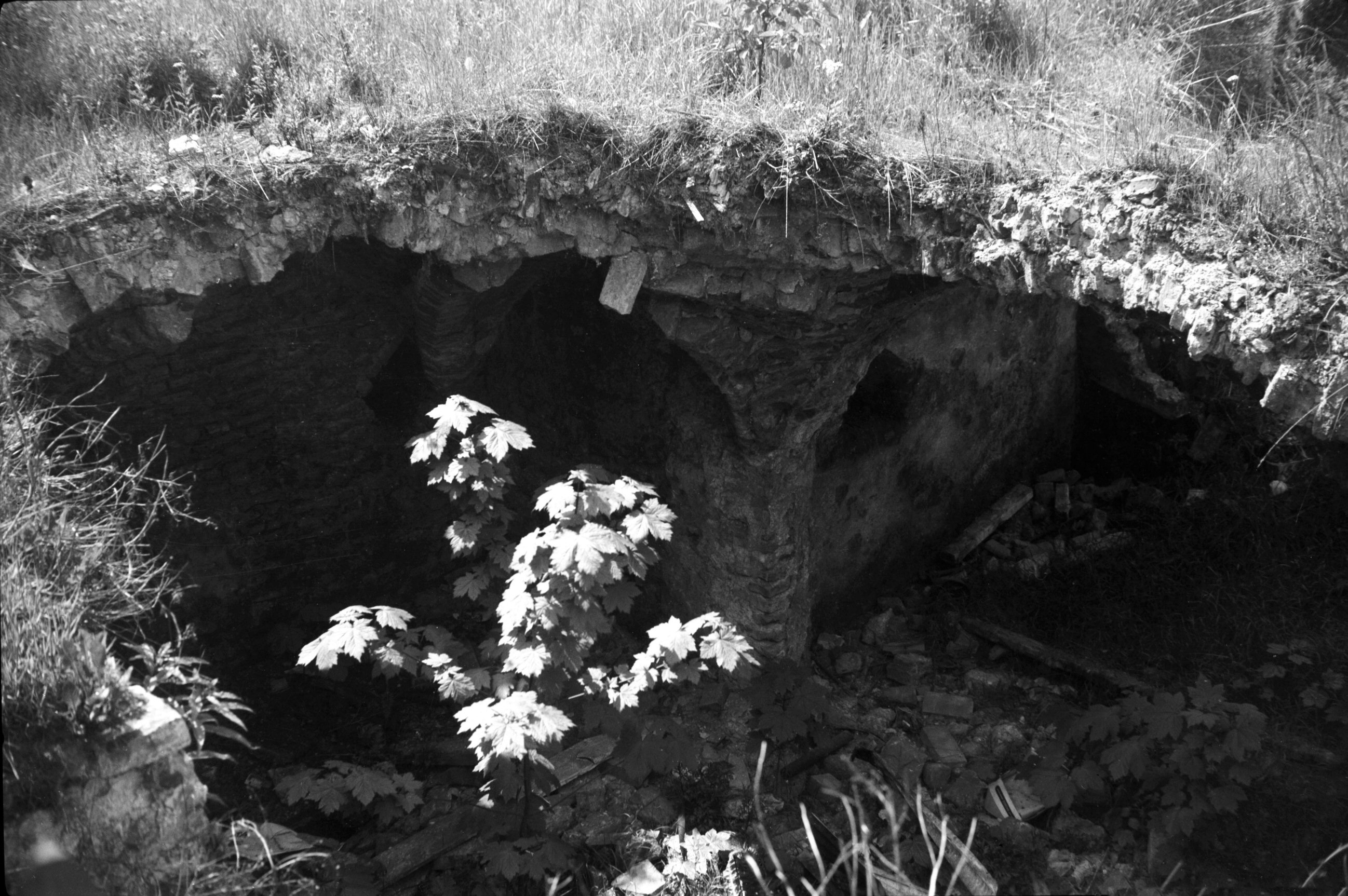
St Stephen's St 12 cellar air raid damage [3849]
1950-05-23
12 to 14 St Stephen's St. |
|
|
St Stephen's St 12 cellar air raid damage [4247]
1954-05-25
12 to 14 St Stephen's St. Mediaeval brick vaulting of
cellar damaged by enemy action in 1942. Barwell's Court
in background. |
|
|
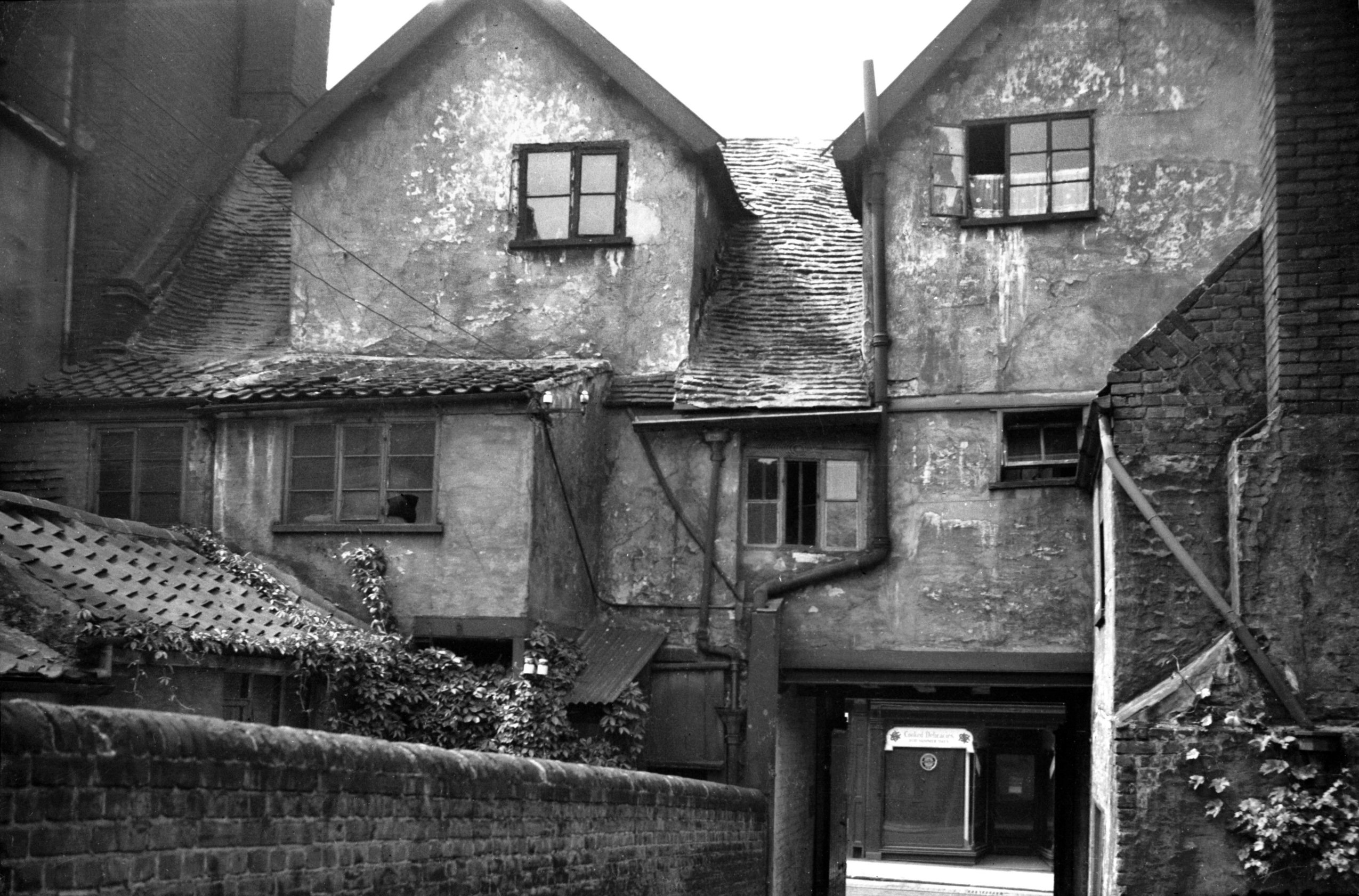
St Stephen's St Loyalty Court view east [1802]
1937-07-17
|
|
|
St Stephen's St Loyalty Court view west [1035]
1936-06-16
|
|
|
St Stephen's St west side [4755] 1964-04-18
Site of 40 to 46 on left. 38 to 2 standing. |
|
|
St Stephen's St 40 to 46 formerly Woolworth [7915]
2003-02-18
Sainsbury's when built in the 1960s. Now the site of an
entrance to the Chapel Field shopping mall. |
|
|
St Stephen's St Wades Court view east [1914]
1937-08-23
South side. |
|
|
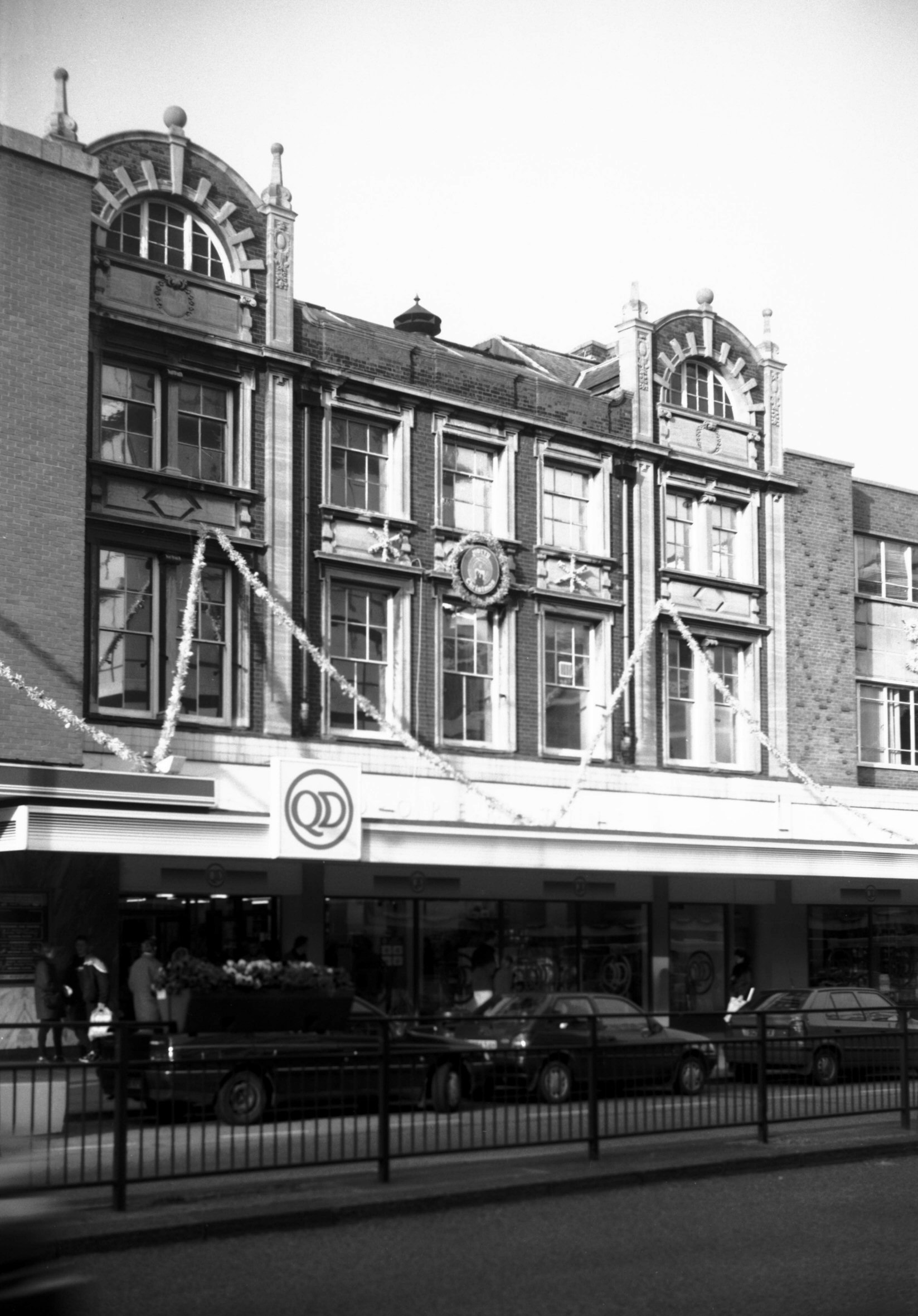
St Stephen's St 48 QD former Coop store [7720]
1999-11-28
Erected 1903. |
|
|
St Stephen's St 52 to 62 [4658] 1962-03-28
Prior to street widening. |
|
|
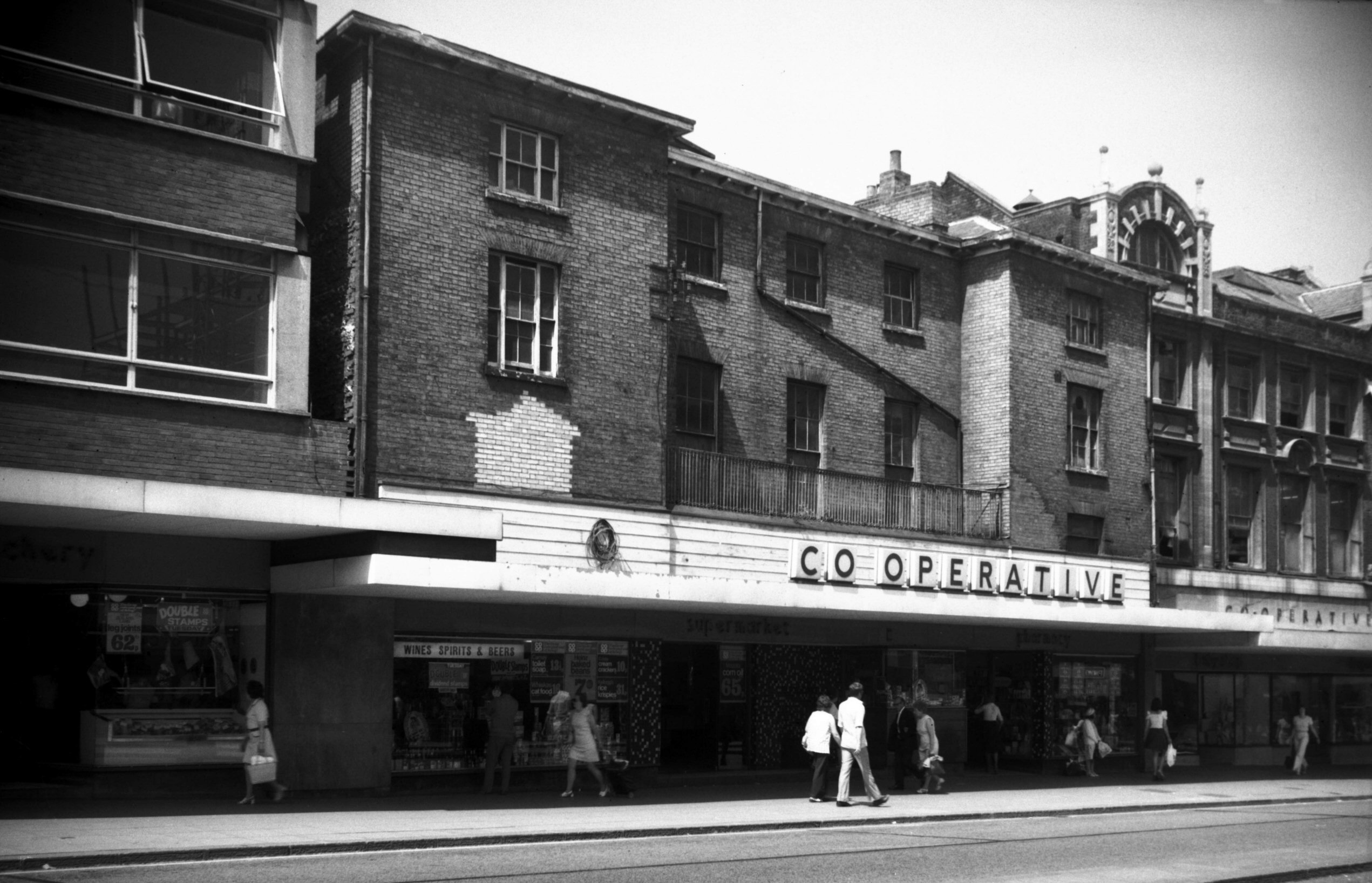
St Stephen's St 58 [5429] 1975-06-13
The Co-op. |
|
|
St Stephen's St George Yard south side [1036]
1936-06-16
View west. |
|
|
St Stephen's St 74 St Stephen's Gates [4657]
1962-03-28
Prior to street widening. Caley's chimney. |
|
St Swithin's Alley: |
| |
From
St
Benedict's St / Ten Bell Lane to Westwick St |
|
|
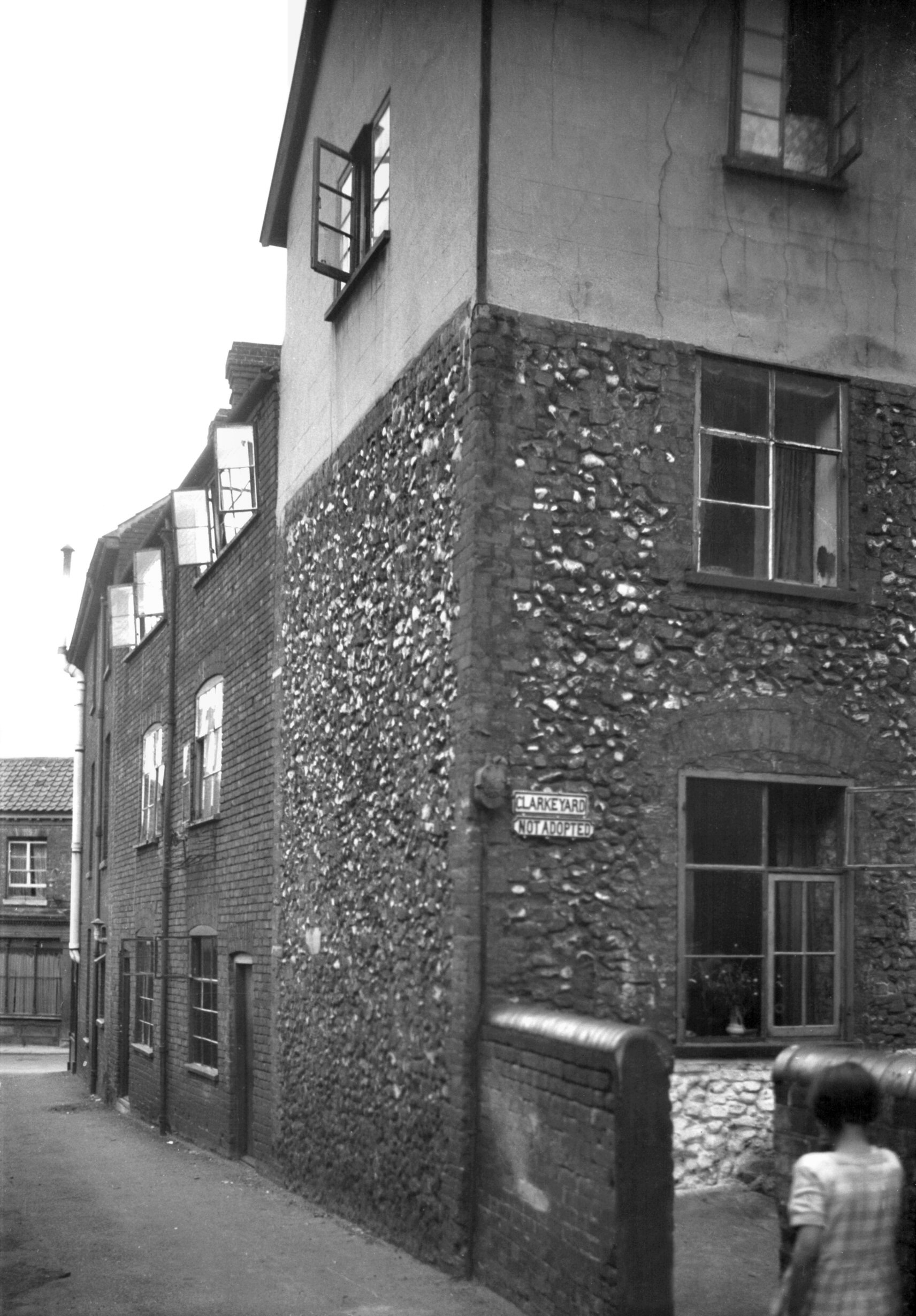
St Swithin's Alley 14 to 16 Clarke's Yard [1081]
1936-07-06
|
|
|
St Swithin's Alley St Swithin's Hall [6650]
1990-09-28
Built 1908. West side. |
|
|
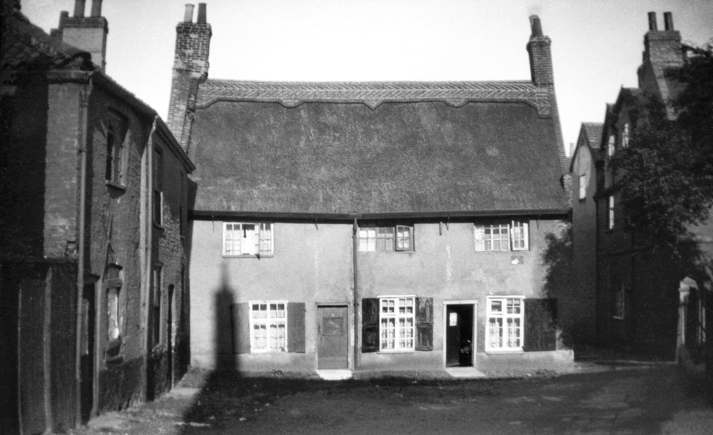
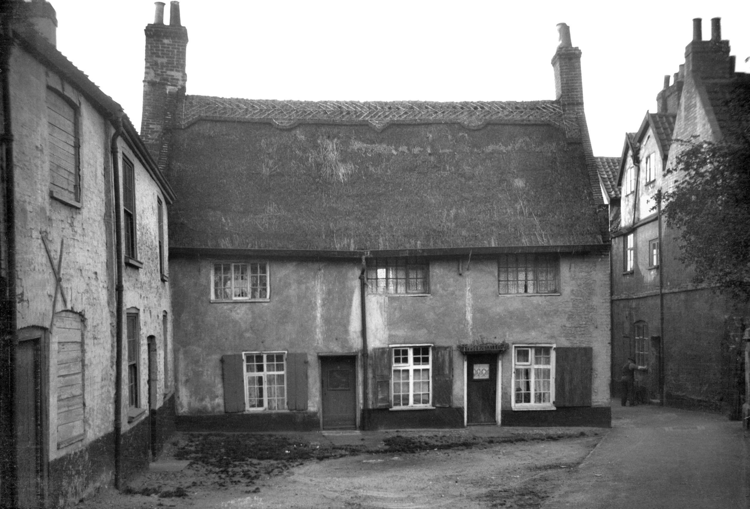
St Swithin's Alley thatched cottages [B203]
1931-00-00
|
|
|
St Swithin's Alley thatched cottages [0583]
1935-05-17
|
|
|
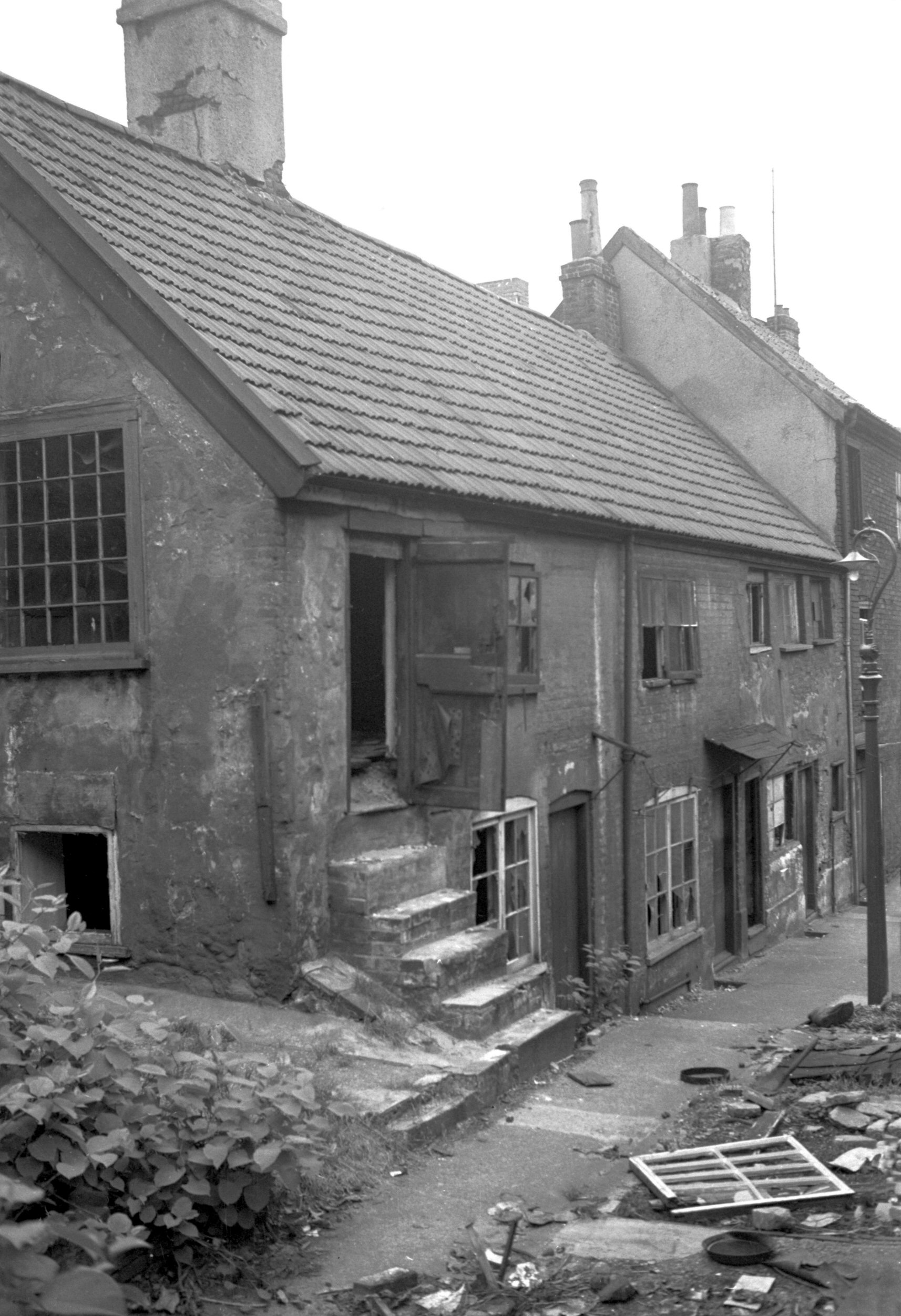
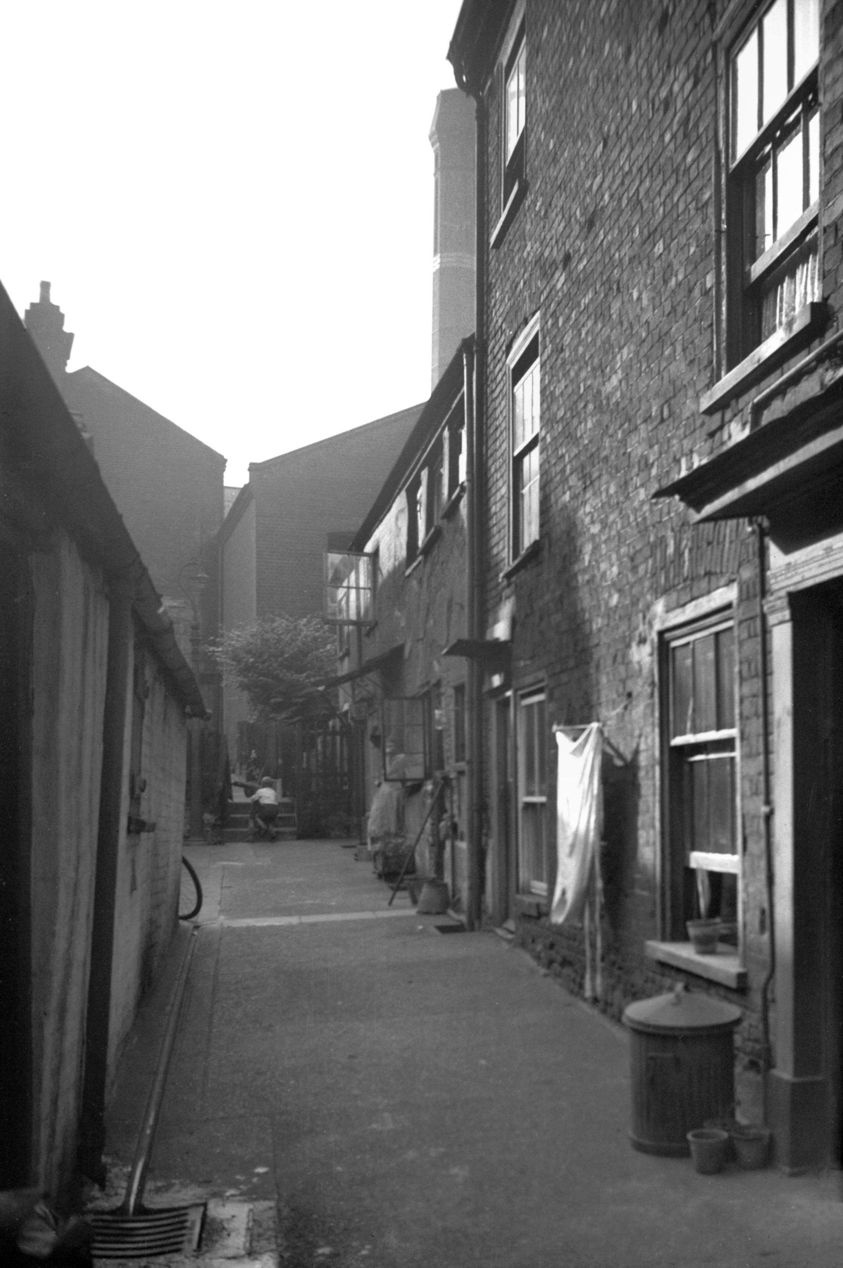
St Swithin's Alley thatched cottage Rectory [2482]
1938-06-18
Adjacent to St Swithin's church in St Benedict's St is St
Swithin's Alley where, straddling the lane, is an old
house reconditioned in the 1930s by the Norwich Amenities
Preservation Society. This is notable as one of the few
ancient buildings within the city walls still retaining a
covering of thatch. A yard at the rear bears the name of
the Hampshire Hog, the sign of an adjacent tavern, being
possibly the last house in England where the game of
logats was played. The logats, resembling policemen's
truncheons, were to be tossed as near as possible to a
wheel-shaped jack which had previously been thrown
towards the opposite end of the ground; there was some
similarity to the game of bowls. A set of logats is
preserved in the Strangers Hall Museum.
On the east side of the alley, overlooking St Swithin's
churchyard, stood another interesting gabled house of
about the 17c. This was once the St Swithin's parsonage,
but in later years it became divided into a number of
tenements and degenerated so much that in 1938 it had to
be pulled down. This was a pity, as when viewed alongside
its thatched neighbour it made a typical "artist's
corner". |
|
|
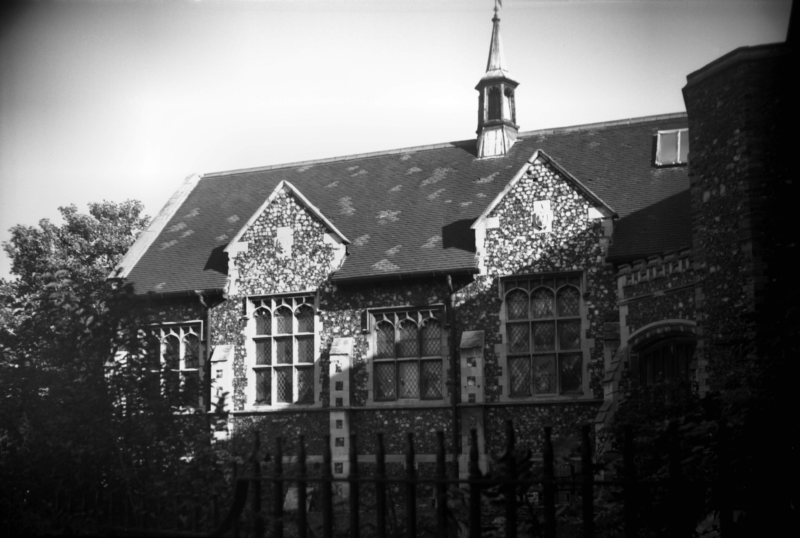
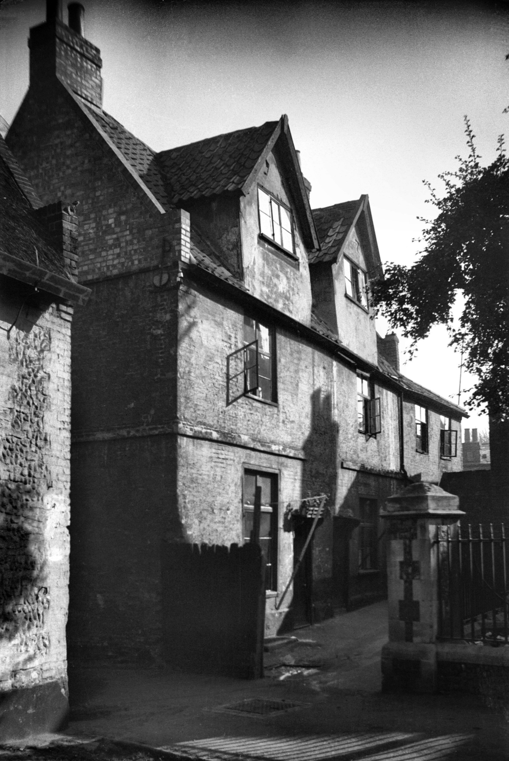
St Swithin's Alley 23 to 24 old rectory [1489]
1936-10-04
St Swithin's old rectory. |