|
Prince of Wales Rd: |
| |
From
King St / Agricultural
Hall Plain / Upper King St to Riverside Rd / Thorpe Rd / Riverside
passing St Faith's Lane, Mountergate, Rose
Lane, Recorder Rd
South side |
|
|
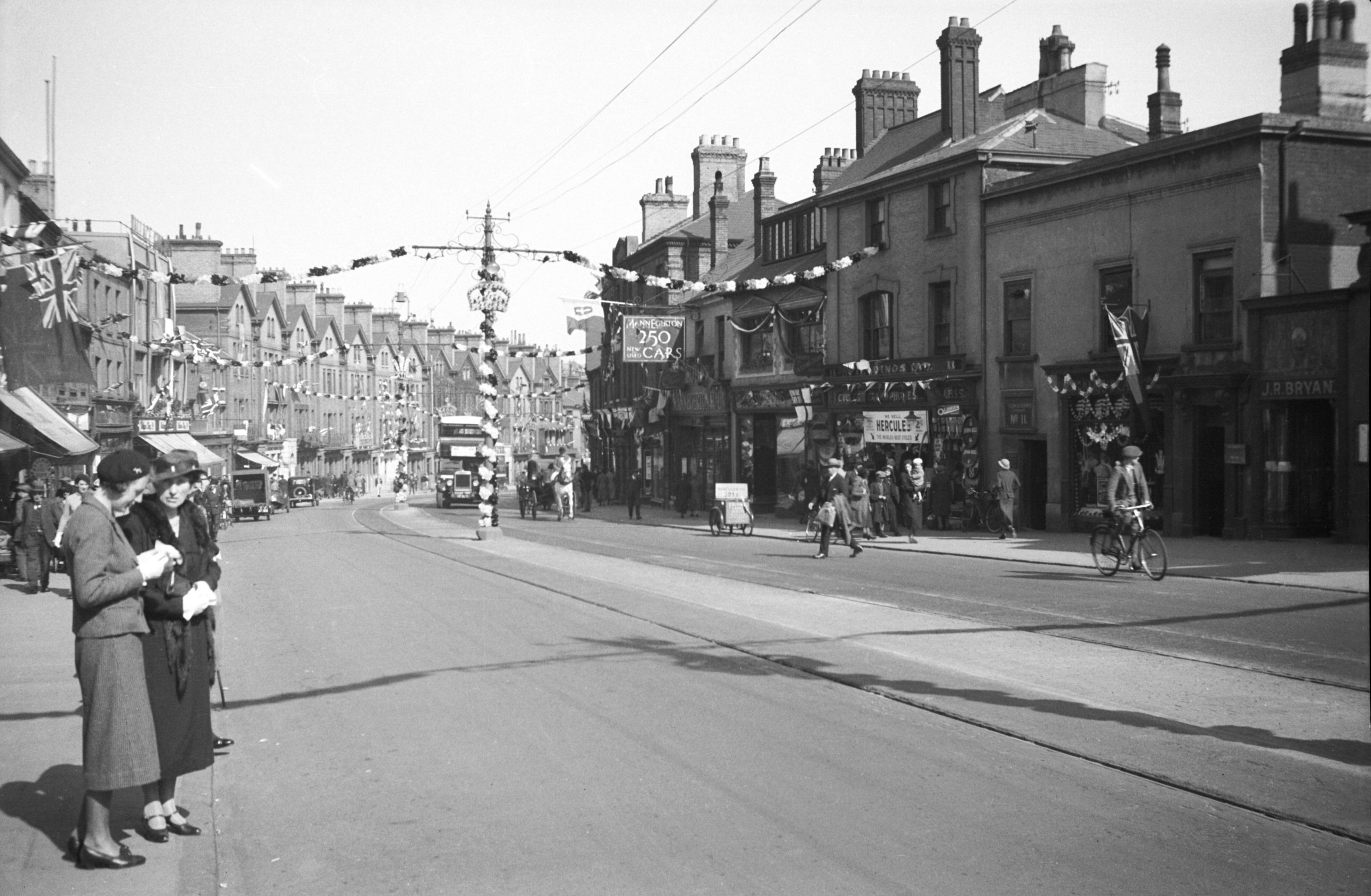
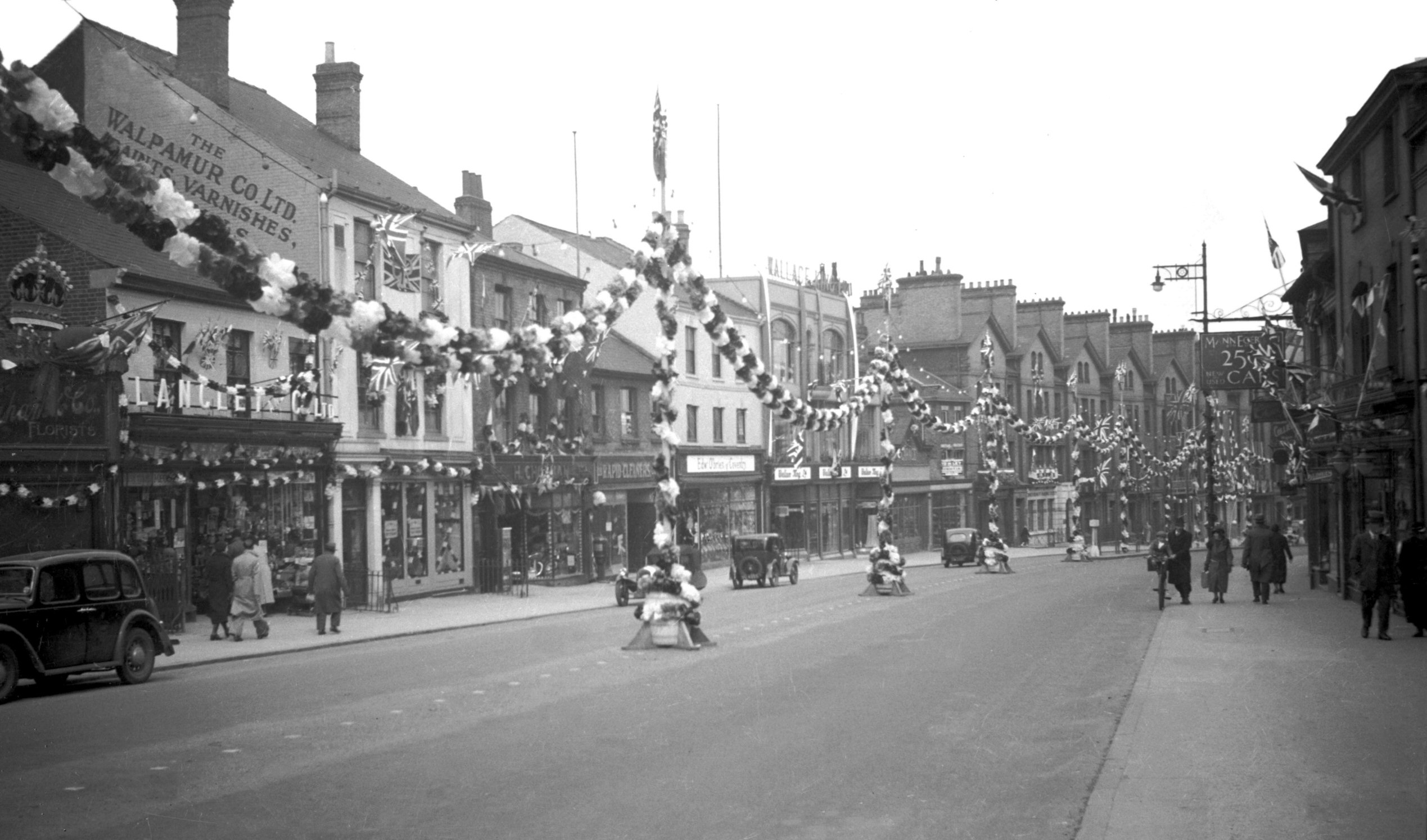
Silver Jubilee Prince of Wales Rd view east [0510]
1935-05-04
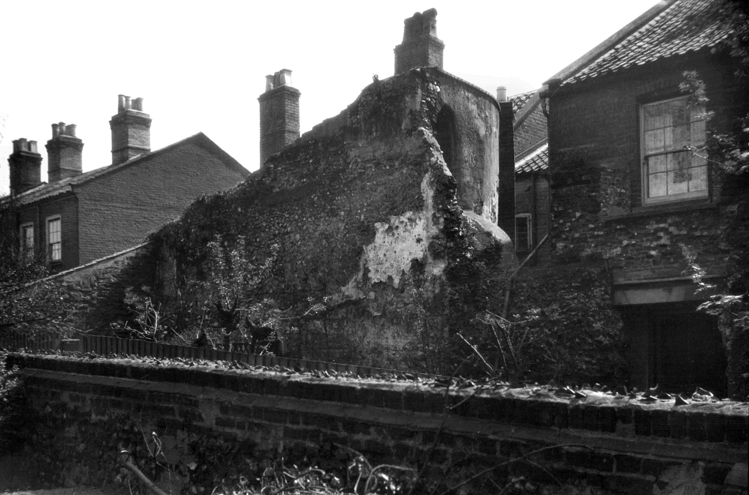
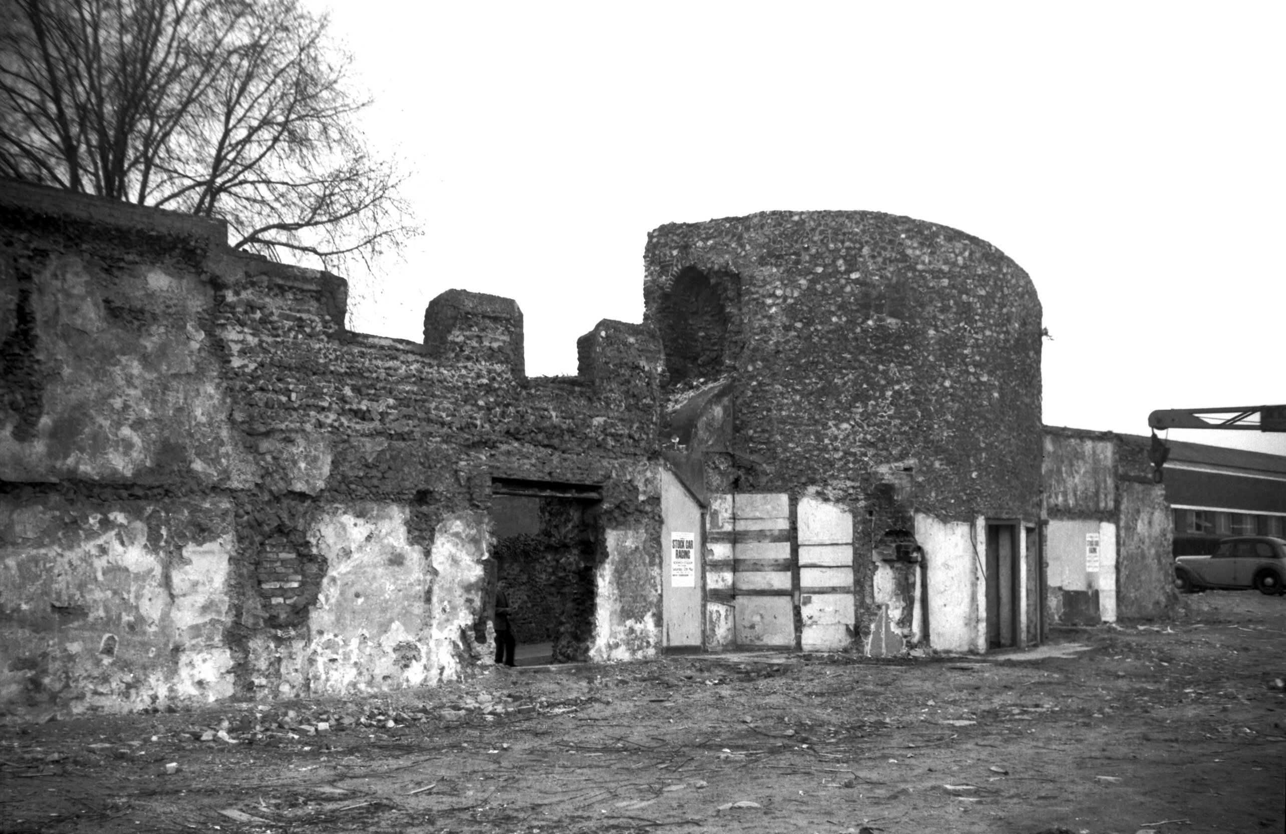
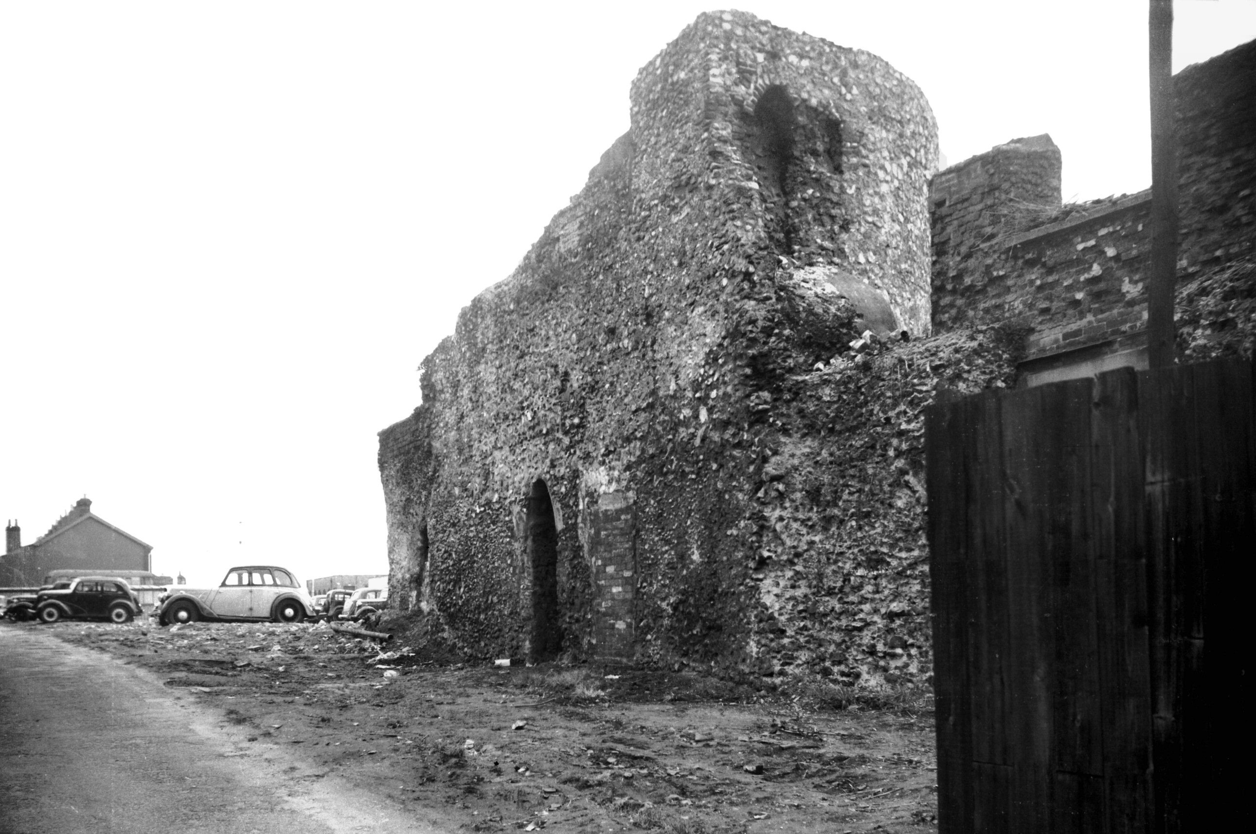
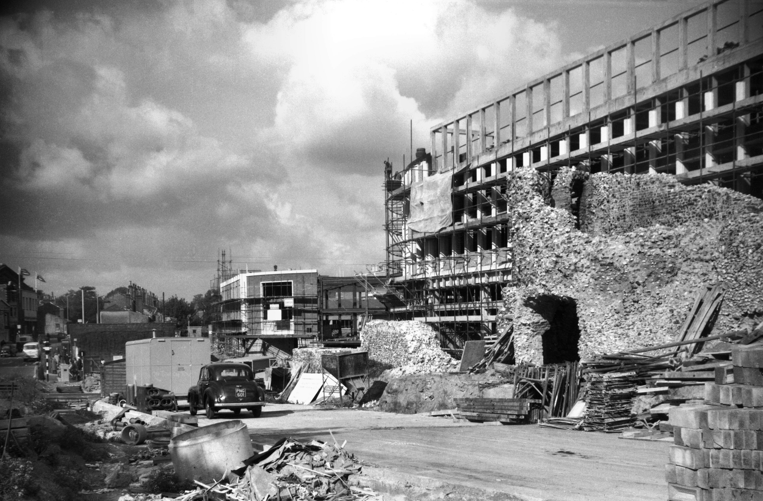
Silver jubilee decorations. Not until 1860 was Prince of
Wales Rd constructed as a grand approach to Thorpe
Station. Running southeast from Bank Plain and Castle
Meadow, it was built over land once occupied by the
monastery of the Greyfriars, of which nothing now remains
except a length of the precinct wall along the upper part
of St Faith's Lane. An ancient stone bridge that
straddled a dyke adjacent to the Horse Fair Green was
destroyed early in the 20c; it was considered to have
been the work of the Greyfriars when they built their
wall. |
|
|
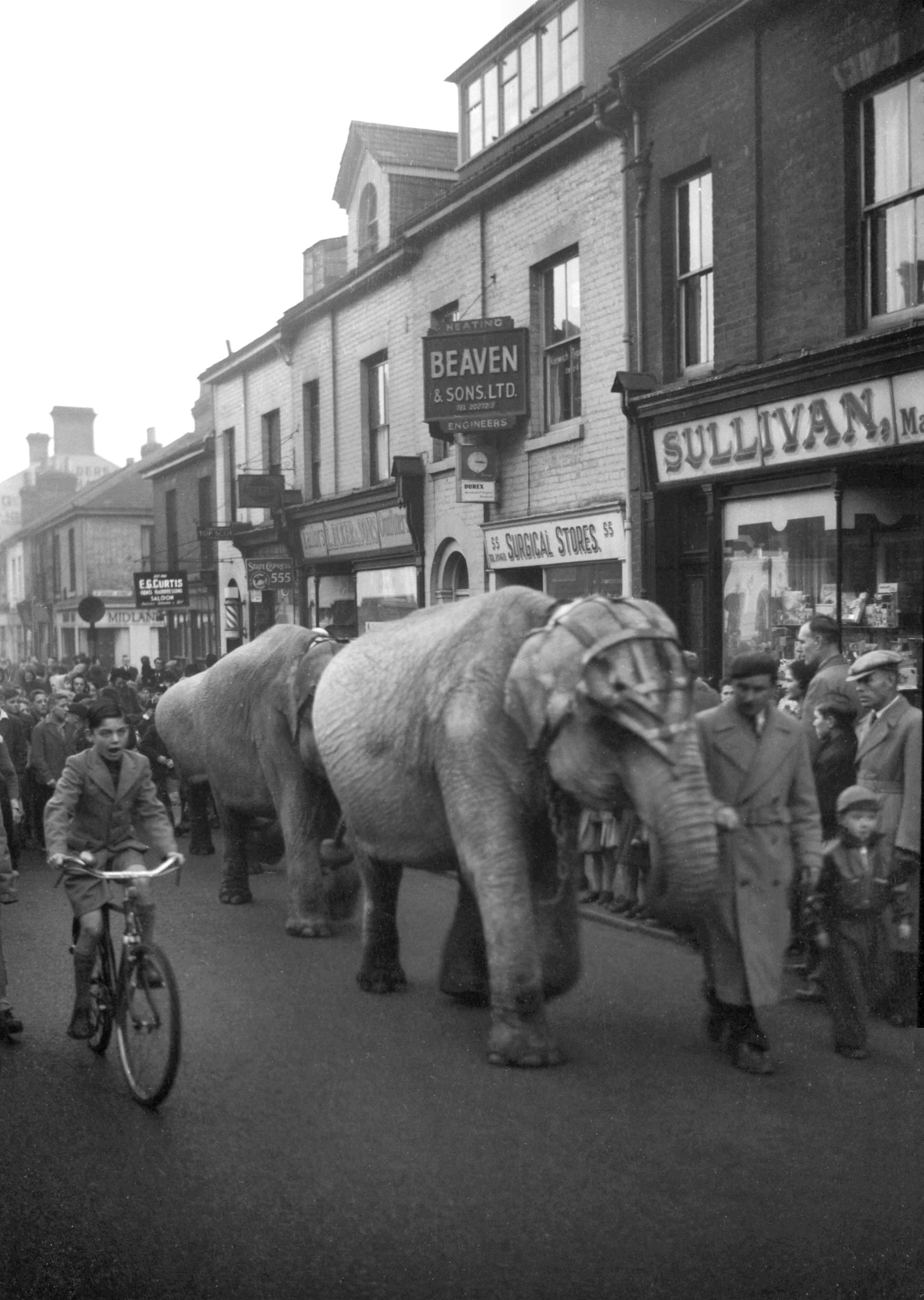
Elephant parade on Prince of Wales Rd [4240]
1953-11-29
En route to the Theatre Royal. |
|
|
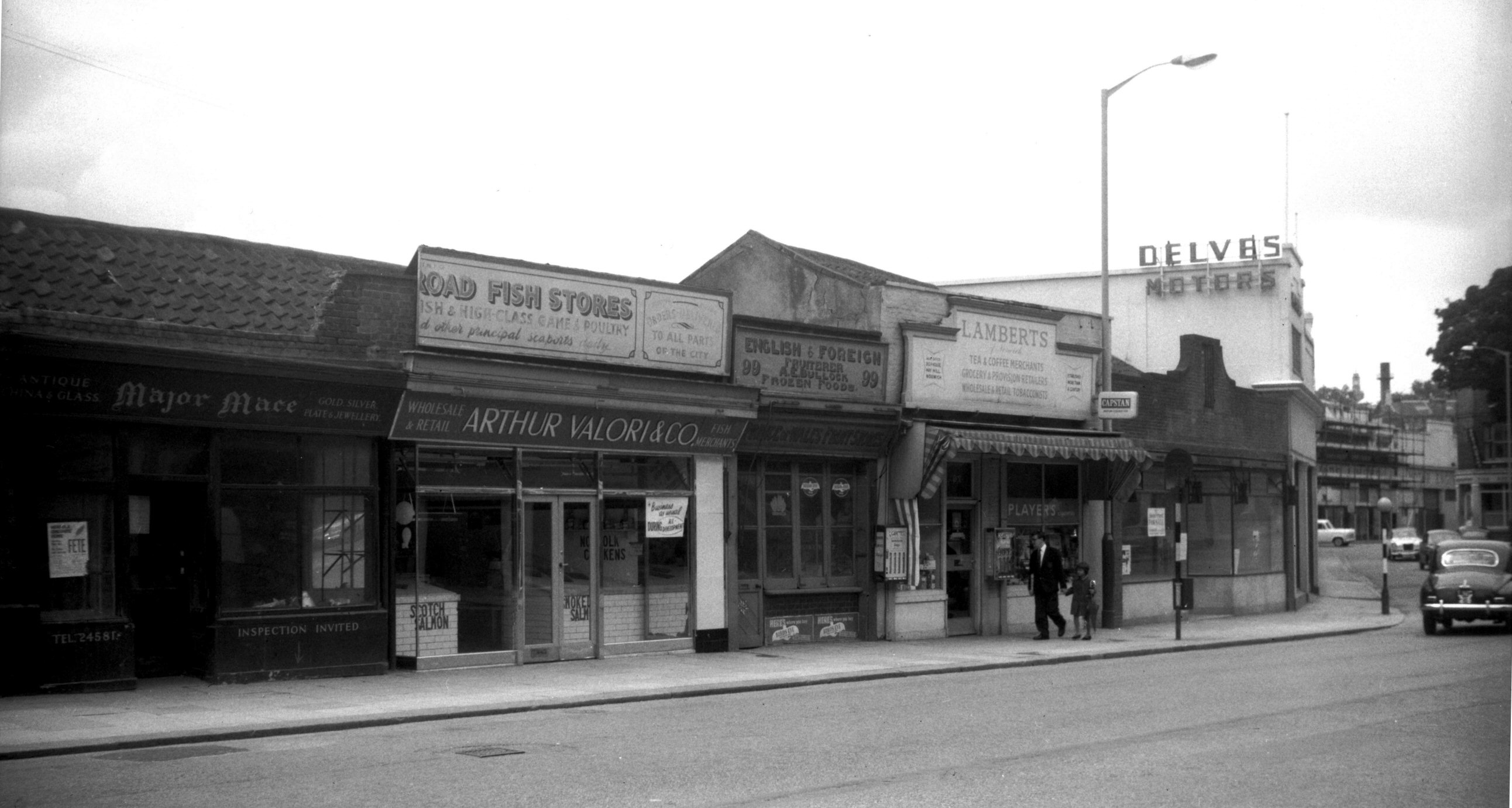
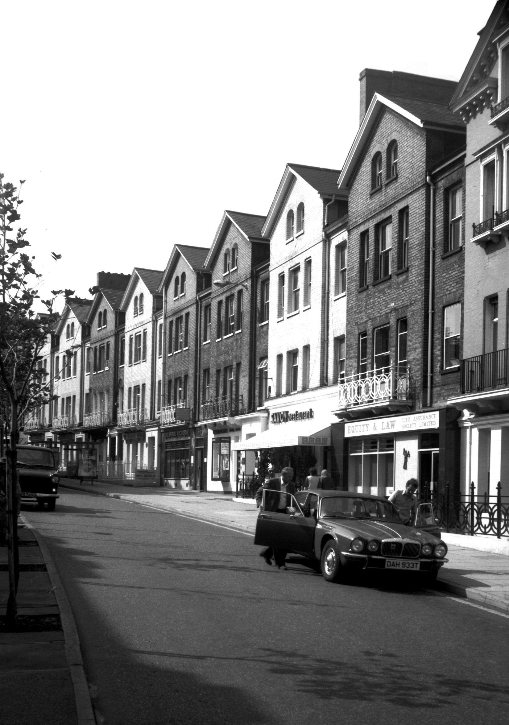
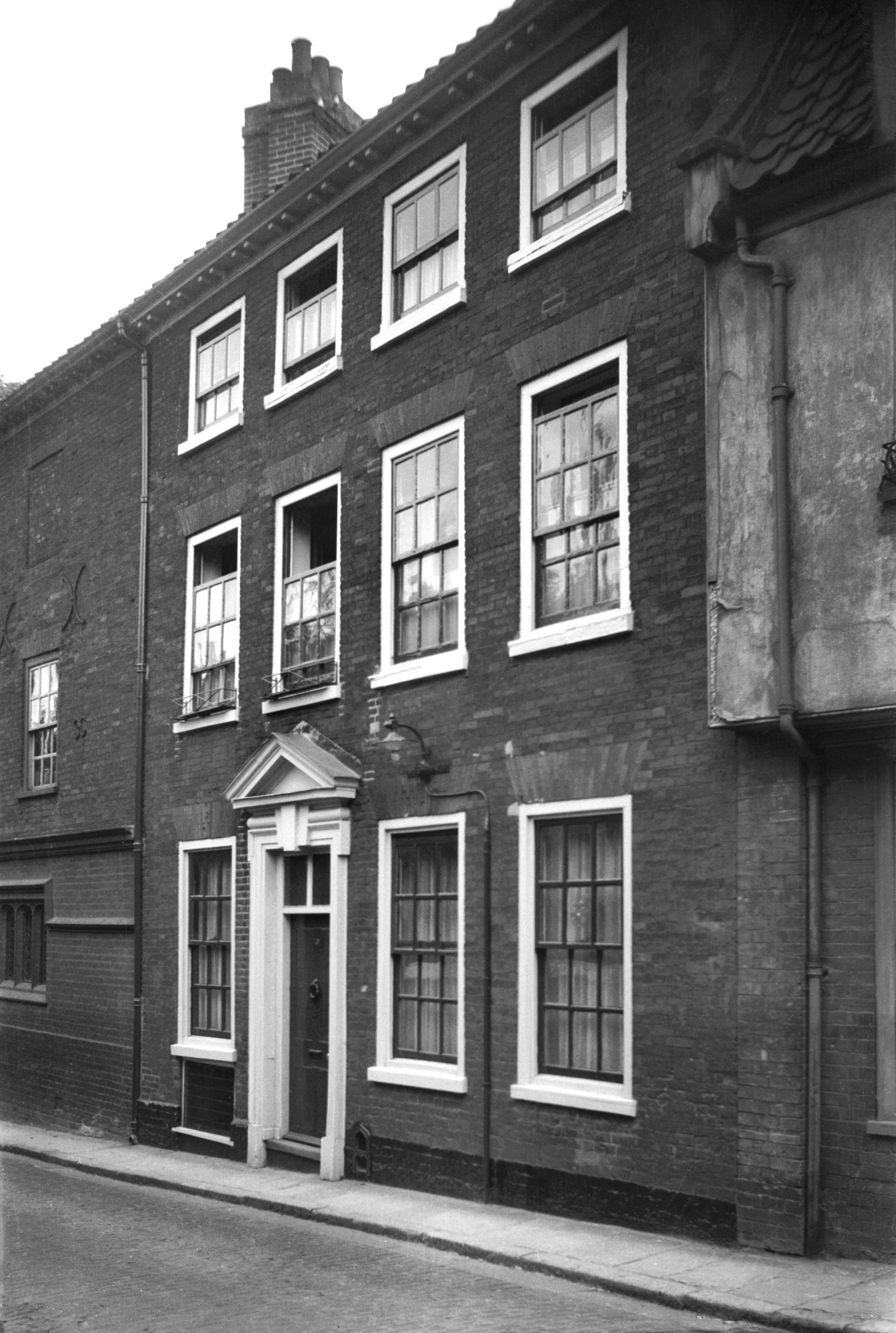
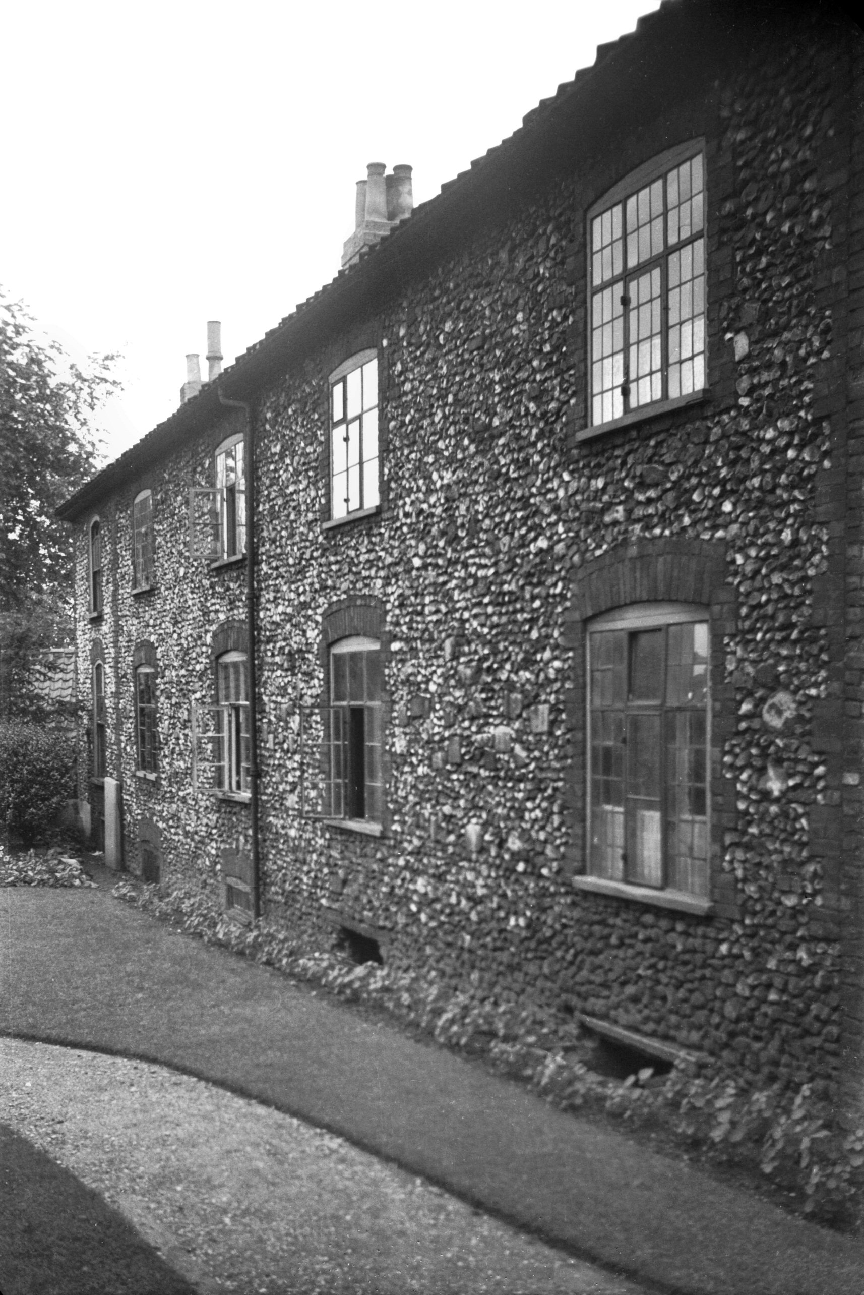
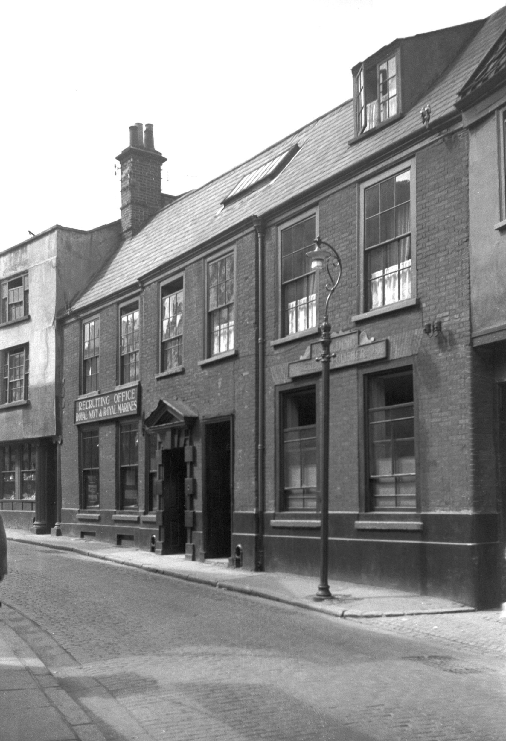
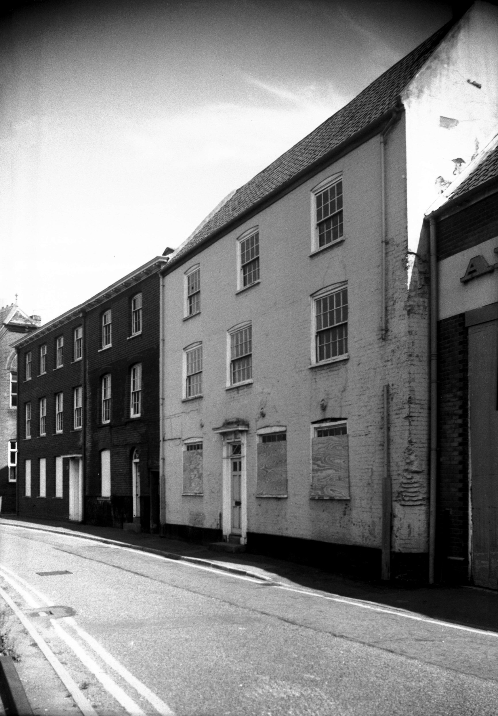
Prince of Wales Rd 95 to 101 [4774] 1964-06-14
|
|
|
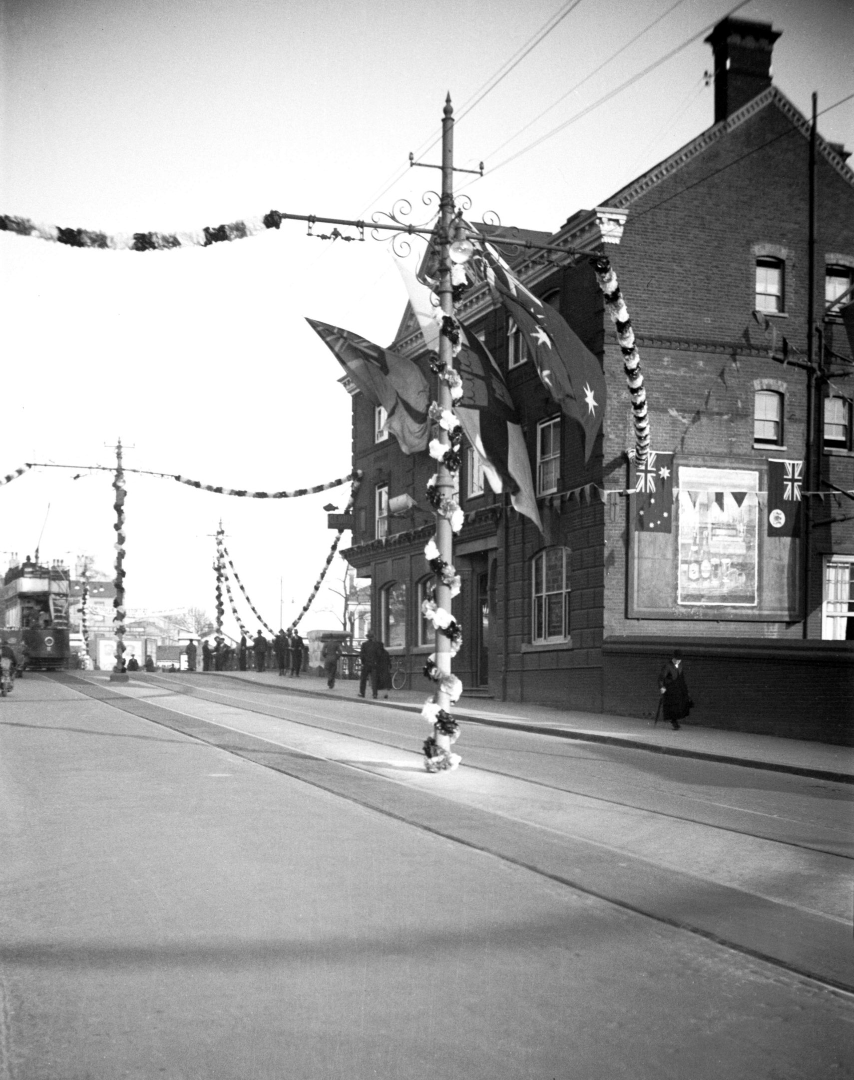
Silver Jubilee Great Eastern Hotel [0506] 1935-05-03
Great Eastern Hotel, Prince of Wales Rd. Silver jubilee
decorations. |
|
|
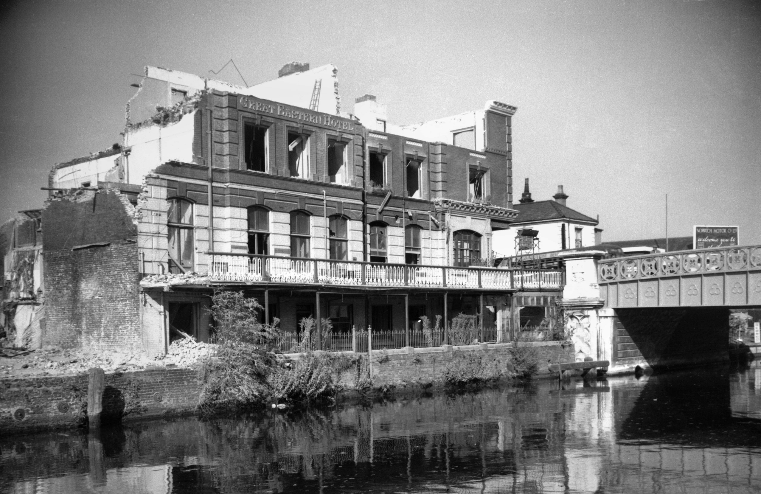
Prince of Wales Rd Great Eastern Hotel [4752]
1963-10-12
111 Prince of Wales Rd, during demolition. |
|
|
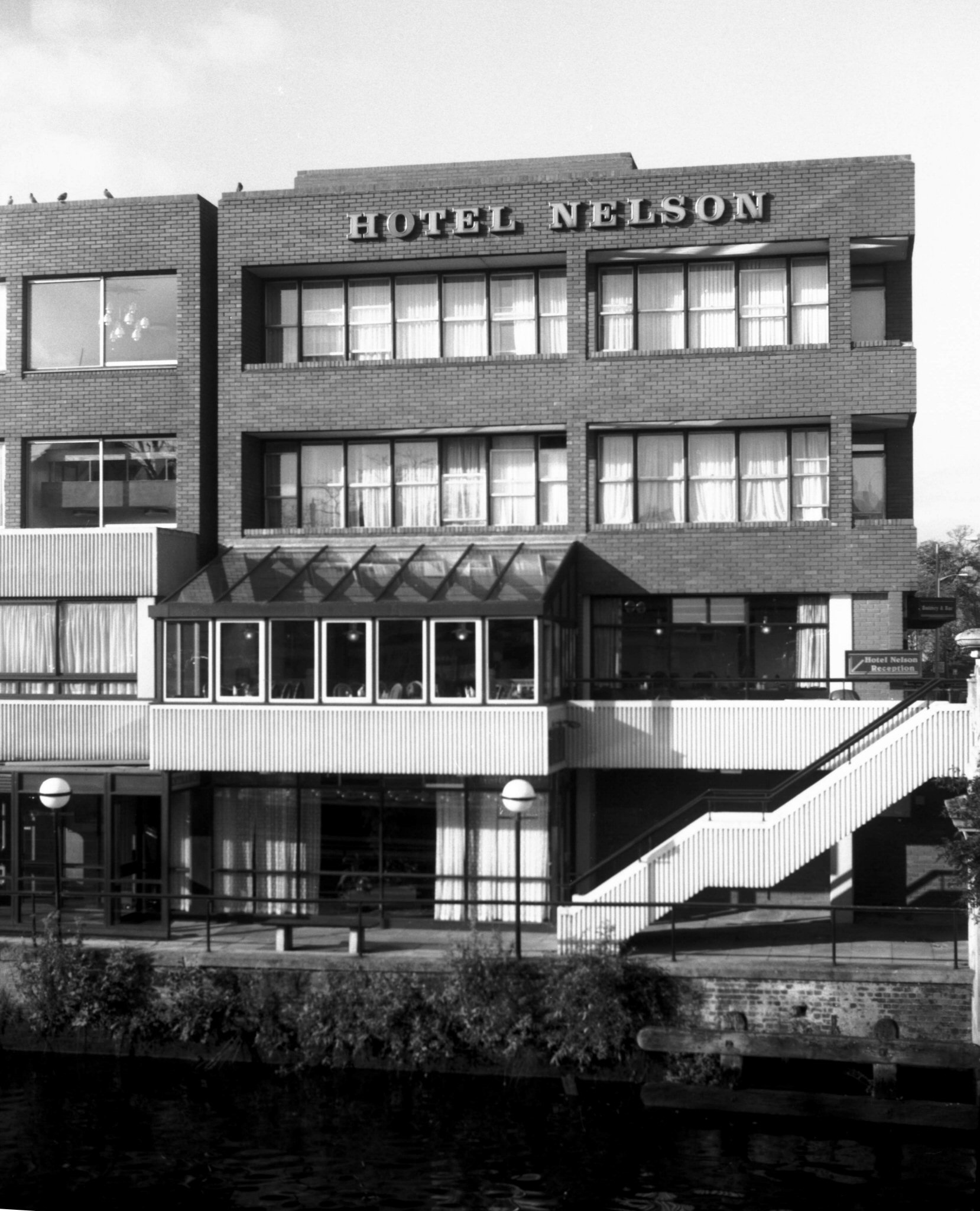
Prince of Wales Rd Nelson Hotel [7712] 1999-11-12
Built 1969, architects Feilden and Mawson. |
| |
North
side |
|
|
Prince of Wales Rd 2 and L Upper King St 19 [7704]
1999-10-18
|
|
|
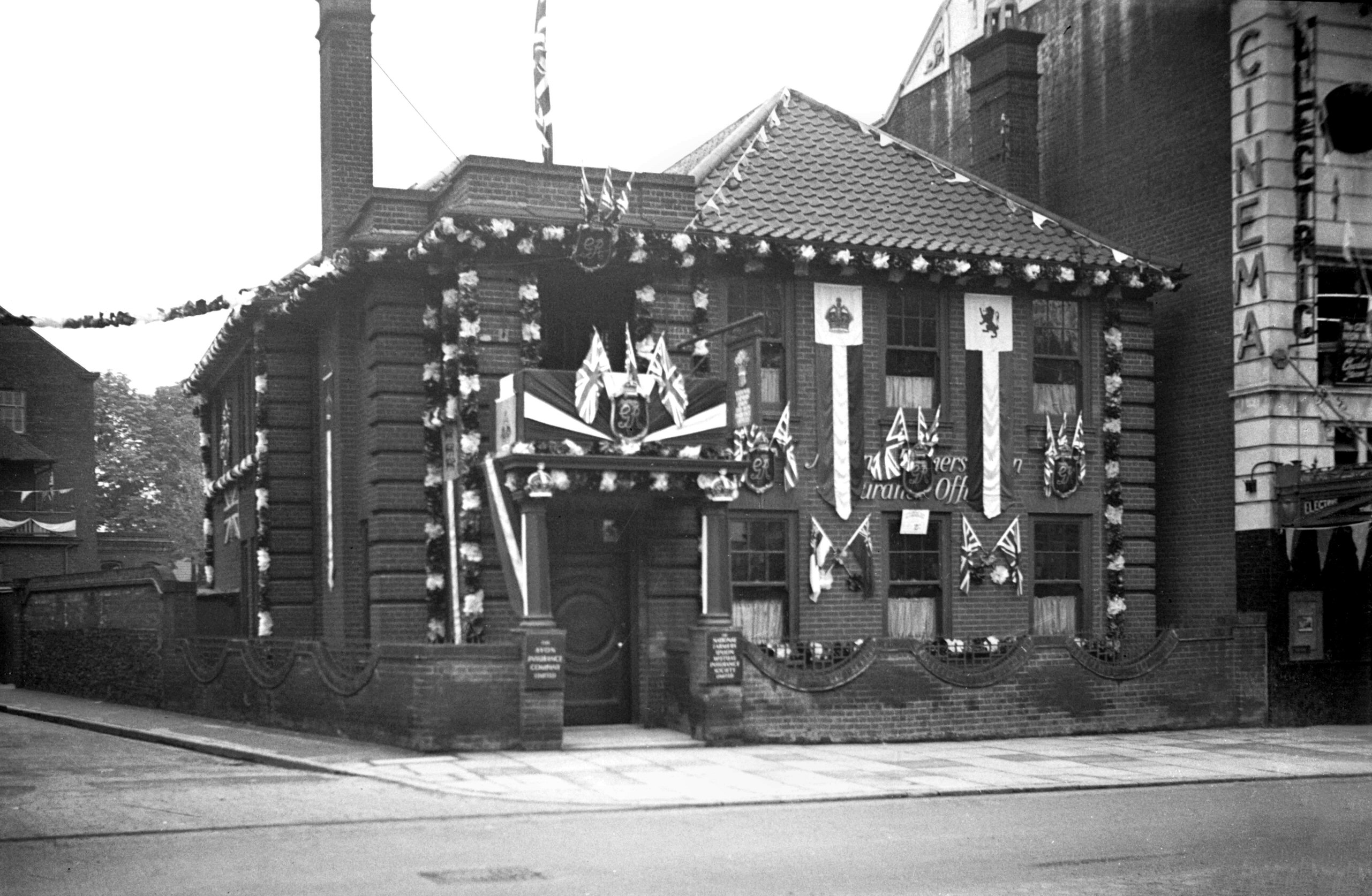
Coronation Prince of Wales Rd [1563] 1937-05-09
1937 coronation decorations. |
|
|
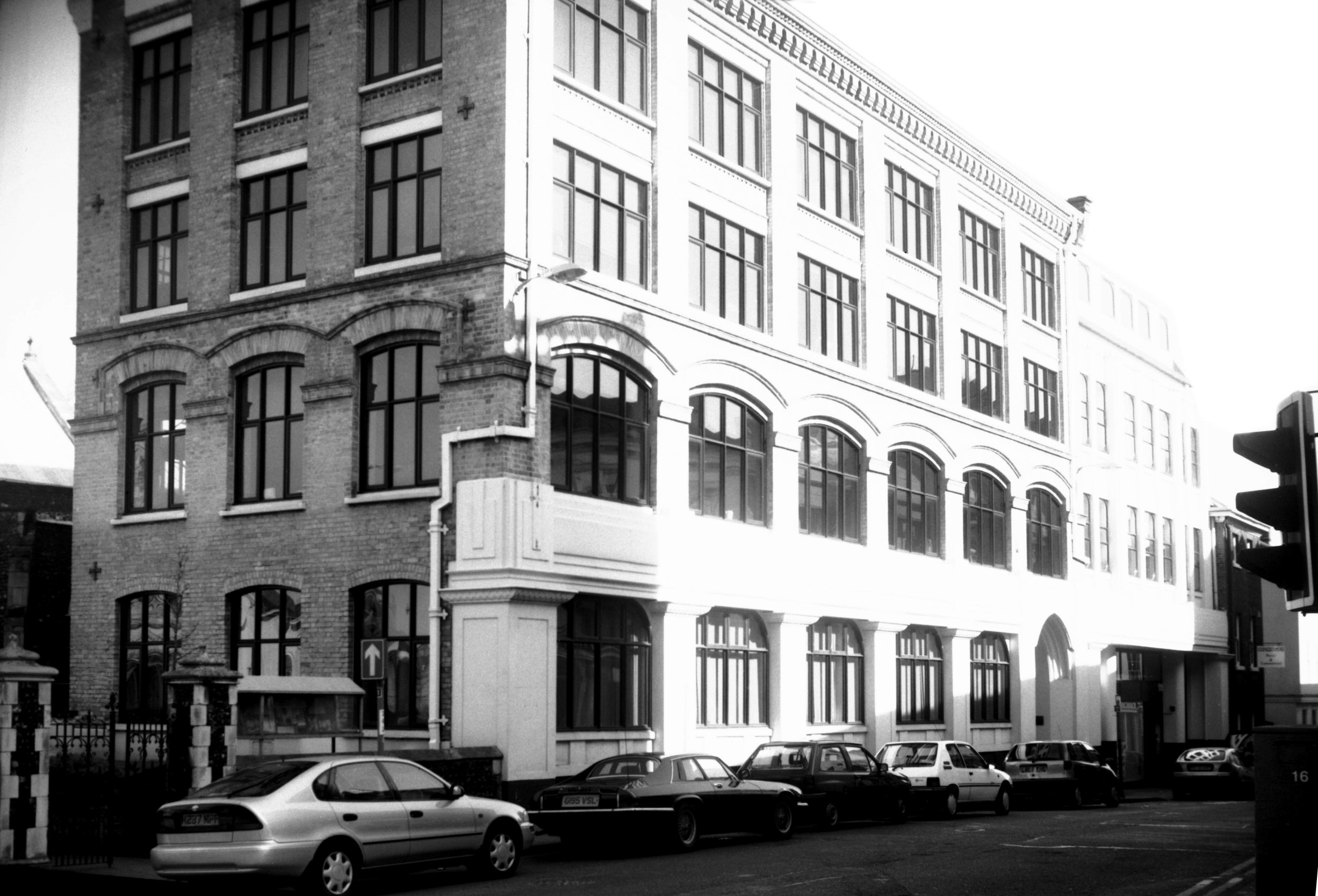
Prince of Wales Rd 38 to 52 [6221] 1981-08-04
|
|
|
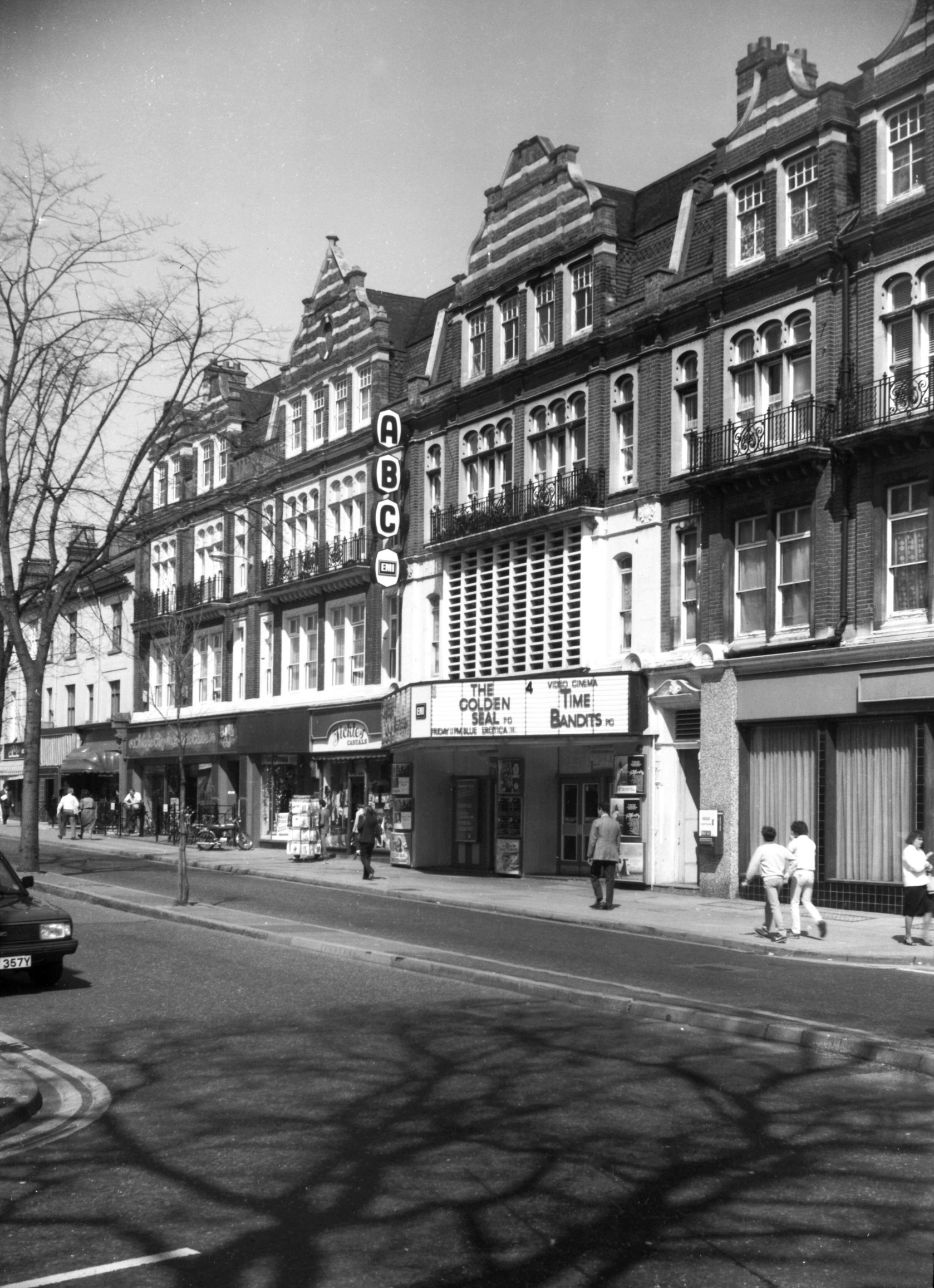
Prince of Wales Rd 86 to 98 [6295] 1984-04-24
Alexandra Mansions. Built c1890 as the first block of
residential flats in Norwich, with shops on the ground
floor. |
|
|
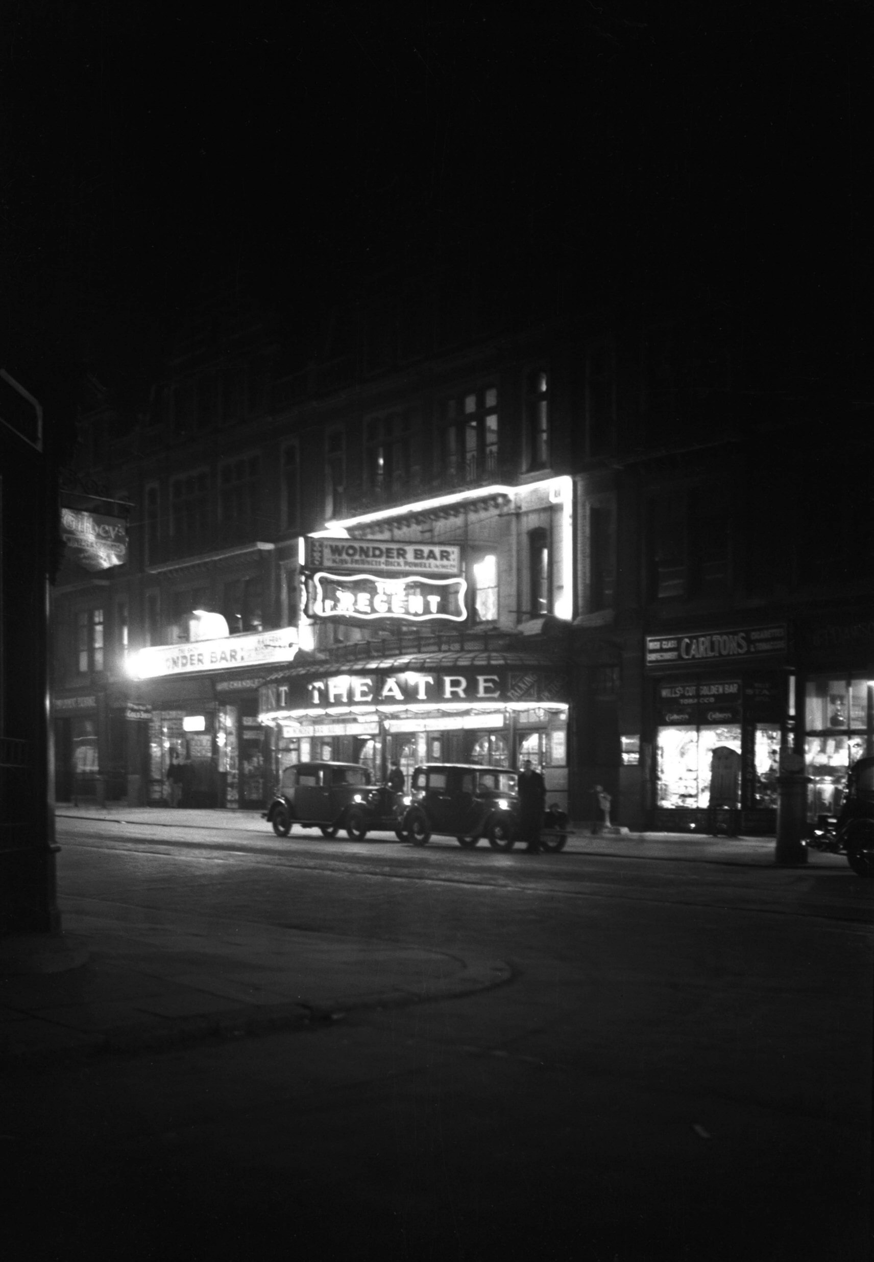
Prince of Wales Rd Regent Theatre at night [0323]
1934-11-26
Opened 1923. |
|
|
Coronation Prince of Wales Rd 100 [1578] 1937-05-12
100 Prince of Wales Rd, second prize business premises
for the 1937 coronation decorations. |
|
|
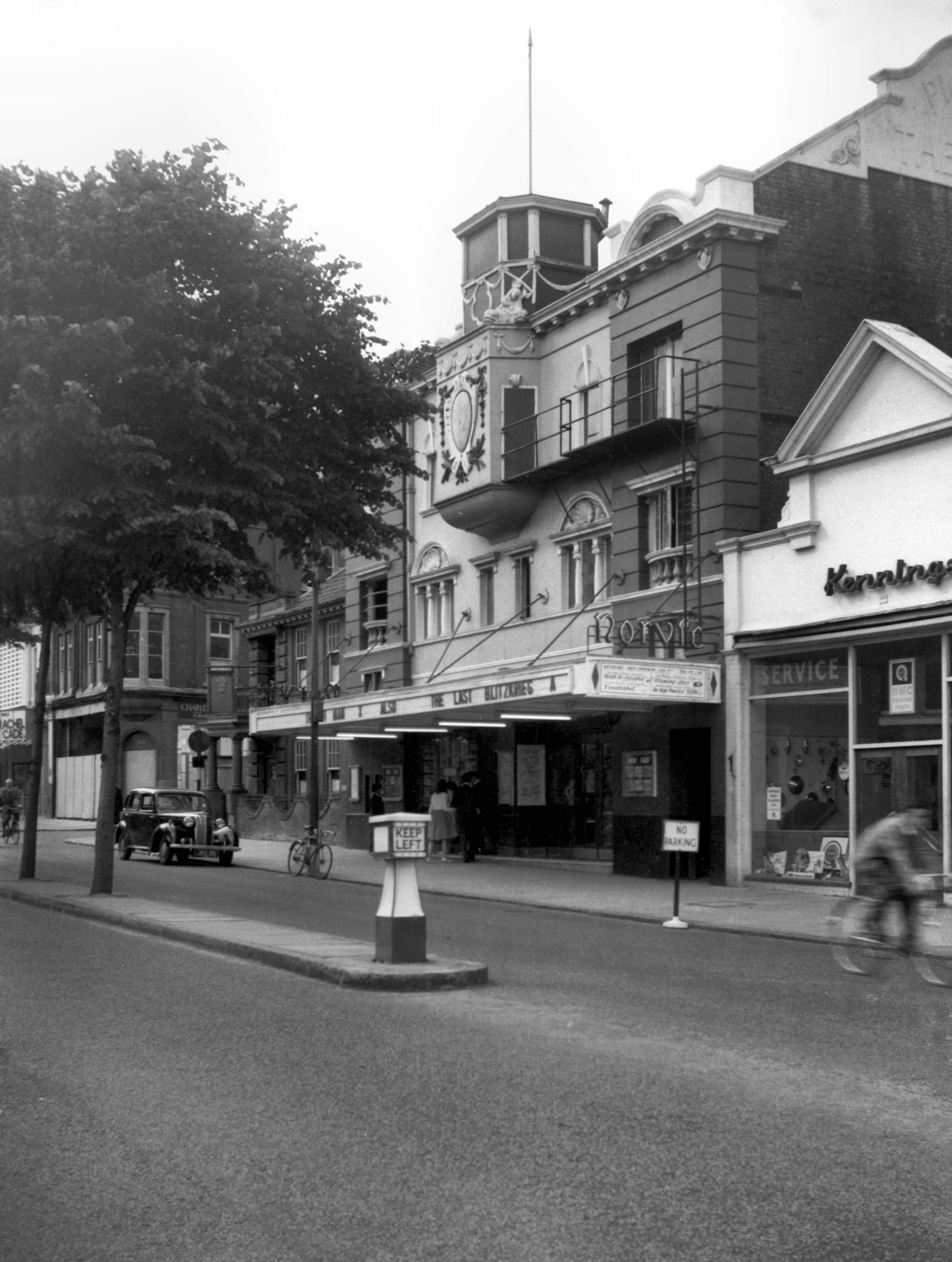
Prince of Wales Rd Norvic formerly Electric [4609]
1961-06-10
Opened as the "Electric" on Boxing Day 1912. It
was given its new name when modernised in 1949. Closed
1959. |
|
|
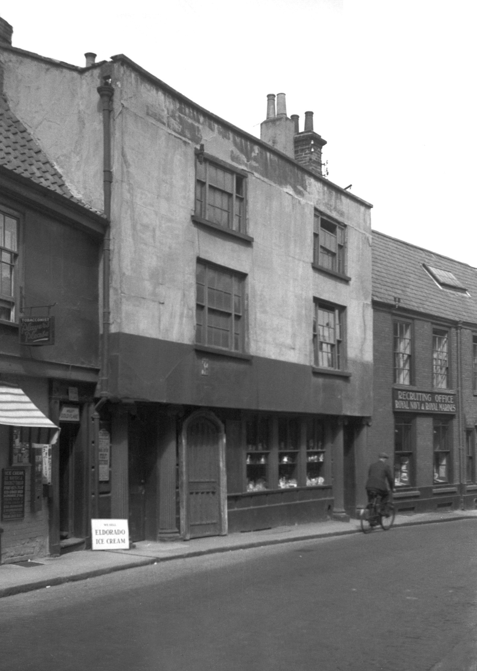
Prince of Wales Rd 116 to 120 view east [B574]
1933-06-07
|
|
|
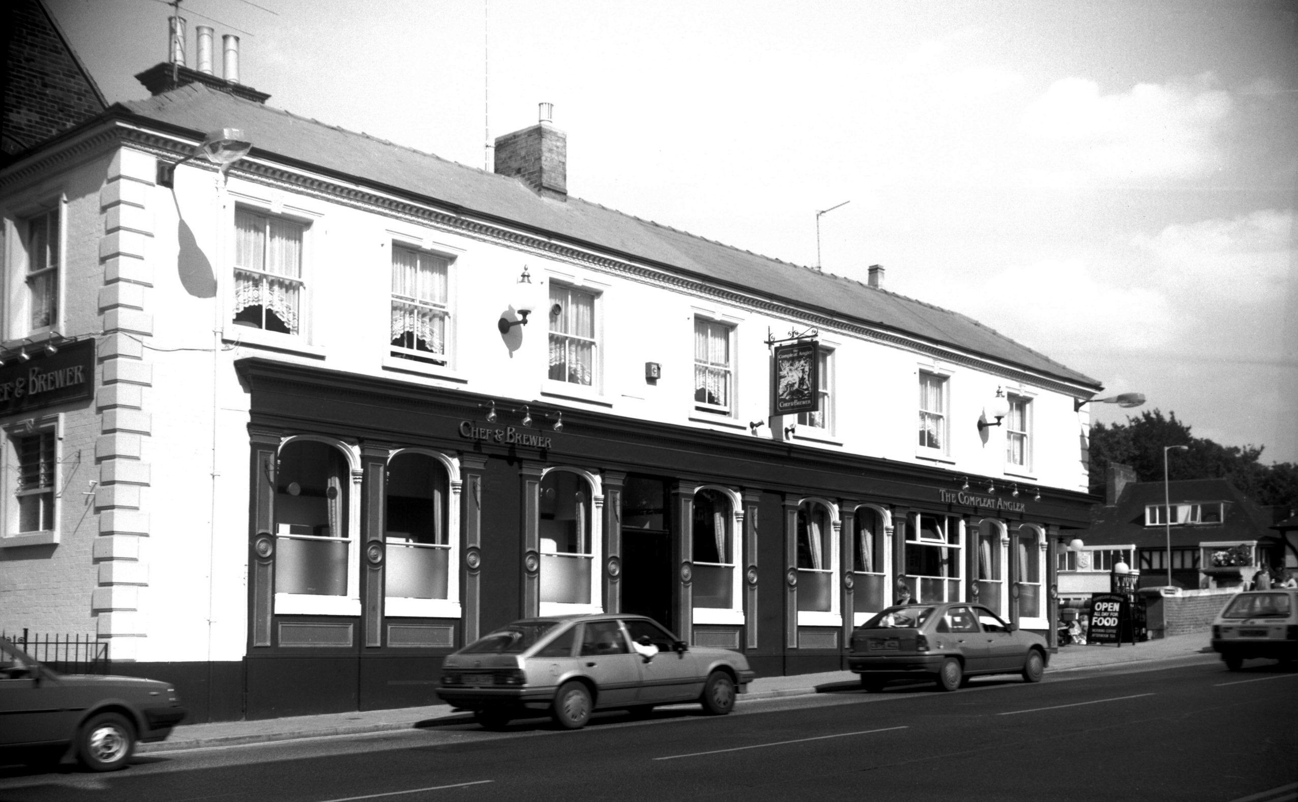
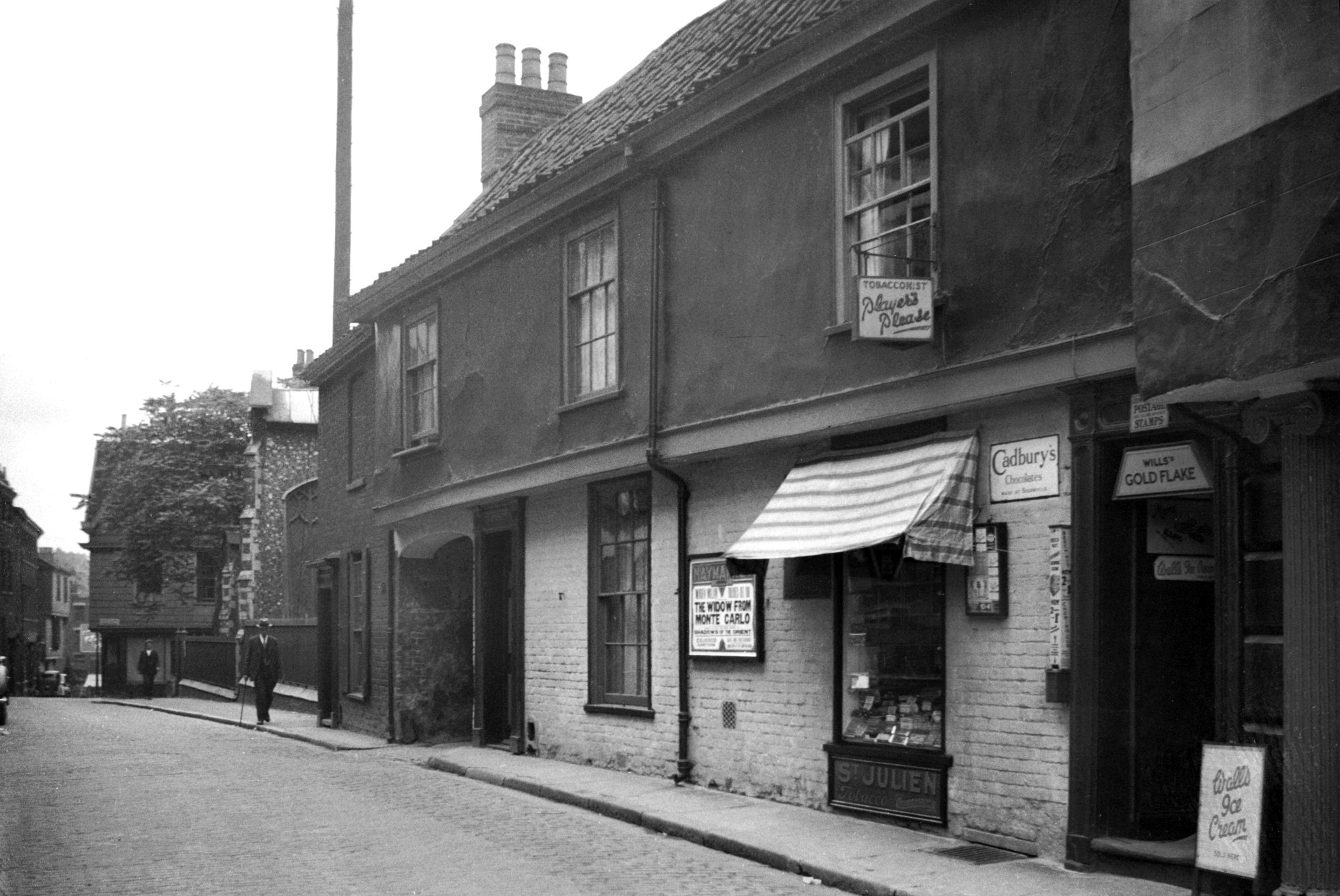
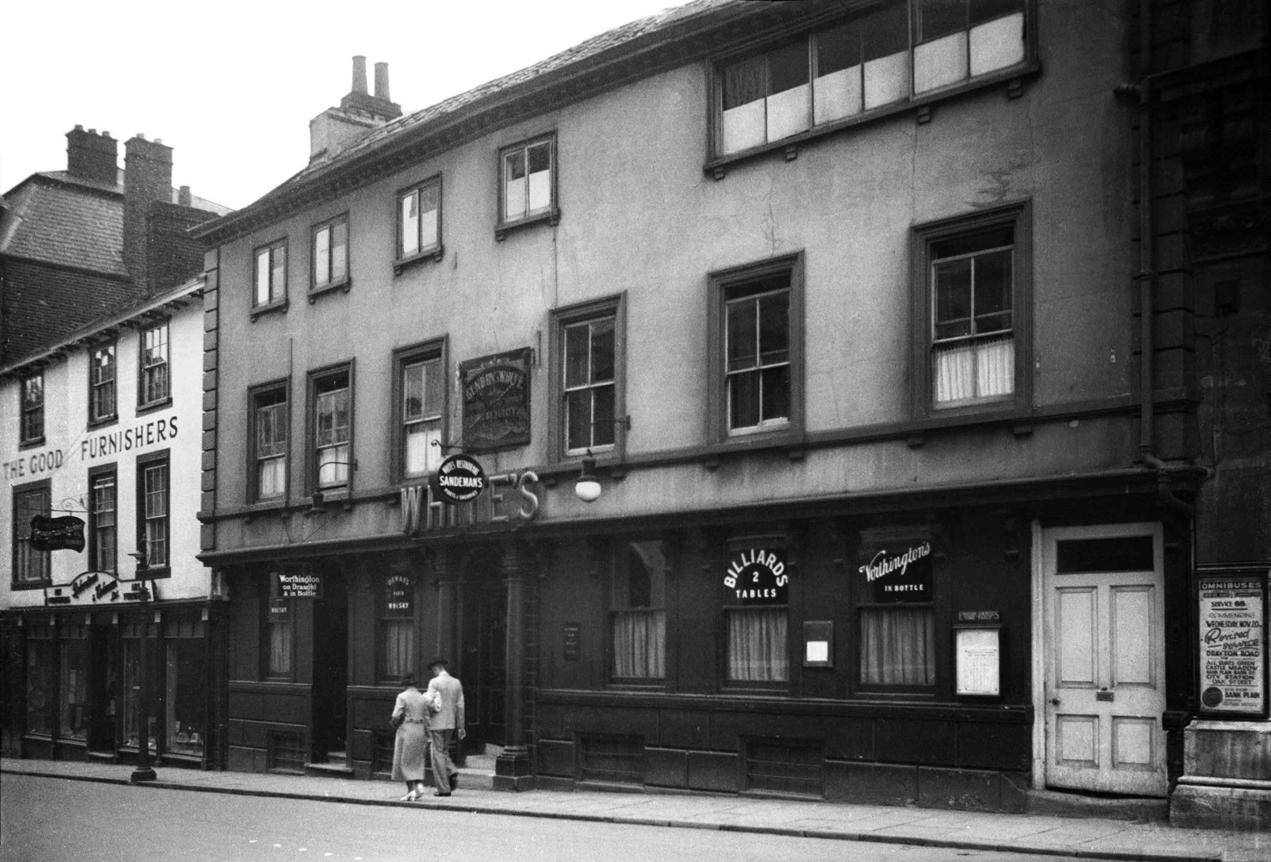
Prince of Wales Rd 122 Compleat Angler PH [6524]
1988-08-26
Formerly the Norfolk Railway House PH. It was once the
Tollhouse for the adjoining Foundry Bridge. |
|
|
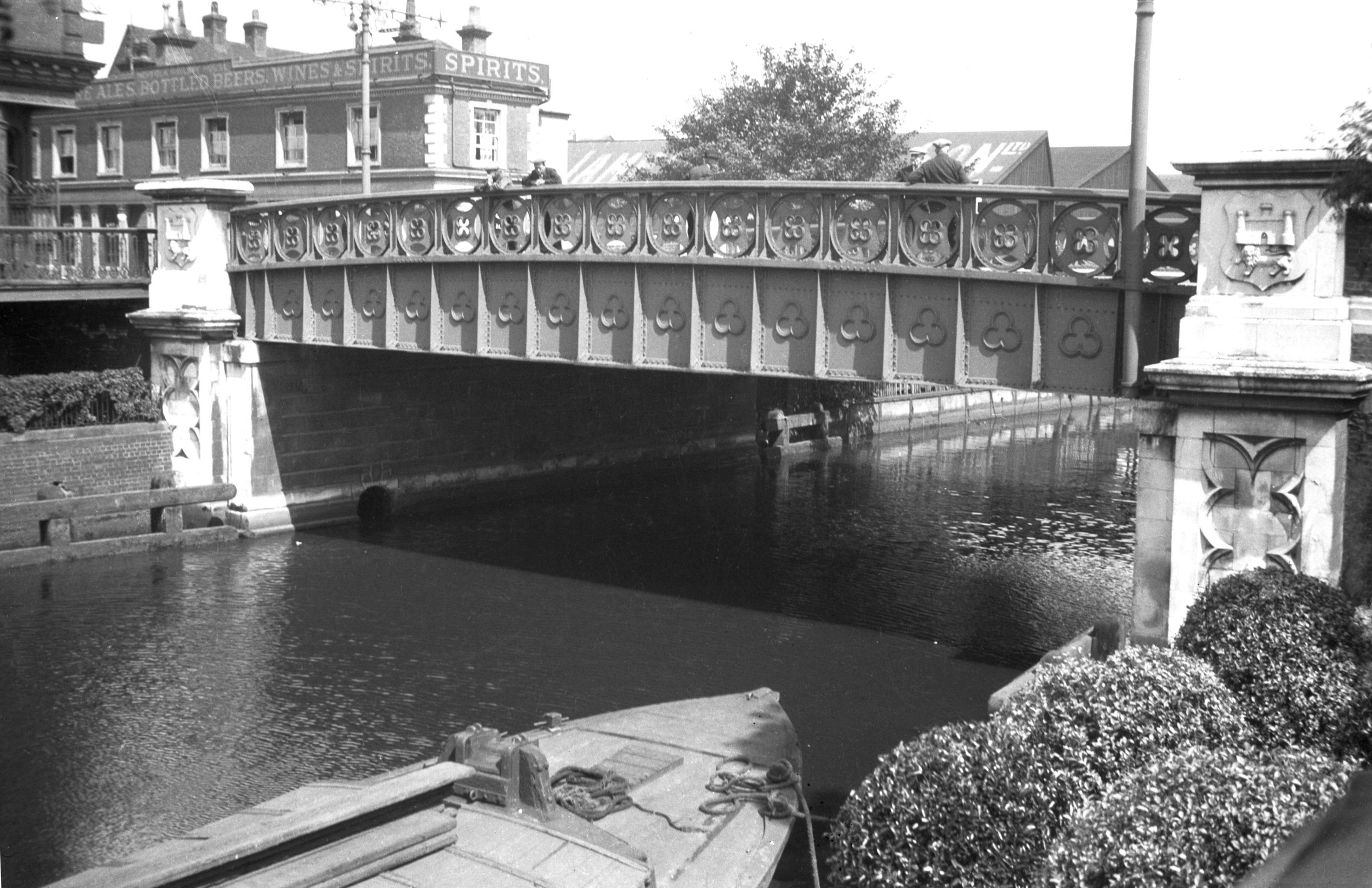
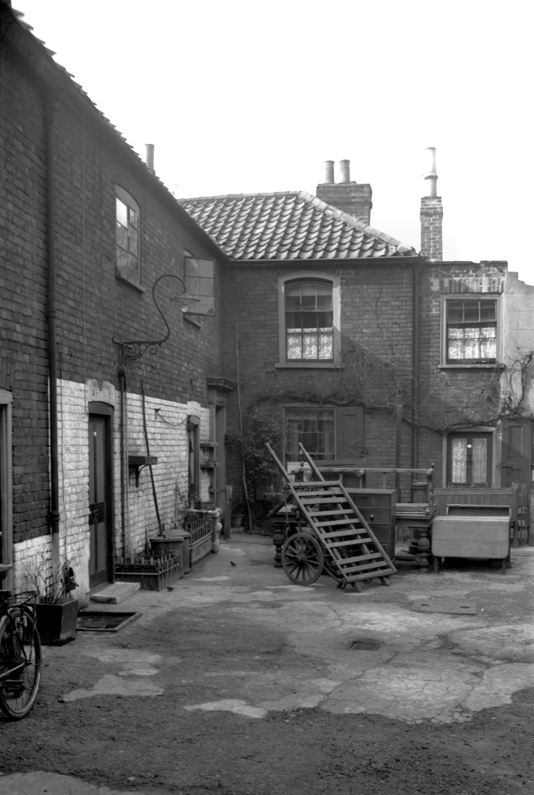
Wensum Foundry Bridge south side [B617] 1933-07-09
The first to occupy this site was a toll bridge built of
wood in 1811 - the contractors Mendham of Holt. In 1844
with the coming of the railway it was replaced by one of
iron by Bradley and Co of Wakefield, and designed by
C.D.Atkinson. Cost £800. It was then freed from toll.
The present structure was built when Thorpe Station was
enlarged; contractors R.Tidman and Co of Rosary Rd,
Norwich. Cost £12,032. Opened 17th January 1888. |
|
Princes St: |
| |
From
St Andrew's
Hall Plain to Tombland
passing Elm Hill, Redwell
St
South side |
| |
|
|
|
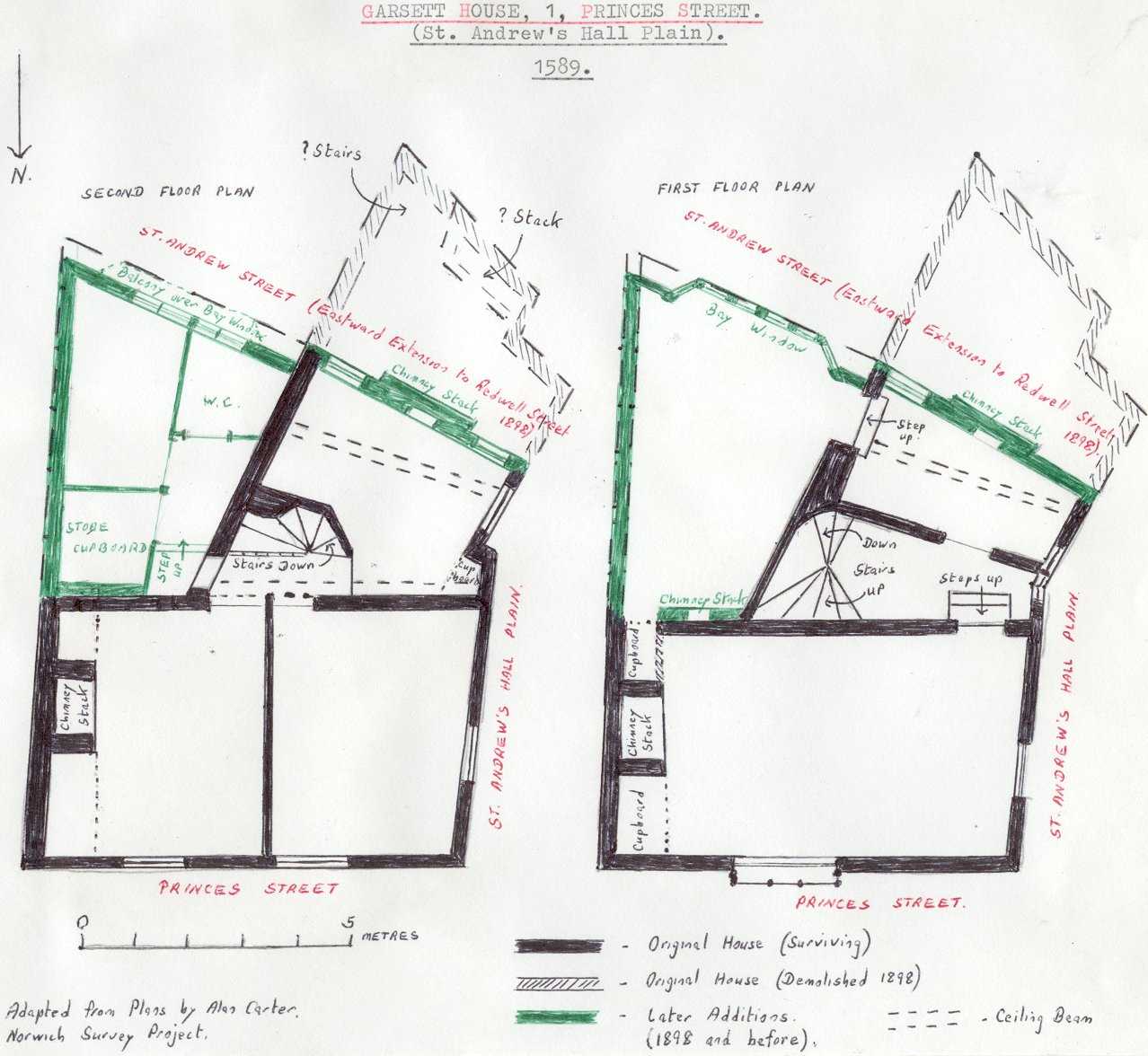
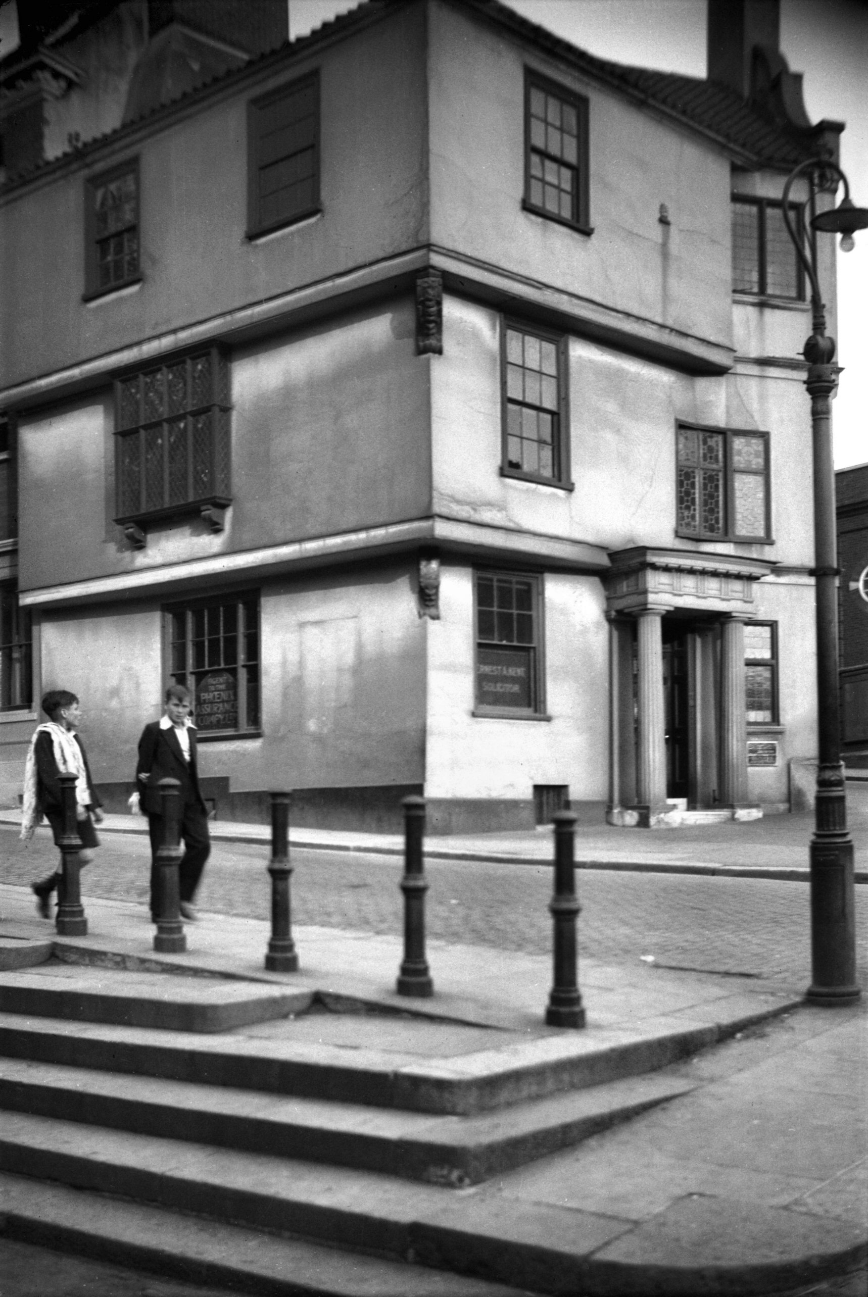
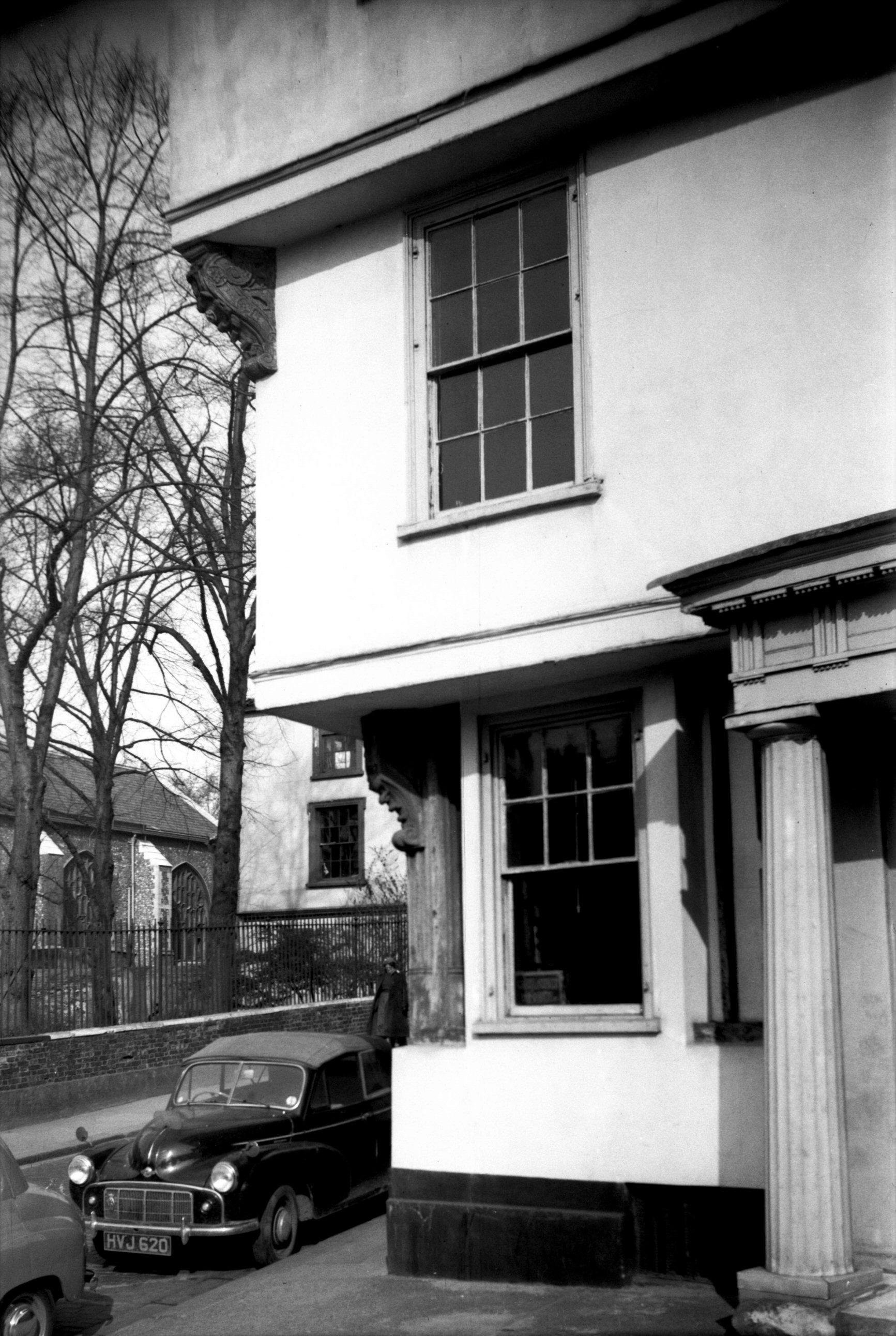
Princes St 1 Garsett House from NW [0628] 1935-08-09
|
|
|
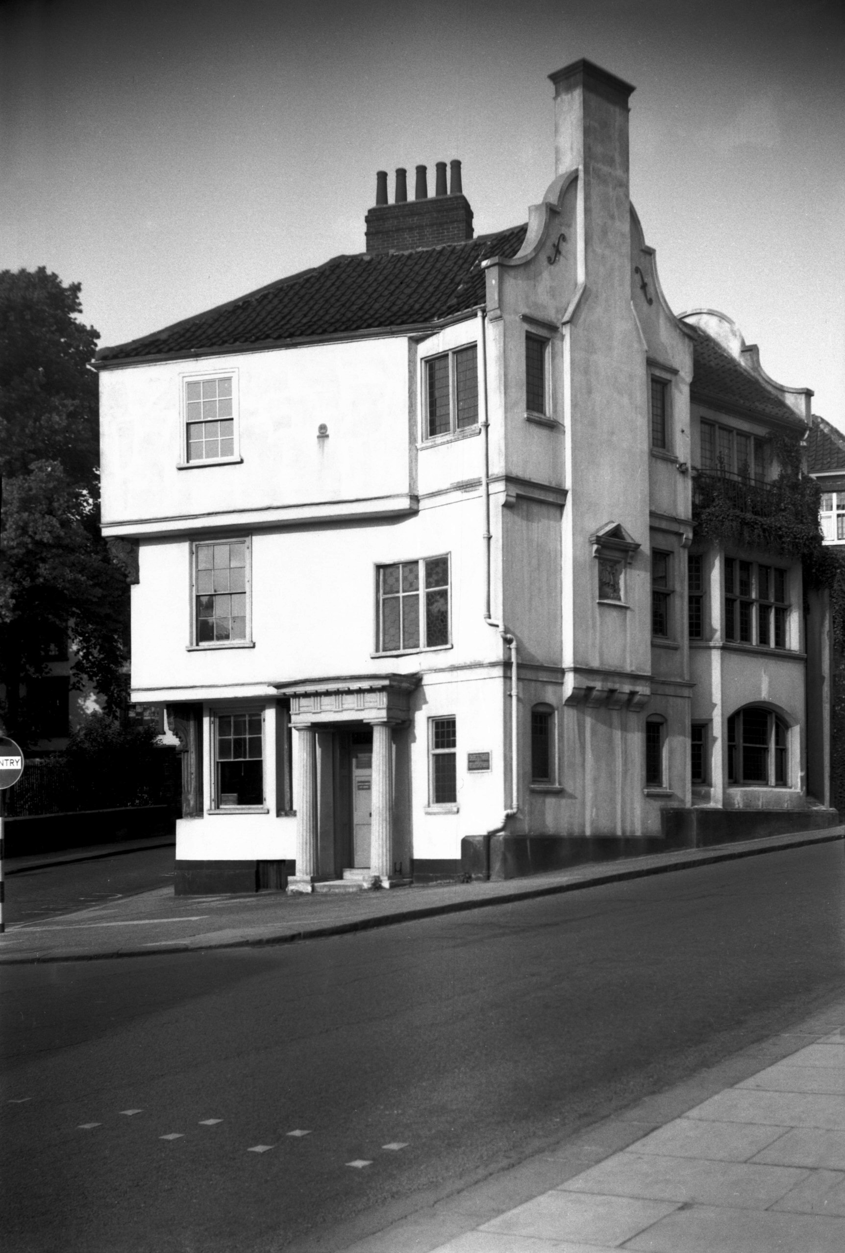
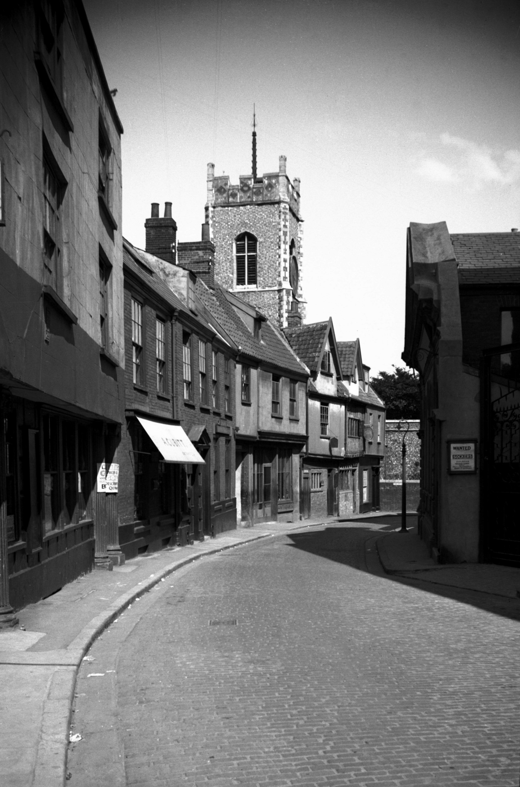
Princes St 1 Garsett House from SW [4449] 1956-07-08
To the north of St Andrew's Church are St Andrew's and
Blackfriars' Halls, once the nave and chancel of the
great church of the Dominicans or preaching friars.
Adjacent to this, at the junction of St Andrew's and
Princes St, is Garsett House, formerly known as Armada
House. This is a timber-framed building of three storeys,
each upper floor having a considerable overhang, with the
top floor supported at its northwest angle by an ornately
carved wooden bracket. That formerly supporting the first
floor was unfortunately cut away at some time unknown,
but in 1946, when some replastering became necessary, the
great corner post from which it projected was brought to
view, together with remains of Tudor windows.
The surviving bracket has carved upon it the date 1589,
the year after the Spanish Armada, an event commemorated
by a plaque depicting a galleon, moulded in plaster, on
the modern south gable wall.
This wall had had to be built up when in 1898 part of the
south wing was cut away to permit the construction of a
road taking the new tramway line from Bank Plain and
Redwell St into St Andrew's. At the same time, and for
the same reason, the adjoining City Arms public house, a
building of somewhat similar age and appearance to that
of Garsett House, was cleared away. The regret felt over
its loss was tempered slightly by its bringing into
public view the mediaeval Suckling Hall.
Records of early owners of the Garsett House site include
John de Norweigh and John Pirremund. They were succeeded
in 1373 by Adam Bass, who in 1385 left it to his wife
Agnes. In 1495 Robert Dilham owned it, followed by
William Crane in 1505. In 1570 the Langoll Rents showed
Robert Gartside (or Garsett) occupying this tenement. An
Alderman at the time of his death, on 18th March 1611, he
is probably the same as Robert Garsted, a tailor,
admitted to the freedom of the city in 1558, and Robert
Gassett, Sheriff in 1599. He and his family are
commemorated in St Andrew's Church by a mural monument
which has his bust carved in marble, together with small
effigies of his son Robert and daughter Elizabeth.
Not much else is known of the history of the house until
we come to the 19c. In 1864 the wife of G.C.Kerry had a
school here known as Sunderland House. Later came Alfred
Kent, a solicitor, who was succeeded by his son Ernest,
also a solicitor and well-known local antiquary. Ernest
Kent left the building on his death to the Norfolk and
Norwich Archaeological Society, who adapted the first
floor as their library and headquarters.
In the early 1880s the ground floor was let to Dr William
Guy, the public vaccinator, and in the society's library
may be seen a scurrilous cartoon from Daylight, an
independent local weekly journal; in it Dr Guy and
another person are seen standing in front of Garsett
House, in the window of which appears the legend
"Shortly to Let. Vaccination Station and Disease and
Death Factory". The late Miss Clara Leeds, who was a
granddaughter of Dr Guy, once assured me that he was in
fact a most kindly and gentle man, and this cartoon
caused him considerable distress. |
|
|
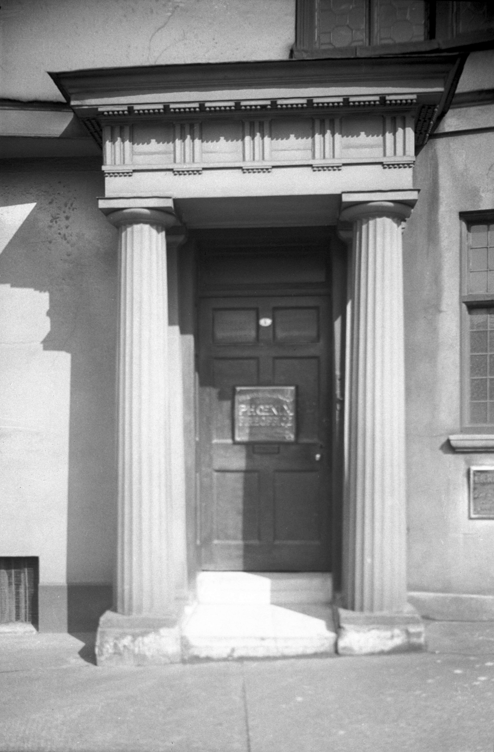
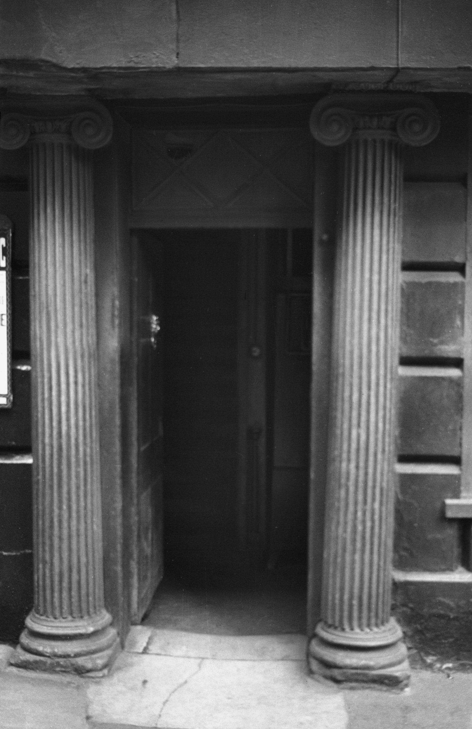
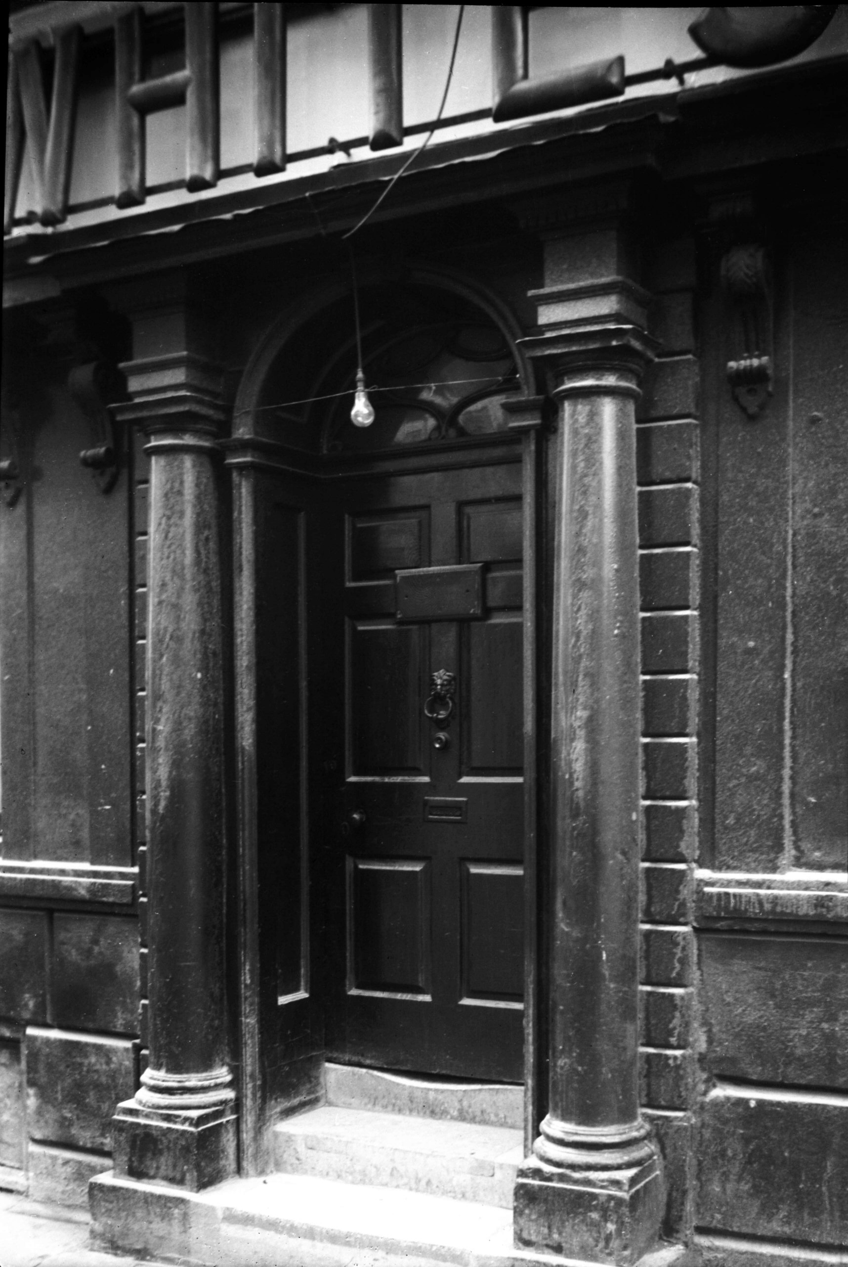
Princes St 1 Garsett House Georgian doorway [0460]
1935-04-19
|
|
|
Princes St 1 Garsett House corner post [4420]
1956-03-27
Corner post and brackets, the upper one bearing the date
1589. |
|
|
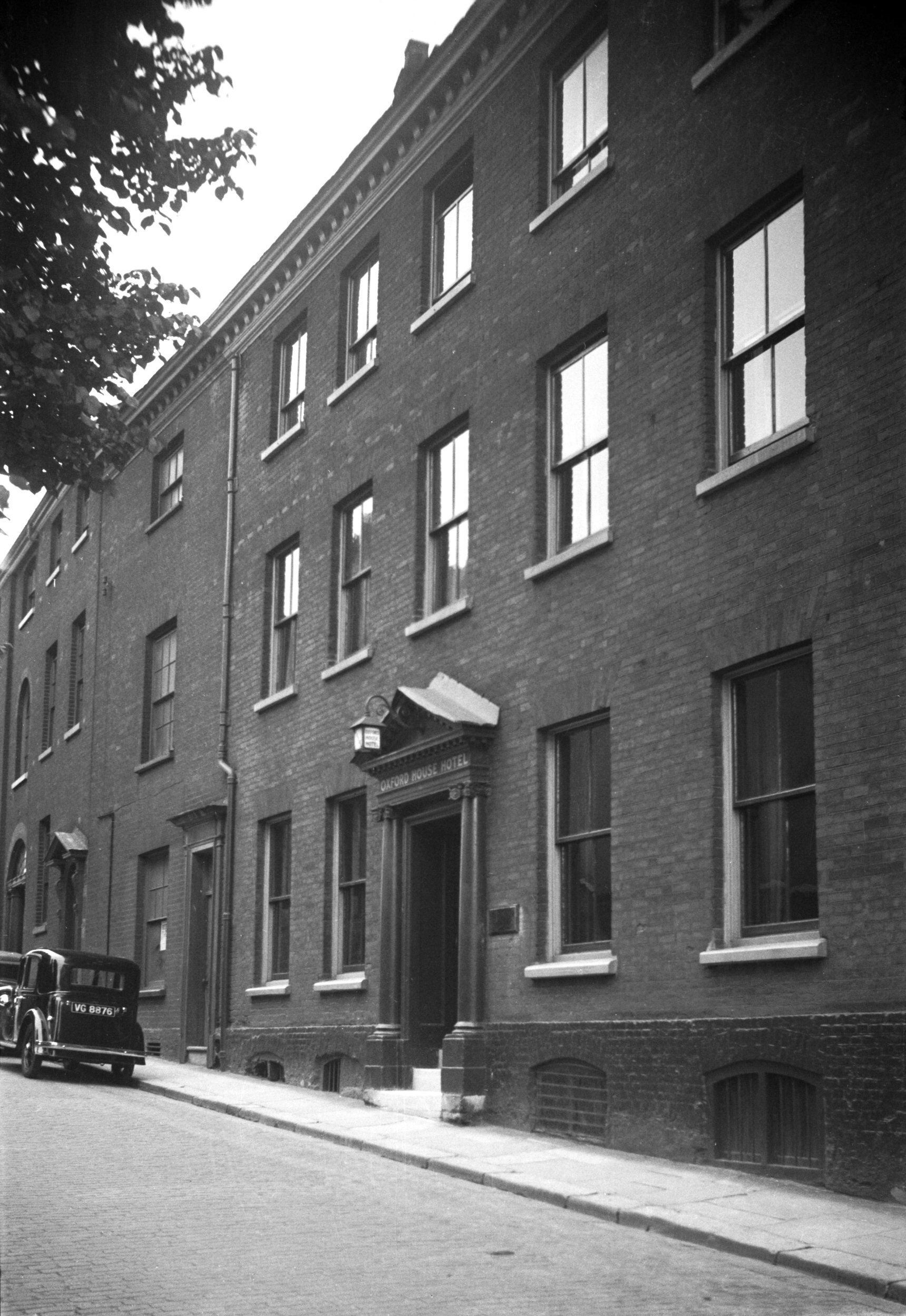
Princes St 3 Oxford House to 5 [1104] 1936-07-12
|
|
|
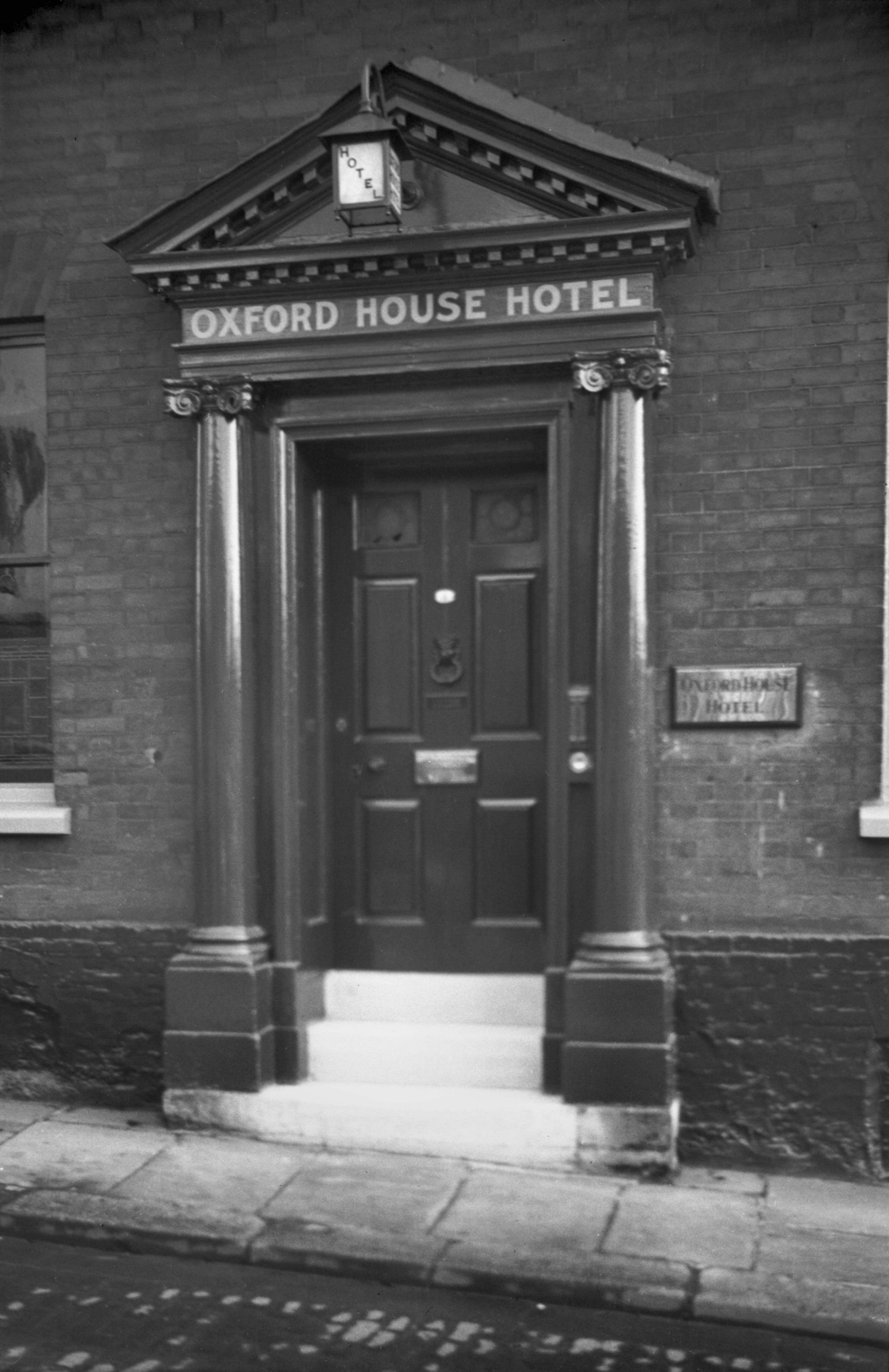
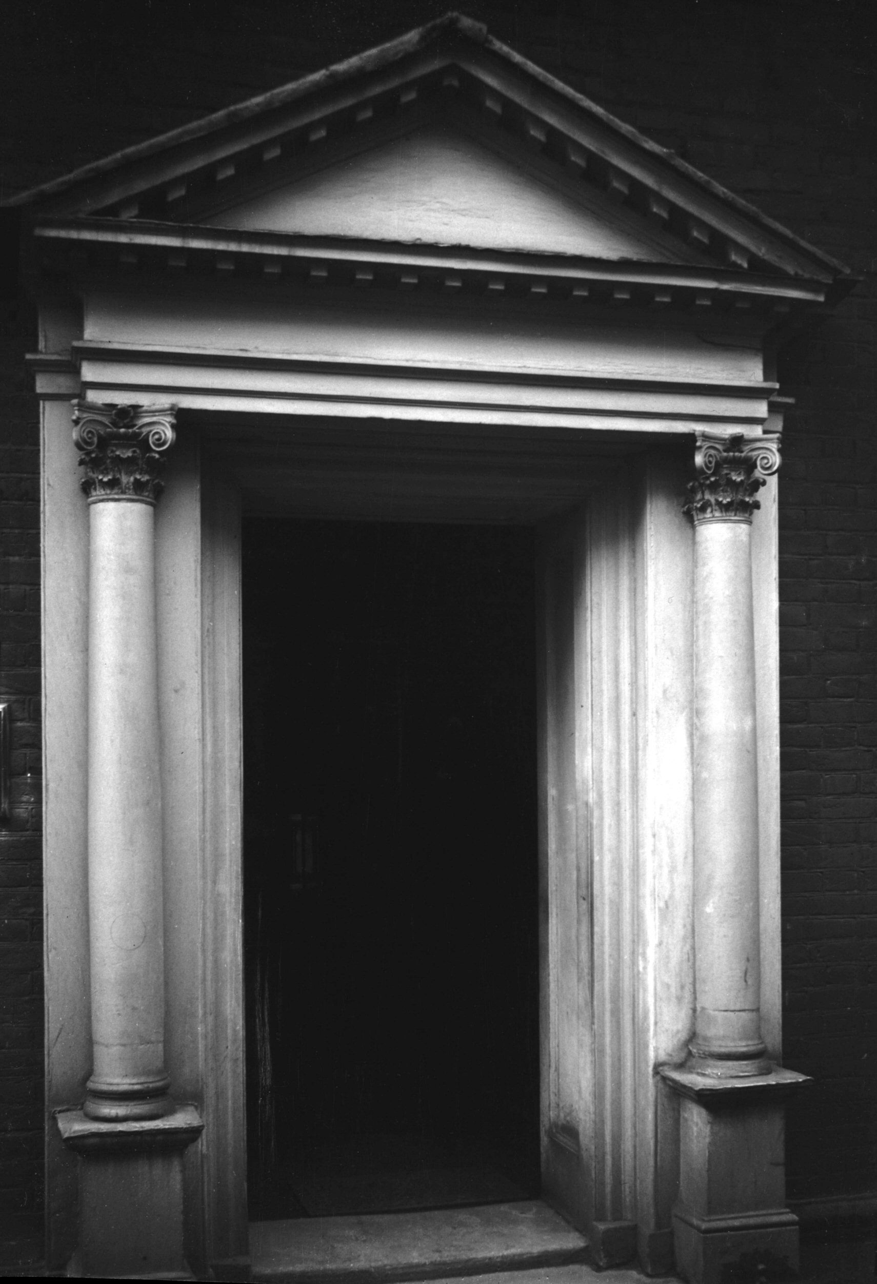
Princes St 3 Oxford House Georgian doorway [0461]
1935-04-19
|
|
|
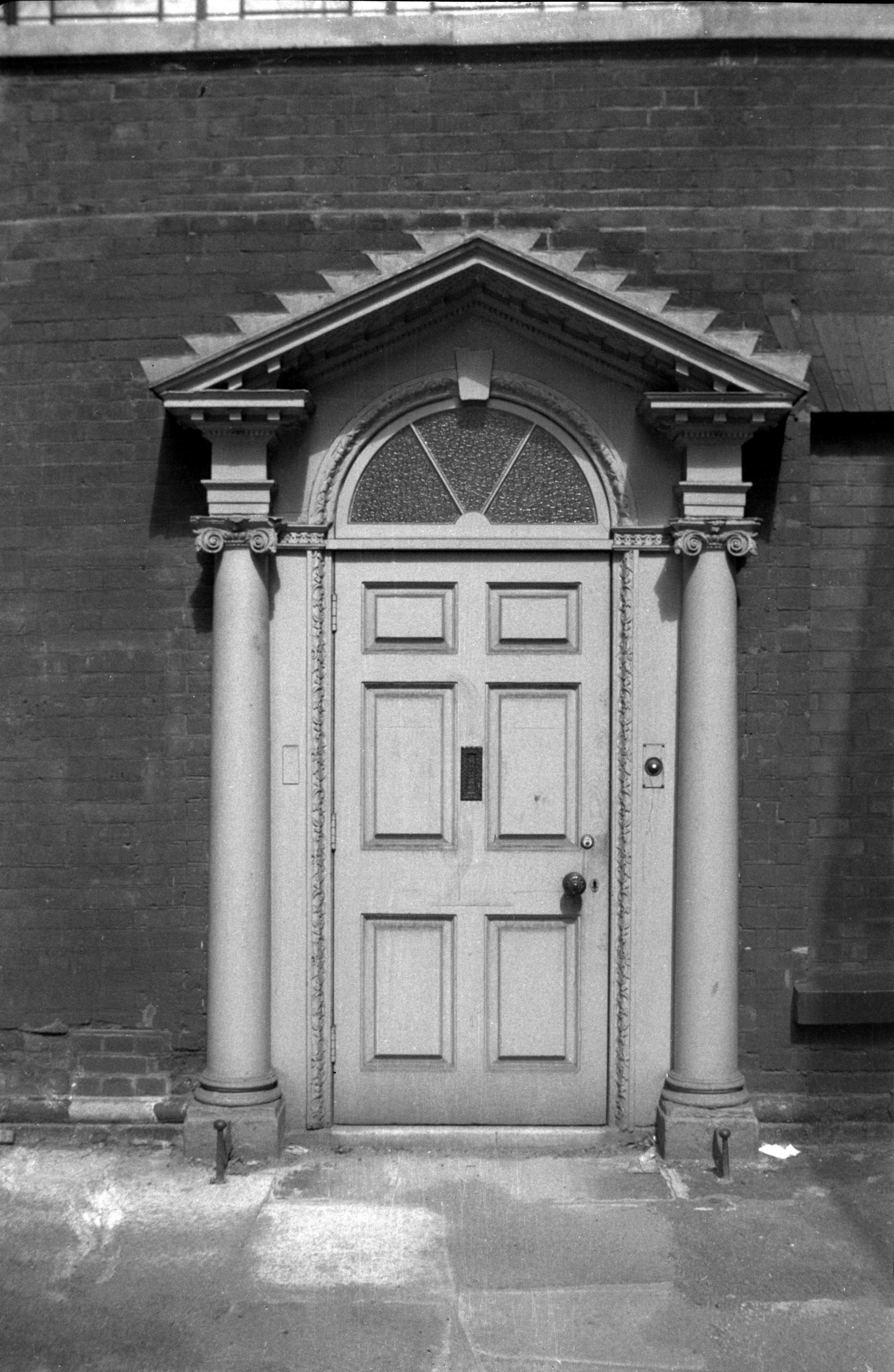
Princes St 9 Regency Georgian doorway [0462]
1935-04-19
|
|
|
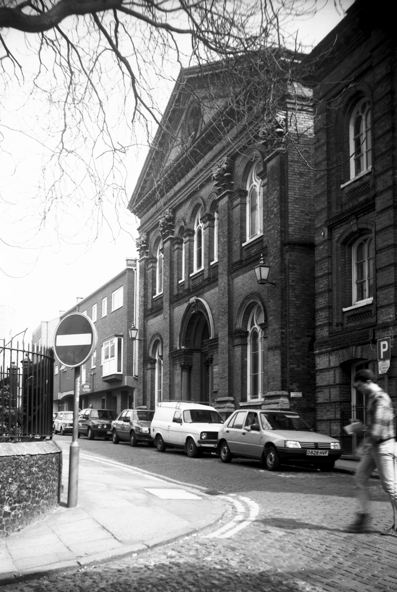
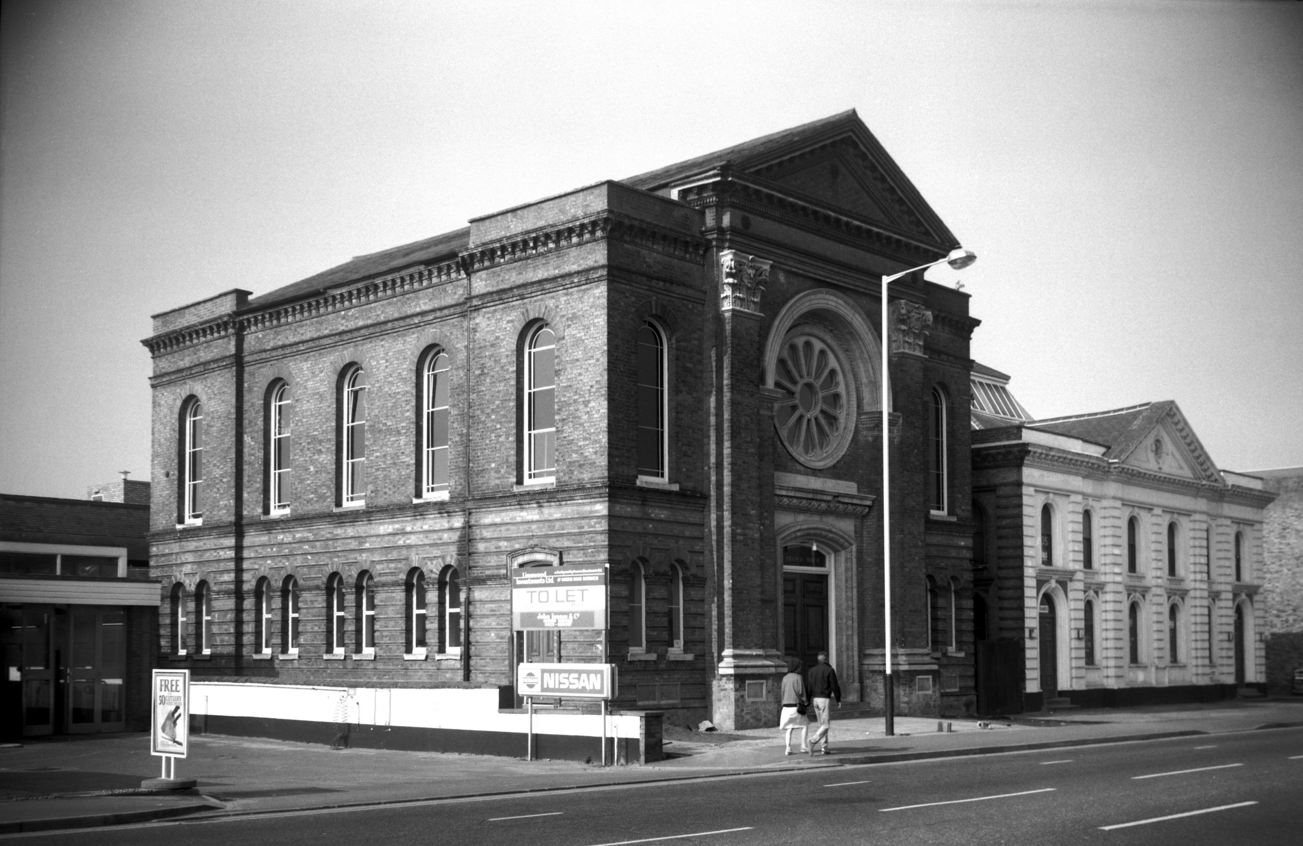
Princes St United Reformed church [6452] 1987-04-25
Formerly Congregational. Remodelled with new facade 1869,
architect Edward Boardman. |
|
|
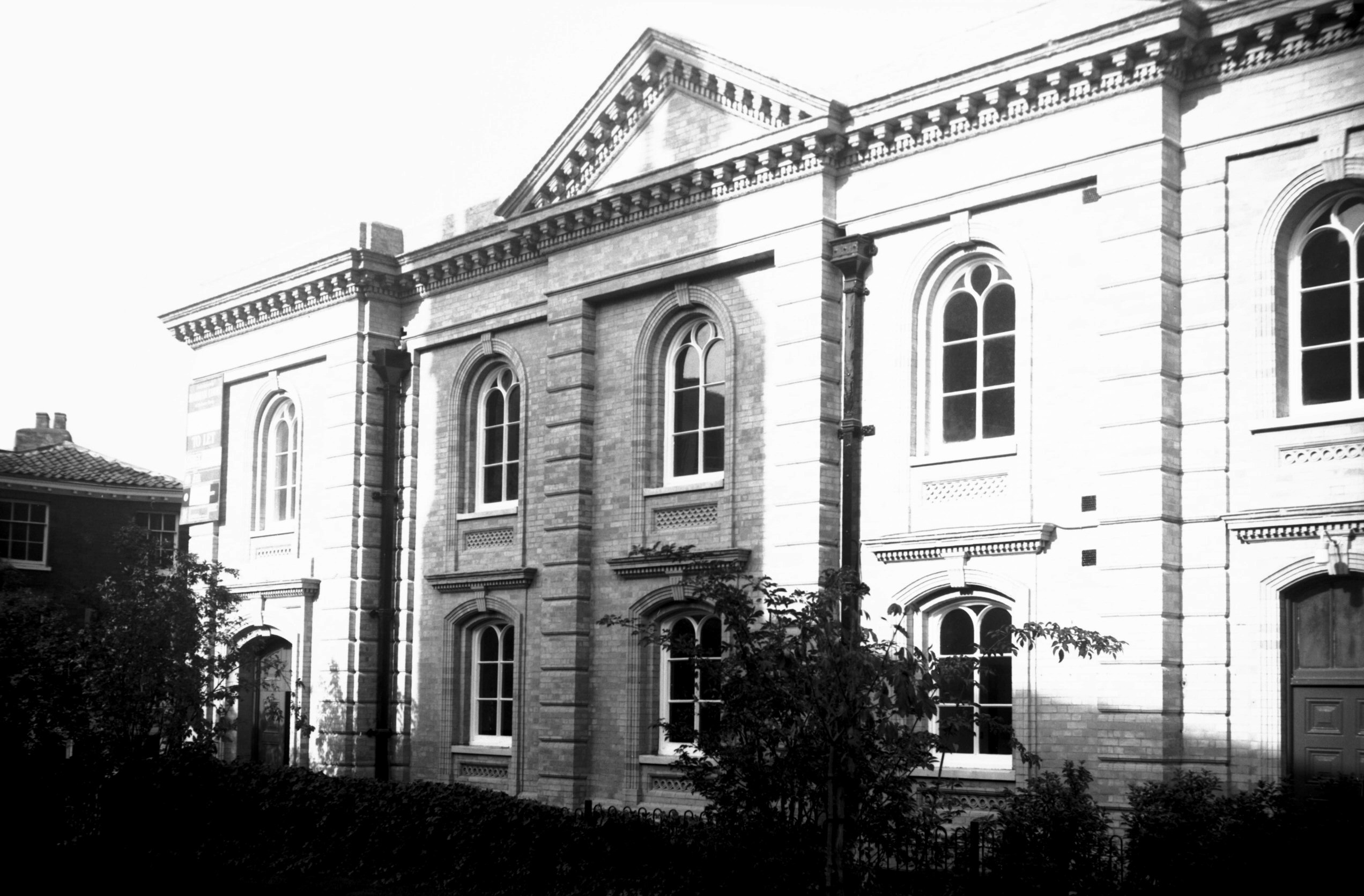
Princes St United Reformed Lecture Rooms [6659]
1990-10-12
Opened 17th January 1881, architect Edward Boardman. |
|
|
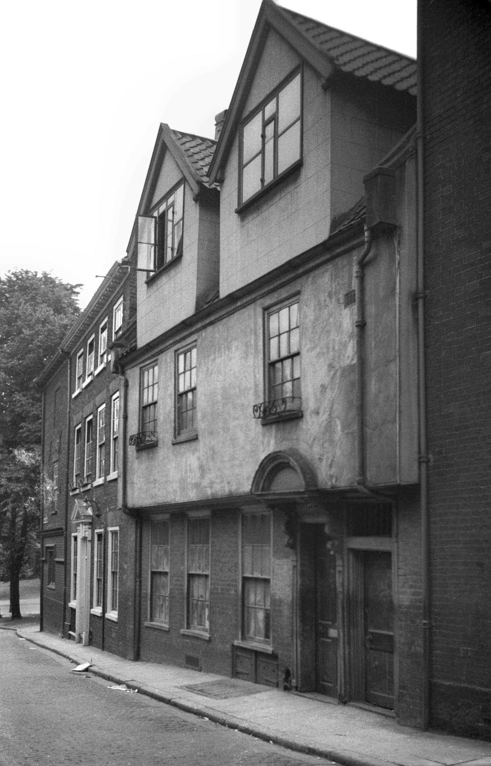
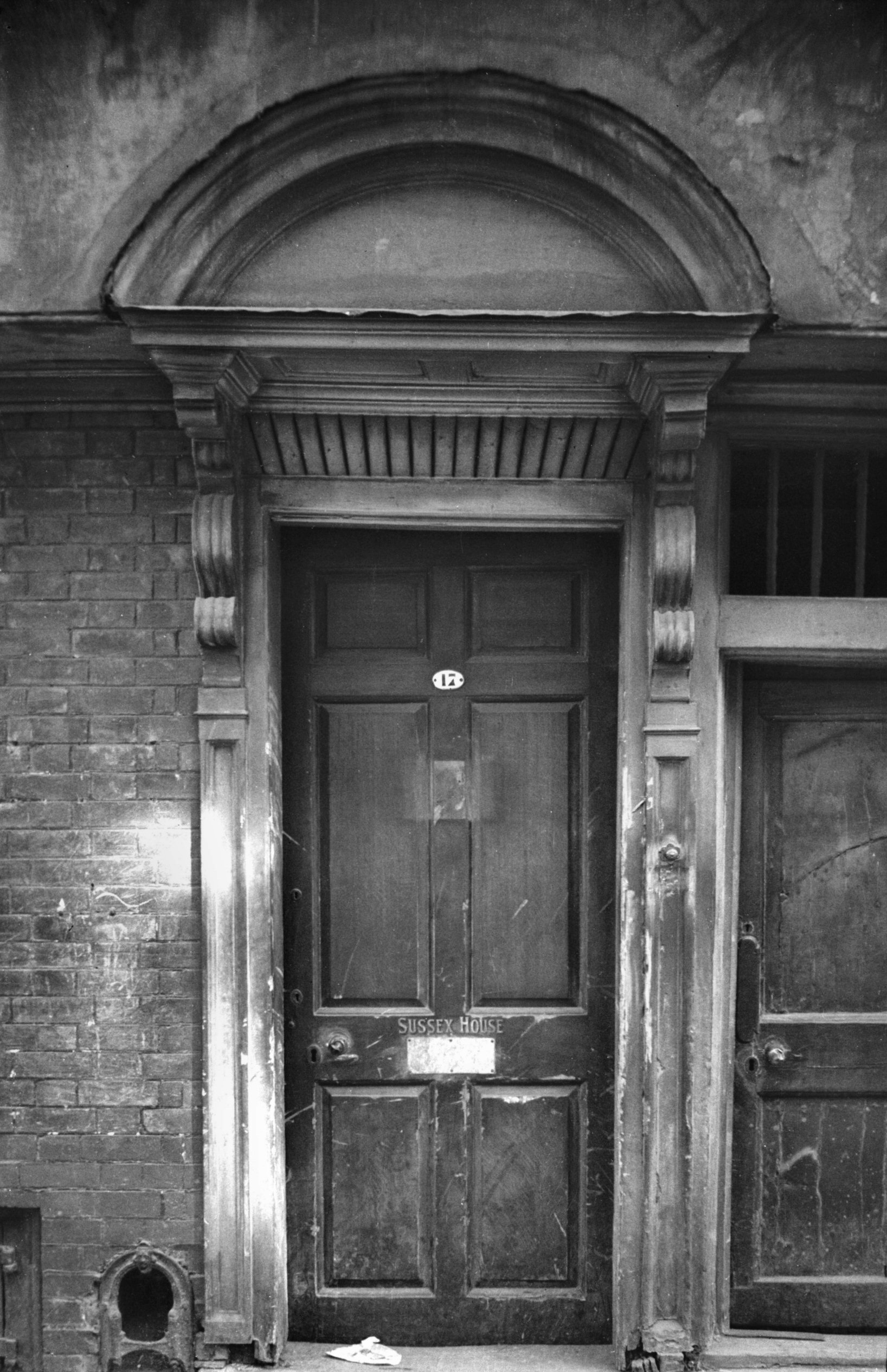
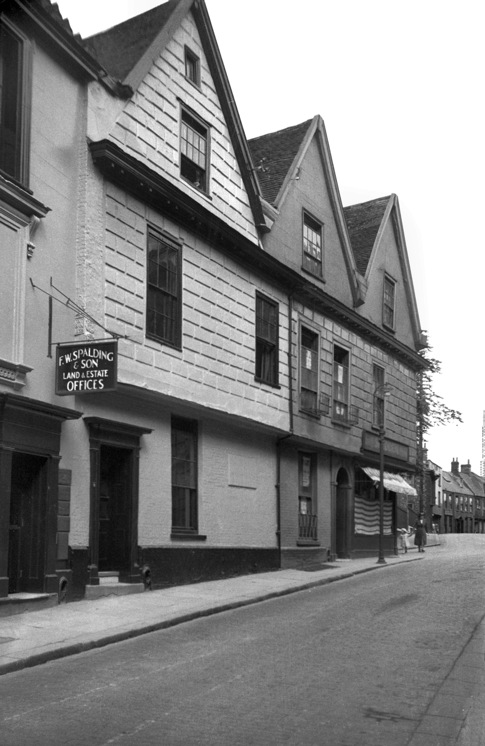
Princes St 17 Sussex House [1098] 1936-07-12
Demolished in 1939, Sussex House at 17 Princes St was a
timber-framed house believed to have been built about
1500. Its first floor overhung the pavement by about a
foot. About a century after its building two sturdy
dormers were added to give light to the roof space, and
further alterations were made about 1700 by the insertion
of sash windows and a new doorway of wood, consisting of
narrow panelled jambs from the top of which projected
large carved brackets. These stood out sufficiently to
support an elliptical hood or pediment placed immediately
below one of the first-floor windows. This and adjoining
property lying behind houses on Tombland were all cleared
away to extend a shoe factory. In its turn this too was
pulled down and was replaced in 1974 by the present shops
and offices, built in a style rather more sympathetic to
the old character of the street. |
|
|
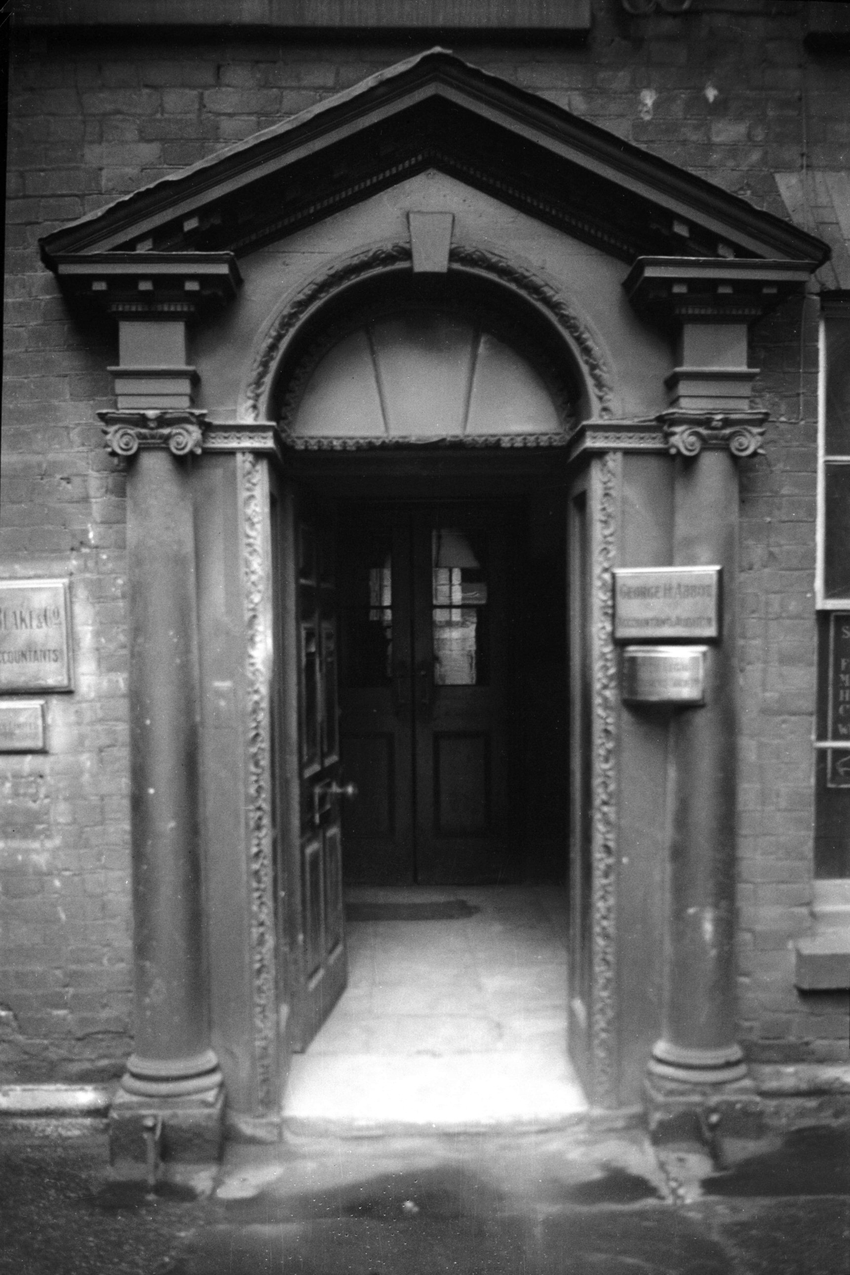
Princes St 17 Sussex House 17c doorway [0614]
1935-08-05
|
|
|
Princes St 19 [1077] 1936-07-06
|
| |
North
side |
|
|
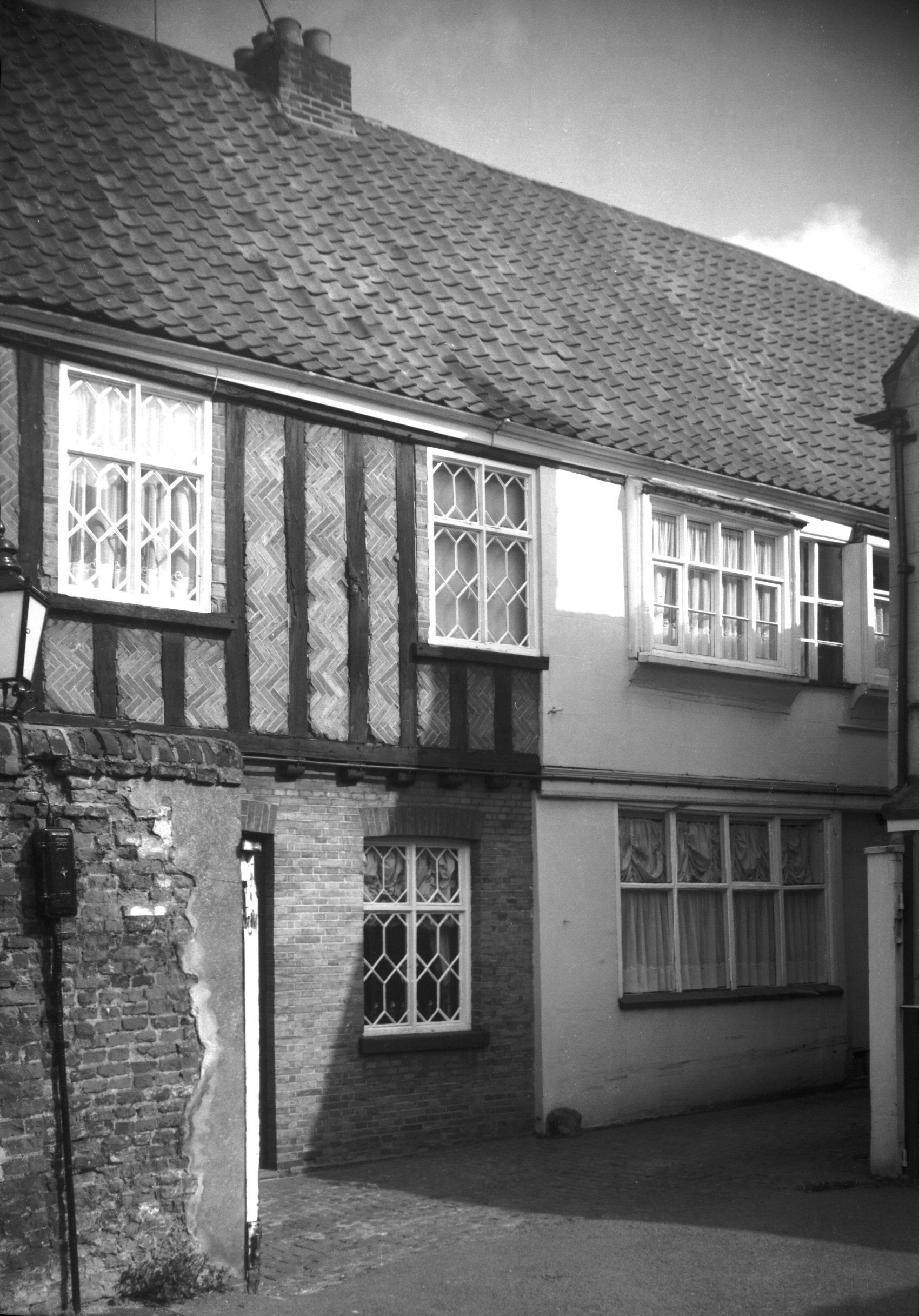
Princes St 4 to 6 [2714] 1938-08-15
At the corner of Elm Hill and Princes St, almost opposite
Garsett House, stands the timber-framed mansion built by
Richard Mann about 400 years ago. Its southern and
eastern elevations are both depicted in the margin of
James Corbridge's map of Norwich; it is now probably the
only one of the mansions so illustrated still to be
surviving, at least in recognisable form. Later residents
here included Robert Bendish, Alderman, Sheriff in 1663
and Mayor in 1672, whose wife gave to St Peter Hungate
Church its Communion plate in gratitude for her recovery
from a serious illness. Robert died in 1693 and was
succeeded by Mordecai Hewitt, a merchant; then Hewitt
Elwin, who in 1719 sold the house to John Reeve, also a
merchant. Corbridge called him "Capt. Jno.
Reevs" and shows a balcony at first-floor level
above what is now a corner shop. This was for many years
a drapery establishment kept by Miss Shedden, but is now
a baker's and confectioner's.
Following the demolition of the adjoining and
comparatively modern 2 Princes St, the building has had
its western gable rebuilt. This, together with
conservation work carried out on its timber framework,
will, it is hoped, ensure its continued existence for
many years. |
|
|
St Peter Hungate view NE from Redwell St [2184]
1938-03-19
|
|
|
St Peter Hungate view NE from Princes St [B132]
1931-00-00
|
|
|
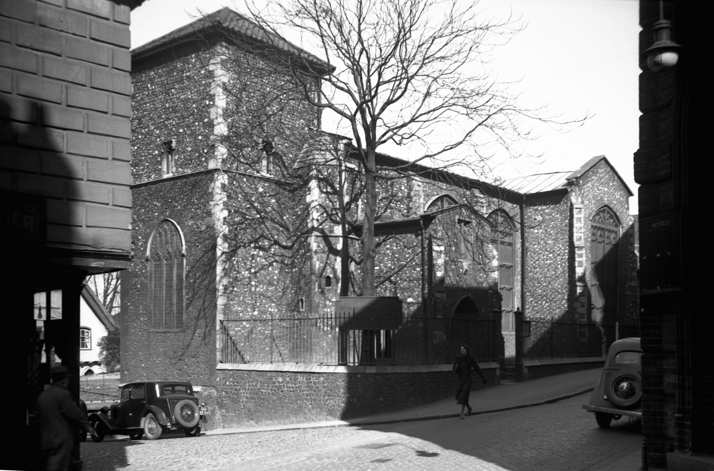
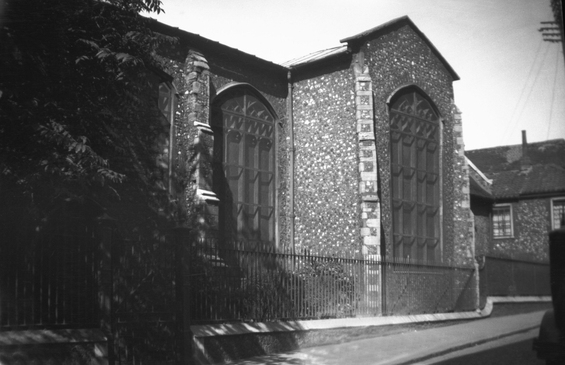
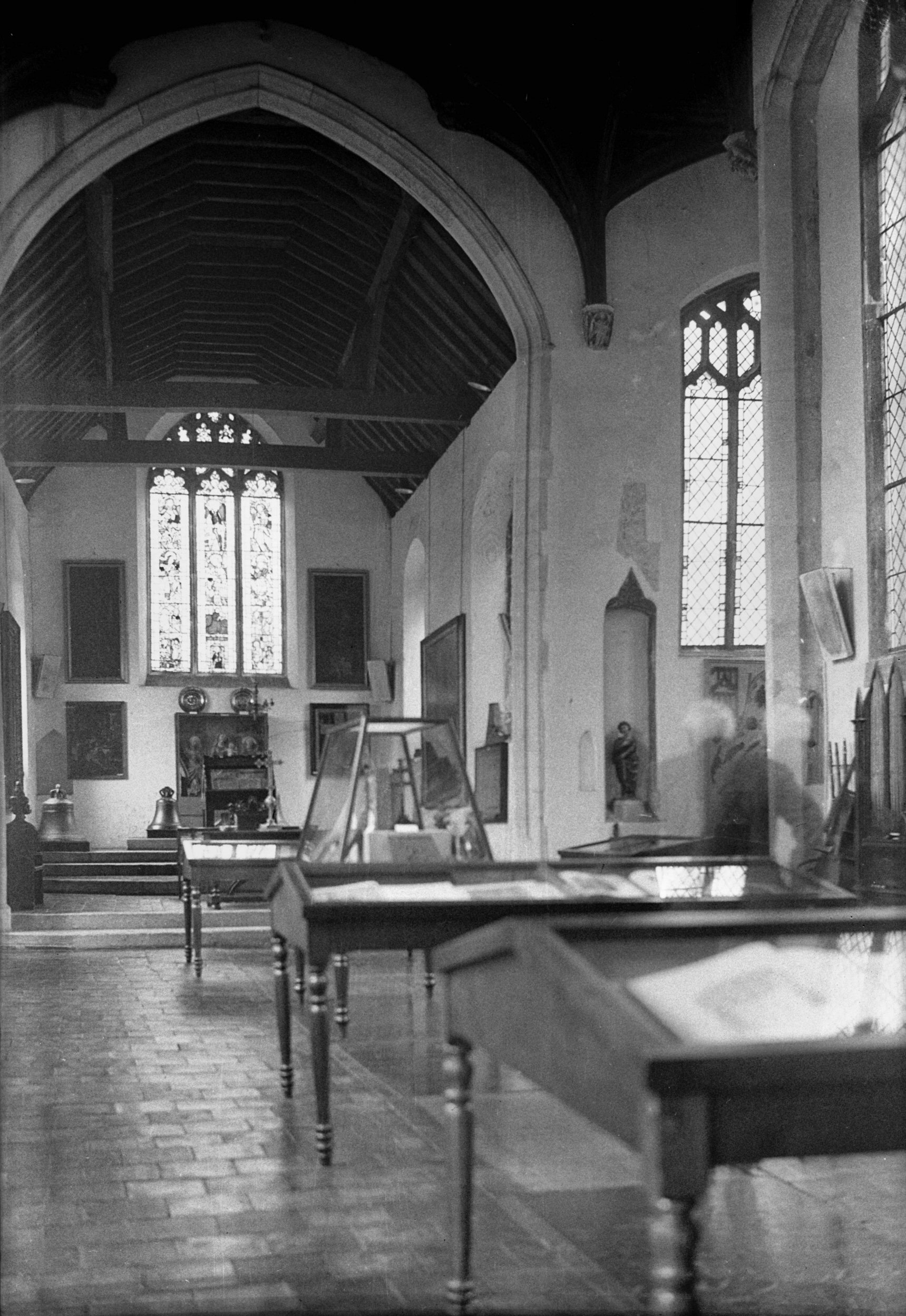
St Peter Hungate view NW [2209] 1938-03-26
The present building, a cruciform structure, was built by
John Paston and Margaret his wife (the patrons of the
benefice) and was finished in 1460. This church, long
disused, was converted into an Ecclesiastical museum in
1932. |
|
|
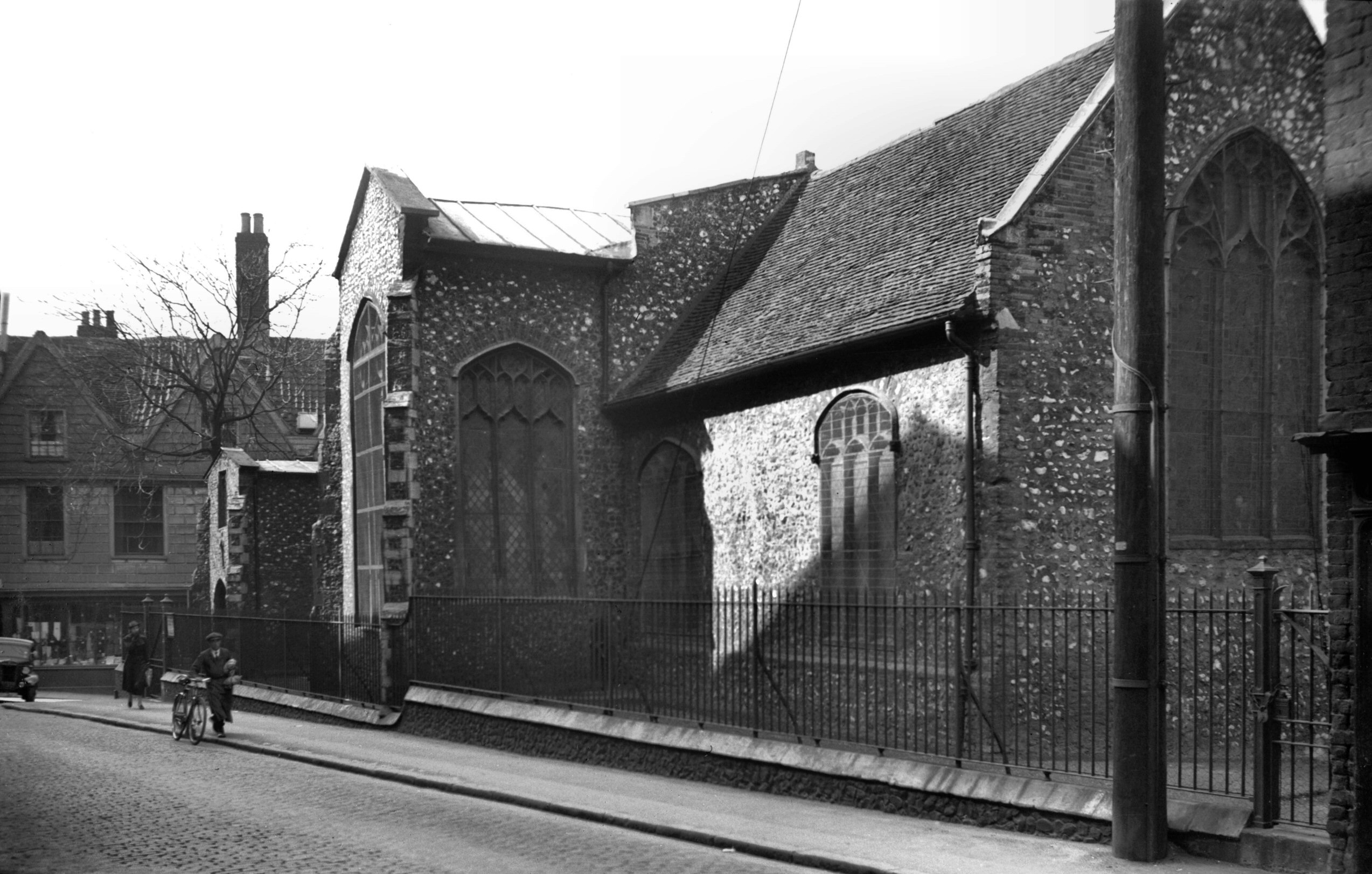
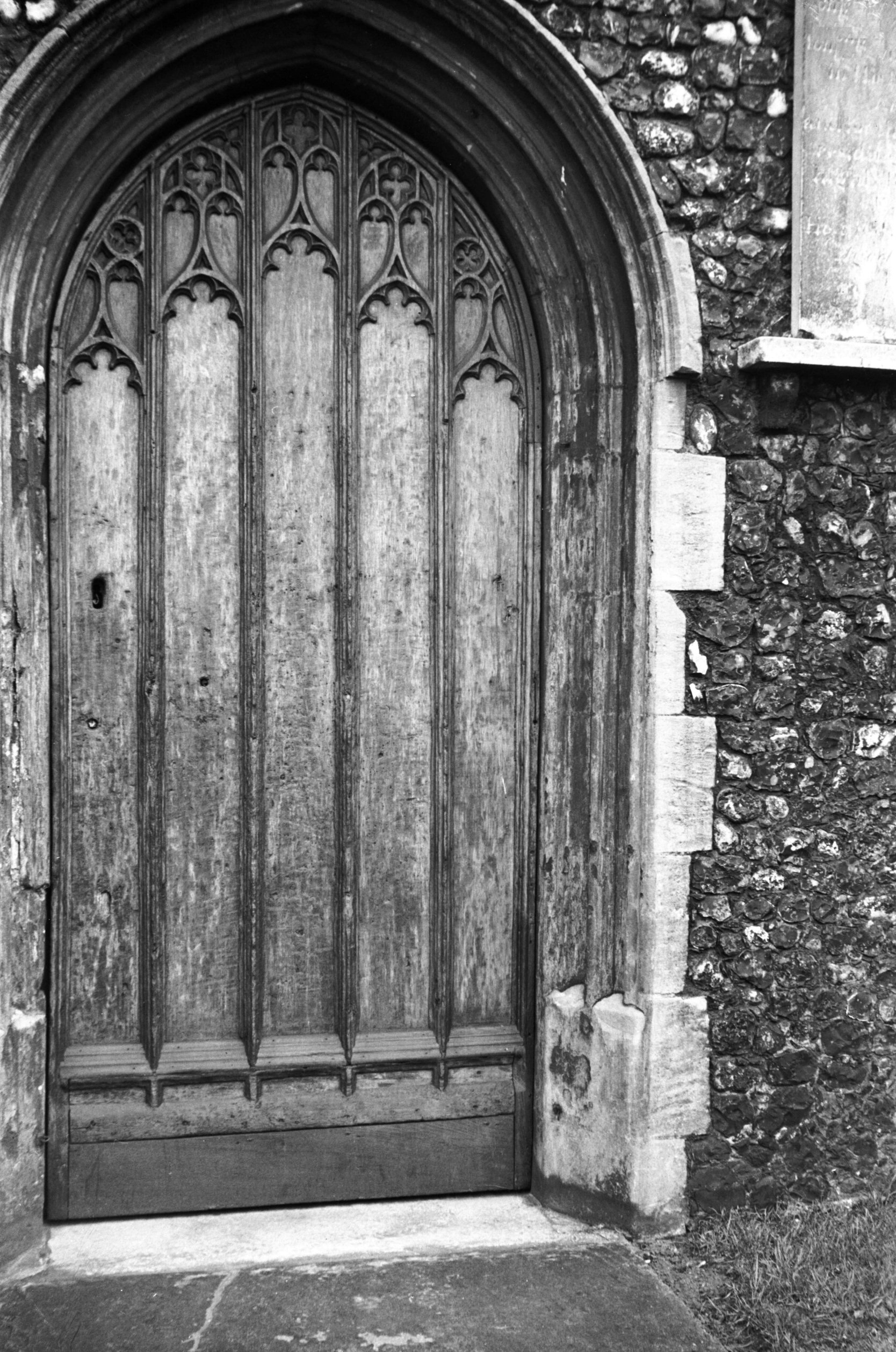
St Peter Hungate 15c north doorway [1929] 1937-08-25
With fine Perpendicular tracery. |
|
|
St Peter Hungate interior view east [1924] 1937-08-25
|
|
|
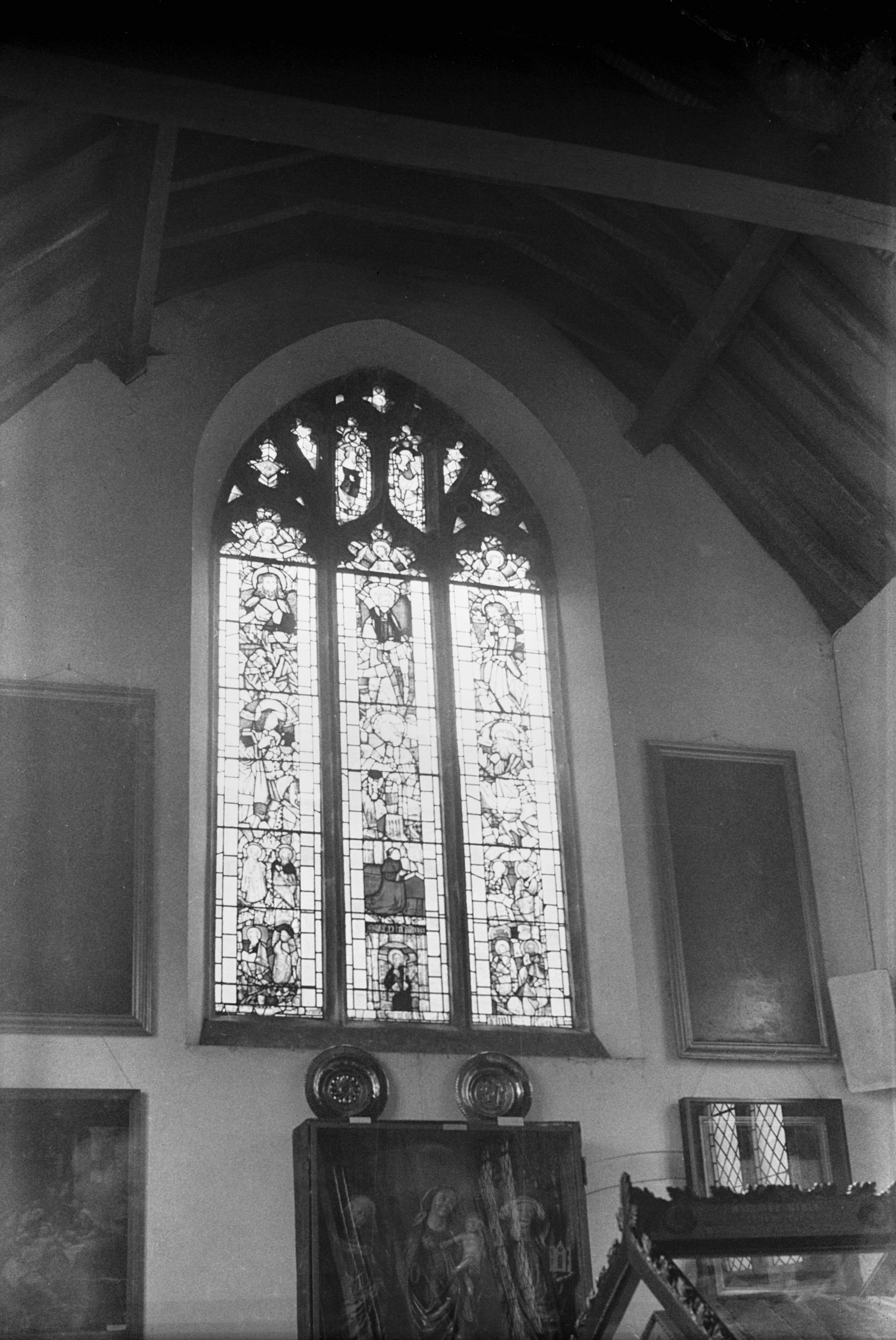
St Peter Hungate east window [1925] 1937-08-25
15c and 16c glass. |
|
|
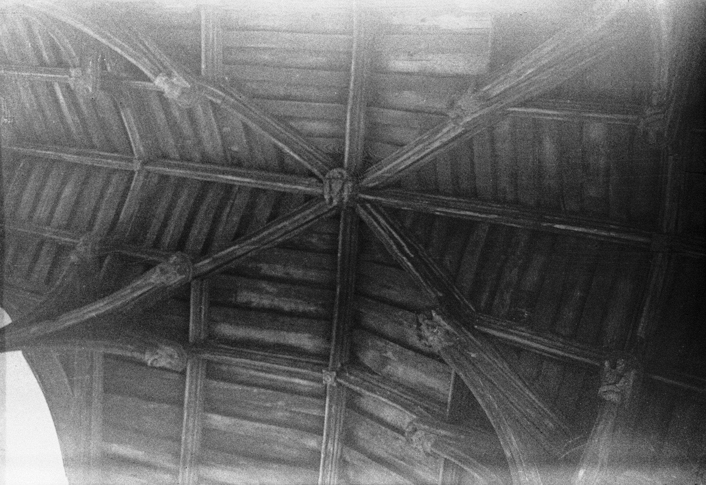
St Peter Hungate crossing roof [1927] 1937-08-25
Great cross ribs and large wooden boss. |
|
|
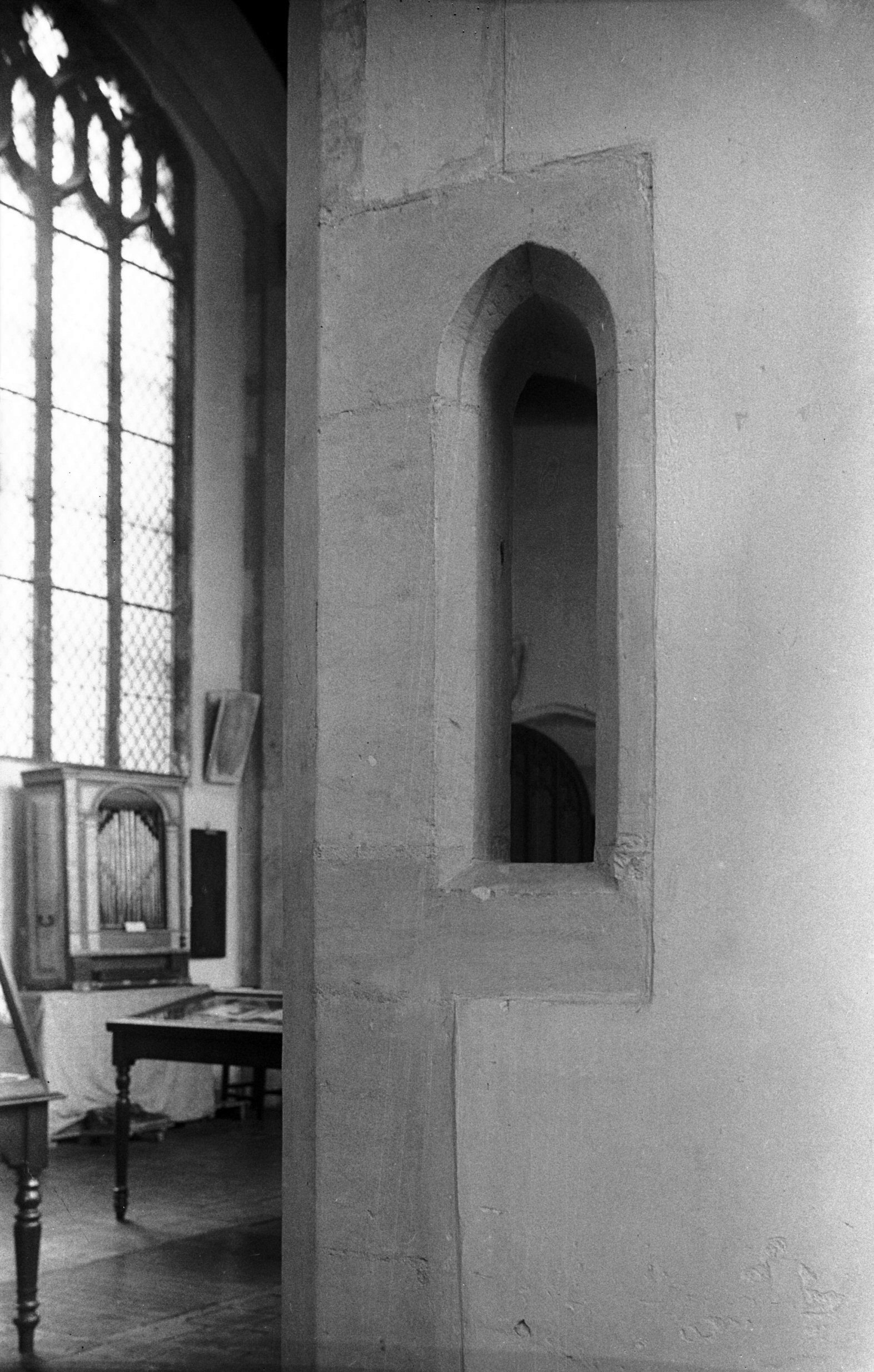
St Peter Hungate squint from nave [1926] 1937-08-25
Northerly one of a pair of squints or hagioscopes from
nave into side chapels. |
|
|
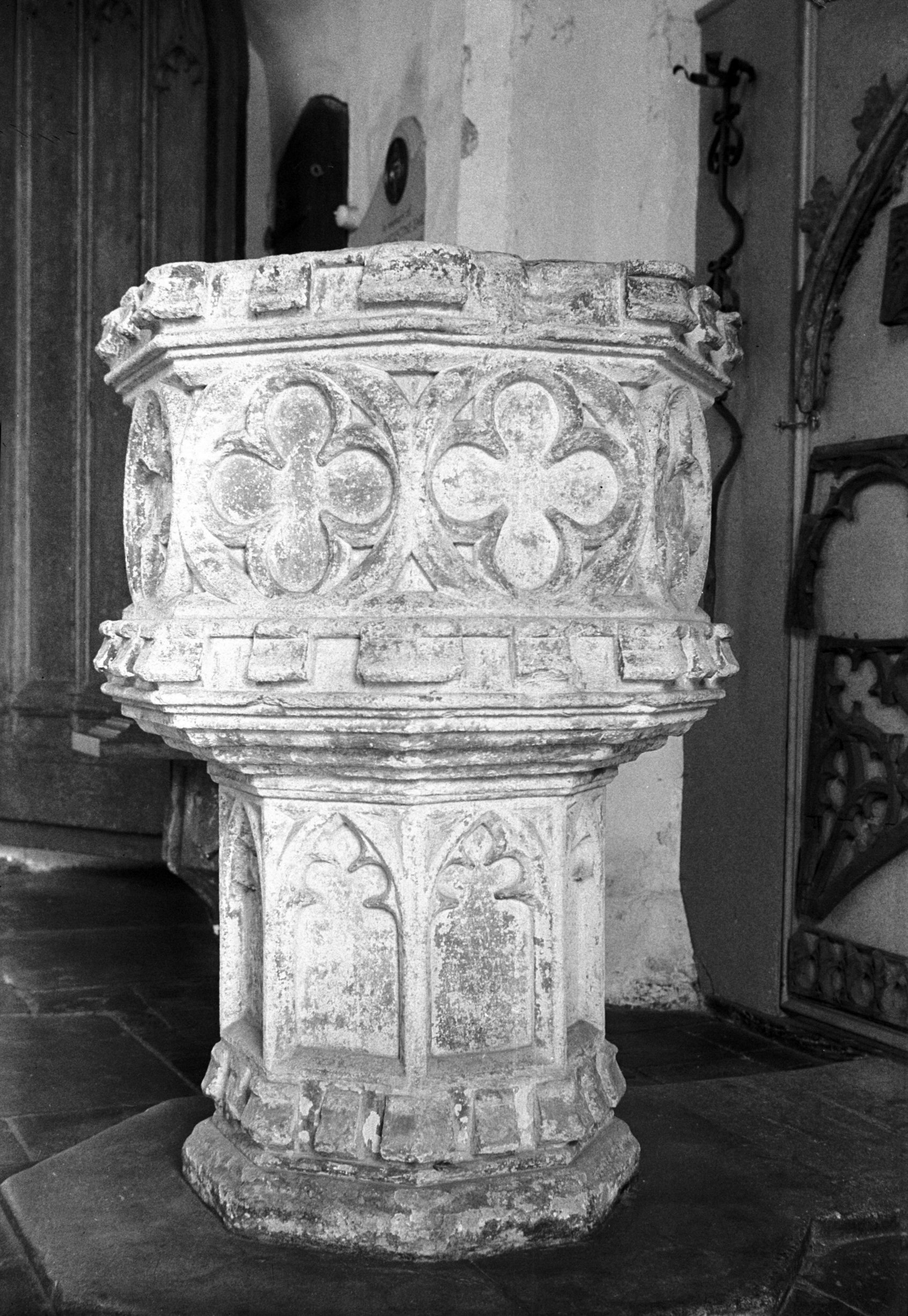
St Peter Hungate 15c font [1928] 1937-08-25
Early 15c with traceried bowl and shaft, the bowl having
top and bottom battlemented mould. |
|
|
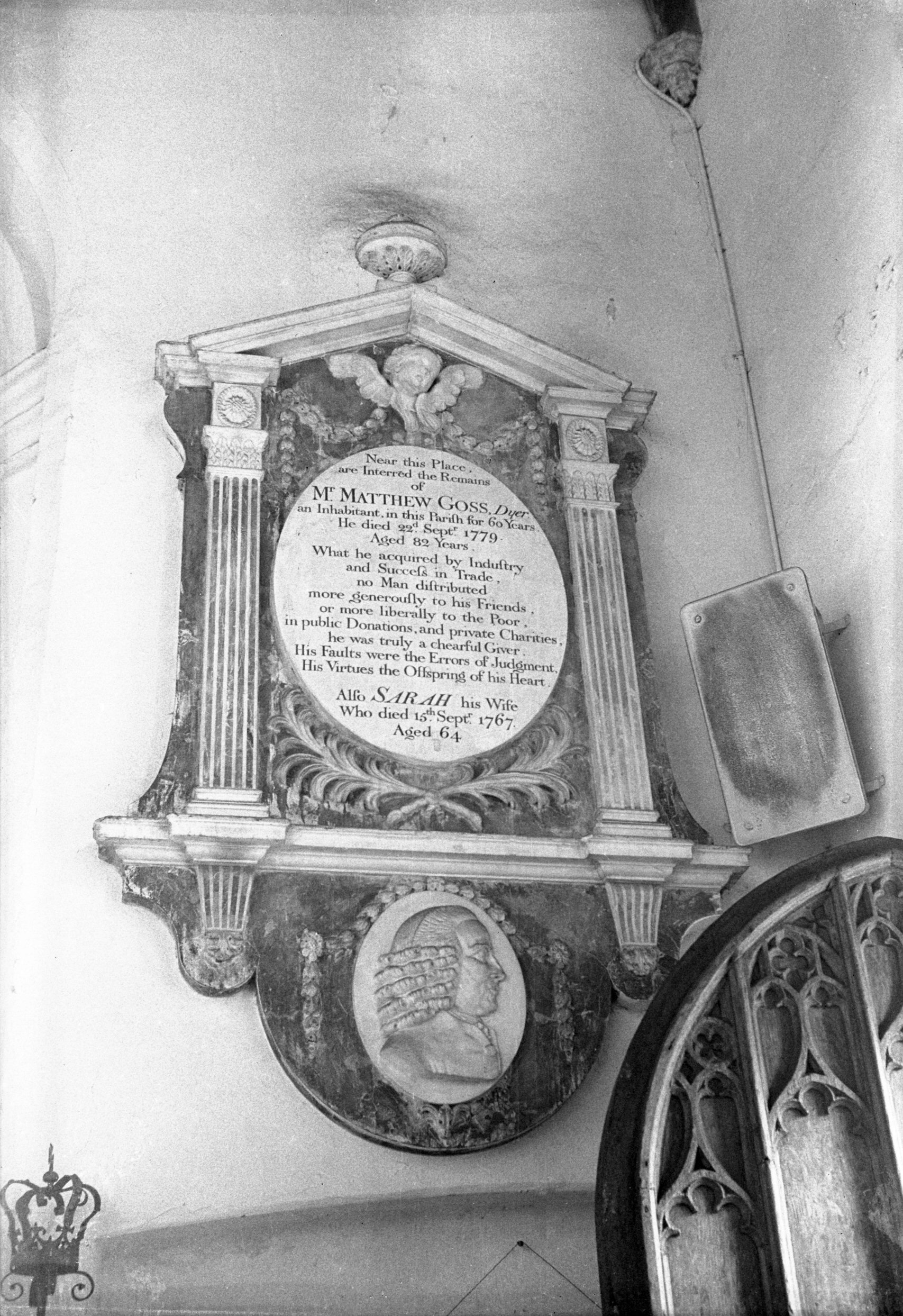
St Peter Hungate Matthew Goss monument [1930]
1937-08-25
Matthew Goss, died 1779. In 1757 he presented to the City
the Mayor's Chain with medal. He was himself never Mayor. |
|
|
Princes St Mandell's Court rear of W side [1102]
1936-07-12
From St Peter Hungate churchyard. |
|
|
Princes St Mandell's Court view NW [2899] 1939-03-31
|
|
|
Princes St 8 to 12 [1100] 1936-07-12
|
|
|
Princes St 14 [2718] 1938-08-15
The messuage of Ralph Gunton, Notary in 1414 and of
Thomas Bromefield, surgeon, in 1498-99. Afterwards of
Thomas Baget, physician, and in 1535-36 of Thomas Cappes,
doctor. In 1622 and 1626 Lady Juliana Barney, widow, held
it. |
|
|
Princes St 14 [3623] 1946-04-19
|
|
|
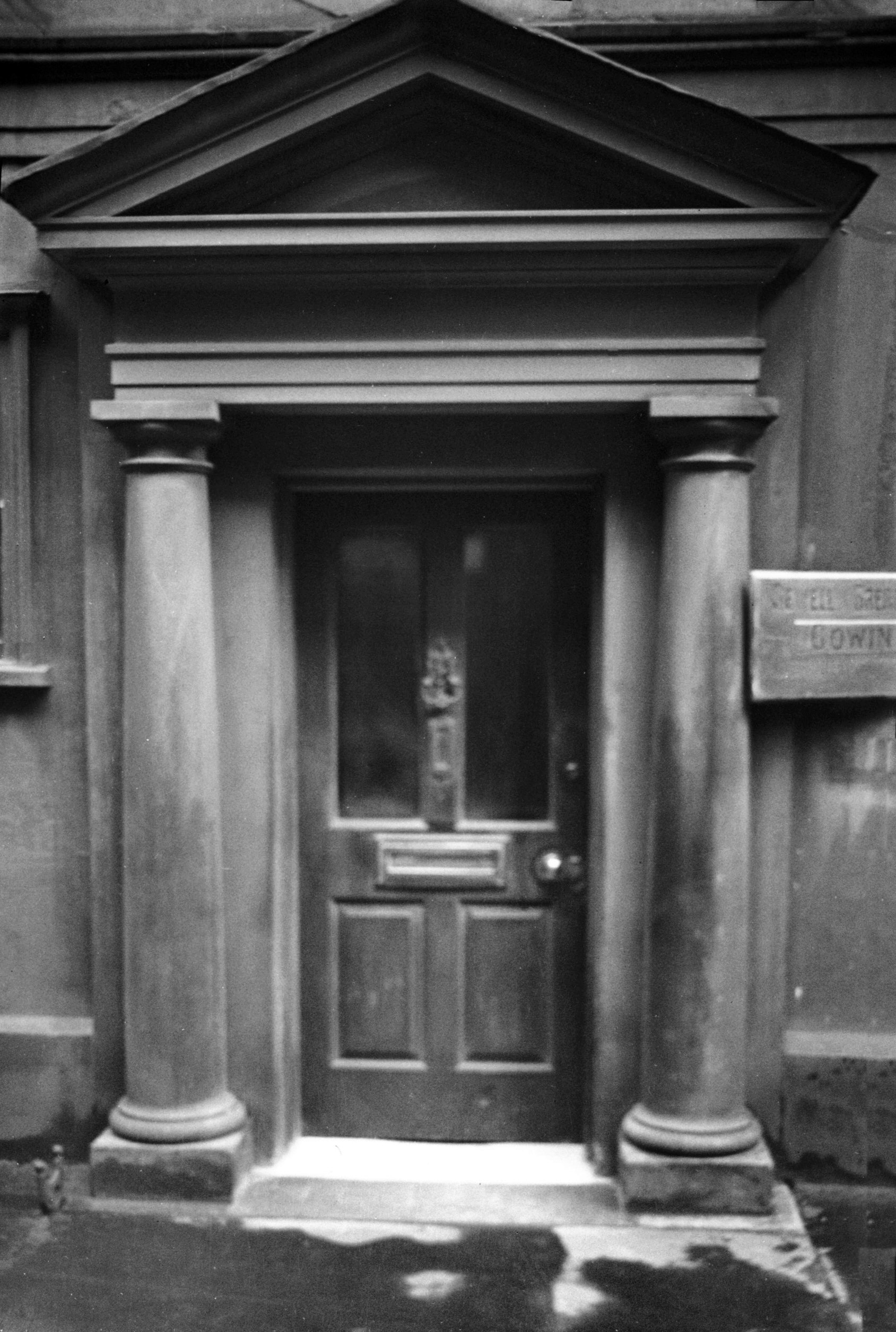
Princes St 14 Georgian doorway [0480] 1935-04-20
|
|
|
Princes St 14 to 26 St George Tombland [0607]
1935-08-05
|
|
|
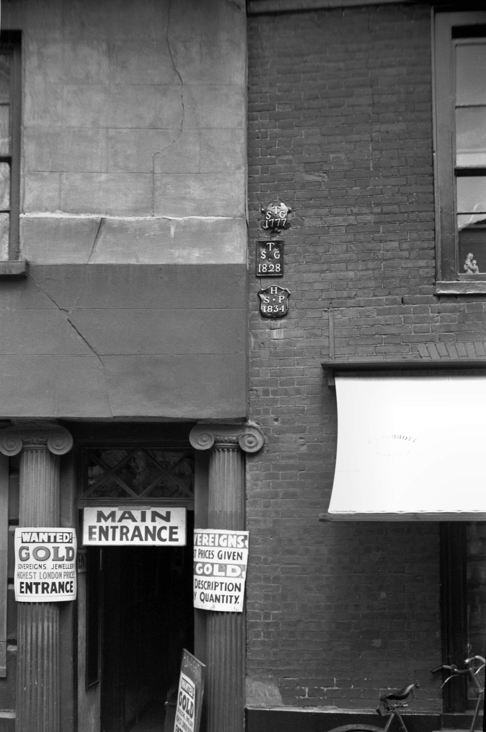
Princes St 16 boundary plates [0178] 1934-08-07
High up on the wall of No 16, are two (but formerly
three) parish boundary plates, a feature to be seen
dotted around the city at various points. 200 years ago,
when each parish was responsible among other things for
the maintenance of its poor, the exact demarcation of
boundaries was very necessary. This was especially so in
a place like Norwich, where the boundaries of some
three-dozen parishes interlock like an intricate jigsaw
puzzle. In 1934, when a count was taken, 173 of these
leaden plates were still found attached to buildings,
with 17 others in museums or in private hands.
The oldest parish mark, not a plate but an inscribed
stone, in set in the front wall of the Coach and Horses
public house in Bethel St, marking the boundary between
St Giles and St Peter Mancroft parishes; this is dated
1710. The latest one is for St Benedict and is dated
1854. An unusual one for All Saints' parish declares,
"A.S.P. ends here. 1778". Others include
symbols of the parish saints, such as an anchor for St
Clement and a knife for St Bartholomew. Of the two still
here in Princes St one dated 1834 is for St Peter
Hungate; the other, dated 1777, is for St George
Tombland. The one now missing was also for St George and
dated 1828. None of the three was marked with a symbol. |
|
|
Princes St 16 to 18 Princes Inn site of [2717]
1938-08-15
See also 168 King St. |
|
|
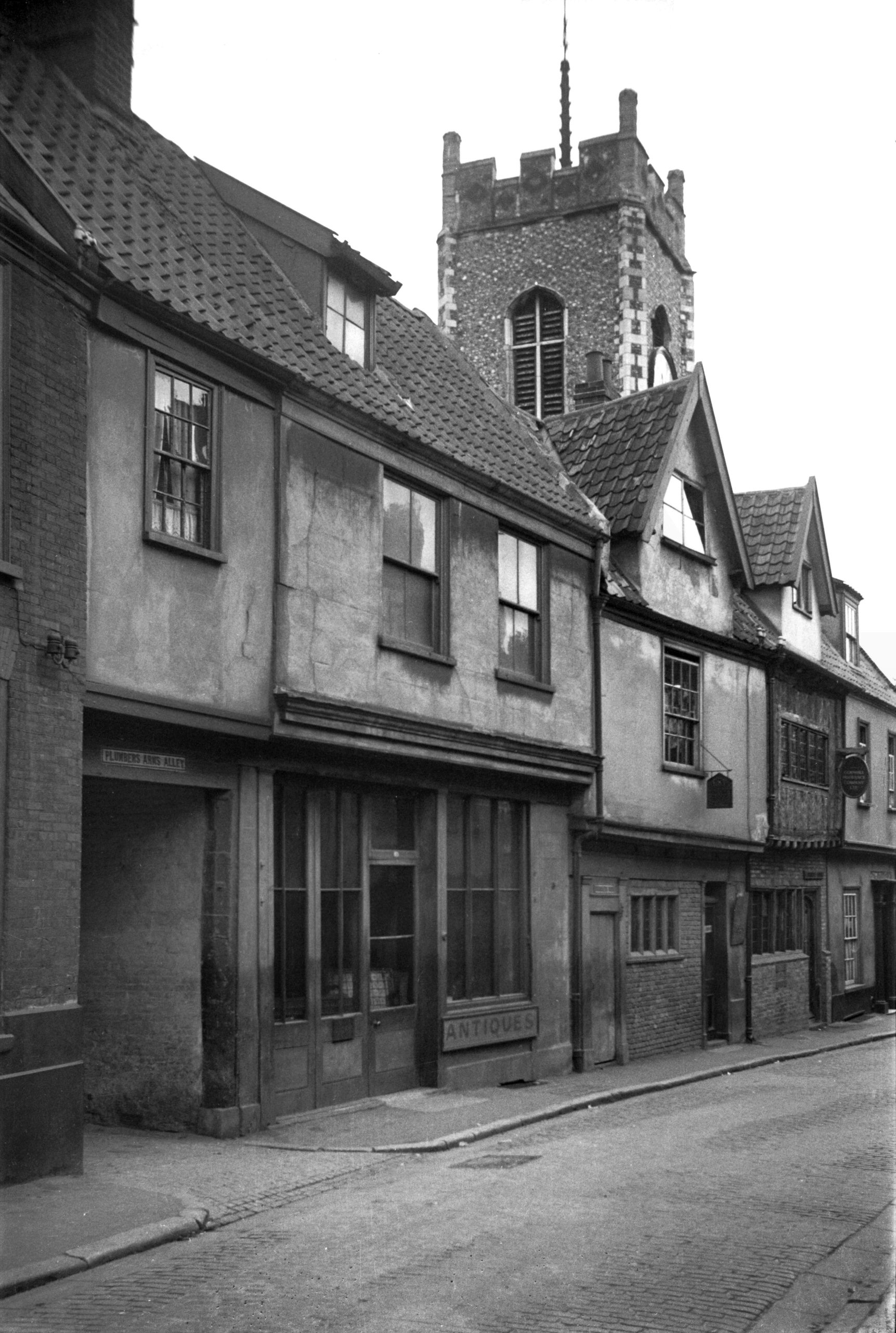
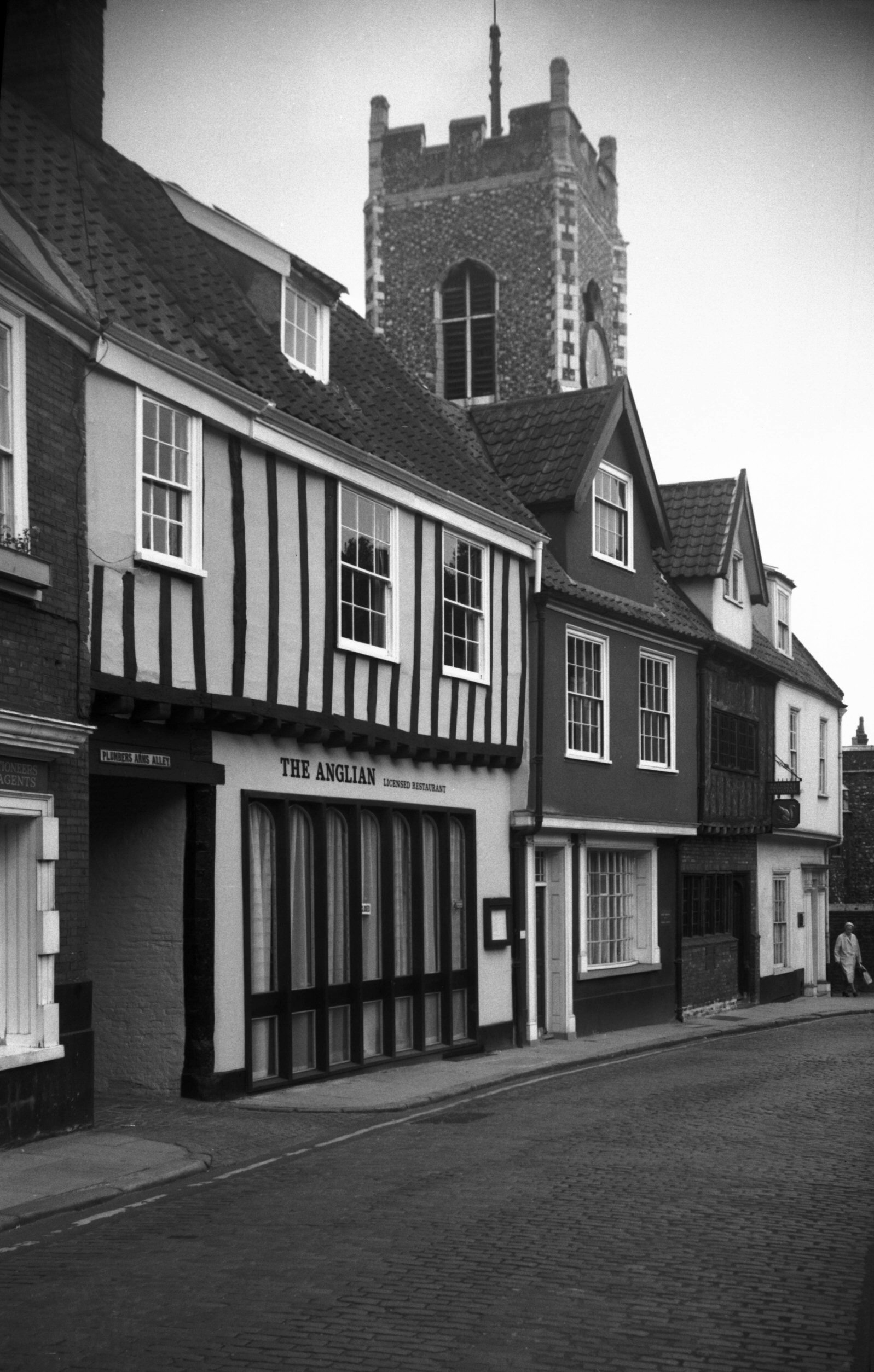
Plumbers' Arms Alley view south [0627] 1935-08-09
Between 18 and 20 Princes St. |
|
|
Plumbers' Arms Alley view north [2898] 1939-03-31
|
|
|
Plumbers' Arms Alley east side [6491] 1988-04-12
|
|
|
Princes St 20 to 26 [1101] 1936-07-12
|
|
|
Princes St 20 to 26 [5306] 1970-08-29
|
|
|
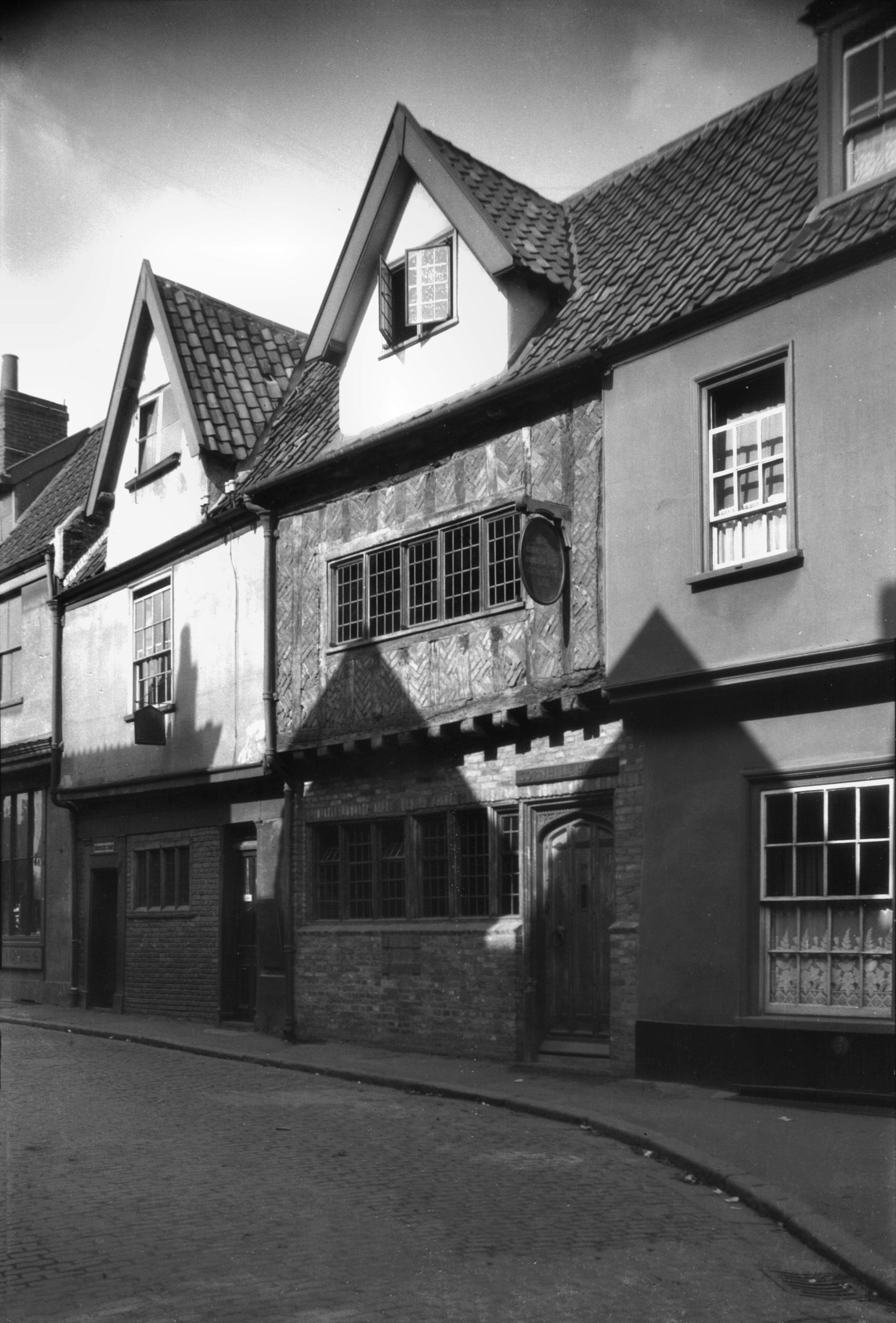
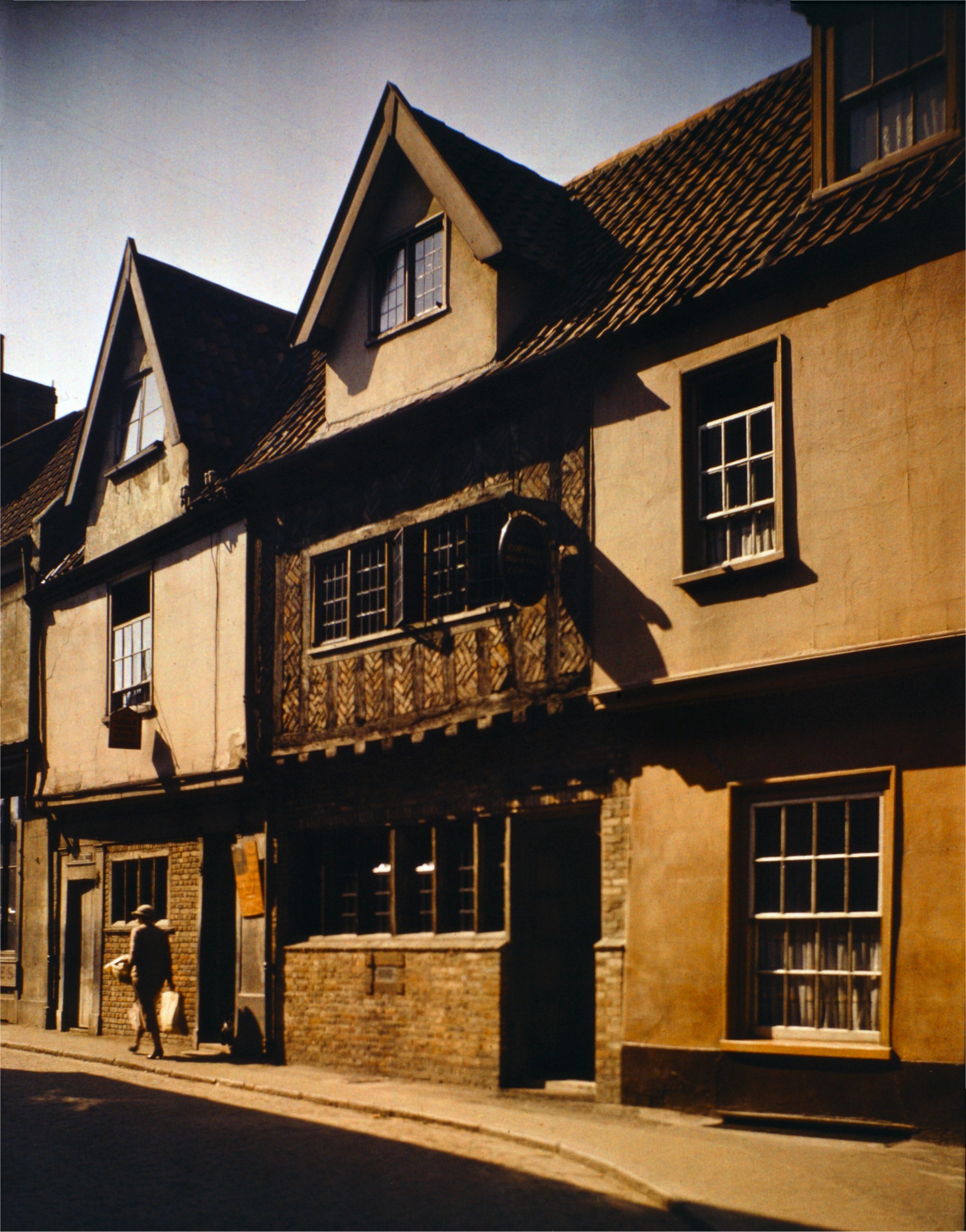
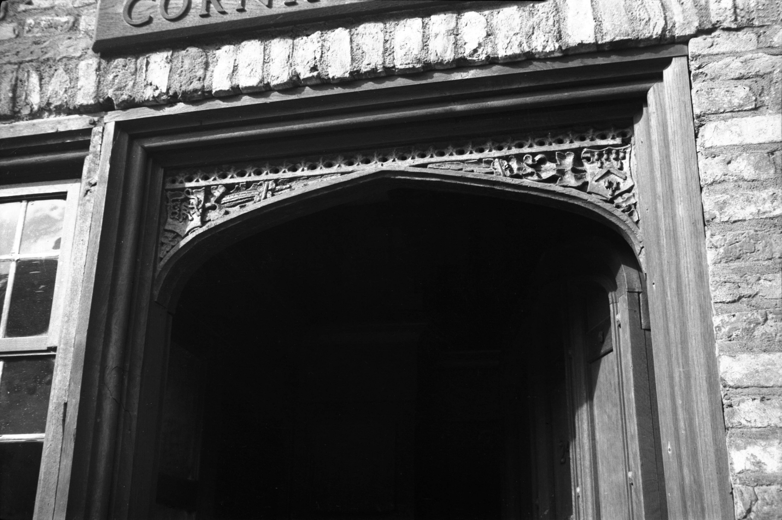
Princes St 22 to 24 Cornhill House [0297] 1934-09-23
No 24 is a Tudor building restored in 1932 by local
architect Cecil Upcher for the Cornhill Insurance
Company. The work included among other things the
construction of a dormer in the roof and the stripping of
the plaster from the front of the first floor. This
brought to light the original timber frame with its
infilling of bricks laid in herringbone fashion.
The wooden lintel above the front door, although ancient,
is not an original feature; it came from l5 Fyebridge St,
formerly the residence of Edmund wood, a grocer who was
Sheriff in 1536 and Mayor in l548. In the spandrels of
the arch are his arms and those of the Grocers' and
Mercers' companies.
According to Edward Tillett in his account of St George's
parish, this and the house next door at No 26 were
formerly one property, a tavern with the sign of the
Horse and Groom. First mentioned in 1784, it received
four years later the sum of 6s 1d from the churchwardens
"for repairing windows...broken in doing repairs to
the Church".
No 26, by the way, was restored by Mr Upcher in 1956; a
long Tudor window frame was found and left in position.
The front of the building had been "modernised"
in Georgian times, with sash windows and a pillared
doorway. |
|
|
Princes St 22 to 24 COLOUR [0964] 1936-05-16
|
|
|
Princes St 24 doorway carved lintel [3756] 1948-09-11
|
|
|
Princes St 26 [6413] 1986-07-07
|
|
Quakers Lane: |
| |
From
St Martin's
Lane to Gildencroft |
|
|
Quakers Lane 3 to 5 [0864] 1936-04-10
See 47 St Martin's Lane for
weavers' cottages on east side of Quakers Lane.. |
|
Quayside: |
| |
From
Wensum St / Fyebridge
St to Bedding Lane
passing Pigg Lane |
|
|
Quayside 3 [0974] 1936-05-18
|
|
|
Quayside 6 [6622] 1990-07-12
|
|
|
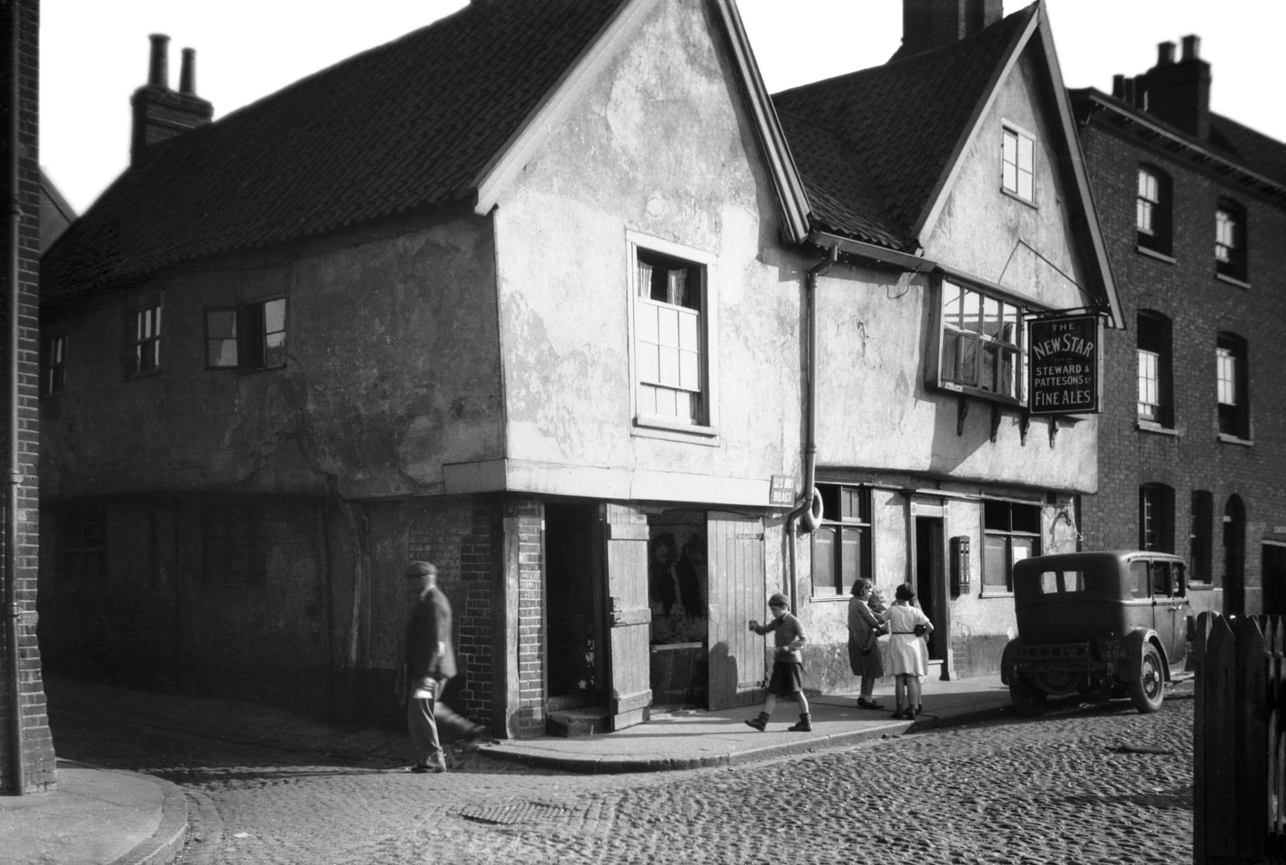
Quayside 8 New Star PH [0973] 1936-05-18
At No 8 Quayside, at the northwest corner of Pigg Lane,
stood the New Star inn. This was a timber-framed
building, having the ground-floor walls of brick, jettied
first floor, and gabled attic storey. The upper walls
were plastered and colourwashed. When in 1871 it was
acquired by the brewers Steward and Patteson it was
apparently known as The Jolly Young Waterman but a
directory of 1877 lists it by its later name. Repaired
and redecorated in 1954, when it was described as being
among the city inns scheduled for preservation, it was
closed only three years later, and the suggestion was
then made that the City Council should buy it and convert
it into two dwellings. Although this proposal was turned
down on the grounds of cost, the old inn was nevertheless
included in a list of buildings of special architectural
and historic interest, its possible use as a store and
workshop meeting with disapproval.
Despite an offer by the Norwich Society to raise money to
restore it, all this was rescinded in 1962 after it had
been privately acquired, and demolition followed in March
of the next year. It was then that the discovery was made
that it was not a Tudor building but one of earlier date,
incorporating a former mediaeval warehouse, the only one
of its kind to have survived in the city up to that time,
and one of the comparatively few existing in England.
Originally the warehouse was separated by a passage from
the merchant's own house, but the two were, in Tudor
times, made into one set of premises which survived until
1963.
As a postscript, and as though to eradicate finally all
traces of the street's antiquity, the ancient cobbled
paving was taken up in the following year, to be replaced
by a smooth surface of tarmac. |
|
|
Quayside 8 New Star PH Pigg Lane side [3026]
1939-05-29
|
|
|
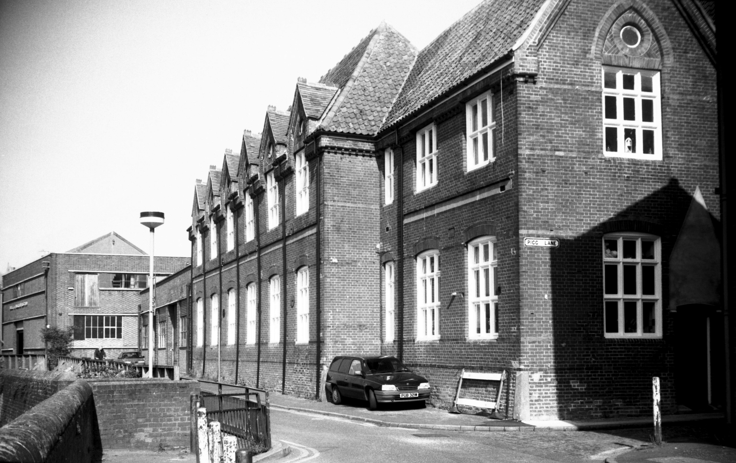
Quayside former school building [7749] 2000-05-05
Former Quayside Boys and special school. |
|
|
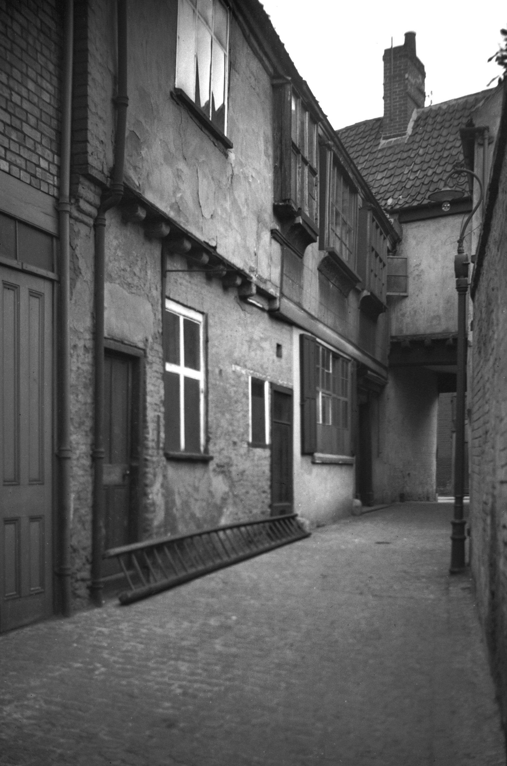
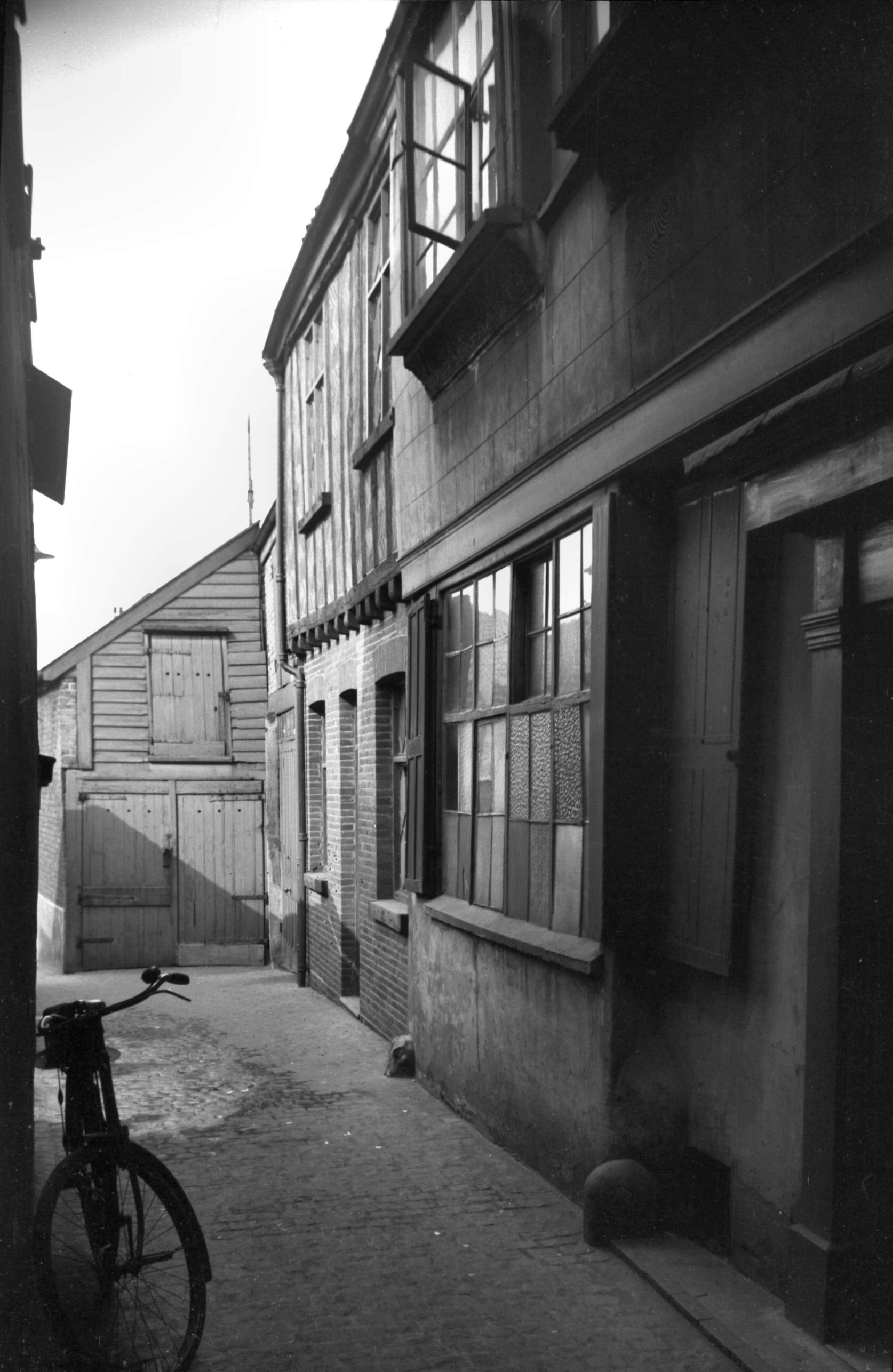
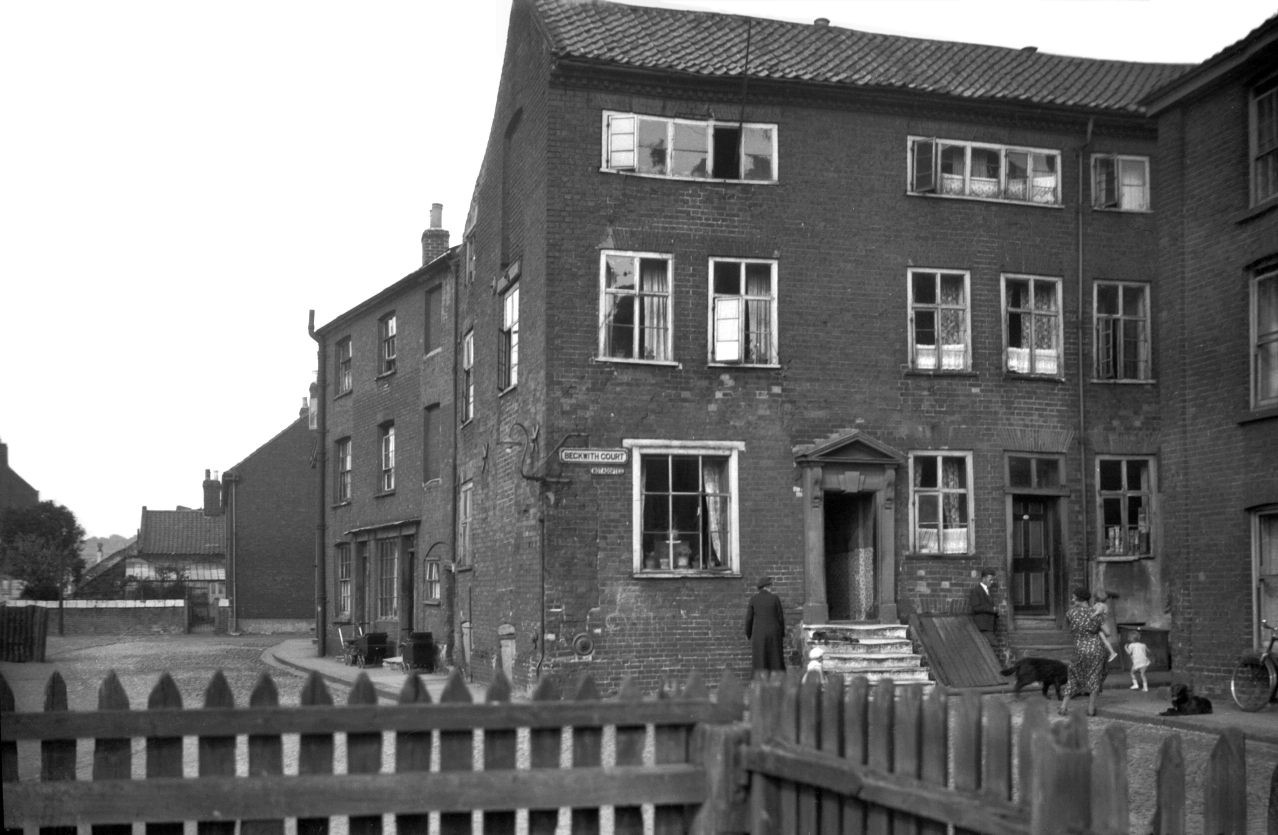
Quayside Beckwith's Court [0994] 1936-06-09
Connecting Quayside to St Martin-at-Palace Plain is
Bedding Lane, which was known as Baddinges Went late in
the 13c. The historian John Kirkpatrick 400 years later,
however, stated "it is now called the Three Privy
Lane." At this, the eastern, end of Quayside
formerly stood a number of tall houses, late Georgian in
origin. Those in Beckwith's Court had in their attic
storeys casement windows of the type usually associated
with weaving. By the mid-1930s these houses had fallen
upon hard times, becoming divided up into multiple
occupation.
Among the several courts that were formerly hereabouts
one had the curious name of Cock and Pie Yard, no doubt
adopted from a public house of that name. Larwood and
Hotten in their History of Signboards stated that
this was once a common sign and considered that it
derived from the Peacock and Pie. In ancient times the
peacock was a favourite dish, being introduced to the
table in a pie, the head elevated above the crust with
beak gilded and tail feathers extended. |
|
Queen's Rd: |
| |
From
St
Stephen's Rd / Chapel Field Rd / St
Stephen's St to Ber St / Bracondale / City
Rd
passing All Saints Green, Grove
Rd, Surrey St, Hall
Rd
West side |
|
|
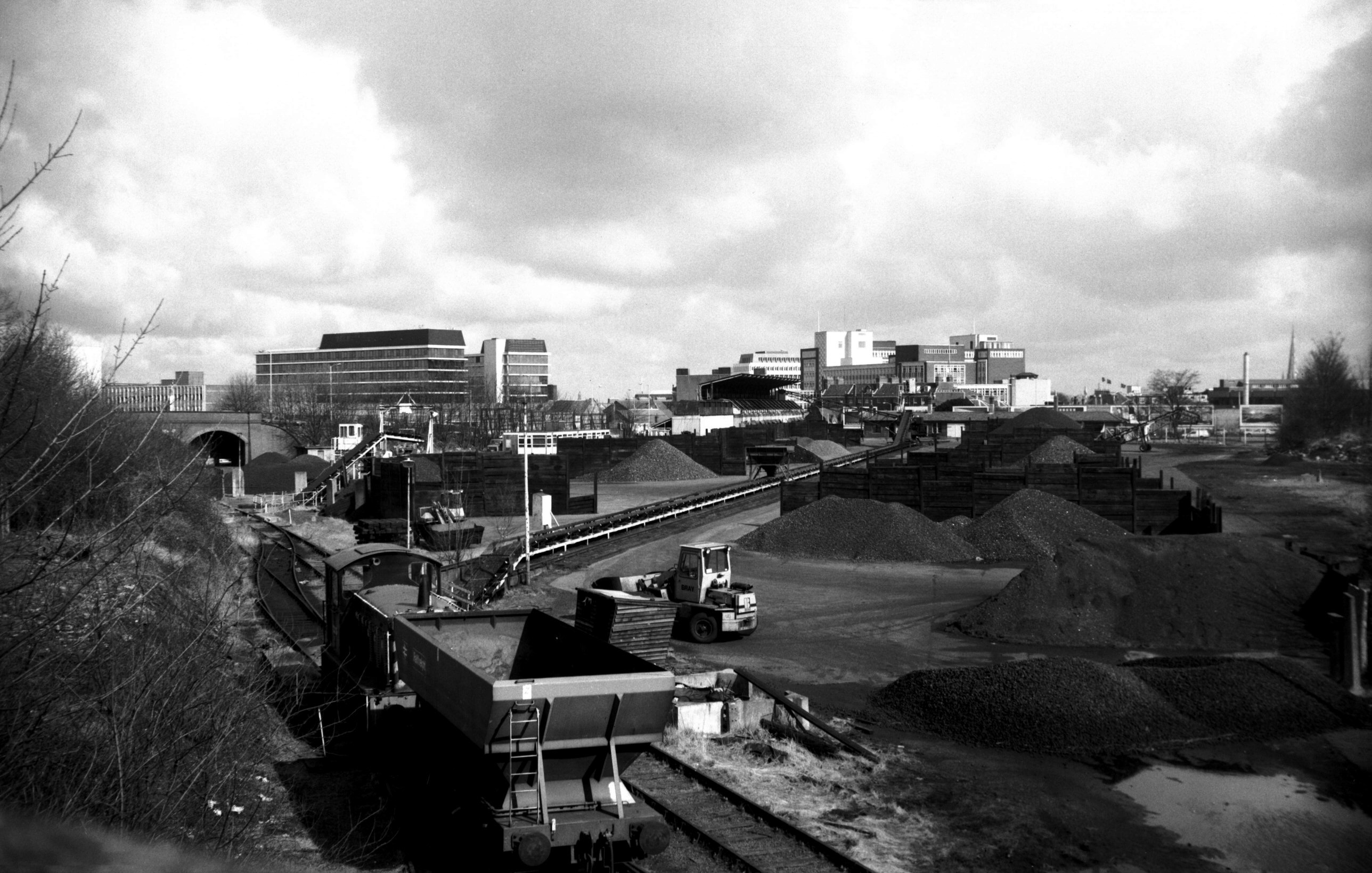
Queen's Rd Coal depot from Southwell Rd [6358]
1986-04-04
|
|
|
Queen's Rd 111 former Coop bakery [6448] 1987-04-17
Built 1914, architects E.Boardman and son. |
|
|
Queen's Rd Primitive Methodist chapel [6447]
1987-04-17
Built 1872, architect Edward Boardman. |
| |
East
side |
|
|
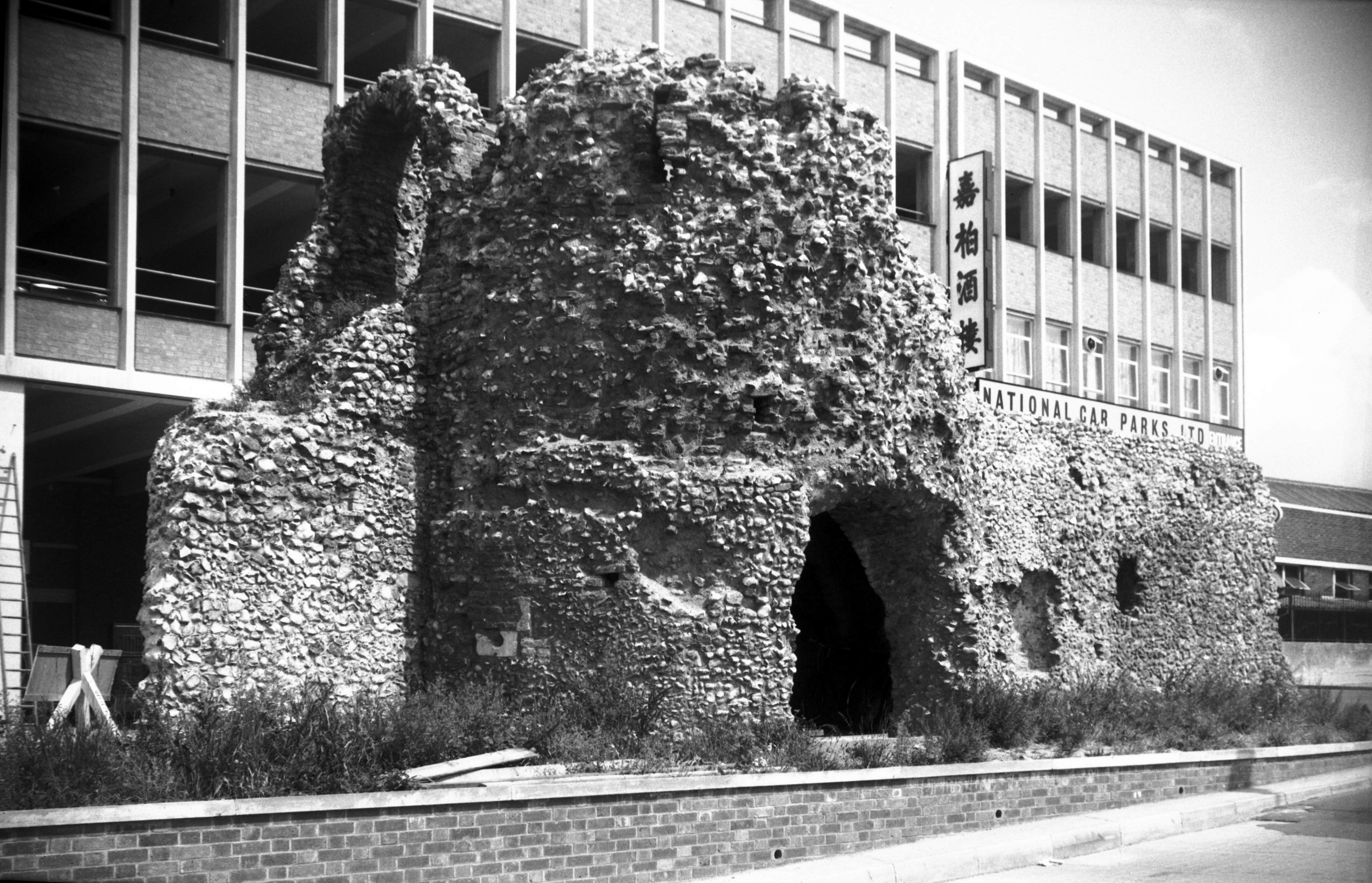
Queen's Rd tower from Bull Lane [0092] 1934-05-10
|
|
|
Queen's Rd tower from Queen's Rd [4663] 1962-05-06
With the road from London leading directly to St
Stephen's St the gate here was perhaps the most important
in the city's circumvallation. Certainly it was the most
imposing in appearance, with a tower on either side
surmounted by battlements, and with the city arms above
the outside arch. What an attraction to antiquarians it
would have been were it standing today, though it would
have posed a problem for present-day traffic. It was,
however, demolished in 1793; no price was charged, the
work being done in exchange for the materials of the gate
alone. This "price" included the paving of 22
yards of the carriageway and finishing an abutment to the
wall, although £20 would be allowed if rusticated piers
were introduced.
On 20th October 1908, the council requested the City
Committee to make a report on the condition of the old
city wall with the possibility of further exposing it to
view. Seven months earlier, when some worn-out cottages
were being demolished in Coburg St, a small section of
the city wall upon which these houses had been built had
collapsed, and it may have been this that prompted the
request for a survey. City Engineer Arthur Collins
presented his report in 1910, but four years later with
the advent of war matters had to be held in abeyance.
In the 1920s and 1930s certain small parts of the wall
were revealed as opportunity allowed, notably at St
Benedict's and Ber St. The construction of the Inner Link
road and the widening of St Stephen's St in the early
1960s, however, provided the opportunity of opening up
considerable length along Chapel Field Road, together
with a smaller section incorporating a tower at Queens
Road.
The latter, known as the eighth tower, had stood in the
back garden of No 8 Queens Road with only its upper
doorway and rear wall visible to the public from Bull
Lane. For a while its fate hung in the balance, one
councillor describing it as "a bit of old
rubbish", but something of a compromise was reached:
part of the adjoining wall had to go but the tower was
allowed to remain, albeit robbed of the smooth flint
facing of its upper stage. A report published in 1964
mentions the brick vault supporting the first floor and a
doorway to the wall walk on the west side. Subsequent
vandalism unfortunately seems to have damaged if not
destroyed the two 14c gun ports also described. |
|
|
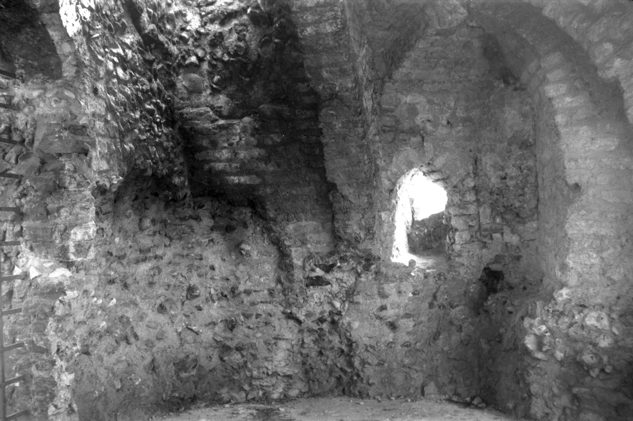
Queen's Rd tower from Bull Lane [4664] 1962-05-06
Showing doorway to wall walk remaining on the west side. |
|
|
Queen's Rd car park construction view NW [4750]
1963-10-05
|
|
|
Queen's Rd tower from Queen's Rd [4806] 1964-08-11
One of two 14c gun ports visible. |
|
|
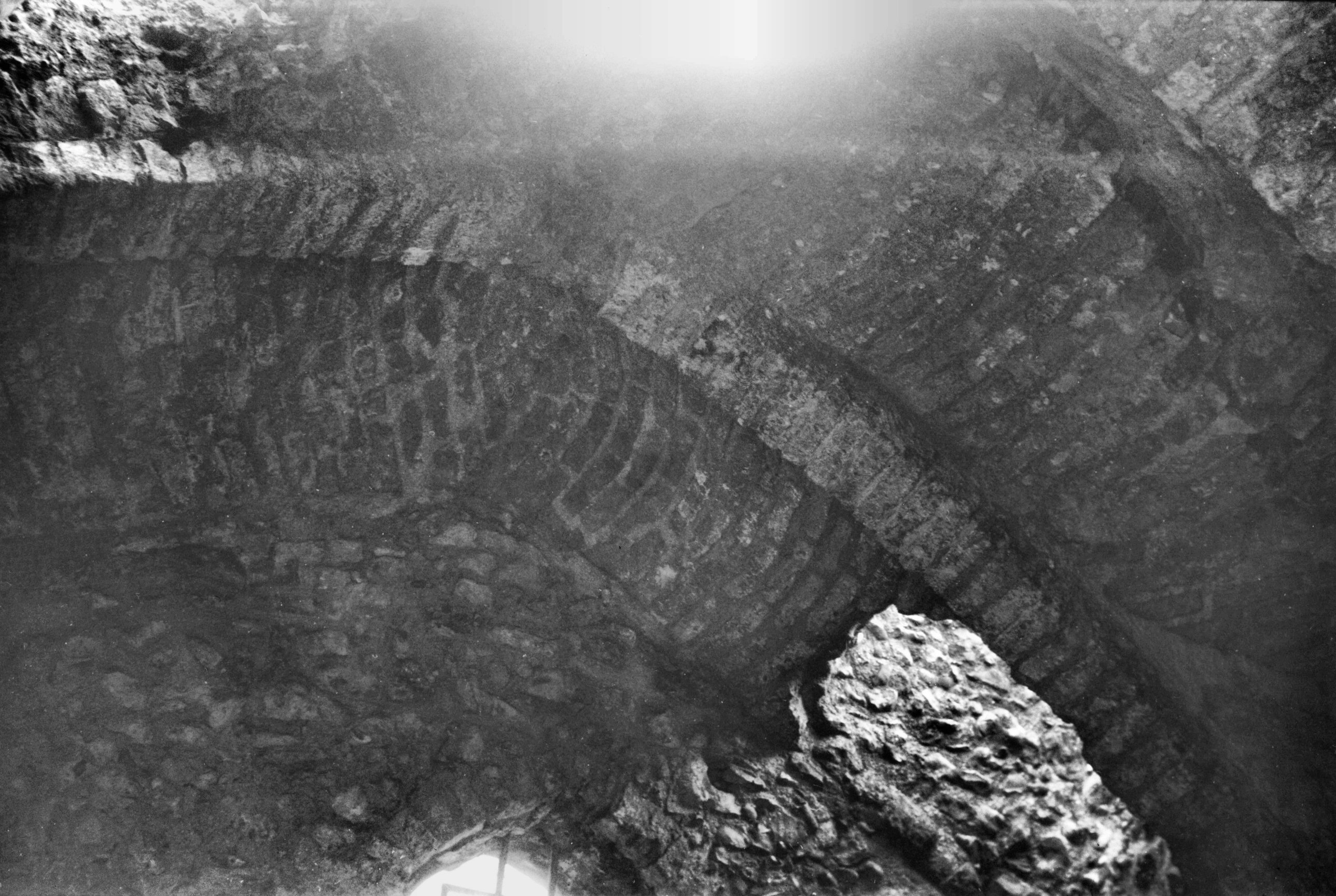
Queen's Rd tower walls and brick vaulting [4889]
1965-04-16
|
|
|
Queen's Rd tower brick vaulting [4890] 1965-04-16
|
|
|
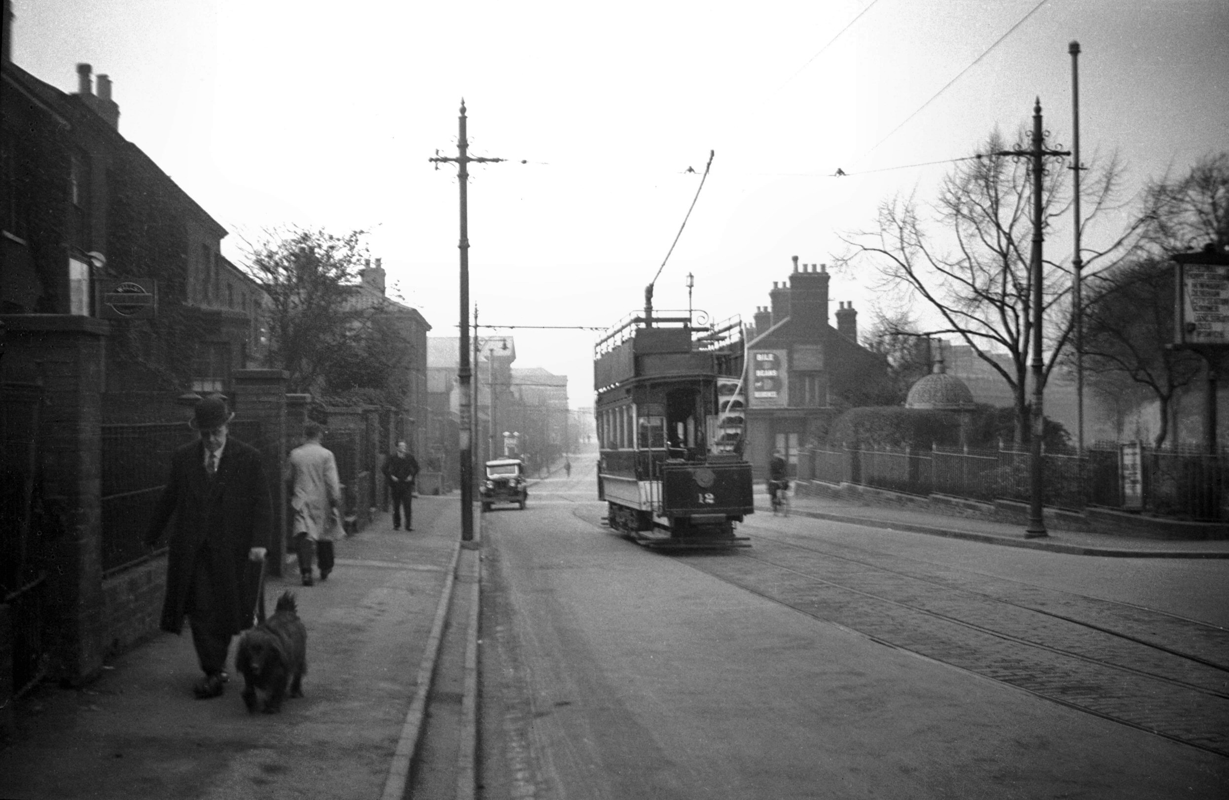
St Catherine's Plain tram on loop line [0038]
1934-02-22
The work of constructing the tramways in Norwich
commenced on 22nd June 1898. On 19th April 1900 trial
trips were made on completed sections, the service being
formally opened to the public on 30th July following. The
bodies of the tramcars, by Brush Electrical Engineering
Co had seats for 26 persons inside and 26 outside.
Commencing in 1923 a number of new tramcar bodies, built
by English Electric Co, were purchased to replace others
which had worn out. These differed in detail and seated
26 inside and 29 outside. Photographed just before
closure. |
|
|
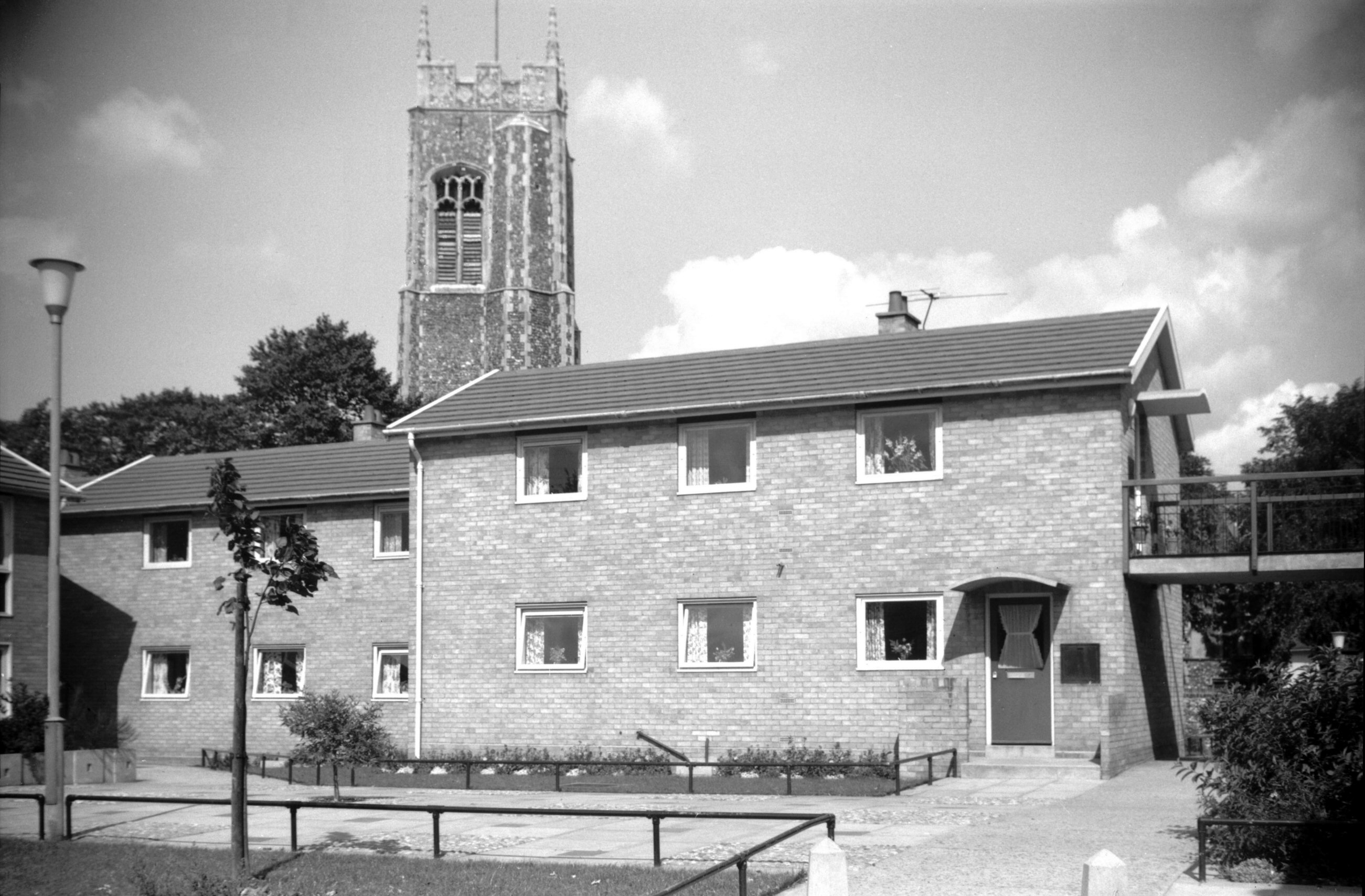
Queen's Rd Alderson Place [4709] 1962-09-07
Erected 1959-60. |
|
Queen St: |
| |
From
Bank Plain / Redwell
St to Tombland / Upper
King St
South side |
|
|
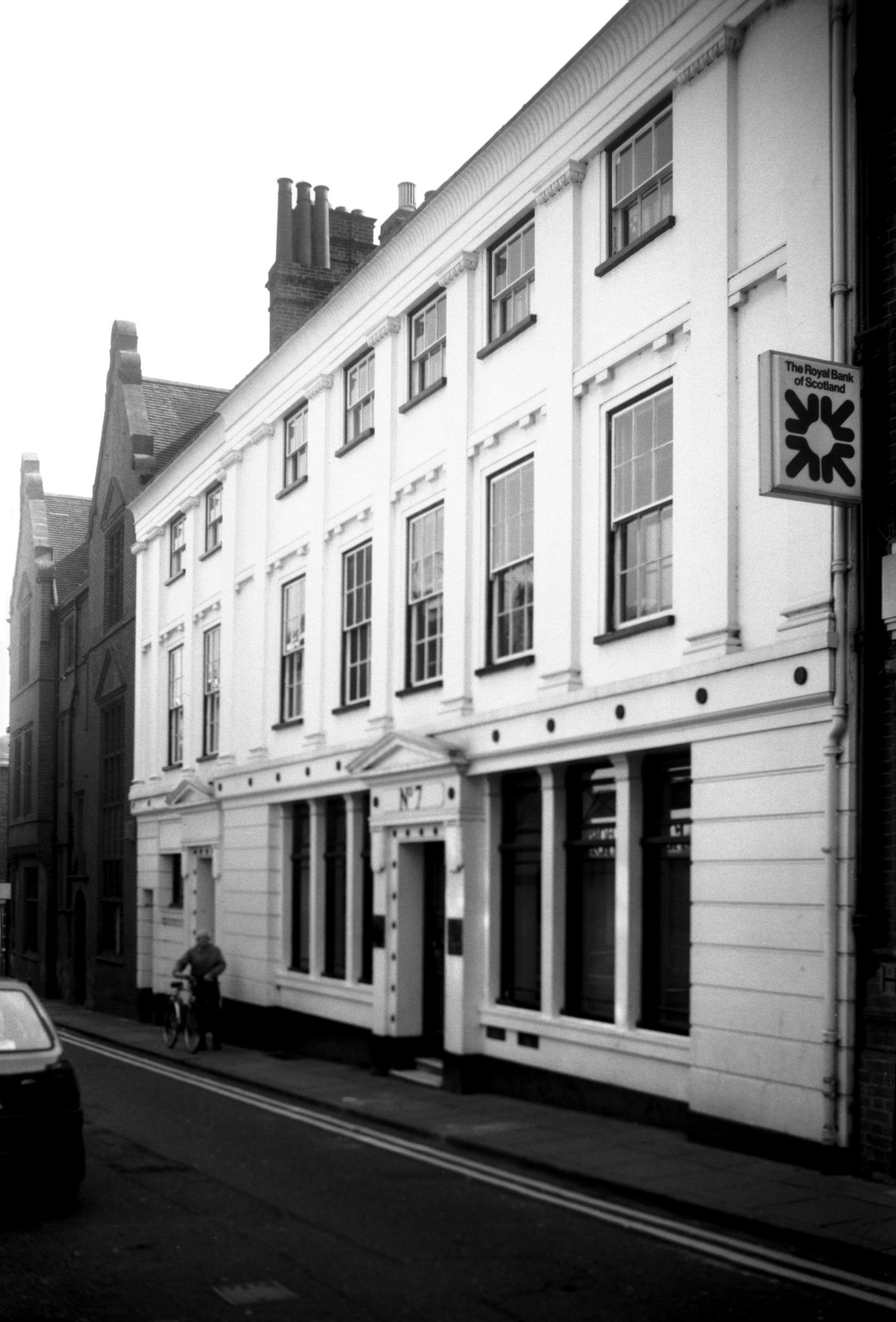
Queen St 1 [1093] 1936-07-12
|
|
|
Queen St 1 Georgian doorway [2095] 1938-02-27
|
|
|
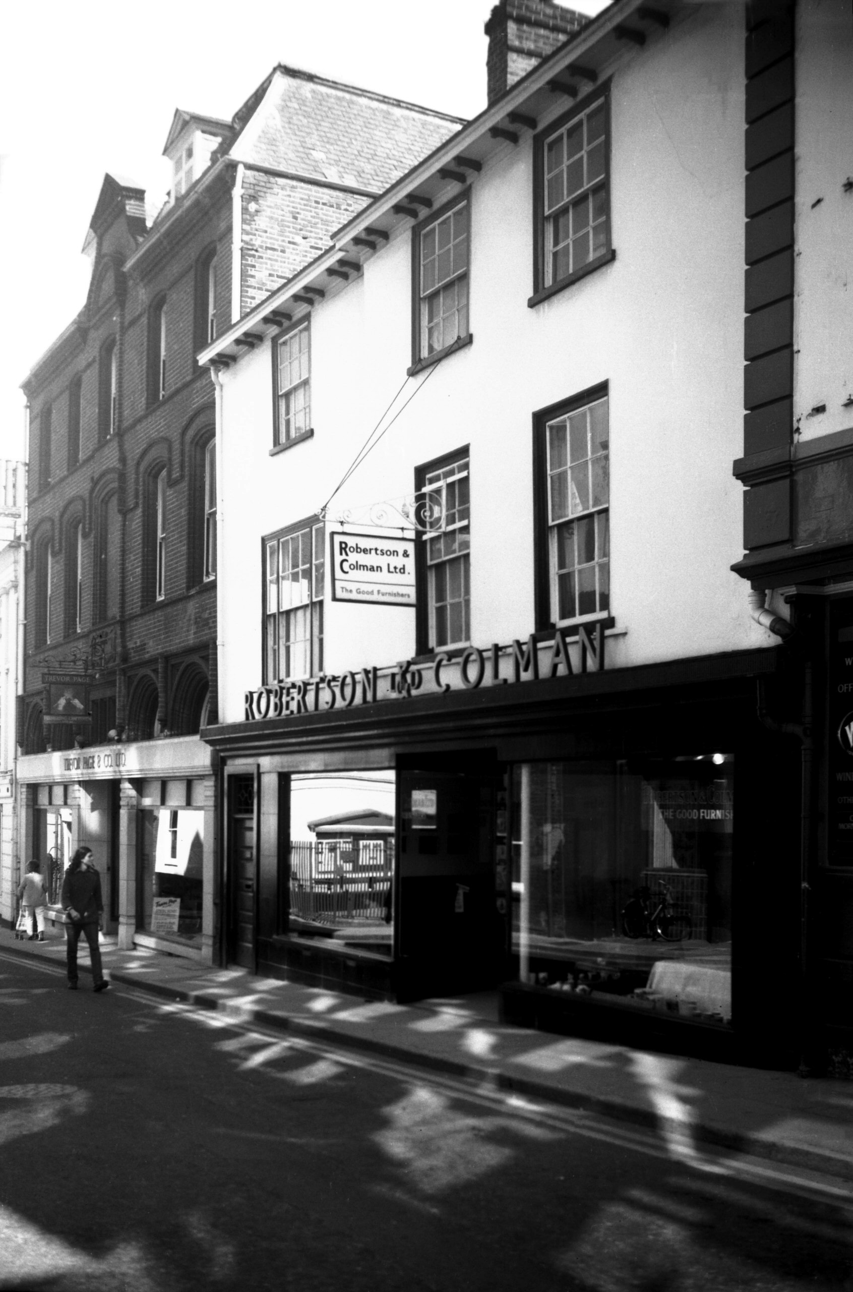
Queen St 3 [6173] 1981-04-17
No 3 is now a modern building, but Ferrier House, the
building that preceded it, was well known by Norwich
folk; it was occupied since 1861 by Robertson and Colman,
a high-class firm of upholsterers and cabinetmakers,
originally trading as Robertson and Sons.
When in 1922 certain alterations were being made to the
premises two important finds were made. The first was a
wooden spandrel carved with the Tudor rose, which Walter
Rye thought dated from about 1475. The other was a
ceiling come 27 feet by 19 feet composed of moulded beams
forming a number of rectangles. Over these were laid oak
bearers, and the spaces between were filled in with
plasterwork on rushes. Although the ceiling was described
as 14c in a brochure published at the time of the
discovery, the writer seems to have overestimated its age
by some 200 years.
During the 16c the house was occupied by the Ferror or
Ferrier family, of whom Robert Ferror was Sheriff in 1507
and Mayor in 1526 and 1536. Later occupants were John
Syer in 1783, and James Nosworthy, jeweller and toymaker,
in 1802 and in 1811, when he was one of the councillors
for the Great Wymer ward. |
|
|
Queen St 7 [7574] 1998-09-06
|
| |
North
side |
|
|
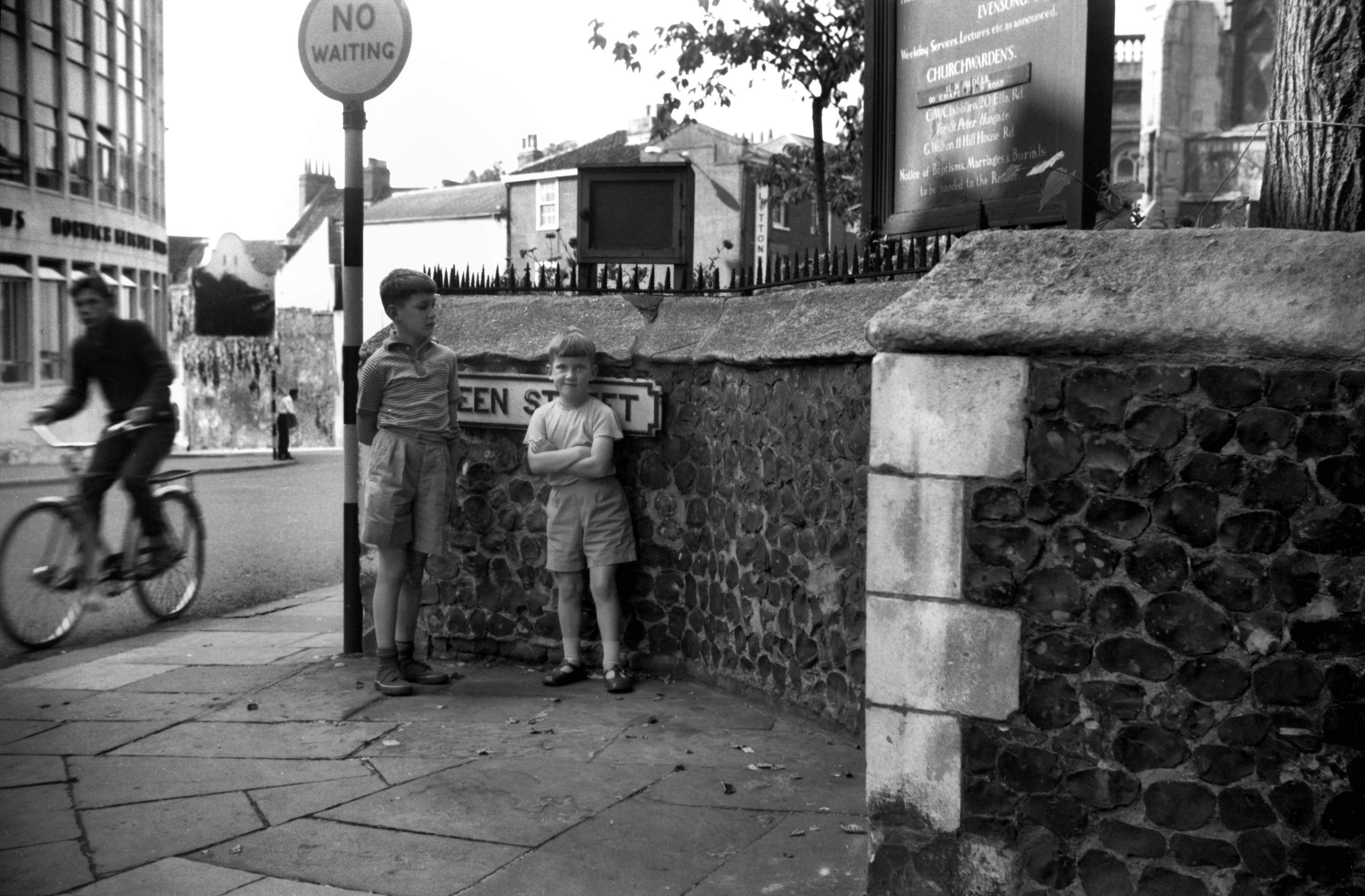
Queen St Red Well site in wall recess [4641]
1961-09-02
Supposedly marks the site of the Red Well from which
Redwell St took its name. Rare photo of the
photographer's two sons. |
|
|
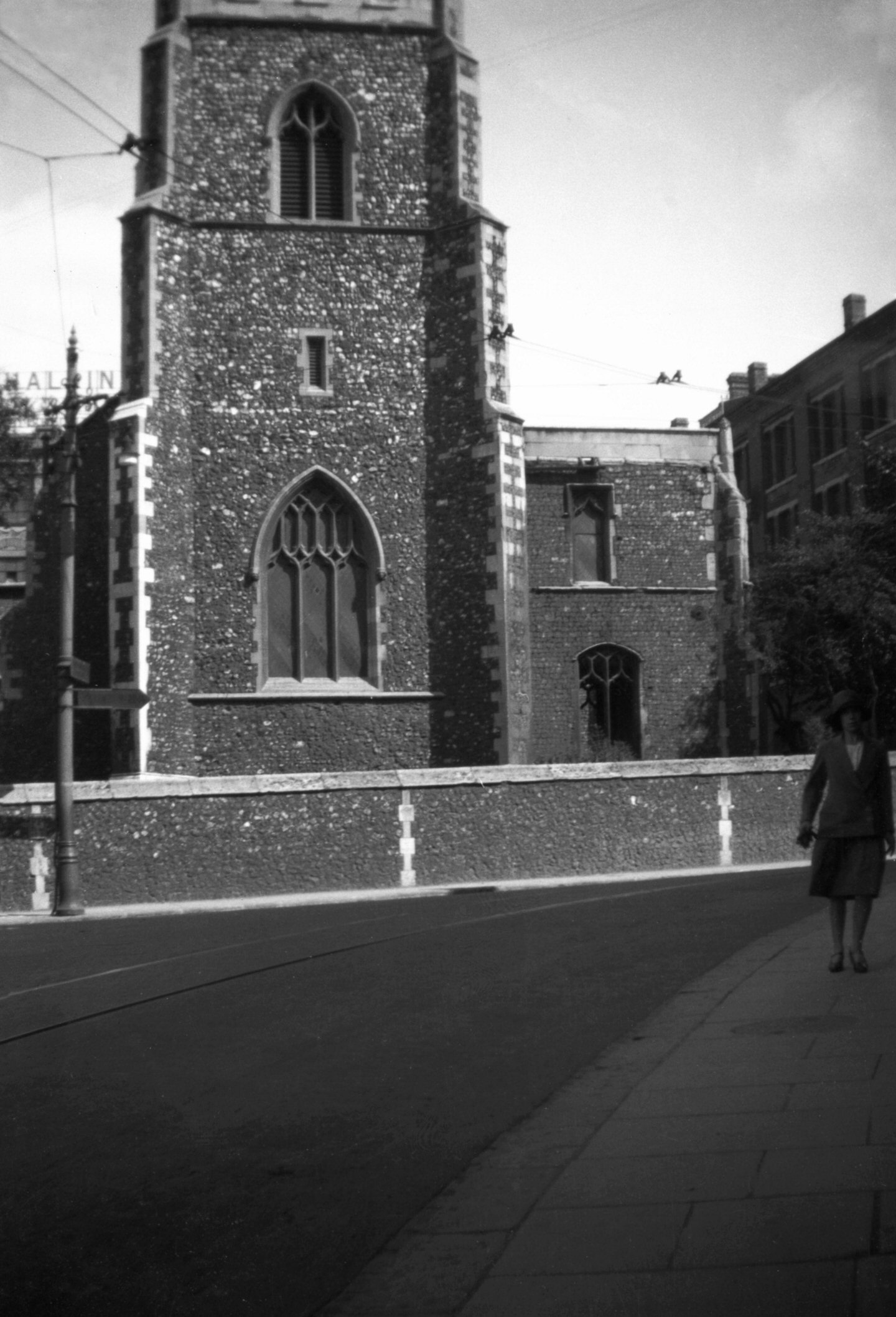
St Michael at Pleas tower and south porch [1546]
1937-04-24
|
|
|
St Michael at Pleas tower and south porch [6646]
1990-09-26
|
|
|
St Michael at Pleas tower from west [B123] 1931-00-00
|
|
|
St Michael at Pleas north transept [2298] 1938-04-12
The church is Perpendicular. |
|
|
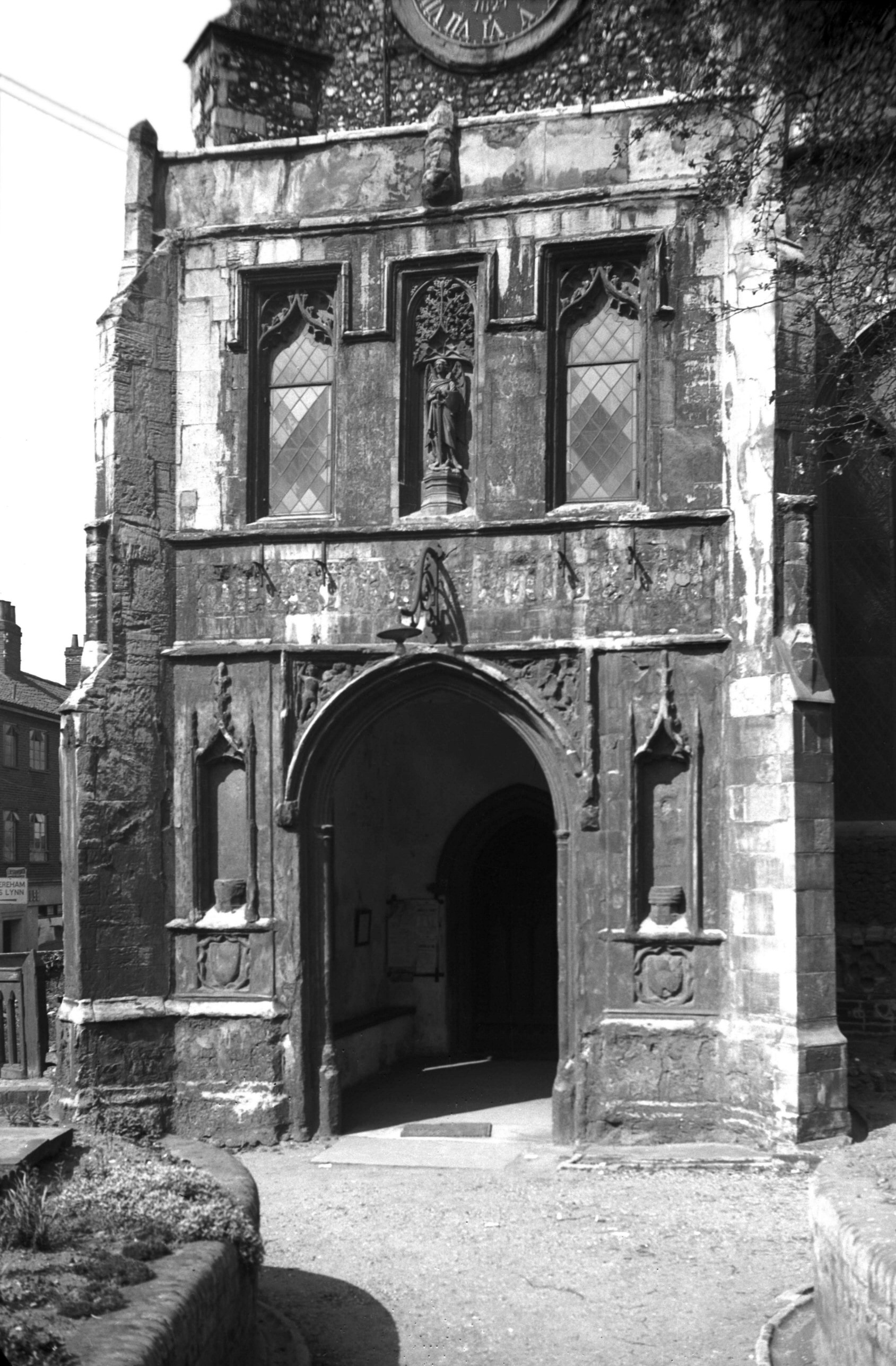
St Michael at Pleas south porch [2297] 1938-04-12
Stooled and canopied niches flank the entrance with
another above. Carved in the spandrels of the entrance
are St Michael and Dragon. |
|
|
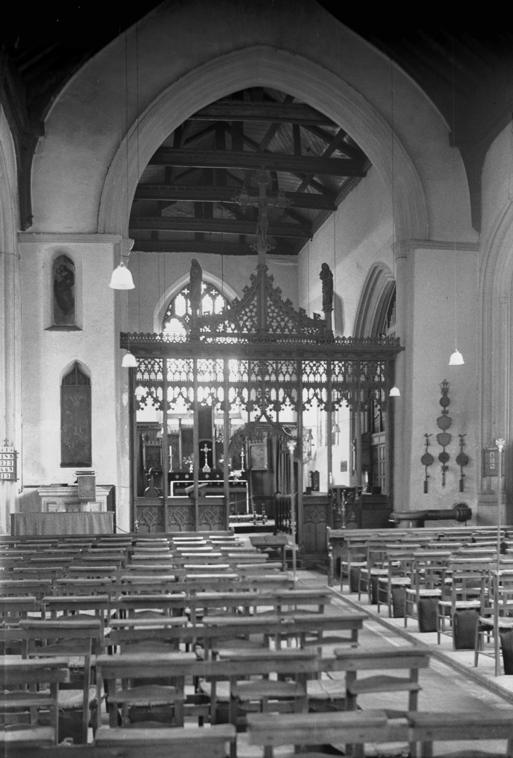
St Michael at Pleas interior view east [1854]
1937-08-07
|
|
|
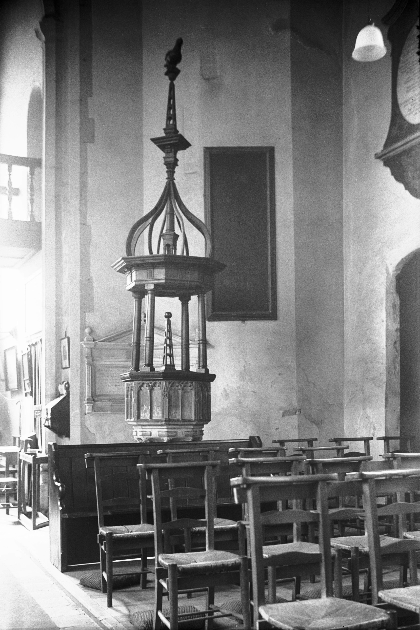
St Michael at Pleas 15c font and 17c cover [1855]
1937-08-07
|
|
|
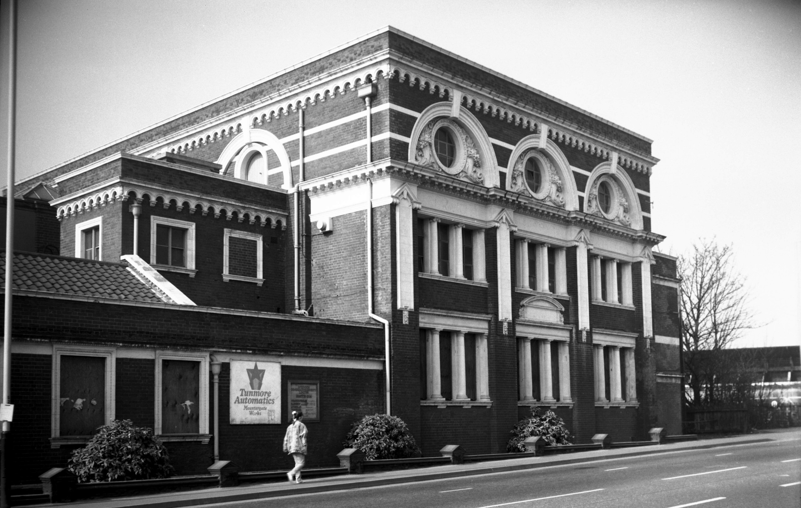
Queen St 2 to 4 former Bally shoe factory [7737]
2000-03-19
|
|
|
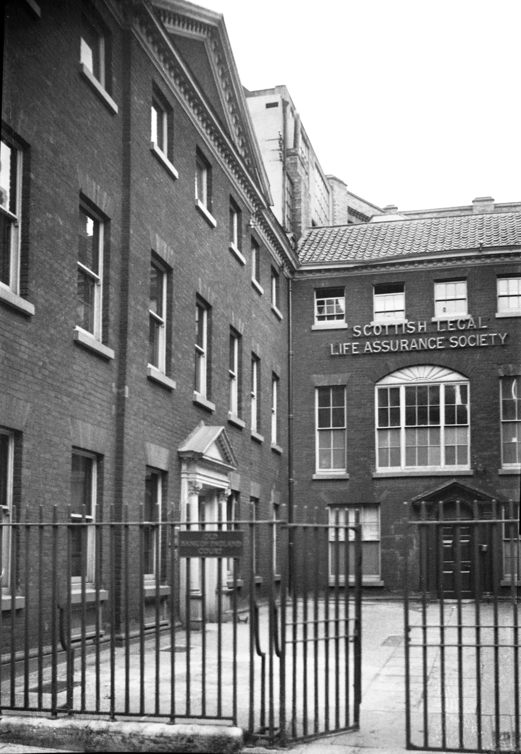
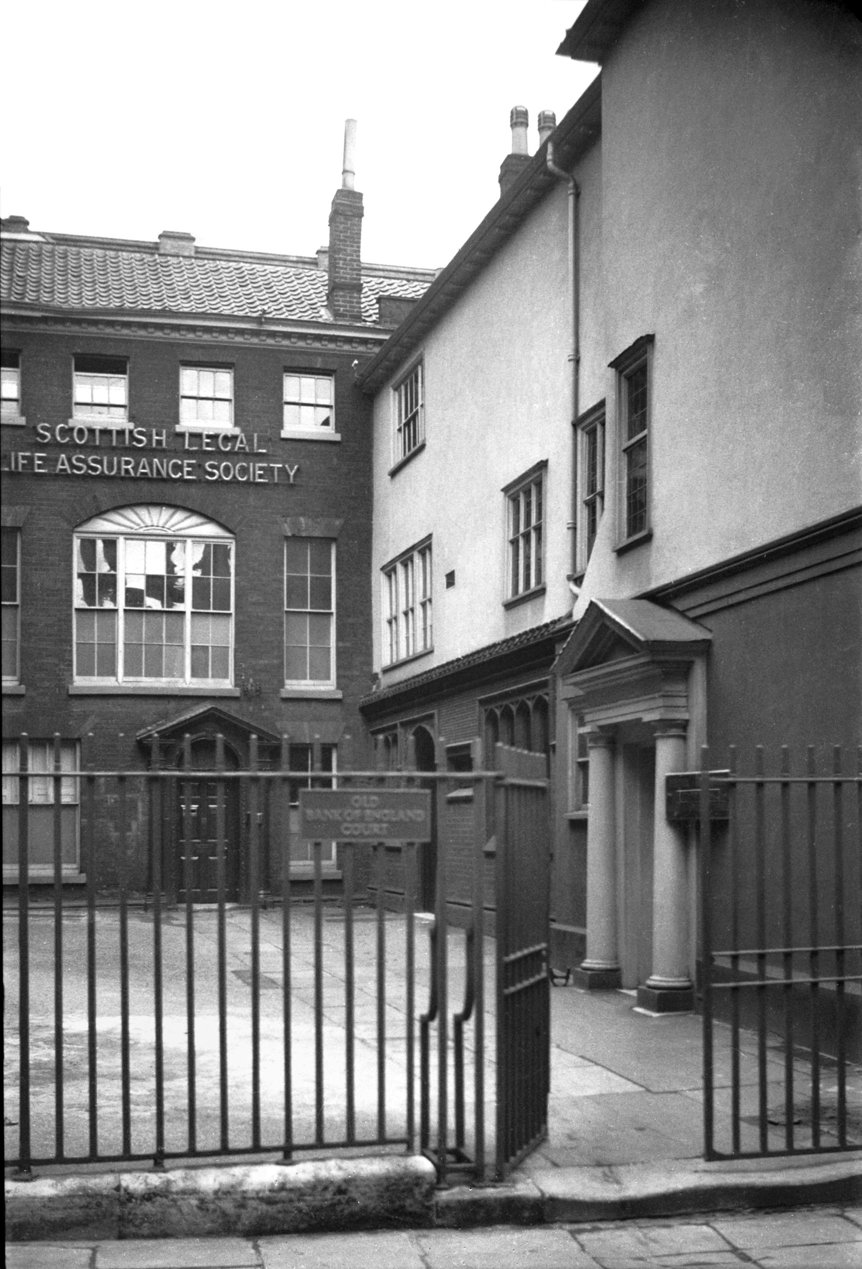
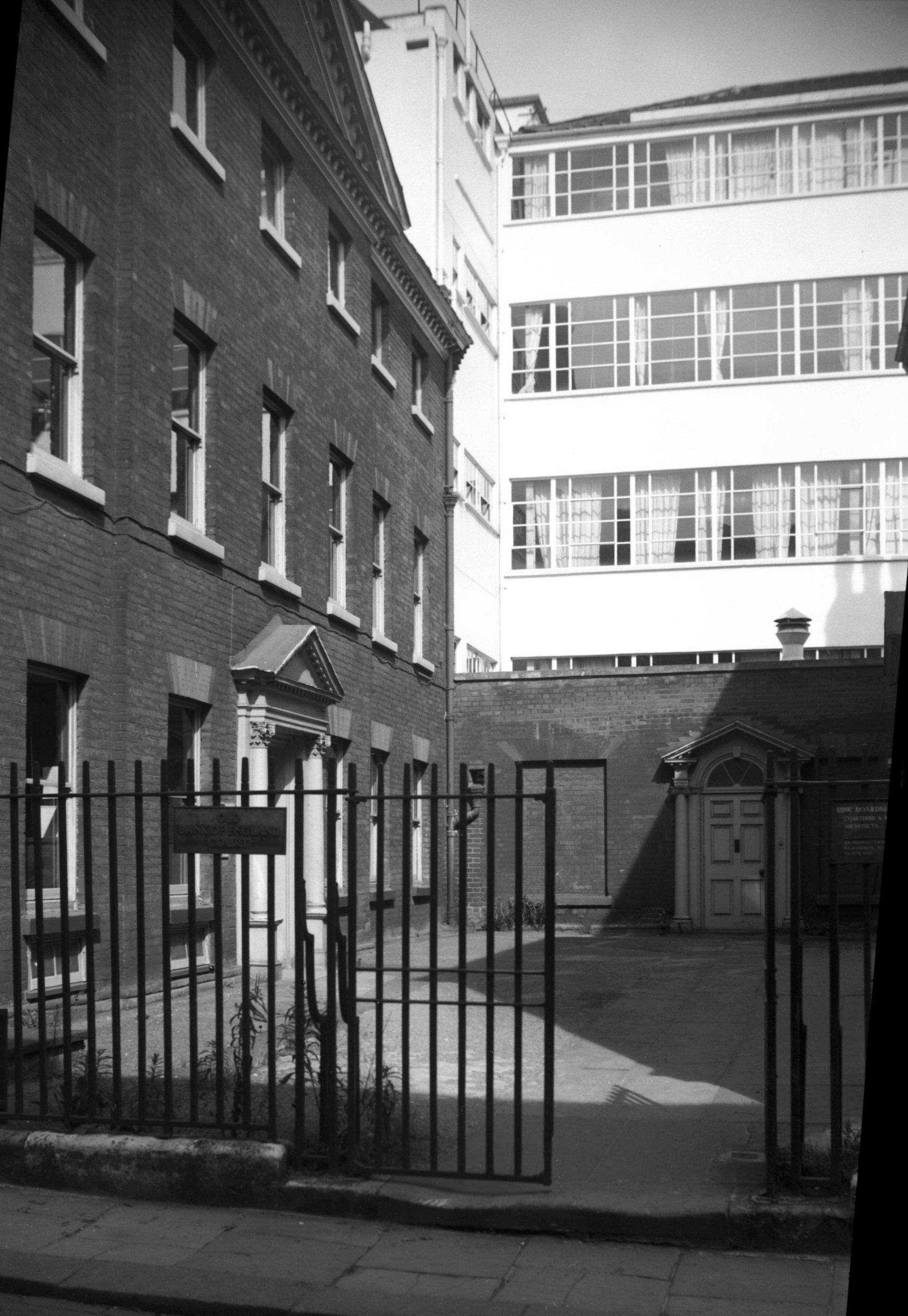
Queen St Old Bank of England Court W and N [1094]
1936-07-12
It seems rather a coincidence that while both the Royal
Bank of Scotland and the Bank of Scotland have been doing
business on the south side of Queen Street, the Bank of
England once had premises almost opposite. In 1825 a
craze for speculation, brought about by the country's
increased prosperity, came to a head. By November of that
year reaction had set in resulting in several banks
suspending payment; in Norwich "Messrs. Gurney's are
said to have staid the plague by merely placing a pile of
one pound notes on the counter". Early in 1826 the
Government moved to prevent a recurrence, proposing among
other things that the Bank of England should open
branches in different parts of the country. One such
branch was accordingly opened in Norwich; in a house on
the north side of what later became known as Old Bank of
England Court. Its life was comparatively brief, however;
not proving very successful, it closed its doors in 1852. |
|
|
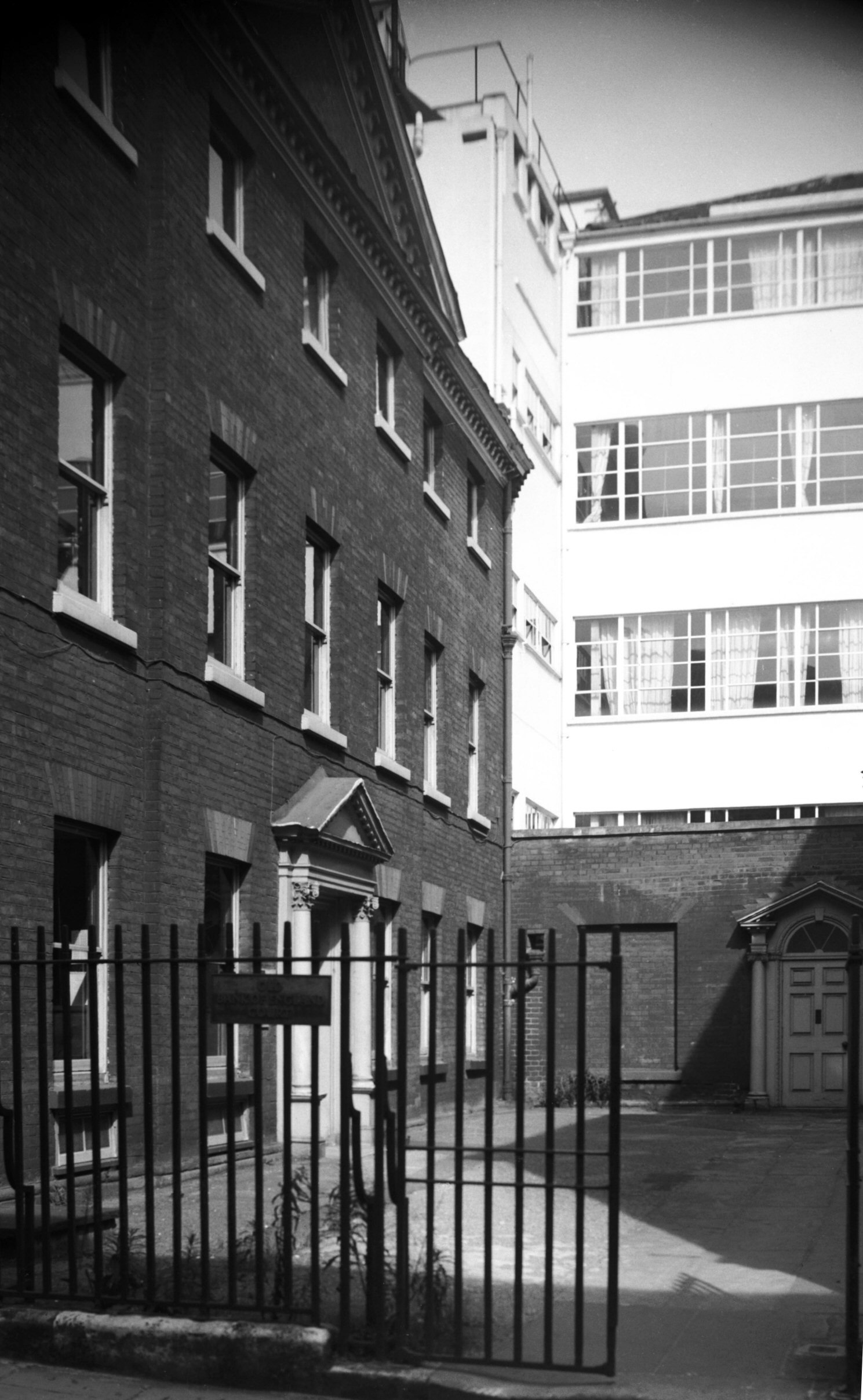
Queen St Old Bank of England Court N and E [1095]
1936-07-12
Also here at one time, and now commemorated by a small
plaque, was the first headquarters of the Norwich Art
Circle, who celebrated their centenary in 1985. An
invitation to their first exhibition, held here in
September 1885, depicted a view of the front of the
building. |
|
|
Queen St Old Bank of England Court N side [2067]
1938-01-17
|
|
|
Queen St Old BoE Ct west Georgian doorway [2068]
1938-01-17
|
|
|
Queen St Old BoE Ct north Georgian doorway [0456]
1935-04-19
|
|
|
Queen St Old BoE Ct north Georgian doorway [3222]
1939-08-07
|
|
|
Queen St Old BoE Ct east Georgian doorway [0457]
1935-04-19
|
|
|
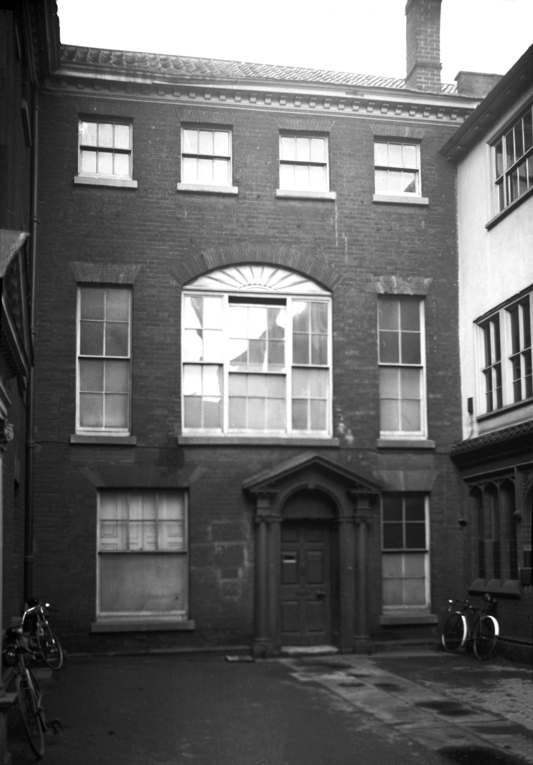
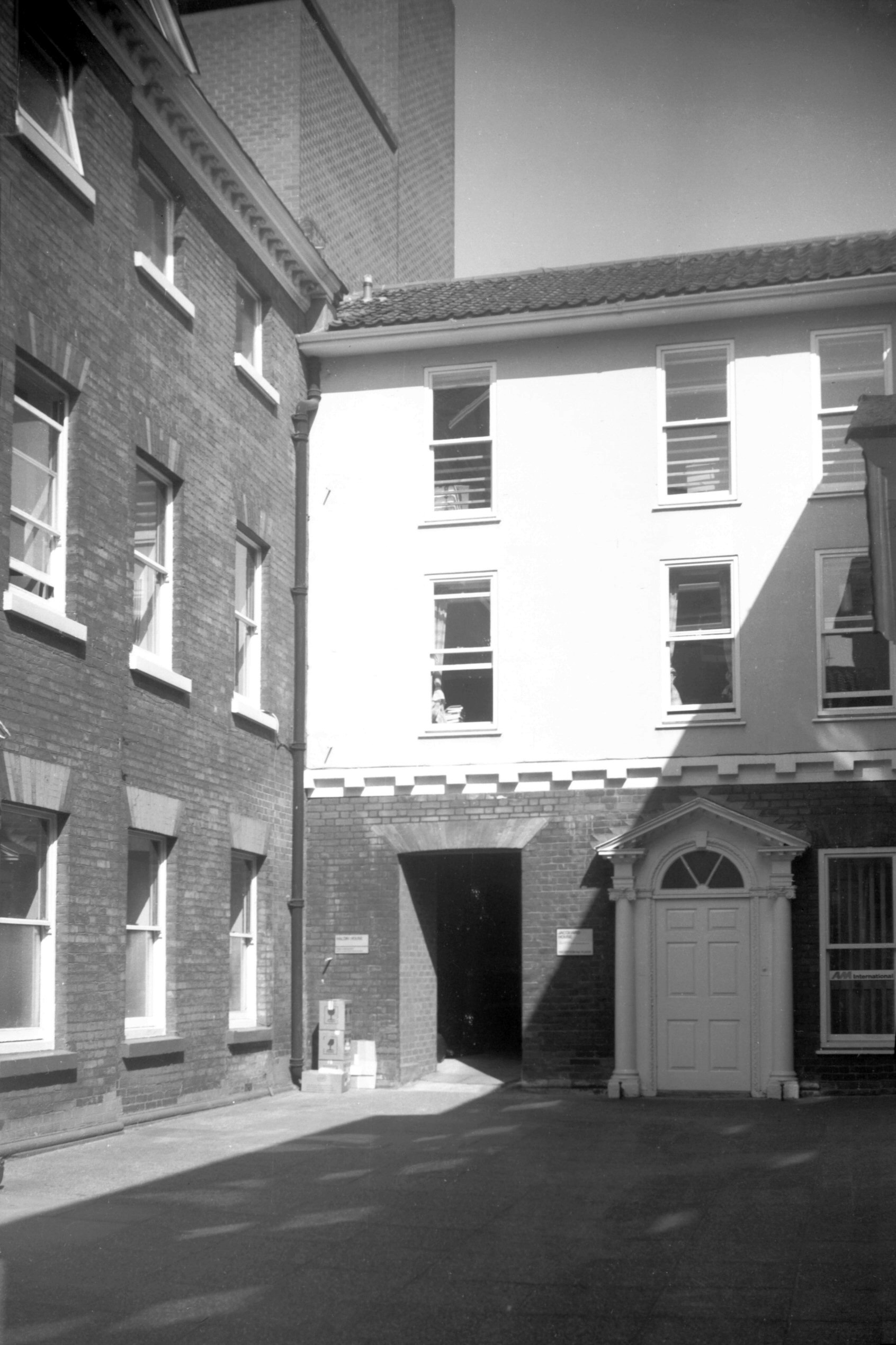
Queen St Old BoE Ct view NW end demolished [4282]
1954-08-29
Only the ground floor of the original house remains, the
upper part having been demolished just before the Second
World War when Bally and Haldinstein's shoe factory was
extended. This left an unsightly gap in an otherwise
stately Georgian square. . . |
|
|
Queen St Old BoE Ct view NW end demolished [4281]
1954-08-29
|
|
|
Queen St Old BoE Ct view NW end rebuilt [6291]
1984-04-24
. . . but after the factory moved to Hall Rd in 1969 the
house was reconstructed. Although the design of its
facade differs from that of the original it nevertheless
harmonises well with its older surroundings. |
|
|
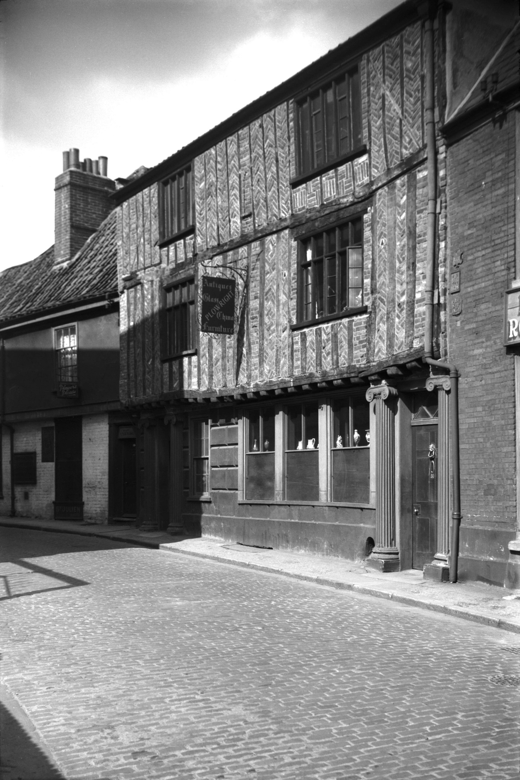
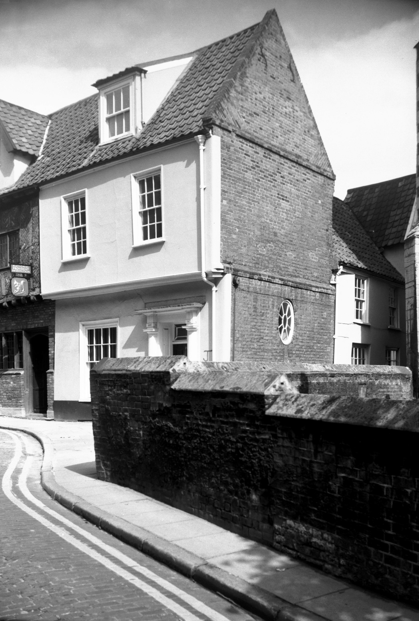
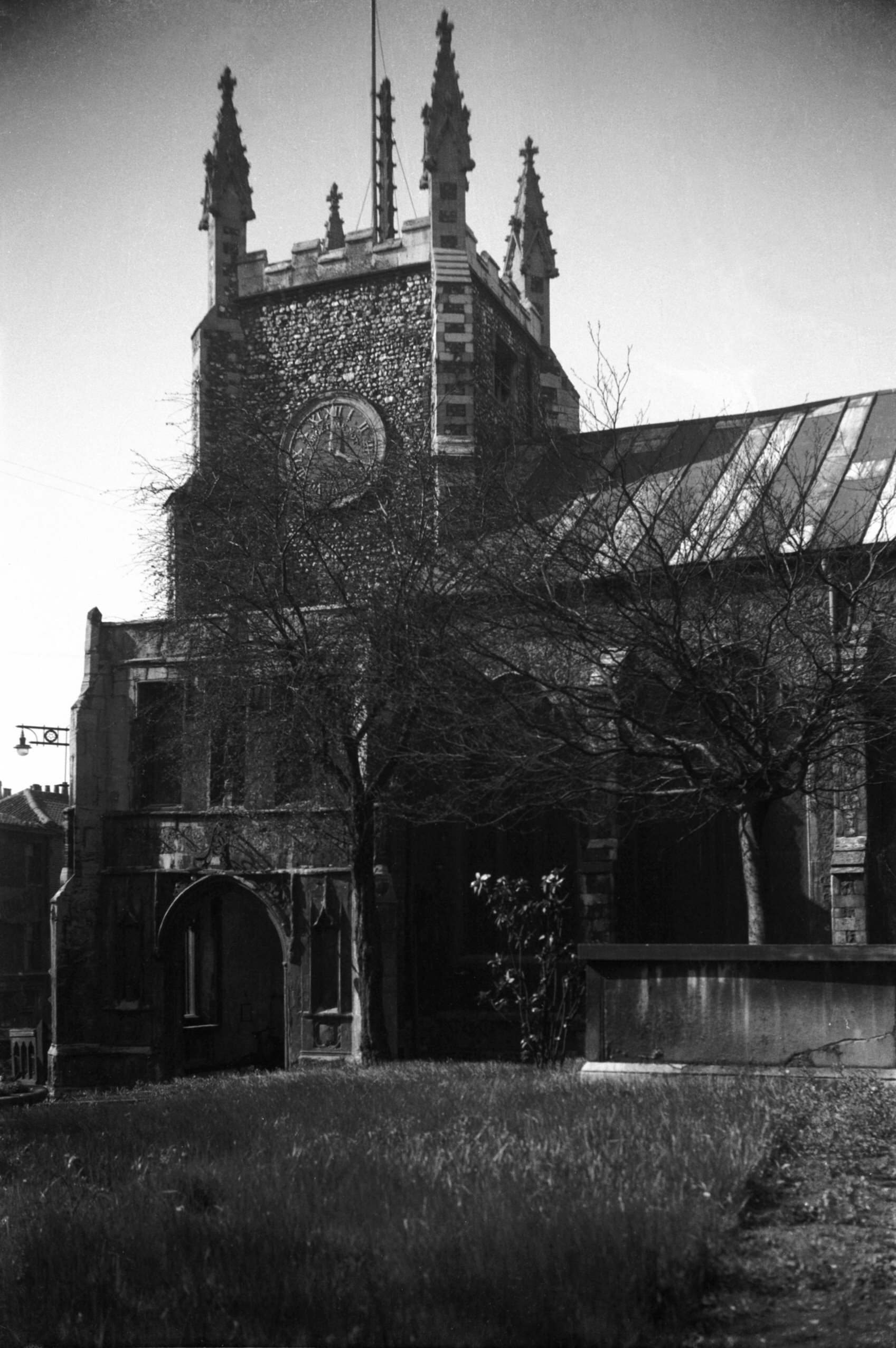
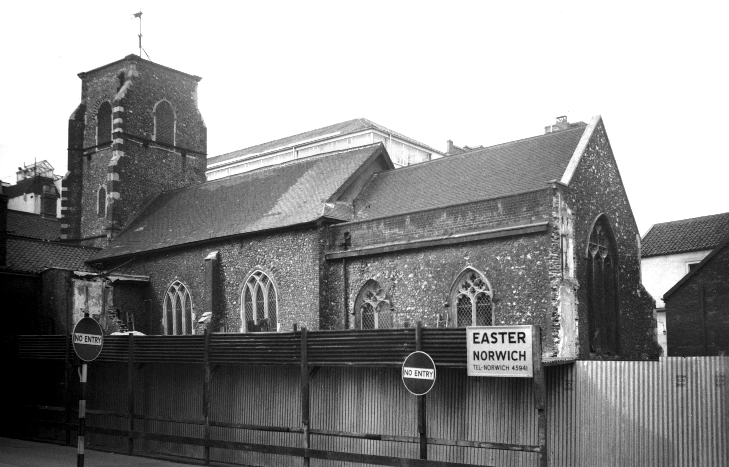
St Mary the Less south side from Queen St [4472]
1956-09-09
At the corner of Queen St and Tombland were previously
two 19c buildings, one occupied by William Plowright, an
antiques dealer, the other by tearooms. The latter was
seriously damaged by incendiary bombs during the war, and
after remaining something of an eyesore both properties
were eventually demolished in 1956.
With the site cleared, the long-hidden church of St
Mary-the-Less was opened to view - but not for long; the
value of the land prohibiting its continuation as an open
space. Nowadays the north side of the church may still be
glimpsed from the precinct known as St Michael-at-Pleas,
between Princes St and Tombland, while from Queen St the
south porch and upper stages of the tower are all that
remain visible. |
|
|
St Mary the Less south porch Queen St [B124]
1931-00-00
|
|
|
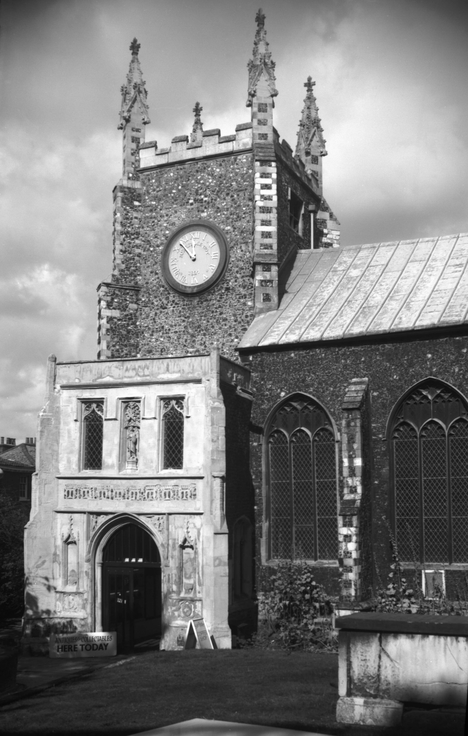
St Mary the Less south porch Queen St [2119]
1938-03-06
The church's history is as chequered as any. At the
dissolution it was granted to the Dean and Chapter of
Norwich Cathedral, who thereupon declared it redundant,
uniting the parish with that of St George Tombland. On
16th June 1544, the church itself was leased by the Dean,
John Salisbury, to the city for 500 years on payment of
£20 and a yearly rent of 4 pence. The furnishings, no
longer required, were then disposed of: the choir desks
went to the city for 15 shillings, the font and a slab to
Thomas Farrour for 6s 8d and the rood loft and desks to
the church of St George Tombland for 30 shillings.
52 hundredweights of lead were sold in 1554 and the roof
tiled, while a few years later £43 was spent fitting the
building out for the use of "strangers" selling
their baize. For this they were charged an annual rent of
£13.
In 1623 it was converted into a hall for the sale of yarn
and woven fabrics, but by 1631 the accommodation had
become inadequate and the presses were moved to the much
larger "New" (now St Andrew's) Hall. Six years
later the French or Walloons took it on for a 40-year
lease for their place of worship, later obtaining a grant
of it in fee.
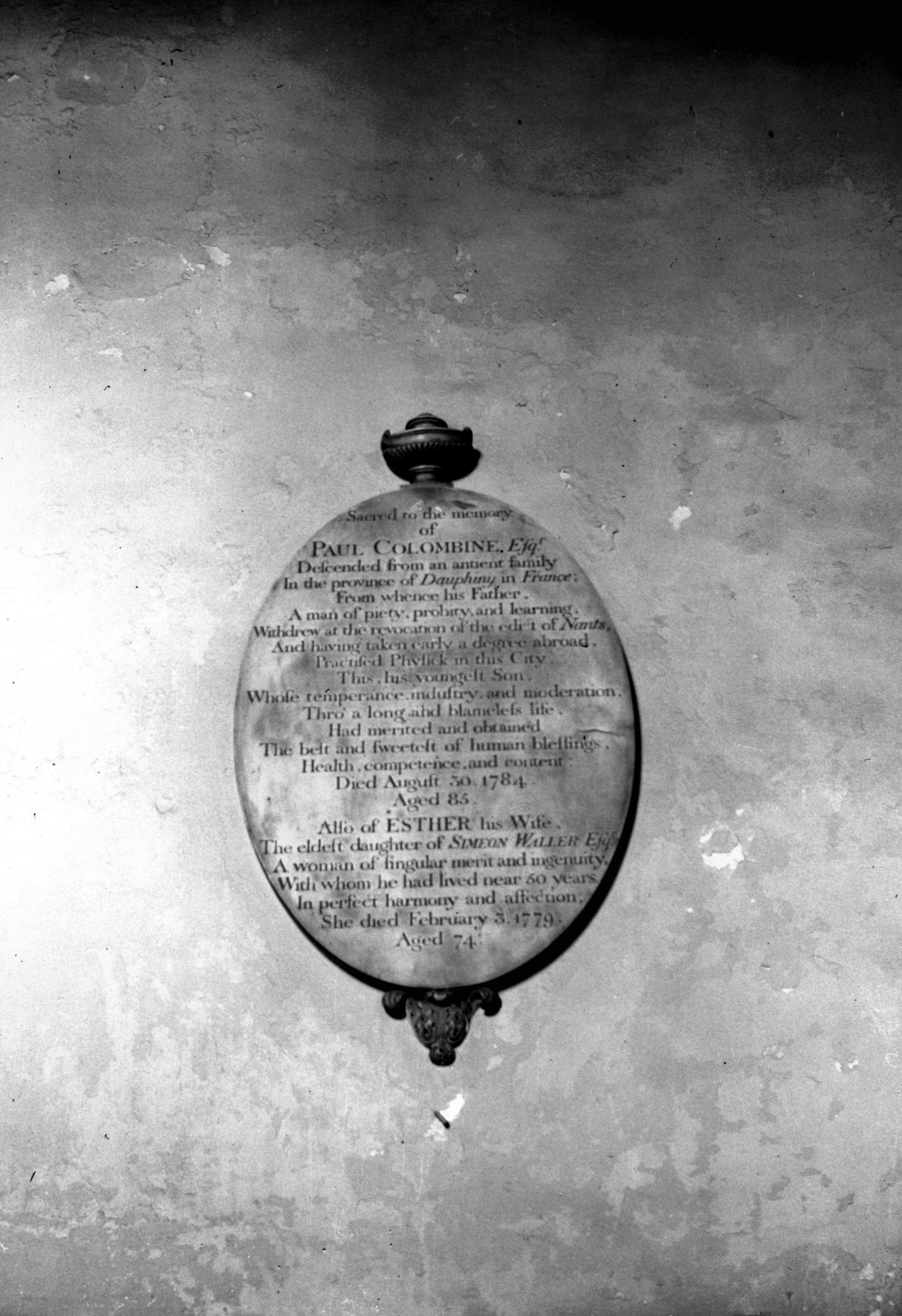
As recorded by an 18c mural tablet to Paul Colombine on
the south wall of the nave, the Revocation of the Edict
of Nantes late in the 17c caused a further influx of
emigrants from the Low Countries. By early in the 19c
however the congregation had dwindled; most had by then
joined the Unitarian or other bodies. The last Elder, in
fact, was appointed in 1803. |
|
|
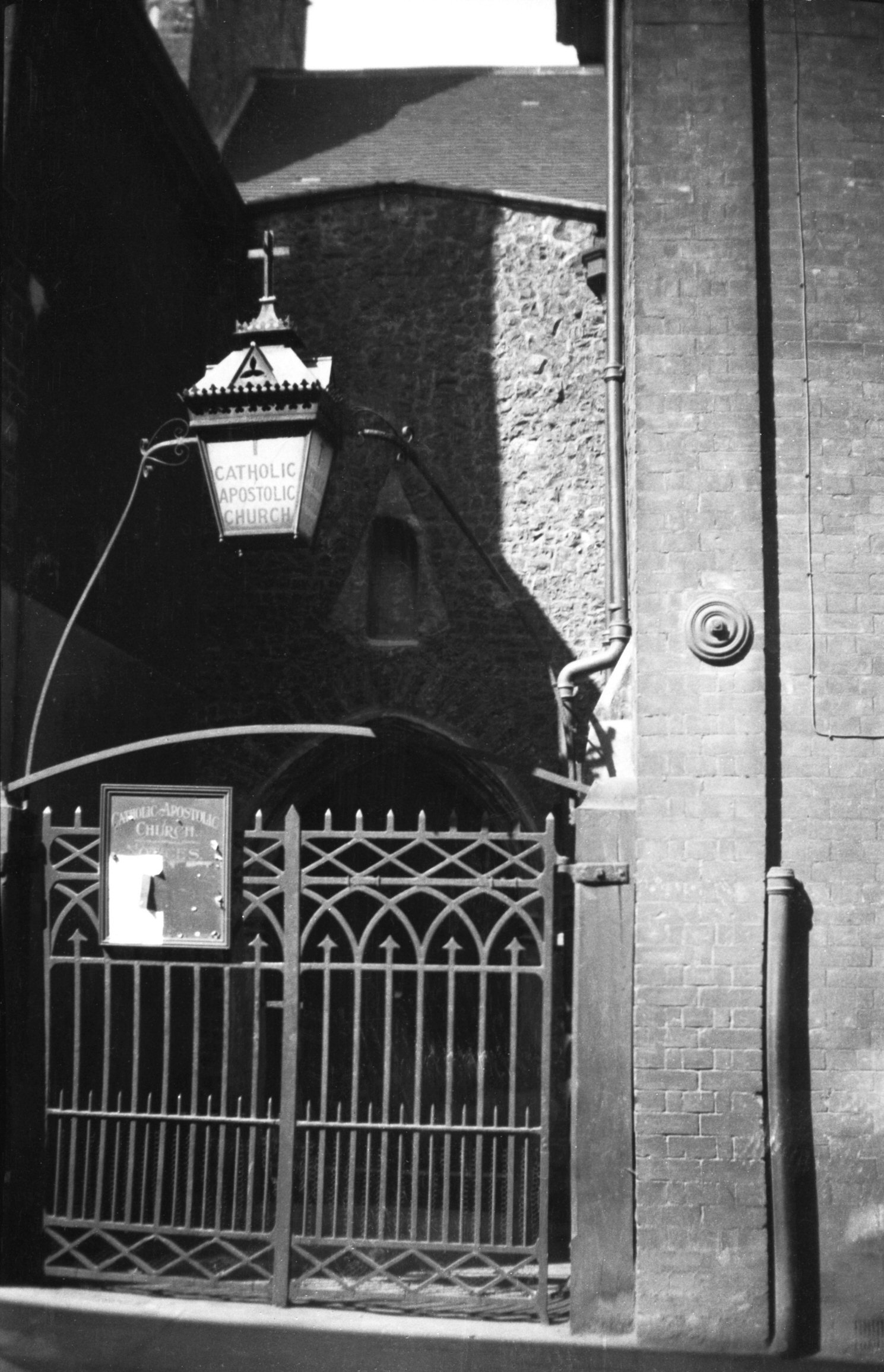
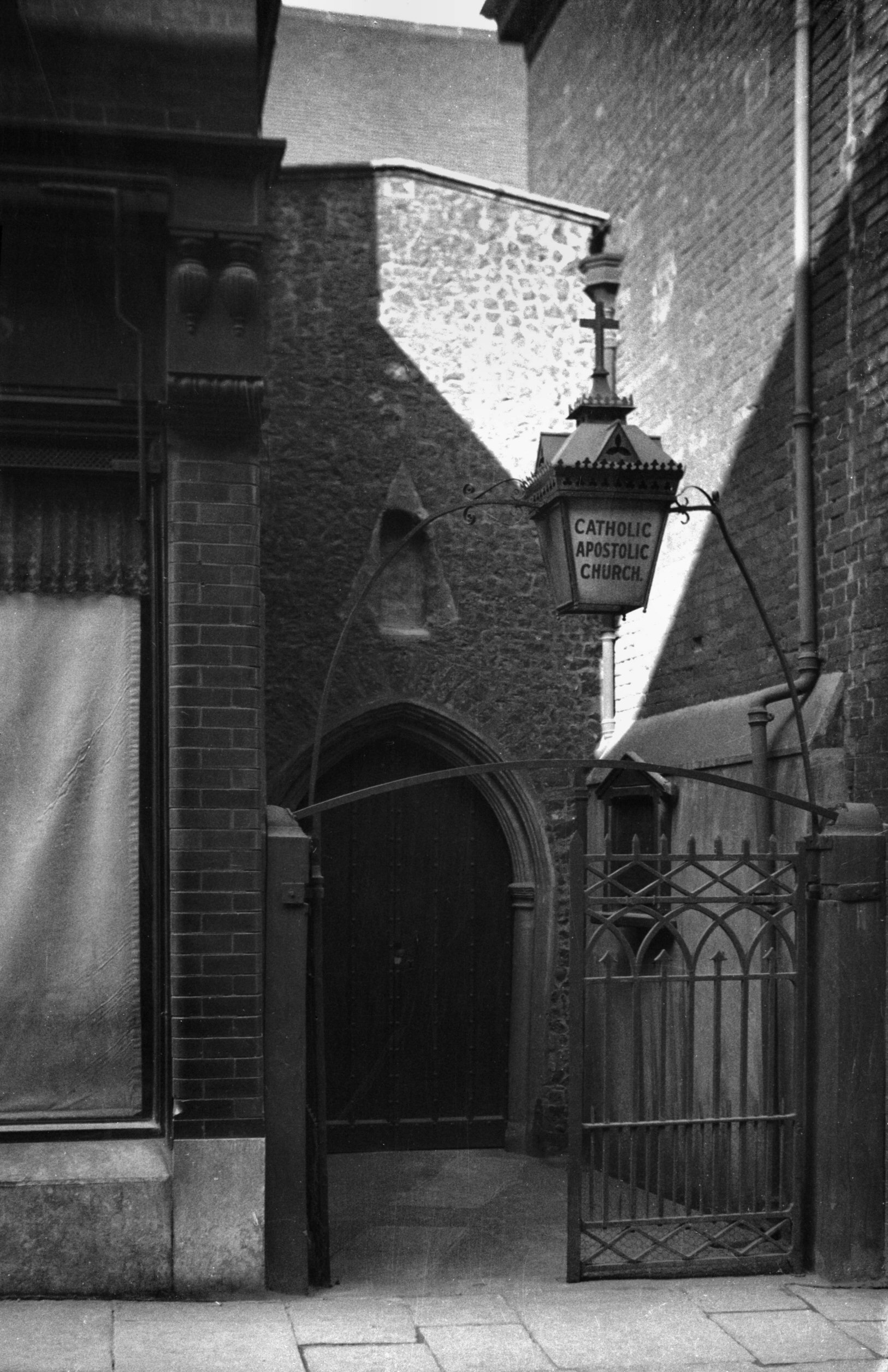
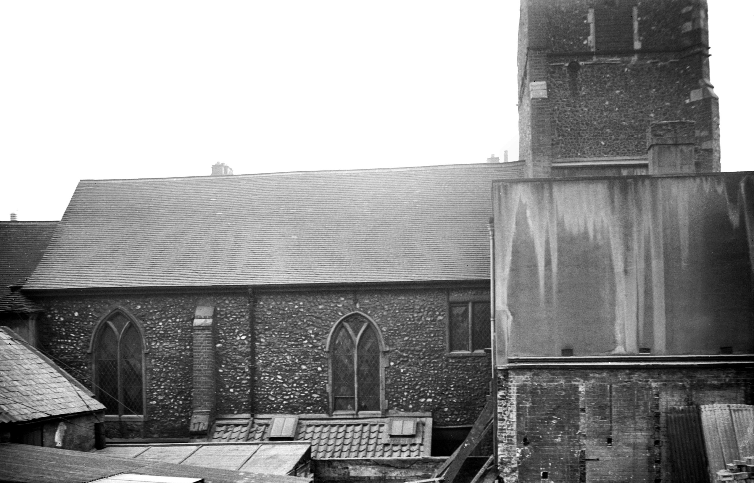
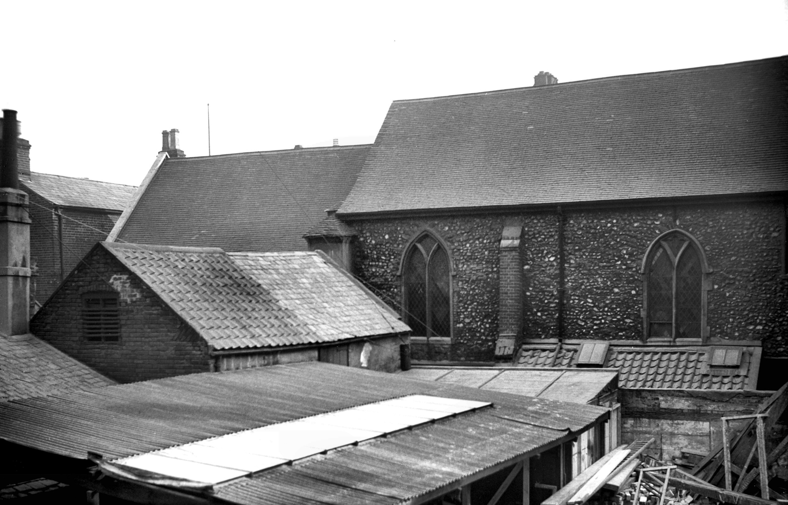
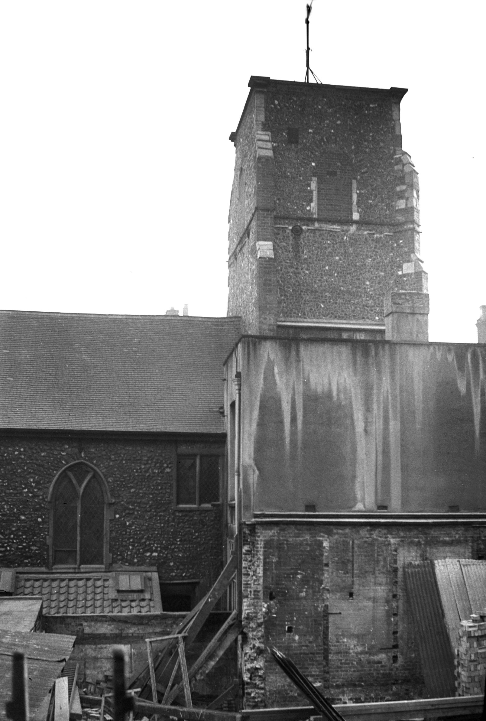
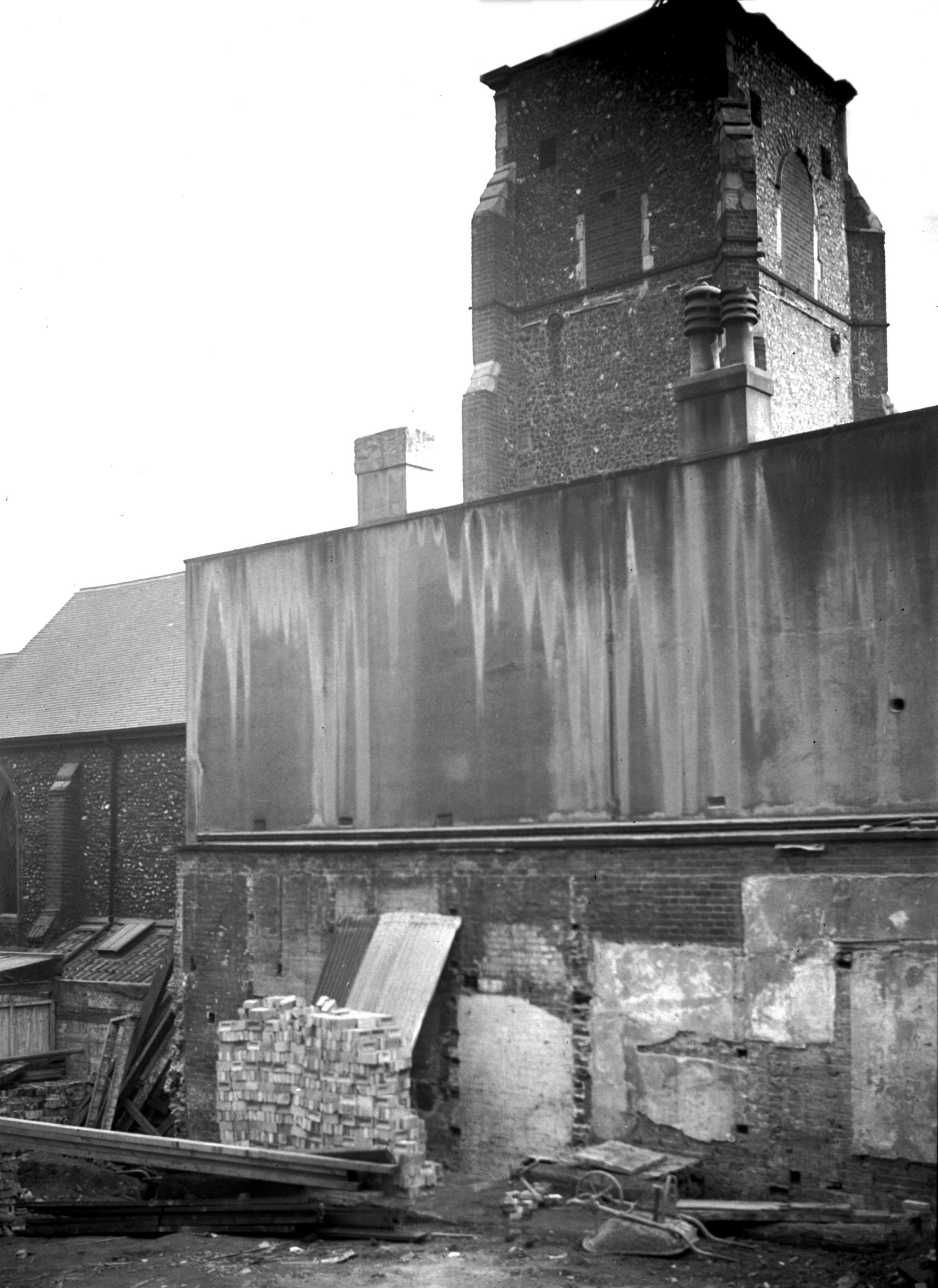
St Mary the Less north side [2093] 1938-02-26
|
|
|
St Mary the Less from Kerrison's Yard [2094]
1938-02-26
About 1862 the trustees let the building to the
"receivers of doctrines enunciated by Emmanuel
Swedenborg", and later (in 1869) to the Catholic
Apostolic church, followers of Edward Irving, who
continued here until moving to other premises in 1953.
Since then it has been used variously as St Andrew's
parish hall and then as a place of storage.
The building itself is not large, and consists of a nave
and chancel with a rood stair turret to the north, a
square west tower and a south porch with room above. |
|
|
St Mary the Less tower from north [2092] 1938-02-26
|
|
|
St Mary the Less tower from NW [2091] 1938-02-26
|
|
|
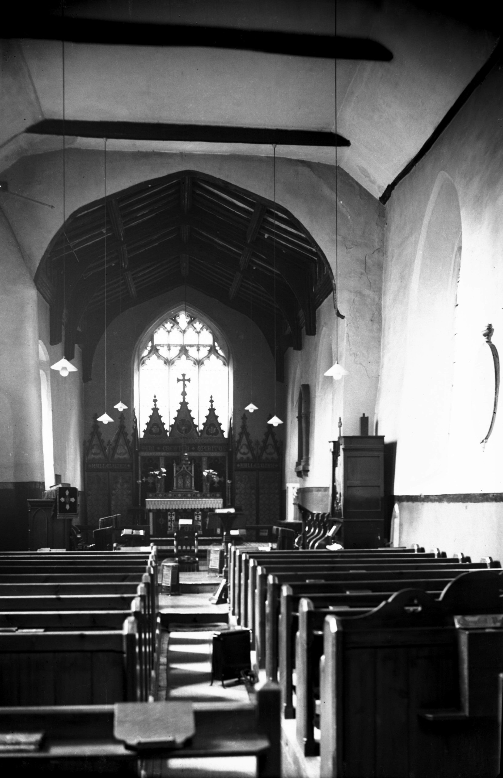
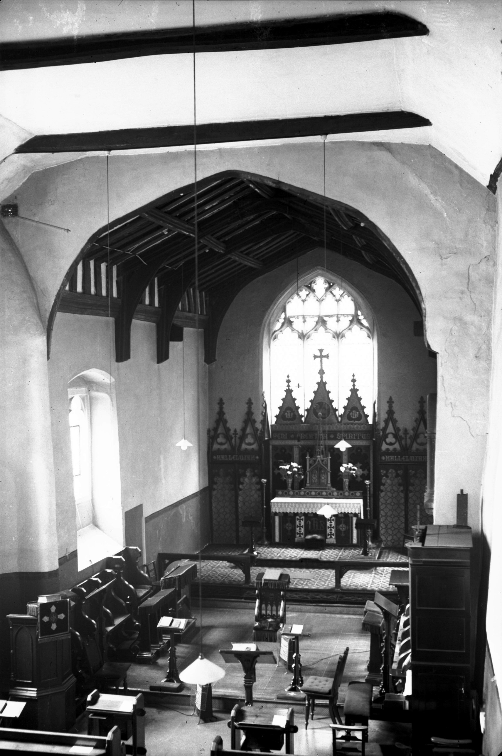
St Mary the Less interior view east [2355] 1938-04-23
|
|
|
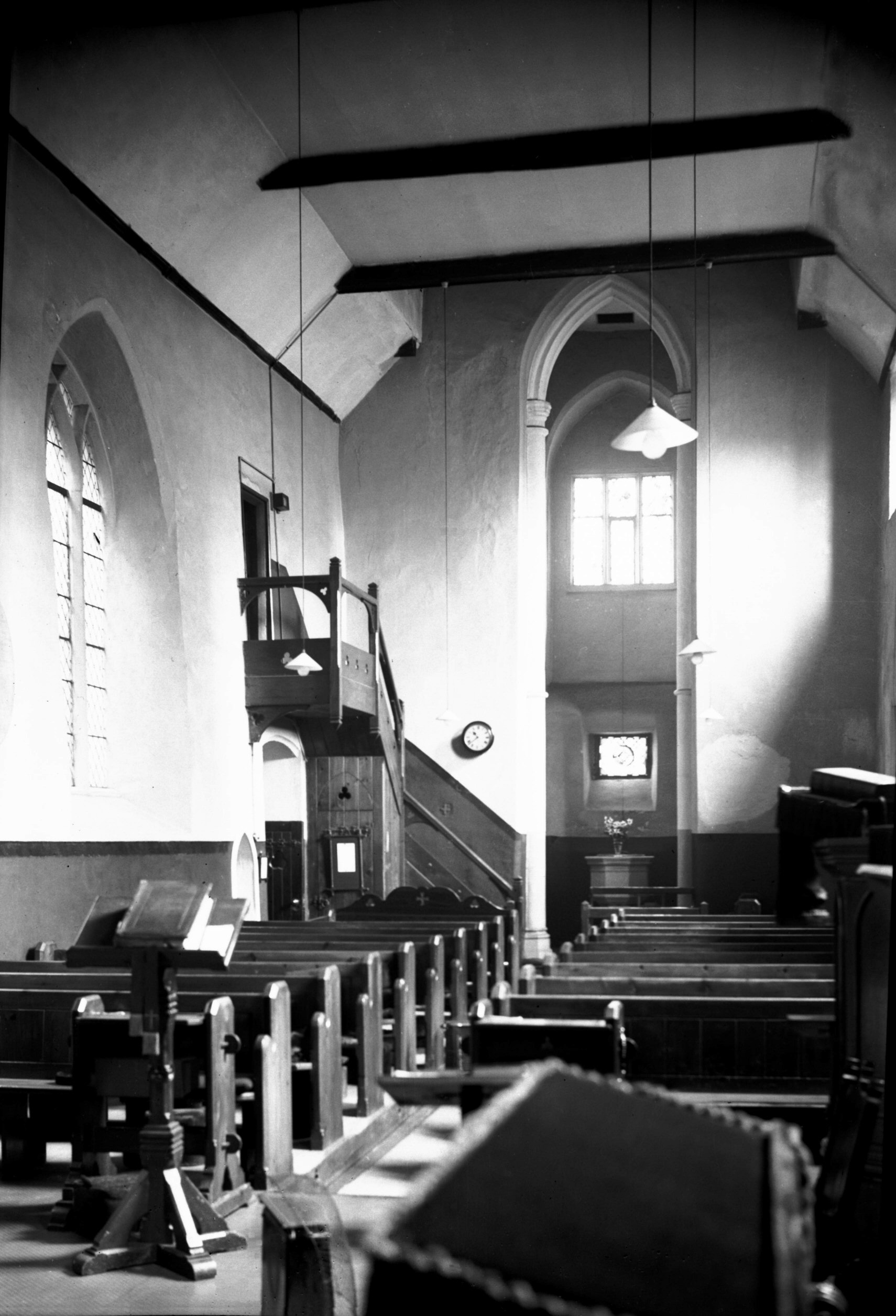
St Mary the Less interior higher view east [2359]
1938-04-23
The furnishings at the time of my visit were quite
modern, but hollowed out of the south wall of the nave
were two piscinae, with an angle piscina in the chancel
at the side of a window whose sill formed the sedilia.
Several small consecration crosses were also to be seen.
The unusually tall and narrow tower arch, reaching almost
to the nave ceiling and having banded shafts, was a
feature not to be missed. |
|
|
St Mary the Less interior view west [2356] 1938-04-23
|
|
|
St Mary the Less Paul Colombine tablet [2358]
1938-04-23
Paul Colombine, son of French refugee, died 30th August
1784. |
|
|
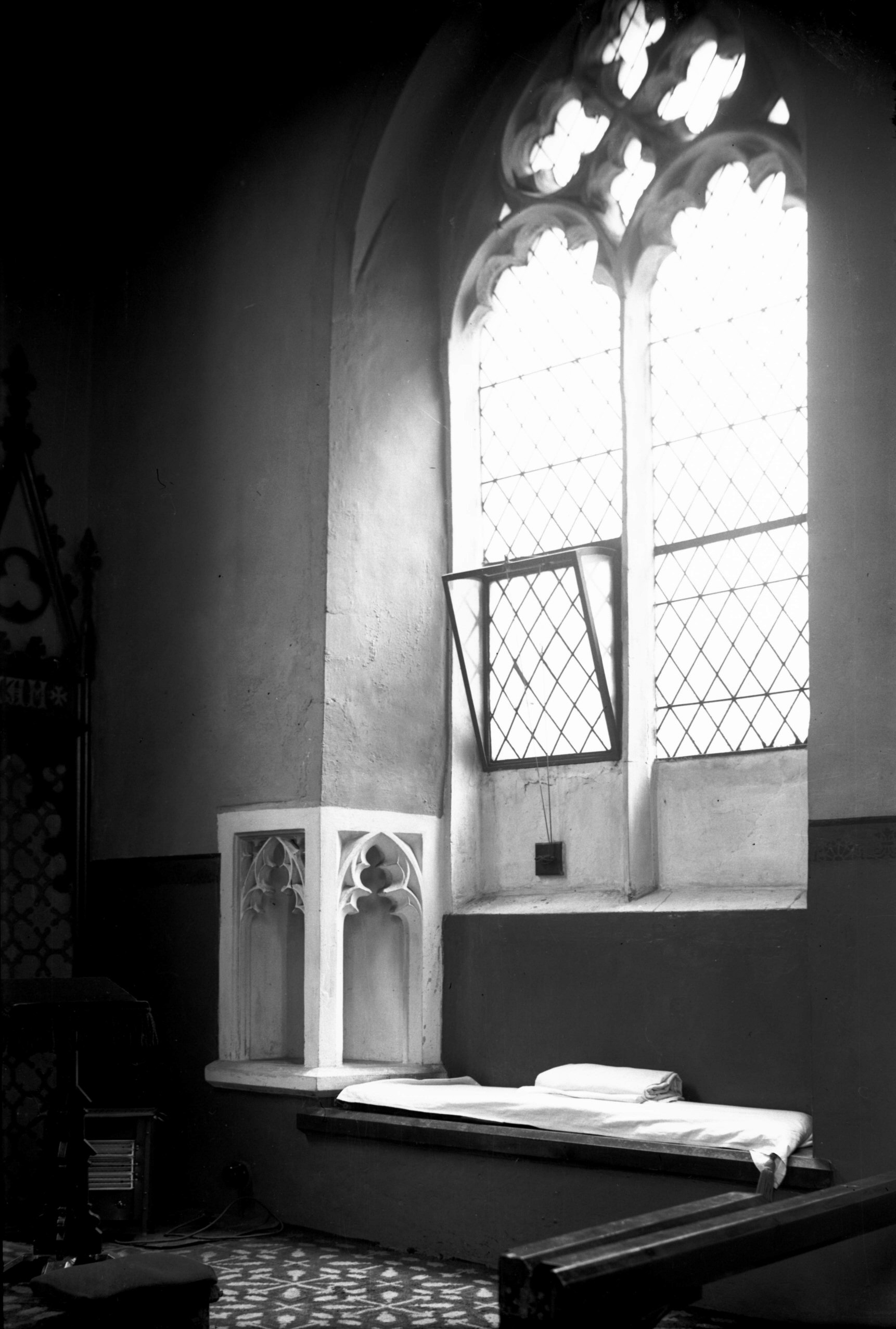
St Mary the Less piscina and sedilia [2357]
1938-04-23
Piscina and windowsill sedilia, south side of chancel. |
|
|
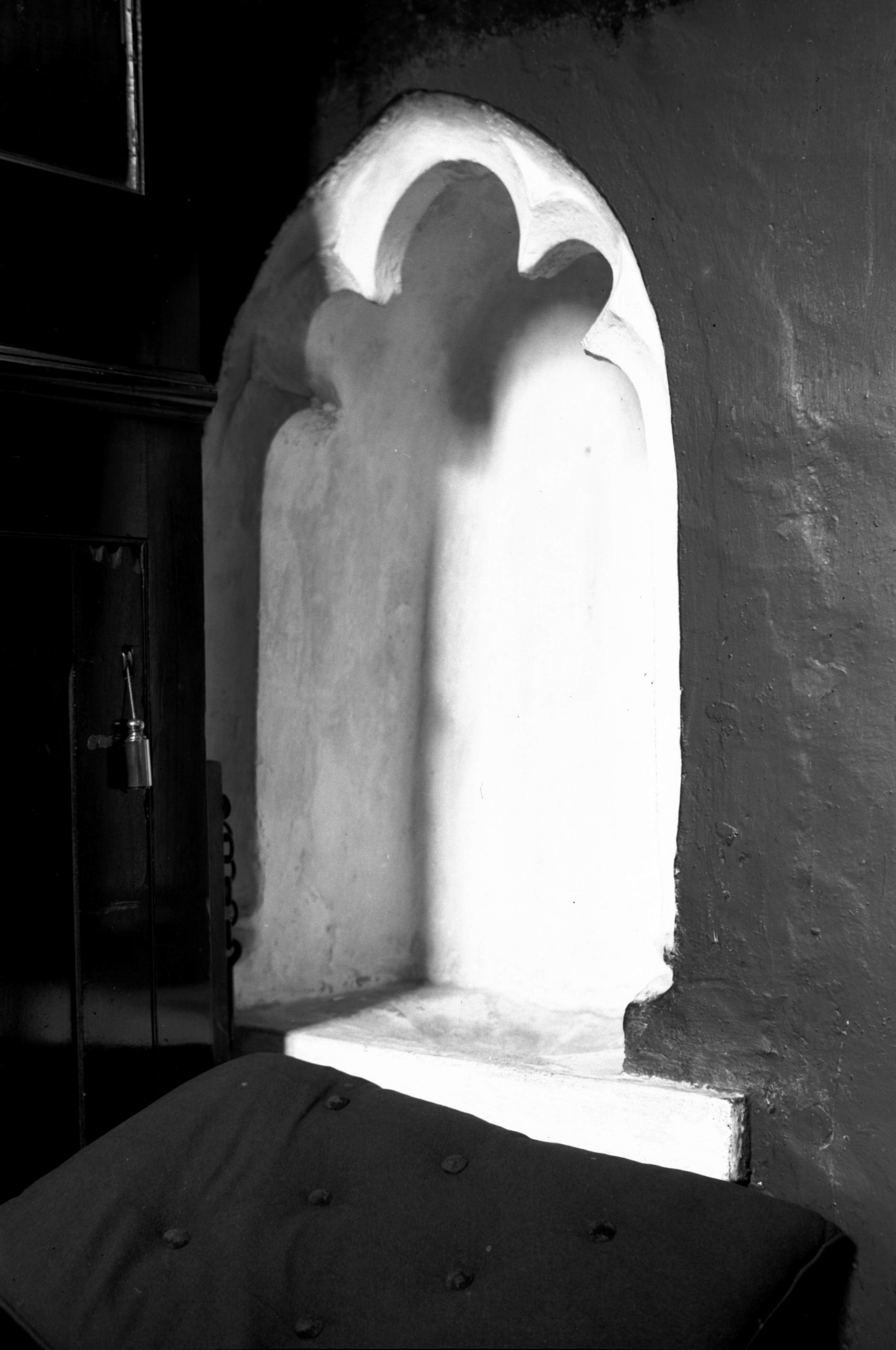
St Mary the Less piscina by chancel arch [2360]
1938-04-23
South side of nave. |