|
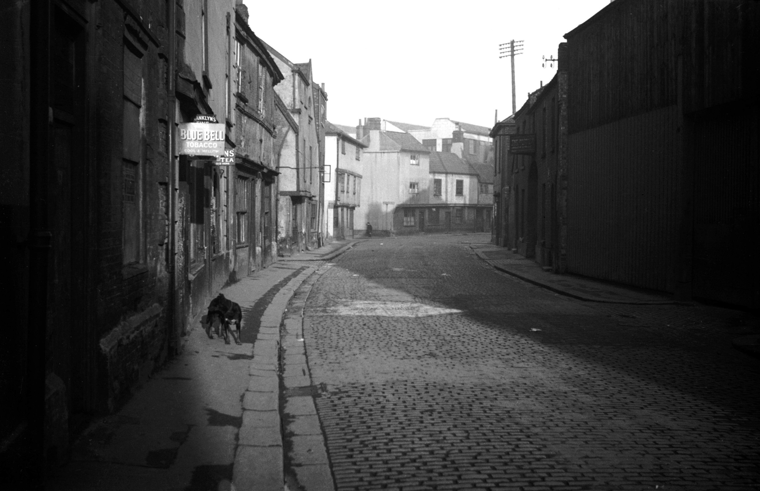
Fishergate: |
| |
From
Fyebridge
St to Cowgate (now Whitefriars)
passing Blackfriar's
St (formerly Peacock St)
North side |
|
|
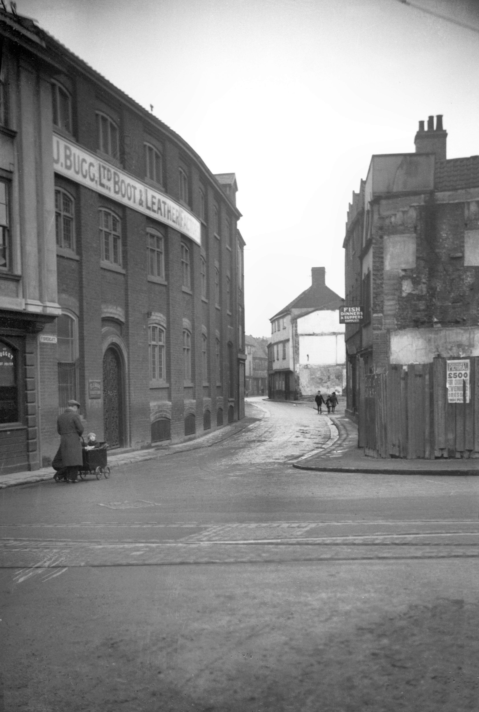
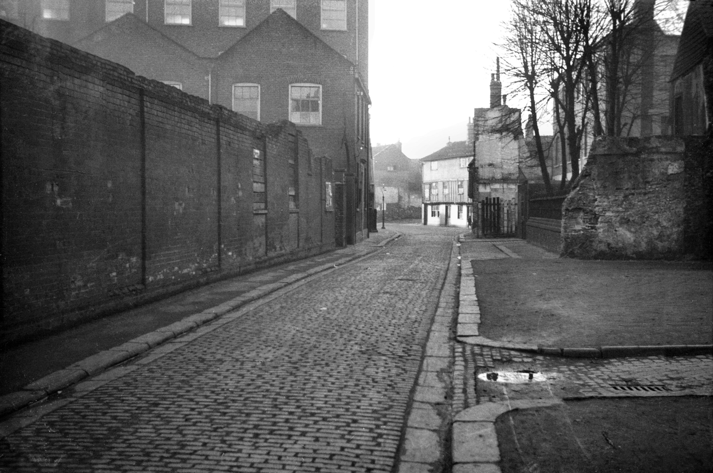
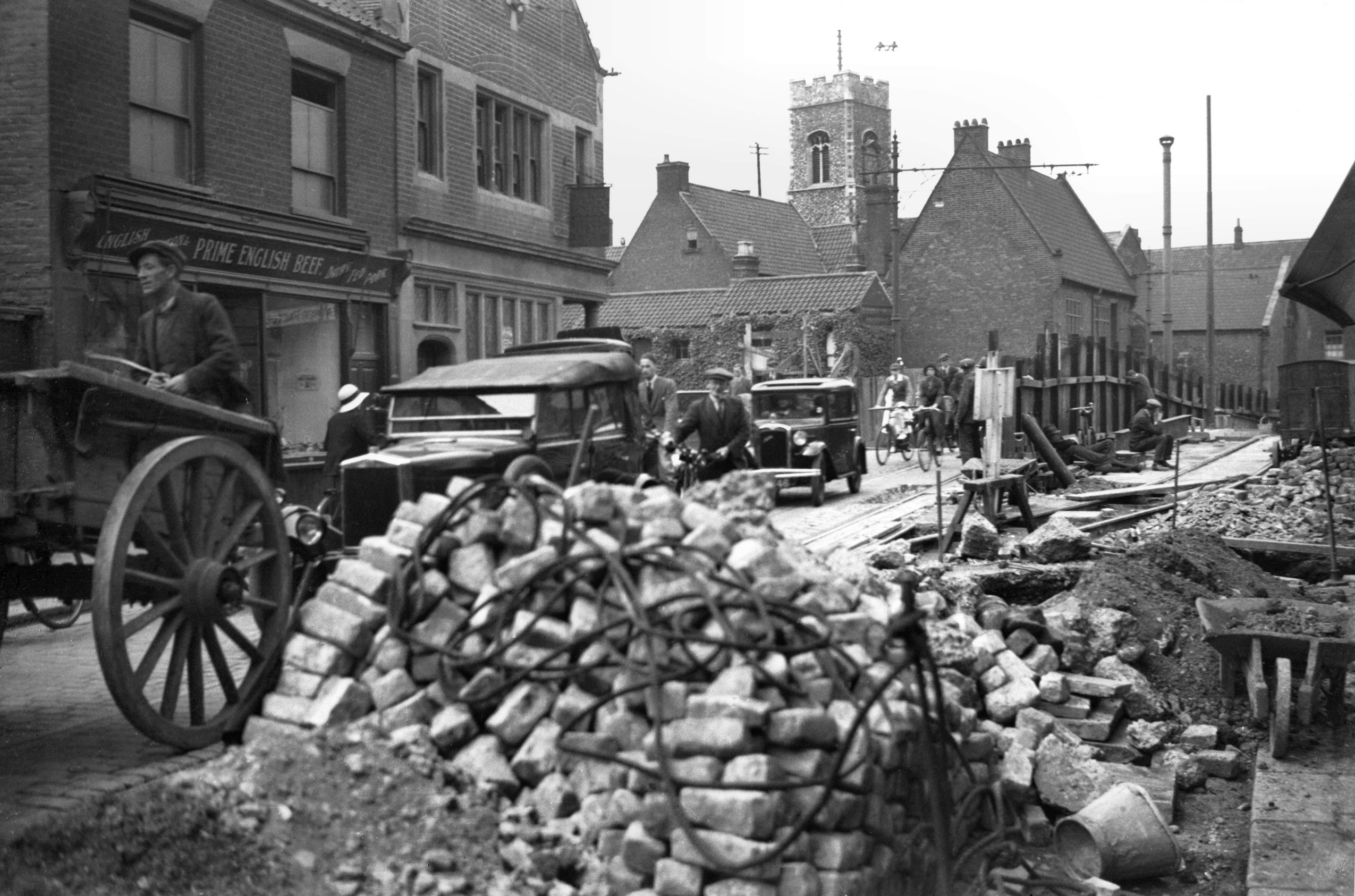
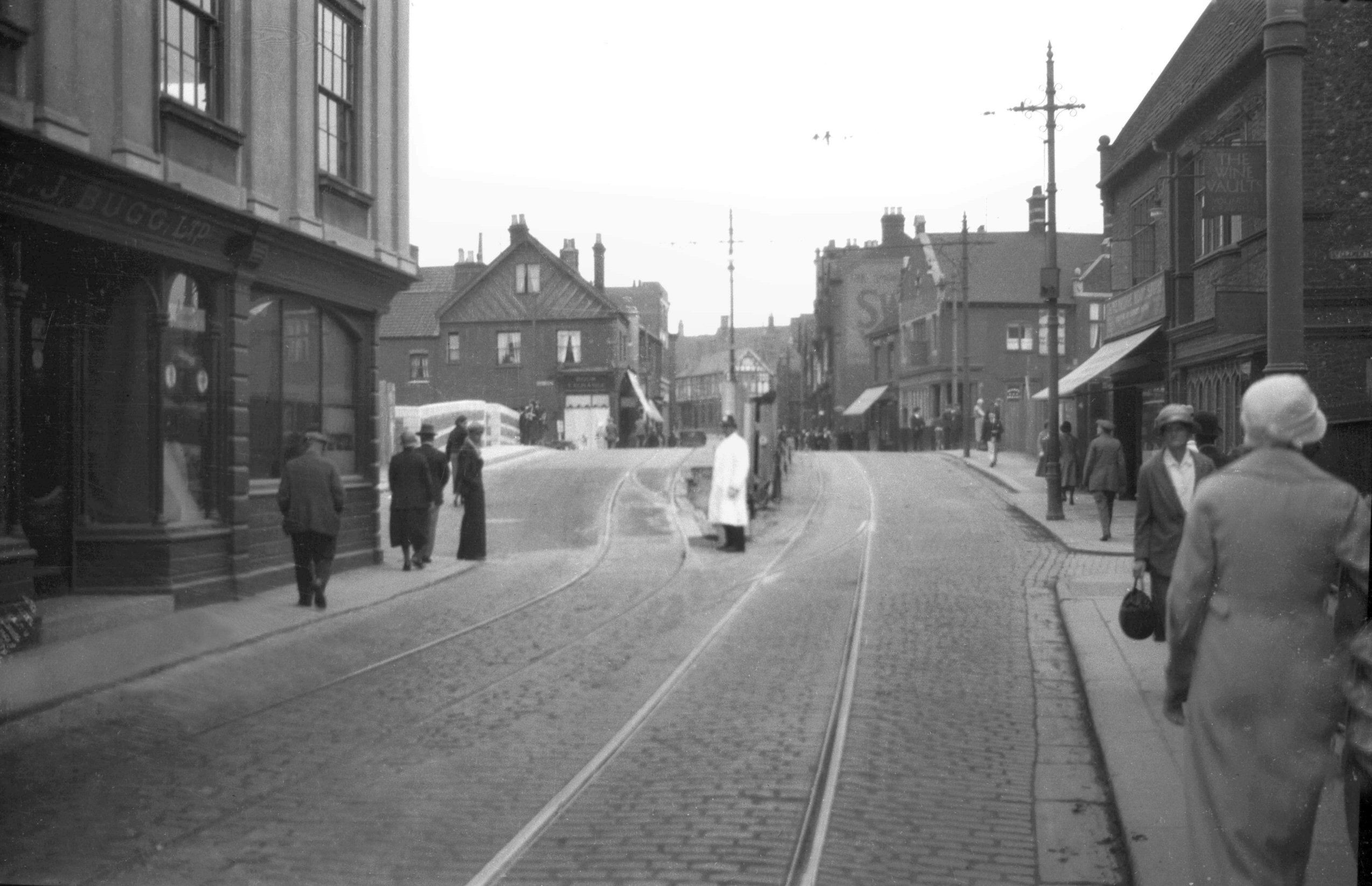
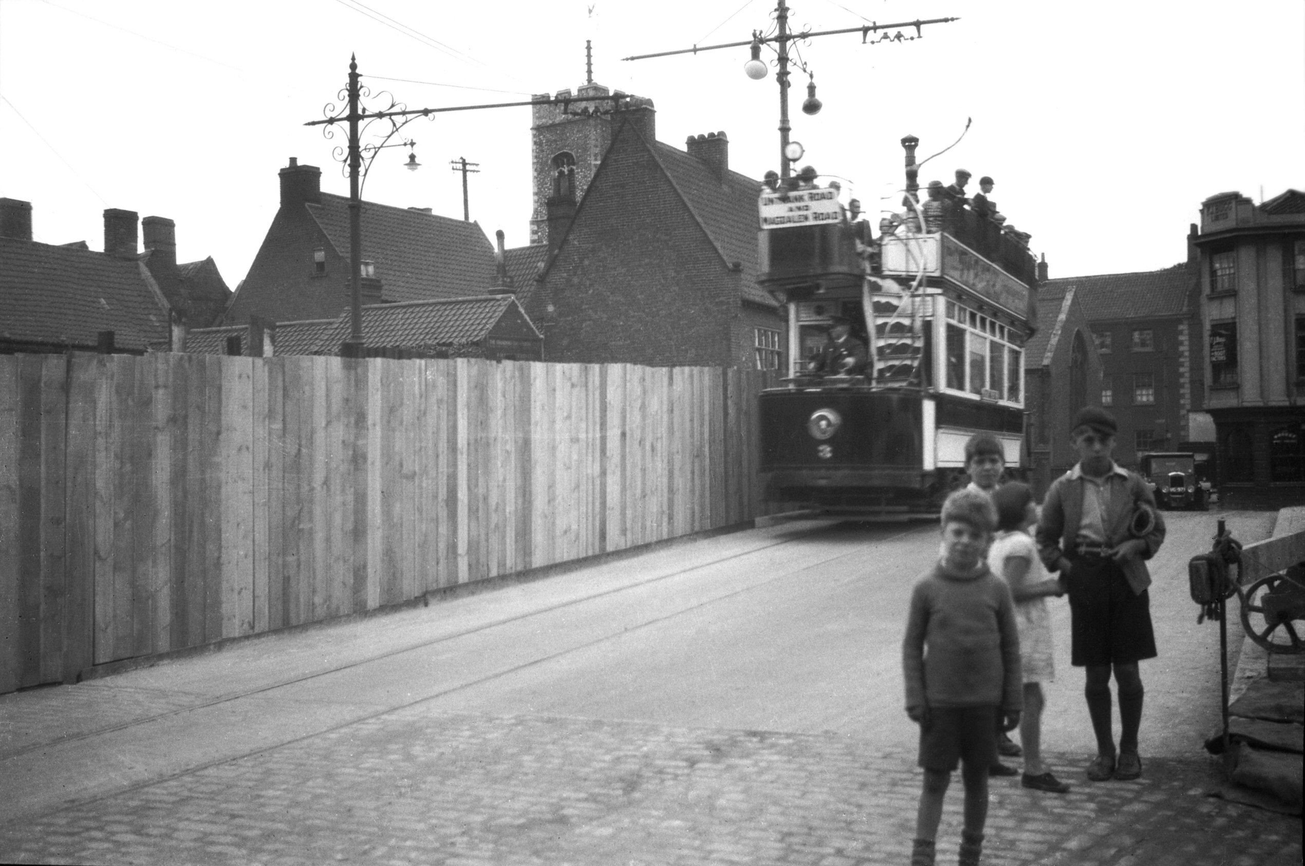
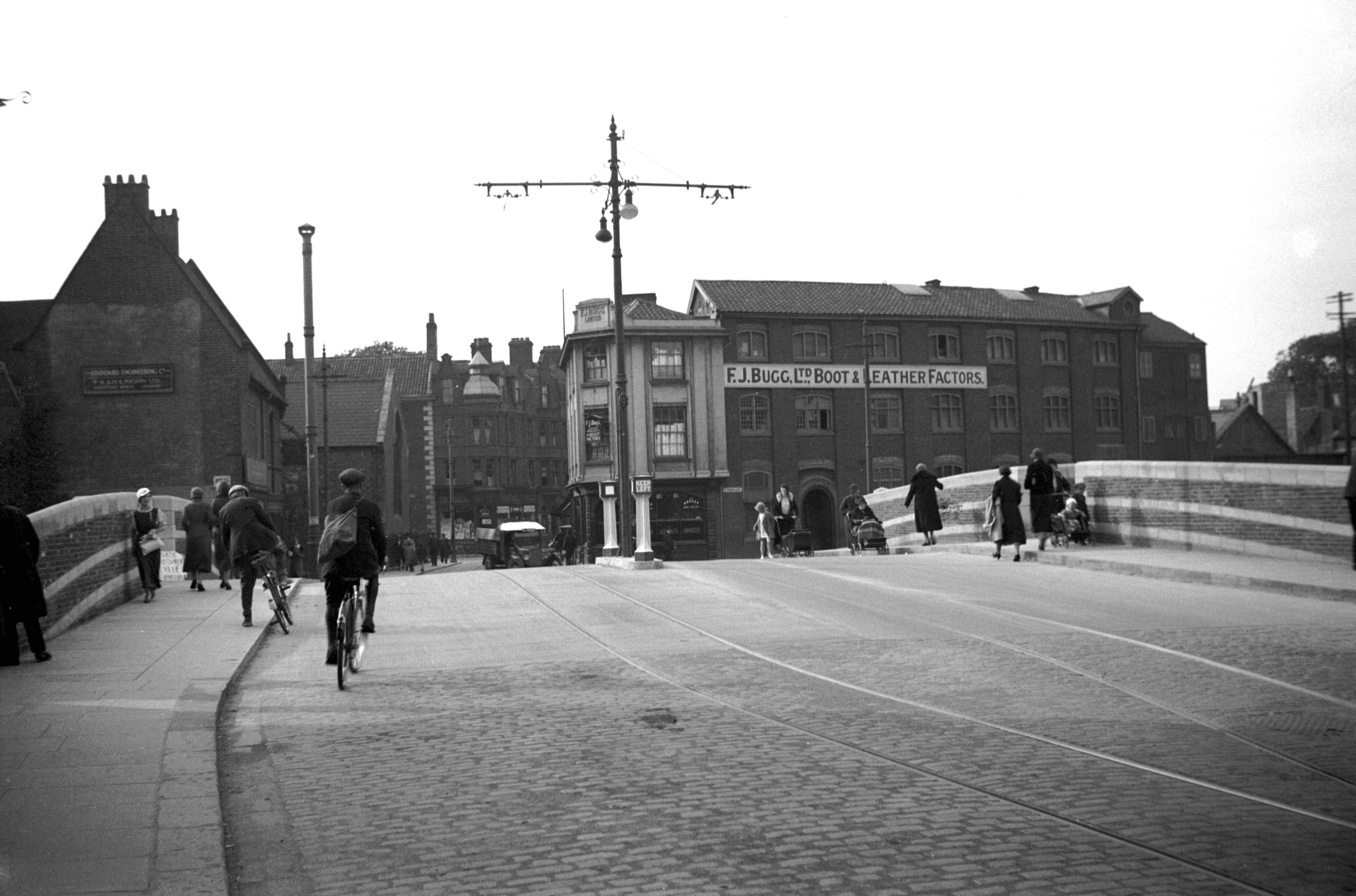
Fishergate view north from Fyebridge St [B804]
1933-11-19
Fishergate 1. |
|
|
Fishergate 1 and left Fyebridge St 7 to 9 [7565]
1998-07-19
|
|
|
Fishergate north side fish curing premises [6292]
1984-04-24
Rear of 17 Fye Bridge St. |
|
|
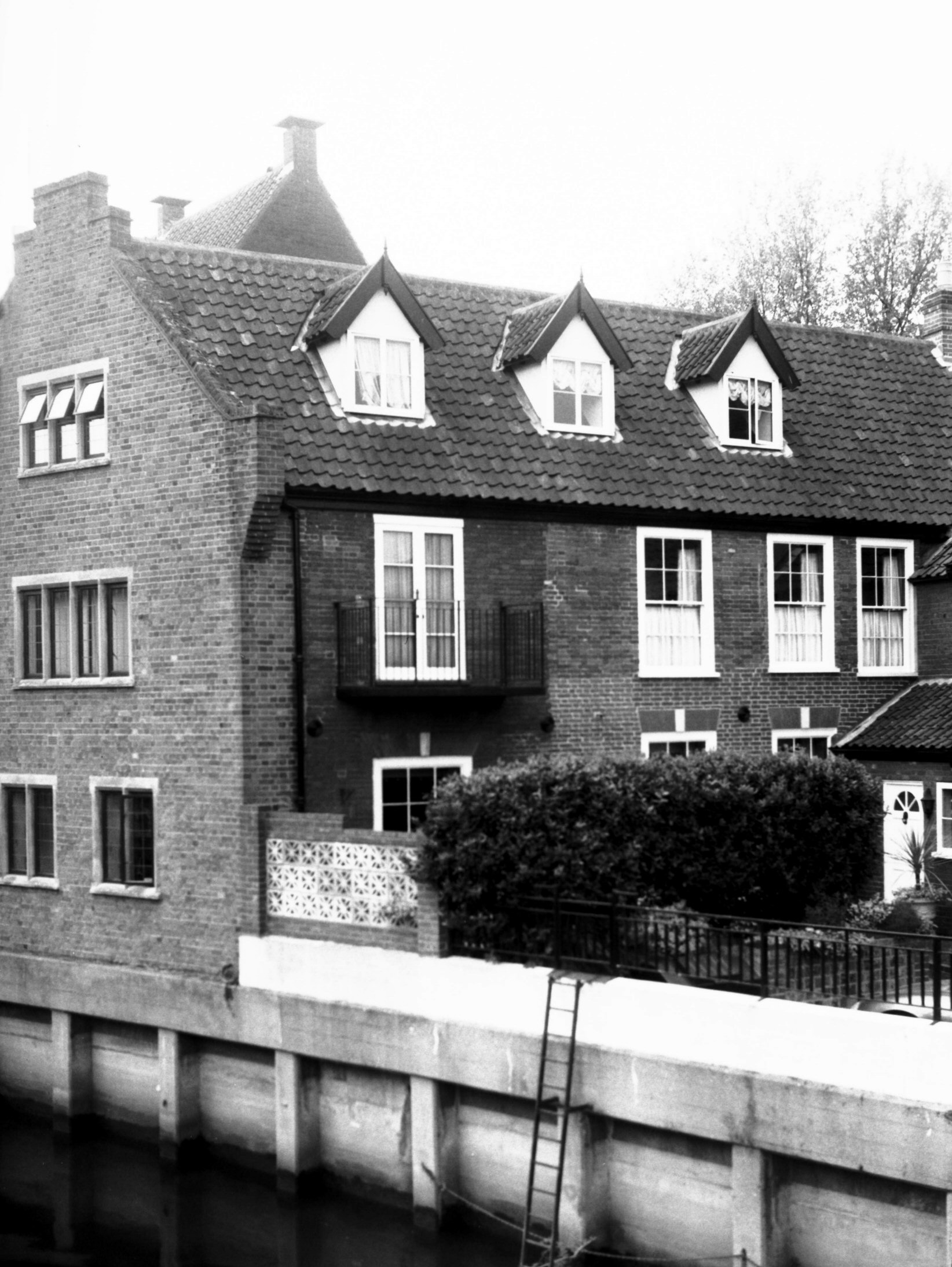
Fishergate 15 to 31 [0782] 1936-03-05
|
|
|
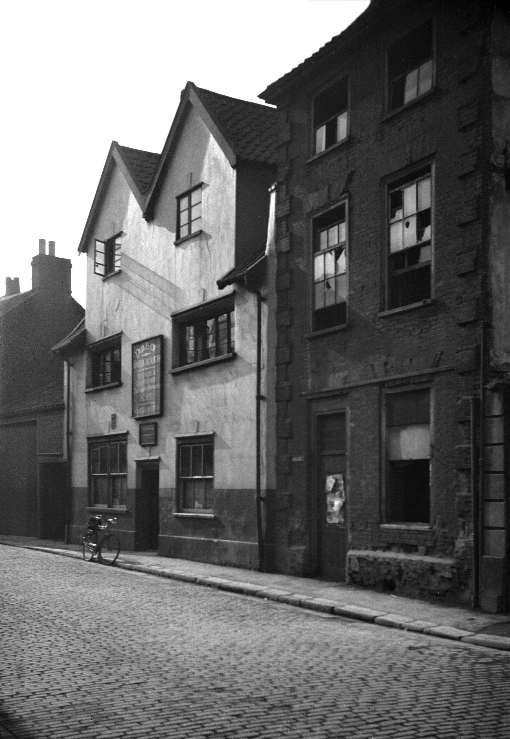
Fishergate 29 Duke of Marlborough PH to 31 [0781]
1936-03-05
|
|
|
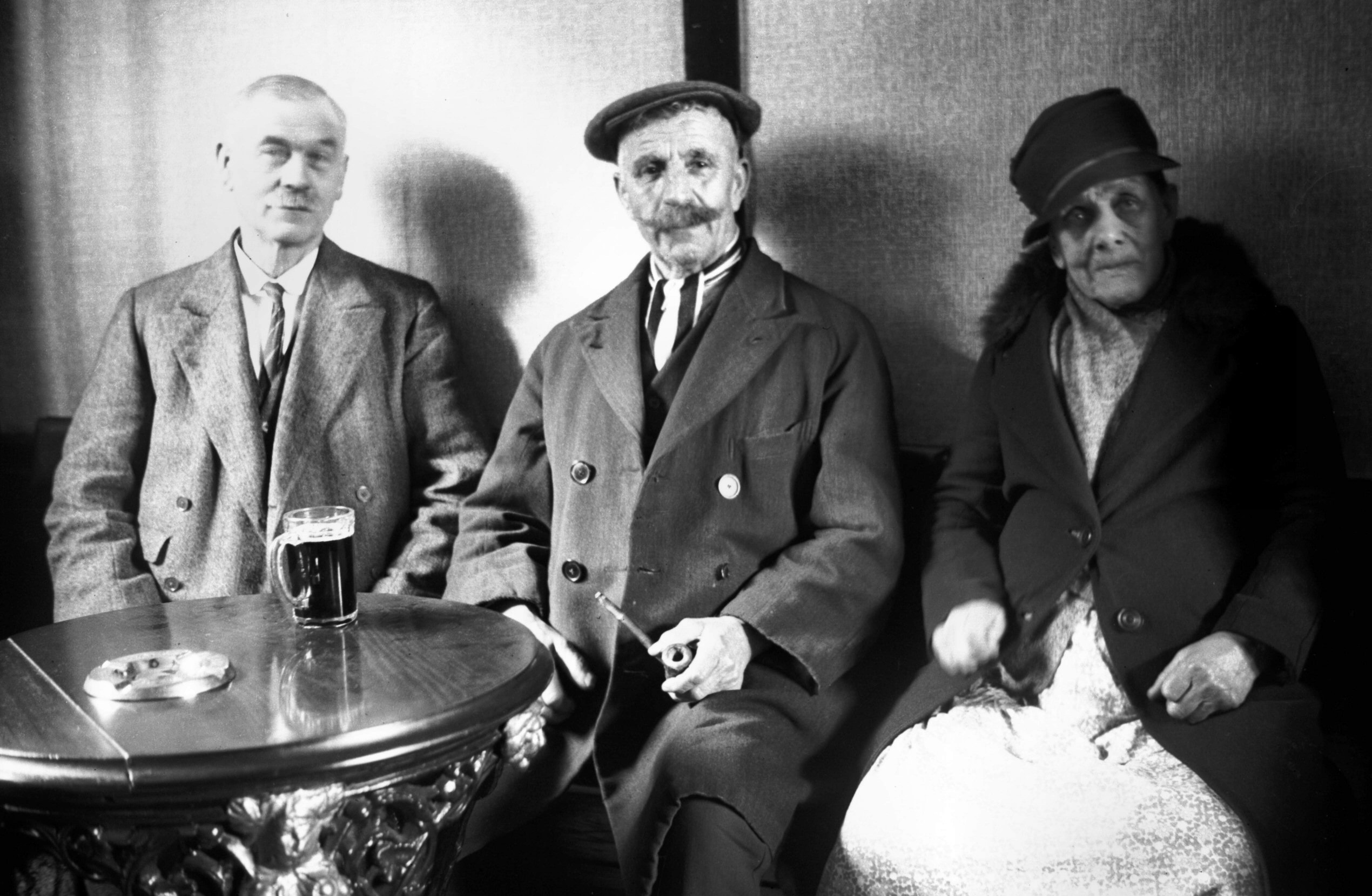
Fishergate 29 Mr Thrower publican on left [2896]
1939-03-31
Landlord and two customers. |
|
|
Fishergate 33 to 35 view east [0019] 1934-01-21
|
|
|
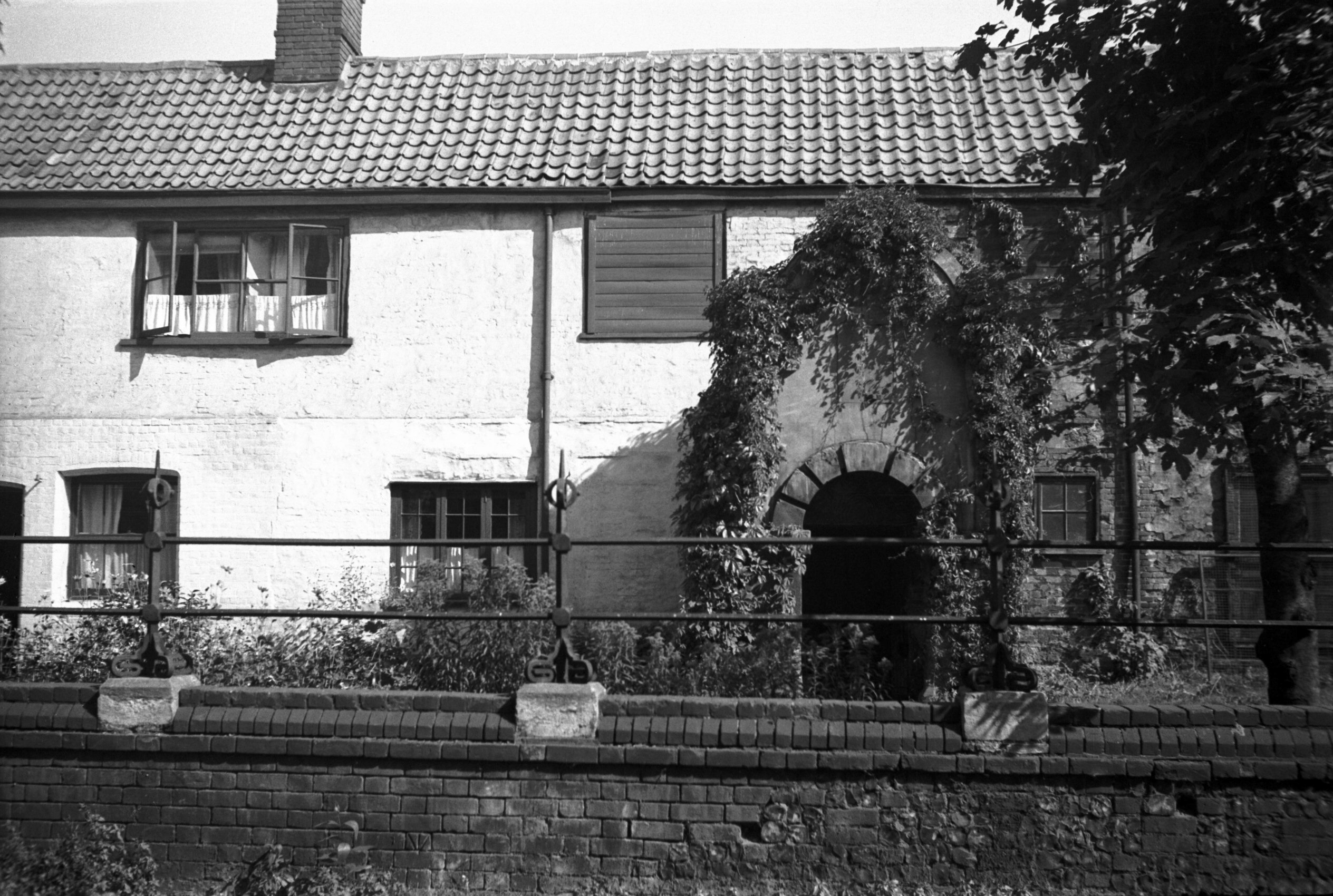
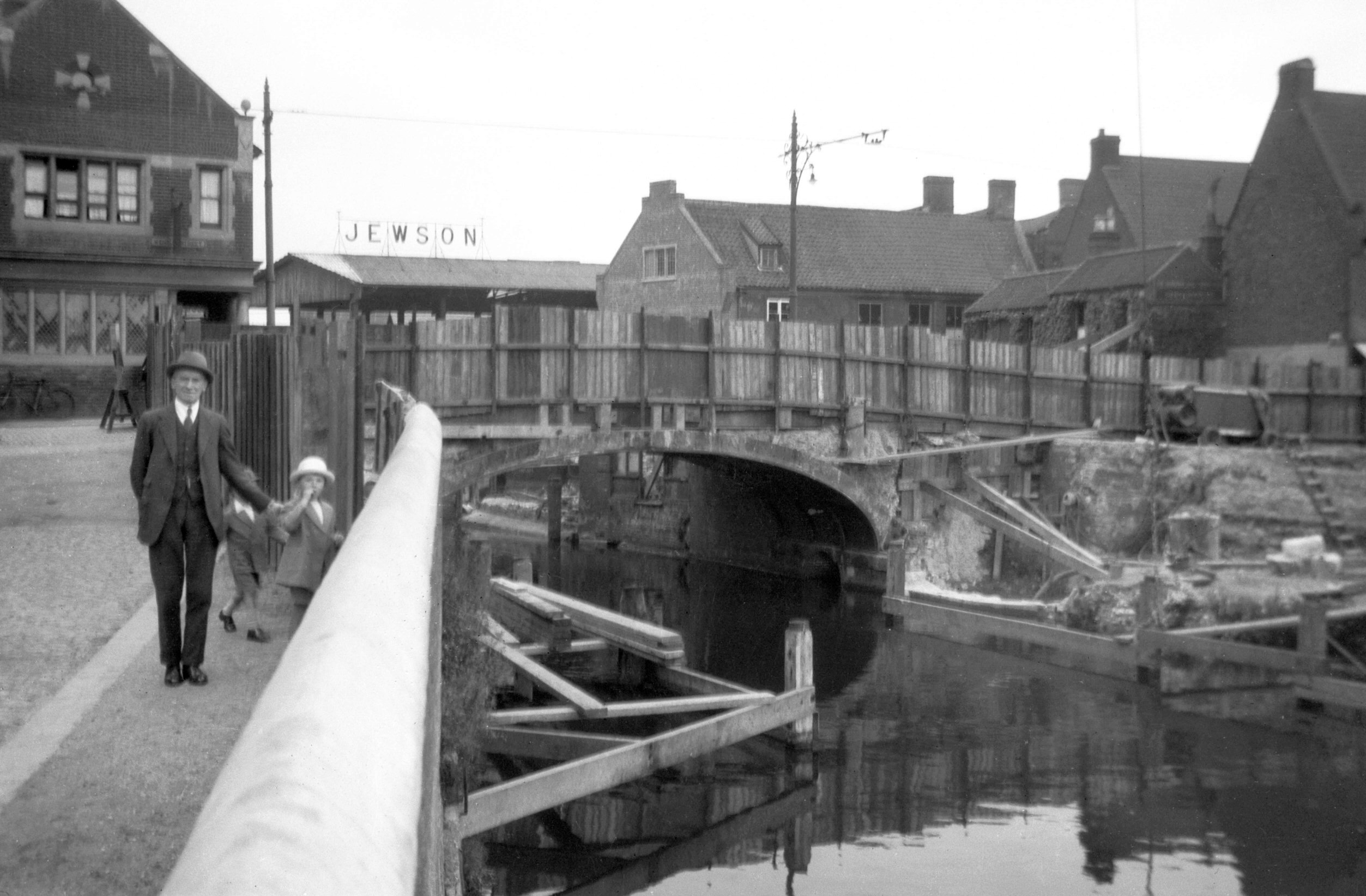
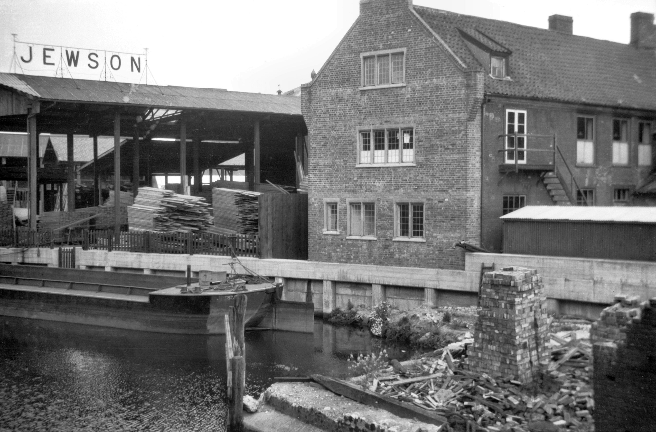
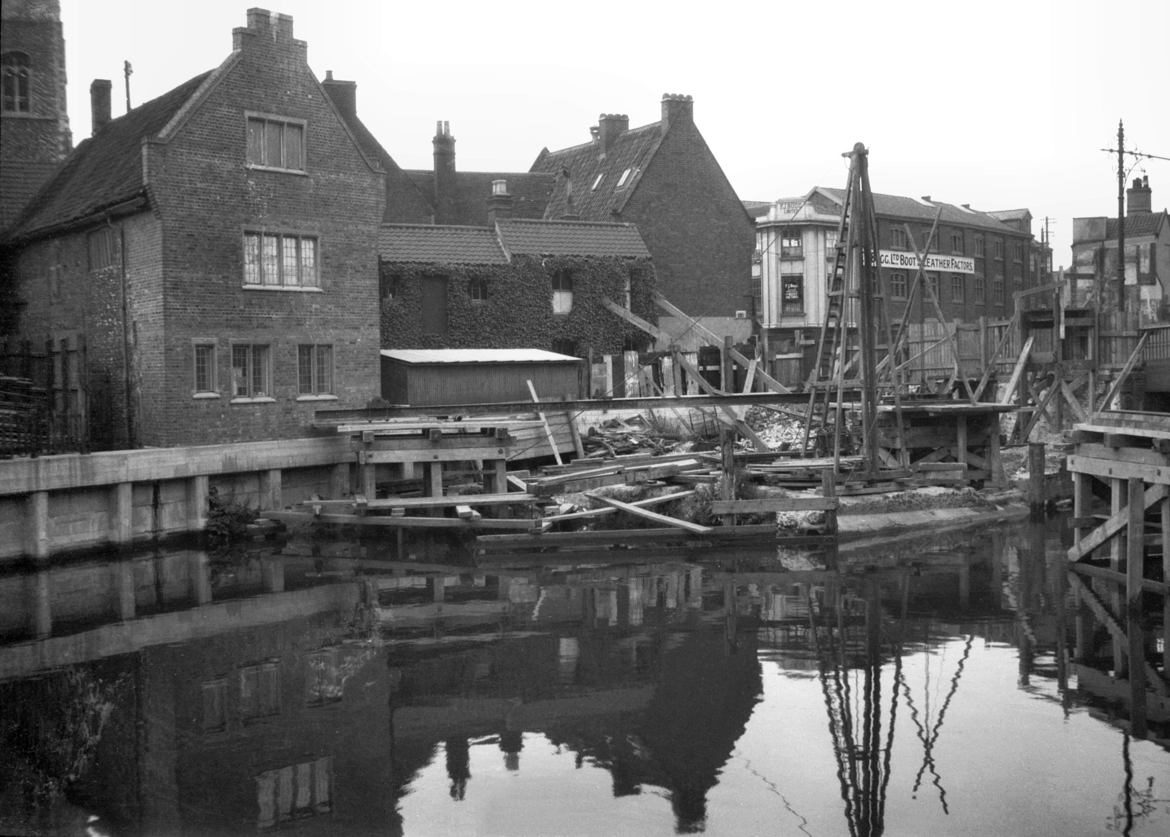
Fishergate Thompson's Yard [6440] 1987-03-12
Adjoining rear of Gurney Court, Magdalen St. |
|
|
Fishergate Thompson's Yard south wing [6441]
1987-03-12
|
|
|
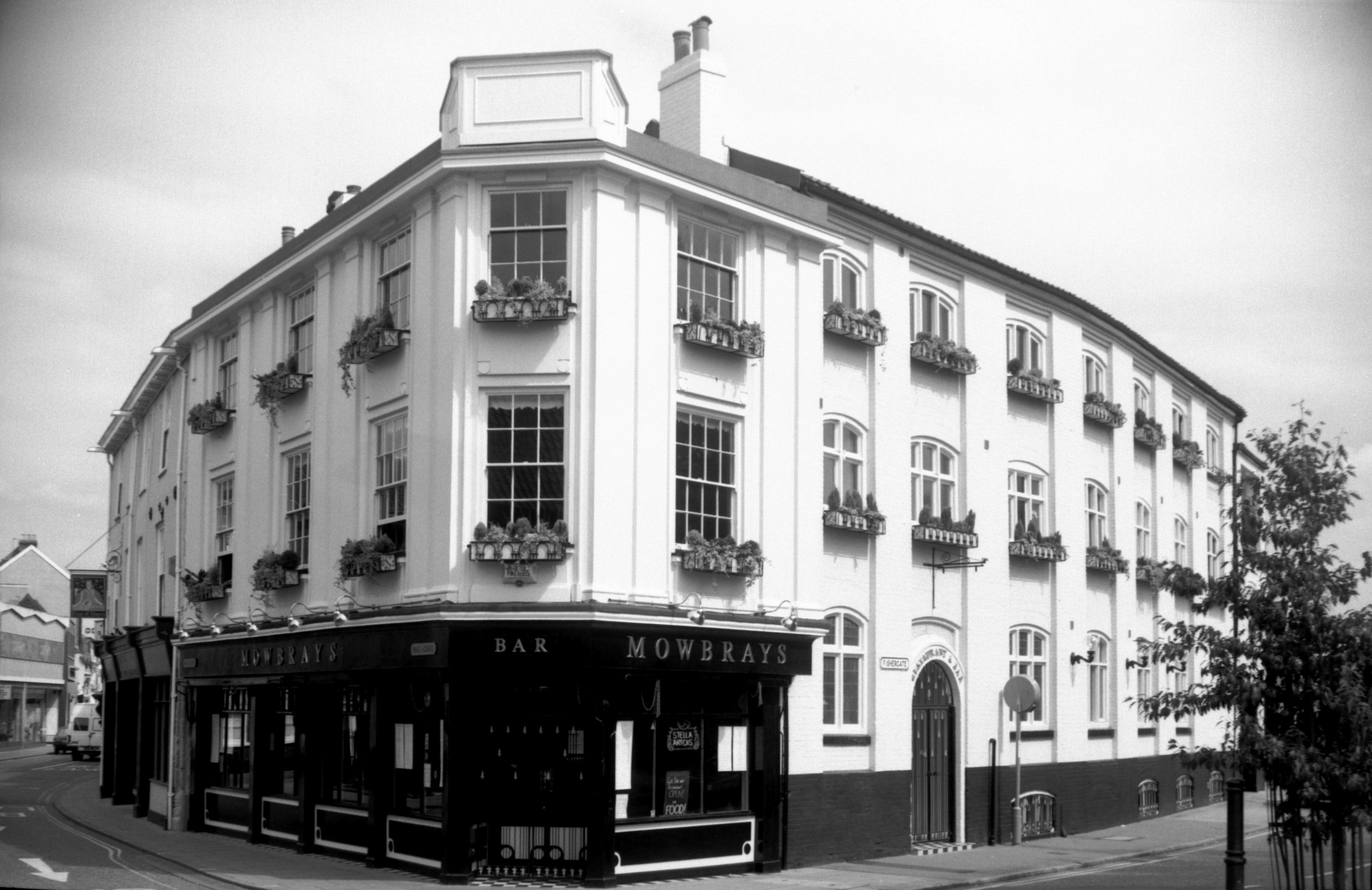
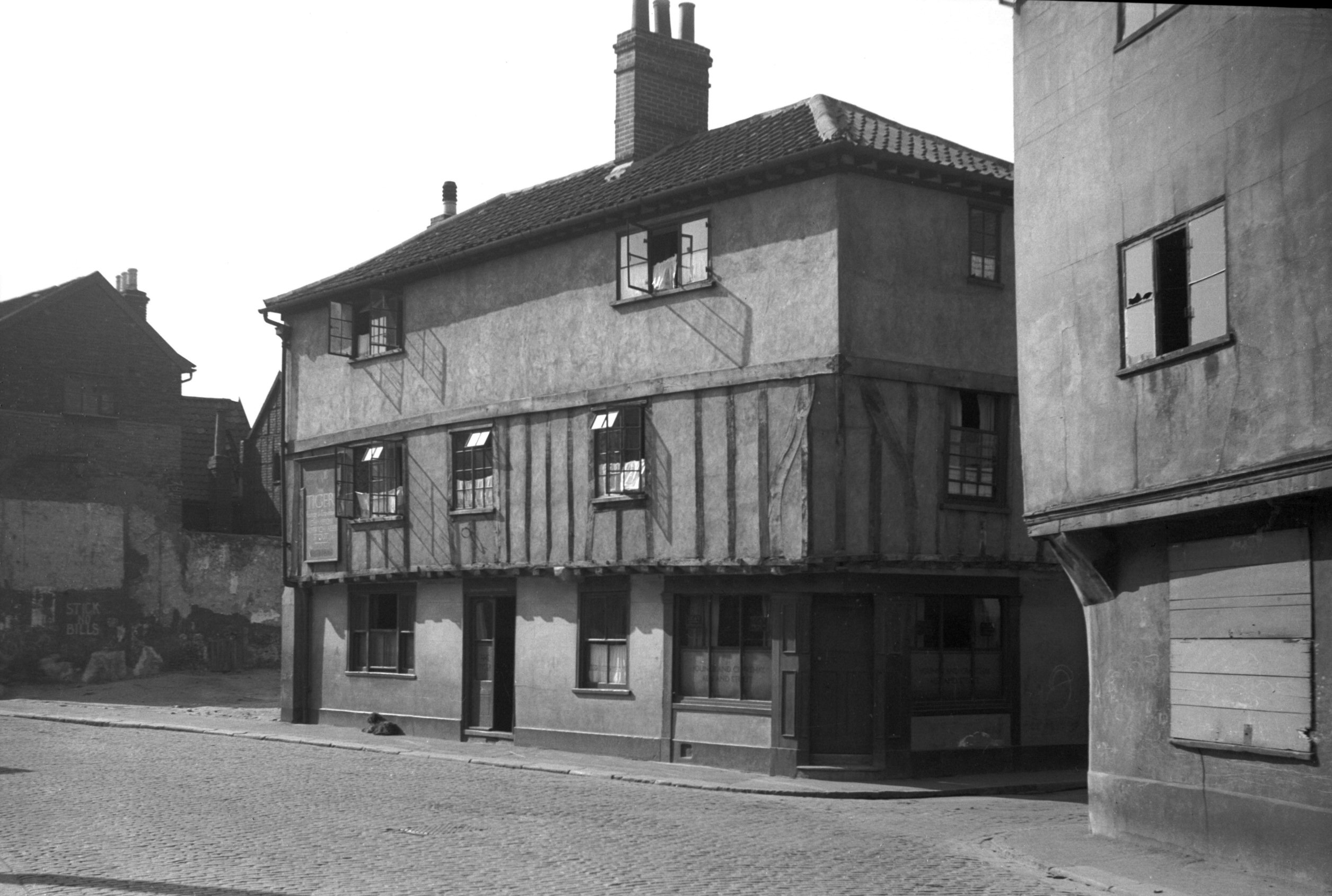
Fishergate 49 Tiger PH [0290] 1934-09-13
Opposite St Edmund's Church is the entrance to the
southern half of what was formerly Peacock St. The
northern half (isolated by the Inner Link road) retains
the old name, but this section is now known
(inexplicably) as Blackfriars St. The Blackfriars'
original site was in Colegate on the other side of
Magdalen St, while much of their later premises survives
as St Andrew's and Blackfriars' Halls on the south side
of the river.
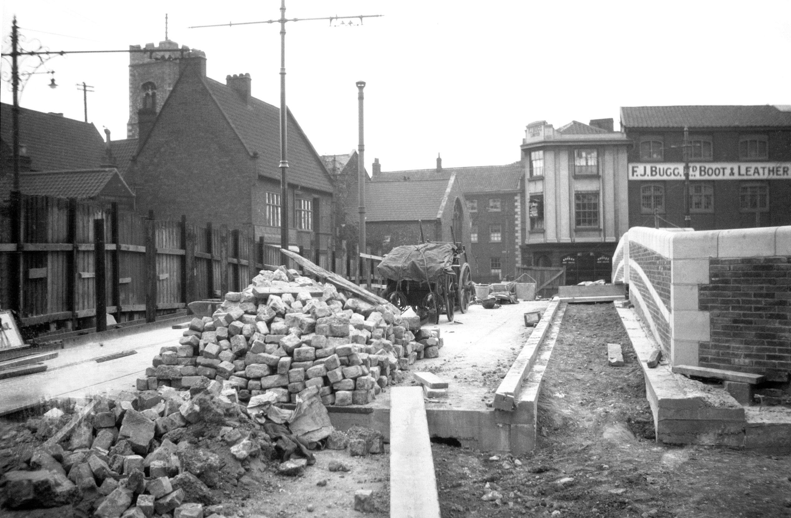
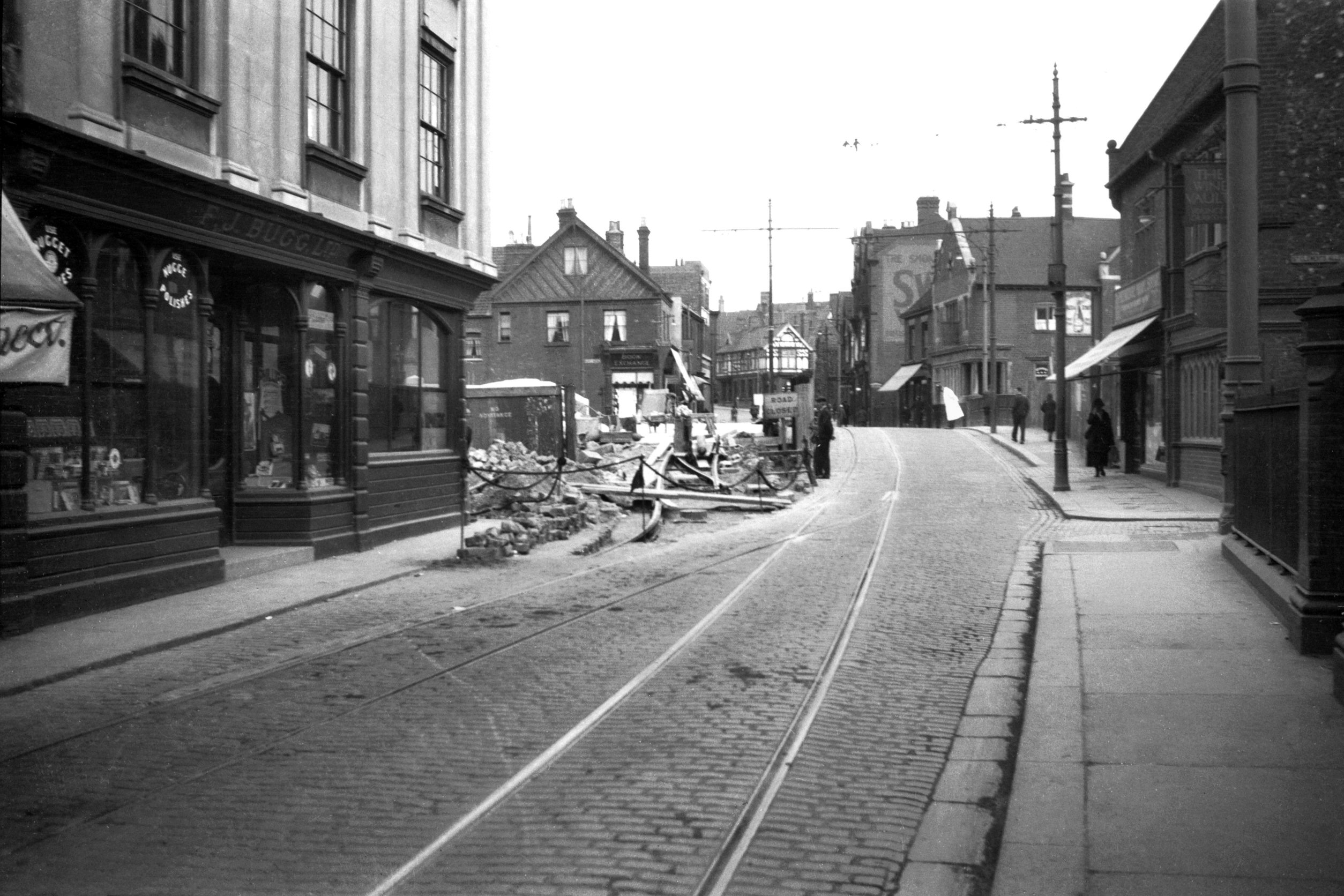
No 49 Fishergate, which stood at the corner until road
works were carried out in 1936, was the Tiger inn.
Writing only three years before its demolition, Ralph
Mottram described it as being "well kept by its
admirable owners, and [with] other frontages shows what
the street was once like". It was a Tudor building
of three storeys, both upper floors being jettied, and
with beams exposed at first floor level. Upon its closure
the licence was transferred to the Oval public house on
Dereham Rd. |
|
|
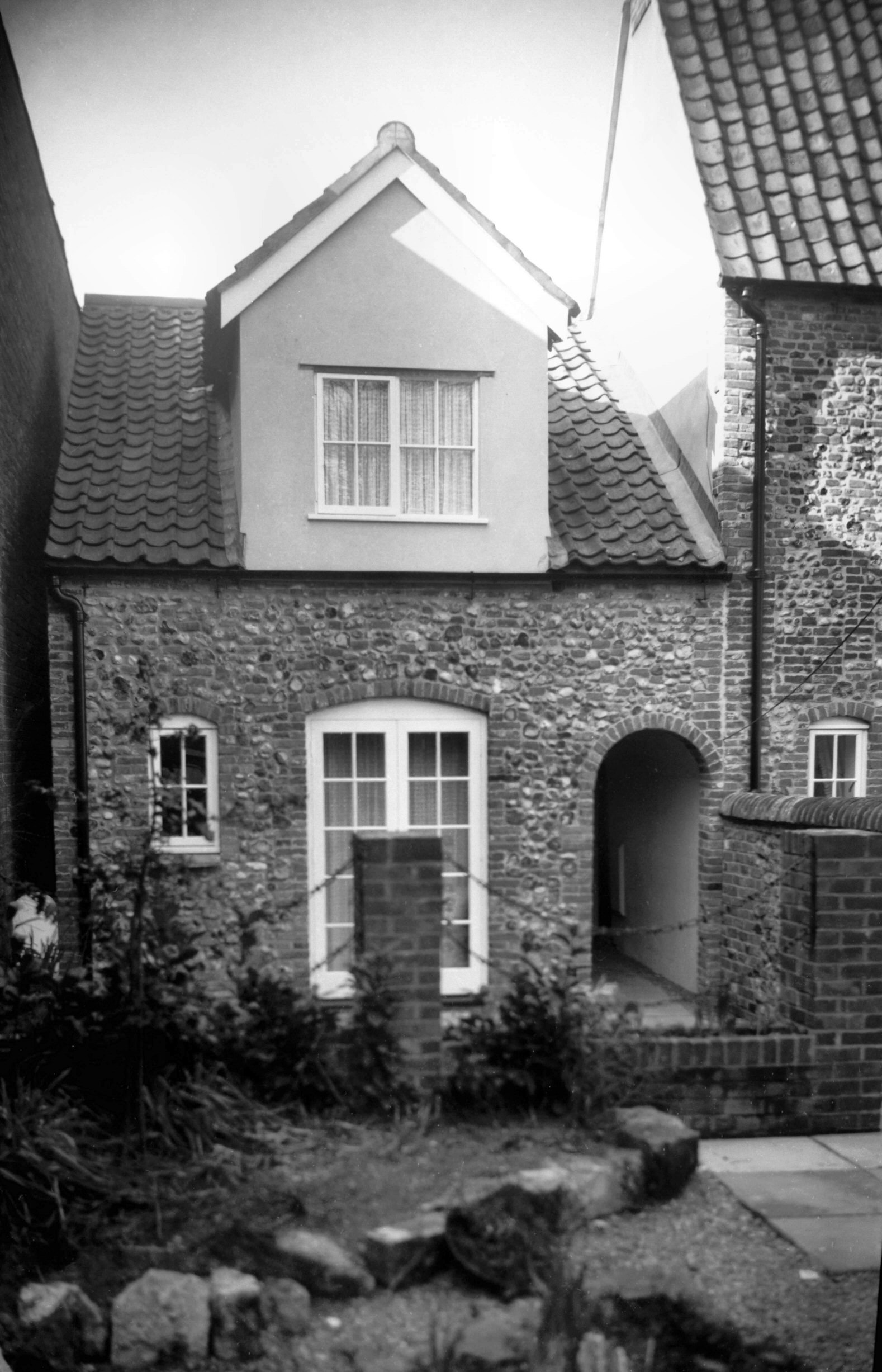
Fishergate 61 Anguish's School [0752] 1935-09-12
Entering Fishergate from Whitefriars, on the north side
is the site of Anguish's School - or as it was more
popularly called the "Bluecoat" or
"Bluebottle" School. Named after its founder,
Thomas Anguish (Mayor in 1611), the school occupied a
house and other property bequeathed by him for the
education of boys and girls "who have not friends to
help them". On 1st January 1621, ten boys and two
girls were the first to be admitted, but as further
bequests and endowments were made, so the numbers were
increased.
Francis Blomefield, the 18c Norfolk historian, giving a
very full account of its foundation and extension added
"this hath now no less than thirty and six poor boys
who are decently clothed in blue coats and red
caps". The girls, incidentally, had in 1664 been
transferred to a separate establishment at Golden Dog
Lane under the terms of a bequest by Robert Baron, Mayor
in 1649.
The Fishergate building ceased to be used as a school in
1885 when the endowment income was allocated instead
towards helping boys in secondary education and
apprenticeships. For the girls a school of Housecraft had
been set up in 1864 at Hospital Lane, Lakenham. In the
mid-1930s the schoolhouse itself (the southern wing of
the building facing Fishergate) was removed in order to
widen the road, the master's house with its substantial
brick porch being cleared away over 30 years later. |
| |
South
side |
|
|
Fishergate 16 to 20 [0783] 1936-03-05
|
|
|
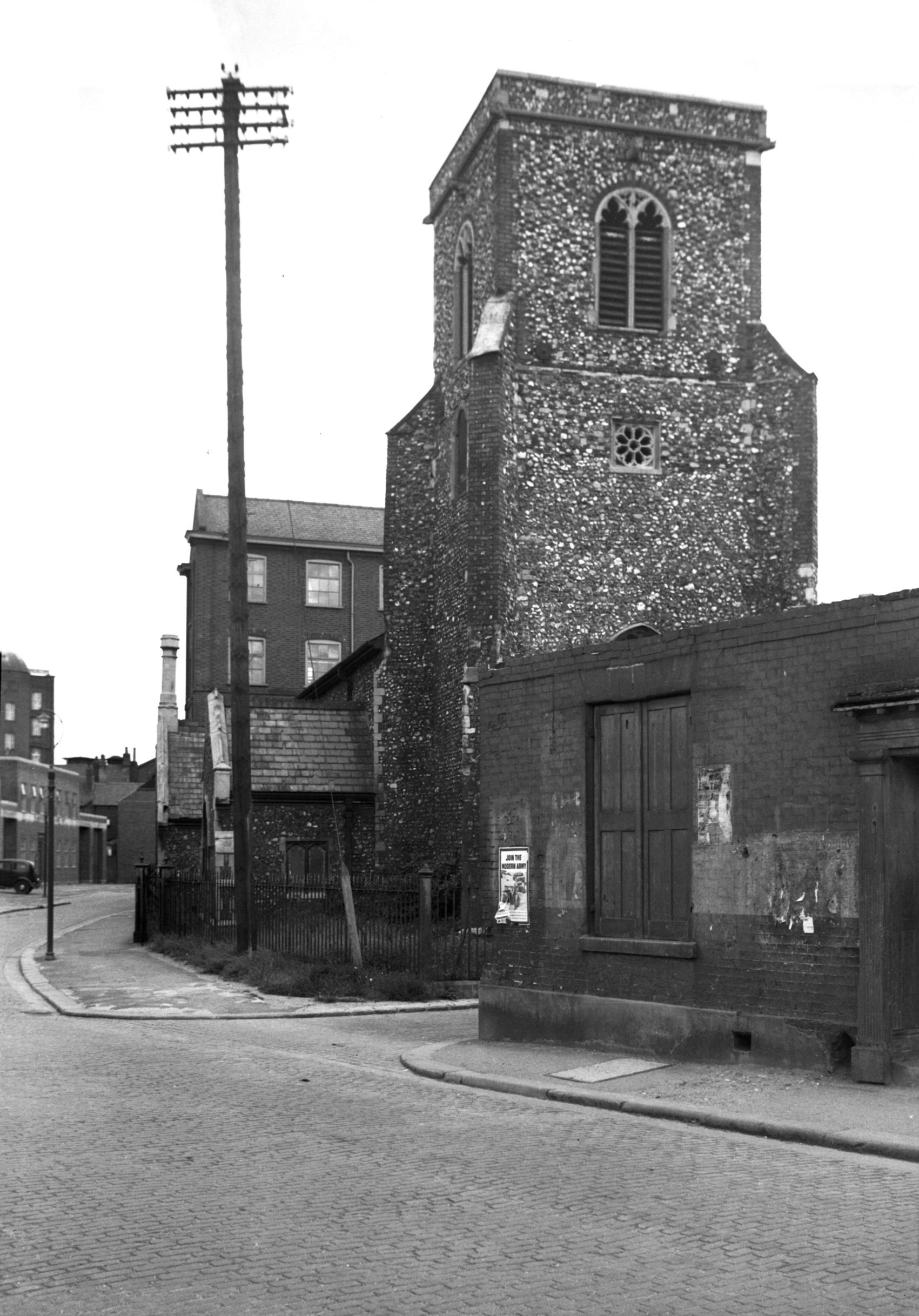
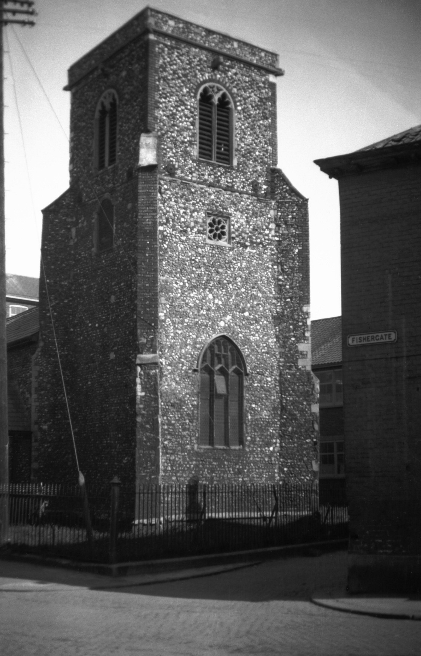
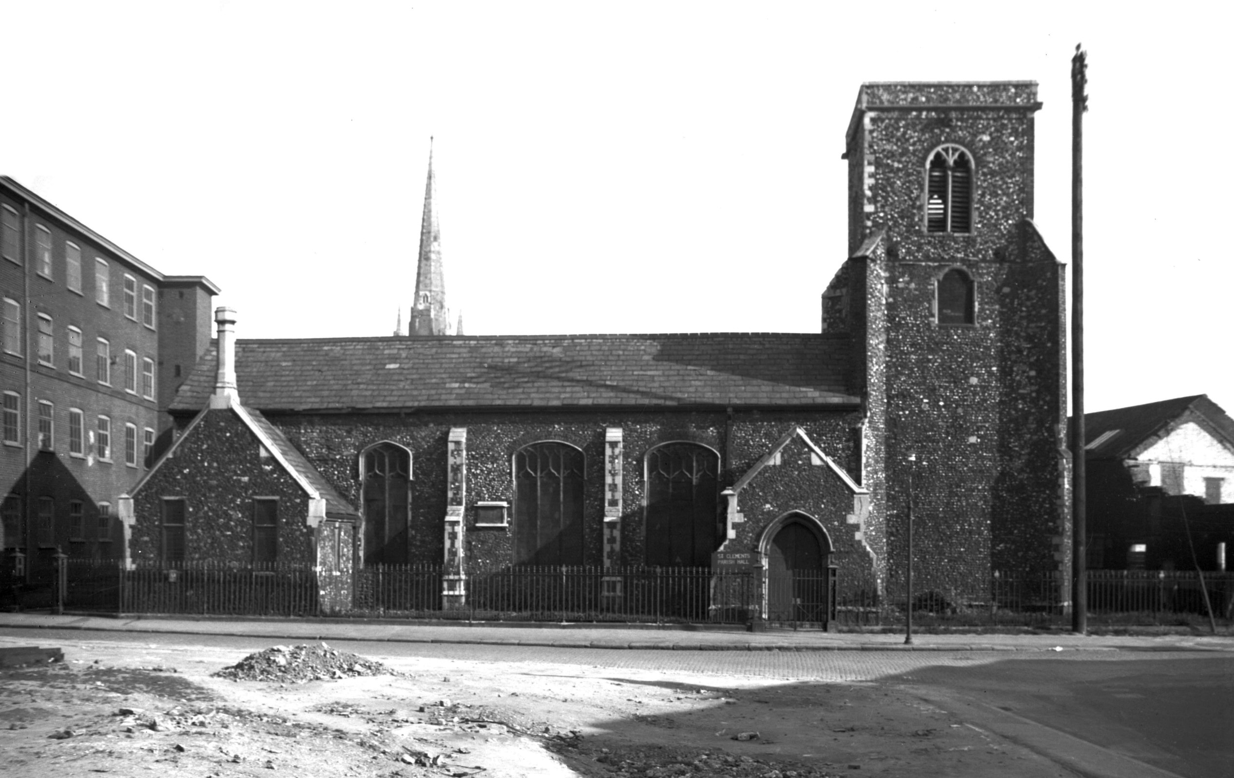
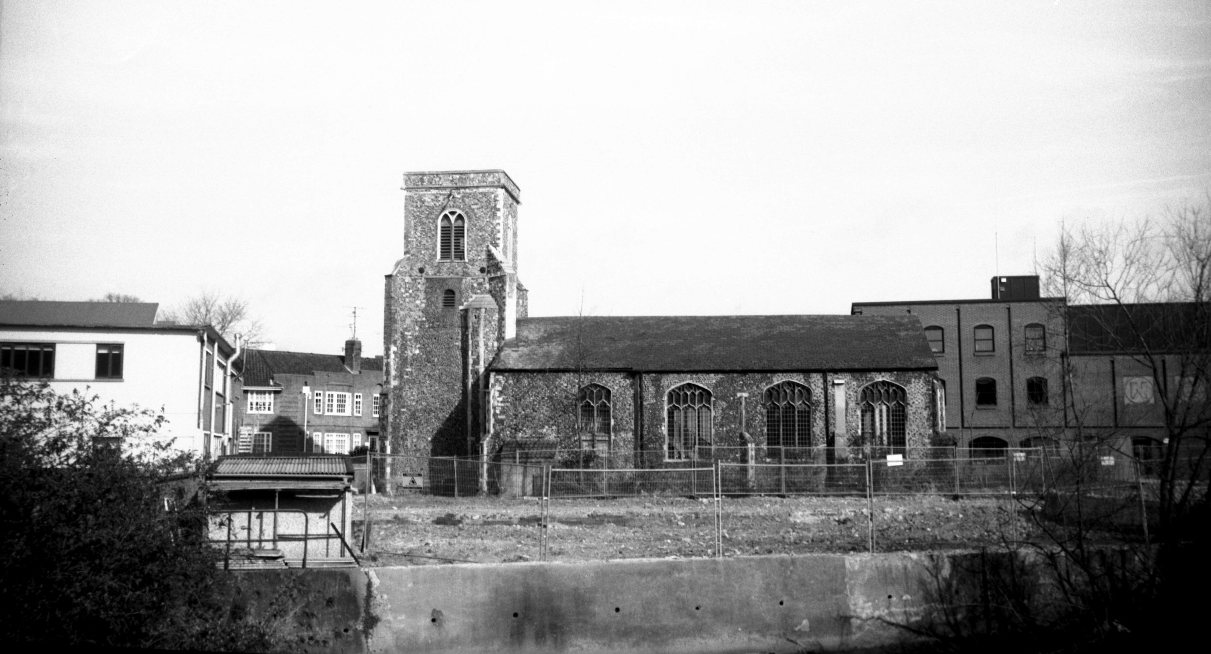
St Edmund's from west [3186] 1939-07-30
St Edmund's Church recently had its fabric restored after
a long period of redundancy and neglect. |
|
|
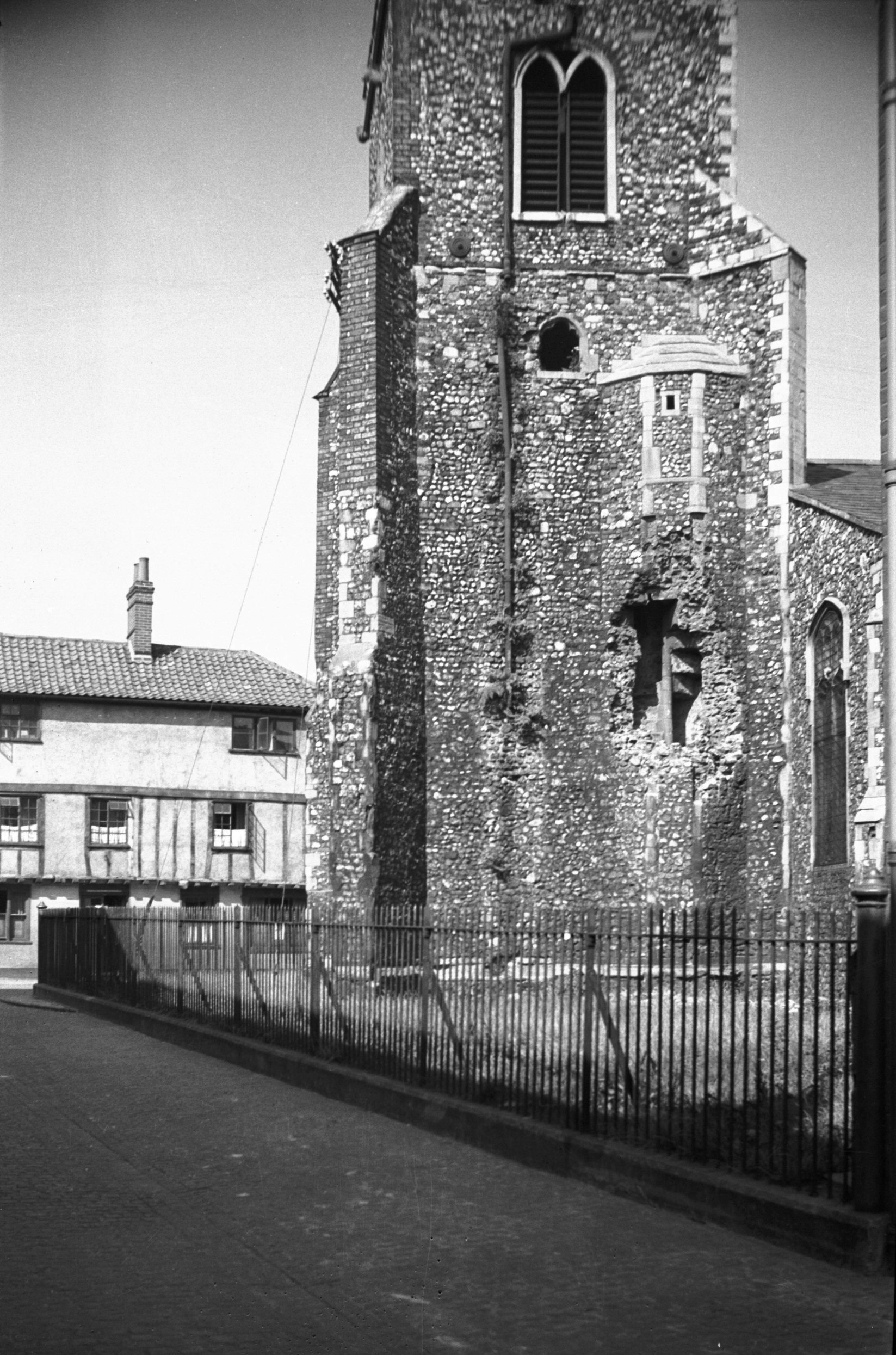
St Edmund's tower from NW [B133] 1931-00-00
|
|
|
St Edmund's north side from Fishergate [2974]
1939-05-13
16c. |
|
|
St Edmund's south side from Quayside [7812]
2001-04-01
|
|
|
St Edmund's tower south side [0753] 1935-09-12
From Hansard Lane. |
|
|
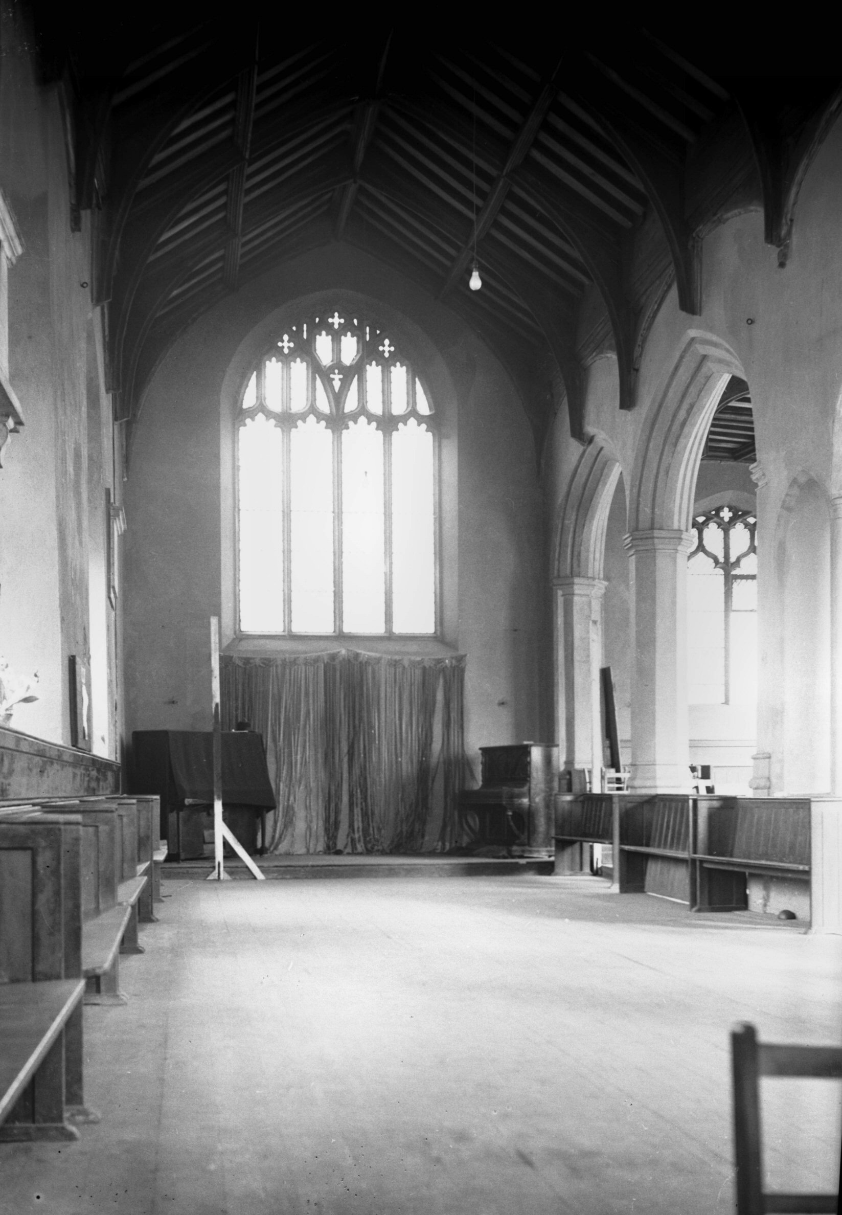
St Edmund's interior view east [2223] 1938-03-30
16c arcading. |
|
|
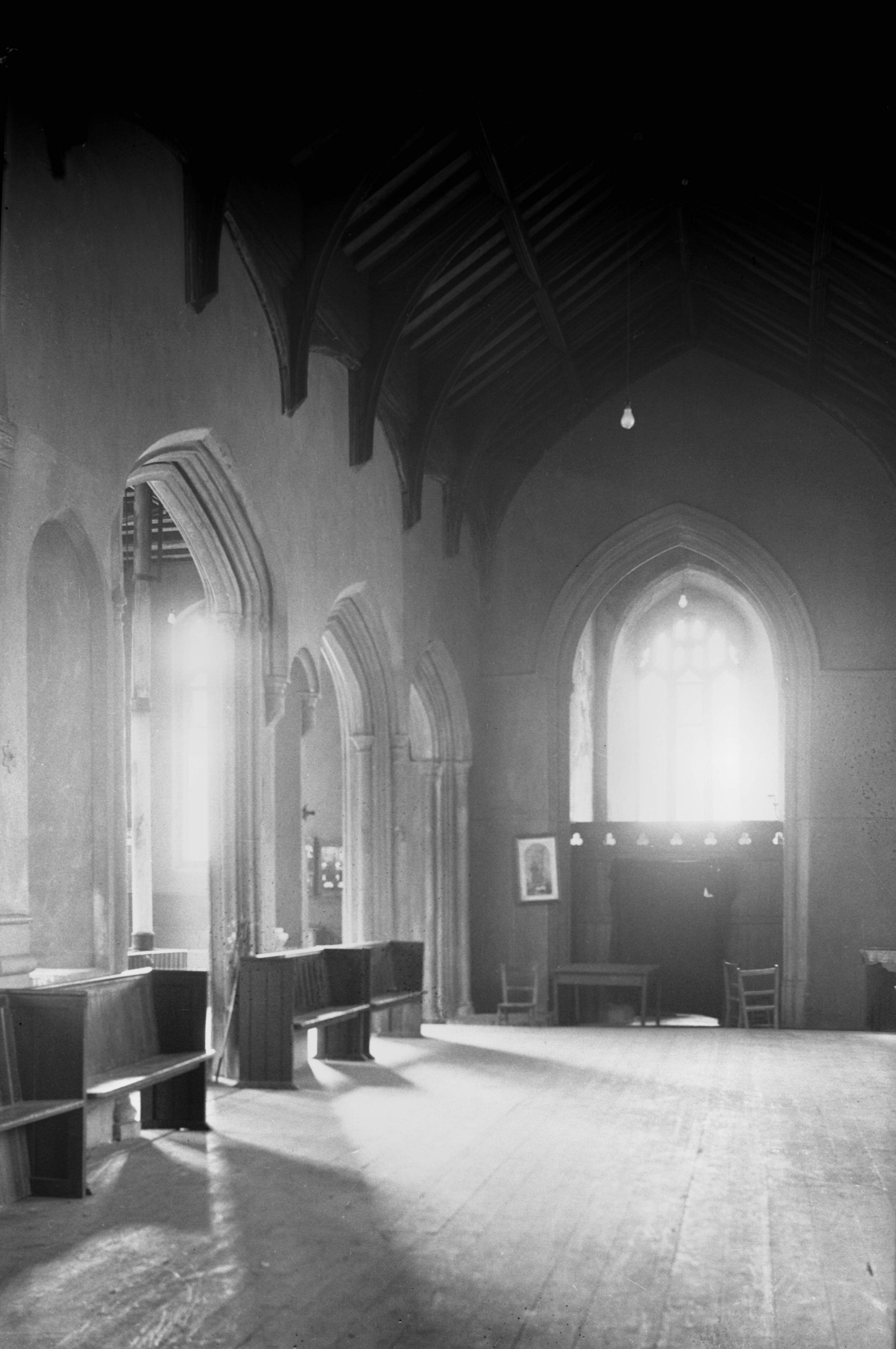
St Edmund's interior view west [2222] 1938-03-30
Two arcade piers have small arches cut through them. |
|
|
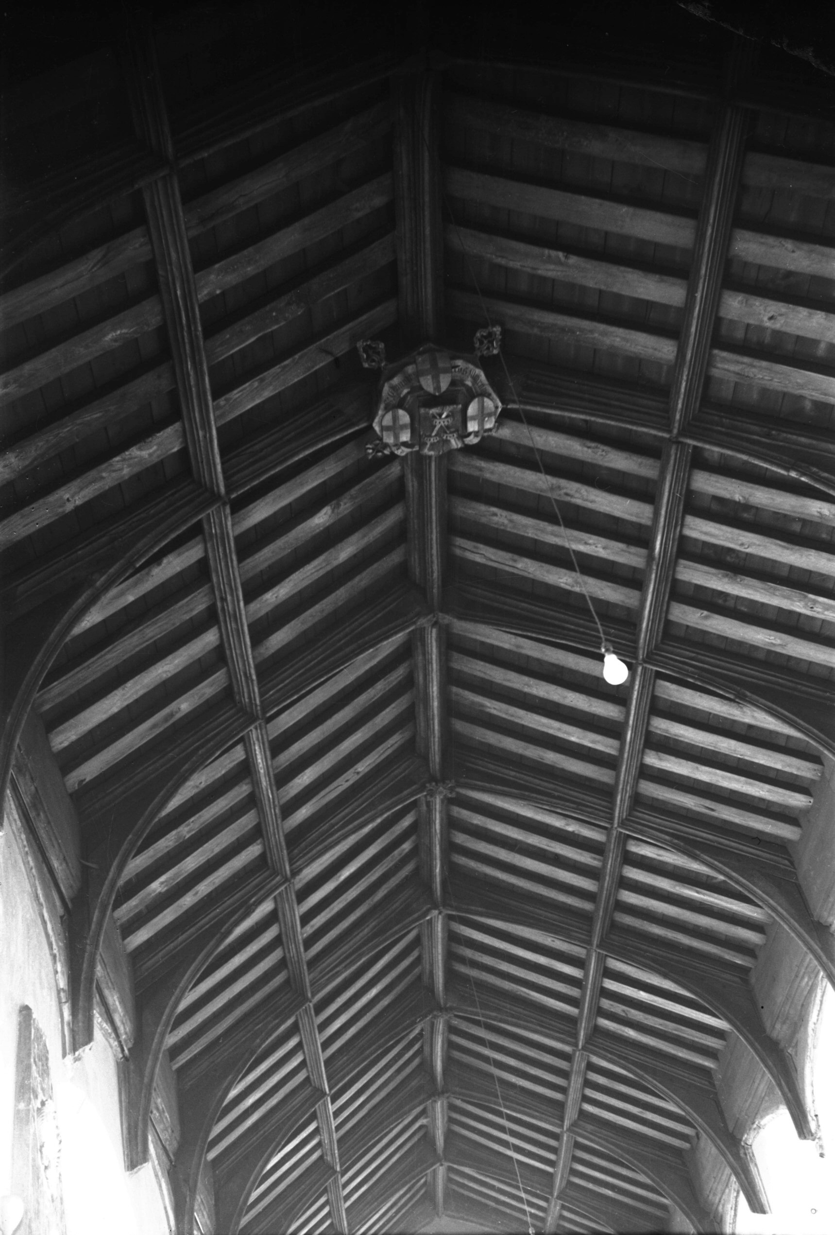
St Edmund's roof and boss [2225] 1938-03-30
Original open timber roof with large central wooden boss. |
|
|
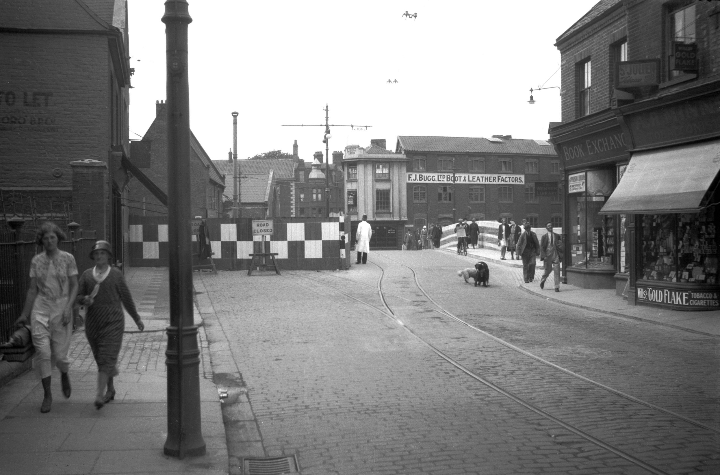
Fishergate view west from Cowgate [0020] 1934-01-21
|
|
Fyebridge St: |
| |
From
Quayside / Wensum
St to Colegate / Magdalen
St
passing Fishergate, St
Clement's Alley
East side |
|
|
Fyebridge St 11 to 15 Robert Wood's house [6320]
1984-10-04
Robert Wood, Mayor 1578. |
|
|
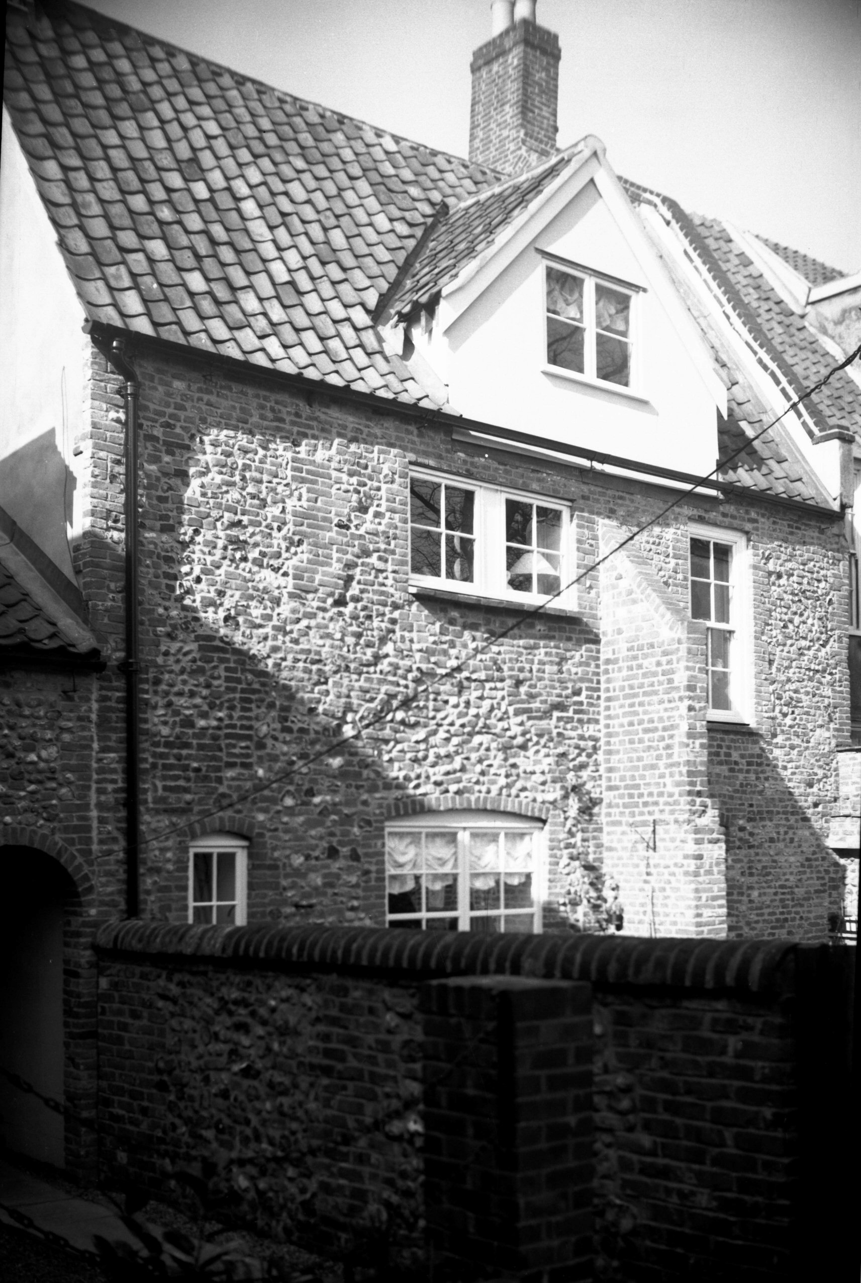
Fyebridge St 11 15c stone shaft [1691] 1937-06-06
Fyebridge St (surely one of the shortest thoroughfares in
the city) connects Magdalen St and Wensum St. Around
1920, Ian C.Hannah in his book The Heart of East
Anglia called attention to a stone shaft of the 15c
wedged between two shop fronts, of which No 11 was one.
This was indeed a surviving fragment of the house of
Edmund Wood, a grocer, who was Sheriff in 1536 and Mayor
in 1548, in which year he died. His son Robert succeeded
him, becoming Mayor in 1569 and again in 1578 when he was
knighted by Queen Elizabeth I during her visit to
Norwich.
Much of the original house remains behind its 18c
"re-front", but the stone angle shaft was
unfeelingly cemented over, some time after this picture
was taken in 1937. Happily though it has recently been
re-exposed, perhaps as a result of the attention drawn to
it by my 1987 book Disappearing Norwich. Another relic,
the spandrels of its doorway, carved with Edward's arms
and those of the Grocers' and Mercers' Companies, now
forms part of the front doorway of 24 Princes St. |
|
|
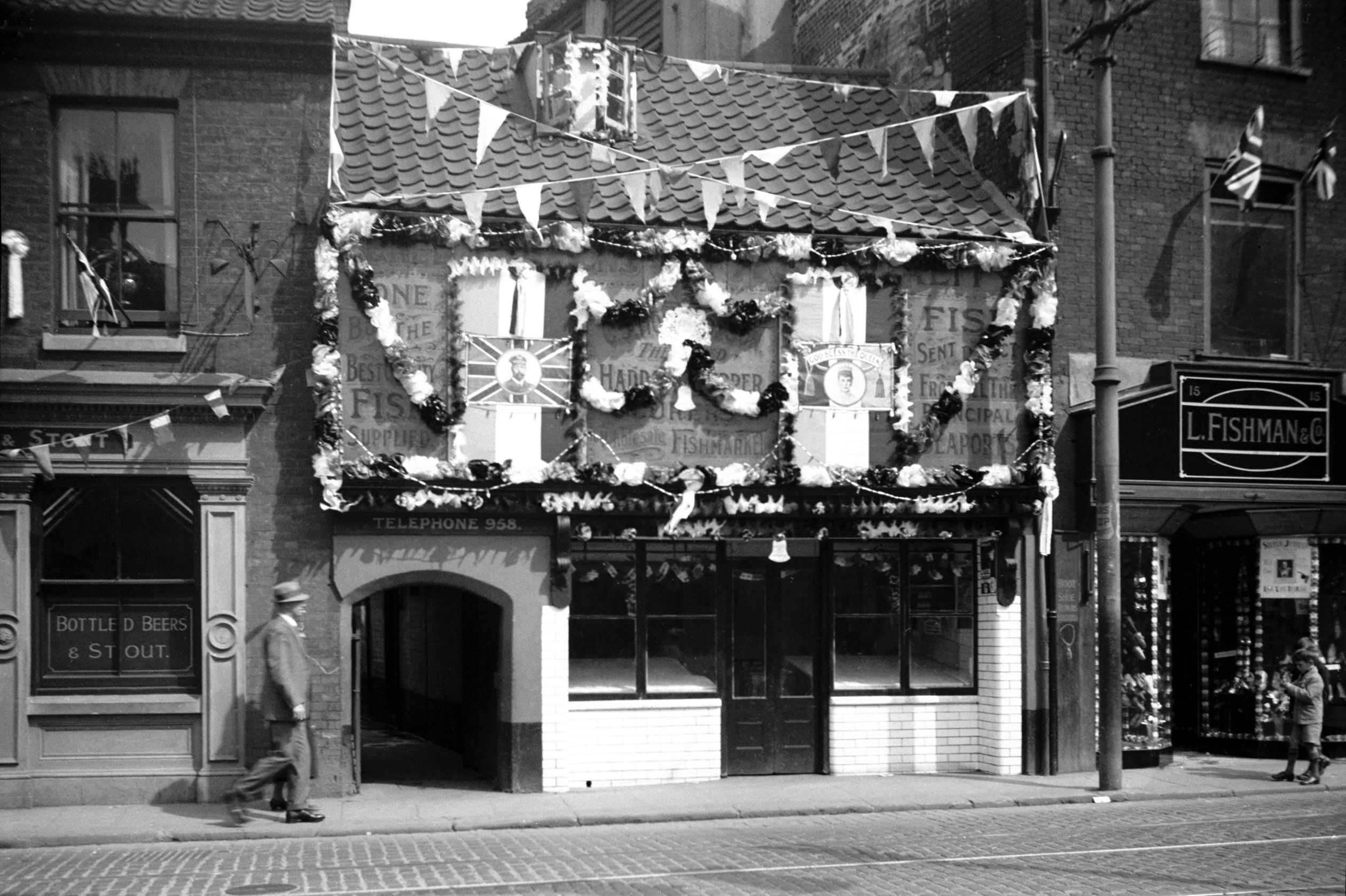
Silver Jubilee Fyebridge Howard's fishshop [0519]
1935-05-05
Silver jubilee decorations. |
|
|
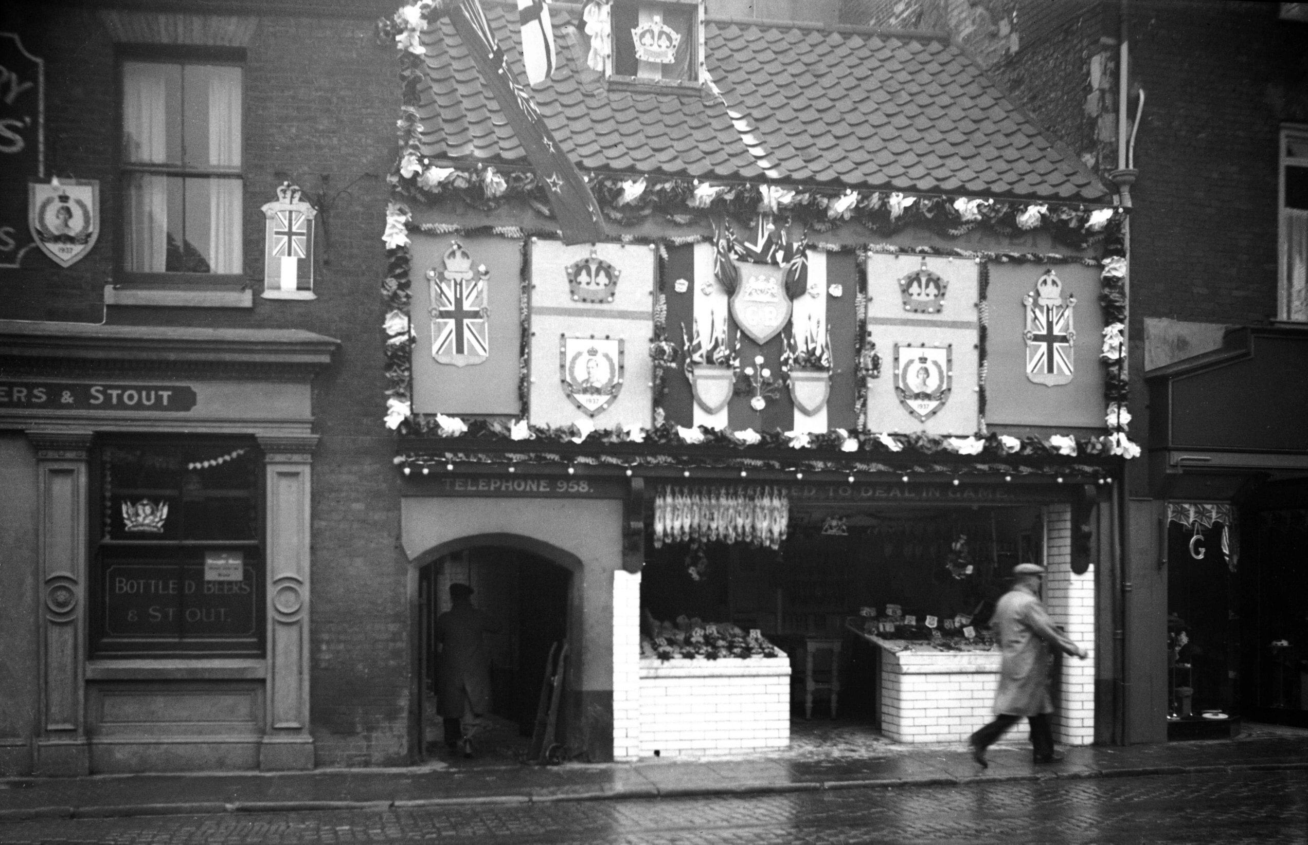
Coronation Fyebridge St Howard's fishshop [1621]
1937-05-13
C.J.Howard, Fyebridge St, very highly commended business
premises. 1937 coronation decorations. |
|
|
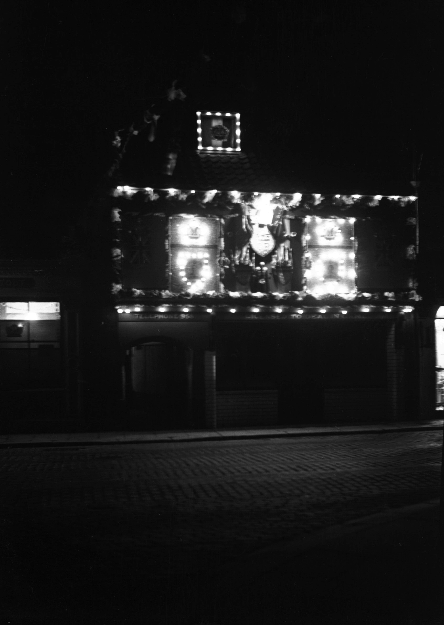
Fyebridge St 17 Howard's fishshop floodlit [1630]
1937-05-13
For 1937 coronation celebrations. |
|
|
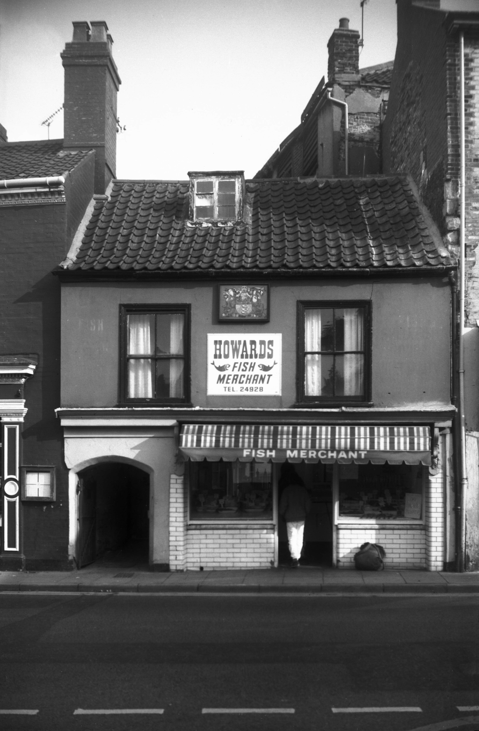
Fyebridge St 17 Howard's fishshop [6349] 1985-10-22
|
|
|
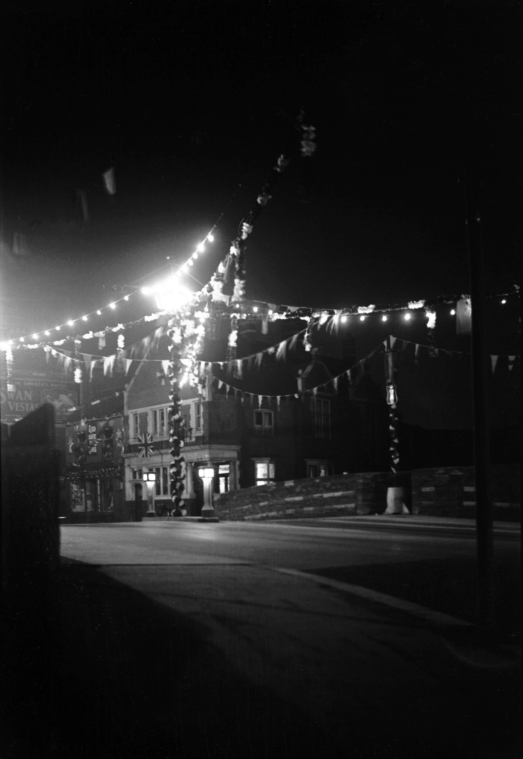
Fyebridge St coronation floodlit [1629] 1937-05-13
|
| |
|
|
|
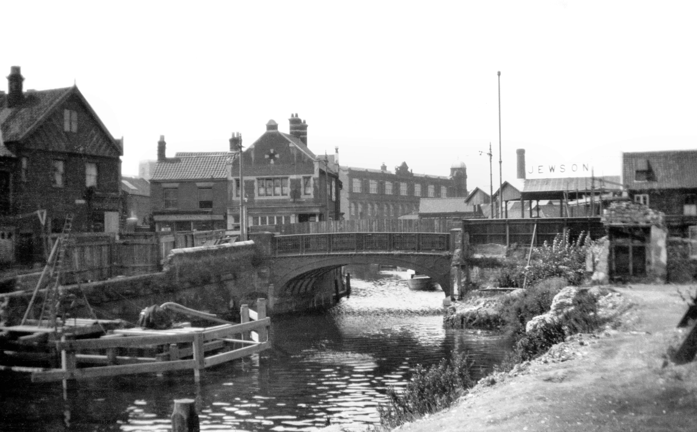
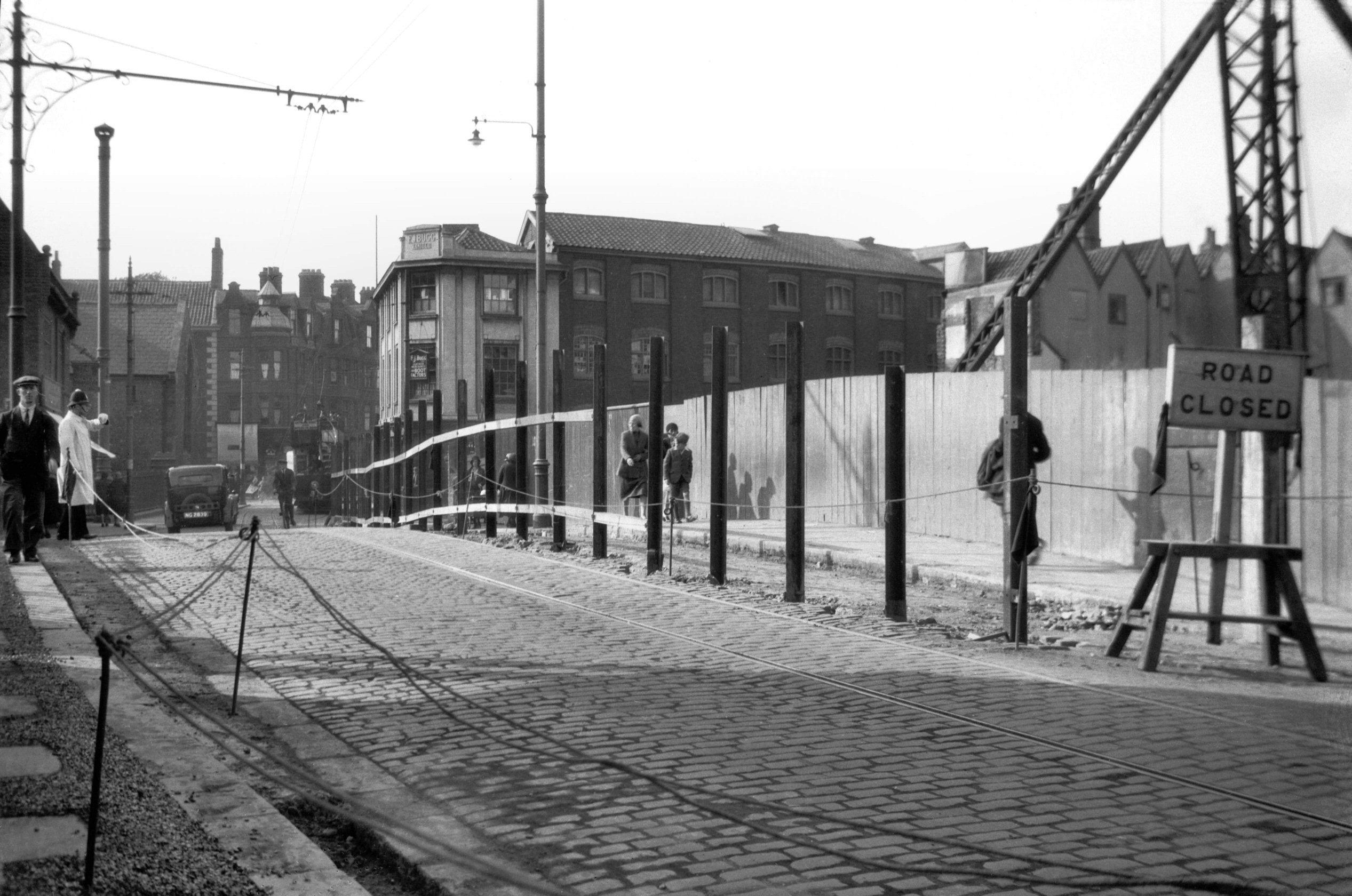
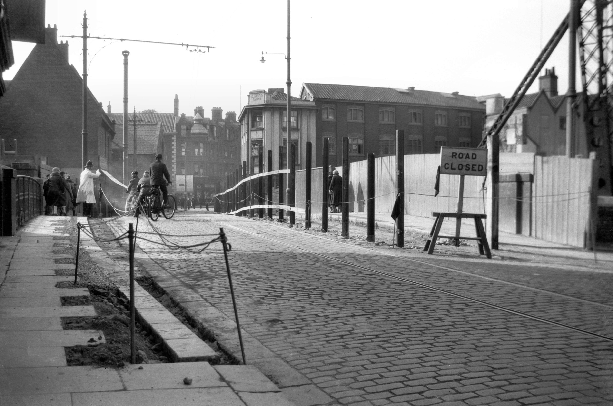
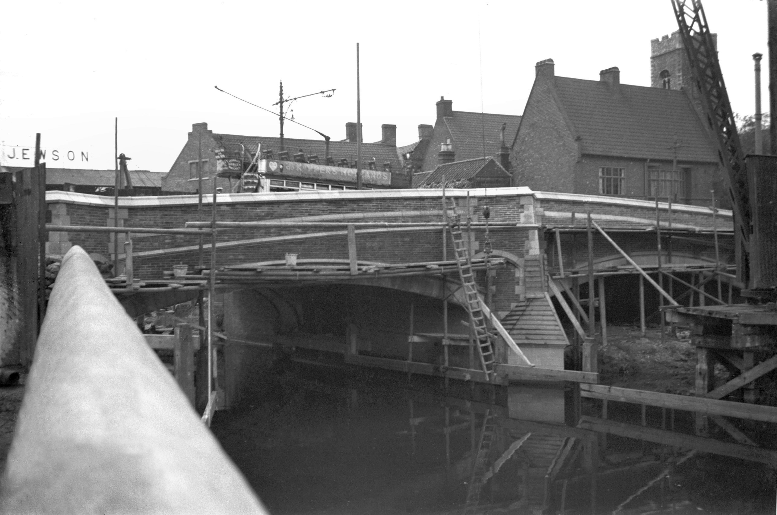
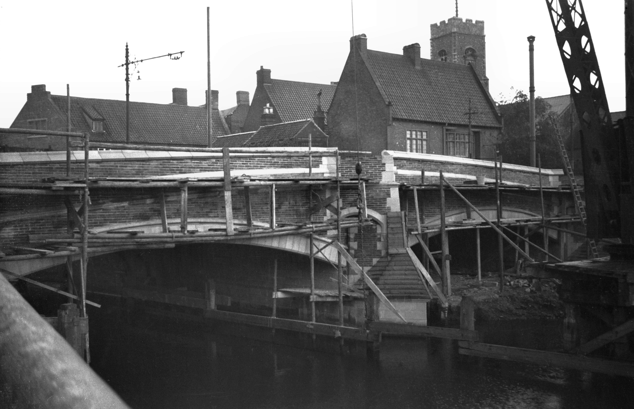
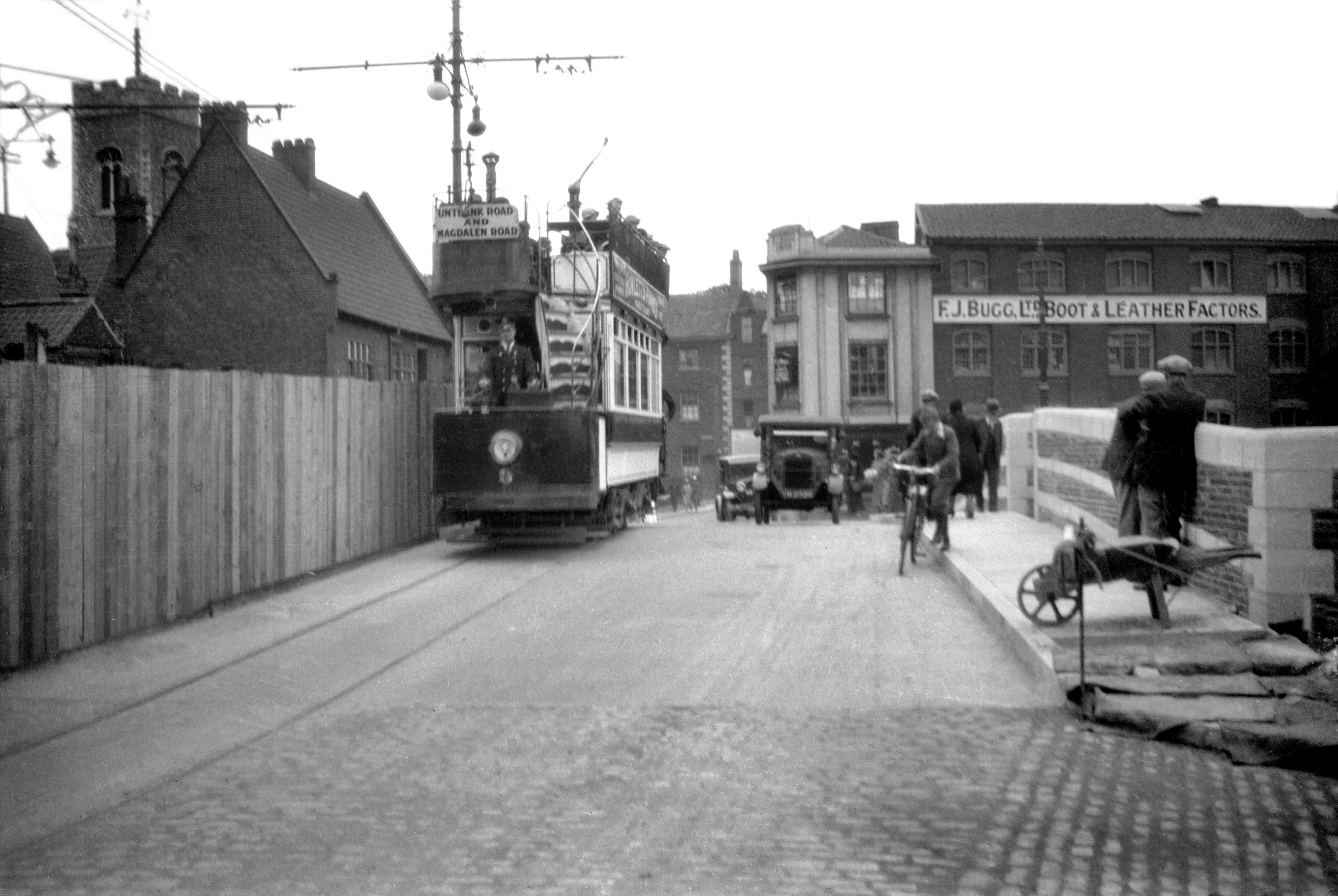
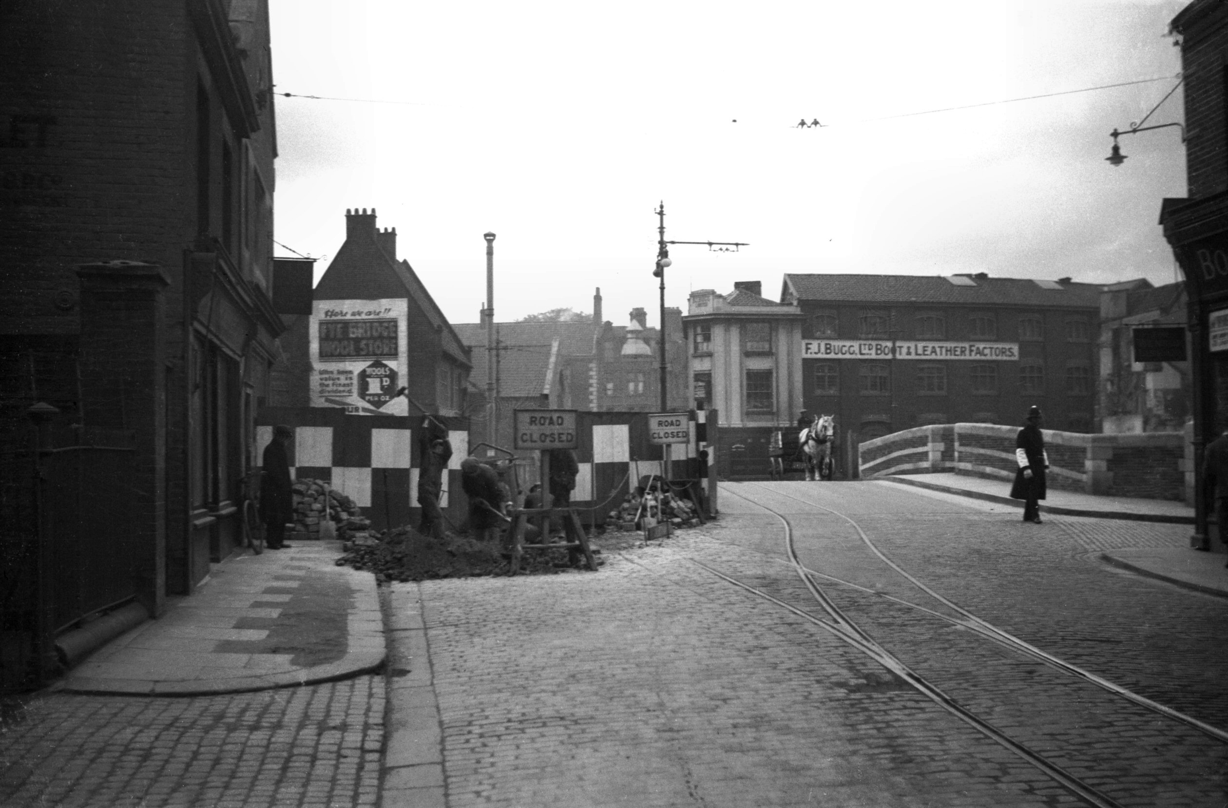
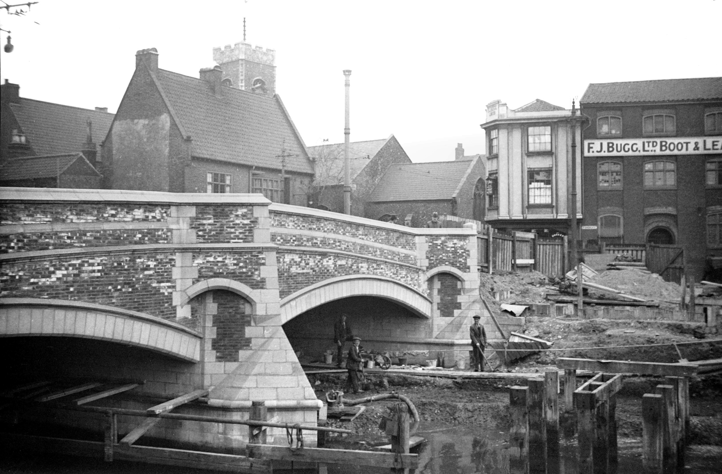
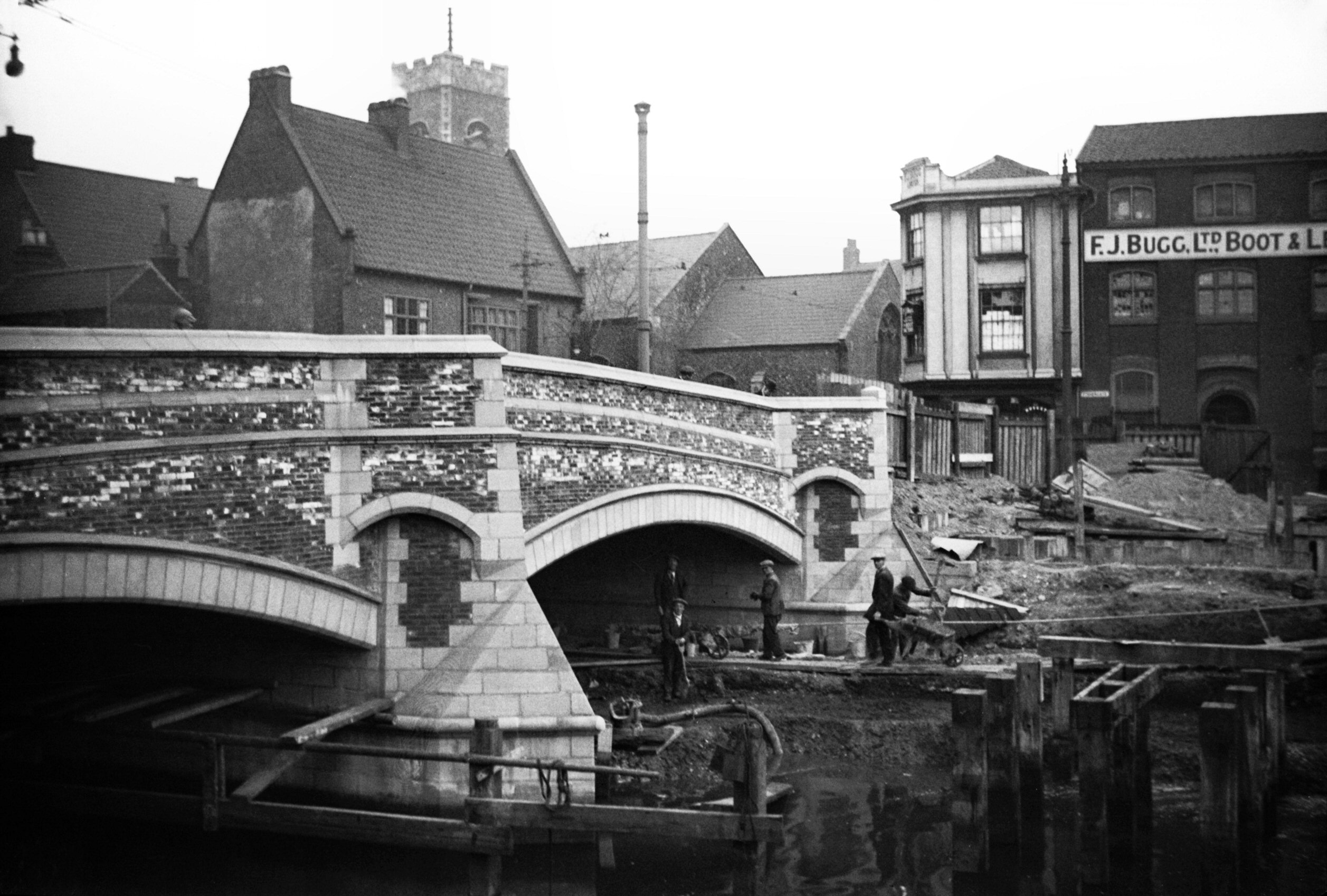
1931-08 East side before demolition [B074] 1931-08-03
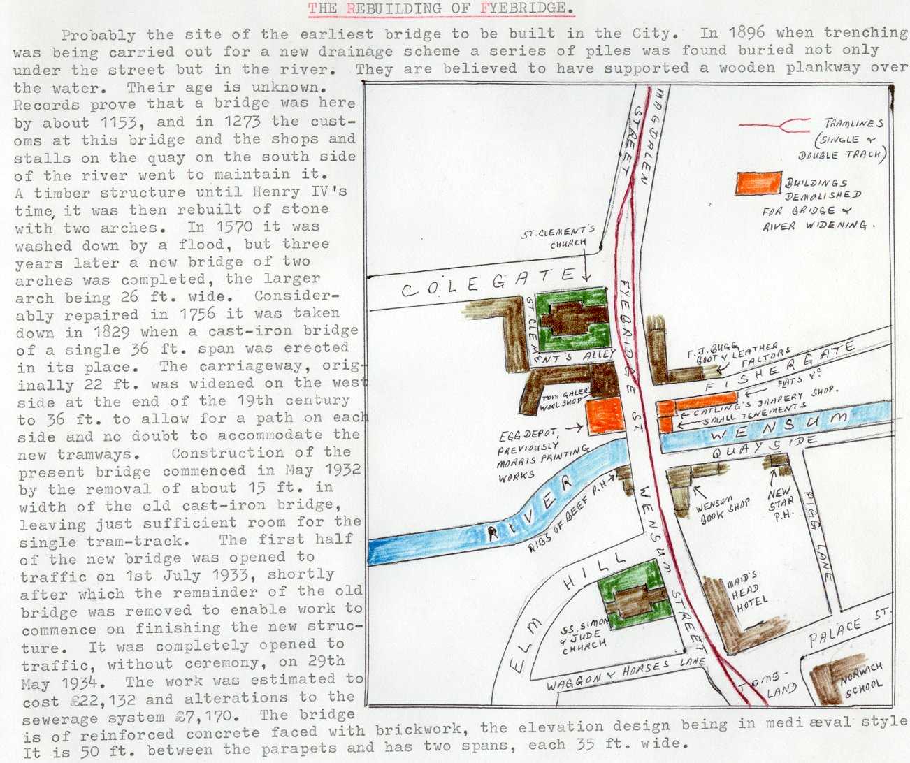
Probably the site of the earliest bridge to be built in
the City. In 1869 when trenching was being carried out
for a new drainage scheme a series of piles was found
buried not only under the street but in the river. They
are believed to have supported a wooden plankway over the
water. Their age is unknown, but fragments of pottery
found here at the same time were deemed to be of early
Saxon origin. Records prove that a bridge called
"Fibrigge" or "Fifbrigge" was here by
about 1153, and in 1273 the customs at this bridge and
the shops and stalls on the quay on the south side of the
river went to maintain it. A timber structure until Henry
IV's time, it was then rebuilt of stone with two arches.
In 1570 it was washed down by a flood, but three years
later a new bridge of two arches was completed, the
larger arch being 26 feet wide. Considerably repaired in
1756 it was taken down in 1829 when a cast-iron bridge of
a single 36 feet span was erected in its place
(photographed). The carriageway, originally 22 feet wide
was widened on the west side at the end of the 19c to 36
feet to allow for a path on each side and no doubt to
accommodate the new tramways.
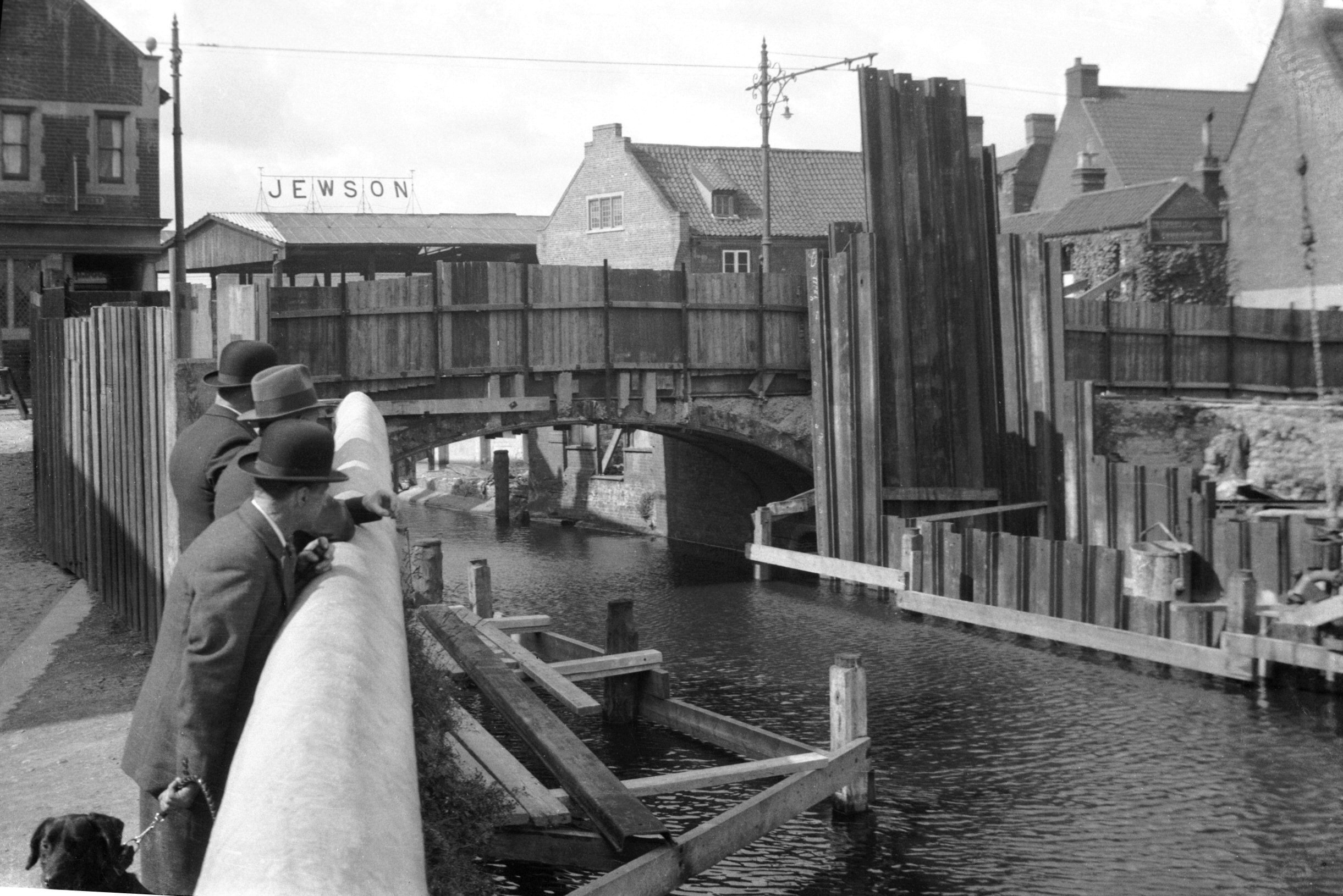
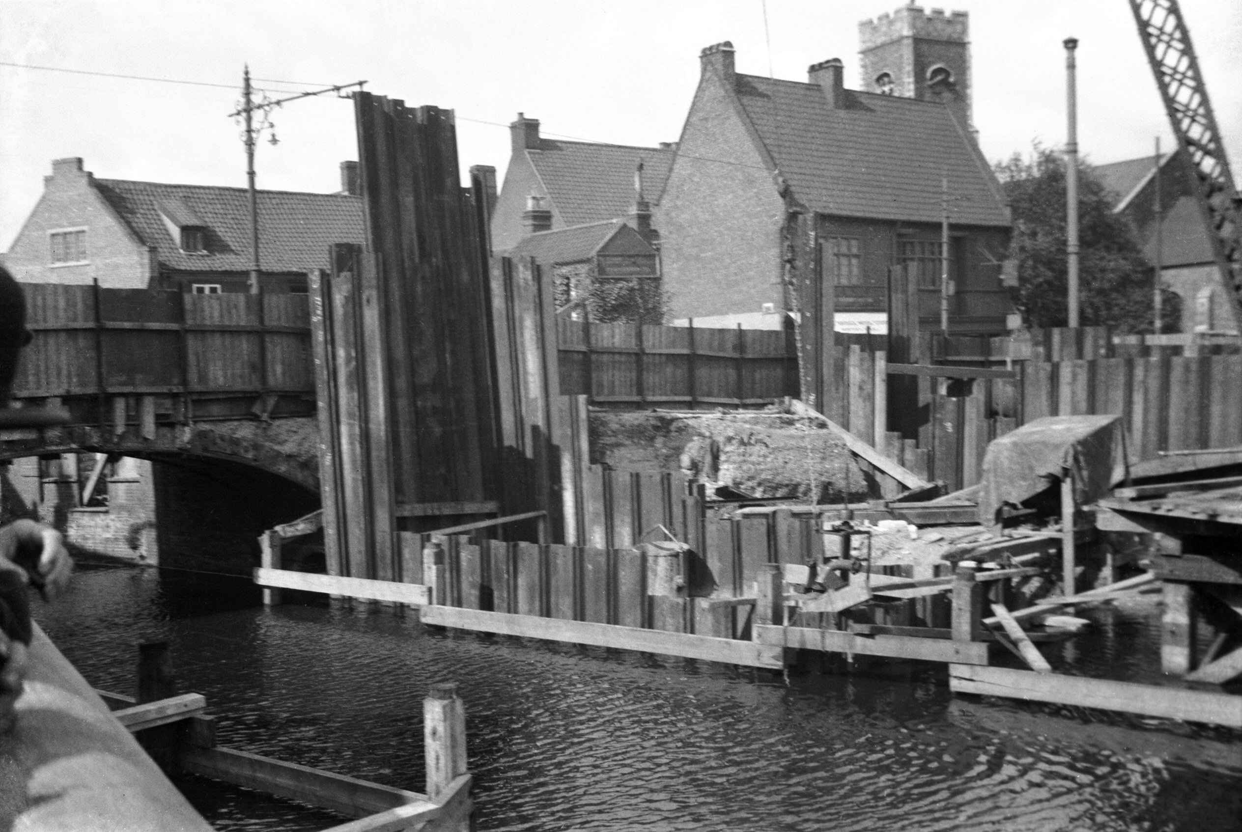
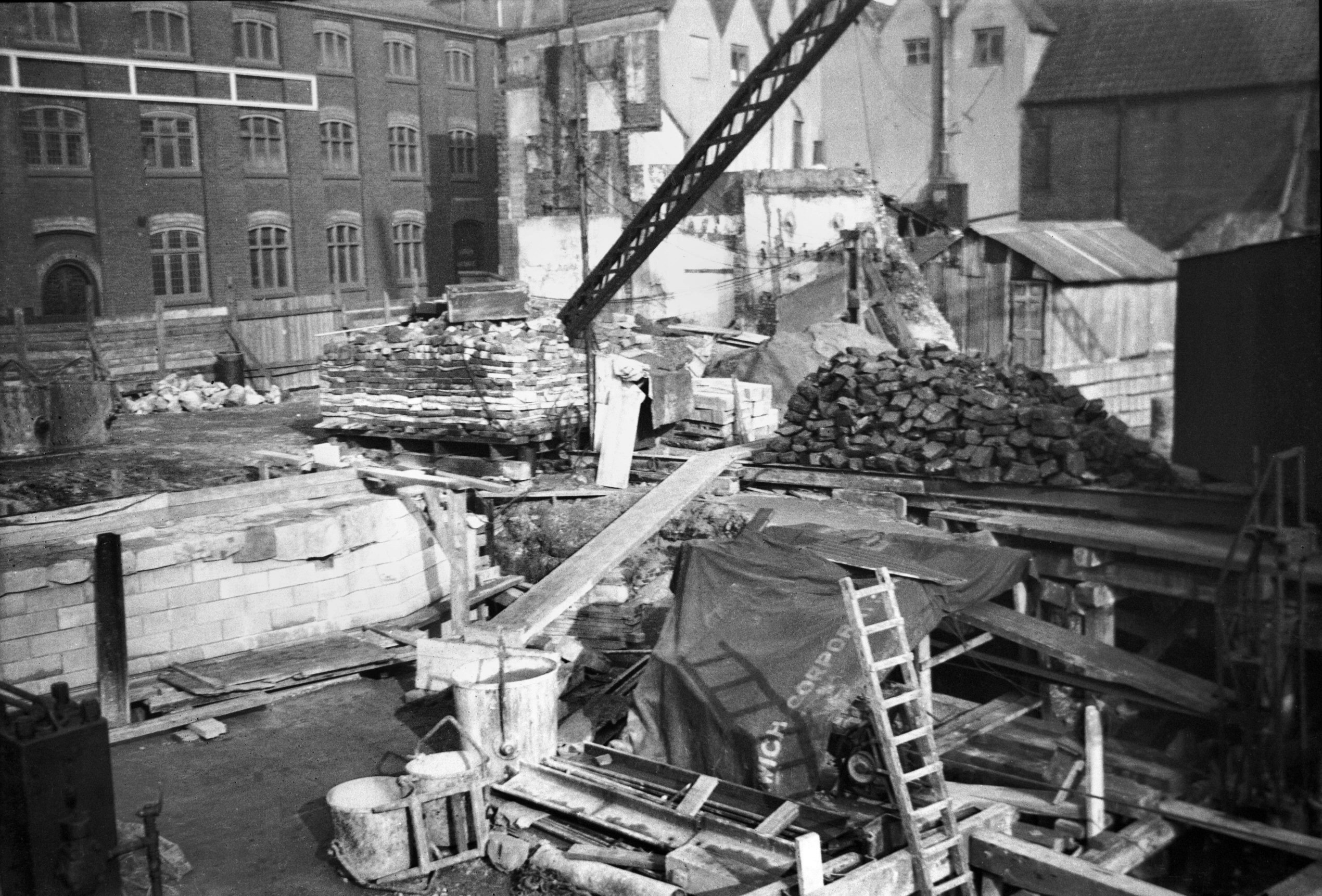
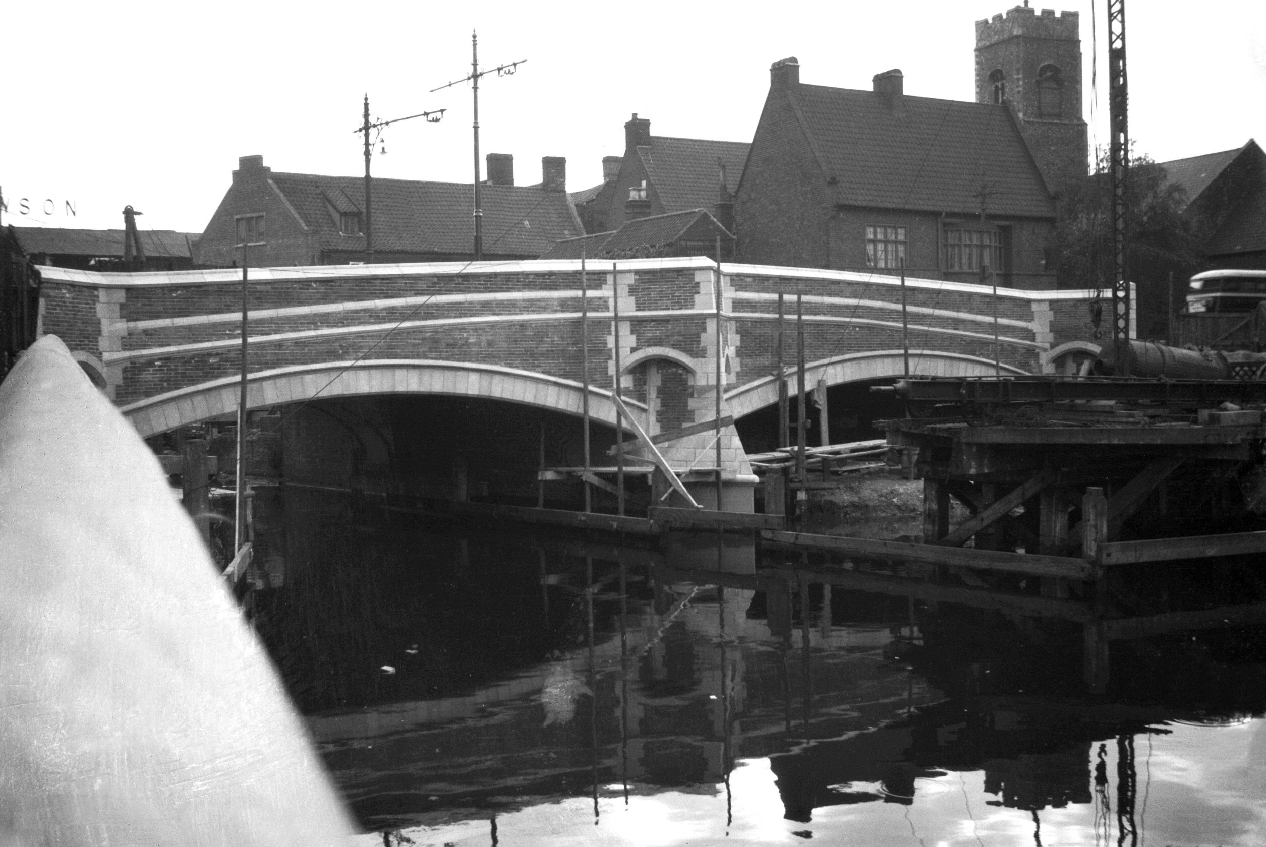
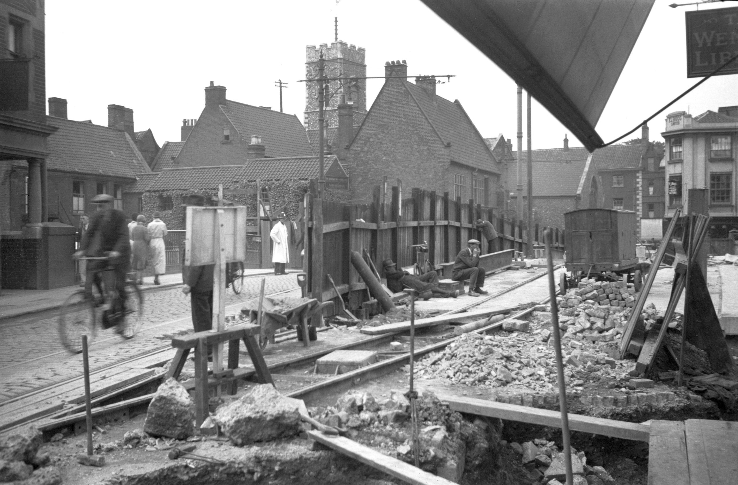
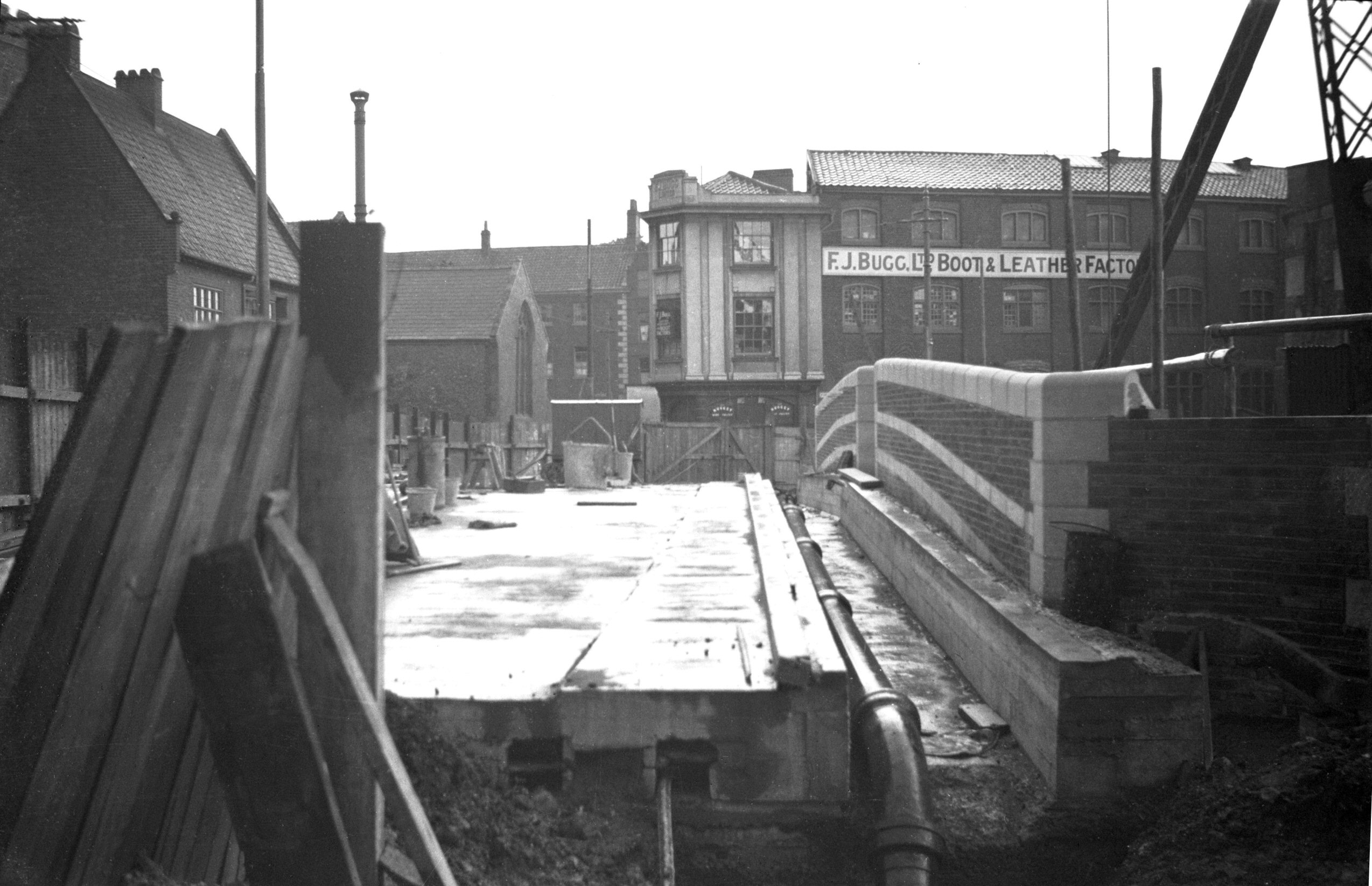
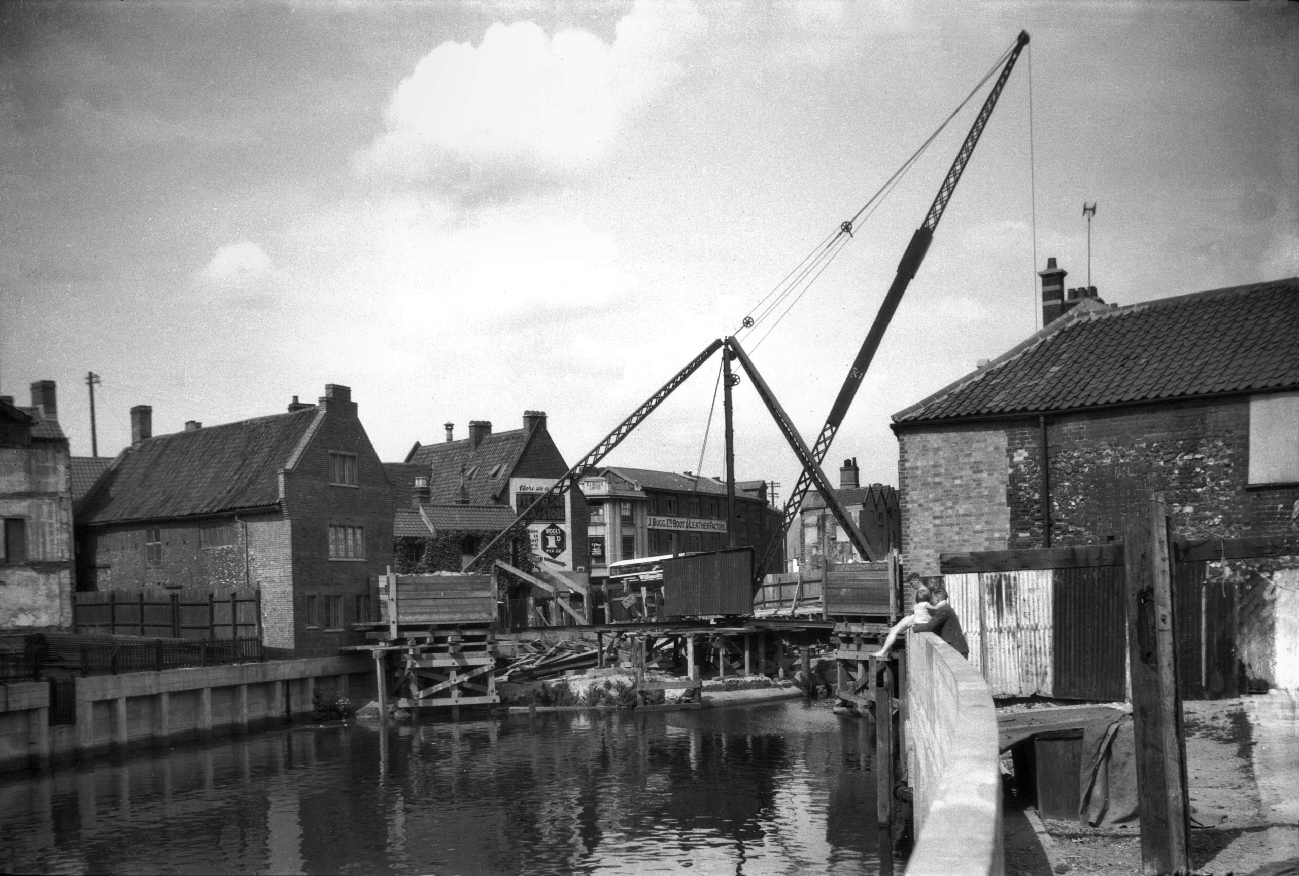
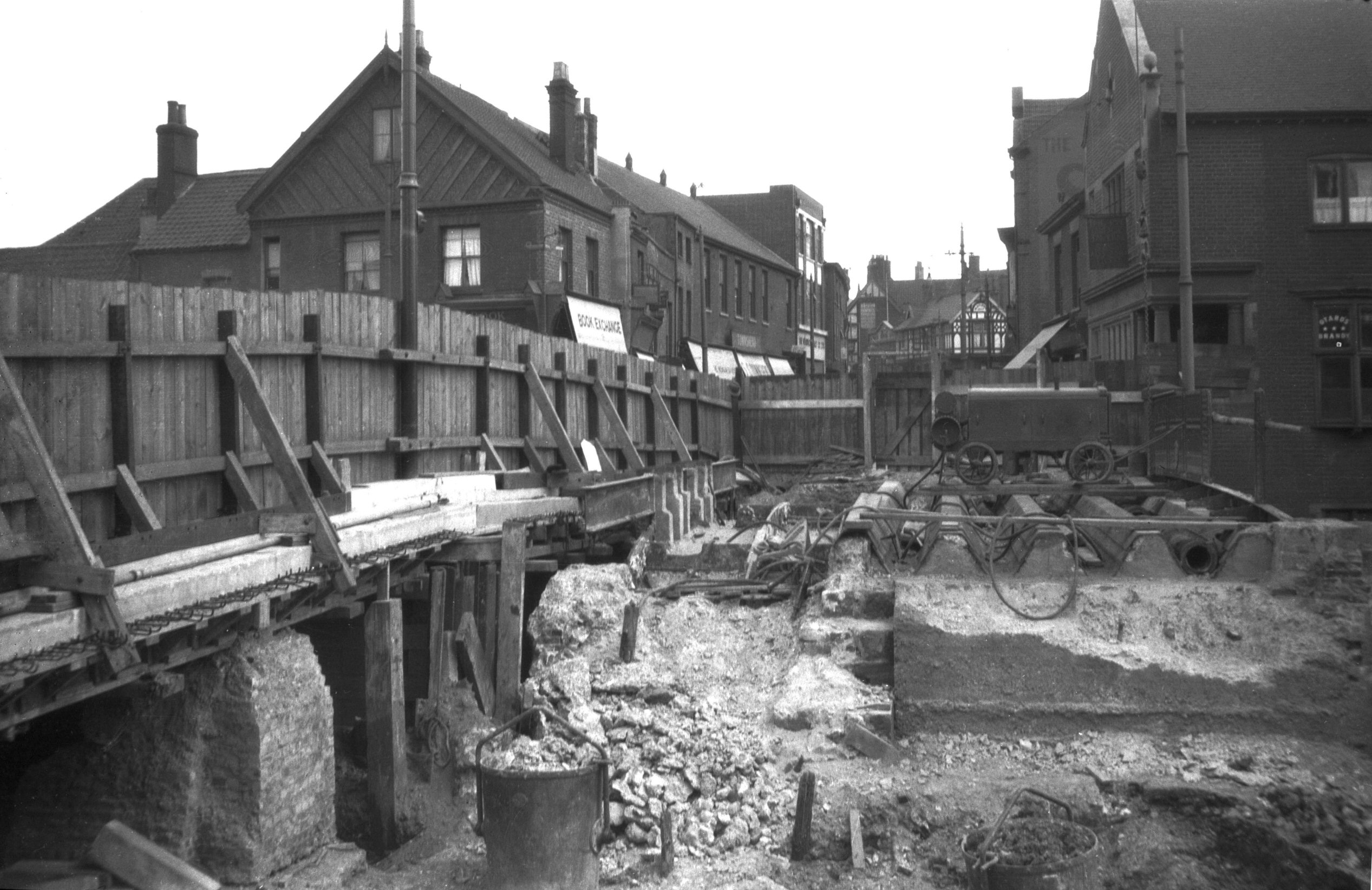
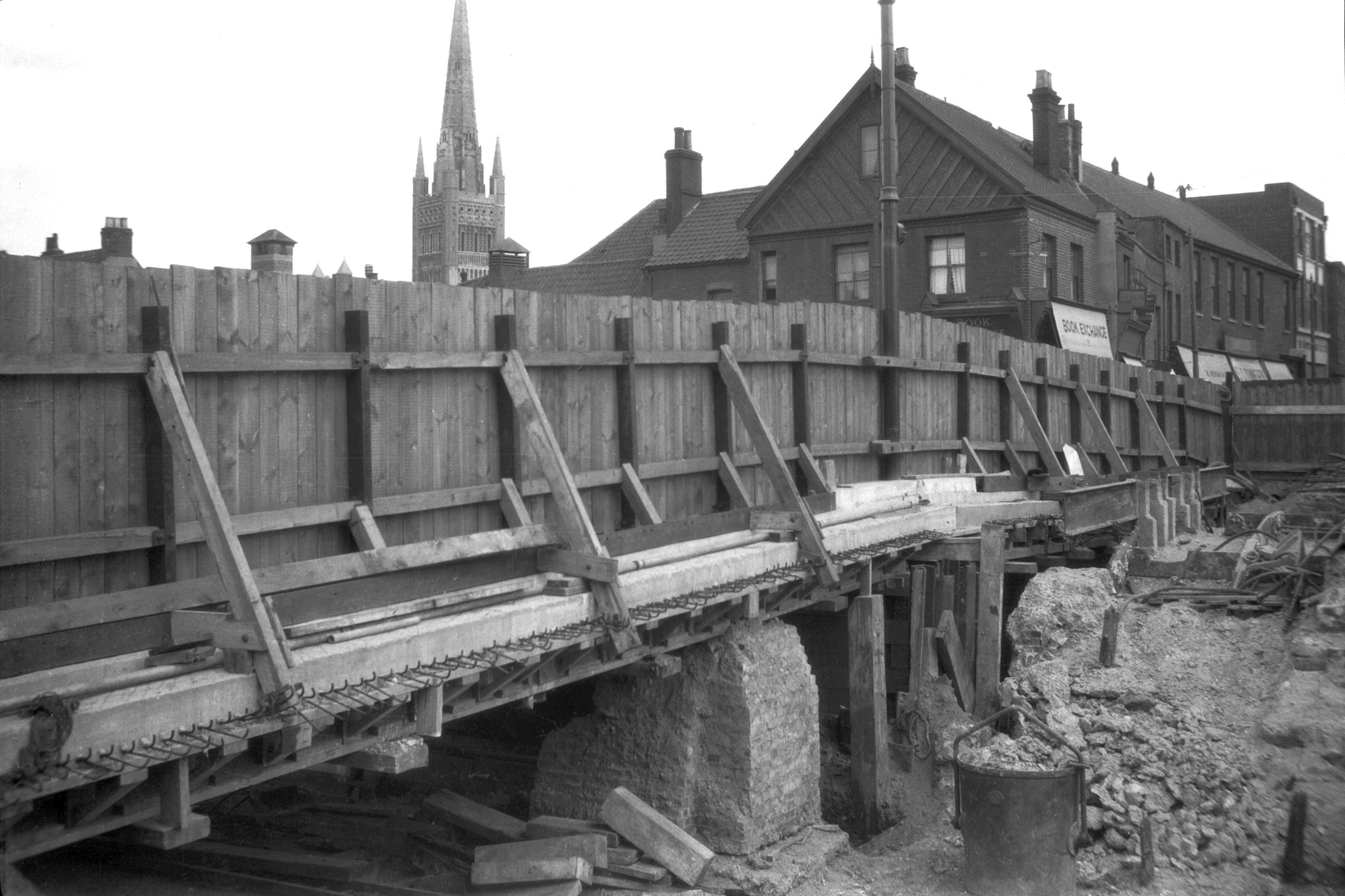
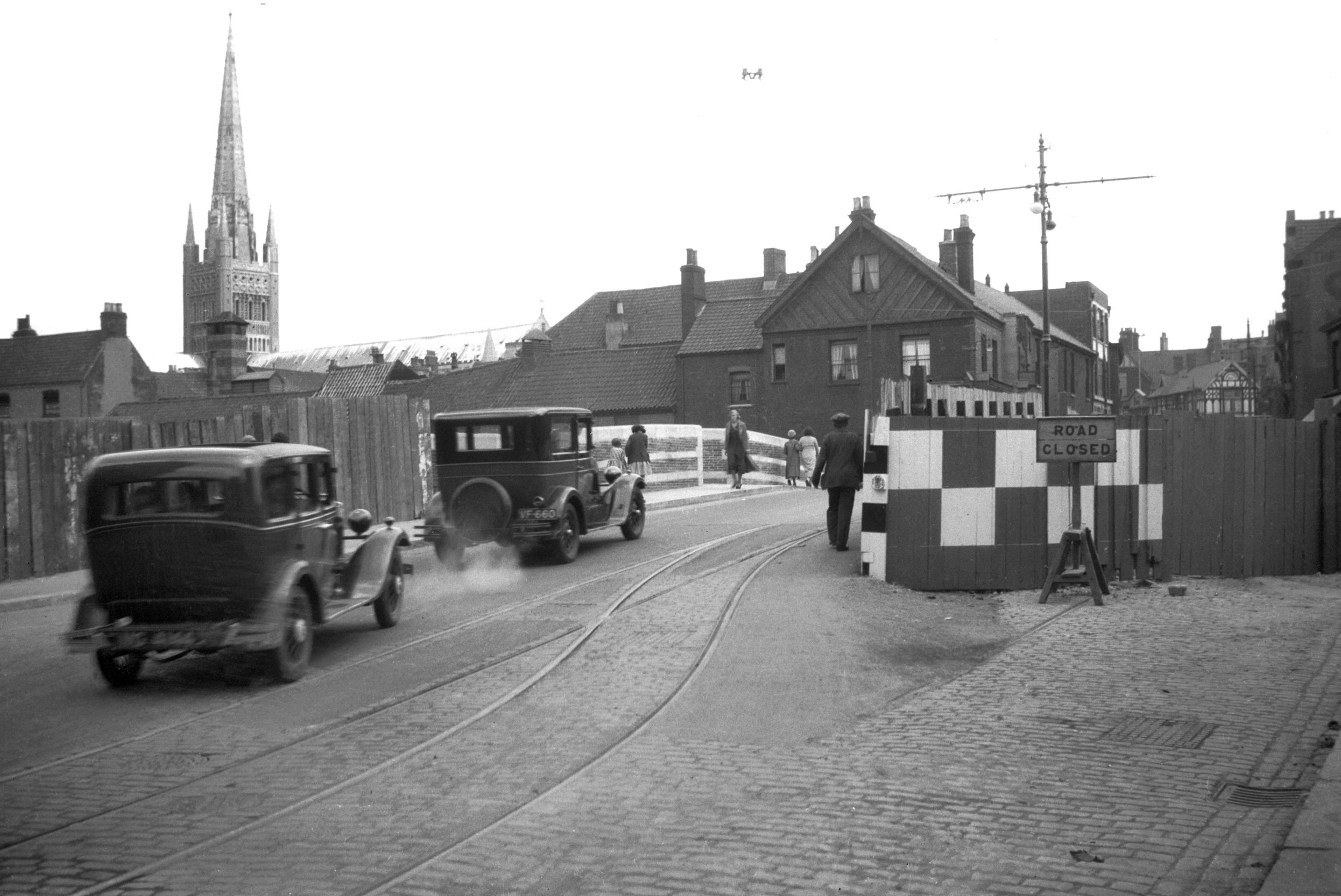
Construction of the present bridge commenced in May 1932
by the removal of about 15 feet in width of the old
cast-iron bridge, leaving just sufficient room for he
single tram-track. The first half of the new bridge was
opened to traffic on 1st July 1933, Councillor
H.C.Southgate being the first motorist to cross, shortly
after which the remainder of the old bridge was removed
to enable work to commence on finishing the new
structure. It was completely opened to traffic, without
ceremony, on 29th May 1934. The work was estimated to
cost £22,132 and alterations to the sewerage system
£7,170. The bridge is of reinforced concrete faced with
brickwork, the elevation design being in mediaeval style.
It is 50 feet between the parapets and has two spans,
each 35 feet wide. |
|
|
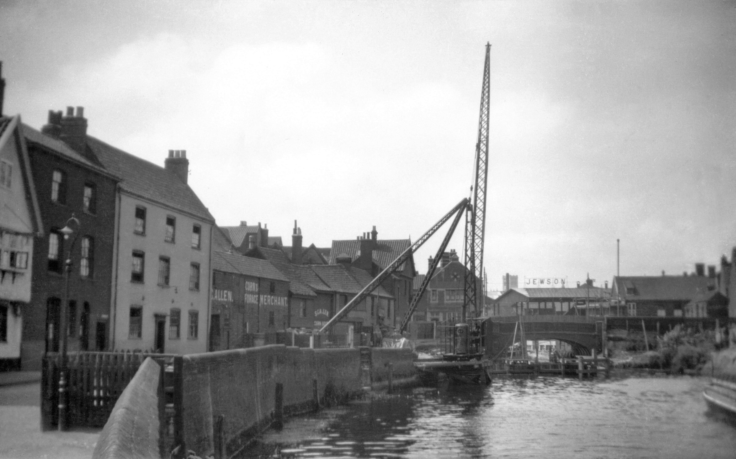
1931-08 Reconstruction crane at Quayside [B075]
1931-08-03
East side of bridge. |
|
|
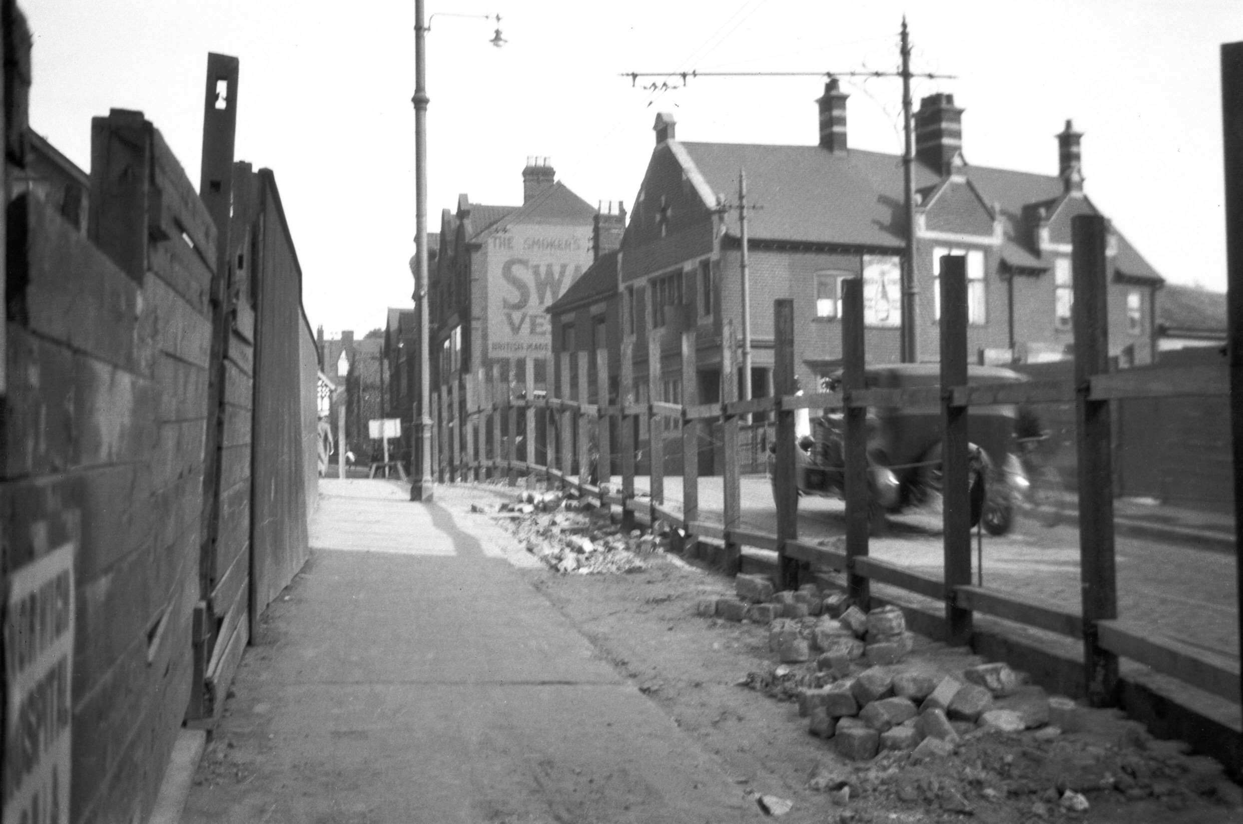
1932-05 Fence on E side before demolition [B291]
1932-05-23
View south. |
|
|
1932-05 Fence on E side before demolition [B292]
1932-05-23
View north. |
|
|
1932-05 Fence on E side before demolition [B293]
1932-05-23
View north. |
|
|
1932-07 East side before rebuilding [B403] 1932-07-31
From Quayside. |
|
|
1932-07 Wensum new and old river widths [B402]
1932-07-31
|
|
|
1932-09 Central pier cofferdam crane base [B450]
1932-09-25
Cofferdam complete. |
|
|
1932-09 Central pier cofferdam eastern half [B444]
1932-09-11
Cofferdam under construction. |
|
|
1932-09 Central pier cofferdam eastern half [B445]
1932-09-11
|
|
|
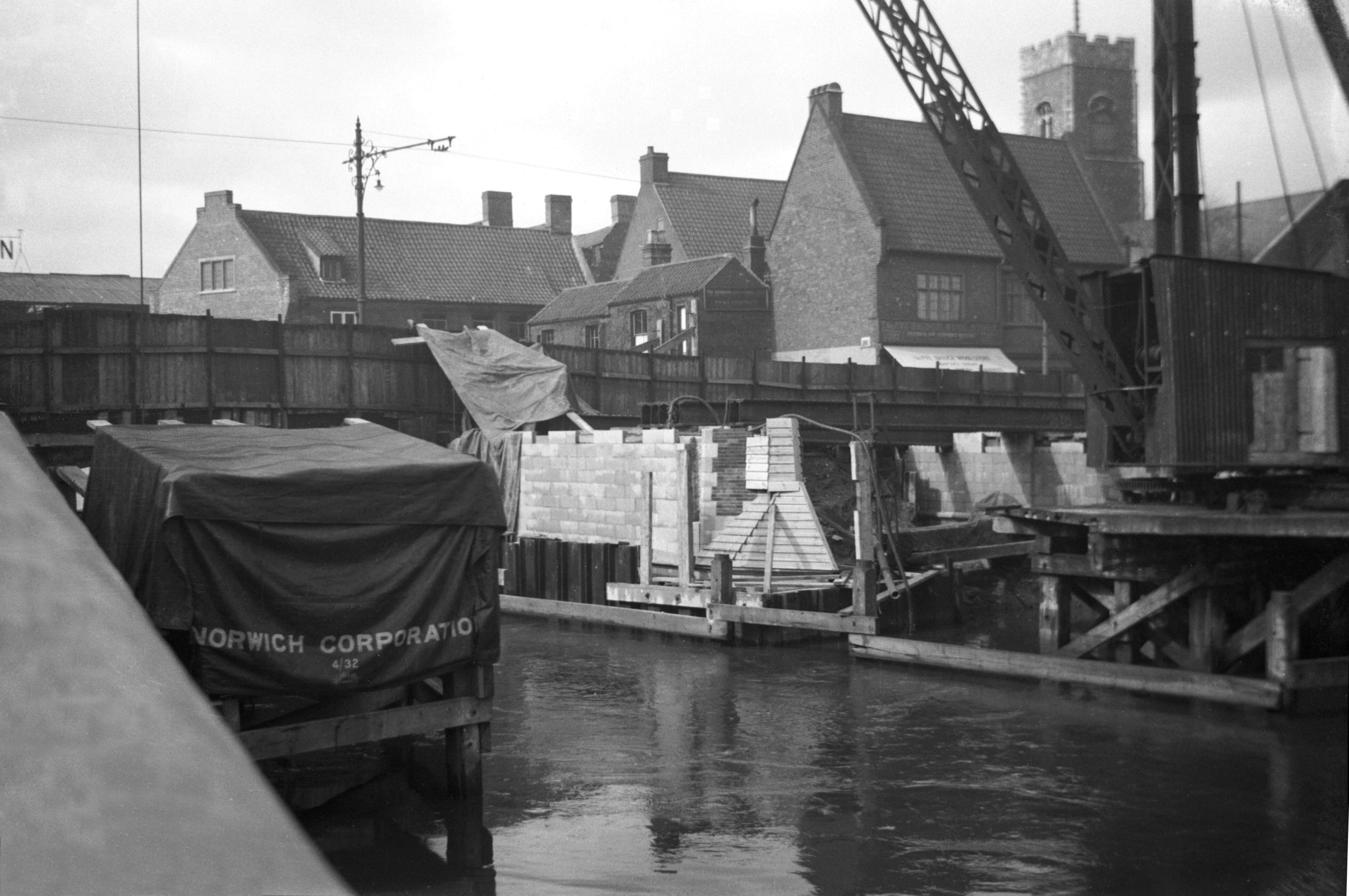
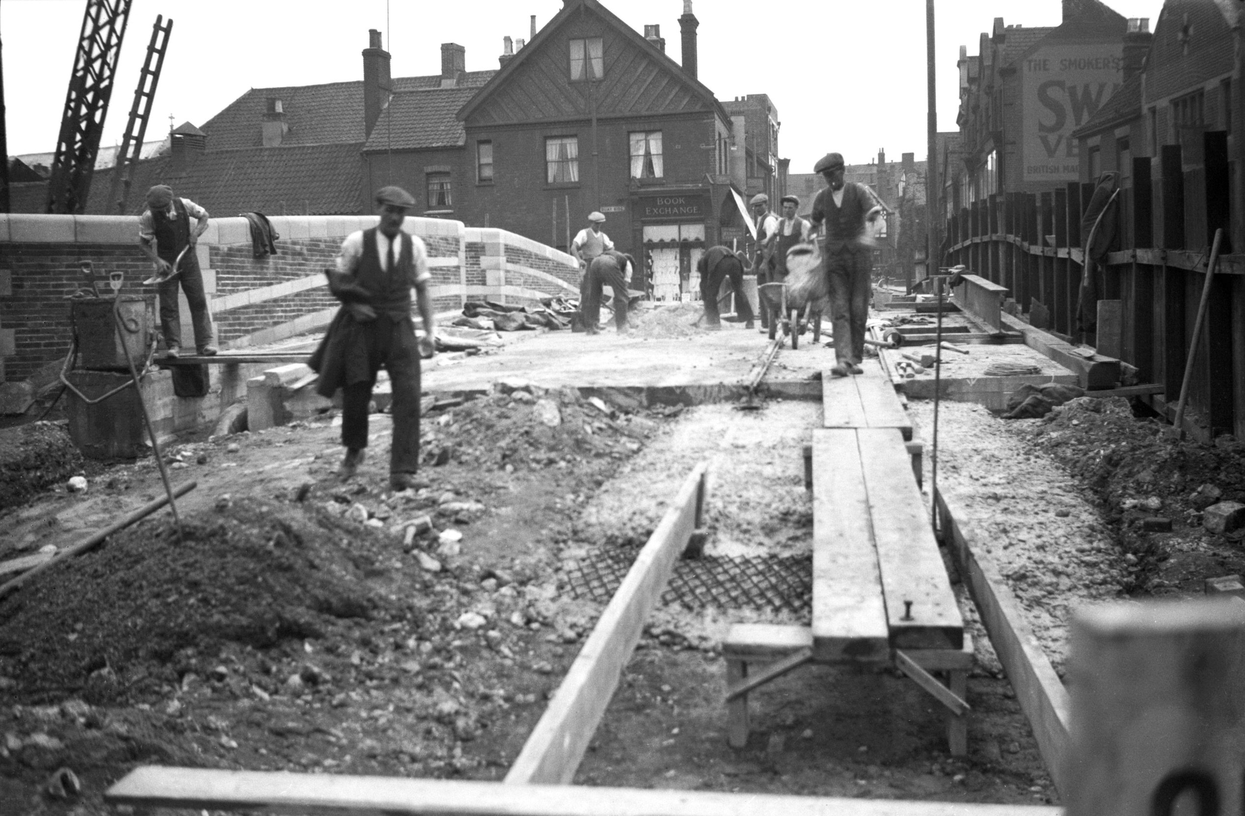
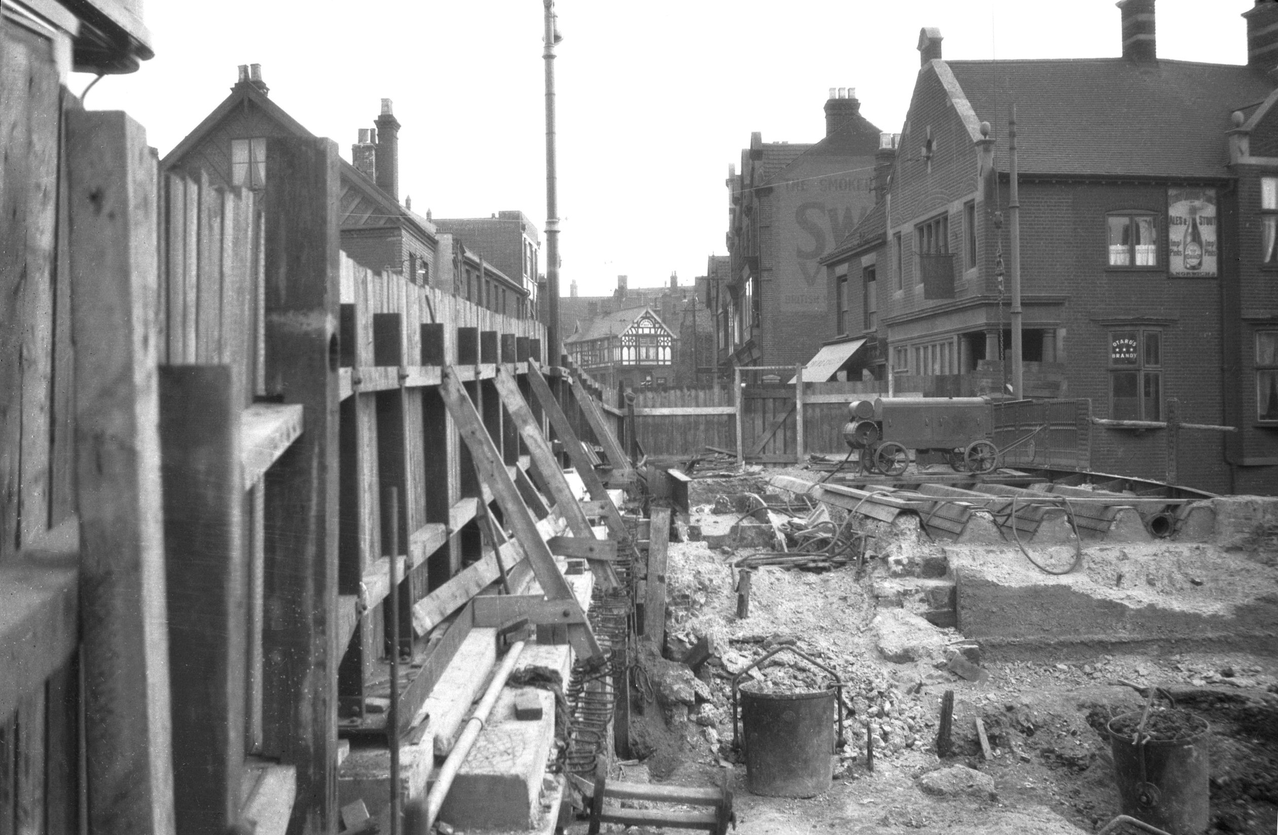
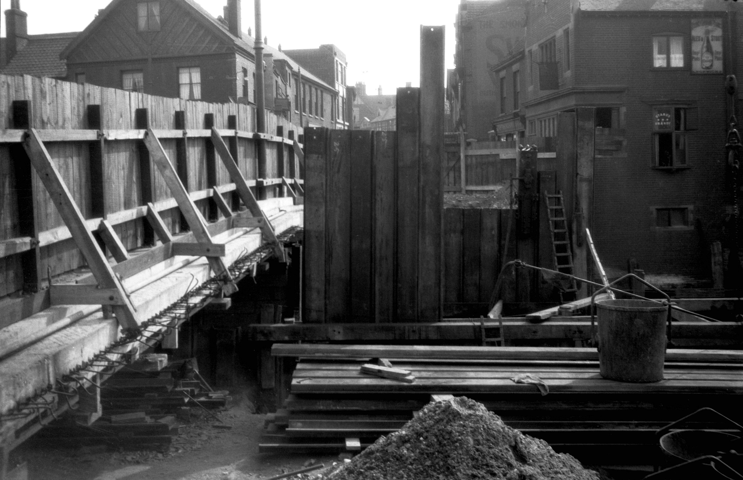
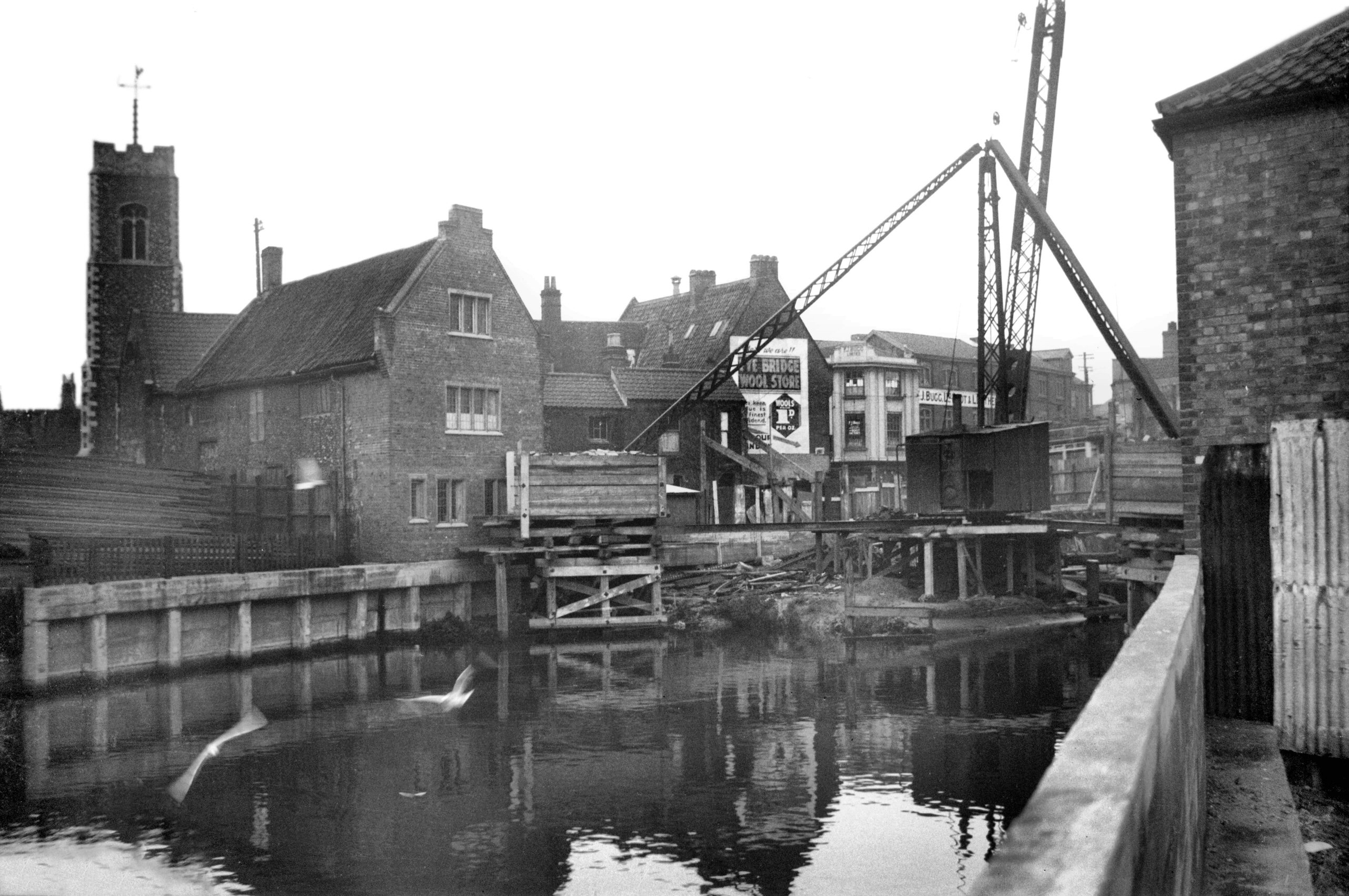
1933-02 Construction material on north bank [B475]
1933-02-12
East side of north pier complete. |
|
|
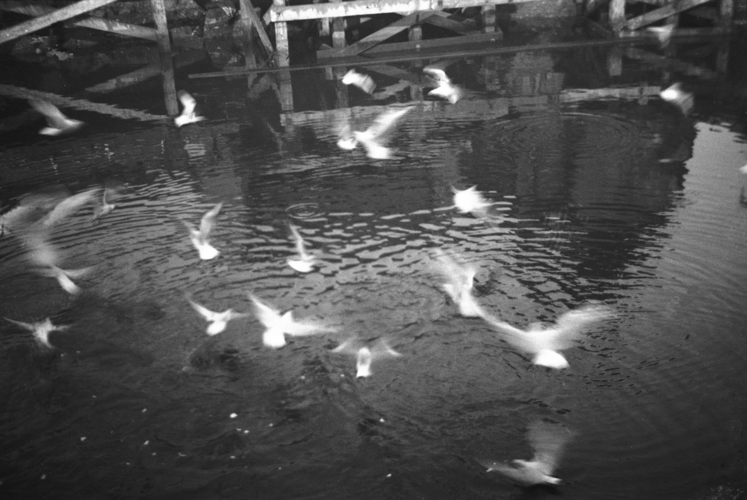
1933-02 Fye Bridge east side seagulls [B476]
1933-02-12
|
|
|
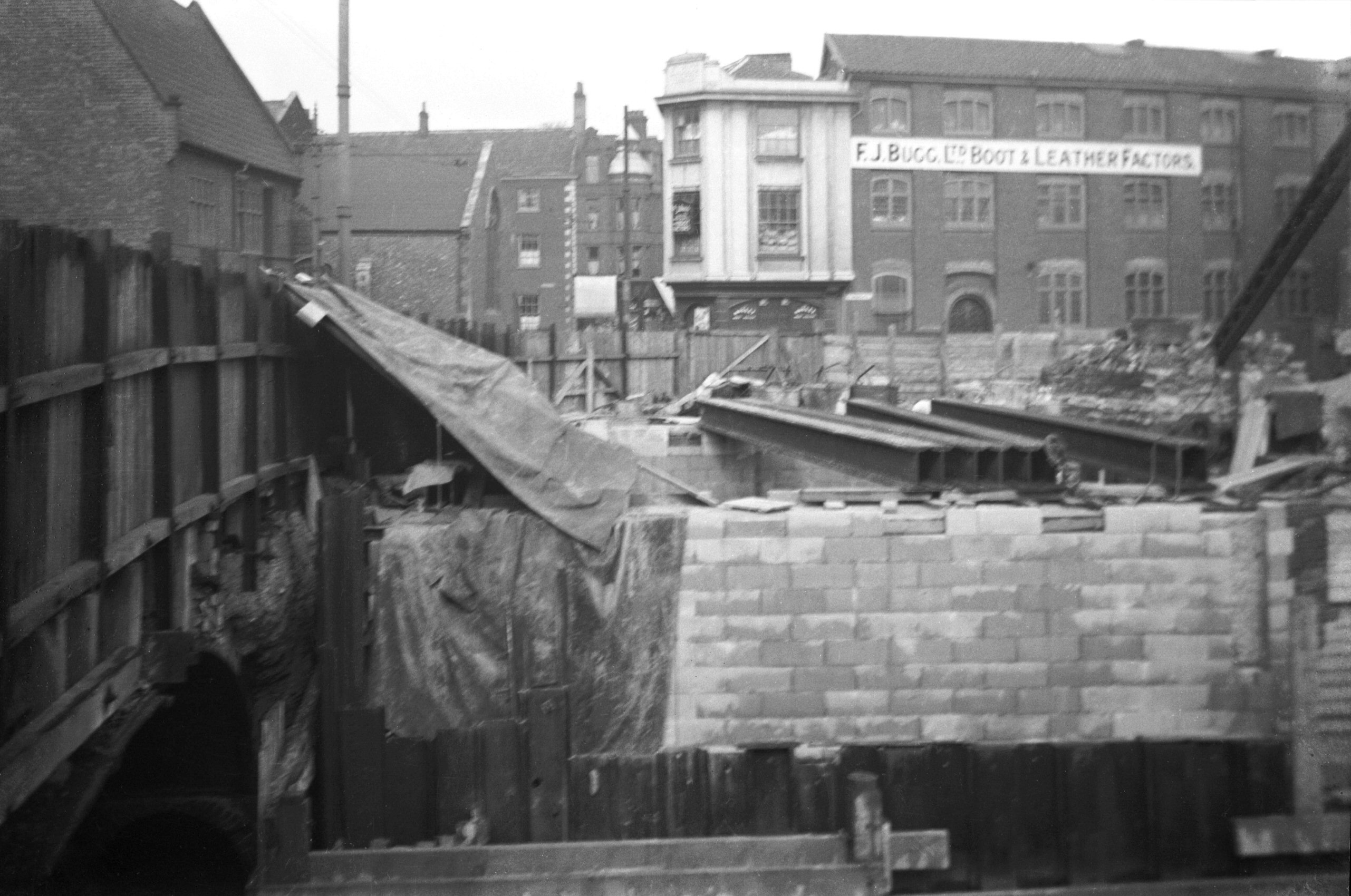
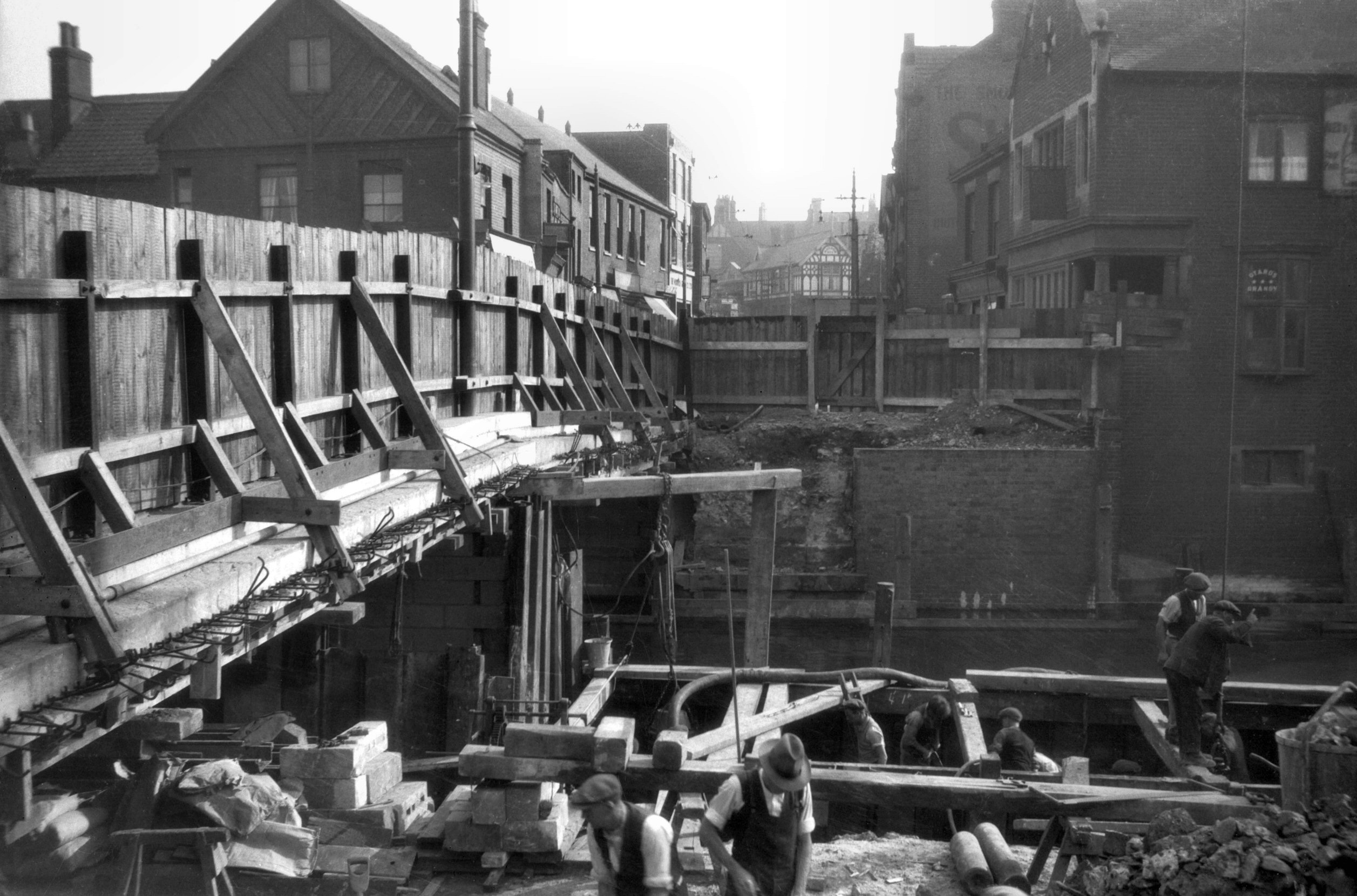
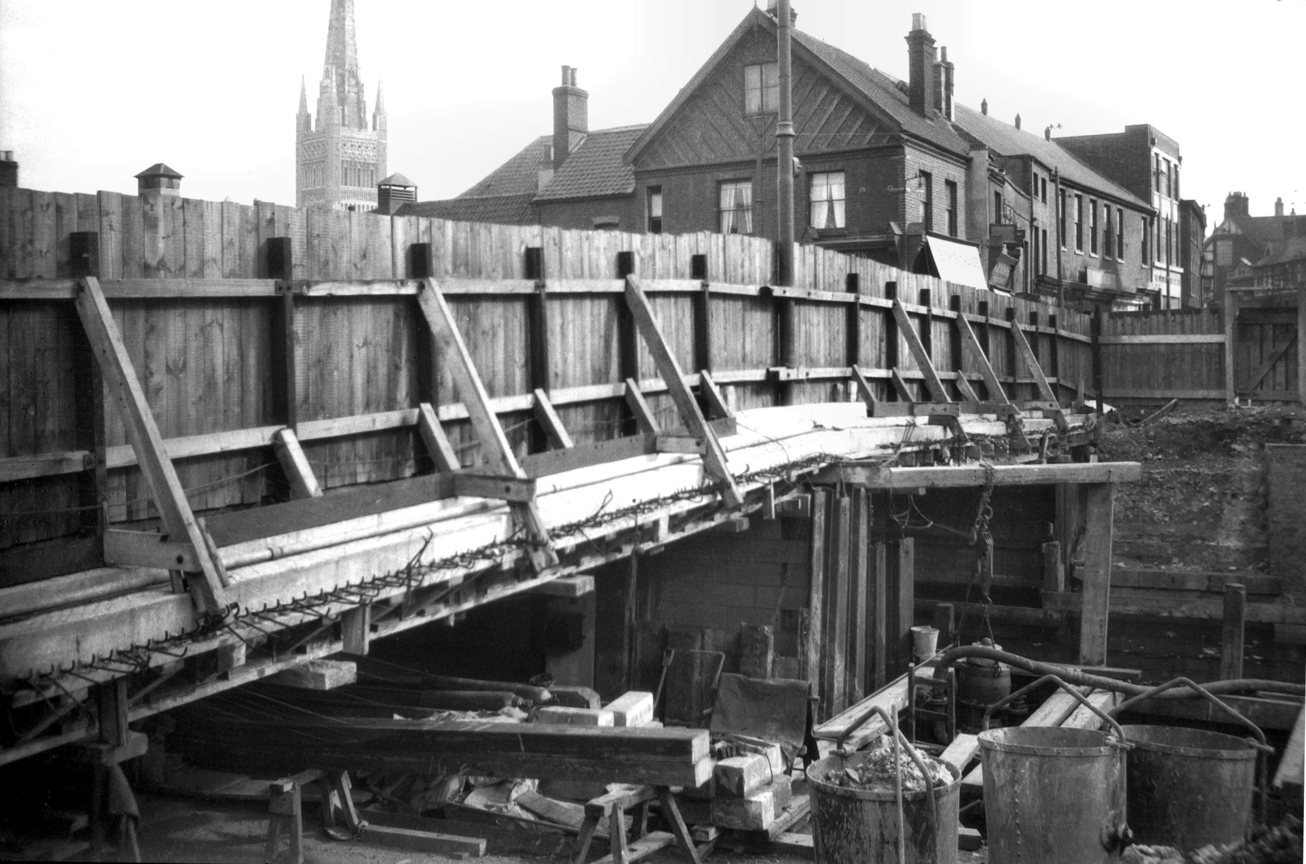
1933-03 Girders N arch E side from Quayside [B499]
1933-03-18
|
|
|
1933-03 Girders N bank central pier E side [B498]
1933-03-18
East side of central pier complete. Girders for north
arch ready to be set in position. |
|
|
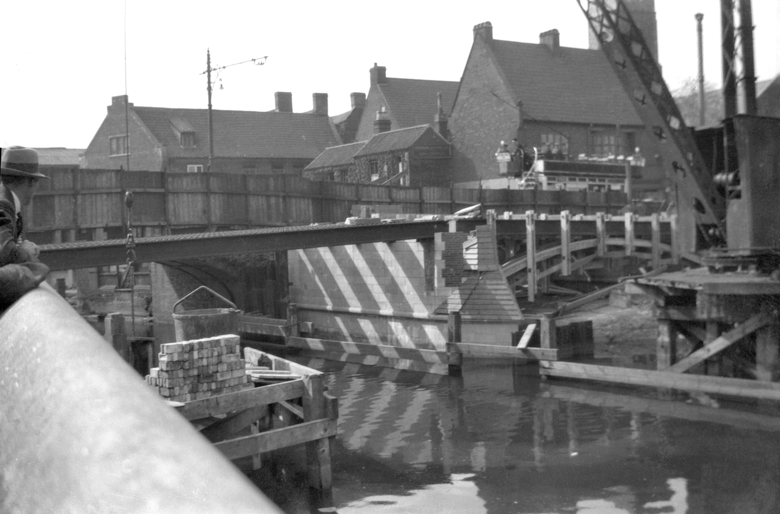
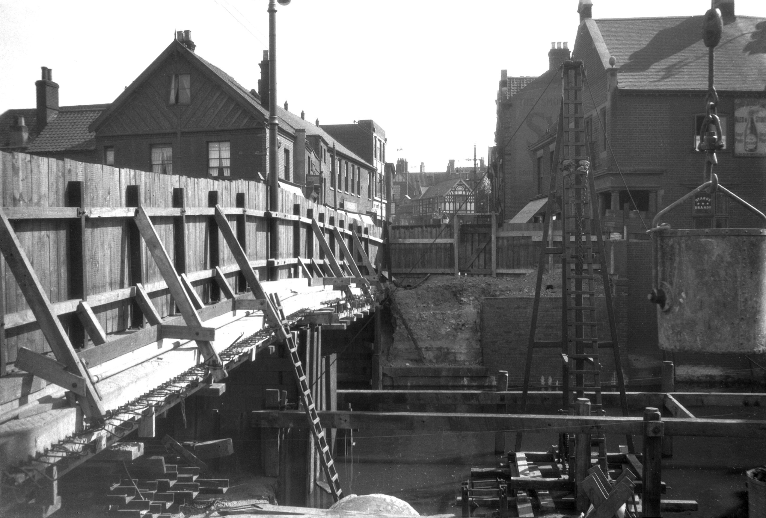
1933-04 East side girders tram approaching [B533]
1933-04-14
North arch complete. Girders for south arch ready to be
set in position. |
|
|
1933-06 Building materials from Wensum St [B592]
1933-06-20
Traffic crossing on the old west carriageway. |
|
|
1933-06 E carriageway construction view S [B593]
1933-06-20
From Fyebridge St. |
|
|
1933-06 From Crown Court Yard Elm Hill [B594]
1933-06-20
Preparations for working on the west side of the bridge. |
|
|
1933-06 From Quayside scaffolding removed [B600]
1933-06-27
East side nearly complete. |
|
|
1933-06 From Quayside tram crossing W half [B590]
1933-06-20
Tram crossing on the old west carriageway. |
|
|
1933-06 From Roache's Court Elm Hill [B597]
1933-06-27
Commencing work on the west side. |
|
|
1933-06 New carriageway construction view N [B599]
1933-06-27
From Wensum St. |
|
|
1933-06 New carriageway from Fyebridge St [B598]
1933-06-27
|
|
|
1933-06 New E side brick and stone parapets [B588]
1933-06-18
East arches and parapet complete. |
|
|
1933-06 New tramlines on east half view N [B591]
1933-06-20
|
|
|
1933-06 Road foundation service pipe duct [B589]
1933-06-18
East carriageway. |
|
|
1933-07 Construction crane on west side [B644]
1933-07-29
From Roaches Court, Elm Hill. |
|
|
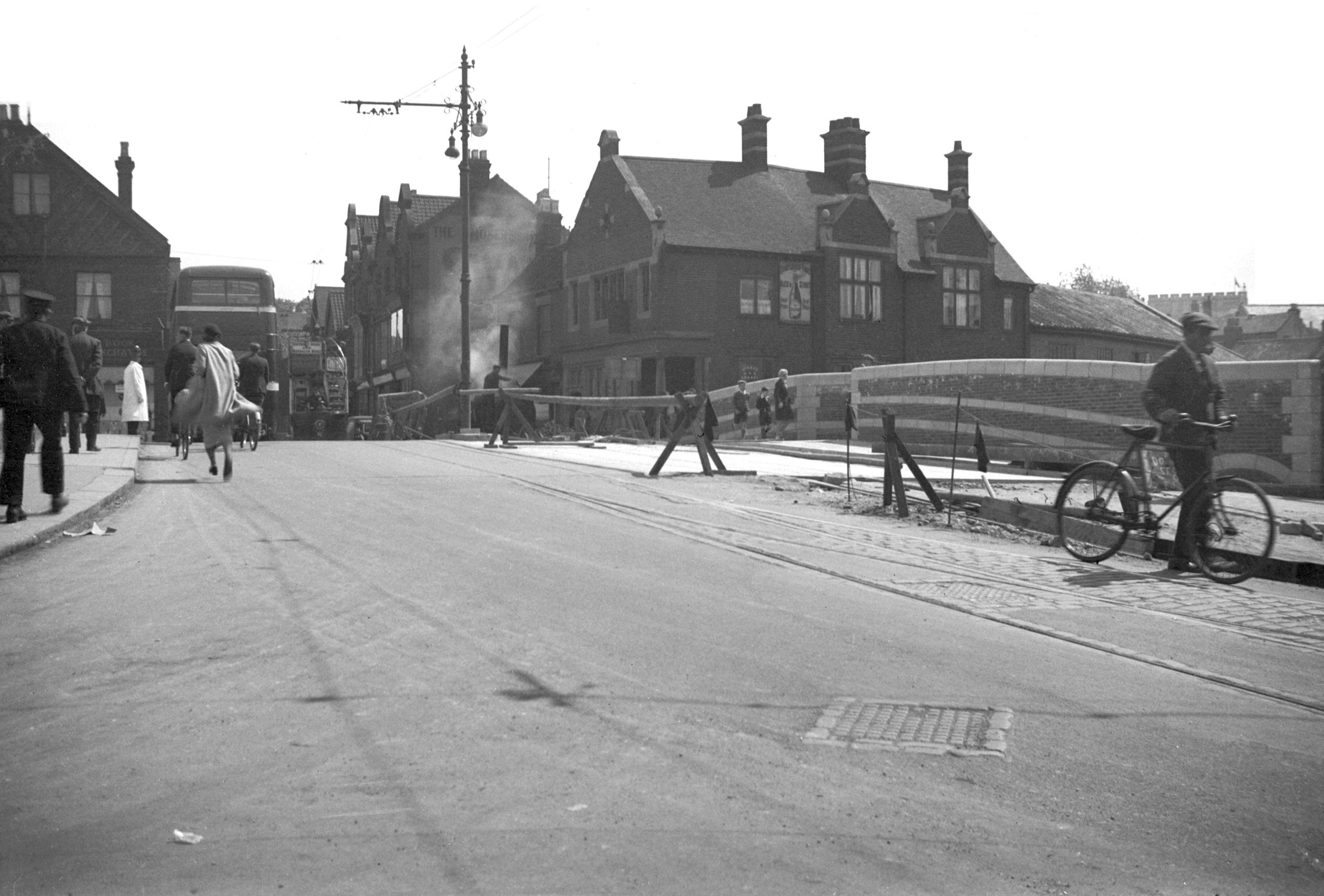
1933-07 From Fyebridge St first traffic day [B606]
1933-07-01
View south. New east and old west carriageways both open. |
|
|
1933-07 Sections of both carriageways [B647]
1933-07-29
Showing the evidence of the 1898 widening from 22 to 36
feet. |
|
|
1933-07 Sections of new carriageway view S [B646]
1933-07-29
Commencement of demolition of west side. |
|
|
1933-07 Tram on E side on first traffic day [B604]
1933-07-01
East side of Fyebridge rebuilt. |
|
|
1933-07 Tram on E side on first traffic day [B605]
1933-07-01
|
|
|
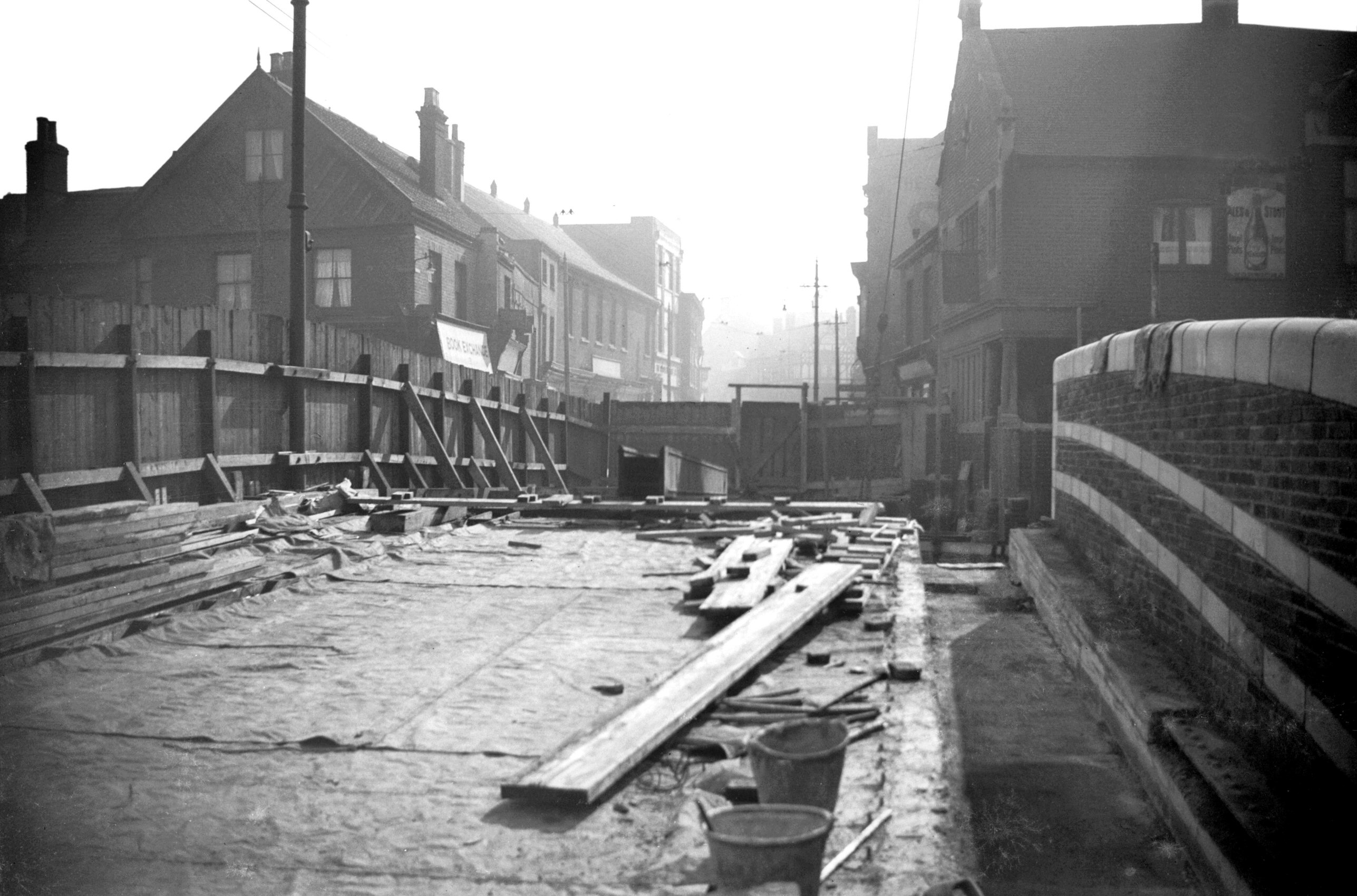
1933-07 West carriageway closed view north [B615]
1933-07-08
From Wensum St. |
|
|
1933-07 West carriageway closed view south [B614]
1933-07-08
Prior to demolition of west side. |
|
|
1933-07 West carriageway surface removed [B645]
1933-07-29
Revealing the straight girders used when the bridge was
widened by 14 feet in 1898. |
|
|
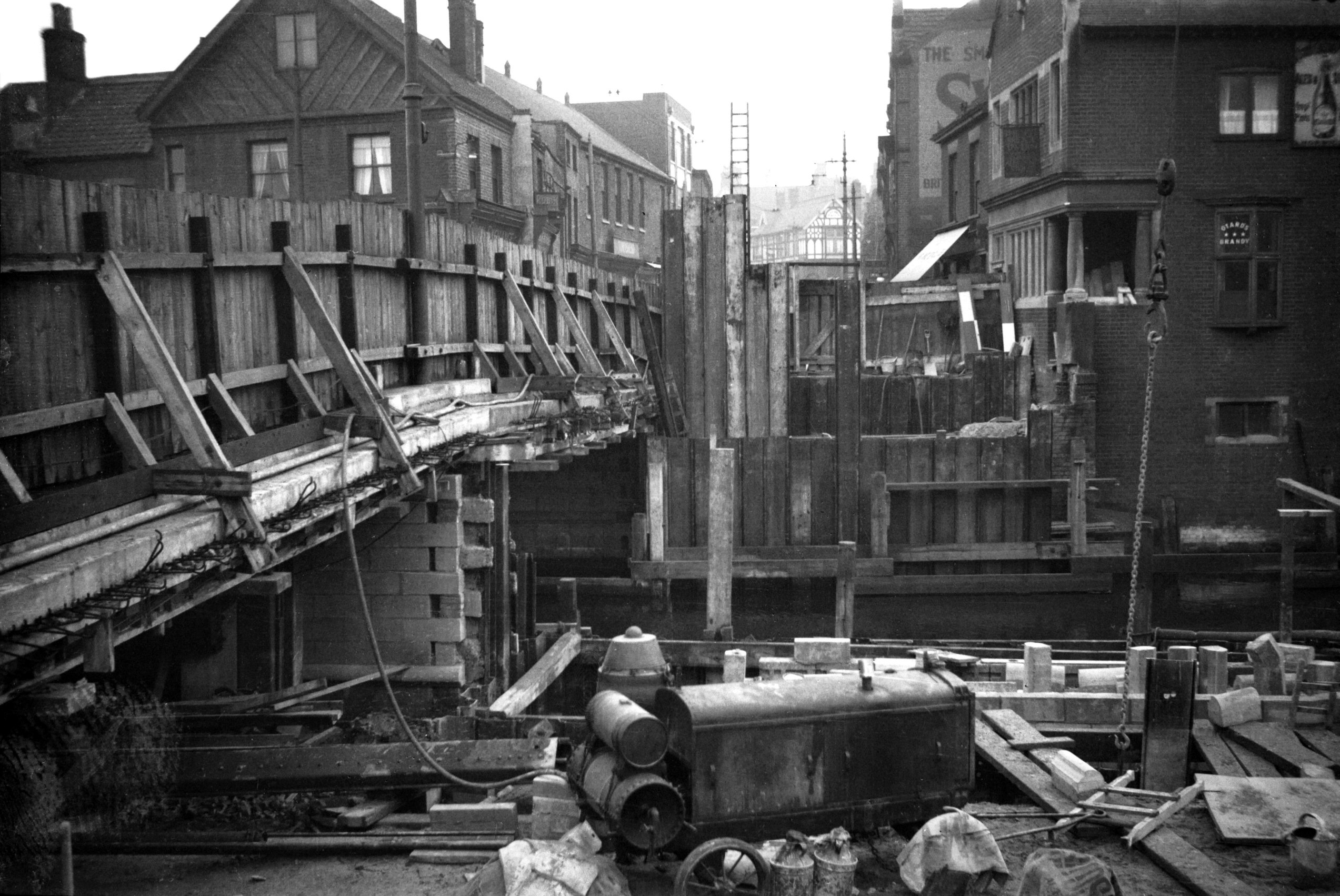
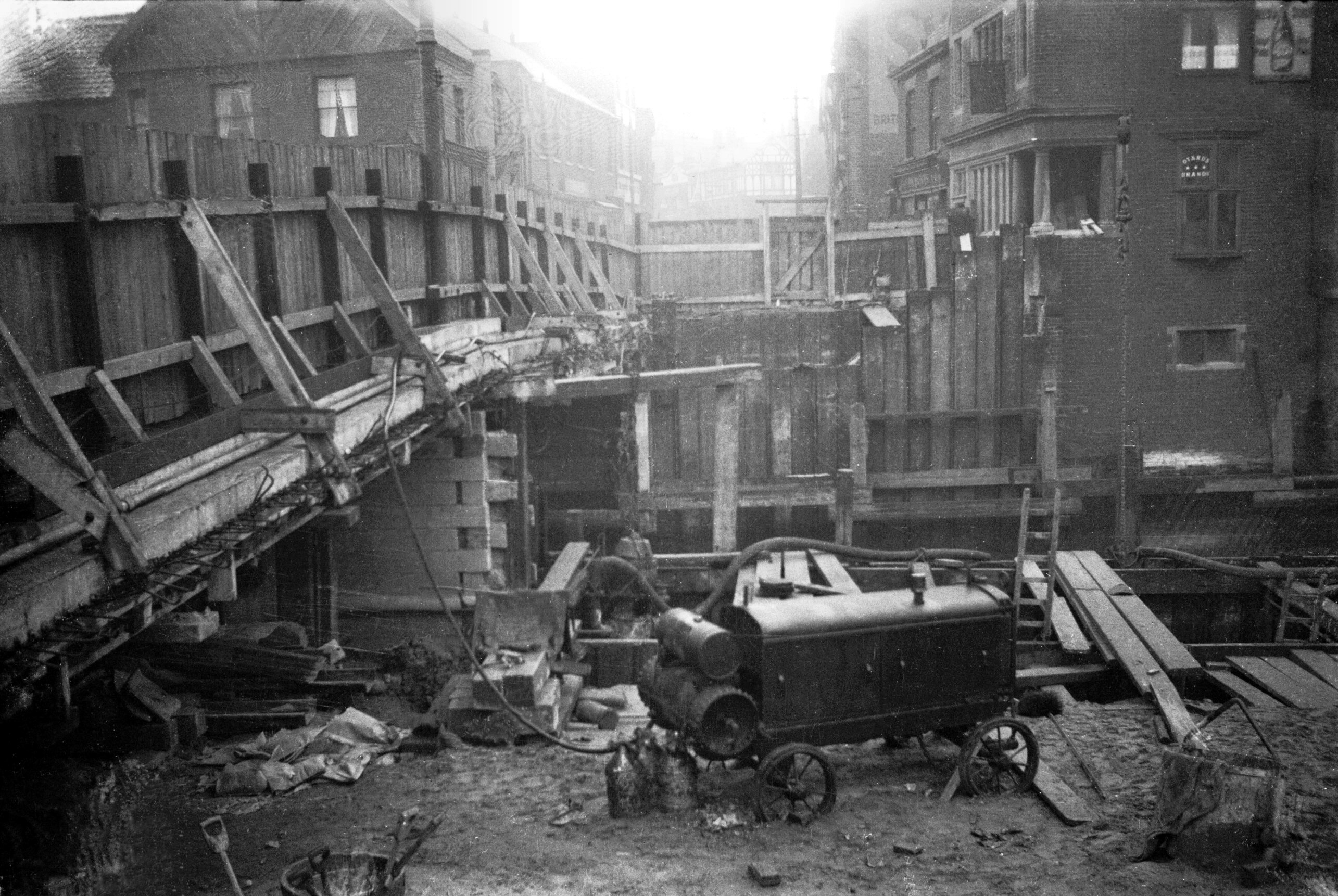
1933-09 Central cofferdam piles west half [B780]
1933-09-17
View south. |
|
|
1933-09 West half cofferdam preparations [B765]
1933-09-05
Demolition of old bridge complete. View south. |
|
|
1933-10 Completed cofferdam west half [B783]
1933-10-05
|
|
|
1933-10 Reconstruction of W side view south [B787]
1933-10-08
|
|
|
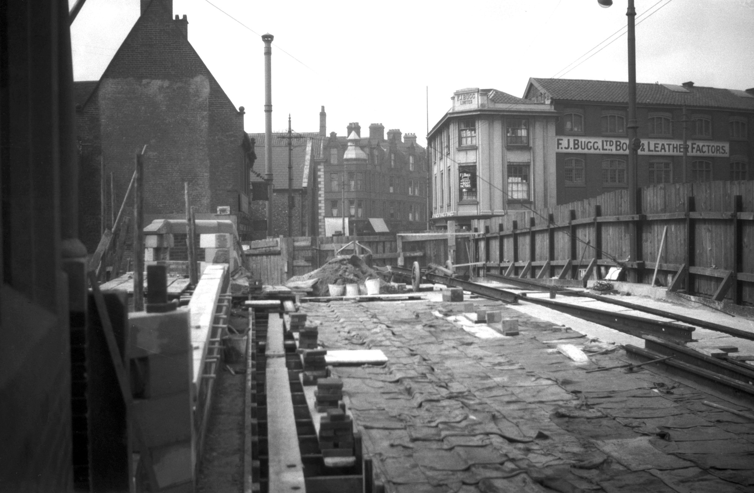
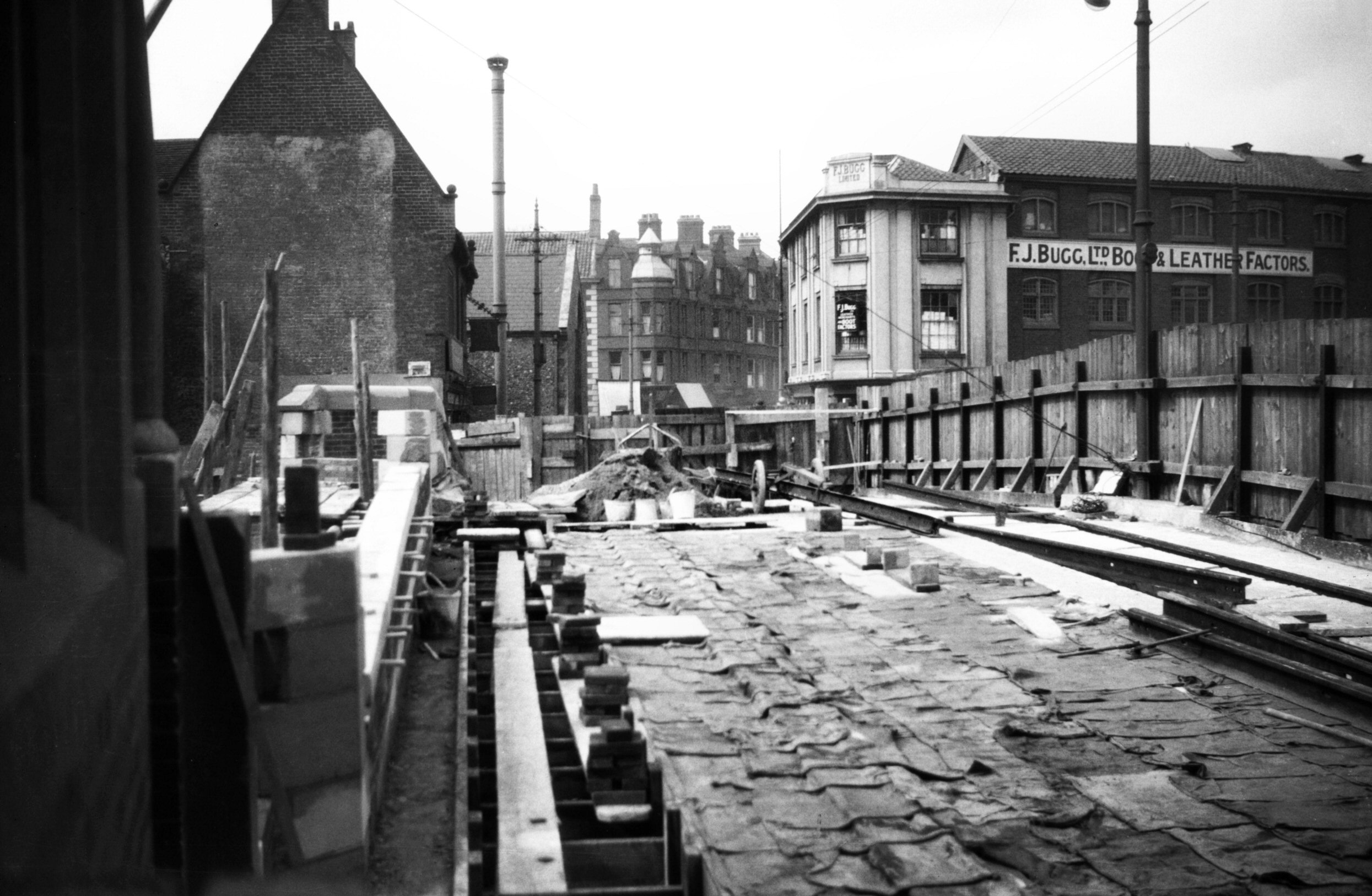
1933-11 Crane from Roache's Court Elm Hill [B806]
1933-11-19
|
|
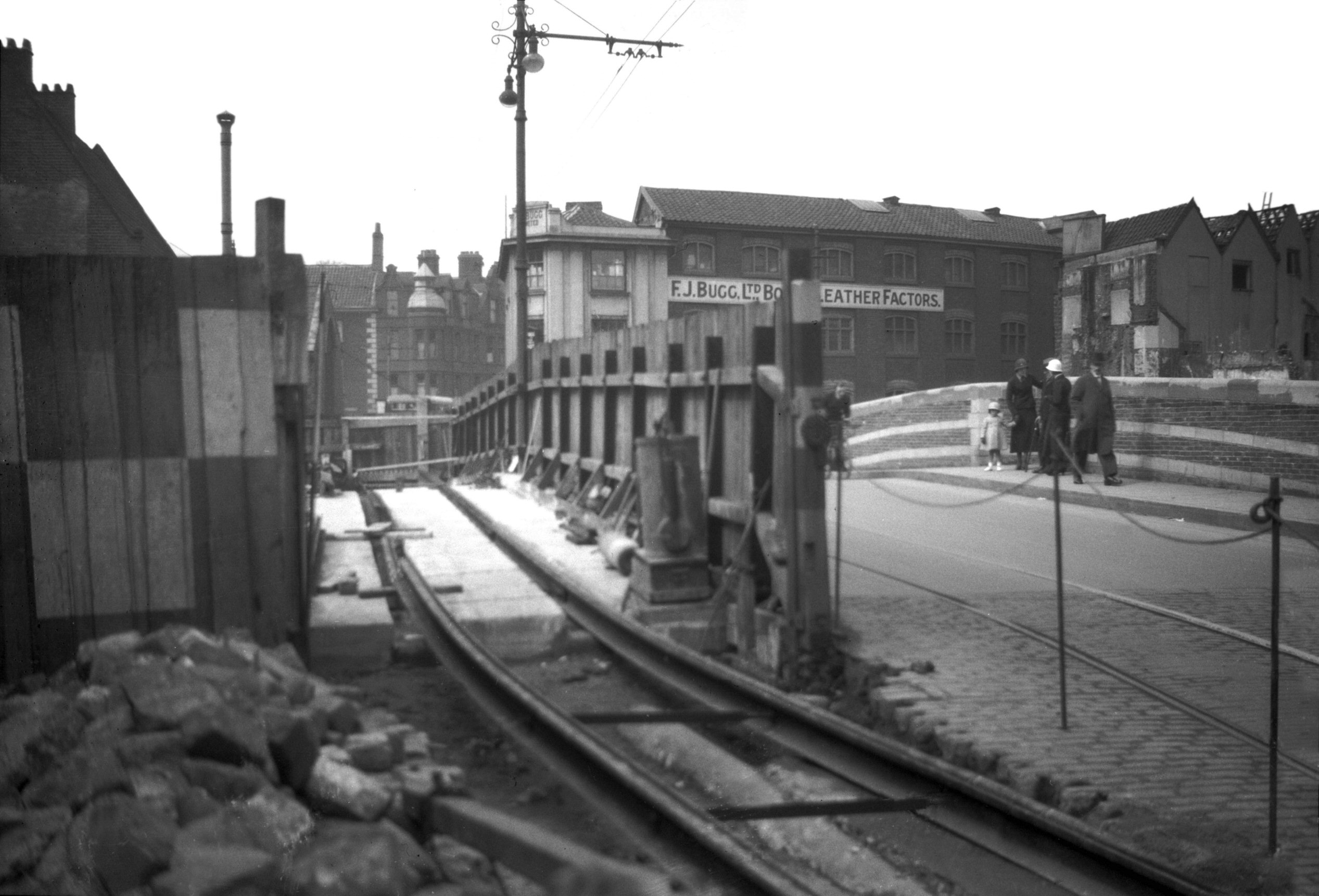
|
1933-11 South pier piles cofferdam W half [B805]
1933-11-19
|
|
|
1933-11 Start of S bank cofferdam west half [B800]
1933-11-12
|
|
|
1933-11 W carriageway construction view N [B797]
1933-11-02
Excavations commenced for the construction of the
remainder of the south pier. |
|
|
1933-11 W carriageway construction view S [B798]
1933-11-02
|
|
|
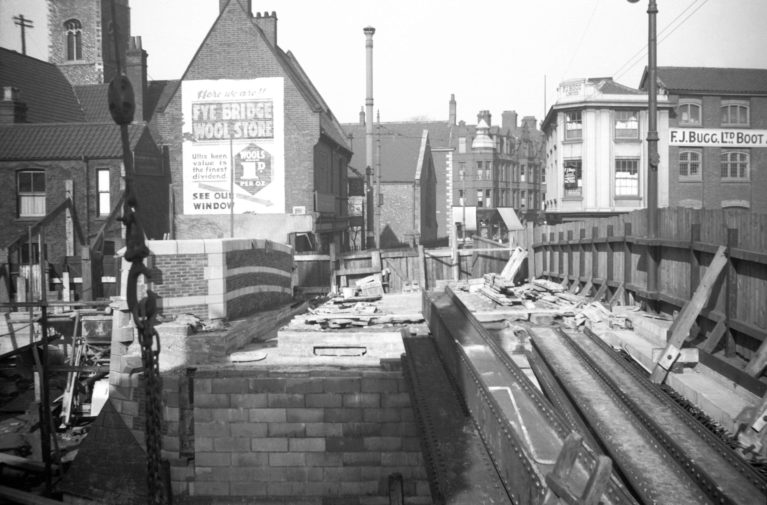
1933-12 Central pier west half complete [B809]
1933-12-05
|
|
|
1933-12 Central pier west half complete [B810]
1933-12-05
|
|
|
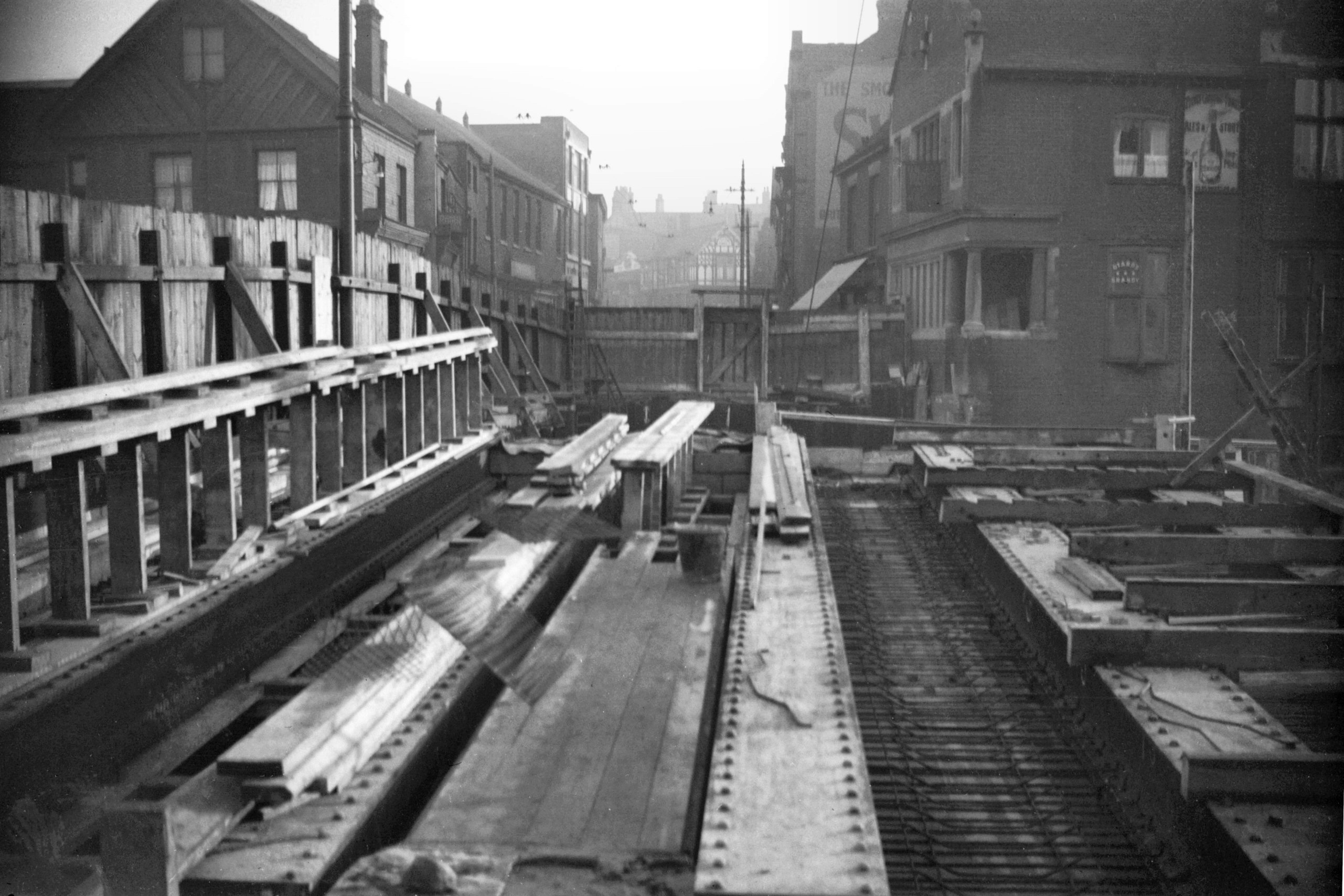
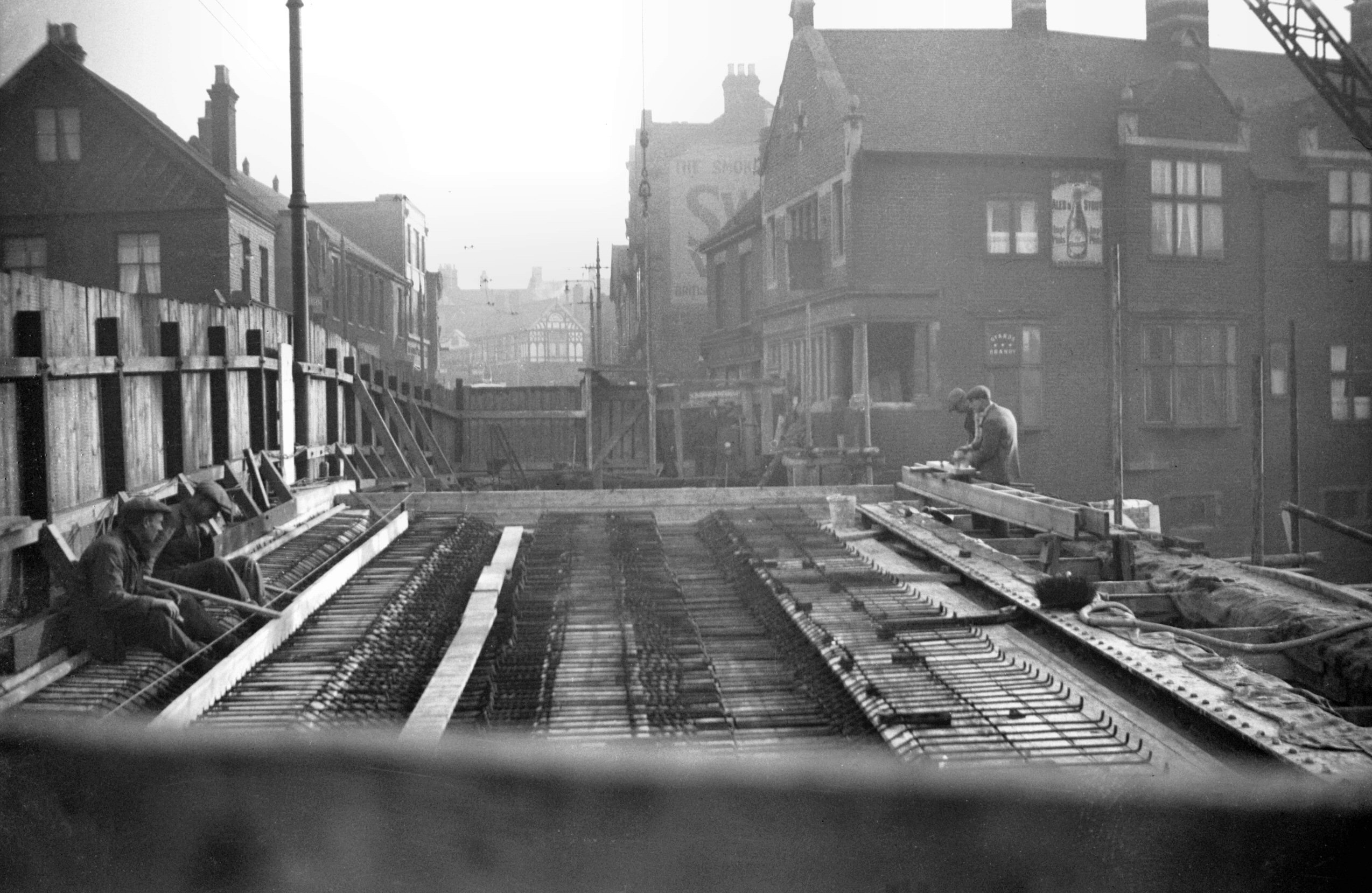
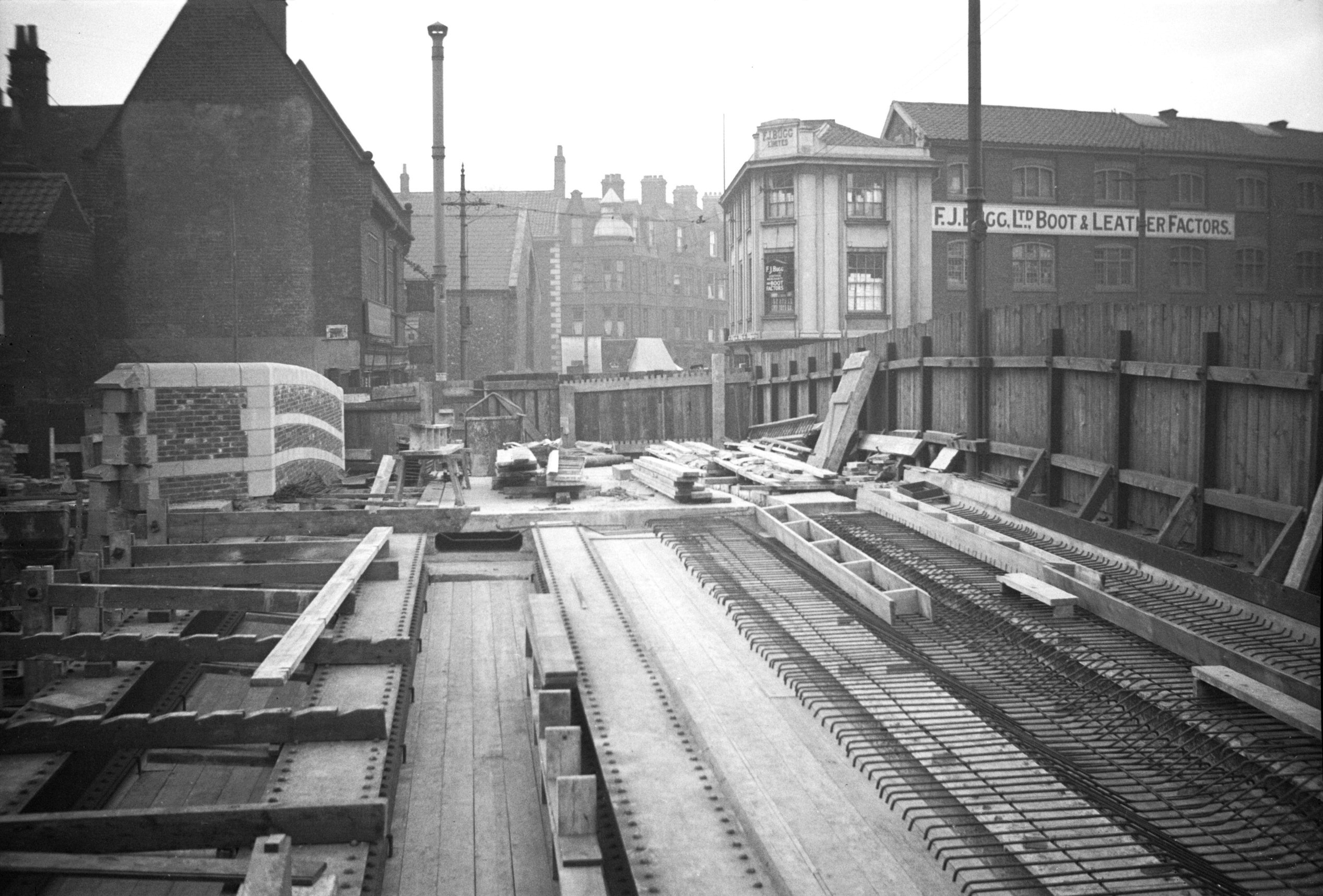
1934-01 Girders west half north side [0001]
1934-01-05
From Fyebridge St. |
|
|
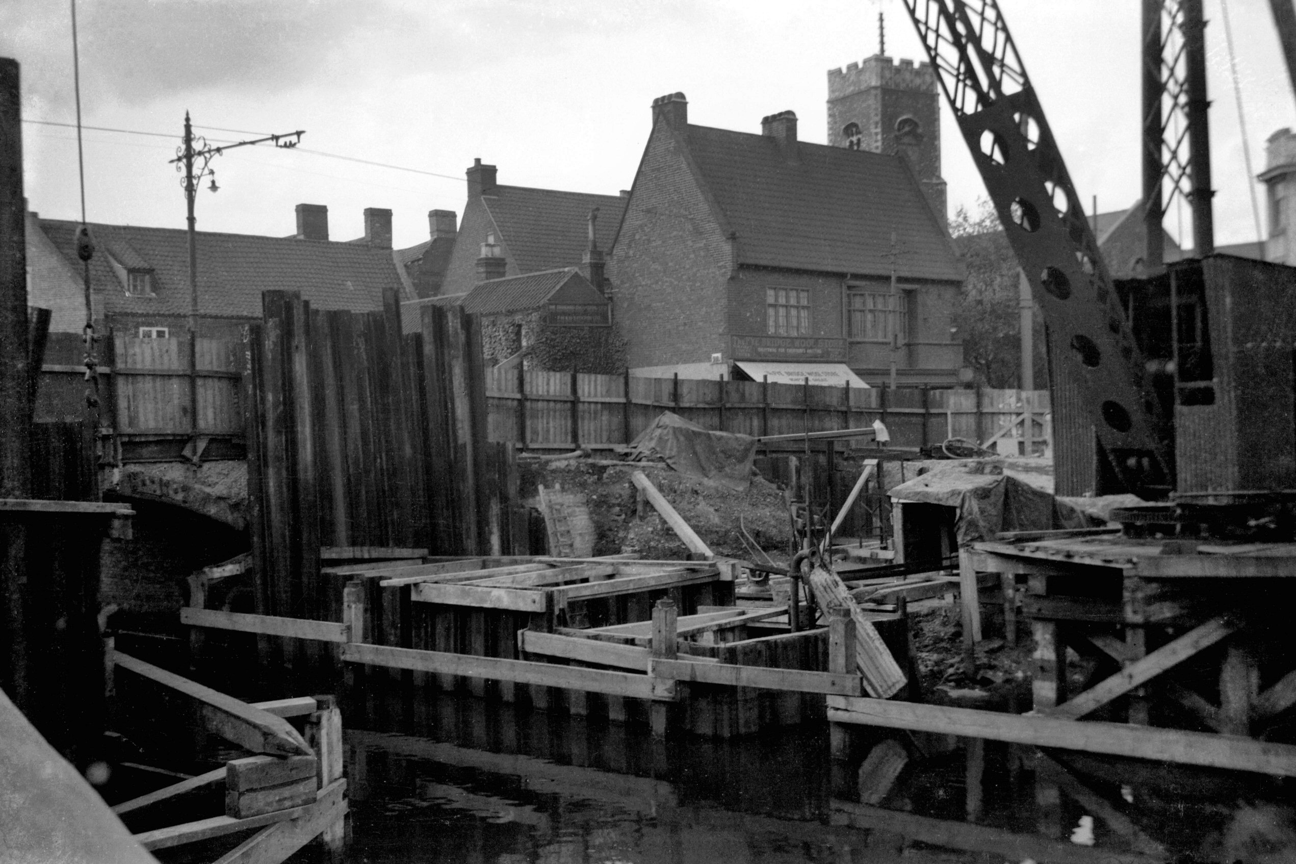
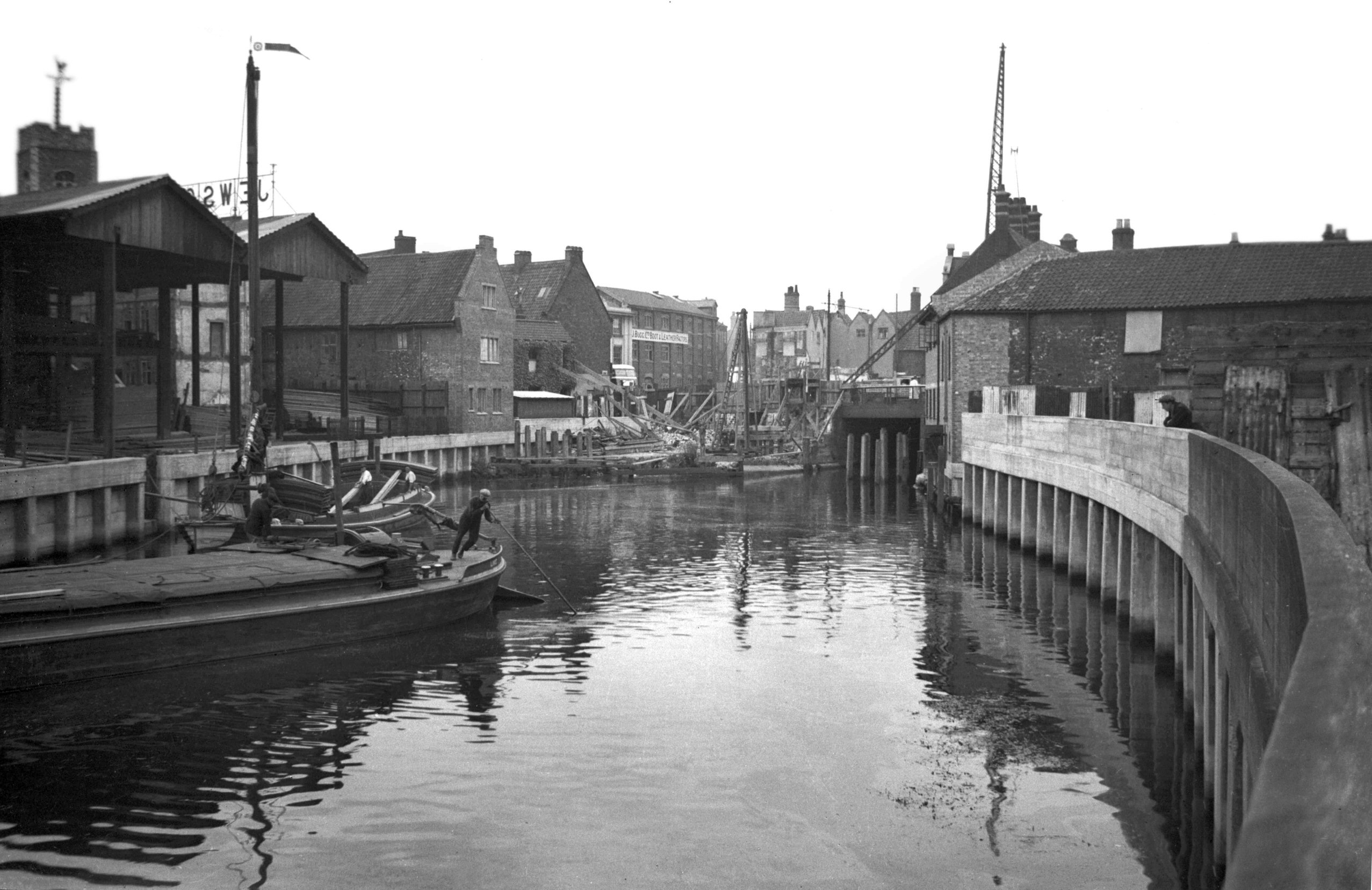
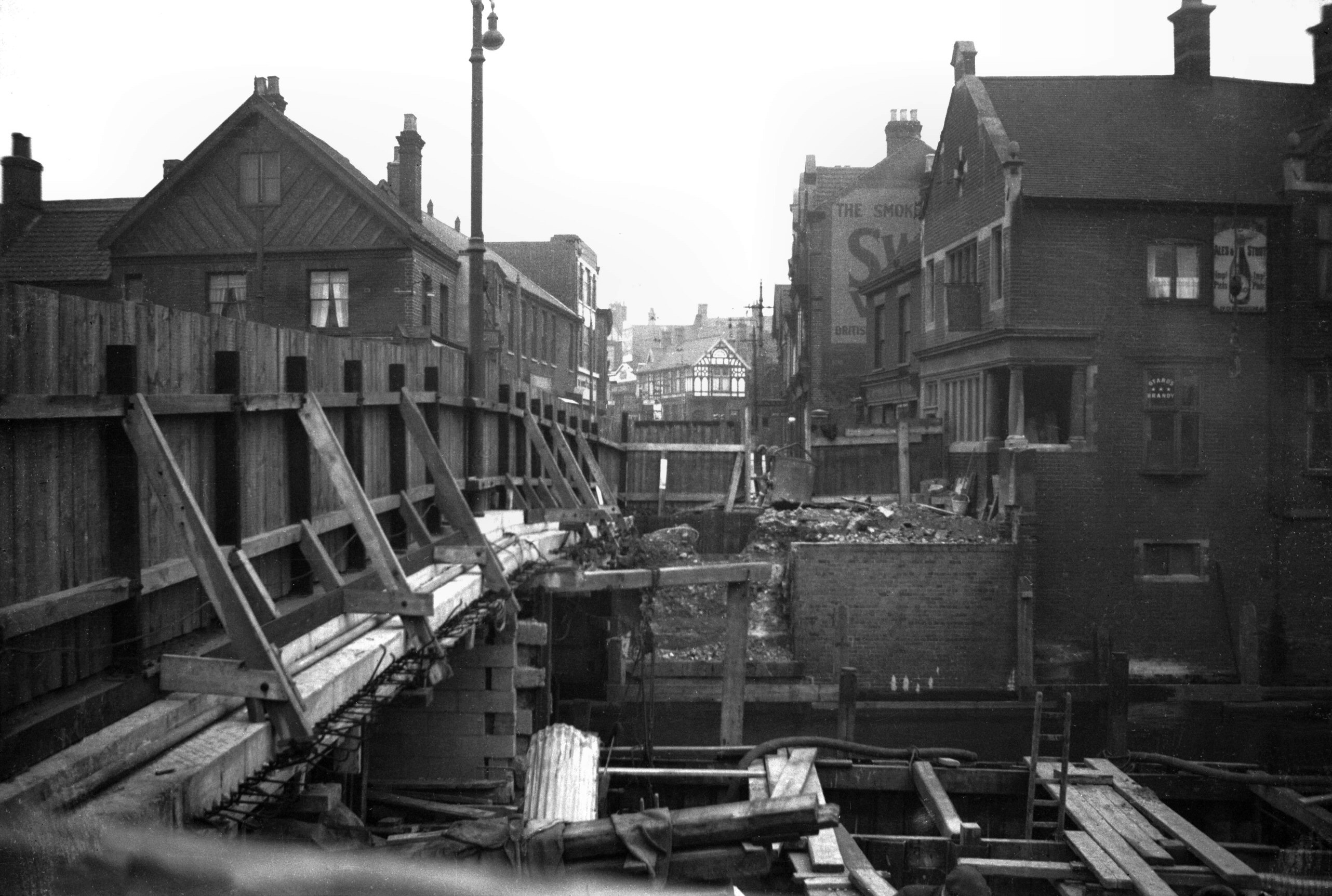
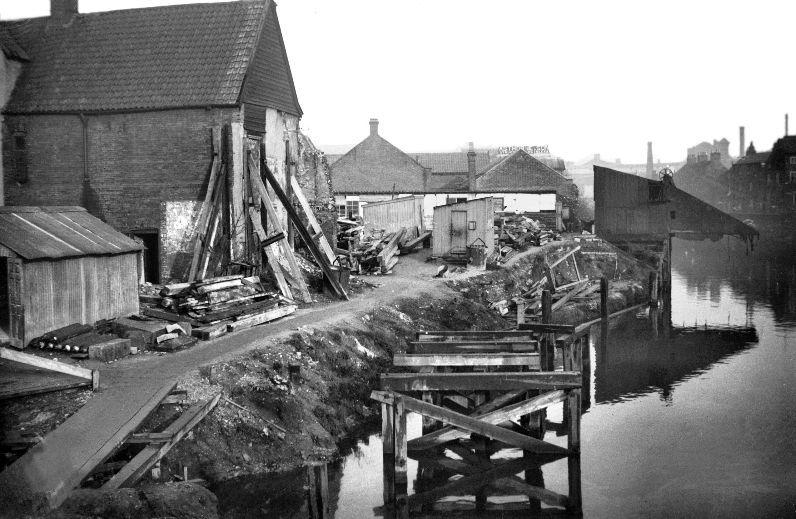
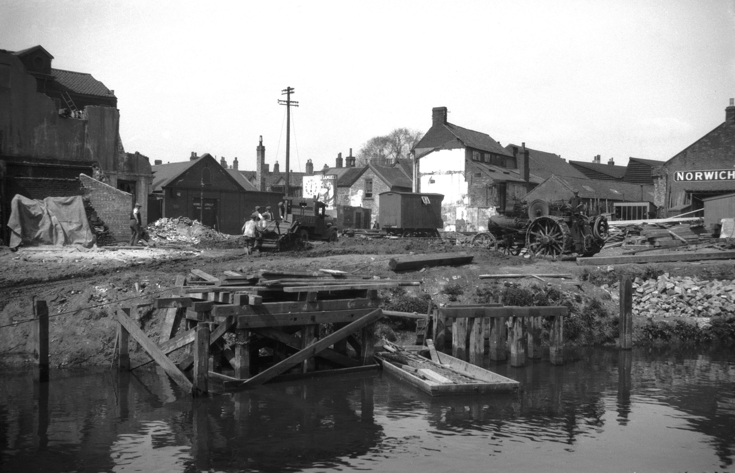
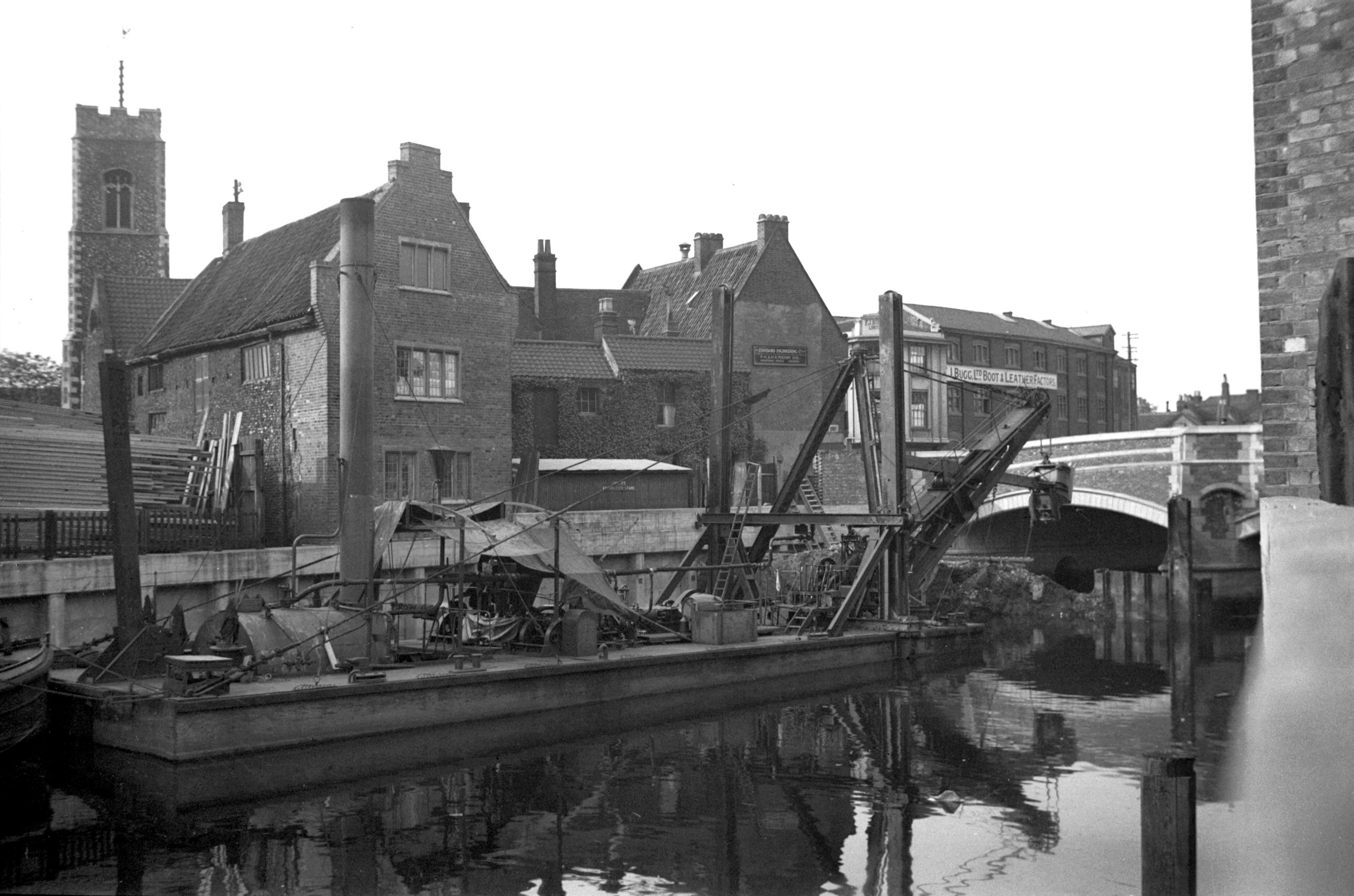
1934-01 Rear of Fishergate north bank [0005]
1934-01-05
View downstream prior to river widening. |
|
|
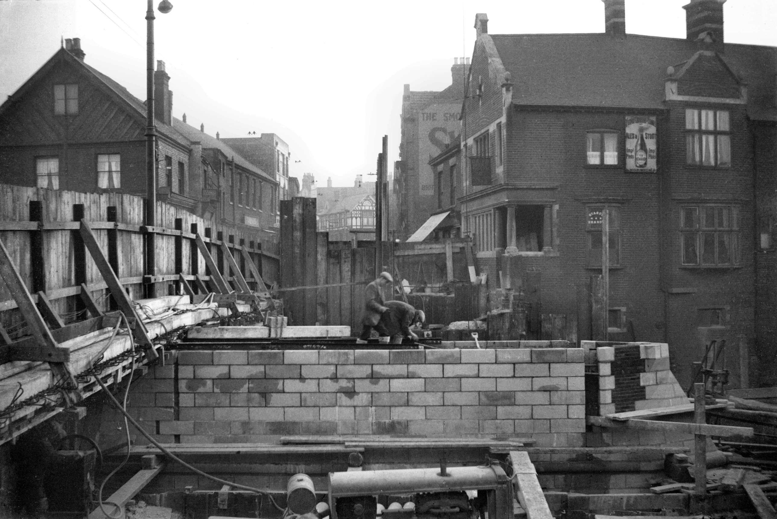
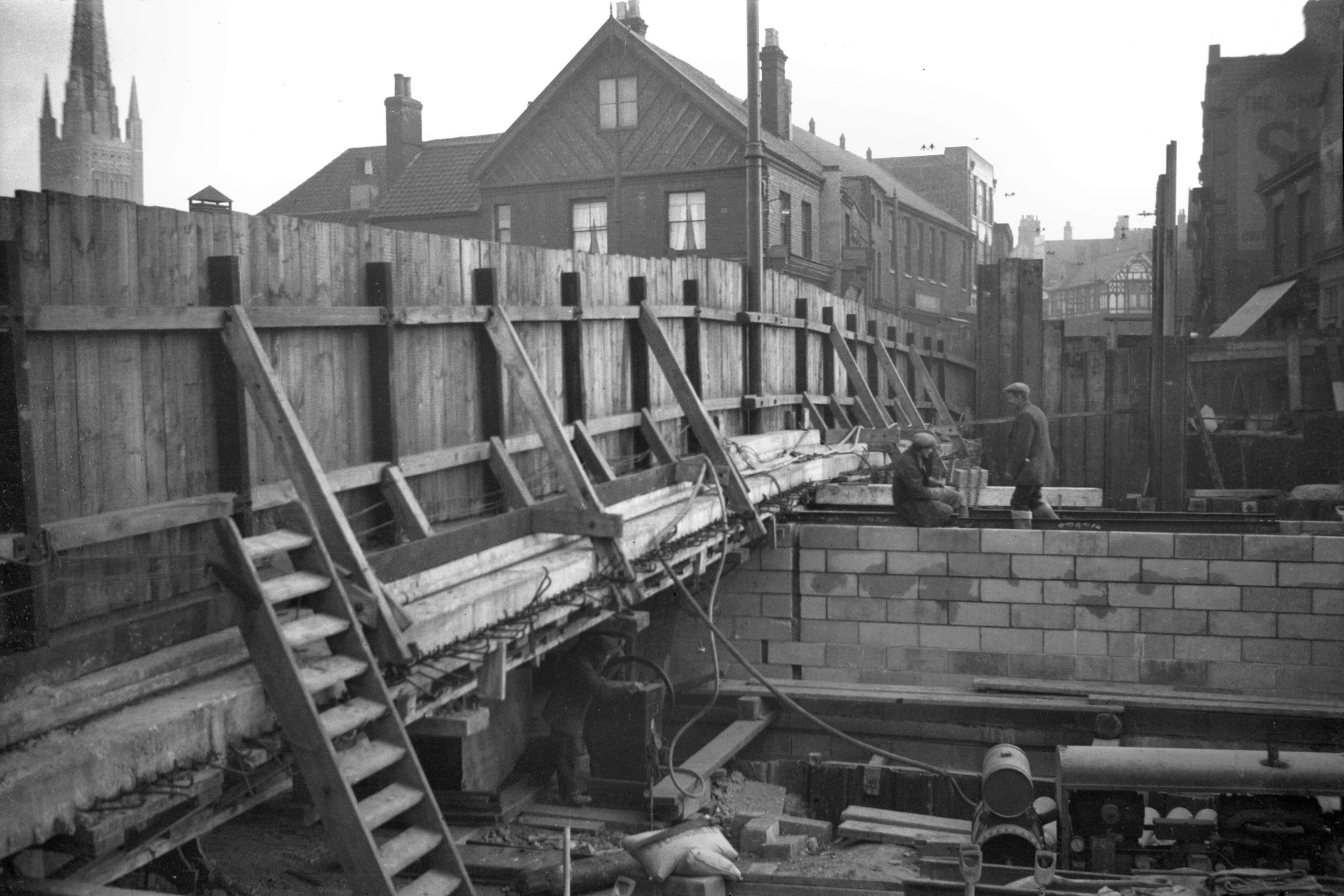
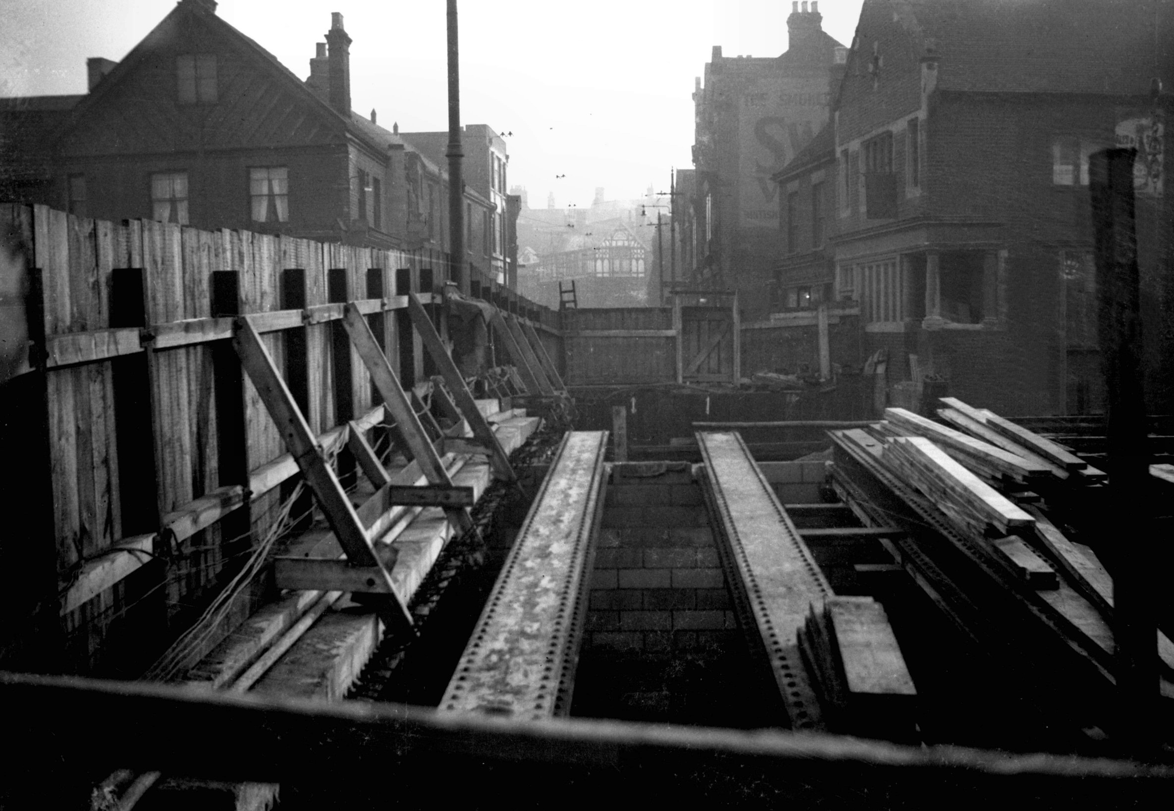
1934-01 West half N arch foundations view S [0018]
1934-01-21
|
|
|
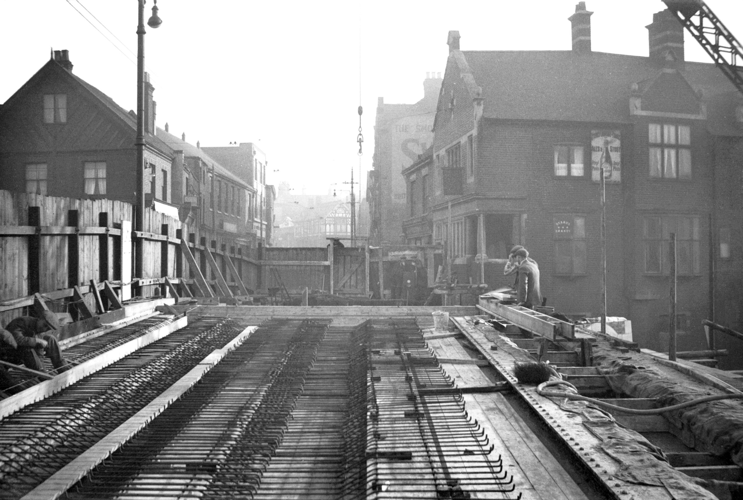
1934-01 West half view north [0003] 1934-01-05
From Wensum St. |
|
|
1934-01 West half view north [0004] 1934-01-05
From Wensum St. |
|
|
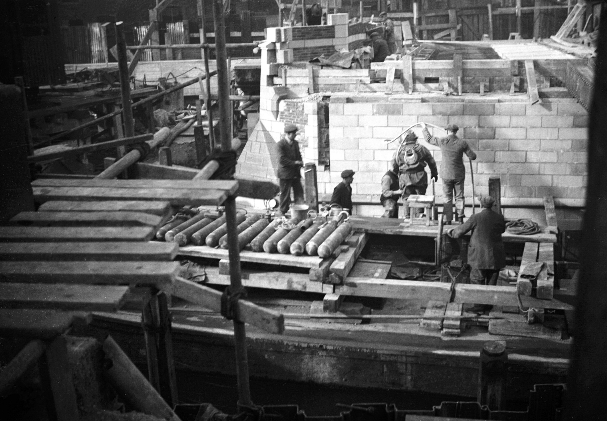
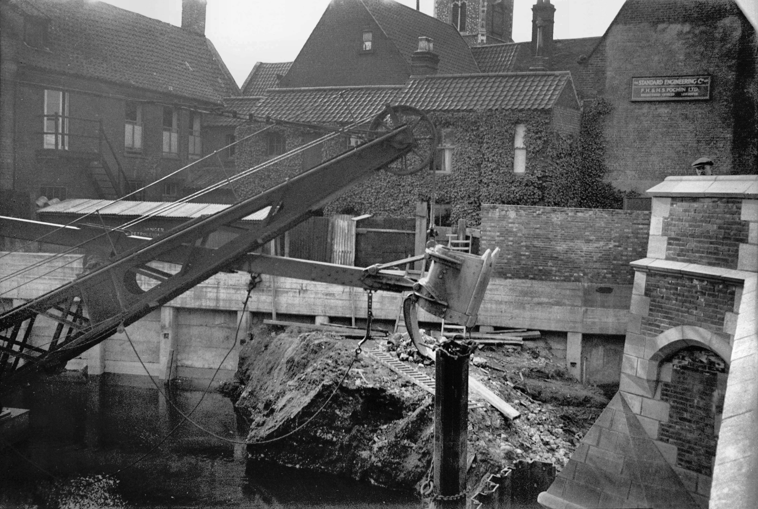
1934-02 Diver by central pier view north [0037]
1934-02-20
About to carry out oxy-acetylene work. |
|
|
1934-02 West half N arch foundations view S [0027]
1934-02-06
|
|
|
1934-02 West half N arch foundations view S [0028]
1934-02-06
|
|
|
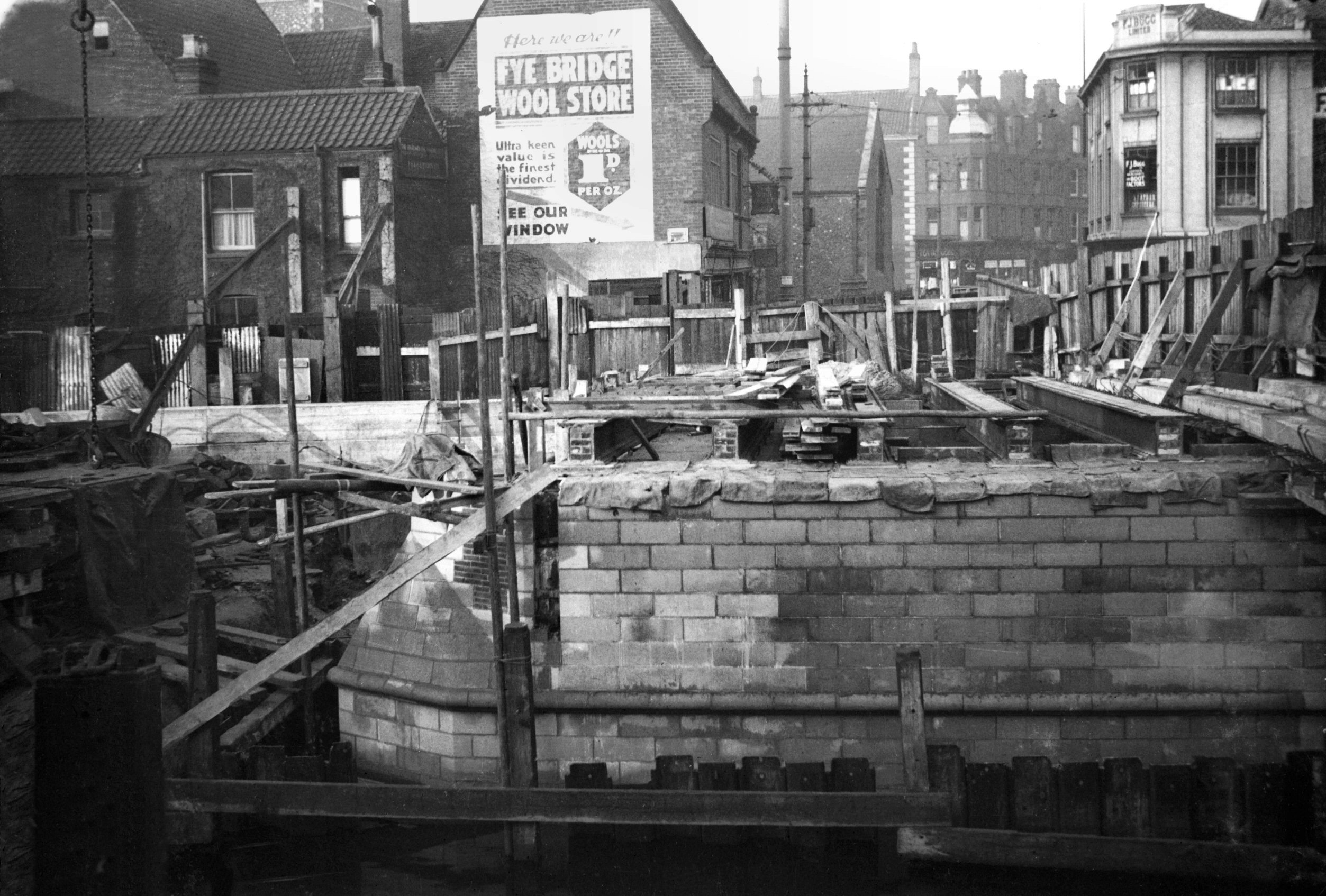
1934-03 Excavations to widen river by arch [0067]
1934-03-31
Digging out earth from below north arch, from Quayside. |
|
|
1934-03 Excavations to widen river by arch [0068]
1934-03-31
|
|
|
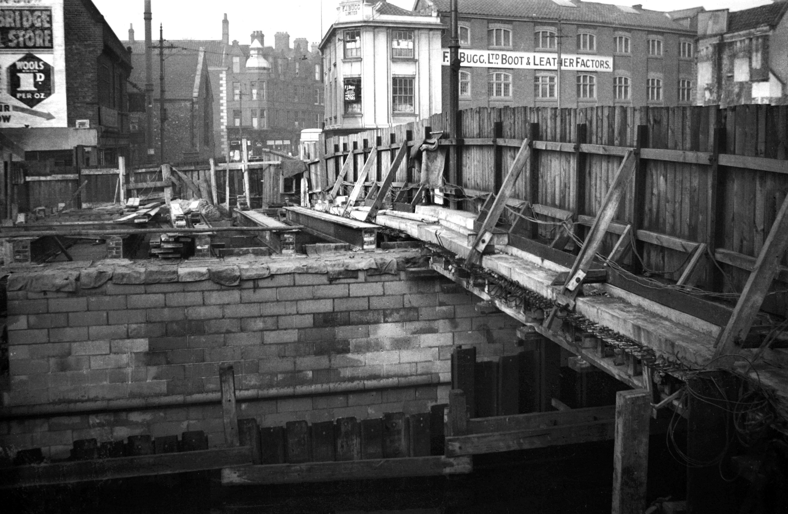
1934-03 Tarpaulins over north arch W side [0048]
1934-03-04
North arch of west carriageway almost complete. |
|
|
1934-03 West side girders S channel view N [0049]
1934-03-04
Girders for west side of south arch ready to be set in
position. |
|
|
1934-03 Wire carriageway foundation W side [0069]
1934-03-31
South arch. |
|
|
1934-04 Tarpaulins on west side view north [0088]
1934-04-28
Tramtrack being laid. |
|
|
1934-04 Tarpaulins on west side view north [0089]
1934-04-28
|
|
|
1934-04 Tramtrack laid on west side view N [0086]
1934-04-28
|
|
|
1934-04 West side parapet nearly complete [0087]
1934-04-28
|
|
|
1934-05 Dredging Wensum by engine on N bank [0091]
1934-05-10
Traction engine dredging by dragline. |
|
|
1934-05 Fence removed from centre of bridge [0105]
1934-05-24
|
|
|
1934-05 West half pedestrians only view S [0096]
1934-05-18
|
|
|
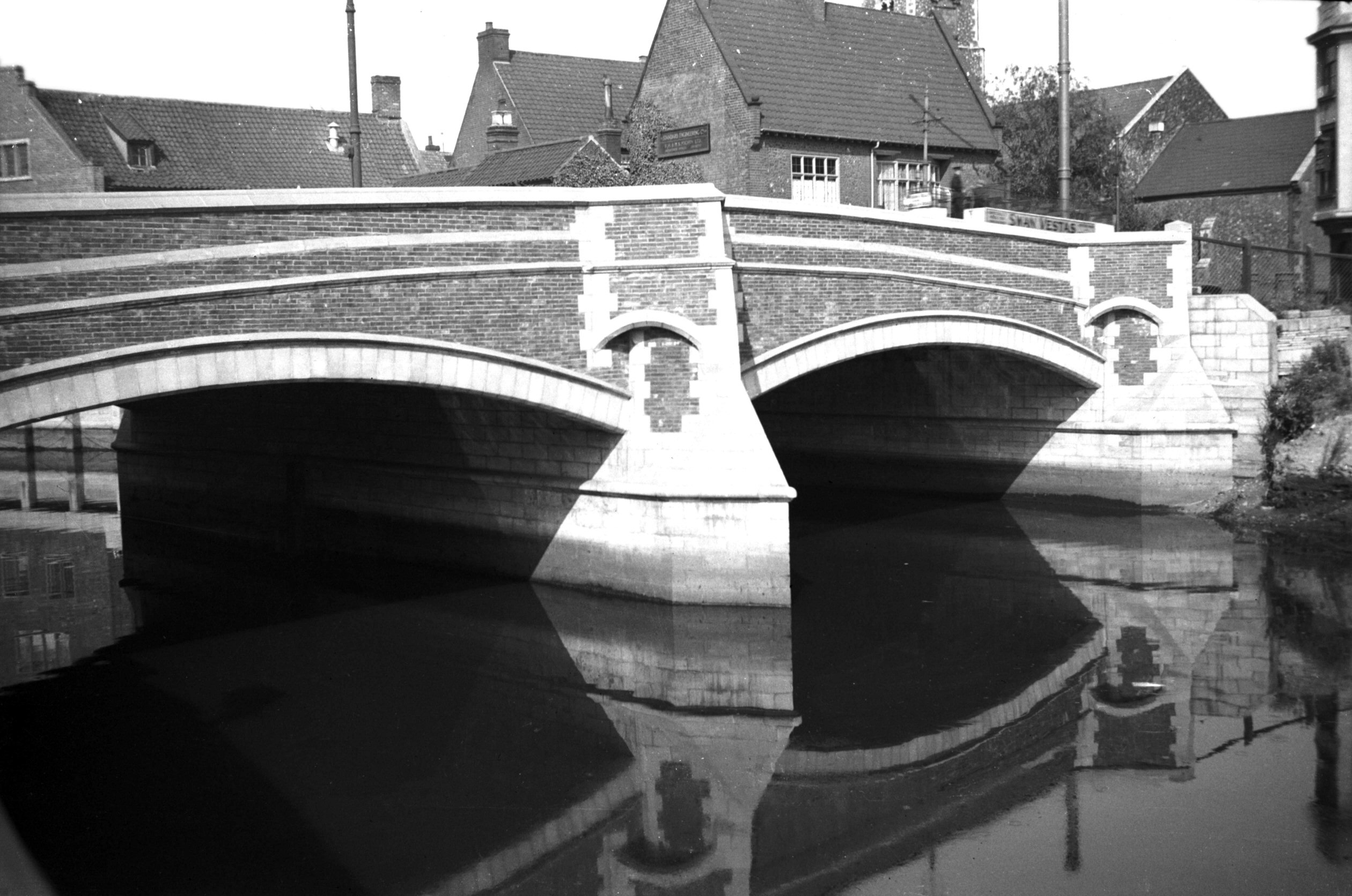
1934-06 Carriageways open to traffic view N [0111]
1934-06-08
|
|
|
1934-06 Carriageways open to traffic view N [0112]
1934-06-08
The bridge was completed and fully opened to traffic on
29th May 1934. |
|
|
1934-06 Dredger by Roache's Court Elm Hill [0113]
1934-06-08
|
|
|
1934-06 Dredger grab for widening Wensum [0110]
1934-06-08
Widening north side upstream of bridge. |
|
|
Wensum Fye Bridge east side from Quayside [0619]
1935-08-06
Probably the first bridge to be built over the river in
Norwich. Records go back to 1153 but in 1896, when
trenching for a drainage scheme, a series of wooden plies
from Elm Hill to Fishergate suggested an earlier wooden
plankway. A timber bridge here until Henry IV's time, it
was then rebuilt of stone. In 1572 a new bridge of two
arches replaced one washed down by floods. Repaired in
1756 it was replaced in 1829 by a single cast iron span
of 36 feet, 22 feet between parapets, later increased to
37 feet on the west side. The present structure has two
spans each of 35 feet, 50 feet between the parapets.
Supported by steel girders it is of reinforced concrete
faced with bricks. First half opened to traffic 1st July
1933. Completely opened 29th May 1934. |
| |
West
side |
|
|
Fyebridge St Fye Bridge House east front [7753]
2000-05-14
See also St Clement's Alley. |