|
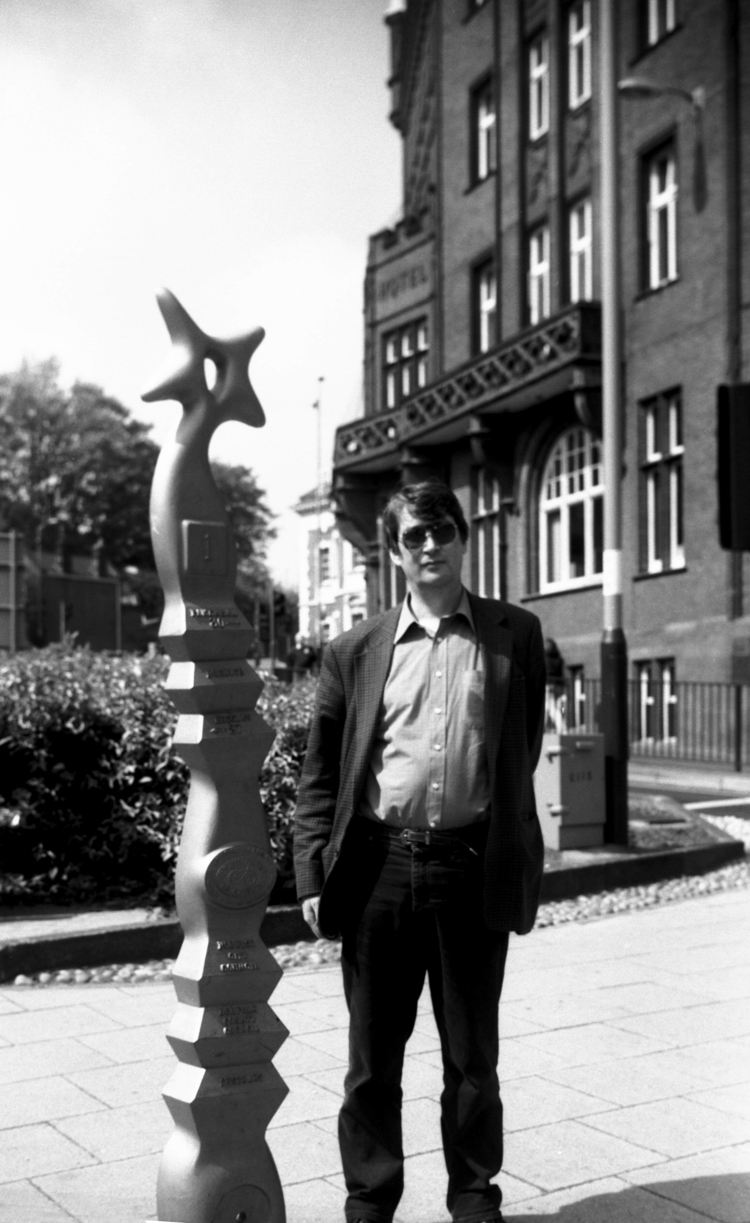
Agricultural Hall Plain millennium milepost [7619]
1999-05-02 Erected 1998. One of many marking the route of the National Cycle Network launched in 1995, it shows the distance to the next post. |
|
|
Bank Plain Edwardian lamp post [7804] 2001-02-13 Late Victorian or early Edwardian. |
|
|
Bank Plain Edwardian lamp post base [7809] 2001-04-01 |
|
|
Bank Plain Edwardian lamp post head [7810] 2001-04-01 |
|
|
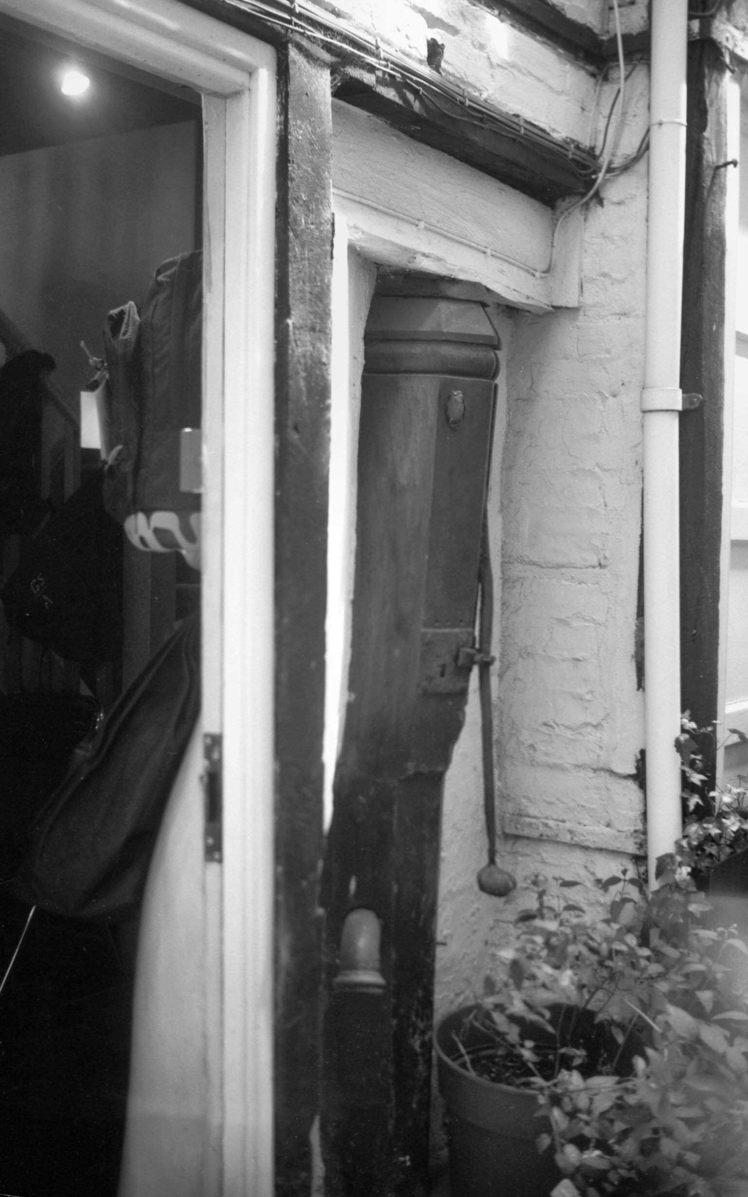
Bedford St Websdale's Court wooden pump [4756]
1964-04-18 |
|
|
Bedford St Websdale's Court wooden pump [7567]
1998-07-25 |
|
|
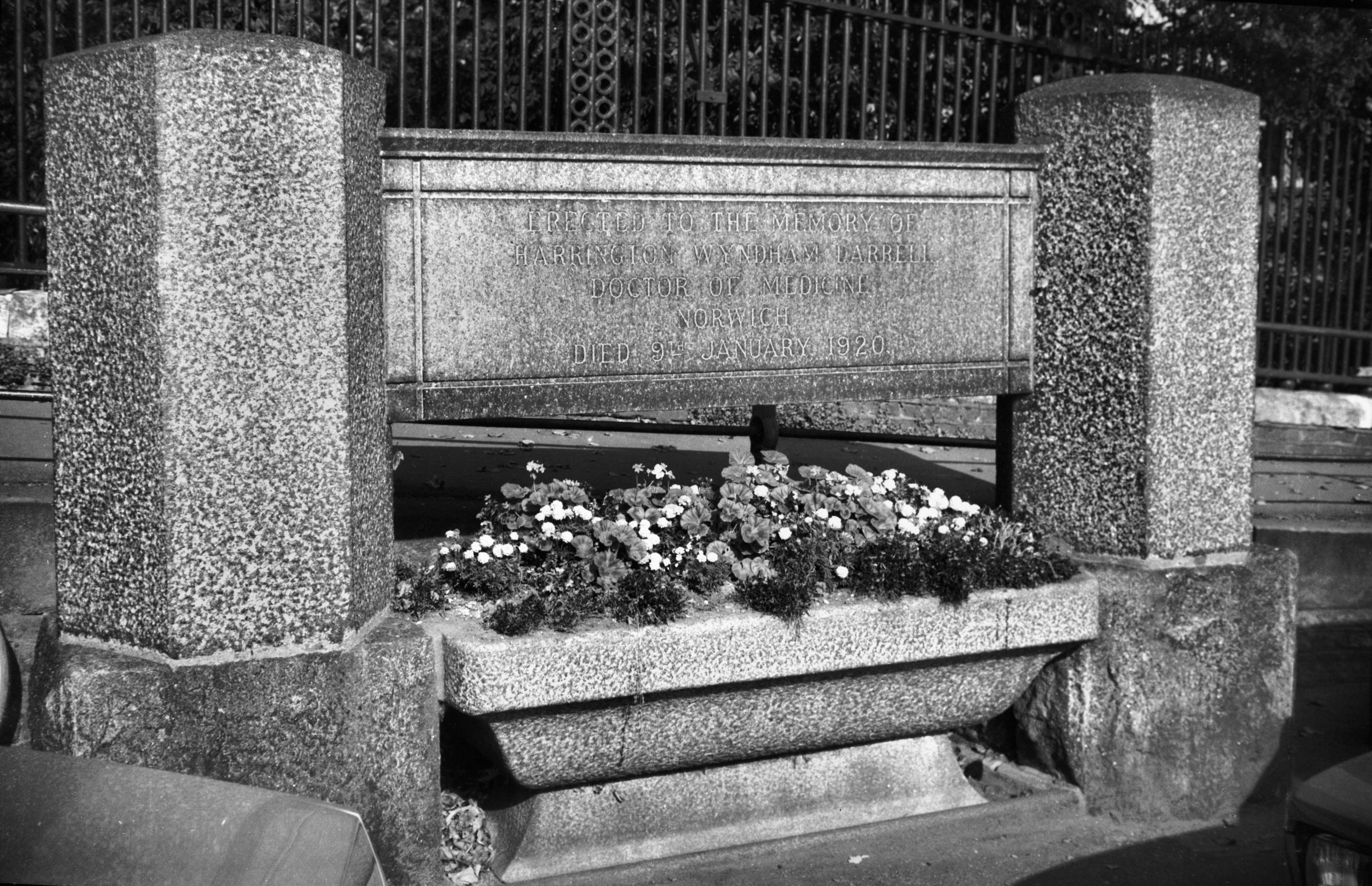
Bell Avenue Dr Darrell's cattle trough [6428]
1986-10-06 Now converted to flower display. Inscribed "Erected to the Memory of/ Harrington Wyndham Darrell/ Doctor of Medicine/ Norwich/ Died 9th January 1920". Dr Darrell was a great animal lover. The trough was originally placed next to his house at 12 All Saints Green. |
|
|
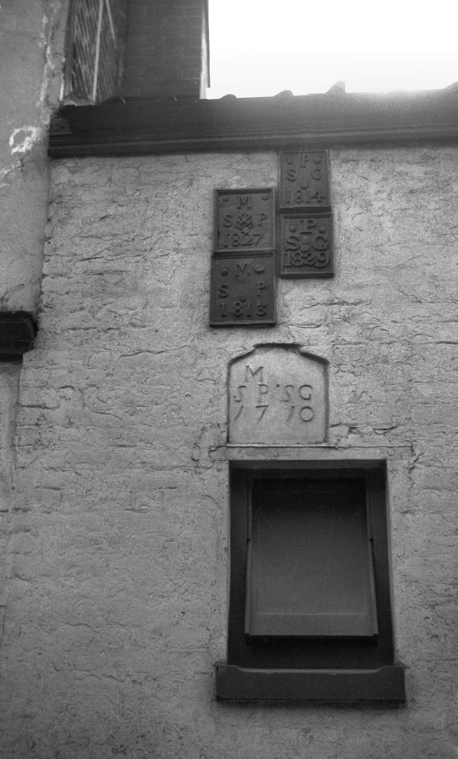
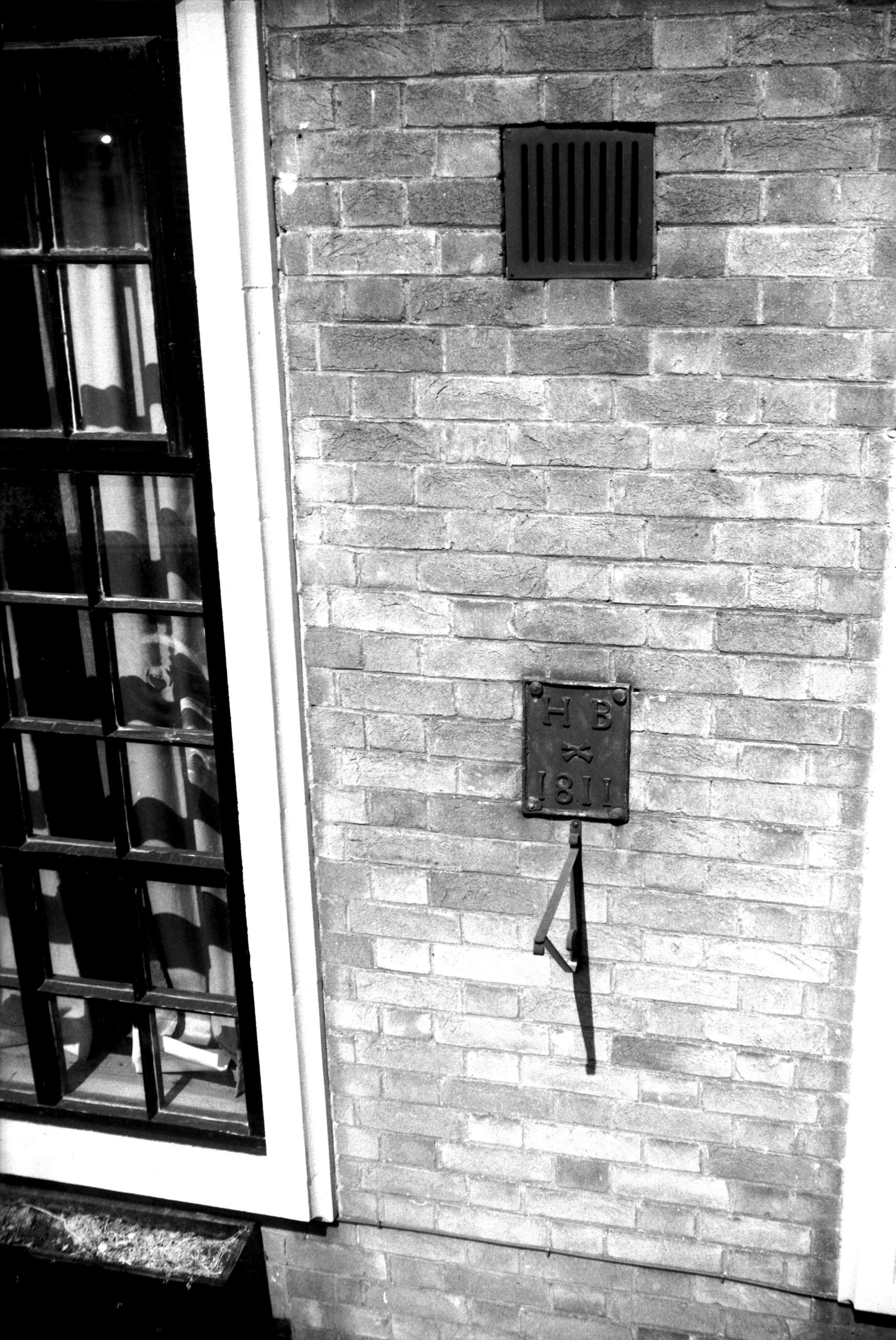
Bethel St 51 boundary plates [2271] 1938-04-07 Four lead plates and inscribed stone at boundary of St Giles' and St Peter Mancroft's parishes. Dates between 1710 and 1829. |
|
|
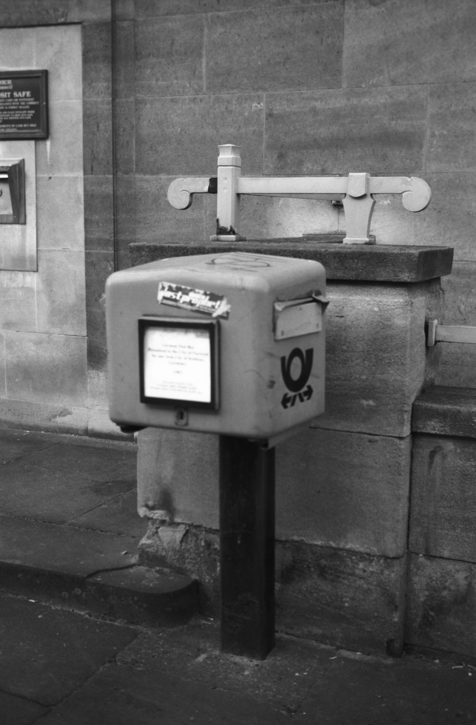
Bethel St German type post box from Koblenz [7914]
2003-02-18 Presented by the twin city. |
|
|
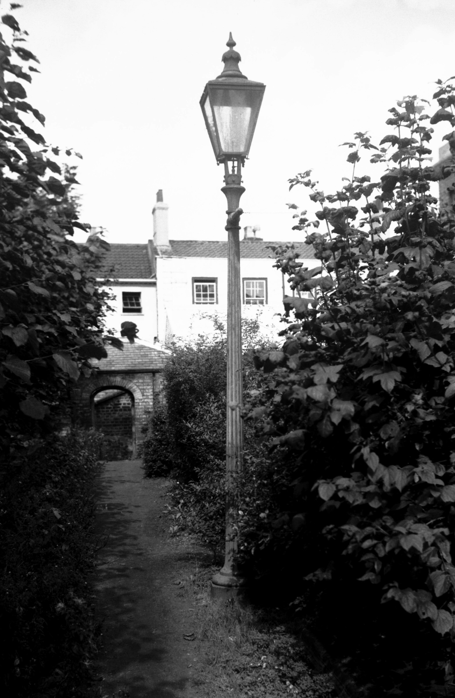
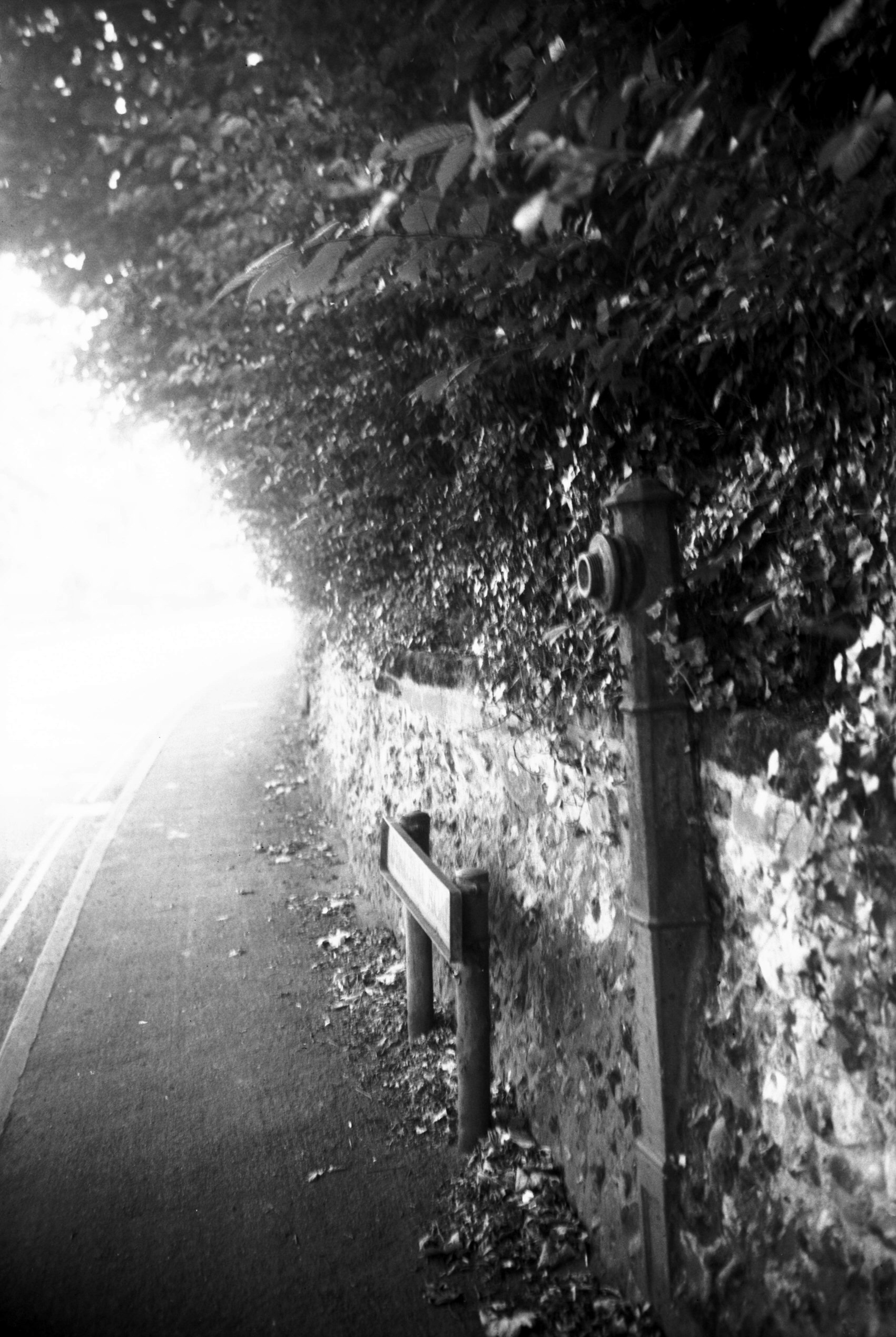
Bethel St St Giles' Terrace gas street lamp [4385]
1955-09-22 A survival from the past which I photographed in 1955 was an old gas lamp lighting the pathway flanking the front gardens here; it has since been converted to electricity, although retaining its original lantern. Most were converted 1911-13. The history of street lighting in Norwich is an interesting one. In August 1807, the Paving Commissioners advertised for tenders for lighting the city by oil, stating that the number of lamps required would be between 1,200 and 1,400. Late in 1819 a Bill was promoted in Parliament for lighting the city with oil gas and "on January 31st, 1820, the first of the iron gas pipes were laid in the Market Place", where by May the gas was producing "a strong and steady light as far as it extended". The works were in St Stephen's Back St (later renamed Malthouse Rd), but in 1825 they were purchased by the British Gas Light Company, who had bought land near St Martin-at-Palace Plain in order to build works for the production of coal gas. In 1830 these were augmented by others at Bishopbridge Rd, and from this time gas lighting was gradually extended throughout the city. 21 years later, when Norwich was the subject of an inquiry by the General Board of Health into its sanitary condition, the Superintendent Inspector, W. Lee, commented on the evidence of Mr Tadman, the gas works manager, and considering the cost of the coals, "the citizens of Norwich had great reason to be satisfied with the company's prices for gas". Unfortunately this happy state of affairs was not to last; in 1880 because of the "unjust and unnecessary burdens imposed upon the citizens through the extravagant charge made for gas" the city council was asked to consider the question of electric lighting. A year later two electric lights had been put up in the Market Place and it was decided to extend the system experimentally to a few other main streets. The first permanent installations were made in 1904, when arc lamps were placed on top of the tram standards in the Market Place, Bank Plain and Prince of Wales Rd, to be followed in 1910-13 by the conversion of all the gas lamps to electricity except for a few isolated lamps in unadopted thoroughfares. Norwich, it was claimed, thus became the first town in England to be entirely lit by electricity. |
|
|
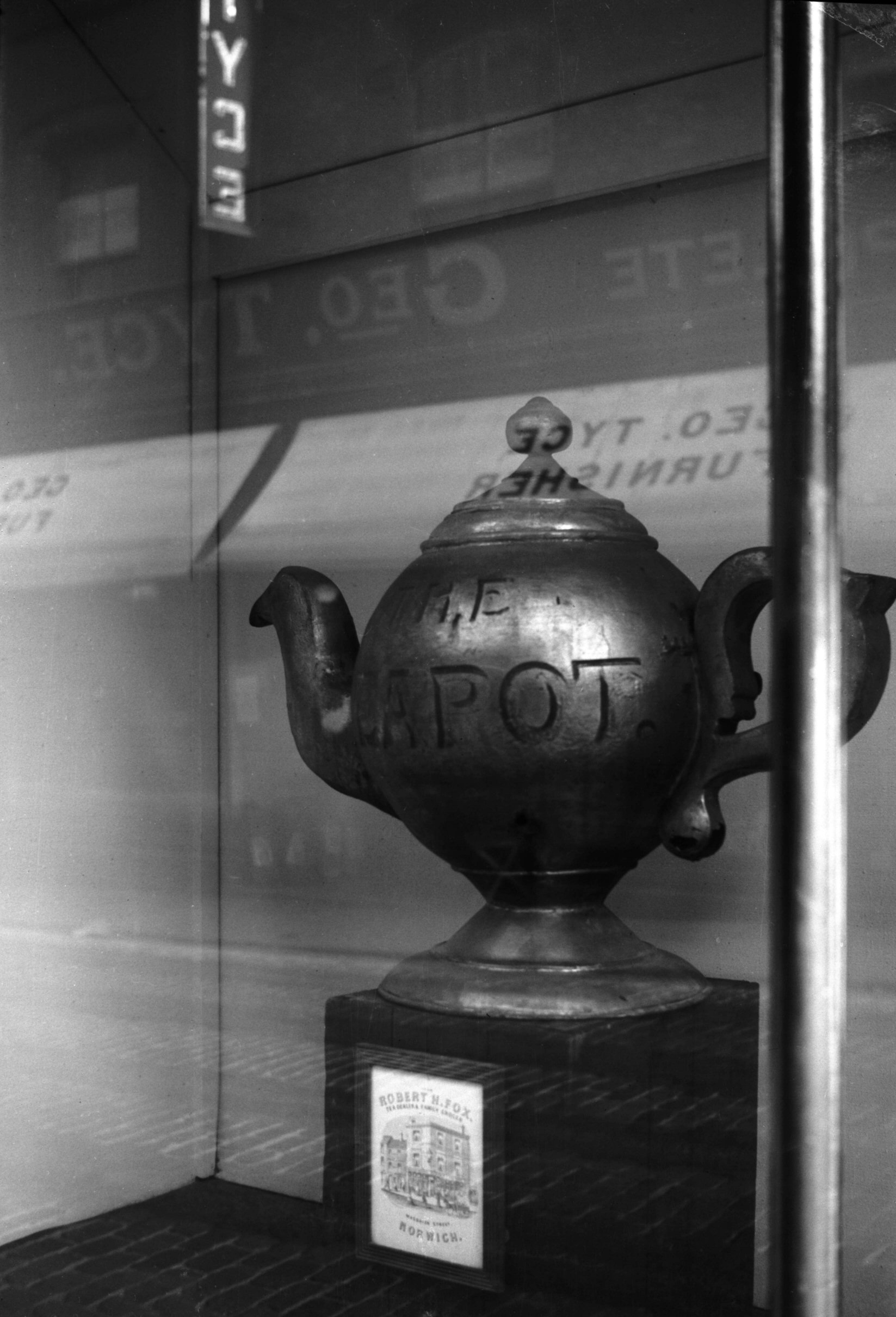
Charing Cross 6 Strangers Hall gold teapot [2425]
1938-05-23 A grocer's sign once displayed by Robt.Fox and later John Dodson at his shop at the corner of Magdalen St and St Saviour's Lane. |
|
|
Close The 64 early 19c cannon corner post [4430]
1956-05-15 Used as a corner post, Francis & Blyth Norwich, early 19c. |
|
|
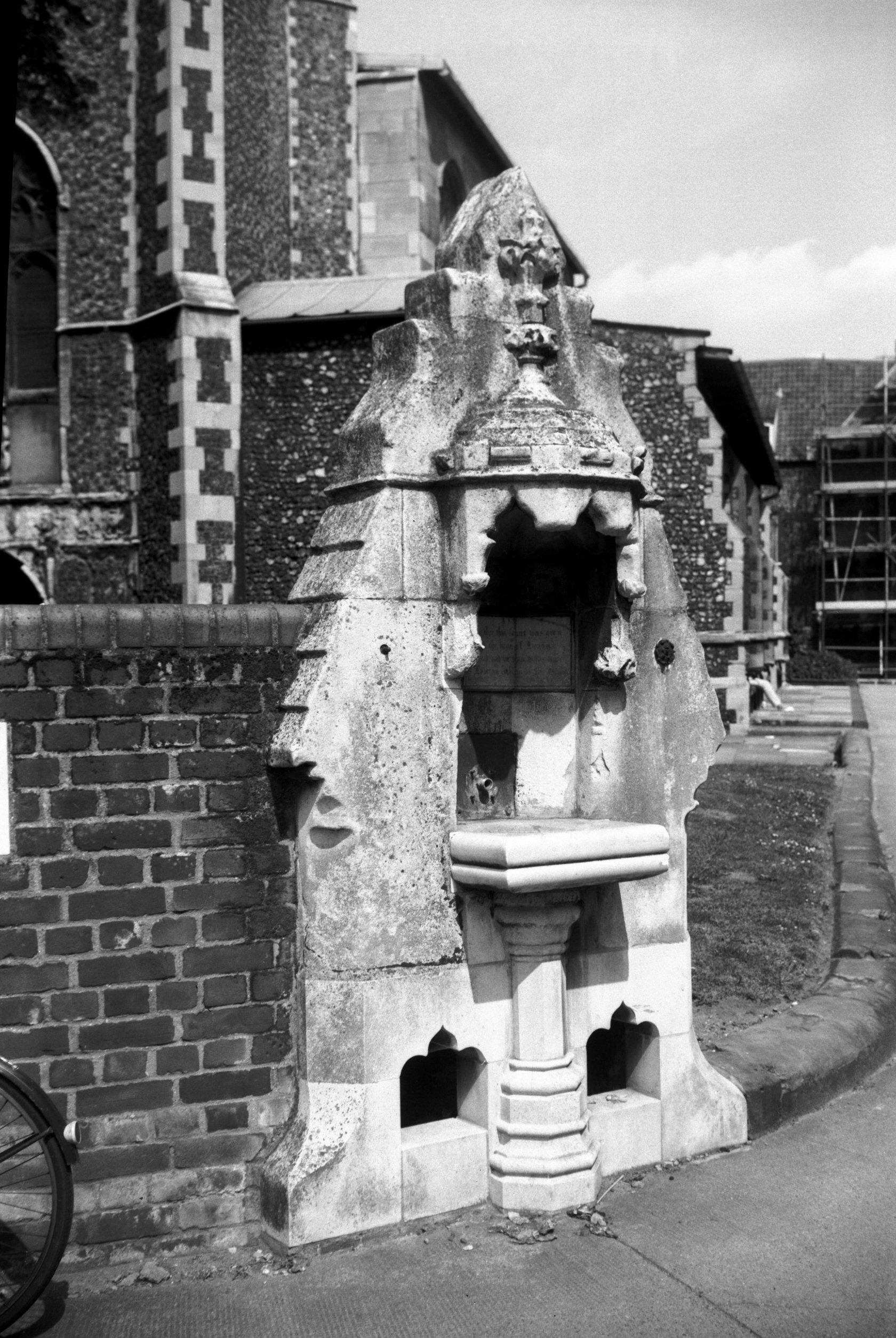
Colegate St George's Drinking fountain [6415]
1986-07-10 At the corner of St George Colegate churchyard. Given to the church in the 19c by J.C.Barnham. Inscribed "Wayfaring Man for thee this Fount was giv'n/ A Channel to impart the boon of Heav'n/ Drink and thank God and in this water trace/ An earnest of His love, an emblem of His Grace". |
|
|
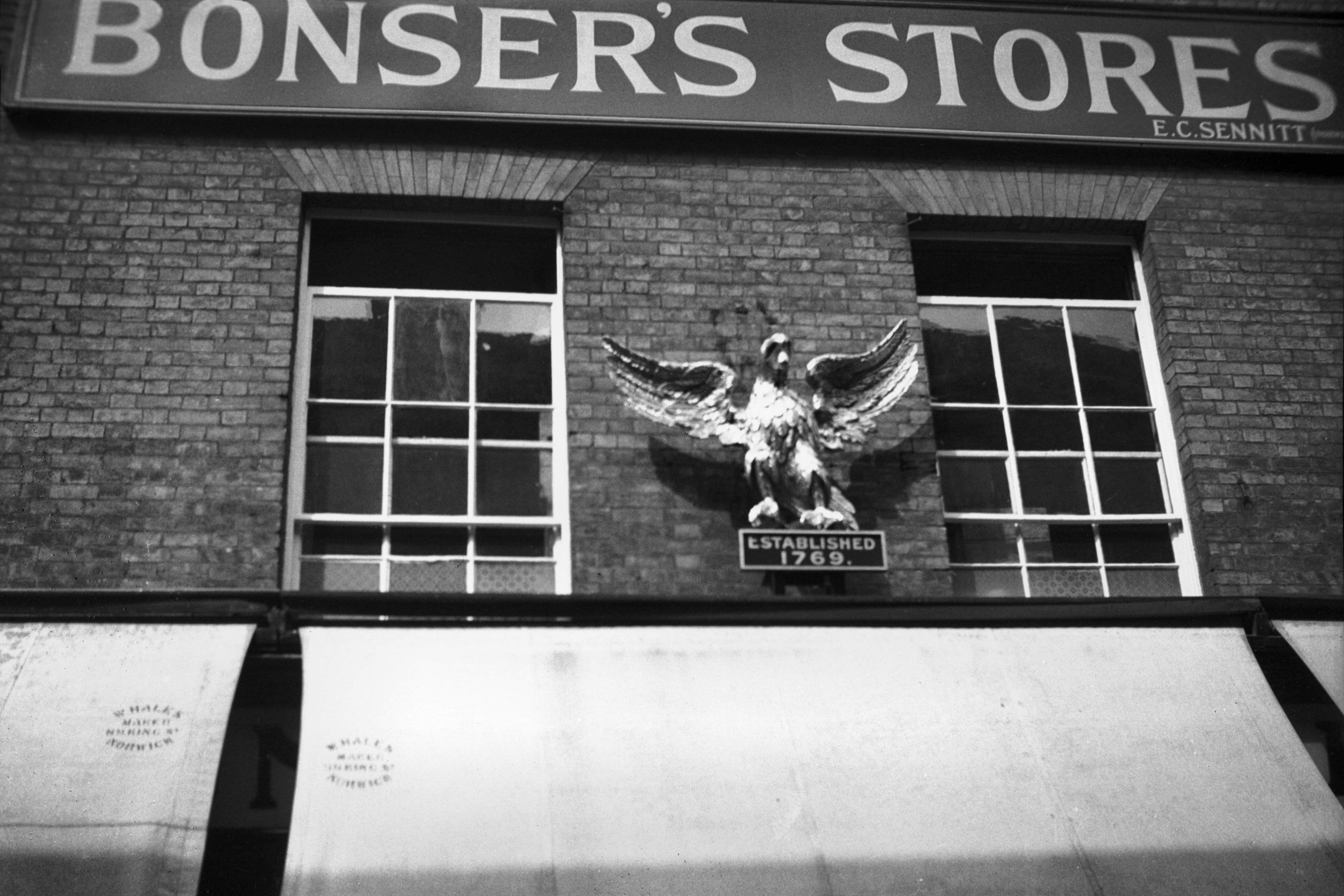
Davey Place 10 Eagle and Pearl at Bonser's [0198]
1934-08-11 Norwich, like other old cities, once boasted of a wide variety of signs displayed over its shop fronts. Except for a few now in the Strangers' Hall museum, such as Dodson's Golden Teapot, Griffiths' Golden Plane, and the two described below, the majority have disappeared, even including the ubiquitous barber's pole. The public houses seem now to be alone in continuing the custom. Here in Davey Place at least two were carrying out their original purpose into the 20c. One was the golden fleece, often referred to as "Skoyles' sheep". This was suspended outside the shop of Riches and Skoyles, where the Monsoon shop later opened. The traditional sign of the wool stapler, it here drew attention to a men's outfitters and hatters. The proprietor, Robert Skoyles, who had succeeded his father in the business, died in 1940 aged 84, but he had given up the shop some 35 years before to go into the wholesale clothing trade, with premises in Pottergate. It is possible that the history of this particular sign went back further than that of Skoyles' shop. For in the 1780s some copper tradesmen's tokens (some circular, some oval) were issued bearing this symbol enclosed by the motto "Good Times will come". A representation of Norwich Castle was shown on the reverse side, with an inscription on the edge stating that it was issued by Richard Bacon of Cockey Lane (now London St). Another old sign to last into the 20c was the Golden Eagle and Pearl, to be seen for many years above Bonsers, the grocer's shop at 10, Davey Place. This sign was originally adopted by Isaac Marsh, a silversmith, who founded his business in 1769 at a shop on the Walk where Lloyd's Bank later opened. Successive owners ware Dunham and Yallop and Etheridge and Ellis, during whose time the character of the firm changed to that of tea dealers. The present sign was carved in 1869 by John Culyer as a faithful copy of the original. About 1875 the firm was acquired by Bonsers, who later moved to Davey Place. Early in the 20c the proprietors were J.Utting in partnership with my great uncle William Plunkett, and they were succeeded by E.C.Sennitt, who had similar shops in St Stephen's and Goat Lane. On their giving up in 1938 Goose's bookshop moved here from the Haymarket and the old sign was handed over to the Norwich Castle museum. |
|
|
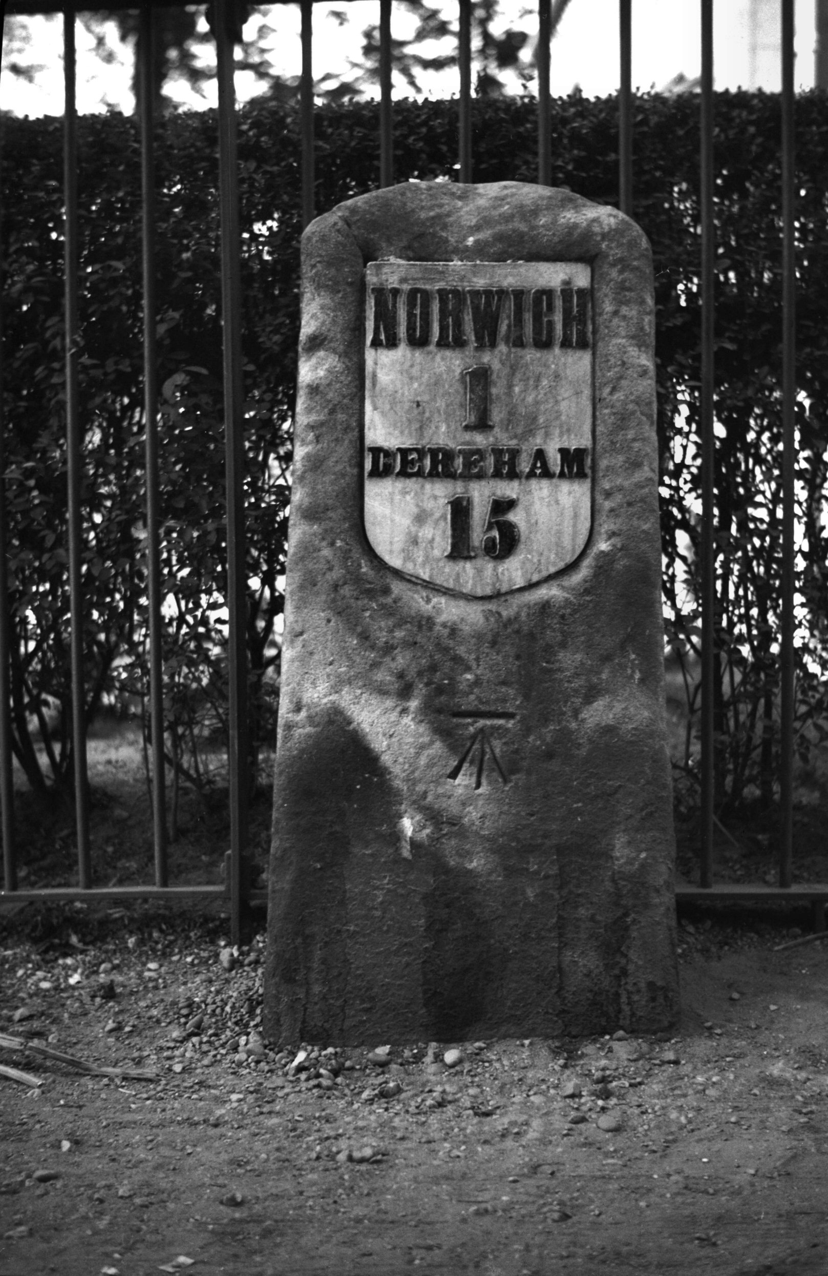
Dereham Rd milestone by Woodlands Park [0609]
1935-08-05 |
|
|
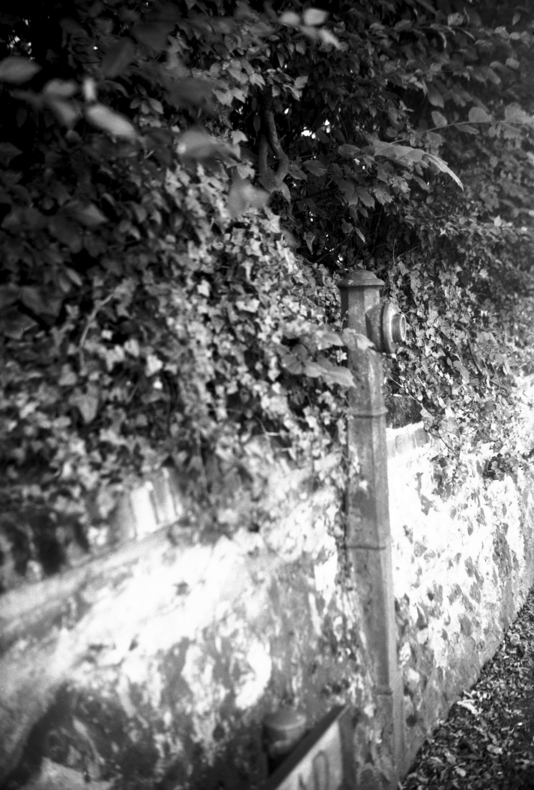
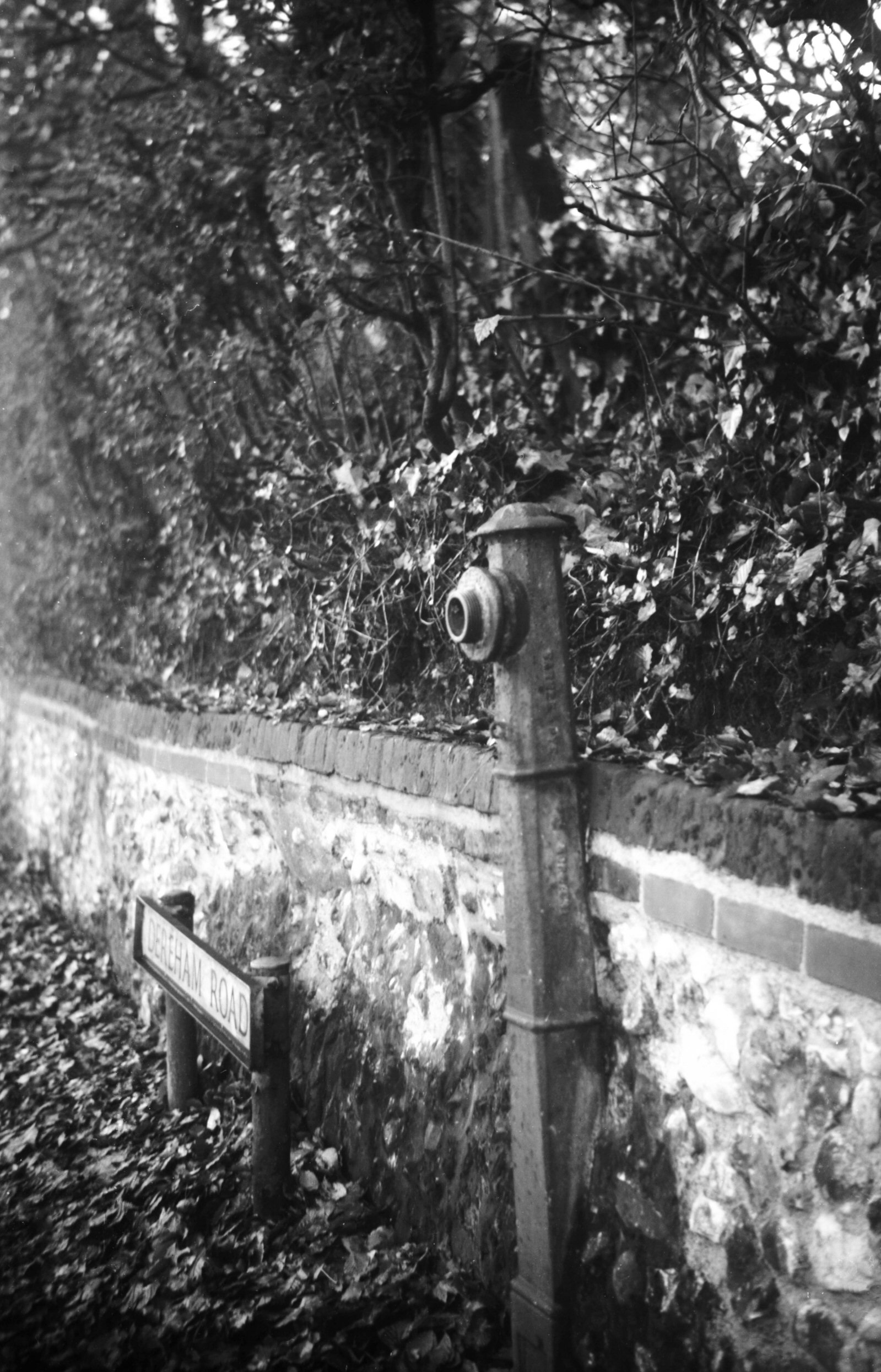
Dereham Rd disused standpipe view west [7890]
2002-07-14 Once used for filling watering carts which laid the dust in dry weather. Cast by Barnes and Pye, Colegate, Norwich. [Another one visible in the photo of 20 St John Maddermarket.] |
|
|
Dereham Rd disused standpipe view east [7786]
2000-11-24 |
|
|
Dereham Rd disused standpipe view east [7889]
2002-07-14 |
|
|
Earlham Rd 1 boundary plates [6618] 1990-07-03 Boundary of Heigham St Bartholomew in 1811. Affixed to the former Grapes Hotel. Unique in being the only one outside the city wall. |
|
|
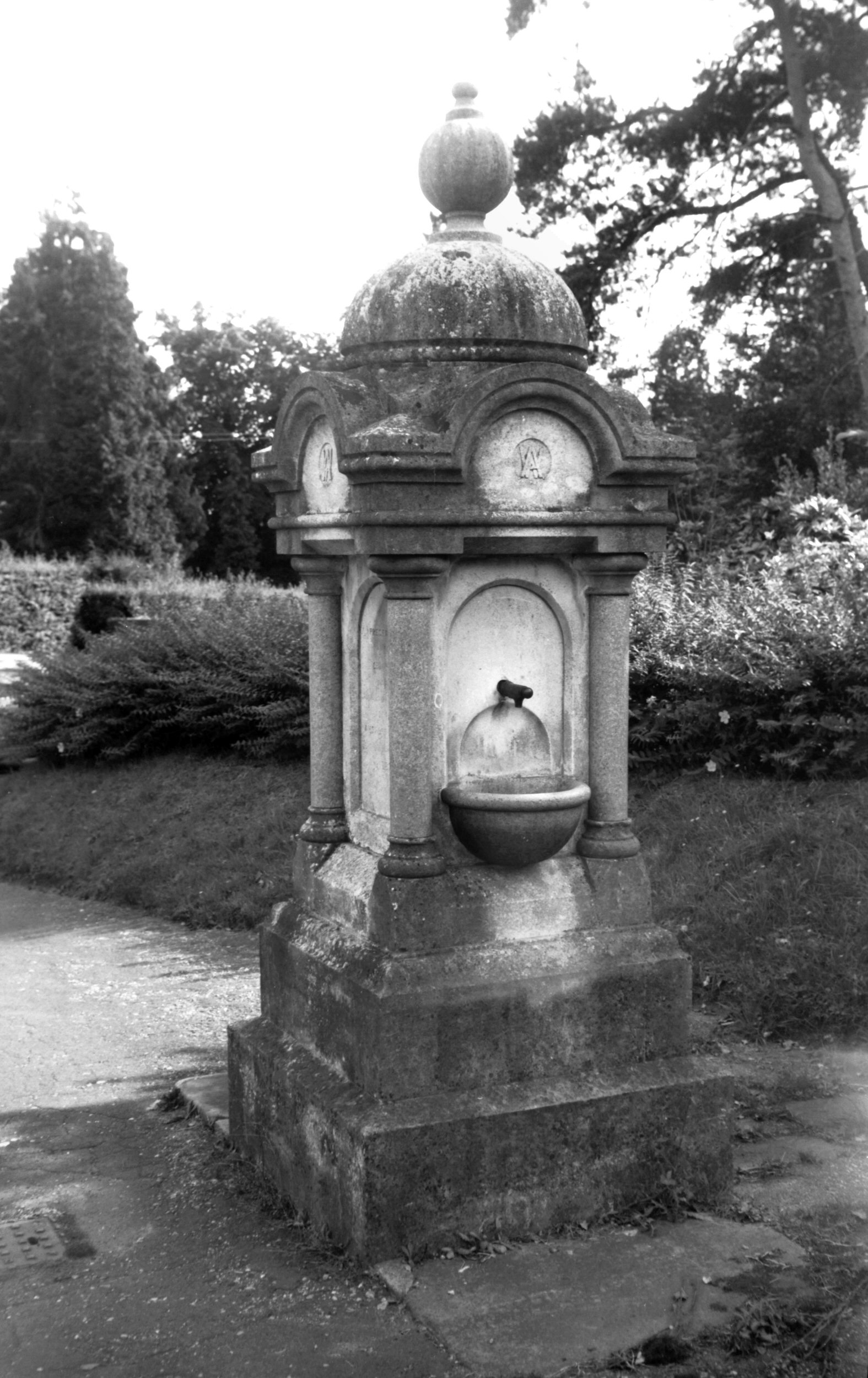
Earlham Rd Cemetery drinking fountain [7482]
1997-09-10 "Presented/ by the/ Chairman/ of the/ Burial Board Committee/ Alderman/ Ambrose Winter/ 16th August/ 1892". |
|
|
Heigham Rd former tram standard [7787] 2000-11-24 Corner of West Pottergate. Though now supporting a street lamp, it is the sole survivor of its kind in the city. |
|
|
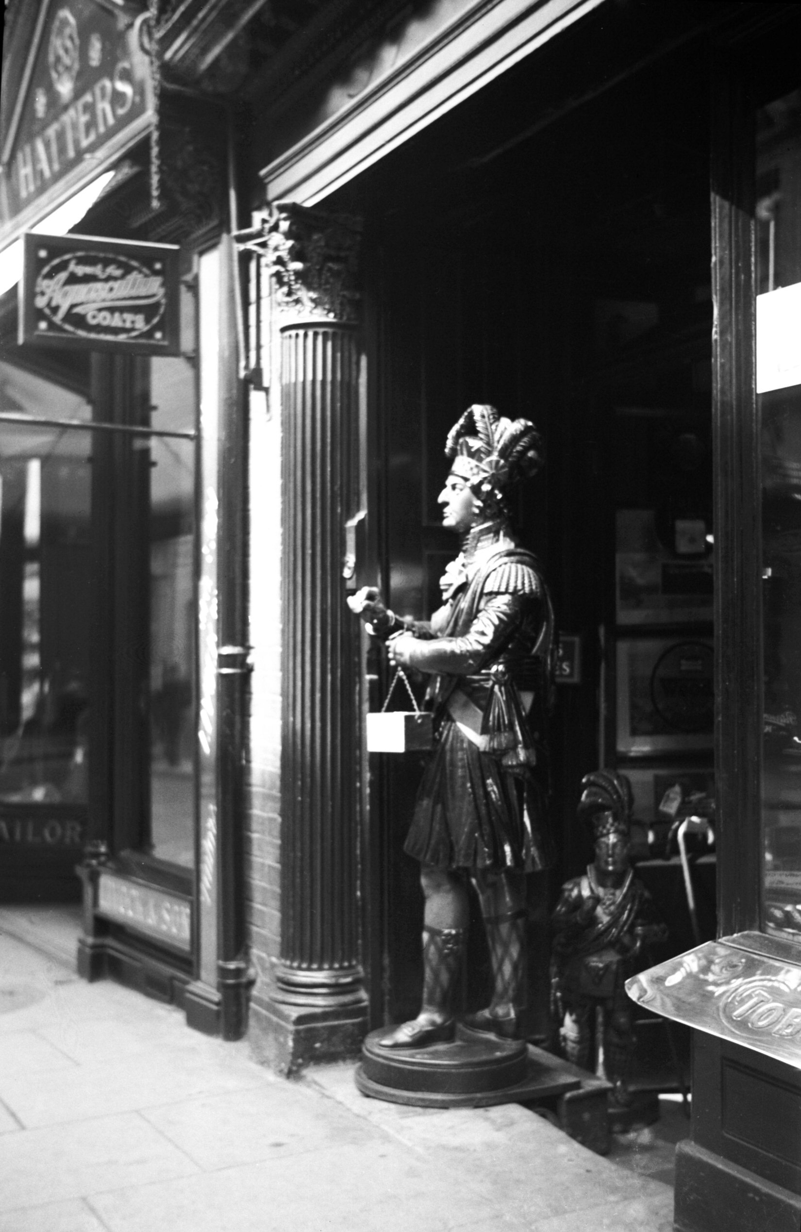
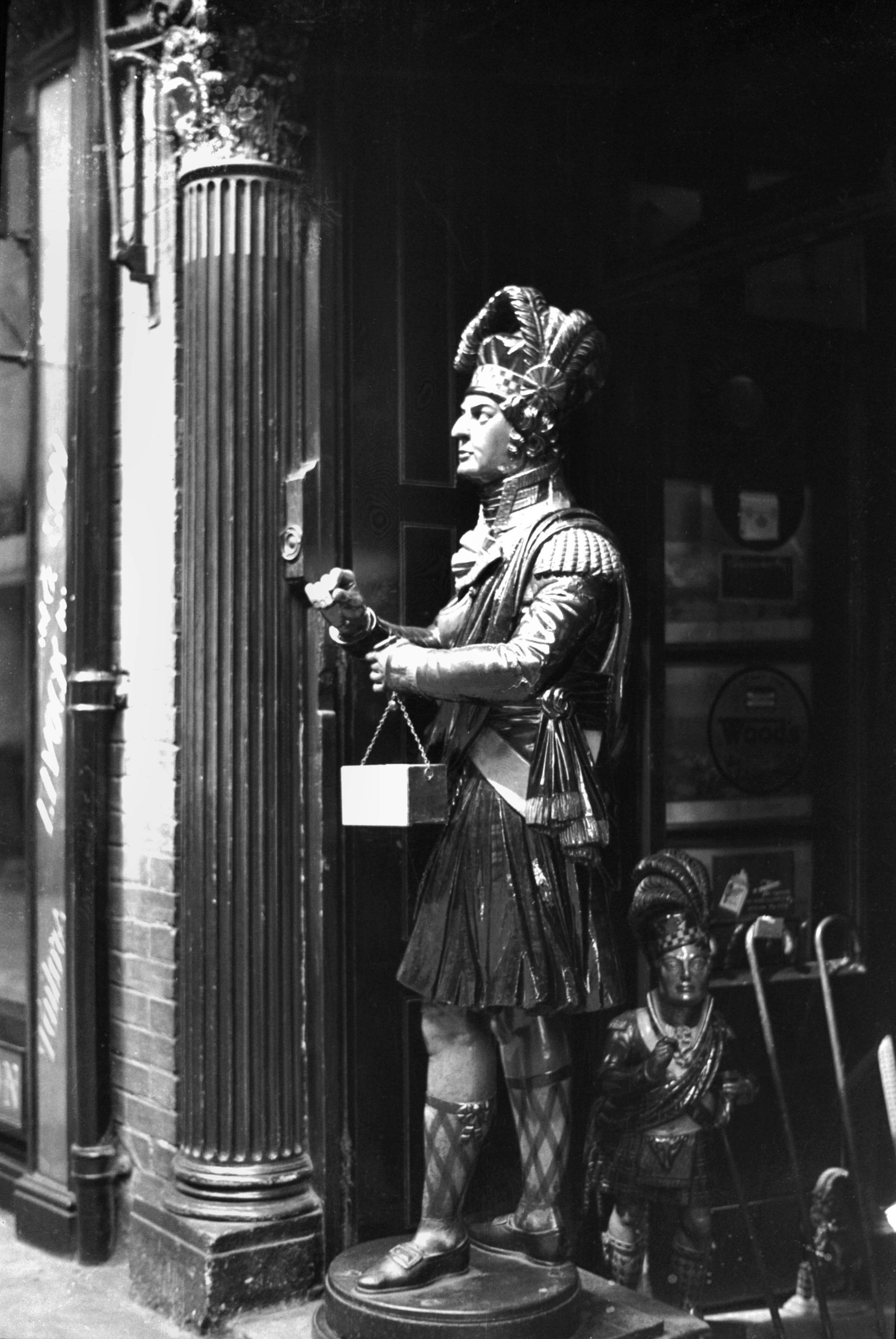
London St 37 Miller's Scotsman shop sign [0175]
1934-08-07 |
|
|
London St 37 Miller's Scotsman shop sign [0176]
1934-08-07 Tobacconists sign probably as old as the business which was founded in 1812. |
|
|
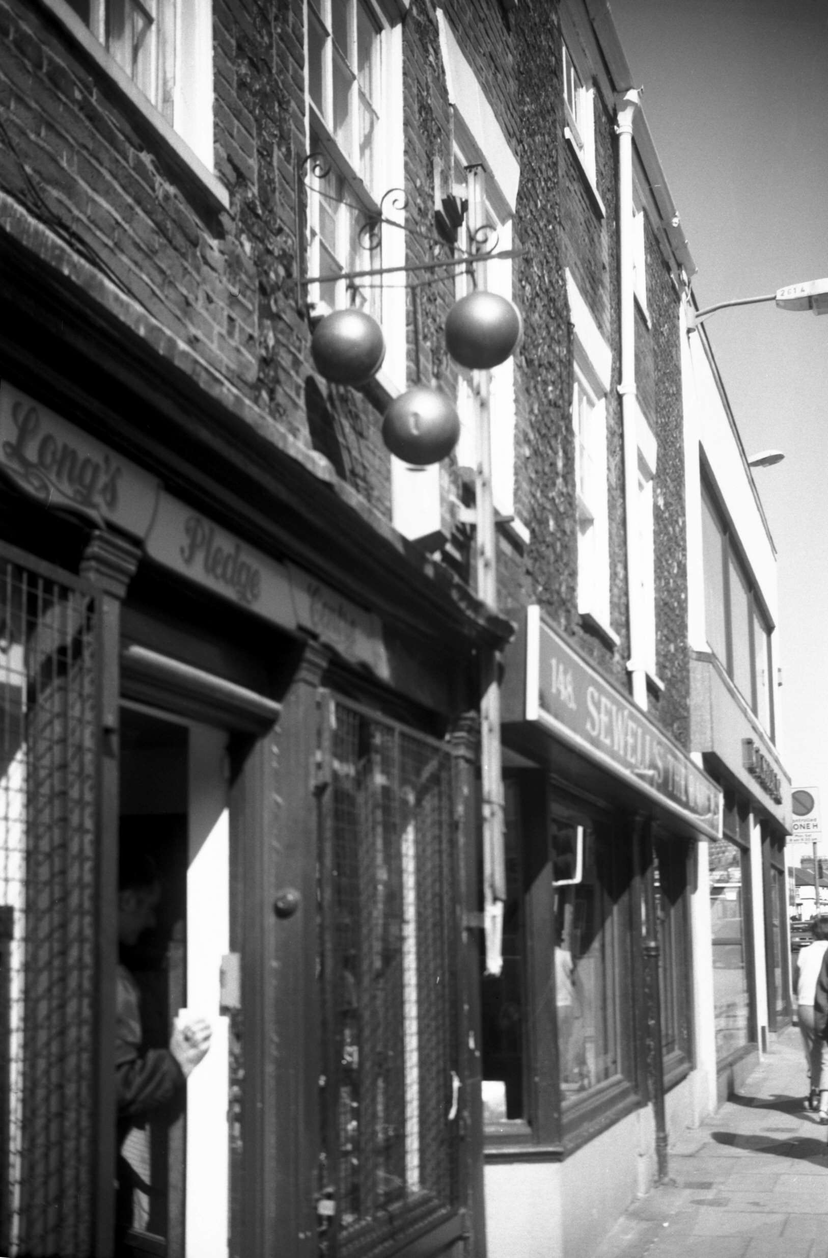
Magdalen St 146 pawnbroker's sign [7875] 2002-04-06 Three golden balls. |
|
|
Market Place The Walk Victorian pillar box [3787]
1949-06-12 The oldest in Norwich. Penfold type. |
|
|
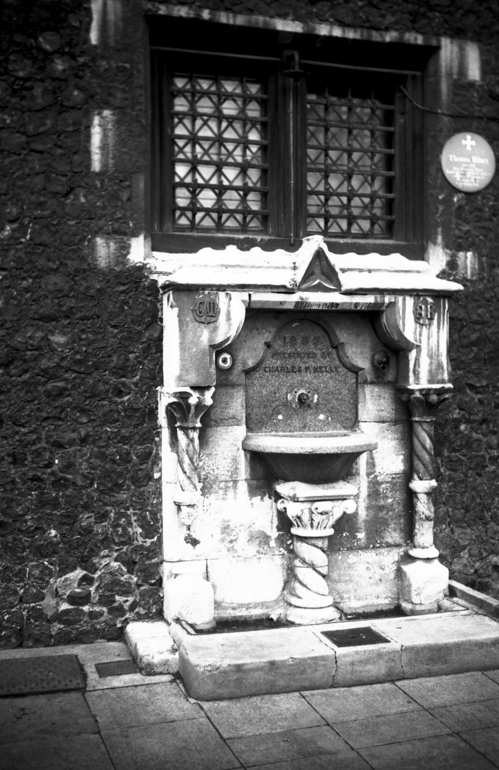
Market Place Guildhall drinking fountain [7447]
1997-04-27 At east end of Guildhall, presented in 1859 by Charles P.Melly. |
|
|
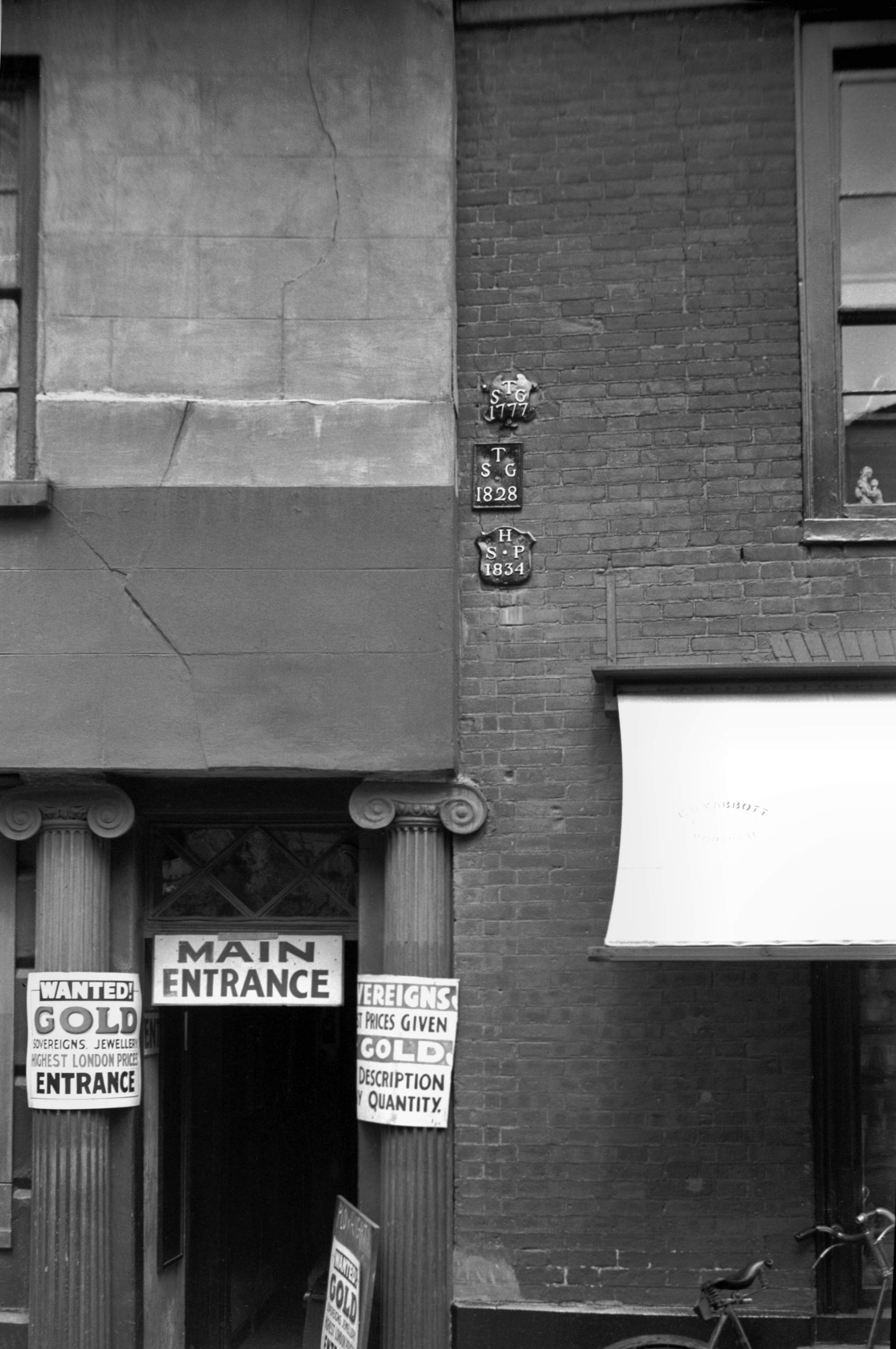
Princes St 16 boundary plates [0178] 1934-08-07 High up on the wall of No 16, are two (but formerly three) parish boundary plates, a feature to be seen dotted around the city at various points. 200 years ago, when each parish was responsible among other things for the maintenance of its poor, the exact demarcation of boundaries was very necessary. This was especially so in a place like Norwich, where the boundaries of some three-dozen parishes interlock like an intricate jigsaw puzzle. In 1934, when a count was taken, 173 of these leaden plates were still found attached to buildings, with 17 others in museums or in private hands. The oldest parish mark, not a plate but an inscribed stone, in set in the front wall of the Coach and Horses public house in Bethel St, marking the boundary between St Giles and St Peter Mancroft parishes; this is dated 1710. The latest one is for St Benedict and is dated 1854. An unusual one for All Saints' parish declares, "A.S.P. ends here. 1778". Others include symbols of the parish saints, such as an anchor for St Clement and a knife for St Bartholomew. Of the two still here in Princes St one dated 1834 is for St Peter Hungate; the other, dated 1777, is for St George Tombland. The one now missing was also for St George and dated 1828. None of the three was marked with a symbol. |
|
|
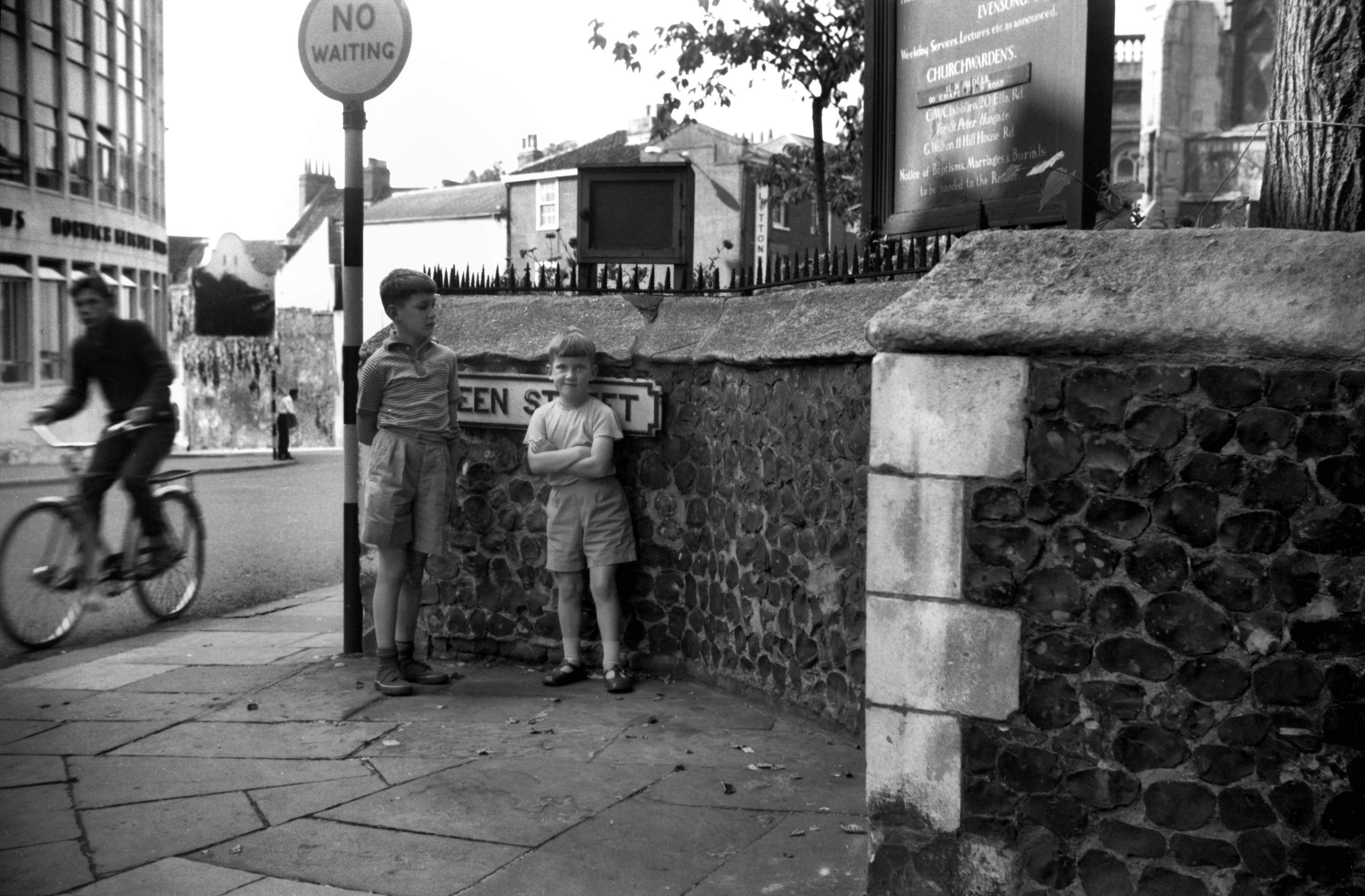
Queen St Red Well site in wall recess [4641]
1961-09-02 Supposedly marks the site of the Red Well from which Redwell St took its name. Rare photo of the photographer's two sons. |
|
|
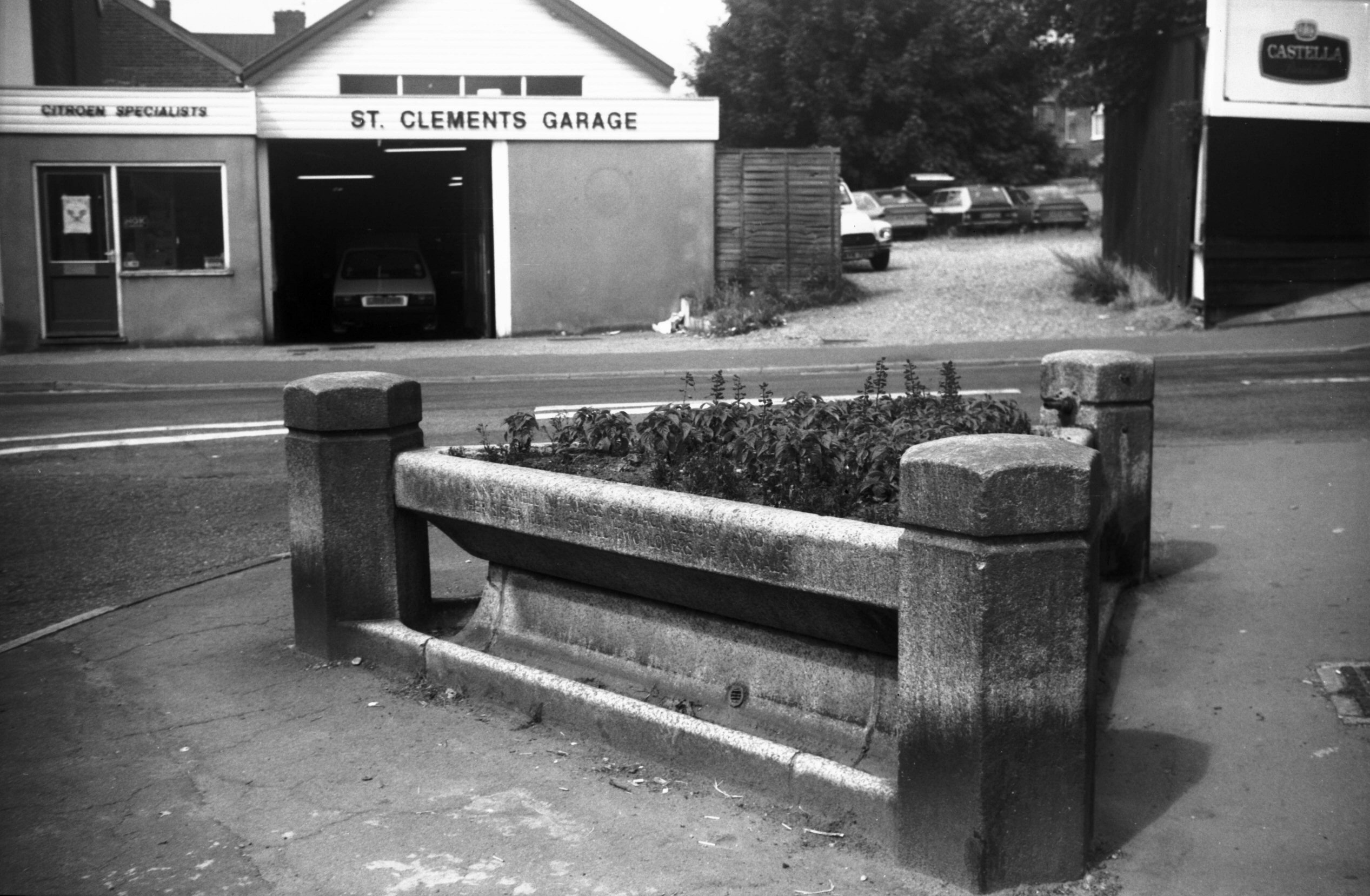
St Clement's Hill Sewell Park cattle trough [6564]
1989-07-14 Now converted to flower display. Inscribed "1917/ This Fountain was placed here by/ Ada Sewell in memory of her Aunt/ Anna Sewell authoress of Black Beauty and of/ her Sister Edith Sewell/ Two lovers of animals". |
|
|
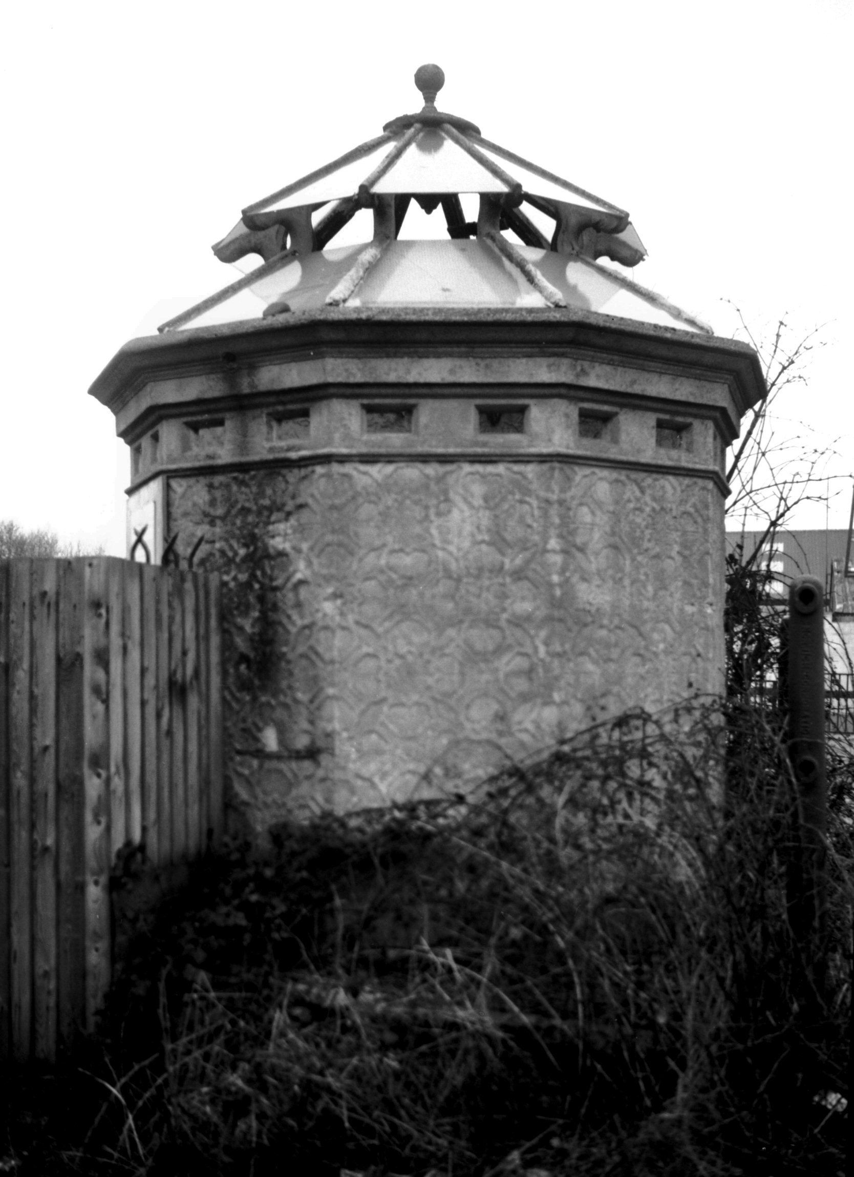
St Crispin's Rd concrete public toilet [7430]
1997-02-22 Built c1919. Believed to be the oldest one of concrete in the world. |
|
|
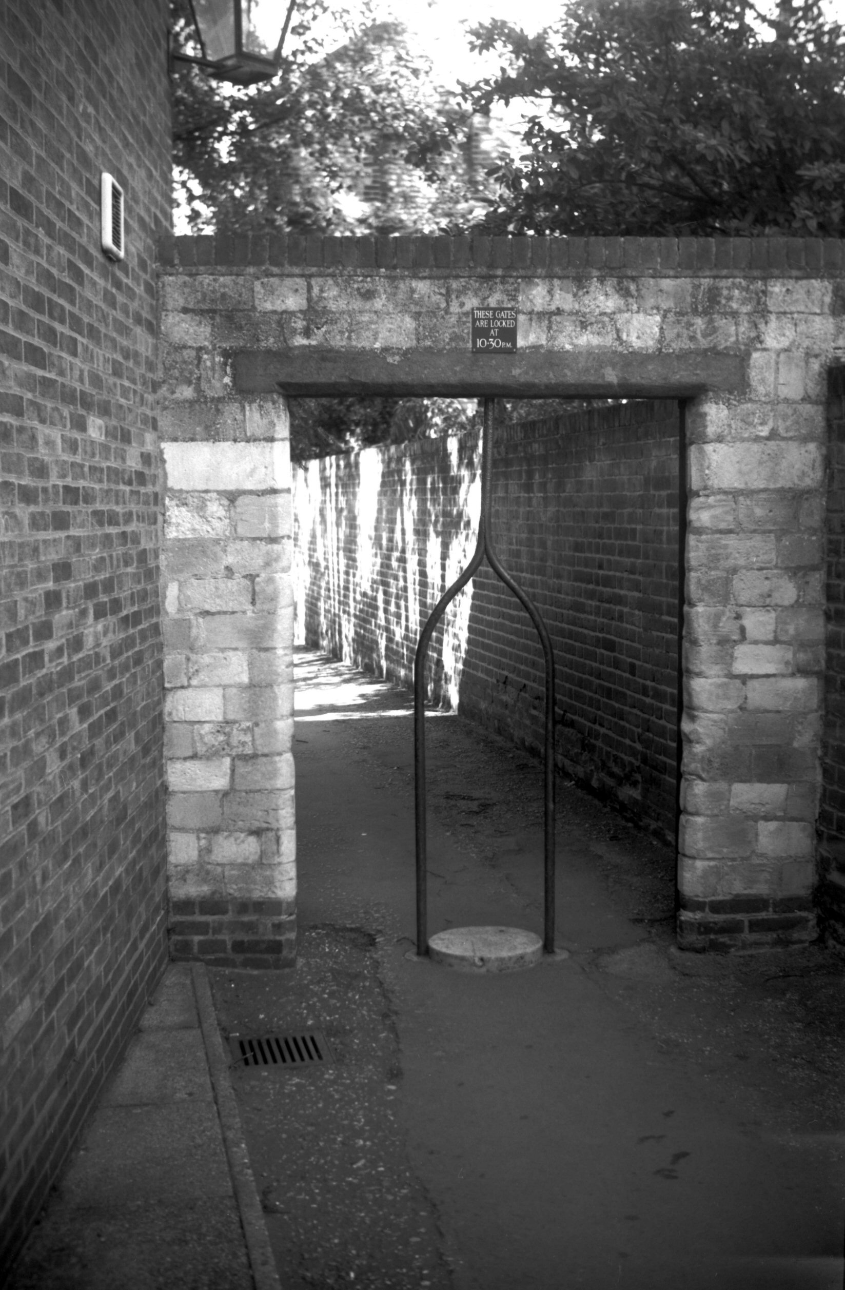
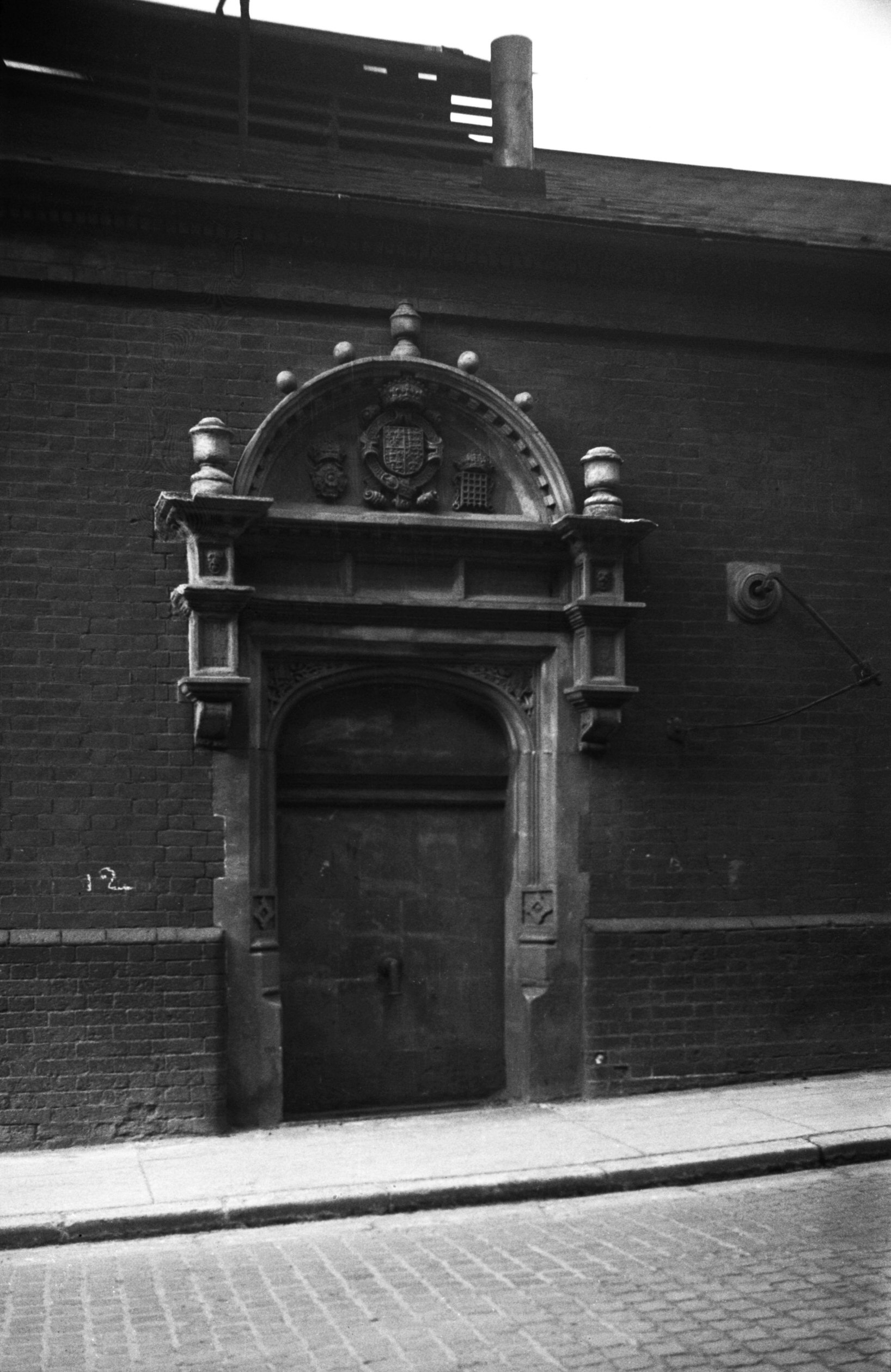
St Faith's Lane Hairpin Gate to The Close [7454]
1997-06-01 Leading from the Horse Fair in St Faith's Lane. |
|
|
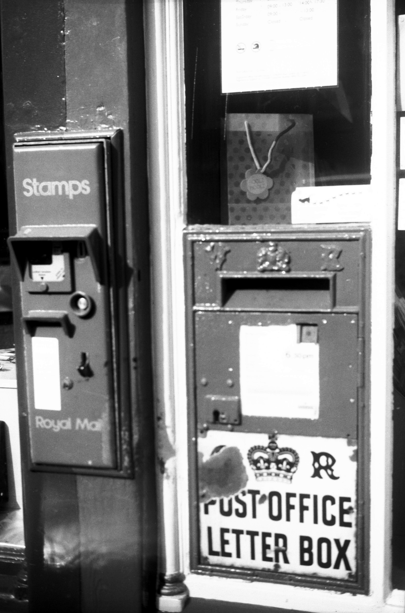
St Giles' St Upper Victorian letter box [7872]
2002-03-16 And postage stamp vending machine, 85a Upper St Giles' St. |
|
|
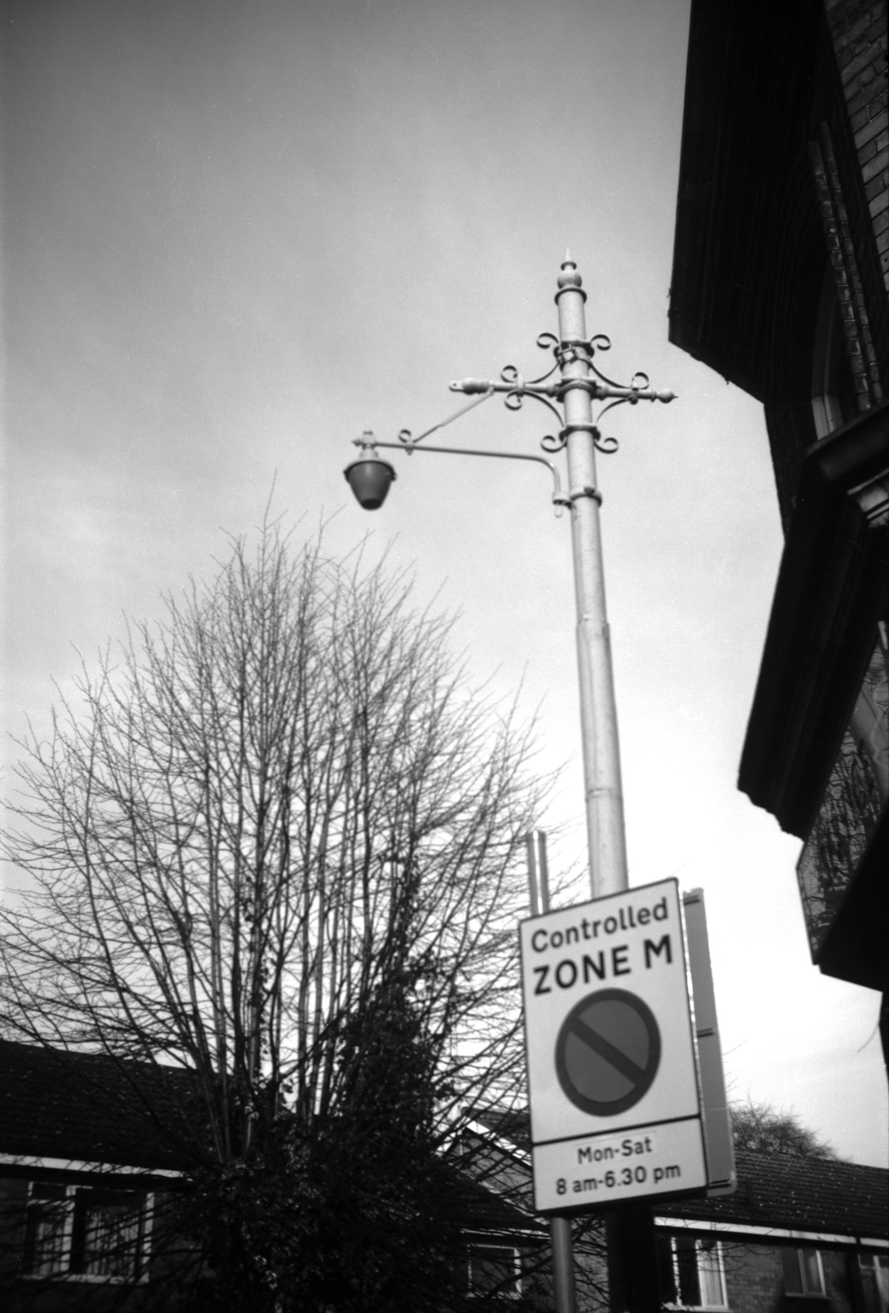
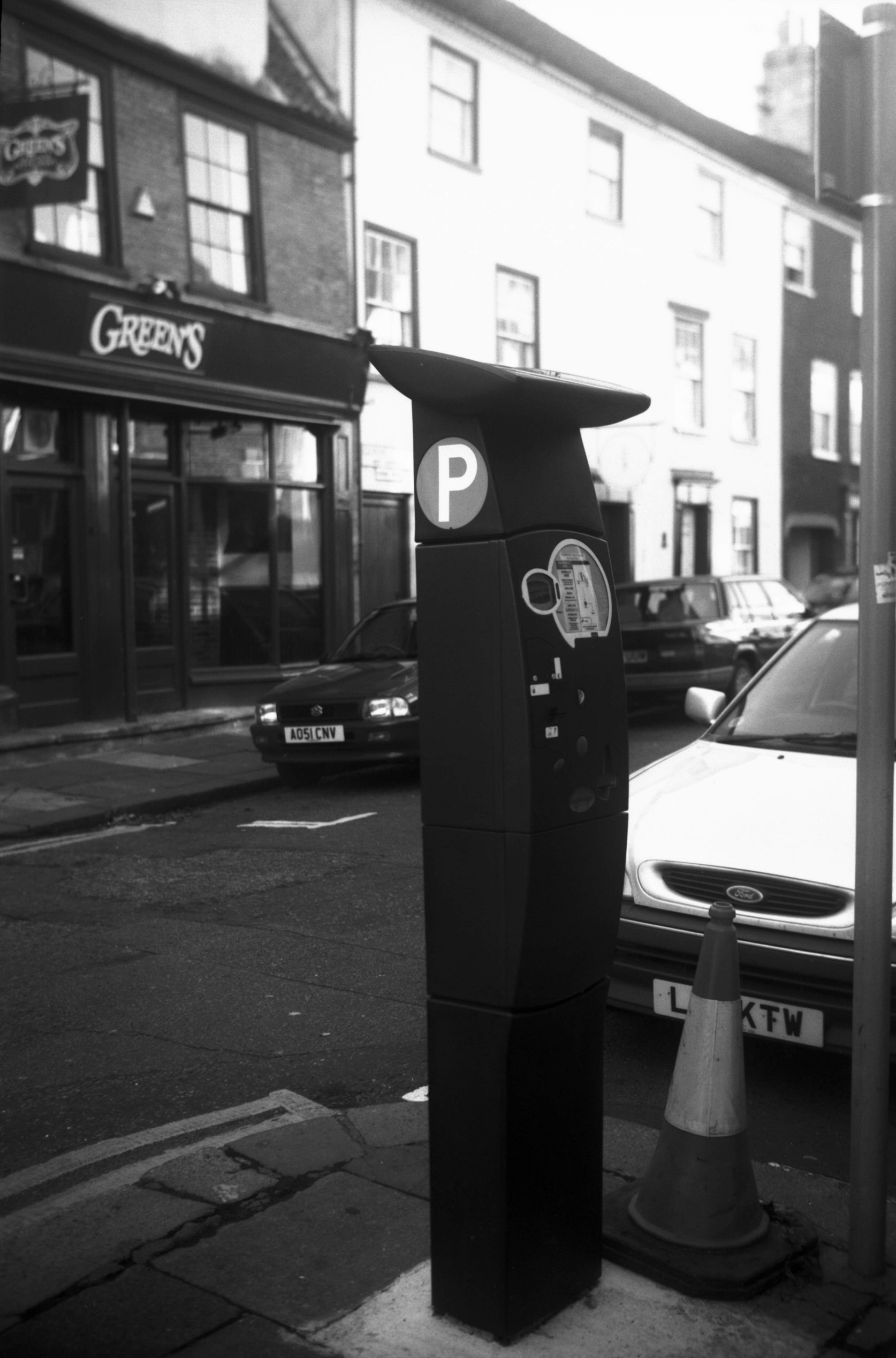
St Giles' St Upper parking meter [7860] 2001-10-28 Solar powered. These first appeared in Norwich in August 2001. |
|
|
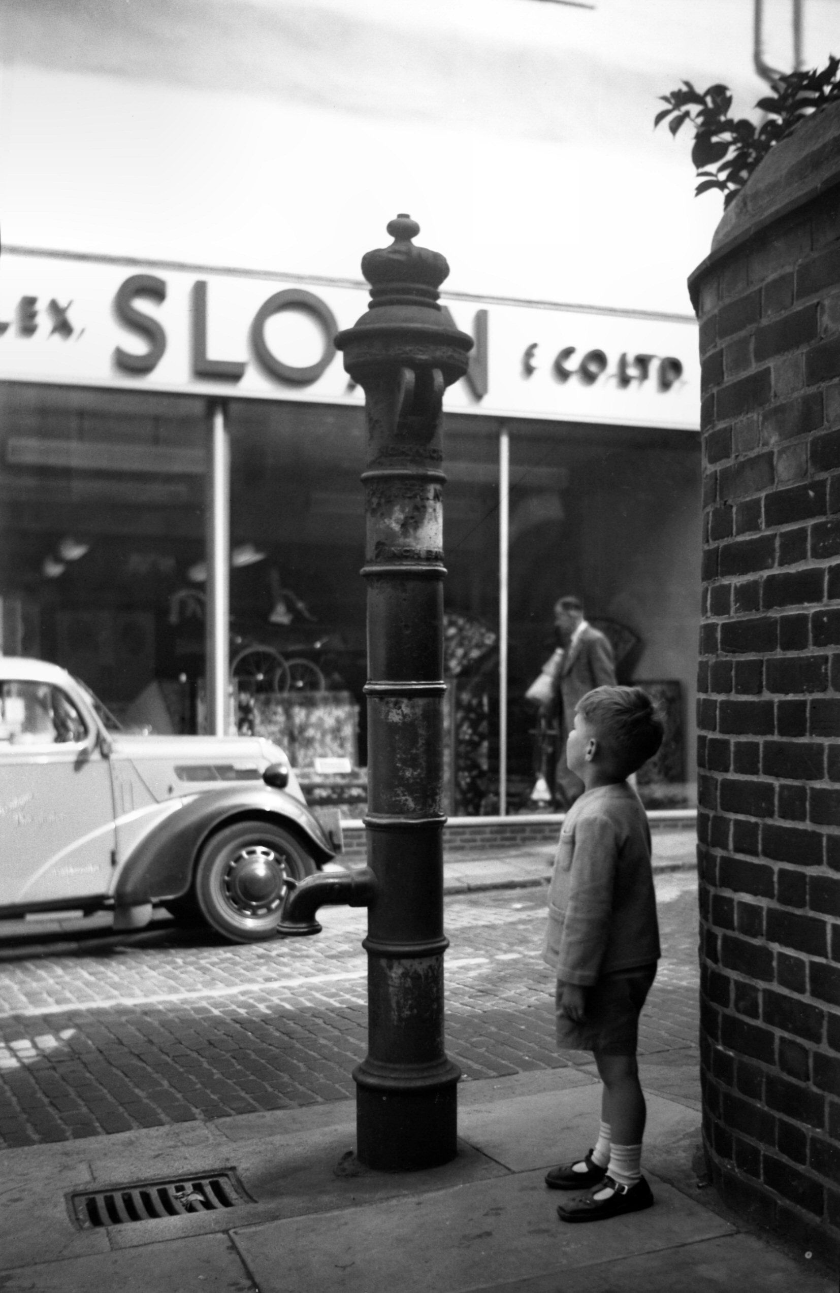
St John Maddermarket Shalders' pump [4344] 1955-07-30 At the foot of St John Maddermarket's churchyard still stands a relic of former times - the parish pump. The inscription giving the maker's name is now badly corroded, but it appears to have been a fountain pump patented by one Shalders, whose business was situated in nearby Redwell St. Similar pumps once lined the roads between Cringleford and Wymondham. These were placed there at the beginning of the 19c by the Turnpike Trustees; their specific purpose was to provide water for experiments in roadmaking as well as for laying the dust. Although there is no evidence that they were provided with troughs, it is possible that adjoining ditches were flooded to enable drovers to water their cattle on the long journey to the London market. The significance of the situation of this one at the Maddermarket, with the land sloping towards it from the adjoining burial ground, was not lost on a former city analyst; he described it as "pure essence of churchyard". |
|
|
St John Maddermarket Shalders' pump [4421] 1956-03-27 Common pump, "Shalder's Patent Fountain Pump", c1836. |
|
|
St Peter's St Penfold type pillar box [7913]
2003-02-18 Replica penfold box. |
|
|
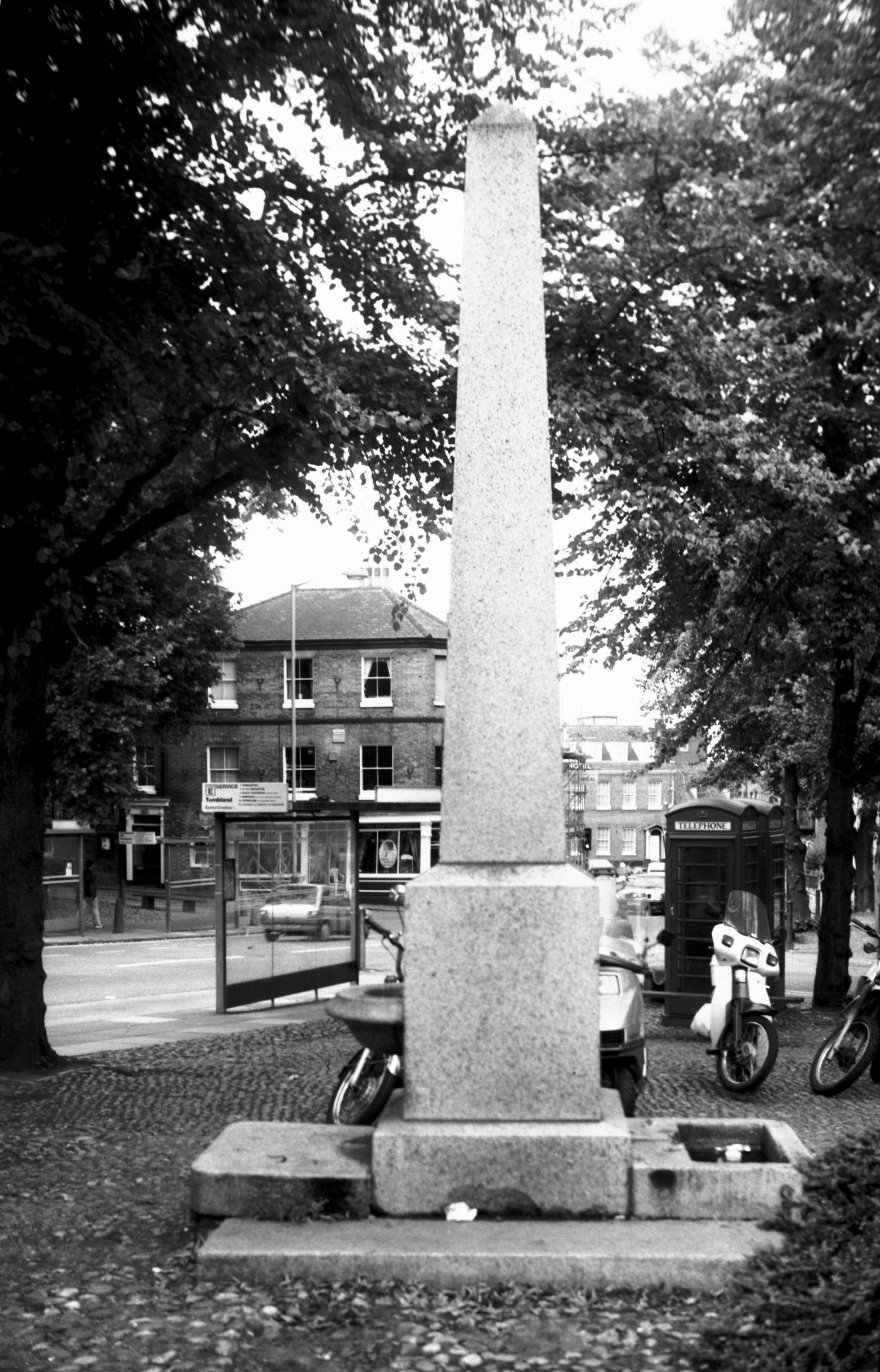
Tombland obelisk drinking fountain [7392] 1996-09-10 Erected 1860 by John Henry Gurney to mark the site used by machinery to raise and store water for the higher parts of the city from c1700 to c1850. |
|
|
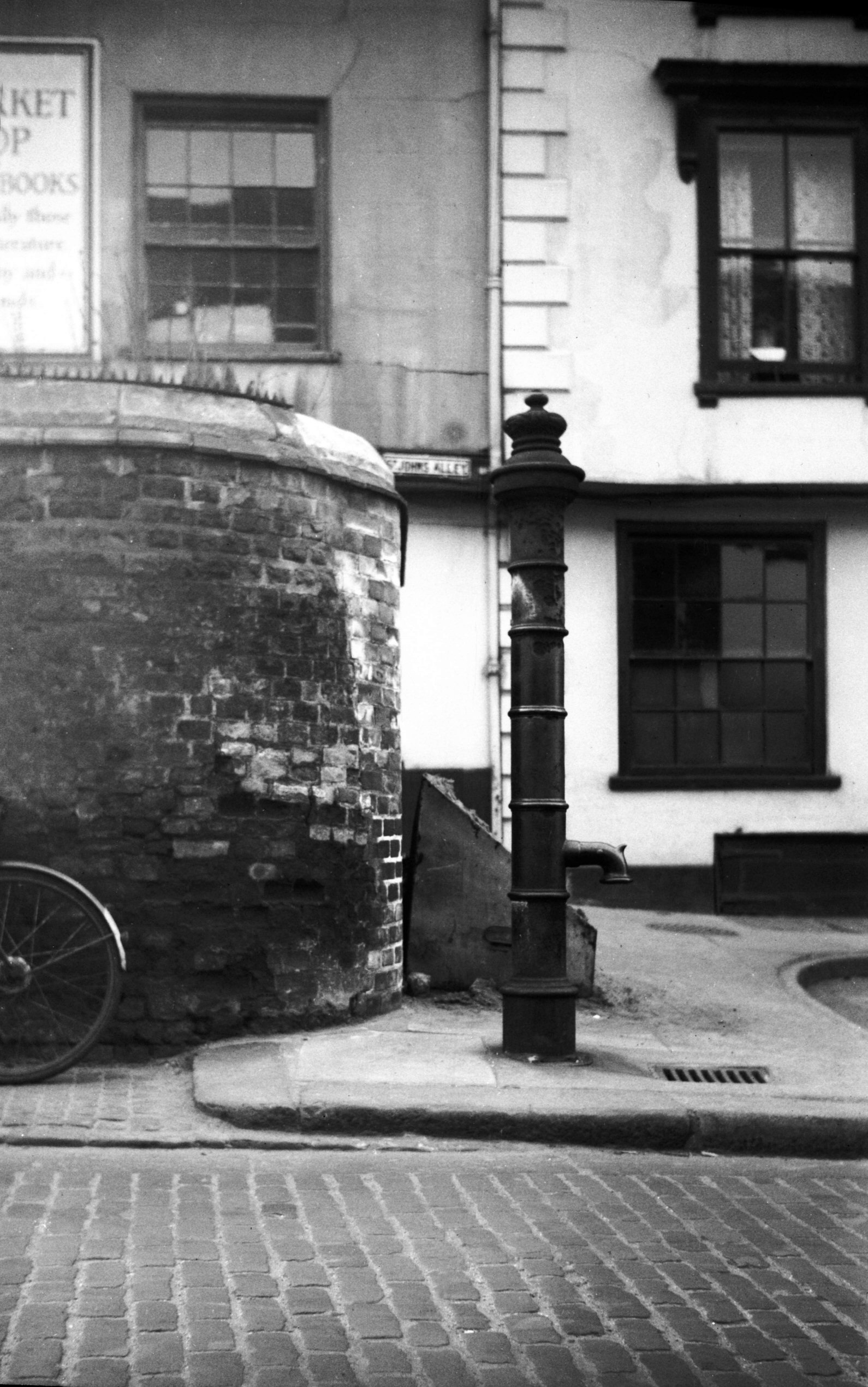
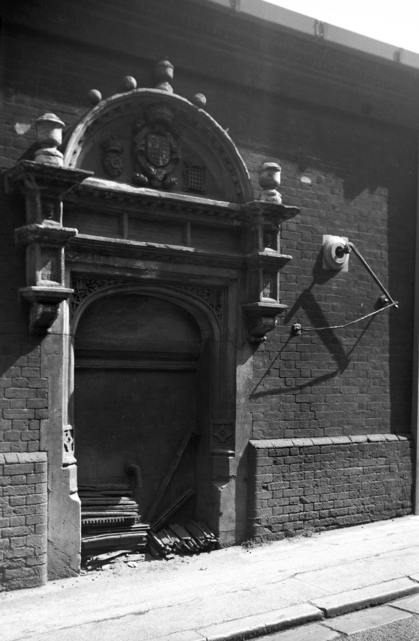
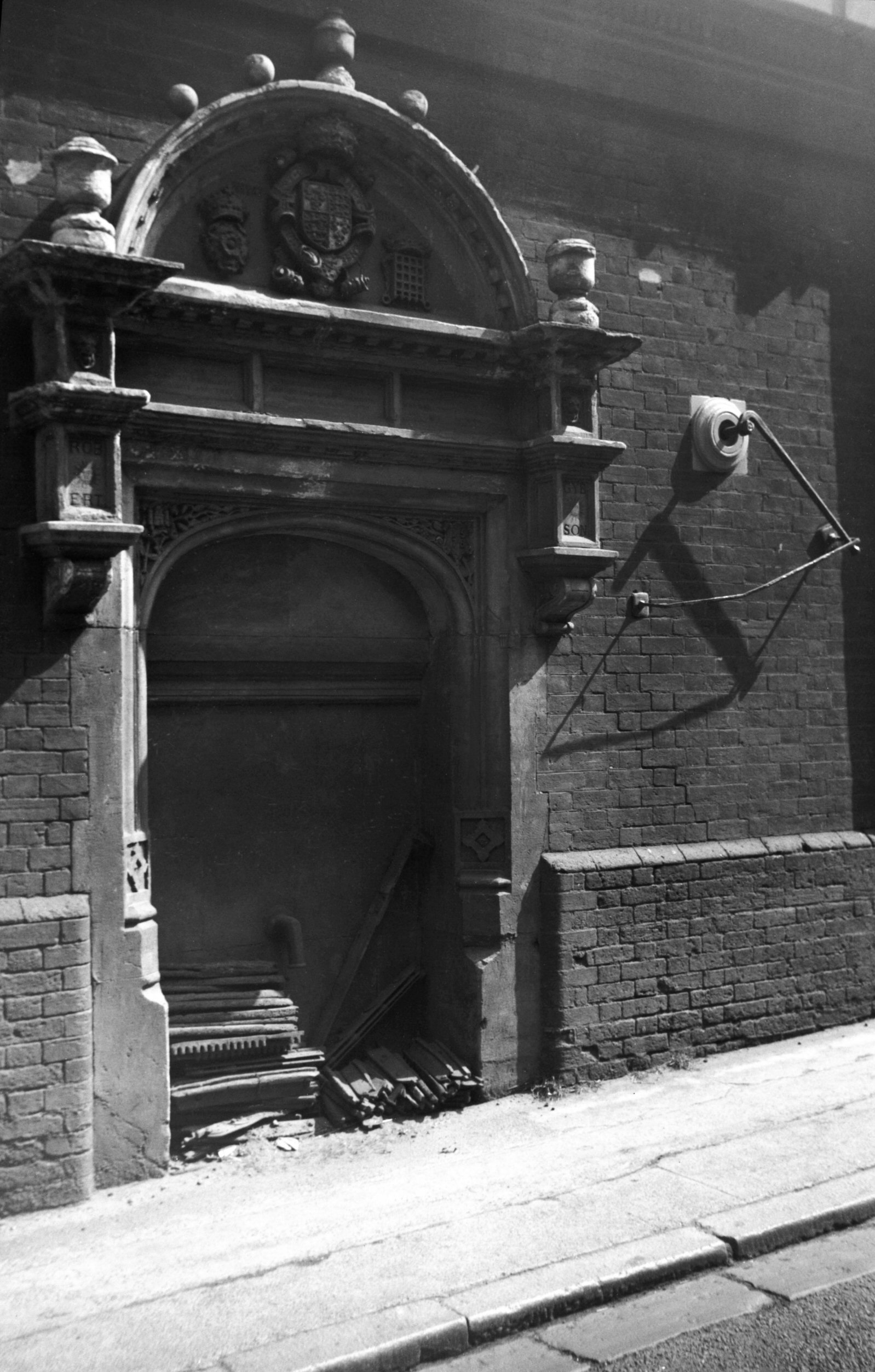
Westwick St Gibson's pump [0114] 1934-06-08 At the east end of Westwick St only a short distance away from another at St John Maddermarket, is an old pump known as known as Gibson's Conduit. This was for many years set into the boundary wall of Bullard's brewery facing Westwick St. After the conversion of the property into flats and offices, however, it was dismantled and re-erected on the other side of the wall, where it now faces the Anchor Quay development and is set off to much better advantage. It appears that St Lawrence's well, known to have existed here since the time of Edward I, was granted in 1547 to the parishioners, together with a lane leading to it from the street, on condition that they erected a door at the south end of the lane, to be open by day and closed at night. In 1576 this well and lane were granted to a beer brewer, Robert Gibson (Sheriff in 1596), on condition that he brought the water from the well by a pipe to the public street, there to erect a pump at his own expense. This he did two years later, and had a verse inscribed on the stonework extolling his goodness for carrying out the work. Unfortunately it seems that Gibson was an irascible person, which led him into trouble on more than one occasion. In 1590, for instance, he abused the newly elected Mayor, Thomas Pettus, both privately and in open court. Things seem to have been smoothed over, but in 1602 the Mayor, Thomas Lane, was similarly abused, and this led to Gibson being removed from the aldermanic bench. He was also disenfranchised "of and from the freedom and liberties of this city and forever henceforth to be a foreigner and so continue" - the penalty for failing to he "buxom to the Mayor". Gibson died in 1606, presumably still disenfranchised, and was buried in the chancel of St Lawrence's Church. |
|
|
Westwick St Gibson's pump [4435] 1956-05-21 |
|
|
Westwick St Gibson's pump [4436] 1956-05-21 |
|
|
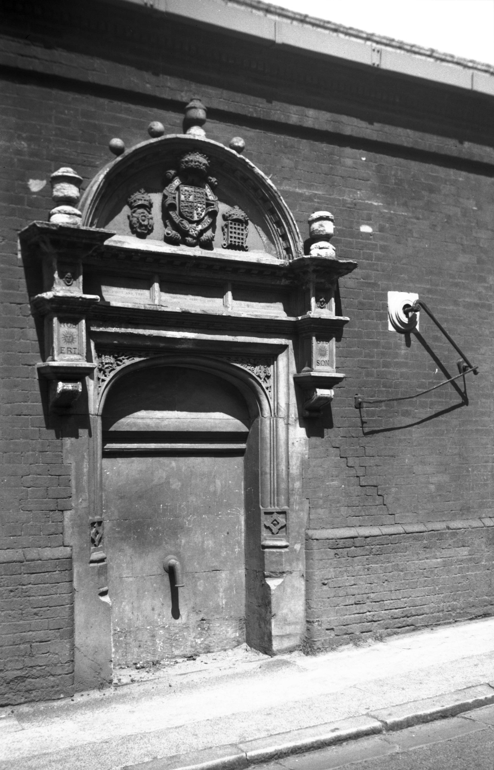
Westwick St Gibson's pump [4447] 1956-06-13 A public spring rose near this spot in the time of Edward I, and in 1576 it was granted to Robert Gibson on condition that he piped the water to the street and there erected a pump at his own expense. Photographed 1956 in the wall of Bullard's brewery. |
|
|
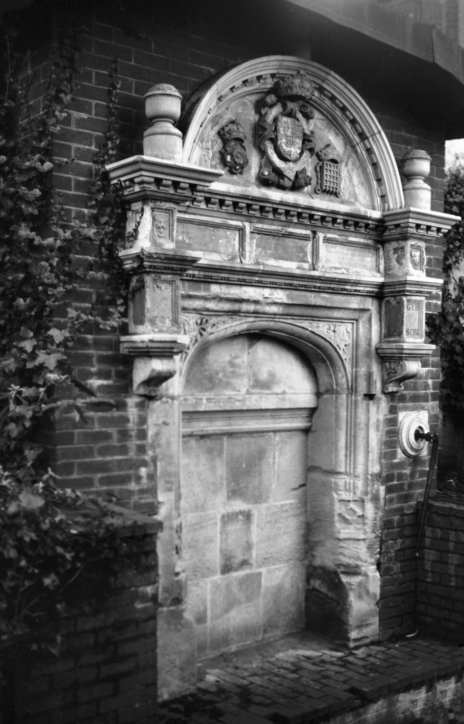
Westwick St Gibson's pump resited [7605] 1998-12-13 Photographed 1998 facing north towards Anchor Quay. |
Text and photographs copyright George Plunkett